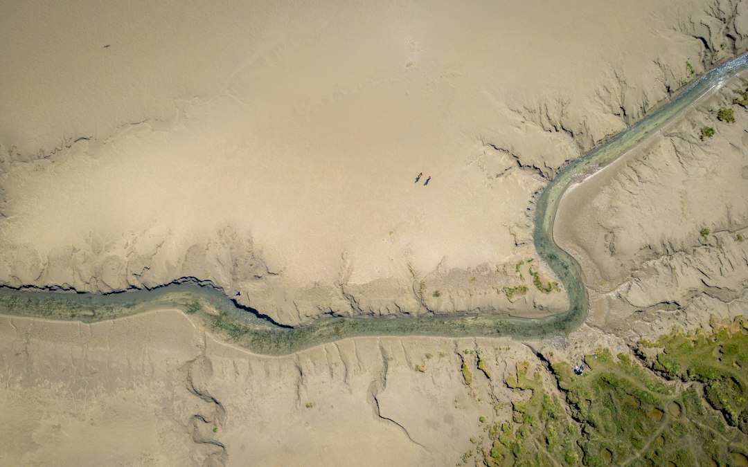
The intricate dance of water and land shapes the world’s river systems, a dynamic process known as river morphology. Understanding these ever-changing forms is crucial for managing water resources, predicting flood hazards, and preserving aquatic ecosystems. Traditionally, studying river morphology involved extensive field surveys, a labor-intensive and often dangerous endeavor. However, the advent of satellite technology has revolutionized this field, offering a bird’s-eye view of rivers on an unprecedented scale and with remarkable temporal frequency. Satellite data provides a wealth of information, from the subtle meandering of a small stream to the grand architecture of deltas, allowing scientists to analyze, monitor, and predict the behavior of these vital arteries of the Earth.
The Unseen Landscape: How Satellites Reveal River Forms
The fundamental advantage of satellite imagery lies in its ability to capture large spatial extents and provide repeated observations over time. This synoptic perspective is invaluable for comprehending the complex interactions that drive river morphology. Satellites equipped with various sensors can detect distinct spectral signatures of water, vegetation, and landforms, enabling the mapping of river channels, floodplains, and associated features with high accuracy. From the visible light spectrum that reveals the color and turbidity of water to infrared bands that can distinguish between healthy vegetation and bare soil, a diverse range of information can be extracted. Furthermore, advancements in radar technology allow for the penetration of clouds and nighttime imaging, ensuring continuous data acquisition even in challenging environmental conditions. The temporal aspect of satellite data is equally transformative. By comparing images taken at different times, researchers can track changes in river width, sinuosity, channel patterns, and sediment deposition over days, months, years, and even decades. This historical record is essential for understanding the evolutionary trajectory of a river system and for identifying trends that might otherwise remain hidden.
Mapping the Blueprint: Channel Geometry and Features
Satellite data excels at delineating the physical boundaries of river channels. Techniques like automated edge detection and supervised classification can precisely map the extent of the water body, revealing its width, depth variations (inferred from water surface texture and flow patterns), and overall shape. Key morphological features such as meanders, oxbow lakes, point bars, and islands are readily identifiable. The curvature of meanders, quantified by sinuosity indices, provides insights into flow dynamics and the rate of bank erosion. The presence and evolution of oxbow lakes offer direct evidence of past channel shifts. Point bars, the depositional features on the inside bends of meanders, signal areas of sediment accumulation and can indicate the river’s tendency to migrate laterally. Islands, whether ephemeral or permanent, can influence flow patterns and act as indicators of sediment transport dynamics. Beyond the main channel, satellite imagery can also map braided river systems, characterized by multiple interwoven channels and abundant gravel bars, as well as anastomosing systems, with more interconnected channels. The resolution of satellite imagery dictates the level of detail that can be discerned, with very high-resolution imagery enabling the identification of smaller-scale features like riffles and pools.
The Flow of Sediment: Tracking Deposition and Erosion
Sediment transport is a primary driver of river morphology. Satellite data offers a unique window into these processes by allowing for the mapping of sediment plumes, depositional zones, and areas of active erosion. The color and turbidity of the water, visible in optical imagery, directly correlate with suspended sediment concentration. By analyzing changes in water color over time, scientists can infer areas where sediment is being picked up (erosion) or deposited. Furthermore, the development and expansion of sandbars and deltas are clearly visible in satellite imagery, providing direct evidence of sediment accumulation. In deltas, the intricate patterns of distributary channels and the progradation (forward growth) of land into the sea are a testament to ongoing sediment deposition. Comparing multitemporal imagery allows for the quantification of sediment accumulation rates in specific areas, aiding in the understanding of channel infill and the potential for sediment-related hazards. Remote sensing techniques can also identify areas of active bank erosion by observing the loss of vegetation and the widening of the channel margins.
Beyond the Water’s Edge: Floodplains and Riparian Zones
River morphology is not confined to the main channel; the surrounding floodplains and riparian zones are integral components of the riverine landscape. Satellite data provides an invaluable tool for mapping these areas and understanding their dynamic interaction with the river. Floodplains are characterized by their distinct geomorphology, often exhibiting evidence of past flood events in the form of levees, backswamps, and terraces. Satellite imagery can accurately delineate the extent of these features, helping to define the natural flood hazard zones. Riparian vegetation, the plant communities that thrive along riverbanks, is also a key indicator of river health and morphology. Changes in vegetation cover, density, and species composition, detectable through spectral analysis, can signal shifts in water levels, soil moisture, and the extent of inundation. For instance, a healthy riparian forest often indicates a stable channel, while the encroachment of invasive species might suggest altered flow regimes or increased sediment deposition. Satellite monitoring of riparian vegetation can therefore serve as a proxy for understanding long-term geomorphic processes and ecosystem health.
Understanding river morphology is crucial for effective water resource management and environmental conservation. A related article that delves into this topic is available at MyGeoQuest, where researchers explore how satellite data can be utilized to analyze river shapes, flow patterns, and sediment transport. This innovative approach not only enhances our comprehension of river dynamics but also aids in predicting changes due to natural and anthropogenic influences.
A Symphony of Change: Monitoring Dynamic River Systems
The dynamic nature of rivers necessitates continuous monitoring to understand their evolution and predict future behavior. Satellite data, with its capacity for frequent and widespread observation, is perfectly suited for this task. By analyzing time series of satellite imagery, researchers can identify patterns of change, quantify rates of erosion and deposition, and develop models to forecast how rivers will respond to natural processes and human interventions. This ongoing assessment is critical for effective river management and for mitigating the risks associated with a changing climate.
Tracking Lateral Migration and Channel Evolution
Rivers are rarely static entities. They actively erode their banks on one side and deposit sediment on the other, leading to a gradual or rapid shift in their course over time. This lateral migration is a fundamental process in shaping river valleys and can have significant implications for infrastructure and land use. Satellite imagery provides a powerful means of quantifying this migration. By comparing the positions of river banks in successive images, scientists can measure the rate at which a river is moving laterally. This information is vital for identifying areas at risk of bank failure and for planning protective measures. Furthermore, the evolution of channel patterns, such as the straightening of meanders or the abandonment of old channels, can be tracked over extended periods, revealing the long-term geomorphic trajectory of a river system. The development of braided or anabranching channels can also be monitored, providing insights into the river’s response to changes in water discharge and sediment load.
Detecting and Quantifying Avulsion Events
Avulsion, the sudden and often dramatic abandonment of an existing river channel and the formation of a new one, is a significant geomorphic event with profound consequences. It can lead to widespread flooding, alter landscapes, and impact human settlements. Satellite imagery plays a crucial role in detecting and analyzing avulsion events, especially in large river systems like deltas where traditional ground-based observation is challenging. By comparing high-resolution imagery before and after a suspected avulsion, researchers can pinpoint the exact location of the new channel formation and map the extent of flooding associated with the event. Time series analysis can reveal the precursor signs of avulsion, such as the gradual building up of sediment in the channel, the development of new splays, and changes in flow distribution. Quantifying the volume of sediment redistributed and the area affected by flooding during an avulsion event is essential for understanding its impact and for developing more accurate predictive models.
Understanding Sediment Budgets and Delta Dynamics
Sediment is the lifeblood of river systems, shaping their morphology and sustaining valuable ecosystems like deltas. Accurately estimating the sediment budget – the balance between sediment input, transport, and output – is essential for understanding river behavior and for managing land loss or gain. Satellite data provides a scalable approach to estimating sediment fluxes. By mapping areas of erosion and deposition, and by correlating water turbidity with sediment concentration, researchers can infer sediment transport rates across large river basins and their associated deltas. In deltaic regions, satellite imagery is indispensable for monitoring land subsidence, deltaic progradation, and the impact of sea-level rise. The growth and shrinkage of deltas are directly observable, offering critical data for coastal management and for understanding the complex interplay between riverine and marine processes. Analyzing the patterns of distributary channel development and abandonment within a delta provides further insights into the dynamic equilibrium between sediment supply and the forces of the sea.
Unlocking the Secrets: Techniques and Technologies

The effective utilization of satellite data for river morphology analysis relies on a suite of advanced techniques and technologies. From sophisticated image processing algorithms to sophisticated modeling approaches, these tools transform raw satellite observations into meaningful scientific insights. The continued development of these technologies promises even greater understanding of our planet’s dynamic river systems.
Image Processing and Feature Extraction
The initial step in analyzing satellite data involves processing the raw imagery to enhance its quality and extract relevant information. This includes techniques such as radiometric calibration, atmospheric correction, and geometric rectification to ensure accurate spatial representation and spectral values. Feature extraction algorithms are then employed to identify and delineate river channels, floodplains, and other geomorphic features. These can range from simple thresholding methods for identifying water bodies to more complex object-based image analysis (OBIA) that classifies image patches based on their spectral and spatial characteristics. Machine learning and deep learning algorithms are increasingly being used for automated feature extraction, allowing for the rapid and consistent mapping of riverine features across vast areas. The classification of different land cover types within the riparian zone, such as forests, grasslands, and bare soil, is also crucial for understanding the geomorphic and ecological context of the river.
Digital Elevation Models (DEMs) and Topographic Analysis
While satellite imagery provides a planimetric view of rivers, integrating it with Digital Elevation Models (DEMs) is essential for a complete three-dimensional understanding of river morphology. DEMs represent the Earth’s surface topography and can be derived from various satellite-based methods, including stereo photogrammetry and interferometric synthetic aperture radar (InSAR). By overlaying satellite imagery onto DEMs, researchers can analyze river gradients, calculate channel slopes, and identify topographic controls on river behavior, such as incised valleys or expansive floodplains. DEMs are also crucial for hydrological modeling, enabling the simulation of water flow and inundation patterns. The accuracy of the DEM directly influences the reliability of these analyses, making the development and refinement of high-resolution DEMs a critical area of research. Analyzing the elevation of river terraces and floodplains within a DEM can provide valuable information about the long-term geomorphic evolution of a river system.
Remote Sensing of Water Properties and Flow Dynamics
Beyond mapping the physical boundaries of rivers, satellite sensors can also infer properties of the water itself and provide clues about flow dynamics. Water color, as detected by optical sensors, can indicate turbidity, which is directly related to suspended sediment concentration. Analyzing the spatial and temporal patterns of turbidity plumes can reveal areas of active erosion and deposition. Similarly, changes in water surface texture, often visible in radar imagery, can provide insights into flow velocities and turbulence. Advanced techniques, such as the analysis of thermal infrared imagery, can reveal temperature variations in rivers, which can be influenced by groundwater inflows and flow patterns. While direct measurement of water velocity from space is challenging, indirect indicators, combined with hydrodynamic models, allow for inferring flow characteristics and understanding how they influence channel form.
Applications and Implications: Why It Matters
The insights gained from satellite data on river morphology have far-reaching implications for a multitude of applications, impacting environmental management, hazard mitigation, and infrastructure planning. By understanding the fundamental processes that shape rivers, we can make more informed decisions about how to interact with and protect these vital water resources.
Flood Hazard Assessment and Management
Understanding river morphology is paramount for effective flood hazard assessment and management. Satellite imagery can accurately map existing floodplains and identify areas prone to inundation based on historical flood extents and current channel characteristics. By analyzing the sinuosity and channel width of a river, scientists can estimate its capacity to convey floodwaters. The presence of levees, their stability, and potential breach points can also be assessed using high-resolution imagery. Furthermore, by tracking changes in river morphology over time, such as increased sediment deposition that reduces channel capacity or lateral migration that encroaches on floodplains, authorities can anticipate and prepare for future flood events. Remote sensing can also be used to rapidly assess damage after a flood, identifying inundated areas, damaged infrastructure, and areas requiring immediate attention.
Water Resource Management and Planning
The morphology of a river system profoundly influences its hydrological behavior and its capacity to store and convey water. Satellite data can provide crucial information for water resource management. Mapping the extent and connectivity of surface water bodies, including lakes and wetlands associated with rivers, helps in understanding water availability. Identifying areas of groundwater recharge and discharge, often linked to riparian zones and riverbed characteristics, is also vital for sustainable water management. Furthermore, understanding how river morphology affects sedimentation rates in reservoirs is crucial for long-term water storage planning and for managing the operational life of these structures. The analysis of delta dynamics is particularly important for understanding freshwater-saltwater intrusion in coastal aquifers, a growing concern with rising sea levels.
Ecological Conservation and Restoration
Healthy riverine ecosystems are intrinsically linked to their morphology. Satellite data can assist in identifying and monitoring critical habitats for aquatic and riparian species. For example, the presence of diverse channel forms, such as riffles, pools, and backwaters, creates a variety of ecological niches. Satellite imagery can map these features and track their changes over time, providing insights into habitat availability. Monitoring riparian vegetation health and extent is crucial for assessing the ecological integrity of river corridors. Changes in vegetation cover can signal impacts from altered flow regimes, increased erosion, or human land use. Satellite-derived information on river morphology can also guide river restoration efforts, helping to identify areas where natural processes need to be re-established or where engineered interventions are required to promote ecological recovery.
Understanding river morphology is crucial for effective water resource management and environmental conservation. A related article that delves into this topic through the lens of satellite data can be found at My Geo Quest. This resource provides insights into how advanced satellite imagery can reveal changes in river systems, helping researchers and policymakers make informed decisions about river management and restoration efforts.
The Future of River Morphology Studies with Satellites
| Metric | Description | Satellite Data Source | Typical Resolution | Application in River Morphology |
|---|---|---|---|---|
| River Width | Measurement of river channel width at various points | Landsat, Sentinel-2 | 10-30 meters | Monitoring channel changes and bank erosion |
| River Meander Migration | Tracking lateral movement of river bends over time | Sentinel-1 SAR, Landsat | 10-30 meters | Understanding sediment transport and floodplain dynamics |
| Water Surface Elevation | Height of water surface relative to a datum | ICESat-2, SWOT (upcoming) | Meter-level vertical accuracy | Assessing flow dynamics and flood risk |
| Riverbed Topography | Elevation and shape of the riverbed | Airborne LiDAR, Satellite-derived bathymetry (e.g., Sentinel-2) | Sub-meter to 10 meters | Analyzing sediment deposition and erosion patterns |
| Surface Water Extent | Spatial extent of water bodies within the river system | MODIS, Sentinel-1 SAR | 10-250 meters | Flood mapping and seasonal variation studies |
| Flow Velocity | Speed of water flow in the river channel | Radar Doppler (e.g., Sentinel-1), SWOT (future) | Variable, meter to tens of meters | Hydrodynamic modeling and sediment transport analysis |
The integration of satellite data into the study of river morphology is not a static endpoint but rather an ongoing evolution. As satellite technology continues to advance and analytical techniques become more sophisticated, our understanding of these dynamic systems will deepen, leading to more effective management and conservation strategies. The future promises a more holistic and predictive approach to river science.
High-Resolution Imaging and Enhanced Temporal Frequency
The relentless march of technological innovation is leading to increasingly higher spatial and temporal resolutions in satellite imagery. Future generations of satellites will offer even finer detail, allowing for the observation of smaller-scale morphological features and more precise measurement of change. This means that subtle shifts in channel form, individual sediment transport events, and the behavior of smaller tributaries will become more readily observable. Coupled with enhanced temporal frequency – the ability to acquire images more often – this will provide near real-time monitoring capabilities for many river systems. This will be particularly transformative for understanding rapidly changing environments, such as those experiencing flash floods or dynamic deltaic progradation.
Integration with Ground-Based and In-Situ Data
While satellite data offers a broad spatial perspective, its interpretation and validation are often enhanced by integrating it with ground-based observations and in-situ measurements. The future will see even more seamless integration of these data sources. For instance, drone-based imagery, equipped with sophisticated sensors, can provide hyper-resolution data for localized areas, complementing satellite observations and allowing for detailed validation. Acoustic Doppler Current Profilers (ADCPs) and other in-situ sensors can provide direct measurements of water velocity and sediment transport, which can be used to calibrate and validate satellite-derived estimates. This multi-source data fusion will lead to more robust and reliable scientific conclusions.
Advanced Modeling and Predictive Capabilities
The wealth of data generated by satellites, when combined with advanced computational modeling, holds immense potential for predicting future river behavior. Machine learning and artificial intelligence are increasingly being employed to develop sophisticated hydrodynamic and geomorphic models that can simulate river response to various scenarios, including changes in climate, land use, and water management strategies. These models, fueled by satellite-derived inputs, will enable more accurate flood forecasting, better prediction of erosion and deposition hotspots, and improved assessments of the long-term sustainability of river systems. The ability to forecast changes in river morphology will be crucial for proactive planning and for mitigating the impacts of natural hazards in an ever-changing world.

This River is Literally Erasing Islands
FAQs
What is river morphology?
River morphology refers to the study of the shape, size, and features of a river and its surrounding landforms. It includes the analysis of river channels, banks, floodplains, and sediment transport.
How can satellite data help in understanding river morphology?
Satellite data provides valuable information on river morphology by allowing researchers to monitor changes in river channels, track sediment movement, measure river width and depth, and assess floodplain dynamics over large spatial scales and extended time periods.
What types of satellite data are commonly used to study river morphology?
Commonly used satellite data for studying river morphology include optical imagery, radar data, and LiDAR (Light Detection and Ranging) data. Each type of data offers unique advantages for analyzing different aspects of river systems.
What are some of the key benefits of using satellite data for studying river morphology?
Using satellite data for studying river morphology allows for cost-effective and efficient monitoring of large river systems, enables the assessment of remote and inaccessible areas, provides valuable data for flood risk management, and supports the development of sustainable river management strategies.
How can the information obtained from studying river morphology through satellite data be applied in real-world scenarios?
The information obtained from studying river morphology through satellite data can be applied in various real-world scenarios such as river restoration projects, flood forecasting and management, infrastructure planning, environmental impact assessments, and the development of policies for sustainable water resource management.