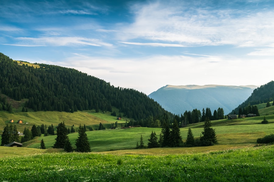
The European Plains represent a vast and historically significant swathe of land, a crucial element in understanding the continent’s geography, demographic distribution, economic development, and, perhaps most critically, its tumultuous military history. Primarily encompassing the North European Plain and the broader Great European Plain, this immense region, characterized by its relative flatness and fertile soils, has been a cradle of civilization, a conduit for migration and conquest, and the engine of industrial innovation. Decades of geological processes, from glacial sculpting to the deposition of fertile loess, have shaped this land into a landscape that has profoundly influenced the trajectory of European history, serving as both a breadbasket and a battleground.
The very foundation of the European Plains is etched in the dramatic geological events of Earth’s past, most notably the powerful erosive and depositional forces of the last Ice Age. These ancient glaciers, vast rivers of ice that covered much of northern Europe, were the primary sculptors of the immense, relatively flat terrain that defines the plain today. Their relentless movement ground down mountains, scoured valleys, and, as they retreated, deposited colossal amounts of sediment. This glacial legacy is not just about the absence of significant topographical barriers; it is also about the creation of the very characteristics that make the plain so remarkable.
Glacial Legacy: The Architects of Flatness
During the Pleistocene Epoch, massive ice sheets advanced and retreated across the European continent multiple times. These colossal glaciers acted as immense bulldozers, dismantling existing mountain ranges and smoothing the landscape into vast plains. As the ice sheets melted, they left behind vast deposits of till, moraines, and outwash – a jumble of sand, gravel, and clay that further contributed to the undulation, or lack thereof, of the terrain. The sheer scale of these glacial actions effectively leveled large portions of Europe, creating the open, expansive land that would later be so significant for human settlement and movement. The characteristic features of the North European Plain, in particular, bear the indelible marks of this glacial sculpting, with its numerous lakes, drumlins, and eskers as testament to the ice’s passage.
The Loess Belt: A Fertile Foundation
Beneath the glacial deposits lies another crucial geological characteristic: the loess belt. Loess is a fine-grained, wind-blown sediment, rich in minerals, that accumulated over millennia, particularly during interglacial periods. This thick layer of silty soil is exceptionally fertile, making the European Plains one of the most agriculturally productive regions on Earth. The loess is particularly concentrated in a belt stretching across parts of Eastern and Central Europe, from France eastward to Ukraine. This inherent fertility has been a cornerstone of European agriculture for centuries, supporting dense populations and contributing significantly to the continent’s food security and economic prosperity. The presence of loess ensures that even relatively modest elevations can support robust agricultural output, a stark contrast to mountainous regions where farming is often a more arduous and limited endeavor.
Elevation and Drainage: Subtle Variation, Profound Impact
While broadly characterized by its flatness, the European Plains are not uniformly flat. Elevations are generally low, with the vast majority of the plain lying below 152 meters (500 feet). Many areas average around 170 meters (560 feet), representing a gentle undulation rather than dramatic peaks and valleys. This low elevation provides several key advantages. Firstly, it facilitates accessibility and ease of travel. Secondly, it allows for the formation of extensive river systems. These rivers, often slow-moving and meandering due to the gentle gradient, act as vital arteries for transport and trade. Major rivers like the Rhine, Elbe, Oder, and Vistula traverse the plains, connecting inland areas to the coast and to each other, historically crucial for the movement of goods, people, and ideas. The interplay of low elevation and extensive river networks has been instrumental in shaping settlement patterns and economic development.
The European plains, characterized by their vast expanses of flat land and fertile soil, play a crucial role in the continent’s agriculture and biodiversity. For a deeper understanding of the geographical features and ecological significance of these plains, you can explore a related article that delves into their formation and impact on local ecosystems. To read more, visit this article.
The Strategic Imperative: A Geography of Conflict
The defining characteristic of the European Plains, from a military and historical perspective, is their astonishing lack of natural defensive barriers. This absence of mountains, deep canyons, or significant natural obstacles has transformed the plain into a vast, open corridor, often described as an “invasion highway.” This geographic reality has had a catastrophic and consistent impact on European history, dictating the course of countless wars, migrations, and political realignments. The ease with which armies could advance across these open lands meant that conquest and invasion were often facilitated by the very topology of the region, making defense a constant and often precarious endeavor.
The Open Corridor: An Inviter of Conflict
The sheer expansiveness and flatness of the Great European Plain, stretching from the Atlantic coast of France and the UK eastward to the Ural Mountains in Russia, presents a continuous and largely unobstructed path. Unlike regions fortified by mountain ranges or significant water bodies, the plain offers little in the way of natural resistance to invading forces. This has rendered many nations situated within its embrace vulnerable to external aggression. Throughout history, from the migrations of Germanic tribes to the Napoleonic Wars and the brutal campaigns of World War II, armies have moved and fought across these plains with relative ease. The lack of impediments meant that decisive battles were often fought in open engagements, and the ability to project power across vast distances was paramount.
Impact on Military Strategy and History
The strategic implications of this open geography are profound. Military leaders have long recognized the plain as the most challenging theater for defensive operations in Europe. Likewise, it has been the primary route for expansion and conquest. The course of nearly every major war and economic shift in European history has been shaped by the dynamics of the plain. Nations that successfully controlled key points or advantageous positions on the plain could project power and influence across vast distances. Conversely, those that failed to defend their frontiers often found themselves overrun. This has led to a constant cycle of alliances, betrayals, and power struggles, all playing out on the fertile, yet vulnerable, expanse of the European Plains. The very concept of the “heartland” in military strategy often refers to control of these strategically vital plains.
The Franco-Belgian Coalfields and Beyond: Industrial Arteries
The industrial might of Europe was also intrinsically linked to the geology of its plains. The presence of significant coalfields, stretching from the Franco-Belgian border all the way to the Donets Basin in Ukraine, provided the raw materials essential for the Industrial Revolution. These rich deposits became focal points for the development of heavy industry, driving economic growth and transforming societies. The easy accessibility of these resources, facilitated by the flat terrain and navigable river systems, allowed for the efficient extraction and transportation of coal and iron ore, fueling factories and laying the groundwork for modern industrial economies.
A Demographic Tapestry: Population Density and Urbanization
The confluence of fertile land, navigable waterways, and relatively easy accessibility has made the North European Plain one of the most densely populated regions on the continent. This demographic concentration is not a recent phenomenon; it is a pattern that has evolved over millennia, driven by the inherent advantages of the landscape. Major urban centers and industrial hubs dot the plain, testament to its capacity to support large populations and facilitate economic activity. From the bustling metropolises of the UK and Belgium to the vast cities of Eastern Europe, the plain is a living testament to human settlement and development.
Navigable Rivers: Lifelines of Trade and Settlement
The extensive network of navigable rivers that crisscross the European Plains has played a pivotal role in shaping population distribution and fostering urbanization. Rivers like the Rhine, Elbe, Oder, and Vistula have historically served as vital arteries for trade, communication, and transportation. Their gentle gradients made them ideal for the development of barge traffic, allowing for the efficient movement of goods and people between inland regions and coastal ports. This accessibility fostered the growth of settlements along their banks, which in turn evolved into major cities and commercial centers. The ability to move resources and products easily across the landscape was a significant factor in attracting and sustaining large populations.
Agricultural Bounty: Sustaining Population Growth
The exceptional fertility of the loess soils across the European Plains has provided a consistent and abundant food supply, capable of supporting significant population growth. For centuries, the agricultural output of these plains has been a cornerstone of the European economy. This consistent food security allowed for populations to expand beyond subsistence levels, freeing up labor for other pursuits, including craft production, trade, and later, industrial manufacturing. The “agricultural revolution” in Europe was heavily reliant on the productivity of these fertile plains, setting the stage for subsequent demographic and economic transformations. The European Union, in particular, continues to benefit from the high agricultural output of these regions, making them a primary global producer of staple crops like wheat, barley, and sugar beets.
The Rise of Industrial Hubs: A Magnets for Migration
The presence of abundant natural resources, particularly coal, combined with the flat, accessible terrain and established transportation networks, made the European Plains the cradle of the Industrial Revolution. The development of heavy industry in the 19th and 20th centuries led to a dramatic influx of population from rural areas and other parts of Europe seeking employment in factories and mines. This period of rapid industrialization spurred the growth of existing cities and the creation of new industrial centers, further concentrating population density. The plains became a magnet for migration, transforming the demographic landscape and creating the urbanized fabric that characterizes much of the region today.
The Breadbasket of Europe: Agricultural Prowess
The fertile soils of the European Plains, particularly the renowned loess belt, have cemented its status as an agricultural powerhouse. The region’s inherent capacity for high-yield farming has made it a critical contributor to both European and global food security. This agricultural prowess is not merely a historical footnote; it remains a vital component of the modern European economy, ensuring a consistent supply of essential commodities and underpinning the success of the European Union’s agricultural policies.
Loess Soils: The Foundation of Fertility
The key to the plains’ agricultural success lies in its unique soil composition. The thick layers of loess, a fine, wind-blown silt deposited over millennia, are exceptionally rich in nutrients and possess excellent water-holding capacity. This makes them ideal for a wide range of crops, requiring less intensive fertilization and irrigation than many other soil types. The loess belt, stretching across significant portions of the plain, acts as a natural fertility reservoir, providing an enduring advantage for agricultural production. This inherent richness allows for sustained cultivation without rapid depletion of soil resources.
Dominant Crops: Wheat, Barley, and Sugar Beets
The European Plains are a primary global producer of several key agricultural commodities. Wheat and barley, staple grains that form the basis of many diets, thrive in the region’s climate and soil conditions. Their cultivation is widespread, contributing significantly to both domestic consumption and international trade. Equally important is the production of sugar beets. The plains are a major European center for sugar beet cultivation, a vital crop for the confectionery and food processing industries. This agricultural specialization has not only supported the livelihoods of millions but also shaped the economic landscape of the nations within the plain.
The EU’s Agricultural Engine: Economic Significance
The agricultural output of the European Plains is of immense economic significance to the European Union. The region represents a substantial portion of the EU’s total agricultural production, influencing market dynamics and trade policies. The Common Agricultural Policy (CAP) of the EU has, for decades, aimed to support and stabilize agricultural production across the Union, with the plains playing a central role in achieving these objectives. The continued productivity of this region is crucial for maintaining food security within the EU and for its position as a major global exporter of agricultural products. The economic impact extends beyond farming, encompassing food processing, logistics, and related industries.
The European plains, characterized by their vast expanses and rich biodiversity, play a crucial role in the continent’s ecology and agriculture. For those interested in exploring this topic further, a related article can be found at My Geo Quest, where you can discover more about the unique features and significance of these landscapes. Understanding the dynamics of the European plains not only enhances our appreciation of nature but also highlights the importance of conservation efforts in these vital regions.
Geographic Extent and Connectivity: A Continental Span
| Country | Area (sq km) | Population |
|---|---|---|
| France | 551,695 | 67,081,000 |
| Germany | 357,022 | 83,190,556 |
| Poland | 312,696 | 38,386,000 |
| Ukraine | 603,500 | 41,660,000 |
The sheer scale of the Great European Plain is staggering, a vast expanse that bridges numerous nations and defines a significant portion of the European continent. Its geographic reach, from the western coasts of the Atlantic to the eastern reaches of the Ural Mountains, signifies its pervasive influence on the interconnectedness and historical development of Europe. This immense area is not a monolithic entity but rather a mosaic of diverse landscapes within a generally flattened topography, all linked by a complex web of historical interactions and geographical continuities.
Eastward Expansion: From Atlantic Shores to Ural Foothills
The Great European Plain’s dominion is immense, spanning an approximate 4,000,000 square kilometers. Its western edges touch the Atlantic coast of France and the United Kingdom, acknowledging the significant influence of this flattened topography even in island nations and western mainland Europe. From these western frontiers, the plain stretches eastward, a vast, uninterrupted expanse that eventually abuts the Ural Mountains in Russia, marking the traditional geographical boundary between Europe and Asia. This immense longitudinal reach underscores its role as a primary transit corridor for peoples, ideas, and armies throughout history.
Nations Embraced: A Mosaic of Territories
Numerous nations find their territory significantly shaped by the presence of the European Plains. Belgium and the Netherlands, with their low-lying, fertile lands, are deeply integrated into this geographical phenomenon. Germany, a central European power, has a substantial portion of its territory dominated by the North European Plain, influencing its historical development and economic structure. Denmark, with its Jutland peninsula, forms a significant northern extension. Poland, a nation historically shaped by its position on the plains, has a vast expanse of its territory covered by this feature. The Baltic States – Estonia, Latvia, and Lithuania – also possess significant areas of plain land, linking them to the broader geographical and historical narrative of the region.
Interconnectedness: Rivers, Roads, and Railways
The relative flatness of the European Plains has facilitated the development of extensive transportation networks, fostering a high degree of interconnectivity between the nations it encompasses. The navigable river systems, as previously discussed, are ancient highways, complemented in modern times by a dense network of roads and railways. These infrastructure developments have further cemented the plain’s role as a conduit for trade, travel, and cultural exchange. The ease with which goods and people can move across these relatively unobstructed lands has fostered economic integration and a shared sense of geographical identity, despite the political and cultural diversity of the nations involved. This connectivity has been a driving force behind Europe’s historical evolution, from early trade routes to the modern era of globalization.

Why Russia Can Never Feel Safe
FAQs
What are European plains?
European plains are vast, flat expanses of land that cover a significant portion of the European continent. They are characterized by their low elevation and lack of significant topographical features such as mountains or hills.
Where are European plains located?
European plains are located in various parts of the continent, including Eastern Europe, Central Europe, and Western Europe. Some of the major European plains include the North European Plain, the Great Hungarian Plain, and the Russian Plain.
What are the characteristics of European plains?
European plains are known for their fertile soil, which makes them ideal for agriculture. They also have a relatively mild climate and are home to a diverse range of flora and fauna. Additionally, many major rivers, such as the Danube and the Rhine, flow through these plains.
How do European plains contribute to the economy and environment?
European plains play a crucial role in the continent’s economy, as they are major agricultural areas that produce a variety of crops. They also support various industries and provide important habitats for wildlife. Additionally, the rivers that flow through these plains are vital for transportation and trade.
What are some of the challenges facing European plains?
European plains face challenges such as urbanization, industrialization, and environmental degradation. These factors can lead to issues such as habitat loss, pollution, and soil erosion. Additionally, climate change poses a threat to the delicate balance of these ecosystems.