
The Eastern Front, a vast and historically significant theater of conflict, is a landscape shaped by immense geographical features that have profoundly influenced military operations for centuries. From the sprawling plains and vital river systems to the imposing mountain ranges and notorious marshlands, understanding the Eastern Front’s geography is paramount to comprehending the strategic ebb and flow of battles fought upon its soil. While historical conflicts have left indelible marks, the current geopolitical climate in Eastern Europe, particularly in Ukraine, underscores the enduring relevance of these geographical realities. This article delves into the key strategic locations and geographical aspects of the Eastern Front, explaining their significance in both historical and contemporary contexts.
The Eastern Front is dominated by an almost unbroken expanse of plains, stretching from the Baltic Sea to the Black Sea. This seemingly featureless terrain, however, is punctuated by vital river systems that have historically served as both natural barriers and crucial arteries for movement and supply. The scale of these plains often dictates the nature of warfare, favoring large-scale offensives and rapid advances when weather and ground conditions permit. Conversely, the rivers, with their inherent logistical challenges for crossing and their potential to become significant obstacles, introduce critical choke points and defensive opportunities.
The Dnieper River: A Continental Divide
The Dnieper River stands as one of Europe’s longest and most significant waterways, bisecting Ukraine and playing a central role in the nation’s geography and history. Its course from the north to the south, emptying into the Black Sea, has historically acted as a natural dividing line, influencing settlement patterns, trade routes, and military campaigns. During various conflicts, control of the Dnieper crossings has been a constant strategic objective. Bridges, ferries, and fords have been hotly contested, with the river’s width and current often dictating the feasibility and success of amphibious assaults or defensive stands.
Crossing Operations and Defensive Lines
The Dnieper’s numerous tributaries and its broad main channel present formidable challenges for large-scale troop movements. Military planners have always had to account for the significant engineering and logistical effort required to cross such a barrier. For defenders, the Dnieper can serve as a natural moat, forcing attackers to concentrate their efforts at specific crossing points, thereby creating predictable zones of engagement where defensive forces can mass their firepower. Conversely, its meanders and marshy banks can offer concealed approaches for reconnaissance or raiding parties, complicating defensive strategies. The strategic importance of controlling key crossing points, such as those near Kyiv historically, or more recently along its southern reaches, has been consistently demonstrated throughout military history.
The Ukrainian Steppe: The Canvas of Warfare
Beyond the river systems lie the vast Ukrainian steppes, a region of rolling grasslands and fertile agricultural land. This open terrain, particularly during the drier months, has facilitated large-scale mechanized warfare, allowing for rapid advances and sweeping maneuvers. The vastness of the steppes, while offering opportunities for envelopment and encirclement, also presents challenges for maintaining supply lines over long distances. This delicate balance between mobility and logistic sustainment has often been a decisive factor in campaigns fought across this region.
Logistical Vulnerabilities and Supply Arteries
The open nature of the steppe makes it vulnerable to swift advances by well-supplied forces. However, the same openness also means that logistical convoys are exposed. Control of key transportation nodes becomes paramount. In the modern context, while the steppe remains fertile ground for mechanized warfare, the reliance on road and rail networks for supply has amplified the strategic importance of these arteries. Towns and cities along these routes, acting as critical logistics hubs, become prime targets for both offensive and defensive operations.
The geography of the Eastern Front during World War II played a crucial role in the strategies and outcomes of various battles. For a deeper understanding of how the terrain influenced military operations, you can explore this related article on the subject. It provides insights into the topographical challenges faced by both the Axis and Soviet forces. For more information, visit this link.
The Pripet Marshes: A Historical Stumbling Block, Modern Relevance
The Pripet Marshes, an immense wetland stretching across parts of Ukraine, Belarus, and Poland, have for centuries been a formidable natural barrier to military movements. Covering over 104,000 square miles, these waterlogged expanses have historically forced armies to detour or expend considerable effort to traverse, often rendering large-scale flanking maneuvers impossible or impractically slow. Their dense vegetation, unreliable terrain, and extensive water bodies have posed significant challenges for troop deployment, vehicle movement, and logistical support.
Impact on Historical Invasions and Defenses
During World War II, for instance, the Pripet Marshes played a significant role in shaping the initial German invasion of the Soviet Union, Operation Barbarossa. The marshes acted as a natural buffer, channeling German advances along more defined axes and influencing the strategic objectives of the Wehrmacht. Defensive forces also utilized the marshes to their advantage, creating impassable zones that could funnel enemy forces into pre-prepared kill zones or simply deny them access to vital areas. The difficulty of operating in such terrain meant that specialized units, such as airborne troops or those equipped with specialized equipment, were often required for operations in or around the marshes.
Modern Context: Shifting Strategic Significance
While the Pripet Marshes remain a geographical reality, their direct impact as a hindrance to large-scale military movement in the modern era has somewhat diminished in comparison to historical periods. The development of significant road networks, including the M14 Highway which passes near the southern edge of the marshes, allows for more controlled and albeit still challenging passage. However, the strategic significance of areas adjacent to the marshes, or routes that skirt them, remains high. The M14 Highway itself, leading towards Crimea, has become a critical strategic artery, and its control or disruption has a profound impact on southern military operations. The ability to bring Ukrainian fire control over this route highlights how modern weaponry can influence the strategic value of even historical geographical obstacles. The marshes themselves can still influence battlefield tactics, potentially serving as natural obstacles to conceal troop movements or create defensive positions.
The Carpathian Mountains: A Natural Fortress in the South
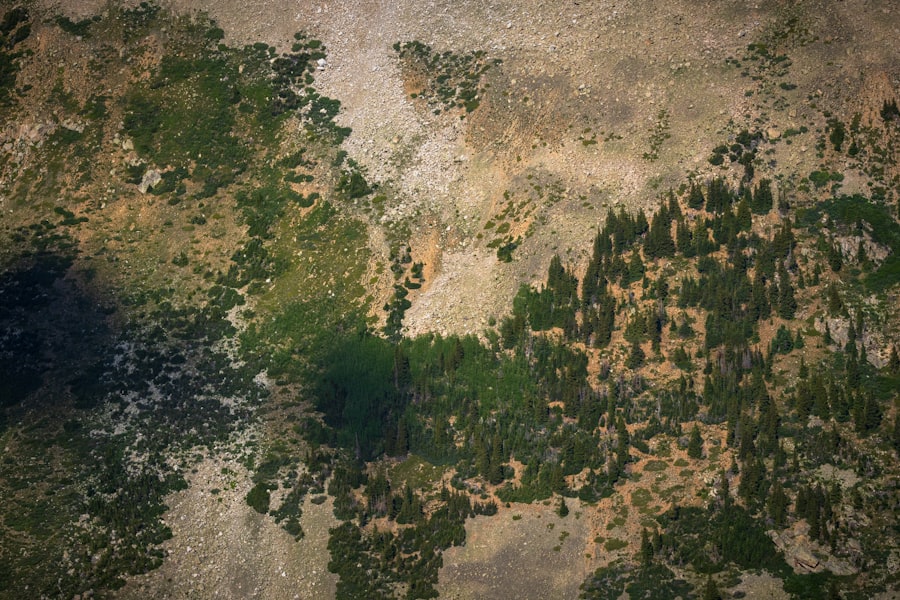
The Carpathian Mountains form a significant arc of elevated terrain in the southwestern part of the Eastern Front, predominantly impacting the southern theater of operations. Unlike the vast plains, this mountainous region presents a stark contrast, offering natural defensive advantages and presenting considerable operational challenges for invading forces. The rugged topography, characterized by steep slopes, narrow valleys, and dense forests, breaks up open terrain and limits maneuverability, thereby favoring defensive strategies and partisan warfare.
Influencing Defensive Geometry and Access Routes
The Carpathian Range acts as a substantial natural barrier, effectively shielding the Hungarian Plains to the west. This protective semicircular formation influences the defensive geometry of the southern theater by channeling potential invasion routes into specific mountain passes and valleys. Control of these passes, such as the Veretsky Pass or the Dukla Pass, has historically been crucial for securing access into or out of the region. For an invading force, the mountains represent a significant logistical and tactical hurdle, requiring specialized units and considerable preparation to overcome.
Limited Mobility and Elevated Defensive Advantages
The limited mobility afforded by the mountainous terrain significantly impedes large-scale mechanized advances and rapid flanking maneuvers that are often characteristic of warfare on the Eastern Front’s plains. This characteristic favors defensive forces, who can utilize the natural terrain to establish strong points, create ambushes, and exploit the enemy’s vulnerability to artillery fire from elevated positions. The forests and rugged slopes provide excellent cover for infantry, making it difficult for attackers to maintain situational awareness and coordination. Moreover, the presence of the Carpathians can influence the overall strategic direction of a campaign, often forcing military planners to either bypass the region, attempt a costly mountain assault, or focus their efforts on flanking it.
Key Strategic Hubs and Frontline Nexus Points

The vastness of the Eastern Front is not solely defined by its geographical features but also by the crucial human-made and natural choke points that emerge within its landscape. These are the locations where logistics converge, where troop movements are concentrated, and where the fate of entire fronts can be decided. Understanding the current strategic importance of these hubs is vital for grasping the dynamics of ongoing conflicts.
Pokrovsk (Donetsk Region): The Current Epicenter of Logistics
In the current conflict, Pokrovsk, located in the Donetsk Region, has emerged as a critically important strategic hub. Its significance stems from its position as a major logistics intersection for Ukrainian supply lines and troop movements. The ability to move reinforcements, munitions, and essential supplies through Pokrovsk is vital for Ukraine’s defensive capabilities in the eastern theater. Consequently, this location has become a focal point of intense fighting, with Russian forces aggressively pushing to sever this crucial artery. Control over Pokrovsk would severely hamper Ukraine’s ability to sustain its forces in the eastern Donbas and significantly alter the strategic balance.
Battling for the Artery of Supply
The heavy fighting concentrated around Pokrovsk underscores its critical role. Russian objectives here are clear: to cut off a vital lifeline for Ukrainian forces. Ukrainian efforts are equally dedicated to defending this hub, recognizing that its loss would have cascading negative consequences for their overall military posture. The strategic importance of Pokrovsk is a testament to how relatively small geographical locations can become disproportionately vital when they serve as linchpins in complex logistical networks.
Svato-Crimina Axis (Luhansk Region): Russia’s Defensive Backbone
Conversely, the Svato-Crimina Axis in the Luhansk Region has been identified as Russia’s most vital defensive backbone and supply line in the eastern theater. This axis represents a critical artery for Russian forces, facilitating their movement, resupply, and reinforcement of their positions in the eastern occupied territories. Recent Ukrainian advances in the vicinity of settlements like Kiefka and Spatova have directly threatened this integral line.
Straining and Threatening a Crucial Artery
The Ukrainian efforts to break or circumvent the Svato-Crimina Axis are aimed at disrupting Russia’s ability to maintain its presence and defensive posture in eastern Ukraine. A successful Ukrainian penetration of this axis could isolate Russian forces, disrupt their command and control, and potentially lead to a significant unraveling of their defensive lines in the region. This highlights the dynamic nature of strategic geography, where defensive lines can become offensive objectives and vice versa.
Kupiansk (Northern Donetsk): The Gateway to Encirclement
Kupiansk, situated in northern Donetsk, is a key objective for Russian forces aiming to achieve an operational advantage by encircling the northern Donetsk region. Its control is pivotal for securing the border with the Russian Belgorod region, thereby creating a more defensible and contiguous territory for Russian forces. The capture of Kupiansk would also provide Russia with a springboard for further advances westward, potentially threatening other Ukrainian strongholds.
Securing Borders and Paving the Way for Advance
The strategic importance of Kupiansk lies in its geographical position, which acts as a gateway. For Russia, controlling it means solidifying their border with their own territory, reducing the threat of cross-border raids and facilitating easier logistical support. For Ukraine, its defense is crucial to prevent the erosion of their control over the northern Donetsk region and to maintain strategic depth.
The geography of the Eastern Front during World War II played a crucial role in shaping the strategies and outcomes of the conflict. Understanding the vast landscapes, from the dense forests of Belarus to the expansive steppes of Ukraine, provides insight into the challenges faced by both the Axis and Soviet forces. For a deeper exploration of this topic, you can read a related article that delves into the geographical factors influencing military operations by visiting this link. This resource highlights how terrain and climate affected troop movements and logistics throughout the war.
Border Regions and Buffer Zones: Shaping the Frontline
| Country | Area (sq km) | Length of Front (km) |
|---|---|---|
| Russia | 17,098,242 | 1,600 |
| Germany | 357,022 | 1,200 |
| Poland | 312,696 | 500 |
| Ukraine | 603,500 | 1,000 |
The porous borders and strategic hinterlands of the Eastern Front have always been zones of intense military activity. The establishment of buffer zones and the control of border regions are key objectives that significantly influence the frontline’s shape and the scope of direct engagement.
Vovchansk & Kharkiv Border: Establishing a Fire Superiority Zone
In recent operations, Russian forces have gained limited control south of Vovchansk, on the border with Russia’s Belgorod region. The objective of this limited advance appears to be the establishment of a buffer zone. This buffer zone serves a dual purpose: to provide a degree of protection for Russian territory and, crucially, to bring artillery positions closer to Kharkiv, Ukraine’s second-largest city.
Artillery Reach and Protective Measures
By pushing their lines closer to Kharkiv, Russian forces seek to increase their artillery dominance over the city, thereby intensifying pressure on Ukrainian defenses and potentially impacting civilian morale. The establishment of such buffer zones is a clear indication of strategic intent, aiming to shape the battlefield geometry to their advantage by extending direct fire capabilities into enemy territory.
Marginal Advances and the Static Reality of the Frontline
Despite intense localized combat, recent reports, such as those from the Institute for the Study of War (ISW), indicate that Russia has made only “marginal” or limited gains in several key areas along the southern front. Examples include the areas northeast of Bakhmut, near Avdiivka, and east of Robotyne in the Zaporizhzhia region. This observation highlights a significant contemporary reality: despite significant troop concentrations and fierce fighting, the vastness of the Eastern Front and the nature of modern defense often result in a largely static frontline.
The Microcosm of Localized Combat
These marginal gains, while strategically insignificant on a grand scale, represent intense localized combat and considerable casualties. They illustrate the difficulty of achieving decisive operational breakthroughs in heavily fortified defensive lines. The geographical features, even those seemingly less imposing, combined with modern fortifications and extensive minefields, create a formidable challenge for any offensive operation. This reality of a largely static frontline, punctuated by localized advancements, underscores the enduring strategic importance of the geography that often dictates the pace and scope of these engagements. The Eastern Front, therefore, remains a complex tapestry where geography, logistics, and strategic objectives intertwine, shaping the course of conflict in tangible and enduring ways.

Why Russia Can Never Feel Safe
FAQs
What countries were involved in the Eastern Front during World War II?
The Eastern Front during World War II primarily involved the Soviet Union and Nazi Germany, but also included other countries such as Finland, Romania, Hungary, and Slovakia.
What geographical features characterized the Eastern Front during World War II?
The Eastern Front was characterized by a vast and diverse geographical landscape, including dense forests, expansive plains, marshes, and large rivers such as the Dnieper, Don, and Volga.
How did the geography of the Eastern Front impact military operations?
The diverse geography of the Eastern Front presented significant challenges for military operations, including difficulties in maneuvering large armies through dense forests and marshes, as well as the need to navigate across wide open plains and major rivers.
What were the major battles that took place on the Eastern Front?
The Eastern Front saw several major battles, including the Battle of Stalingrad, the Siege of Leningrad, the Battle of Kursk, and the Battle of Moscow, all of which had significant impacts on the outcome of the war.
How did the geography of the Eastern Front influence the outcome of World War II?
The geography of the Eastern Front played a crucial role in shaping the outcome of World War II, as it presented both opportunities and challenges for the warring parties, ultimately contributing to the Soviet Union’s ability to withstand and repel the German invasion.