The relentless flow of rivers shapes landscapes, sustains ecosystems, and dictates human settlement patterns. Understanding how these vital arteries of the Earth’s surface change over time, a phenomenon known as river migration, is crucial for effective water resource management, hazard mitigation, and ecological preservation. Historically, this tracking relied on laborious fieldwork, historical maps, and limited aerial photography. However, the advent and maturation of remote sensing technologies, coupled with sophisticated data analysis techniques, have revolutionized our ability to monitor and quantify river migration with unprecedented accuracy and scale. This article delves into the power of remote sensing data analysis for tracking river migration, exploring the methodologies, applications, and future potential of this transformative approach.
Understanding River Migration Dynamics
River migration, at its core, is the lateral movement of a river channel across its floodplain. This process is driven by a complex interplay of hydrological and geomorphological factors. Sediment transport is a primary agent; as rivers carry sediment, they deposit it on the inside bends of meanders, causing them to widen, while erosion occurs on the outer bends, leading to channel shift. The velocity and volume of water flow, influenced by rainfall, snowmelt, and land use, directly impact sediment transport capacity and erosive power. Topography plays a significant role, with steeper slopes generally leading to more rapid migration and flatter areas allowing for more extensive meandering.
The Meandering Phenomenon
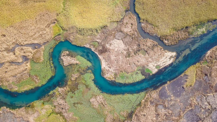
Meandering rivers are characterized by their sinuous, S-shaped curves. This characteristic form arises from natural variations in flow velocity. Within a meander bend, water flows faster on the outer bank, where it erodes the channel, and slower on the inner bank, where it deposits sediment. This differential erosion and deposition create and accentuate the bends over time, leading to a continuous process of channel widening and downstream translation of the meander loop. The wavelength and amplitude of meanders are influenced by factors such as sediment load, bank material resistance, and the river’s discharge.
Braided River Systems
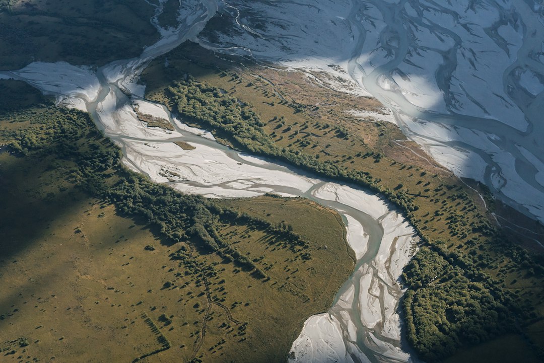
In contrast to meandering rivers, braided river systems are characterized by multiple, interconnected channels separated by ephemeral islands or bars. These systems typically form in areas with high sediment loads and fluctuating discharge, such as glacial outwash plains or mountainous regions. During high flow events, the channels can widen and deepen, transporting large amounts of sediment. As flows recede, sediment deposition creates new bars and islands, often diverting flow and initiating new channels. This dynamic process results in a constantly shifting and complex network of waterways.
Straight and Anabranching Channels
While meandering and braided systems are the most dynamic, rivers can also exhibit straighter or anabranching patterns. Straight channels are often incised into resistant bedrock or have been artificially straightened for navigation or flood control. Anabranching rivers, however, involve multiple channels that diverge and then rejoin, often forming large islands. These systems are less common than meanders but still exhibit significant lateral movement and can be challenging to manage.
Remote sensing data has become an invaluable tool for tracking river migration, providing insights into the dynamic changes in river systems over time. A related article that delves deeper into this topic can be found at MyGeoQuest, which discusses various methodologies and technologies used in remote sensing to monitor and analyze river behavior. This resource offers a comprehensive overview of how satellite imagery and aerial surveys contribute to our understanding of river dynamics and their implications for ecosystems and human activities.
Remote Sensing Technologies for River Monitoring

The ability to capture synoptic views of the Earth’s surface from space or the air has been a game-changer for studying river migration. Remote sensing technologies provide a non-invasive and cost-effective means of collecting data over large areas and long time periods, enabling the observation of subtle and gradual changes in river channels.
Satellite Imagery Acquisition and Characteristics
Satellites equipped with various optical and radar sensors continuously orbit the Earth, capturing images of its surface. Optical sensors, such as those on the Landsat, Sentinel, and MODIS satellites, record reflected sunlight across different spectral bands. This allows for the differentiation of water bodies from land, the identification of vegetation patterns along riverbanks, and the assessment of water turbidity. The resolution of satellite imagery, ranging from tens of meters to sub-meter, determines the level of detail that can be discerned, with higher resolutions being crucial for tracking fine-scale channel changes. Temporal resolution, the frequency with which a satellite revisits a particular area, is also vital for capturing the dynamic nature of river migration.
Aerial Photography and Unmanned Aerial Vehicles (UAVs)
While satellites offer broad coverage, aerial photography and data acquired from Unmanned Aerial Vehicles (UAVs) provide significantly higher spatial resolution and flexibility. Aerial surveys, conducted using manned aircraft, can capture detailed images of river systems at a scale suitable for identifying individual features like point bars and erosion scarps. UAVs, often equipped with advanced cameras and sensors, have emerged as a powerful tool for localized, high-resolution monitoring. Their ability to fly at low altitudes and perform repeated surveys makes them ideal for capturing rapid changes in river morphology and for detailed mapping of specific river reaches.
LiDAR and Radar Altimetry
Beyond optical data, Light Detection and Ranging (LiDAR) and radar altimetry provide valuable topographic information that complements imagery. LiDAR systems emit laser pulses and measure the time it takes for them to return after reflecting off the surface. This allows for the creation of highly accurate digital elevation models (DEMs) of riverbanks and floodplains, revealing subtle changes in elevation that indicate erosion or deposition. Radar altimetry, particularly from satellites like the Jason series, can measure the height of water surfaces, providing insights into river stage and flow dynamics, which are indirect drivers of migration.
Data Analysis Techniques for Tracking River Migration
The raw remote sensing data is only the first step. Extracting meaningful information about river migration requires sophisticated data processing and analysis techniques. These methods leverage the unique characteristics of remote sensing data to delineate channel boundaries, quantify morphological changes, and infer migration rates.
Image Preprocessing and Georeferencing
Before any analysis can occur, remote sensing imagery must undergo rigorous preprocessing. This includes radiometric correction to account for variations in sensor sensitivity and atmospheric conditions, geometric correction to remove distortions, and georeferencing to align the imagery with accurate geographic coordinates. Accurate georeferencing is paramount, as even small misalignments can lead to significant errors in measured channel shifts over time. Cloud masking is also essential for optical imagery, ensuring that clouds do not obscure the river channel.
Feature Extraction: Delineating River Channels
A critical step in tracking river migration is accurately delineating the river channel boundaries in each image. This can be achieved through various techniques. Manual digitization by trained analysts, while accurate, is time-consuming and impractical for large datasets. Automated or semi-automated methods are therefore preferred. Thresholding techniques, which classify pixels based on their spectral values (e.g., pixels with low reflectance in the visible spectrum are likely water), are a common starting point. More advanced methods involve object-based image analysis (OBIA), which segments images into meaningful objects based on their spectral, spatial, and textural properties, followed by classification of these objects as water, land, or vegetation. Machine learning algorithms, such as support vector machines (SVMs) and convolutional neural networks (CNNs), are increasingly being employed for their ability to learn complex patterns and achieve high classification accuracy.
Change Detection and Quantifying Migration
Once river channels are accurately delineated for multiple time points, change detection techniques are applied to quantify migration. Overlaying digitized channel boundaries from different dates allows for the visual identification of shifts. More quantitative approaches include:
Cross-correlation and Image Registration
For precisely aligning images and identifying subtle shifts, cross-correlation techniques can be employed. By analyzing the similarity between image patches from different dates, the amount and direction of translation can be determined. This is particularly useful when dealing with images that may have slight positional inaccuracies.
Metrics of Channel Instability
Various metrics can be calculated to quantify channel migration. Bankline change rate is a fundamental measure, calculated by dividing the distance a bank has moved by the time elapsed between observations. Meander belt width, the total width encompassing the meanders, can also be monitored. Area of erosion and deposition can be calculated by differencing the channel extents between successive images, highlighting areas of active change. Centroid shift of the river channel or specific meander loops provides a generalized measure of lateral movement.
Morphological Analysis and River Morphology Indices
Beyond simple boundary shifts, analysis of river morphology provides deeper insights. Tools that analyze the shape and sinuosity of the river can track changes in meander geometry. Indices such as Sinuosity Index (ratio of channel length to straight-line distance) and Wavelength and Amplitude of Meanders can reveal how the river’s form is evolving. Analysis of cross-sectional profiles, derived from DEMs, can reveal changes in channel depth and bank slope, indirectly indicating migration processes.
Applications of Remote Sensing for River Migration Tracking
The insights gained from tracking river migration have far-reaching implications across various domains.
Flood Hazard Assessment and Mitigation
Understanding historical and ongoing river migration is fundamental for accurate flood hazard mapping. Rivers that are actively migrating pose a greater risk of inundating new areas. Remote sensing data allows for the identification of areas that have been historically impacted by channel shifts and the prediction of future migration pathways. This information is crucial for developing effective flood control measures, guiding land-use planning in floodplains, and establishing early warning systems. For instance, identifying areas prone to avulsion (sudden abandonment of an old channel and formation of a new one) is critical for preventing catastrophic flooding.
Ecosystem Management and Habitat Restoration
Rivers are dynamic ecosystems that support a rich diversity of flora and fauna. River migration creates and modifies habitats, influencing biodiversity. Tracking these changes helps ecologists understand how different species respond to habitat availability and connectivity. For example, the formation of oxbow lakes, former meander loops cut off from the main channel, creates unique wetland habitats. Monitoring the evolution of these features and the surrounding riparian vegetation can inform habitat restoration efforts and conservation strategies for endangered species.
Water Resource Management and Infrastructure Planning
Accurate knowledge of river migration is essential for the sustainable management of water resources and the planning of critical infrastructure. Rivers are often the source of water for irrigation, domestic use, and industry. Changes in channel position can affect the accessibility of water intakes and the efficiency of water delivery systems. Furthermore, bridges, dams, pipelines, and other infrastructure located near rivers are vulnerable to erosion and channel migration. Remote sensing data allows engineers and planners to identify areas of high geomorphic risk and to design infrastructure that is resilient to anticipated river movement, minimizing the need for costly relocation or reinforcement.
Geomorphological Research and Climate Change Studies
River migration is a fundamental process in geomorphological evolution. Remote sensing data provides an unprecedented opportunity to study these processes at regional and continental scales, and over extended time periods, which was previously impossible. By analyzing long-term datasets, researchers can identify trends in migration rates and relate them to climatic factors, land-use changes, and geological controls. This is particularly important in the context of climate change, as altered precipitation patterns and increased glacial melt can significantly impact river regimes and, consequently, migration dynamics. Remote sensing can help elucidate how rivers are responding to a changing climate and predict future behavior.
Remote sensing data has become an invaluable tool in tracking river migration, providing researchers with the ability to monitor changes in river courses over time. A related article that delves deeper into this topic can be found on MyGeoQuest, where innovative techniques and case studies are discussed. For those interested in exploring the implications of these technologies, the article offers insights into how remote sensing can enhance our understanding of river dynamics. You can read more about it in this informative piece on river migration tracking.
Future Directions and Challenges
| Metric | Description | Typical Data Source | Measurement Unit | Frequency of Measurement | Application |
|---|---|---|---|---|---|
| Channel Migration Rate | Rate at which the river channel shifts laterally over time | Satellite imagery (Landsat, Sentinel), Aerial photos | meters/year | Annual to multi-year | Assess riverbank erosion and floodplain changes |
| Bankline Position | Location of riverbank edges at different time points | High-resolution satellite images, UAV/drone imagery | Geospatial coordinates (latitude/longitude) | Seasonal to annual | Track river boundary shifts and sediment deposition |
| Channel Width | Distance between opposite riverbanks | Satellite imagery, LiDAR data | meters | Monthly to annual | Monitor river widening or narrowing trends |
| Flow Velocity | Speed of water flow within the river channel | Radar remote sensing (e.g., SAR), In-situ sensors | meters/second | Daily to seasonal | Understand sediment transport and erosion potential |
| Surface Water Extent | Area covered by water in the river and floodplain | Optical satellite data (MODIS, Sentinel-2) | square kilometers | Weekly to monthly | Flood monitoring and habitat mapping |
| Elevation Change | Change in riverbed or floodplain elevation over time | LiDAR, Radar altimetry | meters | Annual to multi-year | Detect sediment deposition or erosion |
| Vegetation Index (NDVI) | Normalized Difference Vegetation Index to assess riparian vegetation health | Multispectral satellite imagery (Sentinel-2, Landsat) | Index value (0 to 1) | Monthly to seasonal | Monitor vegetation changes due to river migration |
The field of tracking river migration using remote sensing is continuously evolving, driven by advancements in sensor technology, data processing algorithms, and the increasing availability of open-access data.
Integration of Multiple Data Sources
The future lies in the synergistic integration of diverse remote sensing data sources. Combining high-resolution optical imagery with LiDAR-derived DEMs can provide a comprehensive understanding of both surface changes and underlying topographic evolution. Incorporating data from different sensor types, such as thermal infrared for monitoring water temperature or hyperspectral imagery for detailed vegetation analysis, can further enrich the understanding of riverine processes. Furthermore, integrating remote sensing data with in-situ measurements, such as flow gauges and sediment samplers, can provide valuable ground truth and improve the accuracy of models.
Advancements in Machine Learning and Artificial Intelligence
Machine learning and artificial intelligence (AI) are poised to play an even more significant role in automating and enhancing river migration analysis. Deep learning algorithms, such as CNNs, are demonstrating remarkable capabilities in semantic segmentation of river channels and identification of geomorphic features with minimal human intervention. AI can also be used for predictive modeling, forecasting future channel shifts based on historical patterns and environmental factors. The development of AI-powered platforms for interactive analysis and visualization will make these powerful tools more accessible to a wider range of users.
Addressing Data Gaps and Uncertainty
Despite the progress, several challenges remain. Data gaps due to persistent cloud cover, sensor limitations, or the unavailability of historical data can hinder comprehensive analysis. Quantifying uncertainty in measurements and predictions is crucial for making informed decisions. Developing robust methods for error propagation and uncertainty estimation is an ongoing area of research. Furthermore, the long-term availability and accessibility of satellite data archives, particularly at high resolutions, are important considerations for sustained monitoring efforts.
Real-time Monitoring and Predictive Analytics
The ultimate goal is to move towards real-time or near real-time monitoring of river migration. This would enable proactive management and rapid response to geomorphic hazards. Developing systems that can process incoming satellite or UAV data rapidly and alert stakeholders to significant changes would be invaluable. Predictive analytics, leveraging machine learning models trained on vast datasets, will be key to anticipating future migration patterns and providing early warnings, thereby enhancing resilience to the dynamic nature of rivers. The ongoing development of sensor networks, coupled with advancements in cloud computing and data processing, brings this vision closer to reality.
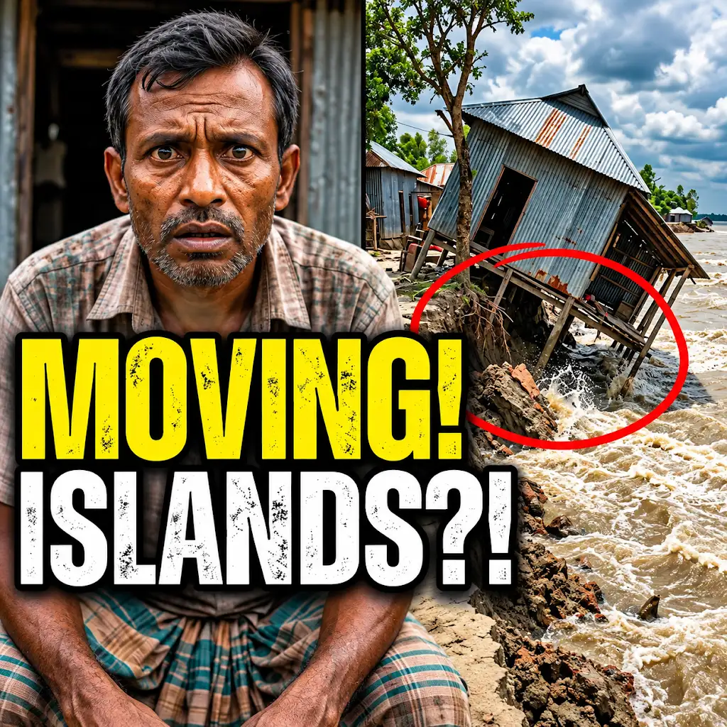
This River is Literally Erasing Islands
FAQs
What is remote sensing data?
Remote sensing data refers to information collected from a distance, typically using satellites or aircraft, to monitor and study the Earth’s surface without direct physical contact.
How is remote sensing data used in tracking river migration?
Remote sensing data is used in tracking river migration by providing detailed images of the river’s path over time. By analyzing these images, researchers can identify changes in the river’s course, erosion patterns, and sediment deposition.
What are the benefits of using remote sensing data for river migration tracking?
Using remote sensing data for river migration tracking offers several benefits, including cost-effectiveness, the ability to cover large areas, and the capability to monitor changes over time without the need for constant physical presence.
Which types of remote sensing technologies are commonly used for river migration tracking?
Common types of remote sensing technologies used for river migration tracking include satellite imagery, LiDAR (Light Detection and Ranging), aerial photography, and radar systems. Each technology offers unique advantages for monitoring river dynamics.
How can remote sensing data help in predicting and managing river migration risks?
Remote sensing data can help in predicting and managing river migration risks by providing early detection of changes in river behavior, allowing authorities to take proactive measures such as implementing flood control measures, land use planning, and infrastructure development to mitigate potential risks.