
The intricate dance of water shaping the earth’s surface is nowhere more vividly displayed than in the dynamic architecture of braided river channels. These complex systems, characterized by a network of interconnected, shifting channels separated by unvegetated bars of sand and gravel, offer a unique window into the fundamental processes of fluvial geomorphology. Understanding the patterns and evolution of braided rivers is crucial for a variety of fields, from hydrological modeling and flood risk assessment to the management of natural resources and the interpretation of ancient landscapes. This article delves into the methods and insights gained from tracking braided river channels, illuminating the geomorphological principles that govern their formation and behavior.
The Genesis of Bifurcation: Environmental Drivers of Braiding
The very existence of a braided river system is a testament to a specific set of environmental conditions. These rivers do not spontaneously emerge; rather, they are sculpted by the interplay of sediment supply, flow dynamics, and the geological substrate. Identifying the key drivers behind braiding is the first step in unraveling the geomorphological tapestry they weave.
Sediment Load: The Lifeblood of Braiding
The most critical factor dictating the formation of braided rivers is an abundant and readily erodible sediment supply. Unlike single-thread rivers that can efficiently transport a steady load of fine-grained material, braided systems thrive on a high discharge of coarse sediment, typically sand and gravel. This abundance of mobile sediment acts as the building blocks for the characteristic bars that define these channels.
Sources of Abundant Sediment
The upstream catchment area plays a pivotal role in supplying the necessary sediment. High rates of erosion, often triggered by steep mountain slopes, glacial meltwater, or significant tectonic activity, can deliver vast quantities of debris to the river system. Glacial outwash plains, characterized by unconsolidated glacial till and moraine material, are classic environments for the formation of braided rivers due to the continuous influx of finely ground rock flour and gravel. Similarly, areas undergoing rapid weathering and mass wasting events, such as landslides and debris flows, contribute significantly to the sediment load.
Sediment Characteristics and Transport
The size, shape, and distribution of sediment particles are also crucial. A diverse range of grain sizes, with a substantial proportion of gravel and coarse sand, is ideal for bar formation. When flow velocities are high, these coarse particles are readily mobilized and deposited. The inherent instability of deposition in a high-sediment regime prevents the establishment of a stable single channel. Instead, sediment deposition leads to the gradual accumulation of bars, which then obstruct and divide the flow, forcing it to bifurcate and create new channels around these emerging landforms.
Flow Regimes: The Sculpting Force
While sediment supply provides the raw material, the flow regime of the river dictates how that material is mobilized, transported, and ultimately deposited. Braided rivers are typically associated with highly variable and often ephemeral flow conditions.
Discharge Variability and Peak Flows
The hallmark of many braided river systems is their pronounced discharge variability. This often manifests as frequent and intense flood events interspersed with periods of lower flow. During high discharge events, the river possesses immense erosive and transport capacity, carrying large volumes of sediment. However, as the flow recedes, the river’s ability to transport this sediment diminishes. The deposited sediment, particularly the coarse material, begins to form temporary obstructions. These obstructions, in turn, divide the flow, creating the characteristic anastomosing network of channels. The rapid fluctuations in water level and velocity prevent the development of a stable channel morphology, as deposition and erosion constantly reshape the riverbed.
Shallow Water Depths and High Velocities
Braided rivers are often characterized by relatively shallow water depths and high flow velocities, especially during peak events. This combination of factors contributes to the mobility of the riverbed. The shallow depth means that even moderate amounts of sediment can significantly constrict the channel, leading to bifurcation. The high velocities ensure that sediment is continuously being transported and redeposited, facilitating the dynamic evolution of bar morphology.
Topographic and Geologic Influences: The Framework
The broader landscape and underlying geology provide the fundamental framework within which braided rivers develop. The gradient of the riverbed, the type of bedrock, and the presence of resistant formations all influence channel behavior.
Steep Gradients and Valley Constraints
Braided rivers are commonly found in proglacial environments, mountainous regions, and areas with steep topographic gradients. The steeper the gradient, the higher the energy of the water, leading to increased erosive power and a greater capacity to transport sediment. Valley walls can also play a role, either confining the braided network or providing sources of colluvial material that contributes to sediment load. In some cases, a narrow, constrained valley can force a high-sediment river into a braided pattern by limiting its lateral expansion.
Substrate Resistance and Alluvial Plains
The resistance of the underlying substrate to erosion is another key factor. Rivers flowing over easily erodible alluvial deposits, such as unconsolidated gravel and sand, are more prone to braiding. In contrast, rivers incising into bedrock tend to develop more stable, single-thread channels, or may exhibit other forms of channel complexity. The geological composition of the floodplain can therefore exert significant control on whether a river adopts a braided morphology.
In the study of braided river channels, understanding the geomorphology is crucial for predicting sediment transport and river dynamics. A related article that delves into these aspects can be found at My Geo Quest, which explores the intricate patterns and processes that shape braided river systems. This resource provides valuable insights into the factors influencing channel morphology and the implications for river management and ecology.
Decoding the Dynamics: Methods for Tracking Braided Channels
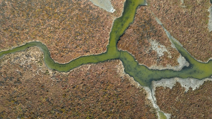
The ephemeral and ever-changing nature of braided river channels presents a significant challenge for geomorphological study. To understand their evolution, researchers employ a suite of innovative techniques that capture their dynamic behavior across various temporal and spatial scales. Tracking these channels provides invaluable data for understanding sediment transport, channel migration, and the overall geomorphological processes at play.
Remote Sensing: A Bird’s-Eye View of Change
The advent of remote sensing technologies has revolutionized the study of braided rivers, offering synoptic and repeated views of vast riverine landscapes. These techniques allow for the observation of channel changes over time without direct physical intervention, which is often impractical in these dynamic environments.
Aerial Photography and Satellite Imagery
Historical aerial photographs and contemporary satellite imagery are invaluable for reconstructing past channel configurations and monitoring ongoing changes. By comparing images from different dates, researchers can delineate channel boundaries, identify bar formation and erosion, and track the migration rates of individual channels. High-resolution imagery, such as that provided by commercial satellites and drone surveys, allows for the detailed mapping of bar morphology, vegetation patterns on bars, and the distribution of different sediment types. Multispectral and hyperspectral imagery can further aid in distinguishing between bare sediment, vegetation, and water, providing richer datasets for analysis.
Interferometric Synthetic Aperture Radar (InSAR)
InSAR techniques can be used to measure land surface elevation changes over time. For braided rivers, InSAR can reveal subtle patterns of subsidence or uplift related to sediment deposition and erosion, providing insights into the three-dimensional evolution of the riverbed and floodplain. While often used for larger-scale tectonic or volcanic studies, its application to fluvial systems is growing, offering a way to quantify volumetric changes within braided channel networks.
Field-Based Data Collection: Ground Truthing and Detailed Analysis
While remote sensing provides a broad overview, detailed field studies are essential for understanding the micro-geomorphological processes and for validating remote sensing data. Direct measurements and observations on the ground offer insights that cannot be obtained from afar.
Channel Surveys and Sediment Sampling
Traditional geodetic surveying techniques, including total stations and GPS, are used to create detailed topographic maps of the riverbed and floodplain. These surveys capture the precise geometry of channels, bars, and other geomorphic features. Sediment sampling is crucial for characterizing the grain size distribution of bedload and suspended load, which is directly related to the river’s transport capacity and depositional patterns. Stratigraphic analysis of exposed riverbed sediments can reveal a history of depositional events and channel shifts.
Acoustic Doppler Current Profilers (ADCPs) and Hydrographic Surveys
ADCPs are essential tools for measuring water velocity profiles across river channels. This data is critical for understanding flow dynamics, identifying areas of high shear stress that drive erosion, and mapping sediment transport pathways. Hydrographic surveys, which map water depth, are also fundamental for characterizing channel morphology and understanding how water is distributed across the braided network. Combining velocity and depth data allows for the calculation of discharge and the estimation of sediment transport rates.
Numerical Modeling and Simulation: Predicting the Future
The complexity of braided river systems makes them ideal candidates for numerical modeling and simulation. These approaches allow researchers to test hypotheses about geomorphological processes, explore the impact of different environmental variables, and predict future channel behavior.
Hydrodynamic and Sediment Transport Models
Sophisticated numerical models are developed to simulate the flow of water and the transport of sediment within braided channels. These models often incorporate principles of fluid mechanics and sediment dynamics to replicate the processes of erosion, transport, and deposition. By adjusting parameters such as sediment supply, discharge variability, and channel geometry, researchers can investigate how these factors influence braiding patterns and channel evolution.
Agent-Based and Cellular Automata Models
More advanced modeling approaches, such as agent-based models (ABMs) and cellular automata (CA) models, can simulate the interactions of individual sediment particles or bar elements within the river system. ABMs can represent the behavior of sediment as discrete “agents” that move and interact according to specific rules, while CA models divide the landscape into a grid and simulate changes in each cell based on local interactions. These models are particularly useful for capturing the emergent properties of complex systems like braided rivers, where macroscopic patterns arise from microscopic interactions.
Geomorphological Patterns: The Signature of Braiding

The tracking of braided river channels consistently reveals a suite of recurring geomorphological patterns that offer profound insights into the fundamental principles governing fluvial systems. These patterns are not static but represent a dynamic equilibrium, constantly adjusting to fluctuating environmental conditions.
Bar Morphology and Evolution: The Building Blocks
The unvegetated bars of sand and gravel are the defining geomorphic features of braided rivers. Their shape, size, and behavior are direct indicators of the river’s energy and sediment dynamics.
Linguoid and Point Bars
The most common bar forms in braided rivers are linguoid bars, which are elongated and point downstream, and point bars, which develop along the inner bends of curves. Linguoid bars form where flow separates and sediment is deposited. As these bars grow, they obstruct the flow, forcing the river to bifurcate. Point bars are also common in braided systems, particularly where there are meander-like bends within the braided network. Their formation and migration are driven by centrifugal forces and helical flow patterns. The dynamic nature of these bars means they are constantly being eroded on their upstream ends and aggraded on their downstream ends.
Interconnected Channel Networks and Islands
The interplay between bars and channels creates a complex, anastomosing network. Channels may merge and diverge rapidly, with islands of sediment forming and disappearing over short timescales. The width of the braided belt is often significantly larger than that of a single-thread channel carrying a similar discharge, reflecting the inefficient flow distribution across numerous, often shallow, channels. The spacing and width of these channels are directly related to the size and spacing of the bars.
Channel Instability and Migration: The Constant Flux
Perhaps the most striking geomorphological pattern observed in braided rivers is their inherent instability and rapid channel migration. Unlike stable rivers, braided systems are characterized by continuous change on a scale that can be observed within human lifespans.
Rapid Channel Shifting and Avulsion
Braided rivers are prone to rapid channel shifting, where the entire network of channels can migrate laterally across the floodplain over periods of years to decades. This is driven by the deposition of large sediment bars that effectively dam or reroute flow. Avulsion, the sudden abandonment of an old channel and the establishment of a new one, is a common process in braided systems, particularly during high-discharge events when large sediment loads can block existing channels and force flow into new paths.
Bar Erosion and Deposition Cycles
The life cycle of a bar in a braided river is typically characterized by rapid deposition followed by equally rapid erosion. During flood events, new sediment is deposited, building up the bar. As flow recedes, or during subsequent lower flow periods, parts of the bar may be eroded, redistributing the sediment and contributing to the downstream transport load. This constant cycle of aggradation and degradation is a fundamental aspect of braided river dynamics.
Floodplain Inundation and Sedimentation: The Wider Impact
The geomorphological patterns observed within the braided channel itself have significant implications for the wider floodplain. The dynamic nature of the channels dictates how and where floodwaters are distributed and how sediment is deposited across the landscape.
Active Floodplain Processes
The active floodplain of a braided river is a zone of continuous geomorphological activity. Frequent inundation and deposition of sediment occur across the floodplain, particularly on the tops of bars and on the areas between channels. This results in a relatively unvegetated and dynamic landscape, with sediment structures constantly being reworked. The fine sediment fractions are often carried further out onto the floodplain, contributing to its overall aggradation.
Development of Alluvial Fans and Deltas
Braided rivers are often the source of large alluvial fans and deltas, particularly where they emerge from confined valleys onto flatter terrain or enter standing bodies of water. The high sediment load and dynamic nature of braided rivers contribute to the rapid progradation of these depositional landforms. The characteristic depositional patterns of alluvial fans and deltas, with their distributary channels and fan-shaped deposits, are directly influenced by the braided morphology of the upstream river.
Insights into Past and Future Landscapes: Applications of Braided River Research
The study of present-day braided river channels is not merely an academic exercise; it provides crucial insights that extend to understanding ancient geological records and predicting the future behavior of river systems in a changing world. The geomorphological patterns observed in these dynamic environments serve as invaluable proxies for past conditions and as indicators of future environmental shifts.
Interpreting Ancient Fluvial Systems: A Geological Archive
Fossilized braided river systems preserved in the geological record offer a unique perspective on past environmental conditions and tectonic regimes. By analyzing the sedimentary structures and geomorphological patterns of ancient braided deposits, geologists can reconstruct landscapes that existed millions of years ago.
Paleochannel Reconstruction and Environmental Reconstruction
The analysis of sedimentary sequences in ancient braided river deposits can reveal the orientation of paleochannels, the types of sediment deposited, and the scale of the braided network. Features such as cross-bedding, ripple marks, and conglomerate layers provide clues about water depth, flow velocity, and sediment transport direction. The presence of characteristic bar forms, even when fossilized, allows for the identification of braided fluvial environments. This information is critical for understanding past climates, erosion rates, and the tectonic history of a region. For example, extensive ancient braided river deposits in certain sedimentary basins are often indicative of arid or semi-arid climates with high sediment supply and ephemeral flood events.
Tectonic Activity and Landscape Evolution
The development and characteristics of ancient braided river systems can also be indicative of tectonic activity. Rapid uplift and erosion in mountainous source areas can lead to increased sediment supply, promoting braiding. The spatial distribution and preservation of braided fluvial deposits can also provide clues about regional subsidence and uplift patterns. Understanding how braided rivers have evolved over geological timescales helps geologists to interpret the long-term evolution of landscapes and the interplay between tectonics, climate, and sedimentation.
Managing Water Resources and Mitigating Hazards: Practical Applications
The dynamic nature of braided rivers poses significant challenges for water resource management and hazard mitigation. Understanding their geomorphological behavior is essential for developing effective strategies.
Flood Risk Assessment and Management
Braided rivers are inherently prone to flooding, and their ever-changing nature makes predicting flood behavior complex. Tracking channel migration and bar formation is crucial for identifying areas of high risk. Numerical models that incorporate the dynamic geomorphology of braided rivers are vital for developing accurate flood inundation maps and for designing effective flood control measures, such as levees and diversion channels. Understanding the processes of avulsion is particularly important for predicting where new flood channels might develop.
Infrastructure Design and Planning
The instability of braided river channels presents challenges for the design and maintenance of infrastructure such as bridges, pipelines, and dams. Structures built within or adjacent to braided river systems must be designed to withstand rapid channel migration, scour, and the deposition of large sediment loads. Long-term monitoring of channel behavior is essential for assessing the risk to existing infrastructure and for informing the planning of new developments. Careful consideration of channel dynamics is also important for the siting of water intake structures and for the management of navigation in braided waterways.
Adapting to Climate Change: Future Riverine Landscapes
Climate change is expected to exacerbate many of the factors that drive braiding, including increased precipitation intensity in some regions and enhanced glacial melt in others. Research into braided rivers offers critical insights into how river systems might evolve in the future.
Predicting Changes in Sediment Supply and Flow Regimes
Changes in precipitation patterns and glacial melt will likely influence sediment supply and discharge regimes in river systems globally. Regions experiencing more intense rainfall events may see an increase in erosion and sediment delivery, potentially leading to the development or expansion of braided river systems. Conversely, changes in snowpack and glacial melt could alter the timing and magnitude of peak flows, impacting channel stability. Understanding the sensitivity of braided systems to these changes allows for predictions about future riverine landscapes.
Ecosystem Impacts and Conservation Strategies
Braided rivers are unique ecosystems that support specialized flora and fauna adapted to dynamic, frequently disturbed environments. Changes in channel morphology and flow regimes due to climate change or human intervention can have significant impacts on these ecosystems. Research into braided river geomorphology can inform conservation strategies by identifying critical habitats, understanding the connectivity between different parts of the river system, and predicting how changes in channel dynamics might affect biodiversity. For instance, understanding how bar formation influences riparian vegetation establishment is crucial for conservation efforts.
The study of braided river channels offers fascinating insights into the dynamic processes of geomorphology, particularly in understanding how sediment transport and flow dynamics shape these unique river systems. For those interested in exploring this topic further, a related article can be found at My Geo Quest, which delves into the various factors influencing the morphology of braided rivers and their ecological significance. This resource provides valuable information for researchers and enthusiasts alike, highlighting the intricate relationships between hydrology and landform development.
The Future of Tracking Braided Channels: Emerging Technologies and Integrated Approaches
| Metric | Description | Typical Values | Measurement Method | Relevance to Braided River Channel Tracking |
|---|---|---|---|---|
| Channel Width | Distance across the river channel from bank to bank | 10 – 500 meters | Field survey, Remote sensing (satellite imagery) | Indicates channel expansion or contraction, important for tracking channel migration |
| Channel Depth | Vertical distance from water surface to riverbed | 0.5 – 10 meters | Echo sounding, Direct measurement | Helps assess sediment deposition and erosion patterns |
| Braiding Index | Ratio of total channel length to valley length or number of active channels | 1.5 – 5 | Image analysis, GIS mapping | Quantifies degree of channel braiding, key for morphological classification |
| Channel Migration Rate | Rate at which the channel shifts laterally over time | 0.1 – 10 meters/year | Time-series satellite imagery, Aerial photographs | Tracks dynamic changes in channel position and shape |
| Bar Area | Surface area of mid-channel bars and islands | Variable, often 10 – 1000 m² per bar | Remote sensing, Field mapping | Indicates sediment accumulation zones and channel stability |
| Sediment Grain Size | Size distribution of sediments in the channel bed | Sand to gravel (0.1 – 64 mm) | Grain size analysis, Sieving | Influences channel morphology and flow dynamics |
| Flow Discharge | Volume of water passing a point per unit time | 10 – 1000 m³/s | Flow meters, Hydrological stations | Controls sediment transport and channel form |
| Channel Sinuosity | Ratio of channel length to valley length | 1.0 – 1.5 | GIS mapping, Remote sensing | Helps differentiate braided from meandering channels |
The ongoing evolution of tracking methodologies promises to provide even more granular and comprehensive insights into the complex world of braided river geomorphology. The integration of emerging technologies with established field techniques, coupled with advancements in computational power, is opening new frontiers in our understanding.
Advancements in Remote Sensing and Geodetic Technologies
The relentless march of technological innovation continues to refine our ability to observe and measure the earth’s surface. These advancements are directly impacting the study of braided rivers.
High-Resolution Drone and Satellite Platforms
The increasing availability of highly detailed aerial imagery from drones and advanced satellite platforms allows for unprecedented spatial resolution in monitoring channel changes. Drones can capture data at very fine scales, enabling the detailed mapping of individual sediment particles, small-scale bar features, and vegetation dynamics on bars. This level of detail was previously unattainable. Similarly, new generations of satellites are offering higher spatial and temporal resolutions, providing more frequent and detailed snapshots of braided river systems globally. This enables the tracking of rapid changes that might have been missed with less frequent imagery.
Lidar and Photogrammetry for 3D Reconstruction
Light Detection and Ranging (Lidar) technology, both airborne and terrestrial, provides highly accurate topographic data, allowing for precise 3D reconstructions of braided river channels and their associated floodplains. Photogrammetry, the science of making measurements from photographs, is also being increasingly used, especially in conjunction with drone imagery, to create detailed 3D models of geomorphic features. These advanced 3D models are invaluable for quantifying volumetric changes in bars and channels, analyzing subtle variations in channel bathymetry, and understanding the spatial relationships between different geomorphic elements.
Integration of Multi-Temporal and Multi-Sensor Data
The true power of modern geomorphological analysis lies in the ability to fuse data from diverse sources and timescales. By combining different types of remote sensing data with field measurements, researchers can create a more holistic and robust understanding of braided river dynamics.
Data Fusion for Enhanced Pattern Recognition
Integrating data from optical satellite imagery, InSAR, Lidar, and ground-based surveys allows for a more comprehensive picture of braided river evolution. For example, combining high-resolution optical imagery that delineates channel boundaries with Lidar data that provides precise elevation information can lead to a more accurate understanding of channel morphology and the volumes of sediment being transported and deposited. Similarly, fusing temporal data from different satellite platforms can reveal subtle changes that might be missed when analyzing data from a single sensor. This multi-sensor approach enhances pattern recognition and allows for the identification of complex interrelationships between different geomorphological processes.
Machine Learning and Artificial Intelligence for Automated Analysis
The sheer volume of data generated by modern remote sensing techniques necessitates the use of sophisticated analytical tools. Machine learning and artificial intelligence (AI) algorithms are proving to be highly effective in automating the process of identifying, tracking, and classifying geomorphological features within braided river systems.
Automated Feature Extraction and Classification
AI algorithms can be trained to automatically identify and delineate braided channels, bars, and other geomorphic features from satellite imagery and other remote sensing data. This significantly reduces the time and effort required for manual interpretation, allowing researchers to analyze larger datasets and focus on higher-level scientific questions. These algorithms can also be used to classify different types of bars or to identify areas of active erosion and deposition based on subtle changes in spectral properties or texture.
Predictive Modeling with Enhanced Data Integration
The integration of AI with numerical models can lead to more accurate and sophisticated predictive capabilities. AI can be used to optimize model parameters, identify key drivers of change, and even develop entirely new predictive models that learn from observed data. This has the potential to revolutionize flood forecasting, sediment transport prediction, and the assessment of future landscape evolution in braided river systems. For instance, AI could be used to identify precursor patterns in satellite imagery that indicate an impending avulsion event, allowing for earlier warnings and more effective mitigation strategies.
Citizen Science and Community Engagement
Involving the public in the process of data collection and monitoring can significantly expand the reach and scope of braided river research. Citizen science initiatives can harness the power of many eyes on the ground to gather valuable information.
Crowd-Sourced Observations and Data Collection
Citizen scientists can be trained to identify and report on braided river features, monitor water levels, and document extreme events. This crowd-sourced data can supplement traditional monitoring efforts, providing a broader spatial and temporal coverage, particularly in remote or difficult-to-access areas. Platforms that facilitate the submission and validation of citizen-generated data are crucial for the success of these initiatives.
Public Awareness and Stewardship
Engaging the public in braided river research can foster greater awareness of their ecological and geomorphological significance. This increased understanding can lead to greater public support for conservation efforts and for the implementation of sustainable land and water management practices that are essential for the long-term health of these dynamic river systems. Educating communities about the risks and benefits associated with braided rivers empowers them to be better stewards of their local environment.
In conclusion, the tracking of braided river channels offers a rich and multifaceted understanding of geomorphological patterns. From the fundamental drivers of sediment and flow to the sophisticated technologies used for monitoring and prediction, the study of these dynamic systems is essential for both scientific advancement and practical application. As technologies continue to evolve and our analytical capabilities expand, our comprehension of these intricate fluvial architectures will undoubtedly deepen, providing invaluable insights for managing our planet’s vital water resources and for interpreting the Earth’s dynamic history.

This River is Literally Erasing Islands
FAQs
What is geomorphology?
Geomorphology is the scientific study of the origin and evolution of landforms, including the processes that shape the Earth’s surface.
What is a braided river channel?
A braided river channel is a type of river channel that consists of a network of interconnected channels separated by small and often temporary islands of sediment. These channels frequently split and rejoin, giving the appearance of braided strands.
How does geomorphology play a role in studying braided river channels?
Geomorphology helps in understanding the formation, evolution, and dynamics of braided river channels by analyzing the processes that shape their morphology, such as sediment transport, erosion, and deposition.
What are some factors that influence the geomorphology of braided river channels?
Factors that influence the geomorphology of braided river channels include sediment supply, water discharge, channel slope, vegetation, and human activities such as dam construction and land use changes.
Why is tracking the geomorphology of braided river channels important?
Tracking the geomorphology of braided river channels is important for understanding how these dynamic systems respond to natural and human-induced changes, which can help in managing river environments, predicting flood risks, and preserving biodiversity.