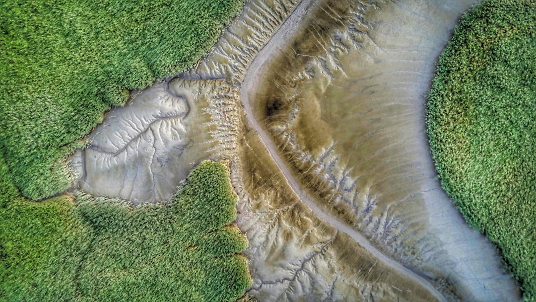
The Earth’s surface is a dynamic canvas, constantly being reshaped by an intricate dance of forces. This ongoing transformation is driven by two fundamental processes: deposition and erosion. Together, they form a perpetual cycle, a testament to the relentless power of nature. Understanding this cycle is key to comprehending how landscapes evolve, from the grandest mountain ranges to the smallest grains of sand. It’s a story written in rock and soil, sculpted by wind, water, and ice over eons.
The Sculptors of Our World: Agents of Erosion
Erosion is the process by which weathered material, whether rock fragments, soil, or sediment, is detached and transported from one location to another. It is not a single event but a continuous action, carried out by a variety of natural agents, each with its unique characteristics and impact. These agents are the primary sculptors of our planet’s topography, carving valleys, shaping coastlines, and transporting vast quantities of material across continents.
The Undeniable Power of Water
Water is arguably the most significant erosional agent on Earth. Its omnipresence in various forms – rain, rivers, oceans, and glaciers – allows it to exert a profound influence on the landscape.
Rainfall and Surface Runoff
When rain falls on exposed land, it begins to pick up loose particles. This process, known as splash erosion, dislodges soil aggregates. As rainfall intensity increases, water begins to flow across the surface, forming rills and gullies. This runoff carries sediment with it, gradually deepening and widening these channels. The erosive power of flowing water is directly related to its velocity and volume. Faster, more voluminous water can entrain larger and heavier particles, leading to more significant downcutting and transport. Over time, a network of drainage systems develops, meticulously carving the land.
The Relentless Force of Rivers
Rivers are powerful agents of erosion, shaping landscapes over geological timescales. They erode their beds and banks through several mechanisms. Abrasion occurs when the sediment carried by the river grinds against the channel bed and walls. Hydraulic action involves the sheer force of the water, especially in turbulent flows, dislodging material. Corrasion, similar to abrasion, specifically refers to the erosive action of rocks and pebbles being tumbled along the riverbed, acting like natural sandpaper. Furthermore, dissolution plays a role, particularly in areas with soluble rocks like limestone, where the water chemically weathers and dissolves the rock. The characteristic V-shaped valleys found in mountainous regions are a direct result of riverine erosion.
The Coastal Frontlines: Ocean Waves
The ceaseless action of ocean waves is a formidable erosional force along coastlines. Waves batter shorelines, gradually wearing away cliffs and beaches. This process, known as wave erosion, can be intensified by the impact of the water, the grinding action of sand and pebbles carried by the waves (abrasion), and the hydraulic pressure exerted by the waves within rock crevices. Over time, wave erosion can create dramatic coastal features such as sea cliffs, sea arches, and sea stacks. The constant movement of water also redistributes sand and sediment, shaping beaches and offshore bars.
The Invisible Hand of Wind
While water often dominates the erosional landscape, wind, particularly in arid and semi-arid regions, is another crucial agent. Wind erosion primarily involves the transport of loose, dry sediment.
Windblown Transport: Deflation and Abrasion
Wind erodes the land through two main processes: deflation and abrasion. Deflation is the lifting and removal of loose particles from the surface by the wind. This process can create depressions in the ground, some of which can become quite large. Abrasion, or sandblasting, occurs when wind-borne particles, such as sand grains, strike rocks and other surfaces, wearing them down and shaping them. This is responsible for the characteristic smooth, polished surfaces seen on rocks in windy deserts, and can even carve intricate patterns.
Dune Formation and Desert Landscapes
Wind’s ability to transport and deposit sand leads to the formation of iconic desert features: sand dunes. As wind velocity decreases or encounters an obstacle, it drops its load of sand, causing the dune to grow. The constant movement of sand by wind sculpts these formations into various shapes, such as crescent-shaped barchans, linear seifs, and star dunes. Wind erosion also contributes to the removal of fine soil particles, leaving behind coarser materials and contributing to desert pavement.
The Slow, Steady Grind of Ice
Glaciers, massive bodies of ice that move under their own weight, are incredibly powerful erosional agents. Their immense mass and slow, persistent movement can dramatically reshape the landscape.
Glacial Carving: U-Shaped Valleys and Fjords
As glaciers flow downhill, they pick up and carry rock fragments. These embedded rocks act like giant chisels, grinding and scraping the underlying bedrock. This process, known as glacial abrasion, is responsible for the distinctive U-shaped valleys that characterize glaciated mountain regions, in contrast to the V-shaped valleys carved by rivers. Glaciers also pluck rocks from the valley walls, a process called plucking, which further contributes to their erosive power. In coastal areas, the sea can flood glacially carved valleys, creating deep, steep-sided inlets known as fjords.
Transporting the Giants: Moraines and Drumlins
Glaciers are also incredibly effective at transporting vast quantities of eroded material. This material, known as glacial till, is deposited when the glacier melts or retreats. The deposition of till can create a variety of landforms, including moraines – ridges of accumulated debris that mark the glacier’s edge or the path it followed. Other glacial depositional features include erratics (large boulders deposited far from their origin) and drumlins (elongated hills formed by glacial ice molding till).
The intricate balance between land deposition and erosion plays a crucial role in shaping our landscapes and ecosystems. For a deeper understanding of this dynamic process, you can explore a related article on the topic at My Geo Quest. This resource delves into the mechanisms of sediment transport, the factors influencing erosion rates, and the implications for land use and conservation.
The Grand Rebuilding: The Art of Deposition

While erosion is the force of removal, deposition is its counterpart – the process of settling and accumulating transported material. It is through deposition that new landforms are created and landscapes are rebuilt. Just as erosion shapes and carves, deposition builds and replenishes. This process is a direct consequence of the diminishing energy of the transporting agent, causing it to release its load.
Where the Rivers End: Deltas and Alluvial Fans
When rivers flow into larger bodies of water, such as oceans, lakes, or even slower-moving rivers, their velocity decreases dramatically. This loss of energy causes the river to drop the sediment it has been carrying.
The Birth of New Land: River Deltas
The most dramatic examples of riverine deposition are deltas. These are fan-shaped or triangular landforms that develop at the mouth of a river where it enters a standing body of water. As sediment-laden water spreads out, its velocity drops, and deposition occurs. Over time, these deposits can build up, creating new land that extends out into the sea or lake. Famous examples include the Nile Delta and the Mississippi River Delta. The intricate network of distributary channels within a delta is a testament to the ongoing deposition and shifting patterns of the river.
Spreading Out: Alluvial Fans
Similar to deltas, alluvial fans are cone-shaped or fan-shaped deposits of sediment that form where a fast-flowing stream emerges from a narrow valley onto a flatter plain. The sudden decrease in gradient and velocity causes the stream to lose energy and deposit its sediment, fanning it out across the surrounding land. Alluvial fans are common in mountainous and desert regions where steep slopes meet flatter basins. They can create fertile agricultural land, but they are also susceptible to flash floods as the sediment can build up and choke the channels.
The Ocean’s Bounty: Beaches and Offshore Deposits
The energy of the ocean, though primarily erosional at the coast, also plays a significant role in deposition.
Accumulating Shores: Beaches and Barrier Islands
Beaches are dynamic systems of deposited sand and gravel that form along coastlines. They are constantly being built up and eroded by wave action and longshore currents. Longshore currents, which flow parallel to the shoreline, are particularly important for transporting sediment along the coast, creating extensive beaches and even barrier islands – long, narrow islands of sand that run parallel to the mainland coast. These islands act as natural buffers, protecting the mainland from storm surges.
The Seabed’s Storehouse: Marine Sediments
Beneath the waves, vast amounts of sediment are deposited, forming thick layers on the ocean floor. These marine sediments include materials eroded from land, organic remains of marine organisms (shells, skeletons), and volcanic ash. Over millions of years, these layers can be compacted and cemented to form sedimentary rocks, providing a rich archive of Earth’s history.
The Wind’s Gentle Touch: Sand Dunes and Loess Deposits
While wind is a powerful erosional agent, its depositional role is equally significant in shaping specific environments.
Sculpted by Air Currents: Sand Dunes
As discussed in the erosion section, wind’s depositional role is intrinsically linked to dune formation. When wind slows down, it releases the sand it carries, leading to the gradual growth and movement of sand dunes. The shapes and sizes of these dunes are dictated by factors such as wind direction, wind strength, and the availability of sand. They are a mesmerizing example of how a seemingly ephemeral force can create lasting, albeit mobile, landforms.
Fine Particles from Afar: Loess Deposits
Loess is a fine-grained, wind-deposited sediment composed primarily of silt-sized particles. It is often formed from the erosion of glacial outwash plains or deserts, and can be transported hundreds or even thousands of kilometers by the wind. Loess deposits are known for their fertility and their ability to form steep, vertical cliffs. Large loess deposits are found in regions like the Great Plains of North America, the North China Plain, and parts of Europe.
The Slow, Steady Accumulation: Glacial Deposits
The material released by retreating glaciers forms distinct depositional landforms.
Till and Its Varied Forms: Moraines, Drumlins, and Eskers
When glaciers melt, they deposit the enormous quantities of rock and sediment they have transported. This unsorted mixture is called glacial till. The deposition of till creates a variety of landforms. Moraines, as previously mentioned, are ridges of till. Drumlins are streamlined, elongated hills formed when a glacier flows over till. Eskers are long, winding ridges of sand and gravel deposited by meltwater streams flowing within or beneath a glacier. These features are clear indicators of past glacial activity.
The Endless Transformation: The Cycle in Action

The processes of erosion and deposition are not isolated events but are inextricably linked, forming a continuous, dynamic cycle that governs the evolution of Earth’s surface. This cycle is a testament to the constant interplay between forces that break down and forces that build up, resulting in the ever-changing landscapes we observe.
From Mountain Peaks to Ocean Basins: The Journey of Sediment
The cycle begins with the weathering and erosion of existing landforms, often highlands and mountains. These elevated areas are subjected to the relentless action of wind, water, and ice, which break down rocks and soil. The liberated material, ranging from fine dust to large boulders, is then transported by these agents. Rivers carry sediment downstream, wind blows it across plains, and glaciers move vast amounts of debris.
The Drop and the Build: Deposition’s Role
As the transporting agents lose energy, typically as they move from higher to lower elevations or encounter larger bodies of water, they deposit their loads. Rivers deposit sediment at their mouths, forming deltas, or where their gradient decreases, forming alluvial fans. Wind deposits sand to create dunes or finer silt to form loess. Glaciers leave behind till and other deposits as they melt. This deposition builds up new landforms, filling in valleys and creating plains.
Reshaping and Renewal: The Continuous Flow
However, these newly formed landforms are themselves subject to erosion. Beaches are shaped by waves, alluvial fans by subsequent floods, and sand dunes by shifting winds. The cycle is therefore a continuous loop of breakdown, transport, deposition, and renewed breakdown. This constant renewal prevents landscapes from becoming static. It is a process that has been occurring for billions of years, shaping the continents and contributing to the very ground beneath our feet. The material eroded from one area becomes the building blocks for another, ensuring that the Earth’s surface is in a perpetual state of transformation.
Factors Influencing the Cycle: Controls on Erosion and Deposition
While the fundamental processes of erosion and deposition are universal, their rates and manifestations are heavily influenced by a variety of factors. These controls determine whether a landscape is more prone to rapid erosion or extensive deposition, shaping the unique characteristics of different regions.
The Crucial Role of Climate
Climate is a primary driver of both erosion and deposition. Temperature and precipitation patterns dictate the type and intensity of erosional agents at play.
Rainfall Intensity and Frequency
Regions with high rainfall and intense storms will experience more rapid water erosion. The frequency of these events also plays a role; a region prone to occasional intense downpours might see significant gully formation, while an area with consistent moderate rainfall might experience more widespread sheet erosion. Arid regions, conversely, are dominated by wind erosion and occasional flash floods.
Temperature and Freeze-Thaw Cycles
Temperature significantly impacts the weathering of rocks, which is the precursor to erosion. Freeze-thaw cycles, where water seeps into rock cracks, freezes and expands, and then thaws, are particularly effective at breaking down rocks in temperate and alpine climates. In very hot and dry climates, thermal expansion and contraction can also contribute to rock disintegration.
The Influence of Topography and Geology
The shape of the land (topography) and the type of rock present (geology) are fundamental controls on the erosional and depositional processes.
Slope Gradient and Relief
Steeper slopes and higher relief (the difference between the highest and lowest points in an area) generally lead to faster erosion. Gravity pulls material downhill more effectively on steep slopes, and water flows more rapidly, increasing its erosive power. Areas with low relief and gentle slopes tend to accumulate sediment as the transporting agents have less energy.
Rock Type and Structure
The resistance of bedrock to erosion varies greatly depending on its type and structure. Hard, crystalline rocks like granite are more resistant than softer sedimentary rocks like shale. The presence of faults, fractures, and bedding planes can create zones of weakness that are more easily eroded. Porous rocks may be more susceptible to chemical weathering, while impermeable rocks can lead to increased surface runoff.
The Pervasive Impact of Vegetation and Human Activity
Living organisms and human actions can significantly alter the natural rates of erosion and deposition.
Vegetation as a Stabilizer
Plant roots help to bind soil particles together, increasing their resistance to erosion. The canopy of trees and plants intercepts rainfall, reducing its impact on the soil surface. Vegetation cover can dramatically slow down erosion rates. Conversely, deforestation or overgrazing can lead to accelerated soil erosion and land degradation.
Human Imprint on the Landscape
Human activities, such as agriculture, urbanization, mining, and deforestation, can have profound impacts on erosion and deposition. Construction projects expose large areas of soil to erosion. Agricultural practices, if not managed sustainably, can lead to significant soil loss. Conversely, some human interventions, like terracing on hillsides, can be designed to reduce erosion. Dam construction alters river flow and sediment transport, leading to deposition upstream and erosion downstream. Understanding these anthropogenic influences is crucial for effective land management.
The intricate balance between land deposition and erosion plays a crucial role in shaping our landscapes and ecosystems. Understanding this cycle is essential for effective land management and conservation efforts. For a deeper dive into the dynamics of these geological processes, you can explore a related article that highlights various factors influencing landforms and sediment transport. This insightful piece can be found here, providing valuable information for anyone interested in the natural world.
The Long View: Geological Significance and Future Implications
| Stage | Description | Key Processes | Typical Timeframe | Examples |
|---|---|---|---|---|
| Weathering | Breakdown of rocks into smaller particles | Physical, chemical, and biological weathering | Years to centuries | Rock cracks, soil formation |
| Erosion | Removal and transport of soil and rock particles | Water runoff, wind, glaciers, gravity | Days to decades | Riverbank erosion, windblown dust |
| Transportation | Movement of eroded materials to new locations | Rivers, wind currents, glaciers | Days to years | Sediment carried downstream |
| Deposition | Accumulation of transported sediments | Settling of particles when energy decreases | Days to centuries | Delta formation, sand dunes |
| Soil Formation | Development of fertile soil from deposited materials | Organic matter accumulation, mineral alteration | Decades to millennia | Topsoil development |
| Landform Stabilization | Establishment of stable landscapes | Vegetation growth, reduced erosion | Centuries to millennia | Grasslands, forests |
The cycle of deposition and erosion is not merely a surface phenomenon; it is a fundamental process that has shaped Earth’s geology over billions of years and continues to influence its future. The cumulative effects of these processes are responsible for creating the vast sedimentary rock record, burying and preserving evidence of past life and environments, and influencing the distribution of natural resources.
Unlocking Earth’s History: The Sedimentary Record
The deposition of sediment is the primary mechanism by which Earth’s history is recorded. Over geological time, layers of sand, silt, mud, and organic matter accumulate, burying older deposits. Through compaction and cementation, these sediments are transformed into sedimentary rocks such as sandstone, shale, and limestone. These rocks are like pages in a giant book, containing fossils that reveal the evolution of life, evidence of ancient climates, and records of past tectonic activity. Studying the patterns of erosion and deposition allows geologists to reconstruct past landscapes and understand the dynamic processes that shaped them.
Resource Distribution and Landscape Evolution
The ongoing cycle of erosion and deposition plays a critical role in the formation and distribution of valuable natural resources. For instance, the erosion of mineral-rich rocks can concentrate valuable elements in placer deposits, which are often found in riverbeds. The deposition of organic matter over millions of years, under specific pressure and temperature conditions, is responsible for the formation of fossil fuels like coal and oil. Furthermore, the slow, persistent reshaping of the landscape by erosion and deposition influences the formation of fertile soils, the carving of river valleys that provide water resources, and the sculpting of coastlines that support diverse ecosystems and human settlements.
The Future of Our Landscapes
The balance between erosion and deposition is constantly shifting, influenced by both natural processes and human activities. Climate change, with its potential for altered precipitation patterns and increased extreme weather events, could accelerate erosion in some areas and alter depositional patterns elsewhere. Understanding the fundamental principles of the deposition-erosion cycle is therefore crucial for predicting and mitigating the impacts of these changes on our landscapes, ensuring the sustainable use of land, and preserving the geological heritage of our planet for future generations. The story of Earth’s surface is one of perpetual motion, a grand narrative written by the tireless forces of deposition and erosion.
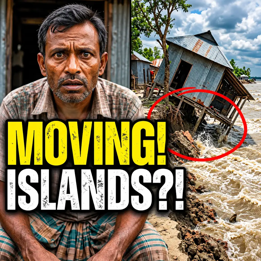
This River is Literally Erasing Islands
FAQs
What is land deposition?
Land deposition is the process by which sediments, such as sand, silt, and rocks, are added to a landform or landmass, typically by natural forces like wind, water, or ice.
How does erosion contribute to the cycle of land deposition?
Erosion wears away rocks and soil from one location and transports them to another, where they are deposited. This continuous movement of sediments is a key aspect of the cycle of land deposition and erosion.
What are some common causes of land erosion?
Common causes of land erosion include water flow (such as rivers and ocean waves), wind, glaciers, and human activities like deforestation and construction.
How does land deposition impact ecosystems?
Land deposition can create new habitats for plants and animals, as well as replenish nutrients in the soil. However, excessive deposition in certain areas can also lead to habitat destruction and changes in local ecosystems.
What are some strategies to prevent excessive land erosion?
Strategies to prevent excessive land erosion include planting vegetation to stabilize soil, implementing erosion control measures like terracing and retaining walls, and practicing sustainable land management techniques to reduce human-induced erosion.