
The Bangladesh delta, a vast and intricate network of rivers and alluvial plains, is a region in perpetual flux. Its very identity is sculpted by the dynamic interplay of water and earth, a ceaseless process of deposition and erosion. This constant reshaping, often referred to as land mass shifting, is not merely a geological curiosity but a fundamental characteristic of the delta’s existence, profoundly influencing its environment, economy, and the lives of its millions of inhabitants. Understanding the myriad causes and far-reaching impacts of this shifting landscape is paramount for the region’s sustainable development and resilience.
The Unfolding Geology of a Dynamic Delta
The Bangladesh delta is a product of an extraordinary geological phenomenon: the confluence of three major river systems – the Ganges, Brahmaputra, and Meghna – discharging immense volumes of sediment into the Bay of Bengal. This constant influx of sediment, carried from the Himalayas and the vast catchments of these rivers, forms the foundation of the delta. However, the story of land mass shifting is not solely about accretion. It is a complex narrative of deposition, erosion, subsidence, and tectonic activity.
Sedimentation: The Lifeblood of the Delta
The primary engine driving delta formation and land building is sedimentation. Rivers, especially during monsoon seasons, carry enormous quantities of silt, sand, and clay. As these rivers reach the deltaic plain and slow down, their sediment-carrying capacity diminishes, leading to deposition. This process creates new land, expands existing islands, and raises the delta’s elevation over geological timescales. The sheer volume of sediment discharged by the Ganges-Brahmaputra-Meghna system is staggering, contributing significantly to the delta’s growth. Floodplains are constantly replenished with fresh layers of fertile alluvium, a process that has supported agriculture for centuries. Natural levees form along riverbanks as sediment is deposited during high flows, creating slightly elevated land suitable for settlement. Oxbow lakes, abandoned meanders of rivers, are testament to the constant course adjustments of these waterways. The formation of chars, or newly emerged sandbars and islands, is a visible manifestation of ongoing sedimentation, offering potential for new land and agricultural expansion.
Erosion: The Sculpting Force
While sedimentation builds land, erosion acts as a powerful counterforce, constantly reshaping the delta. The immense erosive power of the mighty rivers, particularly during flash floods and cyclones, can swiftly dismantle existing landforms. Riverbanks are undercut, islands are submerged, and settlements are washed away. The dynamics of tidal influences also play a crucial role in erosion, especially in the estuarine areas. Tidal currents can erode the seaward edges of islands and the mouths of rivers, contributing to land loss. The phenomenon of “river bank erosion” is a stark and often devastating reality for many communities. Homes, farmlands, and vital infrastructure can disappear within days. This erosion is exacerbated by factors like the natural sinuosity of rivers, increased water velocity during high flows, and human interventions that alter natural flow patterns. The loss of land due to erosion directly impacts agricultural productivity and human settlements.
Subsidence: The Sinking Foundation
Adding another layer of complexity to the delta’s shifting nature is the phenomenon of subsidence, the gradual sinking of the land surface. This can be caused by several factors. The sheer weight of accumulated sediments can compact underlying layers, leading to a slow sinking. Furthermore, the extraction of groundwater for irrigation and domestic use has been identified as a significant contributor to land subsidence in many parts of Bangladesh. As groundwater levels drop, the pore spaces in the soil matrix become empty, leading to increased pressure and compaction, thus causing the land to sink. Tectonic processes, though generally slower, also contribute to the overall subsidence of the delta. This sinking is particularly concerning as it reduces the effective elevation of the land, making it more vulnerable to flooding and sea-level rise. The interplay between sedimentation and subsidence is a delicate balance; if subsidence outpaces accretion, the delta can effectively lose elevation, increasing its susceptibility to inundation.
The shifting land masses of the Bangladesh river delta have been a topic of significant interest due to their implications for both the environment and local communities. A related article that delves deeper into this subject can be found at My Geo Quest, where the dynamics of sediment deposition and erosion in the delta are explored, highlighting the challenges faced by the region in the context of climate change and rising sea levels.
Drivers of Deltaic Transformation
The forces shaping the Bangladesh delta are not static. They are influenced by a complex interplay of natural processes and accelerating anthropogenic pressures, creating a dynamic environment prone to rapid change.
Natural Hydrological Cycles and Extreme Events
The fundamental rhythm of the delta is dictated by its hydrological cycles. The predictable monsoon season brings heavy rainfall and swollen rivers, driving both sedimentation and erosion. Seasonal variations in river discharge create alternating periods of land building and land loss. Beyond these predictable cycles, the delta is also subject to the capricious nature of extreme weather events. Cyclones, originating in the Bay of Bengal, unleash devastating storm surges and intense rainfall, leading to widespread flooding and significant land erosion. These events can dramatically alter river courses, inundate large areas of land, and cause widespread destruction. The increasing frequency and intensity of such events, potentially linked to climate change, further destabilize the deltaic landscape. Floods, whether monsoonal or flash floods, are a regular feature and a primary agent of land movement.
Human Interventions and Their Unforeseen Consequences
Human activities have profoundly influenced the delta’s dynamics, often with unintended consequences. The construction of dams and embankments upstream can alter sediment flow downstream, impacting natural deposition processes. While embankments protect settlements from immediate flooding, they can also concentrate water flow and increase erosion in other areas. Deforestation in the upstream catchment areas leads to increased soil erosion and a higher sediment load in the rivers, potentially accelerating deposition in the delta but also increasing flood intensity. Unplanned urbanization and the construction of infrastructure can alter natural drainage patterns and increase the pressure on land, further exacerbating erosion and subsidence. The widespread extraction of groundwater for agriculture and industrial purposes is a significant driver of land subsidence, a concern that has gained increasing attention in recent years. Dredging of rivers for navigation can also disrupt natural sediment transport and alter local erosion and deposition patterns.
The Looming Shadow of Climate Change
The global phenomenon of climate change casts a long and ominous shadow over the Bangladesh delta. Rising global temperatures are leading to sea-level rise, a direct threat to low-lying deltaic regions. As sea levels rise, the delta becomes more vulnerable to inundation, saltwater intrusion, and increased coastal erosion. Furthermore, climate change is predicted to exacerbate extreme weather events, increasing the frequency and intensity of cyclones and floods, thereby amplifying the destructive forces of erosion and land loss. Changes in rainfall patterns, with potentially more intense downpours during the monsoon and drier periods at other times, will further disrupt the delicate balance of sedimentation and erosion. The thermal expansion of seawater, coupled with the melting of glaciers and ice sheets, contributes directly to global sea-level rise, with disproportionate impacts on low-lying coastal areas like the Bangladesh delta.
Visible Manifestations of a Shifting Land

The geological processes at play in the Bangladesh delta are not abstract concepts; they manifest in tangible and often dramatic ways, shaping the very geography and the lives of its inhabitants.
The Ubiquitous Phenomenon of Riverbank Erosion
Riverbank erosion is perhaps the most visible and acutely felt consequence of land mass shifting. Vast stretches of riverbanks are constantly being undercut and swept away, leading to the disappearance of land and the displacement of communities. This process is a year-round concern, but it intensifies during the monsoon season when river flows are at their peak. Villages, farmlands, schools, and roads are lost to the insatiable appetite of the rivers. Families are forced to abandon their ancestral homes and livelihoods, becoming environmental migrants within their own country. The visual evidence of eroded riverbanks, with trees and houses teetering precariously before collapsing into the water, is a stark reminder of the delta’s dynamism. The constant threat of erosion instills a sense of precariousness among delta dwellers.
The Emergence and Disappearance of Islands and Chars
The delta is characterized by the dynamic birth and death of islands and chars. These are often newly formed landmasses that emerge from the seabed due to sedimentation. While these chars offer opportunities for new settlements and agricultural expansion, their existence is often ephemeral. Subject to the relentless forces of erosion and tidal action, many chars are quickly reclaimed by the sea. The stability of these landforms is highly variable, with some chars persisting for decades and others disappearing within a few years. This ephemeral nature poses a significant challenge for long-term planning and development. The process of char formation can be rapid, with sandbars growing significantly in size over short periods, while erosion can be equally swift, leading to their submergence.
Altered River Courses and Waterways
The constant shifting of land masses inevitably leads to changes in the course of rivers and the configuration of waterways. Rivers meander, abandon old channels, and carve out new ones. This dynamic evolution of the river network directly impacts navigation, irrigation, and the distribution of water resources across the delta. Old riverbeds can become silted up, while new channels can emerge, altering the hydrological landscape. This constant change necessitates continuous adaptation of infrastructure and water management strategies. The very map of the delta is a fluid document, constantly being redrawn by the forces of nature. Changes in river courses can isolate communities, disrupt transportation links, and affect the accessibility of resources.
Impacts on People and Livelihoods
The shifting land masses of the Bangladesh delta have profound and often devastating consequences for the human populations that call this region home, impacting their security, economy, and way of life.
Displacement and Environmental Migration
The most direct and tragic impact of land mass shifting is the displacement of people. As land erodes and islands disappear, communities are forced to migrate, often losing their homes, property, and livelihoods. This leads to significant environmental migration, both within the delta and to urban centers, placing strain on resources and infrastructure. The loss of agricultural land due to erosion and saltwater intrusion forces many to seek alternative employment, often in precarious urban settings. This forced displacement creates a cycle of vulnerability, where displaced populations often lack the resources and support to rebuild their lives. The psychological toll of losing one’s ancestral home and community is immeasurable.
Threats to Agriculture and Food Security
Agriculture is the backbone of the delta’s economy, but it is highly vulnerable to land mass shifts. Erosion destroys fertile farmland, while saltwater intrusion contaminates soil and water, rendering vast areas unsuitable for cultivation. The unpredictable nature of land availability makes long-term agricultural planning extremely difficult. The loss of arable land directly impacts food production, threatening food security for the region and potentially contributing to national food shortages. The constant need to adapt to new landforms and changing soil conditions requires significant resilience and innovation from the farming communities. The livelihoods of millions depend directly on the productivity of these deltaic soils.
Impact on Infrastructure and Development
The dynamic nature of the delta poses significant challenges for infrastructure development and maintenance. Roads, bridges, embankments, and settlements are constantly threatened by erosion and flooding. Building and maintaining infrastructure in such a mobile landscape requires constant investment and innovative engineering solutions. The cost of repairing and rebuilding damaged infrastructure is a significant burden on the national economy. The planned development of the delta is a perpetual race against the forces of nature, where progress can be rapidly undone by an aggressive erosion event or a severe flood.
Health and Sanitation Challenges
Land mass shifting can also have significant impacts on public health and sanitation. The displacement of communities often leads to overcrowding in makeshift settlements, where access to clean water and sanitation facilities is limited, increasing the risk of waterborne diseases. The contamination of water sources by saltwater intrusion can also pose health risks. Changes in river courses can disrupt natural drainage patterns, leading to stagnant water bodies that become breeding grounds for mosquitoes and other disease vectors. The frequent inundation of land can also lead to the spread of waterborne illnesses like cholera and diarrhea.
The shifting land masses of the Bangladesh river delta present a fascinating yet challenging scenario for the region’s inhabitants and ecosystems. As the dynamic interplay of sediment deposition and erosion continues to reshape the landscape, researchers are increasingly focused on understanding these changes. For a deeper insight into this topic, you can explore a related article that discusses the implications of these shifts on local communities and biodiversity. This informative piece can be found here.
Adapting to a Mobile Landscape
| Metric | Value | Unit | Notes |
|---|---|---|---|
| Annual Sediment Deposition | 1.2 | cm/year | Average sediment accumulation in delta region |
| Delta Land Area Change | +150 | km²/year | Net land gain due to sediment deposition |
| River Channel Migration Rate | 50-100 | meters/year | Average lateral shift of river channels |
| Coastal Erosion Rate | 30 | meters/year | Loss of land along coastal edges |
| Sea Level Rise Impact | 3.5 | mm/year | Average sea level rise affecting delta |
| Population Displacement | 100,000 | people/year | Estimated annual displacement due to land shifts |
| Flood Frequency Increase | 15 | % increase over 10 years | Increase in flood events due to delta dynamics |
Given the inherent dynamism of the Bangladesh delta, adaptation and resilience are not merely desirable but essential for the survival and prosperity of its inhabitants.
Integrated Water Resource Management
Effective management of the delta’s intricate water system is crucial. This involves a holistic approach to water resource management, considering the interconnectedness of rivers, groundwater, and the coastal zone. Strategies should aim to balance the competing needs of navigation, irrigation, flood control, and ecological sustainability. Integrated water management aims to optimize water use, minimize water-related disasters, and protect water resources for future generations. This includes measures like maintaining natural river flows, managing sediment transport, and addressing saltwater intrusion.
Sustainable Land Use Planning and Char Development
Developing sustainable strategies for land use is paramount. This includes careful planning for the utilization of newly formed chars, considering their long-term stability and environmental implications. Promoting resilient agricultural practices that can withstand the challenges of soil salinity and erosion is also vital. This could involve the introduction of salt-tolerant crop varieties and improved farming techniques. Responsible land use planning seeks to maximize the benefits of new land while minimizing the risks associated with its ephemeral nature. It also involves identifying and protecting vulnerable areas from further degradation.
Community-Based Adaptation and Early Warning Systems
Empowering local communities to participate in adaptation strategies is essential. This includes strengthening community-based early warning systems for floods and cyclones, enabling timely evacuation and disaster preparedness. Promoting traditional knowledge and local coping mechanisms alongside modern scientific approaches can enhance resilience. Community involvement ensures that adaptation efforts are relevant to local needs and context. Effective early warning systems can significantly reduce loss of life and property during extreme weather events.
Investing in Coastal Protection and Climate-Resilient Infrastructure
Investing in robust coastal protection measures, such as mangrove restoration and the construction of climate-resilient infrastructure, can help mitigate the impacts of sea-level rise and storm surges. This includes building elevated roads and designing flood-proof buildings. Such investments are crucial for protecting existing settlements and vital infrastructure from the growing threats posed by a changing climate. Nature-based solutions, like the restoration of mangrove forests, provide a natural buffer against storm surges and coastal erosion.
The Bangladesh delta is a living testament to the power of geological forces, a landscape in constant metamorphosis. The shifting land masses, driven by a confluence of natural processes and anthropogenic pressures, present profound challenges, but also underscore the remarkable resilience of both the environment and its people. Understanding the intricate causes and far-reaching impacts of this dynamism is not just an academic exercise; it is a critical imperative for charting a course towards a sustainable and secure future for this uniquely vulnerable yet vibrant region. The ability of the delta’s inhabitants to adapt and innovate in the face of such constant change offers a powerful lesson in human resilience against the backdrop of a dynamic planet.
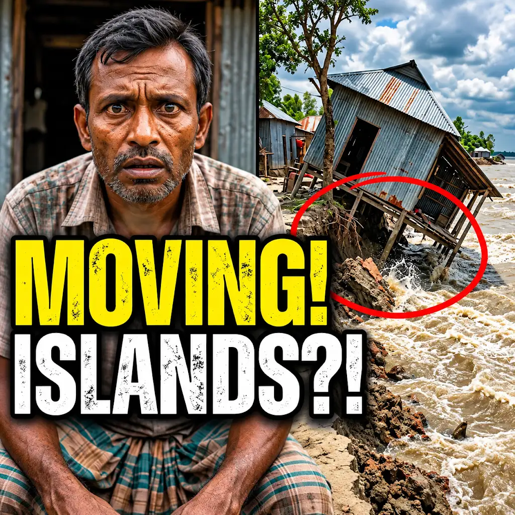
This River is Literally Erasing Islands
FAQs
What causes the land masses in the Bangladesh river delta to shift?
The shifting of land masses in the Bangladesh river delta is primarily caused by natural processes such as erosion, sediment deposition, and tectonic movements.
How does the shifting of land masses affect the local communities in the Bangladesh river delta?
The shifting of land masses can have significant impacts on local communities in the Bangladesh river delta, including displacement of populations, loss of agricultural land, and increased vulnerability to natural disasters.
Are there any efforts being made to mitigate the effects of land mass shifting in the Bangladesh river delta?
Yes, there are various efforts being made to mitigate the effects of land mass shifting in the Bangladesh river delta, including coastal protection measures, reforestation projects, and community-based adaptation strategies.
What role does climate change play in the shifting of land masses in the Bangladesh river delta?
Climate change is exacerbating the shifting of land masses in the Bangladesh river delta by causing sea level rise, increased storm surges, and changes in precipitation patterns, leading to more frequent and severe erosion and sedimentation processes.
How does the shifting of land masses in the Bangladesh river delta impact the biodiversity of the region?
The shifting of land masses in the Bangladesh river delta can impact the biodiversity of the region by altering habitats, disrupting ecosystems, and threatening the survival of various plant and animal species that depend on the delta’s unique environment.