Drivers of Sediment Transport in South Asian Rivers
South Asian rivers, such as the Ganges, Brahmaputra, Indus, and their tributaries, are characterized by immense hydrological and geomorphological dynamism. This dynamism is intrinsically linked to their capacity for transporting vast quantities of sediment. The interplay of climatic, geological, and anthropogenic factors dictates the volume, type, and distribution of sediment carried by these fluvial systems, shaping the landscapes they traverse and influencing the lives and livelihoods of millions. Understanding the primary drivers of sedimentation is crucial for effective water resource management, disaster mitigation, and ecological conservation.
Monsoon Climate and Rainfall Intensity
The dominant influence on sediment generation and transport in South Asia is its pronounced monsoon climate. The summer monsoon, typically from June to September, brings torrential rainfall across the subcontinent, leading to substantial runoff and erosion. High-intensity rainfall events, often occurring in short, concentrated bursts, are particularly effective at dislodging soil particles from the land surface. This process, known as splash erosion, is amplified in the steep, mountainous headwaters of many South Asian rivers, particularly in the Himalayas.
The Role of Intense Rainfall Events
The sheer volume of water delivered by monsoon storms is a primary engine of sediment mobilization. When rainfall exceeds the infiltration capacity of the soil, surface runoff intensifies, carrying loosened soil particles downslope. The duration and intensity of these rainfall events directly correlate with the magnitude of sediment load. Areas experiencing prolonged periods of heavy rain, such as the foothills of the Himalayas and the Eastern Ghats, exhibit higher rates of erosion and consequently, higher sediment concentrations in their rivers. The impact is further exacerbated by the often-steep gradients of the terrain, allowing gravity to assist the erosive power of the water.
Seasonal Variations in Runoff and Sediment Load
Sediment transport in South Asian rivers exhibits a pronounced seasonal pattern, mirroring the monsoon cycle. During the pre-monsoon and monsoon seasons, river flows increase dramatically, leading to peak sediment loads. Conversely, the dry winter months see significantly reduced discharge and consequently, much lower sediment transport. This seasonal variation influences river morphology, channel behavior, and the deposition of sediment in downstream floodplains and deltas. The contrast between the high-energy monsoon period and the quiescent dry season creates a distinct cyclical rhythm in the fluvial system.
Topography and Geomorphology
The physical landscape of South Asia plays a pivotal role in both the generation of sediment and its subsequent transport. The region is home to some of the world’s highest mountain ranges, steep river gradients, and extensive alluvial plains, all of which contribute to significant sediment dynamics.
Himalayan Uplift and Erosion
The ongoing tectonic uplift of the Himalayas is a fundamental driver of sediment production in the northern river systems. As the mountains are continuously pushed upwards, they are simultaneously subjected to intense weathering and erosion. The rapid uplift rate outpaces the rate of denudation in some areas, leading to the generation of vast quantities of unconsolidated rock and soil. Glacial erosion, periglacial processes, and freeze-thaw cycles in the high altitudes further break down rock material, which is then transported by rivers. The young, tectonically active nature of the Himalayas makes them a highly erodible source region for sediment.
River Gradient and Flow Velocity
The gradient of a river is a crucial factor determining its ability to carry sediment. Rivers originating in the steep Himalayas and other upland areas possess high flow velocities, enabling them to entrain and transport larger sediment particles. As these rivers descend into the flatter alluvial plains, their velocity decreases, leading to the deposition of coarser sediments. The contrast between the high-energy mountain streams and the lower-energy plains rivers dictates the spatial distribution of sediment deposition and erosion. Channel gradients also influence the formation of features like alluvial fans and braided river systems.
Land Use and Land Cover Change
Human activities, particularly changes in land use and land cover, have a profound impact on erosion rates and sediment yields from catchments. Deforestation, agricultural practices, urbanization, and infrastructure development all contribute to increased sediment loads in South Asian rivers.
Deforestation and Agricultural Practices
The widespread clearing of forests for agriculture, fuel wood, and development significantly increases soil susceptibility to erosion. Tree roots bind the soil, and forest canopies intercept rainfall, reducing its direct impact. When forests are removed, bare soil is exposed to the erosive forces of rain and wind. Traditional agricultural practices, especially those on slopes without adequate soil conservation measures, can also lead to substantial soil loss. Terracing, contour plowing, and cover cropping are essential techniques to mitigate these impacts, but their adoption varies widely. The loss of vegetative cover leads to a dramatic increase in the amount of sediment that can be mobilized and transported by rainfall runoff.
Urbanization and Infrastructure Development
Urban expansion and the construction of infrastructure, such as roads, dams, and buildings, disturb large areas of land, exposing soil and rock to erosion. Construction sites are particularly prone to sediment runoff, as cleared land and excavated areas are left vulnerable. Runoff from impervious surfaces in urban areas, such as roads and rooftops, can also increase the velocity and erosive power of water, carrying pollutants and sediment into nearby water bodies. Mining activities, often associated with infrastructure development, are also significant sources of sediment pollution. The creation of dust and loose material from construction and mining operations directly contributes to the sediment load in rivers.
Geological Factors and Rock Lithology
The underlying geology of a region significantly influences the erodibility of its soils and rocks, and thus the sediment yield of its rivers. Different rock types possess varying degrees of resistance to weathering and erosion.
Weathering Rates of Different Rock Types
Sediments are essentially products of rock weathering and disintegration. Softer, more easily weathered rock formations, such as shales and sandstones, will yield more sediment than harder, more resistant rocks like granites and basalts, under similar environmental conditions. The prevalence of sedimentary rocks, particularly in the Siwalik ranges and the Indo-Gangetic plain, contributes to the high sediment loads observed in rivers draining these areas. The chemical composition and structural integrity of the rock also play a role in how readily it breaks down.
Soil Properties and Erodibility
The characteristics of the soil derived from the weathering of bedrock are equally important. Soils with low organic matter content, poor structure, and low infiltration rates are more susceptible to erosion. Sandy soils can be easily transported by wind and water, while clay soils, though resistant to initial detachment, can form surface crusts that reduce infiltration and promote runoff. The interplay between the parent rock material and the soil-forming processes dictates the inherent erodibility of the land surface.
Anthropogenic Influences on Sediment Dynamics
Beyond direct land use changes, human interventions in river systems themselves can significantly alter sedimentation patterns. The construction of dams, canals, and other hydraulic structures modifies natural flow regimes and sediment transport capacities, often with cascading effects on downstream environments.
River Engineering and Water Management
The construction of dams across major South Asian rivers, such as the Tarbela Dam on the Indus or the Farakka Barrage on the Ganges, traps a substantial portion of incoming sediment behind the dam. This reduces the sediment load downstream, which can lead to channel degradation and coastal erosion. Conversely, the release of sediment-laden water from barrages or during dam maintenance can cause sudden increases in downstream sedimentation. Irrigation canals and other water diversion projects can also alter flow patterns and influence where sediment is deposited. The human attempt to control and manage river flows often leads to unintended consequences for natural sediment transport.
Mining and Quarrying Operations
Extensive mining and quarrying operations in the catchments of many South Asian rivers release vast quantities of fine particulate matter and coarse debris into the environment. This material is easily mobilized by rainfall and runoff, significantly increasing the sediment load of nearby rivers. Operations in the Himalayan foothills and the mineral-rich regions of central and eastern India are particularly notable sources of sediment pollution from mining. The process of extracting resources directly generates loose material that enters the fluvial system.
Recent studies have highlighted the intricate sedimentation patterns in South Asian rivers, emphasizing their impact on both ecology and human activities. For a deeper understanding of these dynamics, you can explore the article on sedimentation processes and their implications in the region. This resource provides valuable insights into how sediment transport affects river morphology and surrounding communities. To read more, visit this article.
Impacts of Sedimentation on South Asian River Systems
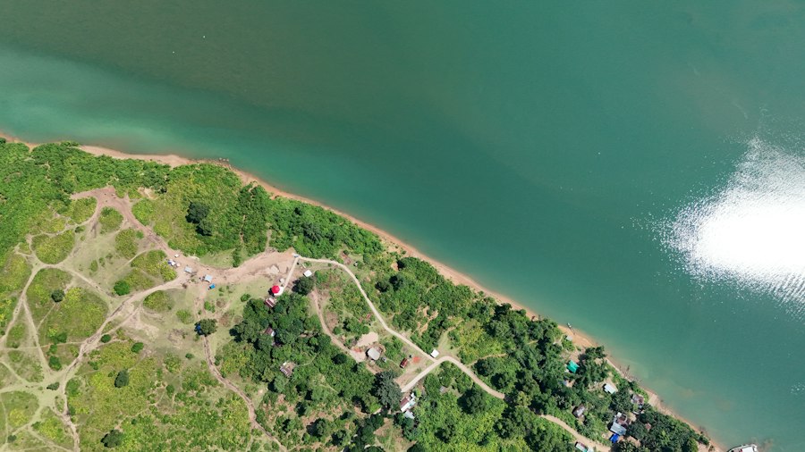
The extensive sediment transport in South Asian rivers has far-reaching consequences, affecting river morphology, water quality, downstream ecosystems, and human infrastructure. The sheer volume of sediment involved often leads to significant challenges in managing these dynamic systems.
Morphological Changes in River Channels
The continuous influx of sediment profoundly influences the physical form and behavior of river channels. Rivers adapt their shape and course to accommodate the sediment load, leading to characteristic morphological features.
Channel Aggradation and Braiding
In areas with high sediment loads and relatively low flow energy, rivers tend to aggrade, meaning their beds rise. This can lead to reduced channel depth and increased flood risk. Many South Asian rivers, particularly in their lower reaches, exhibit a braided channel pattern. This occurs when the river divides into multiple, interweaving channels separated by sandbars and islands. Braiding is a direct response to a high sediment load, where the river cannot maintain a single, stable channel and instead divides to transport the excess sediment. These channels are dynamic and can shift rapidly, posing risks to riverside communities and infrastructure.
Floodplain Development and Delta Formation
The deposition of sediment in river channels and on floodplains is a fundamental process in landform evolution. During flood events, rivers overtop their banks, depositing nutrient-rich sediment onto the adjacent land, creating fertile floodplains. Over geological timescales, this continuous deposition builds extensive alluvial plains, such as the Indo-Gangetic Plain, which are vital for agriculture. At their mouths, rivers build deltas, vast triangular areas of land formed by the accumulation of sediment carried from the interior. The Ganges-Brahmaputra delta, one of the largest in the world, is a testament to the immense sediment-carrying capacity of these river systems.
Water Quality Degradation
Sediment suspended in river water, known as turbidity, can have significant negative impacts on water quality. The presence of fine sediment particles affects the physical, chemical, and biological properties of the water.
Increased Turbidity and Reduced Light Penetration
High concentrations of suspended sediment increase the turbidity of the water, making it cloudy and opaque. This reduces the penetration of sunlight into the water column. For aquatic ecosystems, this has detrimental effects. Photosynthetic organisms, such as algae and aquatic plants, require sunlight for growth. Reduced light penetration limits their productivity, impacting the entire food web. Turbid water can also stress fish by interfering with their gill function and ability to locate food and mates.
Sediment-Associated Pollutants
Sediment particles can act as carriers for various pollutants, including nutrients (nitrogen and phosphorus), heavy metals, pesticides, and other chemical contaminants. These pollutants adhere to the surface of sediment particles and are transported along with them. When sediment settles, these pollutants can be released into the riverbed sediments or taken up by aquatic organisms, leading to bioaccumulation and biomagnification in the food chain. This poses risks to both aquatic life and human health, particularly in areas reliant on river water for drinking and irrigation.
Impacts on Aquatic Ecosystems
The physical and chemical changes brought about by sedimentation have profound consequences for the biodiversity and functioning of riverine and associated aquatic ecosystems.
Habitat Alteration and Loss
The deposition of sediment can drastically alter or destroy aquatic habitats. The infilling of riverbeds can smother benthic organisms (those living on the riverbed), such as insect larvae and mollusks, which form the base of many aquatic food webs. Increased sedimentation can also lead to the siltation of spawning grounds for fish, reducing reproductive success. The alteration of flow regimes due to sedimentation can further stress aquatic communities adapted to specific conditions. Habitat fragmentation and loss due to excessive deposition can isolate populations and reduce overall biodiversity.
Changes in Species Composition
The combined stresses of increased turbidity, reduced light, altered habitats, and pollutant loading can lead to shifts in the composition of aquatic communities. Species that are more tolerant of turbid conditions and can adapt to altered substrates may thrive, while more sensitive species decline. This can result in a loss of specialist species and a shift towards a more generalized and less diverse ecosystem. For example, fish species that rely on clear water for visual predation may be outcompeted by species that rely on other senses.
Challenges for Infrastructure and Human Livelihoods
Sedimentation poses significant challenges for the functioning of vital infrastructure and the livelihoods of millions of people dependent on these river systems.
Reservoir Siltation and Reduced Storage Capacity
Dams are critical for water storage, hydropower generation, and flood control in South Asia. However, reservoirs are susceptible to siltation, the gradual accumulation of sediment within the reservoir basin. This reduces the effective storage capacity of the reservoir over time, diminishing its ability to fulfill its intended purposes. This necessitates costly dredging operations or the construction of new storage facilities. Siltation also leads to the loss of fertile land that is submerged by the reservoir, impacting local communities.
Navigation and Water Supply Issues
High sediment loads can impede river navigation by reducing channel depth and creating navigational hazards like sandbars. Dredging of navigable channels is often required, incurring substantial costs. Sediment can also clog intake structures for water supply systems and irrigation canals, reducing their efficiency and requiring frequent maintenance. In coastal areas, excessive sediment deposition can alter estuarine dynamics and impact fisheries. For communities relying on rivers for transportation, fishing, and water, sedimentation directly impacts their economic well-being and daily lives.
Mitigation and Management Strategies for Sedimentation
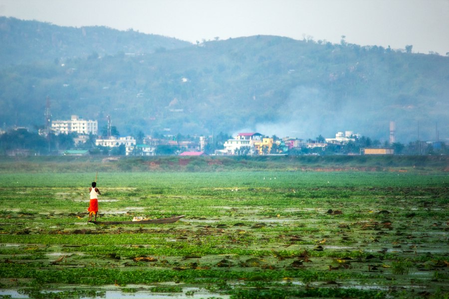
Addressing the complex issue of sedimentation in South Asian rivers requires a multi-faceted approach, integrating strategies that focus on reducing erosion at the source, managing sediment transport, and adapting to the inevitable impacts.
Integrated Watershed Management
Effective management of sediment begins with addressing the issues within the entire river basin or watershed. This involves a holistic approach that considers all land uses and human activities that contribute to sediment runoff.
Afforestation and Reforestation Programs
Planting trees and restoring forest cover in degraded areas, especially in the upper reaches of river basins, is a cornerstone of sediment reduction. Forests act as natural sponges, intercepting rainfall, binding soil with their root systems, and slowing down surface runoff. Afforestation and reforestation programs, particularly in the Himalayan foothills and other vulnerable areas, can significantly reduce soil erosion and, consequently, sediment loads in rivers. These programs also provide ecological benefits, such as improved biodiversity and carbon sequestration.
Soil Conservation Practices in Agriculture
Promoting and implementing sustainable agricultural practices is crucial for reducing erosion from farmlands. Techniques such as contour plowing, terracing, cover cropping, and reduced tillage minimize soil disturbance and enhance soil stability. The adoption of agroforestry systems, which integrate trees and shrubs into agricultural landscapes, can further enhance soil protection and reduce sediment runoff. Educating farmers on the benefits and techniques of soil conservation is key to successful implementation.
Engineering Solutions and Sediment Control
While reducing erosion at the source is paramount, engineering solutions can also play a role in managing sediment once it has entered the river system or in preventing its detrimental impacts.
Sediment Trapping and Flushing in Dams
In reservoirs, strategies can be employed to trap sediment in designated areas or to flush accumulated sediment through controlled releases of water. Sediment traps are often designed at the upstream end of a reservoir to capture the coarser sediment particles before they reach the main storage area. Sediment flushing involves releasing large volumes of water from the reservoir to carry accumulated sediment downstream. However, these methods can be costly and may have downstream environmental impacts, requiring careful planning and monitoring.
Channel Management and Dredging
In navigable waterways and critical infrastructure areas, dredging is often employed to remove accumulated sediment and maintain channel depth. While a short-term solution, it is an essential maintenance activity for many river systems. Techniques like bank stabilization, using vegetation or engineered structures, can also help reduce bank erosion, which is a significant source of sediment. The strategic placement of structures like spurs and groynes can alter flow patterns to encourage sediment deposition in desired areas or to scour sediment from critical zones.
Policy and Governance Reforms
Effective sediment management requires robust policy frameworks, strong institutional coordination, and inclusive governance mechanisms that involve all stakeholders.
Inter-State and International River Basin Cooperation
Many major South Asian rivers flow through multiple states and even countries. Managing sediment effectively necessitates cooperation and agreement among these entities to implement coordinated watershed management and sediment control strategies. Establishing joint river basin organizations and agreements can facilitate data sharing, collaborative planning, and the equitable distribution of responsibilities and benefits. This is particularly crucial for transboundary rivers where upstream activities can have significant downstream consequences.
Environmental Impact Assessments and Monitoring
Rigorous environmental impact assessments (EIAs) should be mandatory for all development projects that could affect sedimentation, including large-scale infrastructure projects, mining, and industrial activities. These assessments should accurately predict potential sediment loads and propose appropriate mitigation measures. Continuous monitoring of sediment loads, water quality, and river morphology is essential to evaluate the effectiveness of management strategies and to adapt them as needed. This data-driven approach ensures that interventions are responsive to changing conditions.
Future Prospects and Challenges in Sediment Management
The challenges posed by sedimentation in South Asian rivers are substantial and likely to be exacerbated by climate change and increasing anthropogenic pressures. However, advancements in technology, growing awareness, and the potential for innovative management approaches offer pathways towards more sustainable solutions.
Climate Change and its Amplifying Effects
Climate change is projected to intensify many of the factors driving sedimentation in South Asia. Increased frequency and intensity of extreme rainfall events, leading to more severe floods and landslides, will accelerate erosion. Changes in glacial melt patterns in the Himalayas could lead to initial increases in sediment discharge followed by potential decreases as glaciers shrink, altering the long-term sediment supply. Rising sea levels can also exacerbate coastal erosion and saltwater intrusion into deltas, interacting with sediment dynamics.
Extreme Weather Events and Increased Erosion
The IPCC reports and regional climate models consistently point towards a future with more frequent and intense extreme weather events in South Asia. This includes more powerful cyclones, heavier monsoon downpours, and prolonged dry spells followed by intense rainfall. These events directly translate to higher soil erosion rates, increased landslide frequency in mountainous regions, and greater sediment loads being transported by rivers. Predicting and preparing for these amplified impacts will be a critical challenge.
Glacial Retreat and Altered Hydrological Regimes
The Himalayan glaciers are vital sources of water for many of South Asia’s major rivers. As these glaciers retreat due to global warming, the initial phase may see increased meltwater and sediment discharge. However, over the longer term, a reduction in glacial ice mass will lead to decreased dry-season flows and potentially reduced sediment supply from these high-altitude sources. This shift will alter the hydrological regime of rivers, affecting their ability to transport sediment and posing challenges for water resource management and ecosystem health.
Technological Innovations and Data-Driven Management
Technological advancements offer new tools for monitoring, modeling, and managing sediment dynamics more effectively. Remote sensing, Geographic Information Systems (GIS), and advanced hydrological modeling are becoming increasingly sophisticated.
Remote Sensing and GIS Applications
Satellite imagery and drone technology provide unprecedented capabilities for monitoring land cover changes, identifying areas of high erosion risk, and mapping sediment plumes in rivers. GIS tools enable the integration of various spatial datasets, facilitating the analysis of watershed characteristics and the planning of conservation efforts. These technologies allow for a more comprehensive and dynamic understanding of sediment sources and pathways across large river basins.
Advanced Hydrological and Sediment Transport Models
Sophisticated hydrological and sediment transport models can simulate river behavior under different scenarios, predicting sediment yields and deposition patterns. These models can be used to assess the potential impacts of land use changes, climate change, and engineering interventions. By providing quantitative insights into complex processes, these models aid in the development of evidence-based management strategies and the optimization of sediment control measures.
Community Engagement and Participatory Approaches
Sustainable sediment management ultimately relies on the active involvement of local communities who are directly affected by and often contribute to sedimentation. Empowering these communities with knowledge and resources is crucial.
Local Knowledge and Traditional Practices
Indigenous and local communities often possess invaluable traditional knowledge about their local environment, including historical patterns of erosion and effective, context-specific land management techniques. Integrating this traditional knowledge with scientific approaches can lead to more effective and culturally appropriate solutions for sediment management. Participatory approaches that involve local communities in the planning and implementation of conservation projects foster a sense of ownership and ensure long-term sustainability.
Livelihood Diversification and Climate Adaptation
Many communities in sediment-prone areas are highly dependent on agriculture, which can contribute to erosion. Diversifying livelihoods away from erosion-intensive activities and promoting climate-resilient agricultural practices can reduce pressure on land resources. Developing early warning systems for floods and landslides, and supporting community-led adaptation measures, are essential for building resilience to the impacts of sedimentation and climate change. These efforts aim to reduce vulnerability and enhance adaptive capacity.
Recent studies have highlighted the complex sedimentation patterns in South Asian rivers, revealing how these processes are influenced by both natural and anthropogenic factors. For a deeper understanding of this topic, you can explore a related article that discusses the implications of sediment transport on river ecosystems and human activities. This insightful piece can be found at My Geo Quest, where you will find valuable information on the dynamics of river sedimentation in the region.
Socio-Economic Implications of Sedimentation in South Asia
| River | Country | Average Sediment Load (million tons/year) | Dominant Sediment Type | Seasonal Variation | Impact on Delta Formation |
|---|---|---|---|---|---|
| Ganges | India, Bangladesh | 1,200 | Silt and Clay | High during monsoon | Significant delta growth |
| Brahmaputra | India, Bangladesh | 1,000 | Silt and Sand | High during monsoon | Major delta expansion |
| Indus | Pakistan | 400 | Silt and Sand | Moderate, peak in summer | Moderate delta formation |
| Mahanadi | India | 150 | Silt and Clay | High during monsoon | Delta growth observed |
| Godavari | India | 120 | Silt and Sand | High during monsoon | Moderate delta formation |
The pervasive nature of sedimentation in South Asian rivers carries significant socio-economic implications, impacting various sectors and affecting the well-being of millions. Understanding these impacts is crucial for effective policy-making and resource allocation.
Agriculture and Food Security
South Asia’s agrarian economy is deeply intertwined with its river systems, which provide water for irrigation and deposit fertile silt on floodplains. While beneficial in moderation, excessive sedimentation can disrupt agricultural productivity and threaten food security.
Fertility of Floodplains and Deltaic Lands
The annual deposition of nutrient-rich sediment on floodplains and deltaic regions has historically been a cornerstone of agriculture in South Asia, creating some of the most productive arable land in the world. These inundations replenish soil nutrients, reducing the need for artificial fertilizers and sustaining high crop yields. This natural fertilization process is a critical factor underpinning the region’s food production capacity.
Impact of Siltation on Irrigation Systems
Excessive siltation in irrigation canals and storage reservoirs can significantly reduce their effectiveness. Silted canals deliver less water to fields, leading to reduced crop yields and increased costs for desilting operations. Furthermore, the reduced storage capacity of silted reservoirs diminishes their ability to provide water during dry periods, increasing vulnerability to drought and impacting the reliability of irrigation. This directly affects the livelihoods of farmers and the overall agricultural output of the region.
Water Resources and Hydropower
Sedimentation poses a direct threat to the sustainability of water resources and the operational efficiency of hydropower projects, which are vital for energy security and economic development.
Reservoir Siltation and Reduced Lifespan of Dams
As mentioned previously, reservoir siltation is a major challenge. The accumulation of sediment reduces the water storage capacity, meaning less water is available for irrigation, domestic use, and industrial purposes. Critically, it also reduces the effective lifespan of these expensive infrastructure projects. Dams designed to last for 50-100 years may become significantly less effective within a few decades due to rapid siltation, necessitating costly interventions or premature decommissioning. This has profound economic implications for national development plans.
Impact on Hydropower Generation
Hydropower projects rely on the consistent flow of water and the integrity of their turbines and other machinery. Silt-laden water can cause significant abrasion and wear on turbine blades, reducing their efficiency and leading to increased maintenance costs. Furthermore, reduced reservoir levels due to siltation can lead to lower water head, consequently decreasing the amount of electricity generated. This impacts the overall energy supply and can lead to increased reliance on more expensive fossil fuels.
Navigation and Transportation Networks
Riverine transportation, an important mode of connectivity in many parts of South Asia, is severely hampered by sedimentation, leading to increased costs and reduced efficiency.
Channel Obstruction and Reduced Navigability
The deposition of sediment creates sandbars, shoals, and shallow areas within river channels, making navigation difficult and hazardous for boats and barges. This reduces the navigability of rivers, limiting the types of vessels that can operate and requiring frequent dredging to maintain essential shipping routes. The cost of dredging and the limitations on vessel size can significantly increase the cost of transporting goods and people by river, impacting trade and economic activity.
Impact on Inland Waterways and Port Operations
Many regions rely on inland waterways for cost-effective transportation of bulk goods. Sedimentation can render these waterways unusable, forcing a shift to more expensive road or rail transport. In coastal areas and estuaries, sedimentation can affect port operations by reducing channel depths, requiring ongoing maintenance and potentially impacting the efficiency of maritime trade. This can have ripple effects on the broader economy by increasing the cost of imported and exported goods.
Coastal and Deltaic Environments
The dynamics of sediment transport play a crucial role in the health and stability of coastal and deltaic environments, which are home to large populations and are vital ecological zones.
Deltaic Land Formation and Subsidence
Deltaic regions, like the Ganges-Brahmaputra Delta, are constantly being built and reshaped by sediment deposition. However, reduced sediment supply due to upstream dams, combined with natural subsidence and rising sea levels, can lead to deltaic land loss. This threatens coastal communities with inundation, increased salinity, and loss of fertile land, impacting livelihoods and displacing populations. The balance between sediment supply and erosion is critical for delta stability.
Coastal Erosion and Salinity Intrusion
In areas where sediment supply is reduced, coastal erosion can accelerate, threatening infrastructure and natural habitats. Reduced freshwater flow due to upstream water diversion can also lead to increased salinity intrusion into coastal aquifers and estuaries. This impacts freshwater availability for drinking and irrigation, affects coastal ecosystems, and can lead to the loss of valuable agricultural land. The interplay of sediment dynamics, sea-level rise, and human intervention creates complex challenges for these vulnerable regions.
Human Health and Livelihood Vulnerabilities
Ultimately, the impacts of sedimentation extend to the health and livelihoods of millions of people, particularly those in rural and low-lying areas.
Waterborne Diseases and Contaminated Water Sources
Turbid water, often carrying pollutants and pathogens, can increase the incidence of waterborne diseases such as diarrhea, dysentery, and typhoid. Contaminated sediment can also pose risks through direct contact or through the consumption of contaminated fish. Ensuring access to safe drinking water and improving sanitation are critical public health challenges exacerbated by sedimentation.
Displacement and Loss of Livelihoods
The cumulative effects of deltaic land loss, coastal erosion, and impacts on agriculture and fisheries can lead to displacement of communities and the loss of traditional livelihoods. Vulnerable populations, often with limited resources, are disproportionately affected by these environmental changes. This can lead to increased poverty, social unrest, and migration, creating broader socio-economic challenges for the region. Addressing sedimentation is therefore not just an environmental or engineering issue, but a fundamental human development and justice concern.

This River is Literally Erasing Islands
FAQs
What factors influence sedimentation patterns in South Asian rivers?
The sedimentation patterns in South Asian rivers are influenced by various factors such as monsoon rainfall, topography, land use changes, deforestation, and dam construction.
How does monsoon rainfall impact sedimentation in South Asian rivers?
Monsoon rainfall plays a significant role in sedimentation patterns as heavy rainfall can lead to increased erosion of soil and sediment transport into rivers, causing higher sediment loads.
What are the consequences of excessive sedimentation in South Asian rivers?
Excessive sedimentation in South Asian rivers can lead to reduced water quality, increased flooding risks, changes in river morphology, and negative impacts on aquatic ecosystems and biodiversity.
How do land use changes contribute to sedimentation in South Asian rivers?
Land use changes such as deforestation, urbanization, and agriculture can accelerate soil erosion, increase sediment runoff, and alter the natural flow of rivers, resulting in changes in sedimentation patterns.
What role do dams play in influencing sedimentation in South Asian rivers?
Dams can impact sedimentation in South Asian rivers by trapping sediment, altering river flow dynamics, and reducing the downstream transport of sediment, which can lead to changes in sediment deposition patterns and erosion downstream.