
The Unfolding Tapestry: Bangladesh’s Rivers from Above
The satellite’s gaze, a silent sentinel in the vast expanse of space, offers a unique and breathtaking perspective on our planet. For a nation like Bangladesh, intrinsically defined by its relationship with water, this aerial viewpoint transforms the familiar into the extraordinary. The intricate, pulsating network of rivers that form the lifeblood of this deltaic land emerges not as mere geographical features, but as a living, breathing organism, a dynamic tapestry woven from countless threads of flowing water. From the heavens, the sheer scale and complexity of Bangladesh’s river systems are revealed in stunning clarity, showcasing their profound impact on the landscape, the environment, and the very rhythm of life for its people.
The intricate river systems of Bangladesh, visible from satellite imagery, reveal the dynamic interplay between water and land in this densely populated region. For a deeper understanding of how these waterways shape the landscape and influence the lives of millions, you can explore a related article that delves into the geographical and environmental aspects of Bangladesh’s rivers. To read more, visit this article.
Navigating the Deltaic Maze: The Dominant Waterways

The satellite imagery paints a vivid picture of Bangladesh’s dominant river systems, highlighting the Brahmaputra, the Ganges (known locally as the Padma), and the Meghna, the three colossal arteries that converge and then pour into the Bay of Bengal. These colossal rivers, born in the distant Himalayas, carve their paths across the subcontinent, their immense power and volume shaping the nation’s geography at every turn. Their confluence creates a vast, fertile delta, a land constantly reshaped by the ebb and flow of their waters. From orbit, the sheer width of these main channels is astonishing, often dwarfing the surrounding landscapes. They appear as majestic, meandering ribbons of brown and blue, their courses etched deeply into the alluvial plains. The satellite reveals not just the primary channels, but also the intricate web of distributaries, tributaries, and oxbow lakes that branch off, creating a complex and ever-evolving aquatic network. This dense hydrography is a defining characteristic of Bangladesh, a constant reminder of its vulnerability and its immense natural wealth derived from these mighty rivers.
The Mighty Brahmaputra: A Force of Nature
The Brahmaputra, a river of immense power and unpredictable nature, presents a formidable sight from the satellite’s perspective. Its wide, braided channels, often characterized by shifting sandbars and extensive erosion, speak to its dynamic and relentless force. From above, one can observe its characteristic “beads on a string” pattern in certain sections, a testament to its tendency to carve new paths and abandon old ones. The satellite captures the sheer scale of its floodplains, vast areas that swell dramatically during the monsoon season, transforming the landscape into a temporary inland sea. The interaction of the Brahmaputra with its surrounding environment is starkly visible: areas of intensive agriculture nestled along its banks, the evidence of human habitation clinging to the elevated ground, and the stark contrast between cultivated lands and the wild, unbridled expanses of water. The river’s sheer volume of sediment transport is also subtly indicated by the muddy, sediment-rich waters that dominate its flow, a constant contributor to the delta’s formation.
The Ganges (Padma): The Sacred Flow
The Ganges, revered by millions, presents a somewhat more settled, yet equally significant, presence in the Bangladeshi landscape. While still a mighty river, its course through Bangladesh often appears more defined than the Brahmaputra, with fewer, though still substantial, braided channels. The Padma, as it is known, is a crucial lifeline, supporting vast agricultural areas and dense populations along its banks. Satellite views reveal its expansive nature, its width a constant presence in the visual field. The river’s interaction with the human landscape is particularly evident here: the dense urban centers that have grown up along its course, the extensive network of ferries and boats that ply its waters, and the agricultural fields that stretch for miles, their irrigation systems intricately linked to the river’s flow. The confluence with the Jamuna (the Bangladeshi name for the Brahmaputra) is a spectacular sight from above, where two colossal rivers merge, their waters distinct in color and texture for a considerable distance before blending into a singular, immense entity.
The Meghna: The Final Embrace
The Meghna, the easternmost major river system and the ultimate recipient of the combined waters of the Ganges and Brahmaputra before their entry into the Bay of Bengal, is a spectacle of immense scale and power. Its sheer breadth, especially in its lower reaches and as it approaches the coast, is awe-inspiring. The satellite captures the deltaic formations that begin to emerge as the Meghna nears the sea, vast islands and intricate channels shaped by the deposition of sediment carried by the immense river flows. The transition from the relatively confined river channels to the sprawling deltaic complex is a dramatic visual transition, showcasing the continuous process of land formation driven by the river’s outflow. The Meghna’s Estuary, a vast expanse where freshwater meets saltwater, is a dynamic environment visible from space, characterized by shifting sandbanks, extensive mudflats, and a complex network of tidal channels.
The Subtlety of Smaller Waterways: A Veined Landscape

Beyond the behemoths, the satellite’s gaze delves into the intricate network of smaller rivers, canals, and haors that suffuse the Bangladeshi landscape. These secondary and tertiary waterways, often overlooked in broad geographical surveys, are the very veins of the delta, facilitating local transportation, supporting unique ecosystems, and sustaining local agriculture. From orbit, these smaller water bodies appear as a finely etched network, a delicate tracery that connects communities and nourishes the land. Their presence is crucial to understanding the daily lives of millions, who depend on these waterways for fishing, irrigation, and travel. The sheer density of this hydrological network is a testament to the deltaic environment, a land shaped and sustained by water at every level.
The Interconnectedness of the Canal System
Bangladesh boasts an extensive and historically significant canal system, a testament to centuries of human ingenuity in managing and utilizing its abundant water resources. Satellite imagery reveals these artificial waterways as straighter, more geometric lines compared to the natural meanders of rivers. They often appear as deliberate incisions into the landscape, connecting distant water bodies, facilitating irrigation, and serving as vital transportation routes for goods and people. The juxtaposition of these man-made channels with the natural river systems provides a unique perspective on the human-environment interface. The satellite can reveal the scale of these networks, the way they are integrated with agricultural practices, and their impact on drainage and water management across vast areas. The interconnectedness is striking, with canals feeding into rivers, rivers branching into canals, and the entire system working in concert to manage the flow of water across the delta.
The Mystique of the Haor Basin
The haors, vast shallow wetlands and inland lakes that dominate northeastern Bangladesh, present a unique and captivating spectacle from the satellite’s perspective, particularly during the monsoon season. These depressions fill with rainwater and river overflow, transforming vast swathes of land into expansive aquatic environments dotted with scattered villages and paddy fields that rise like islands. The satellite captures the surreal beauty of these flooded landscapes, the shimmering expanse of water broken by patches of green. During the dry season, the haors shrink dramatically, revealing large areas of exposed land, often used for agriculture. This dramatic seasonal transformation is vividly documented by satellite imagery, showcasing the cyclical nature of water in this region and the remarkable adaptability of its inhabitants. The intricate network of smaller channels and tributaries that feed into and drain these haors is also clearly visible, highlighting the complex hydrological dynamics that govern these unique ecosystems.
The Deltaic Shoreline: Where Land Meets Sea
The satellite’s perspective offers an unparalleled view of the dynamic interface between Bangladesh’s river systems and the vast expanse of the Bay of Bengal. This is a region of constant flux, where the immense forces of freshwater outflow meet the relentless power of the ocean. The deltaic shoreline is a constantly evolving landscape, sculpted by tidal action, riverine deposition, and the powerful cyclones that periodically sweep across the region. From above, the intricate network of islands, sandbars, and mangrove forests that characterize the Sundarbans, the world’s largest mangrove forest, is particularly striking. This unique ecosystem, a vital buffer against storm surges, appears as a dense green carpet, intricately dissected by tidal creeks and channels. The satellite reveals the scale of land accretion and erosion, the gradual eastward expansion of the delta, and the ever-present threat of sea-level rise.
The Sundarbans: A Vital Green Shield
The Sundarbans, a UNESCO World Heritage site, is a breathtaking spectacle from the satellite’s vantage point. This immense mangrove forest, straddling the border between Bangladesh and India, appears as a dense, unbroken expanse of green, a stark contrast to the more cultivated landscapes elsewhere in the country. The satellite imagery highlights the intricate network of tidal creeks and rivers that crisscross the forest, forming the arteries of this unique ecosystem. The dense canopy of mangrove trees effectively masks the complex morphology of the underlying terrain, but the patterns of water flow and landforms are still discernible. The satellite can reveal the extent of the mangrove cover, areas of regeneration, and regions that may be succumbing to erosion or inundation. The sheer scale of the Sundarbans underscores its critical ecological importance as a natural defense against the destructive forces of cyclones and tidal surges, protecting the densely populated inland areas.
The Expanding Delta and Coastal Vulnerabilities
The satellite’s long-term observational capabilities provide invaluable insights into the gradual expansion of the Ganges-Brahmaputra-Meghna delta, a testament to the continuous deposition of sediment carried by these mighty rivers. From orbit, the landmass appears to be steadily growing eastward into the Bay of Bengal. This process, however, is not without its challenges. Coastal erosion is a significant issue, with shorelines constantly being reshaped by wave action and powerful currents. The satellite can track these changes over time, identifying areas of rapid erosion and deposition. Furthermore, the low-lying nature of the deltaic coast makes it exceptionally vulnerable to the impacts of climate change, including sea-level rise and more frequent and intense storm events. Satellite imagery can help identify areas at greatest risk, monitor changes in salinity intrusion into freshwater resources, and inform strategies for coastal management and adaptation. The stark beauty of the deltaic coastline, as seen from space, belies the precarious balance that exists between land, water, and the ever-present forces of nature.
The intricate river systems of Bangladesh can be vividly explored through satellite imagery, revealing the dynamic interplay between water and land in this lush region. For a deeper understanding of how these waterways shape the landscape and influence local ecosystems, you can refer to a related article that provides insightful analysis and stunning visuals. To learn more about this fascinating topic, visit My Geo Quest for comprehensive information on the river systems of Bangladesh.
The Pulse of Life: Rivers and Human Civilization
| River Name | Length (km) | Average Width (m) | Satellite Observed Flow Rate (m³/s) | Seasonal Variation | Notable Features |
|---|---|---|---|---|---|
| Padma | 120 | 500-1500 | 15,000 | High in monsoon, low in dry season | Major distributary of the Ganges |
| Jamuna | 375 | 600-2000 | 20,000 | Significant seasonal flow variation | Main channel of Brahmaputra in Bangladesh |
| Meghna | 200 | 400-1200 | 18,000 | Swelling during monsoon | Confluence of Surma and Kushiyara rivers |
| Tangon | 150 | 100-300 | 2,500 | Moderate seasonal changes | Tributary of the Brahmaputra |
| Surma | 220 | 200-600 | 3,800 | High flow in monsoon | Originates in India, flows into Meghna |
The satellite’s view of Bangladesh’s river systems is incomplete without acknowledging their profound and inextricable link to human civilization. For millennia, these waterways have been the highways, the sources of sustenance, and the very architects of settlement patterns. From orbit, one can observe the dense clusters of human habitation hugging the riverbanks, the intricate irrigation networks that transform arid lands into fertile plains, and the vital transportation arteries that connect communities. The rivers are not merely geographical features; they are the lifeblood that has nurtured and sustained a civilization, shaping its culture, its economy, and its very identity. The satellite’s detached perspective, however, also highlights the vulnerability inherent in this reliance, revealing the potential devastation wrought by floods, cyclones, and the ongoing challenges of managing these powerful natural forces.
Settlements and Agriculture: A Water-Centric Existence
The satellite imagery consistently demonstrates the profound influence of rivers on the distribution of human settlements and agricultural practices in Bangladesh. Villages, towns, and cities are overwhelmingly concentrated along the riverbanks, capitalizing on the readily available water for domestic use, irrigation, and transportation. The vibrant green patchwork of cultivated fields, so evident from above, is directly sustained by the water flowing through the intricate network of rivers and canals. The satellite can reveal the scale of irrigated agriculture, the types of crops grown, and the patterns of land use that are dictated by the availability and proximity of water. The reliance is not just for irrigation; rivers also provide fertile silt during floods, replenishing the soil and ensuring the continued productivity of the land. The human footprint is thus deeply interwoven with the hydrological network, creating a landscape where the pulse of the river dictates the rhythm of life.
Transportation and Connectivity: Waterways as Arteries
For centuries, and still to a significant extent today, Bangladesh’s rivers have served as its primary transportation arteries. Satellite imagery reveals this enduring reality by showcasing the dense network of ferry terminals, boat launches, and the visible presence of numerous vessels plying the waterways. The comparative ease and cost-effectiveness of water transport, especially for bulk goods, have made rivers the preferred mode of movement for much of the country. Even with the development of road and rail networks, the importance of riverine transport remains paramount. The satellite can illustrate how these waterways connect disparate regions, facilitating trade, commerce, and the movement of people. In many remote areas, rivers remain the only viable means of access, underscoring their continued role as essential conduits of connectivity and integration for the nation. The visual evidence from space clearly illustrates that for Bangladesh, the journey is often best measured in river miles.
The Future of Water: Challenges and Perspectives from Above
The satellite’s persistent gaze offers not just a snapshot of the present, but also a valuable tool for understanding the evolving relationship between Bangladesh and its rivers, particularly in the face of mounting environmental challenges. Climate change, population growth, and increasing demands on water resources present complex dilemmas for this deltaic nation. From orbit, one can observe the subtle but significant shifts occurring in the hydrological landscape, providing crucial data for planning and mitigation. The satellite’s ability to monitor changes over time allows for a long-term perspective on issues such as riverbank erosion, water scarcity, and the impact of human interventions. This aerial vantage point underscores the fragility of the deltaic ecosystem and the urgent need for sustainable water management practices to ensure the continued well-being of both the environment and its people.
Climate Change Impacts: A Visible Transformation
The impact of climate change on Bangladesh’s river systems is a growing concern, and satellite imagery provides compelling visual evidence of these transformations. Rising global temperatures contribute to accelerated glacier melt in the Himalayas, increasing the volume of water flowing into the major rivers, particularly during the monsoon season. This can exacerbate flooding and erosion. Conversely, shifts in rainfall patterns can lead to prolonged droughts, impacting water availability for agriculture and domestic use. Satellite data can monitor changes in water levels, the extent of floodplains, and the occurrence of extreme weather events. Furthermore, sea-level rise, a direct consequence of climate change, is a critical threat to the low-lying coastal areas of Bangladesh. Satellite observations can track the inundation of coastal lands, the erosion of shorelines, and the increased salinity of freshwater sources. The visual evidence from space highlights the urgent need for adaptation strategies and robust disaster preparedness measures.
Sustainable Water Management: Charting a Course Forward
The future of Bangladesh’s relationship with its rivers hinges on effective and sustainable water management. Satellite technology plays an increasingly vital role in this endeavor, providing crucial data for informed decision-making. By monitoring river flows, sediment transport, water quality, and land use patterns, satellites enable a comprehensive understanding of the complex hydrological dynamics at play. This information is essential for planning and implementing measures such as the construction and maintenance of embankments, the development of irrigation systems, and the management of freshwater resources. Furthermore, satellite data can help identify areas prone to waterlogging or drought, allowing for targeted interventions. The visual documentation provided by satellites can also raise public awareness and foster a sense of stewardship for these invaluable natural resources, encouraging a collective commitment to preserving the intricate and life-sustaining river systems of Bangladesh for generations to come. The satellite’s distant yet clear perspective offers a vital compass for navigating the future of water in this extraordinary delta.
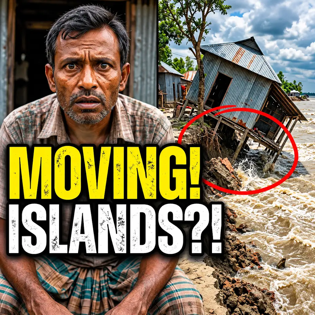
This River is Literally Erasing Islands
FAQs
1. What is the significance of satellite view in studying Bangladesh river systems?
Satellite view provides a comprehensive and detailed perspective of the intricate network of rivers in Bangladesh, allowing researchers to analyze the flow patterns, changes in river courses, and impact of human activities on the river systems.
2. How does satellite imagery help in monitoring river erosion in Bangladesh?
Satellite imagery enables continuous monitoring of river erosion by capturing high-resolution images over time, which helps in identifying vulnerable areas, assessing the rate of erosion, and planning effective mitigation measures.
3. Can satellite view assist in predicting floods along the river systems in Bangladesh?
Yes, satellite view can aid in predicting floods by monitoring water levels, identifying areas at risk of inundation, and providing early warnings to authorities and communities living along the riverbanks in Bangladesh.
4. What role does satellite technology play in managing water resources in Bangladesh?
Satellite technology helps in managing water resources by monitoring water availability, tracking changes in water quality, assessing the impact of climate change on water bodies, and facilitating informed decision-making for sustainable water management practices.
5. How does satellite view contribute to the conservation of biodiversity in Bangladesh river systems?
Satellite view assists in the conservation of biodiversity by mapping habitats, monitoring changes in vegetation cover, identifying critical ecosystems along the river systems, and supporting efforts to protect and restore the rich biodiversity of Bangladesh’s rivers.