The Sarez Lake, a sapphire jewel nestled high in the Pamir Mountains of Tajikistan, remains one of nature’s most captivating and yet least understood marvels. Formed by a catastrophic earthquake and subsequent rockslide in 1911, this immense body of water, known locally as the “Uzoi Dam” (meaning “new dam” in Tajik), is a testament to the raw power of geological forces and a stark reminder of the delicate balance between human civilization and the untamed wilderness. Despite its breathtaking beauty and significant geological importance, Sarez Lake remains largely inaccessible to the outside world, fostering an aura of mystery and earning it the moniker of nature’s hidden wonder. This article aims to shed light on the formation, characteristics, and enduring significance of this extraordinary submerged landscape.
The Cataclysmic Birth of a Mountain Lake
The genesis of Sarez Lake is a story of dramatic upheaval, a singular event that reshaped the very topography of the Pamirs. The year 1911 marked a turning point for the Bartang Valley when a colossal earthquake, estimated to be of magnitude 7.4, struck the region. This seismic jolt triggered a massive landslide, a deluge of rock and debris that cascaded down the slopes, effectively damming the Murghab River. The sheer volume of material, estimated to be in the billions of cubic meters, created a natural barrier of unprecedented scale, blocking the river’s flow and causing the valley to transform into a reservoir.
The Unfolding Tragedy
The immediate aftermath of the earthquake was one of immense devastation for the scattered villages that inhabited the Bartang Valley. The earthquake itself caused widespread destruction, and the subsequent landslide buried settlements, including the village of Sarez, under tons of earth and rock. The inhabitants of Sarez, the very namesake of the lake that would eventually bear its memory, were among the first casualties of this natural disaster. The initial inundation was slow, as the waters of the Murghab River began to pool behind the newly formed Uzoi Dam. However, as the river continued to feed the growing body of water, the scale of the submerged landscape became increasingly apparent. Homes, agricultural lands, and entire ecosystems were swallowed by the rising waters, creating a poignant and tragic submerged world beneath the pristine surface of the nascent lake. The remnants of these lost villages, while submerged, serve as a silent testament to the lives that were irrevocably altered by this monumental event.
The Engineering of Nature
The Uzoi Dam, the natural barricade that contains Sarez Lake, is an engineering feat of staggering proportions, conceived and executed by geological forces rather than human hands. It stands as one of the largest natural dams in the world, a colossal pile of rock, soil, and ice that stretches for kilometers across the Bartang River. The dam’s height varies, but in places, it reaches hundreds of meters, creating a formidable barrier that holds back the vast expanse of the lake. Its composition is a heterogeneous mix, a testament to the chaotic nature of the landslide. Boulders the size of houses lie alongside finer sediments, all compacted by the immense forces of the earthquake and the subsequent pressure of the water. The dam’s stability has been a subject of ongoing scientific scrutiny, given its immense volume and the potential consequences of its failure. Geologists and engineers have meticulously studied its structure, monitoring its integrity for any signs of weakness or erosion, a constant reminder of the inherent risks associated with this natural phenomenon.
The Sarez village, once a vibrant community, is now submerged beneath the waters of the Sarez Lake, a result of a devastating earthquake in 1911 that triggered a massive landslide. This tragic event not only altered the landscape but also left behind a haunting reminder of the village’s existence. For those interested in learning more about the geological and historical significance of the submerged village and its lake, you can read a related article at this link.
The Sapphire Heart of the Pamirs
Sarez Lake is not merely a body of water; it is a breathtaking natural spectacle, a vibrant sapphire set amidst the rugged grandeur of the Pamir Mountains. Its dimensions are impressive, reflecting the scale of the event that created it. The lake stretches for approximately 70 kilometers in length, with an average width of around 1.5 kilometers. Its depth is equally remarkable, reaching over 500 meters in certain areas, making it one of the deepest lakes in Central Asia. The sheer volume of water contained within its basin is astounding, estimated to be in the tens of billions of cubic meters.
The Unveiling of Color and Light
The color of Sarez Lake is its most striking visual characteristic. On a clear day, the water exhibits an intense, almost luminous turquoise hue, a shade so vibrant it appears almost unreal. This remarkable coloration is attributed to several factors. The purity of the glacial meltwater, which forms the lake’s primary source, plays a significant role. This meltwater is exceptionally low in dissolved minerals and organic matter, allowing the sunlight to penetrate deep into the water column. The scattering of light then accentuates the blue and green wavelengths, creating the mesmerizing visual effect. Furthermore, the surrounding landscape, with its snow-capped peaks and barren, rocky slopes, reflects onto the water’s surface, adding to its ethereal appearance. The way light interacts with the water, shifting and changing throughout the day and across different seasons, transforms the lake into a dynamic canvas of blues and greens.
The Mirrored Majesty of the Peaks
The dramatic mountainous backdrop of the Pamirs serves as a spectacular frame for Sarez Lake. The jagged, snow-dusted peaks of the Tien Shan and Pamir ranges rise majestically on all sides, their imposing silhouettes reflected in the glassy surface of the lake. This reflection is often so perfect that it is difficult to distinguish between the actual mountains and their mirrored images. The juxtaposition of the stark, rocky mountains and the serene, vibrant waters creates a scene of unparalleled natural beauty. During different times of day, the light plays upon these peaks, casting long shadows and highlighting their rugged contours, further enhancing the dramatic and awe-inspiring panorama. The reflections are particularly breathtaking during sunrise and sunset, when the sky ignites with fiery hues, painting both the mountains and their watery counterparts in a symphony of color.
Life in the Shadow of the Uzoi Dam
The creation of Sarez Lake has had profound implications for the ecosystems and communities residing in its vicinity. While the lake itself is relatively young in geological terms, life has found a way to adapt and persist, albeit in altered forms, around its immense shores. The isolation of the region, coupled with the inherent risks associated with the dam, has meant that human presence is sparse and carefully managed.
The Hardy Flora and Fauna
Despite its harsh environment, Sarez Lake and its surrounding areas support a surprisingly resilient array of flora and fauna. The high altitude, extreme temperatures, and limited growing season present significant challenges for life. However, hardy alpine plants, such as various species of sedges, grasses, and low-lying flowering plants, manage to eke out an existence in the rocky terrain. These plants are adapted to survive long winters and short, intense summers. The fauna is equally resilient. Ibex and marmots are common sights, their populations thriving in the rugged slopes. Various species of birds, including raptors that soar above the peaks, also inhabit the region. The lake itself, though cold, may support some aquatic life, though detailed ecological studies are challenging due to the lake’s remoteness and the dangers associated with its infrastructure. The unique conditions have fostered specialized adaptations, making the life found here a testament to nature’s enduring spirit.
The Human Element: Resilience and Risk
Human habitation around Sarez Lake is characterized by a profound sense of resilience and an acute awareness of the inherent risks. The communities that live in the Bartang Valley are largely nomadic or semi-nomadic, their lives intertwined with the rhythms of the mountains and the unpredictable nature of the environment. They are accustomed to harsh conditions and possess a deep understanding of the local topography. However, the presence of Sarez Lake and the Uzoi Dam introduces an unprecedented level of vulnerability. The potential for a dam breach is a constant, albeit often unspoken, concern. This awareness has shaped their traditional practices, leading to a cautious approach to settlement and resource utilization in areas perceived to be at higher risk. Despite these challenges, these communities have a rich cultural heritage and a strong sense of self-sufficiency, deeply connected to their ancestral lands. Their lives are a delicate dance with the powerful forces of nature that surround them.
The Constant Vigil: Monitoring the Uzoi Dam
The sheer scale of the Uzoi Dam and the catastrophic potential of its failure necessitate a continuous and rigorous monitoring program. The potential downstream impact of a breach is immense, threatening densely populated areas and vital infrastructure. Consequently, national and international efforts are dedicated to ensuring the dam’s stability and anticipating any signs of distress.
The Scientific Watch
A dedicated team of geologists, hydrologists, and engineers forms the backbone of the dam’s monitoring system. These experts employ a suite of sophisticated technologies to scrutinize every aspect of the Uzoi Dam. Seismic sensors are strategically placed to detect even the slightest tremors that could indicate instability. GPS and other geodetic instruments are used to measure any subtle movements or deformations in the dam’s structure. Water level and pressure gauges provide crucial data on the immense forces at play within the lake. Remote sensing techniques, including satellite imagery, offer a broader perspective, allowing for the detection of changes in the dam’s surface or surrounding slopes. Regular geological surveys and sample analysis provide ongoing insights into the dam’s composition and its long-term structural integrity. This scientific vigilance is a testament to the commitment to understanding and mitigating the risks associated with Sarez Lake.
International Cooperation and Risk Mitigation
Recognizing the transboundary implications of a potential dam failure, international cooperation plays a vital role in the monitoring and risk mitigation efforts for Sarez Lake. Organizations such as the World Bank and the United Nations have been instrumental in providing technical expertise, funding, and support for these crucial endeavors. Joint projects involving Tajik scientists and international researchers facilitate the exchange of knowledge and best practices. Early warning systems are being developed and implemented to alert downstream communities in the event of an emergency. Contingency plans are meticulously prepared, outlining evacuation procedures and response protocols. This collaborative approach underscores the shared responsibility in safeguarding both the immediate region and the wider downstream populations from the potential consequences of this formidable natural wonder. The commitment to international partnership highlights the global significance of ensuring the safety and stability of the Uzoi Dam.
The Sarez village submerged lake, a fascinating natural phenomenon, has drawn the attention of many researchers and adventurers alike. This unique lake, formed after a massive earthquake in 1911, serves as a reminder of the power of nature and the impact it can have on human settlements. For those interested in exploring more about similar geological wonders, you can read an insightful article on the topic at My Geo Quest, which delves into various submerged landscapes around the world.
The Enduring Enigma of Sarez
| Metric | Data |
|---|---|
| Location | Sarez Village, Pamir Mountains, Tajikistan |
| Lake Name | Sarez Lake |
| Formation Year | 1911 |
| Cause of Formation | Earthquake-triggered landslide blocking the Murghab River |
| Lake Length | Approximately 75 km |
| Lake Width | Up to 3 km |
| Maximum Depth | 505 meters |
| Volume | 16 cubic kilometers |
| Natural Dam Name | Usoi Dam |
| Dam Height | 560 meters (world’s tallest natural dam) |
| Risk Level | High risk of dam failure and potential catastrophic flooding downstream |
| Nearby Population Affected | Villages along the Murghab River and downstream areas in Tajikistan and Afghanistan |
Sarez Lake, a testament to nature’s awesome power and a symbol of human vulnerability, continues to captivate the imagination. Its remote location and the challenges associated with its access have preserved its pristine beauty and contributed to its aura of mystery. Yet, beneath this enigmatic facade lies a critical geological formation that demands constant attention and understanding.
A Reservoir of Potential and Peril
Sarez Lake represents a fascinating paradox: a source of immense natural beauty and a potential harbinger of disaster. The vast quantity of fresh water it holds is a resource of immense value, particularly in a region prone to water scarcity. However, the Uzoi Dam’s stability remains a perpetual concern. The ongoing monitoring and research efforts are crucial for assessing the long-term viability of this natural barrier. The decisions made regarding water management, infrastructure development, and risk mitigation will have far-reaching consequences for the communities in the Bartang Valley and beyond. The lake is a constant reminder that even the most magnificent natural wonders can harbor inherent dangers, requiring a delicate balance of respect, understanding, and preparedness.
The Call of the Wild and the Uncharted
The allure of Sarez Lake extends beyond its geological significance; it embodies the spirit of the untamed wilderness. Its inaccessibility, though a practical challenge, has preserved its raw, untouched beauty, making it a destination that calls to adventurers and nature enthusiasts alike. The possibility of exploring its shores, witnessing its vibrant turquoise waters firsthand, and experiencing the grandeur of the Pamir Mountains continues to draw those seeking to venture off the beaten path. However, such journeys are not to be undertaken lightly, demanding thorough preparation, expert guidance, and a profound respect for the formidable environment. Sarez Lake remains a symbol of nature’s grandeur, an uncharted territory where the extraordinary is not just seen but felt, a true hidden wonder of the natural world.
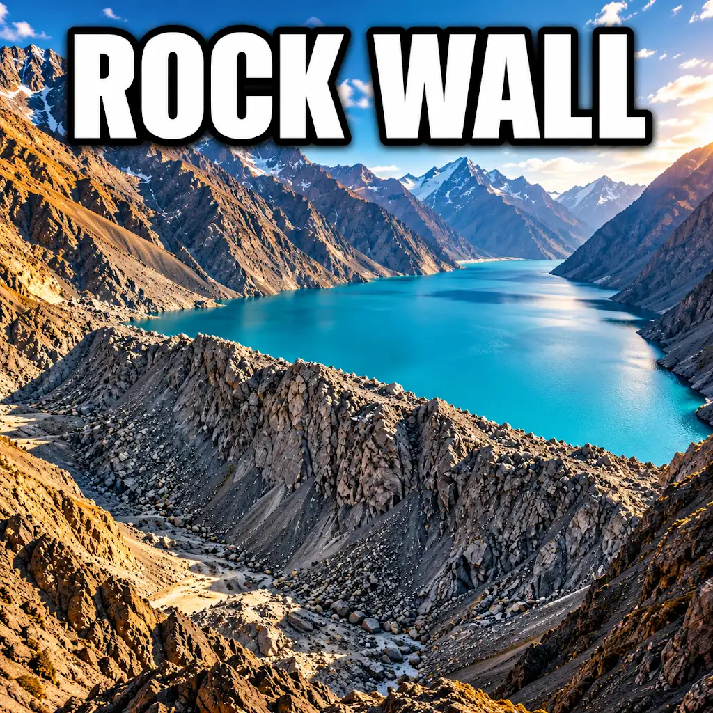
Could a Wave Push Lake Sarez Over This Natural Dam?
FAQs
What is the Sarez village submerged lake?
The Sarez village submerged lake is a large body of water created by a massive landslide that blocked the Murghab River in Tajikistan in 1911.
How deep is the Sarez village submerged lake?
The lake is estimated to be over 500 meters deep in some areas, making it one of the deepest lakes in the world.
What are the concerns associated with the Sarez village submerged lake?
There are concerns that the natural dam holding back the lake could collapse, leading to a catastrophic flood downstream that could affect millions of people.
Is the Sarez village submerged lake a popular tourist destination?
No, the lake is not a popular tourist destination due to its remote location and the potential risks associated with the unstable natural dam.
Are there any efforts to mitigate the risks associated with the Sarez village submerged lake?
Yes, there have been international efforts to study the lake and the stability of the natural dam, as well as proposals for engineering solutions to reduce the risk of a catastrophic flood.