
Cape Horn, a name that echoes with tales of maritime courage and peril, stands as a formidable sentinel at the southern tip of South America. For centuries, this rugged promontory has been the ultimate test for sailors, a place where the vast, untamed forces of the Atlantic and Pacific oceans converge in a violent embrace. Navigating its treacherous geography is not merely a feat of seamanship; it is a battle against the very elements, a testament to human resilience and the enduring allure of the frontier. The sheer isolation, the brutal weather, and the unforgiving underwater topography combine to make Cape Horn a legend etched in nautical history, a place that demands the utmost respect and preparation.
The Symphony of Storms: Atmospheric Fury at the Cape
The prevailing conditions around Cape Horn are characterized by an almost perpetual state of atmospheric turmoil. The region lies within the Roaring Forties and Furious Fifties, belts of powerful westerly winds that circle the globe unimpeded by significant landmasses. These winds, amplified by the dramatic convergence of ocean currents and the surrounding mountainous terrain, frequently reach gale force and beyond, transforming the sea into a churning, chaotic expanse.
The Unrelenting Westerlies
The ceaseless westerly winds are the primary architects of the Cape’s notorious weather. Unlike in the Northern Hemisphere, where continents break up the wind flow, the southern ocean offers a clear path, allowing these powerful currents of air to build immense momentum. Sailors transiting Cape Horn often speak of a relentless battering, a constant struggle against a wind that seems determined to push them back or capsize their vessels. These winds are not just strong; they are often unpredictable, shifting in direction and intensity with alarming rapidity, keeping crews on edge and demanding constant vigilance. The sheer force of these winds can create monstrous waves, capable of overwhelming even the largest of ships.
The Phantom Fog and Icy Embrace
Beyond the wind, the Cape Horn region is also prone to dense fogs, often formed by the interaction of cold air masses with the relatively warmer ocean currents. These fogs are not merely an inconvenience; they represent a significant navigational hazard, reducing visibility to mere feet and making it impossible to judge distances or identify other vessels. Compounding this challenge is the ever-present threat of ice. While not a region of permanent ice sheets like the Arctic or Antarctic, icebergs and growlers can drift into the shipping lanes, particularly in the colder months, posing a catastrophic risk to ships. The combination of zero visibility and unseen obstacles makes navigating these waters a nerve-wracking experience.
The Ephemeral Calm
Paradoxically, moments of unnerving calm can also punctuate the storm-laden atmosphere. These lulls, often referred to as “the Devil’s calm,” are frequently deceptive. They can occur just before a brutal squall, leaving sailors unprepared for the sudden onslaught. The sudden shift from stillness to violent fury can be disorienting and dangerous, as crews may have relaxed their guard only to be caught completely off guard by the returning tempest. These moments of deceptive tranquility serve as a stark reminder that the Cape Horn’s temperament is volatile and demands constant readiness.
Cape Horn, located at the southern tip of South America, is a significant geographical landmark known for its treacherous waters and dramatic cliffs. For those interested in exploring the intricate details of its geography, a related article can be found at My Geo Quest, which delves into the unique features and historical significance of this iconic point. This resource provides valuable insights into the challenges faced by sailors navigating these waters and the ecological importance of the surrounding region.
The Ocean’s Grasp: The Perilous Seas of the Southern Ocean
The sea itself at Cape Horn is as much a formidable adversary as the sky above. The confluence of two vast oceans, coupled with unique underwater features, creates a complex and violent maritime environment that has claimed countless vessels throughout history. The sheer power of the water, combined with its treacherous depths and currents, makes this a truly unforgiving stretch of ocean.
The Unholy Trinity: Atlantic, Pacific, and Antarctic Convergence
The most defining characteristic of the seas around Cape Horn is the convergence of three major ocean currents: the Atlantic, the Pacific, and the Antarctic Circumpolar Current. This meeting point is a cauldron of conflicting water masses, creating turbulent conditions, unpredictable currents, and monstrous waves. The Antarctic Circumpolar Current, in particular, is a powerful force, channeling vast volumes of frigid water around the globe and contributing significantly to the rough seas. The interaction between these currents is not a gentle mixing; it is a violent clash that generates chaotic swells and steep, breaking waves.
The Genesis of the Rogue Wave
It is within this tempestuous environment that the infamous “rogue waves” are born. These solitary, abnormally large waves can appear without warning, dwarfing even the most imposing storm seas. Their sudden emergence and immense height pose an existential threat to even the sturdiest of vessels, capable of sweeping across decks, snapping masts, and causing catastrophic structural damage. The unpredictable nature of these waves makes them one of the most feared phenomena encountered by mariners at the Cape. Their appearance is often attributed to the complex interaction of multiple wave trains and strong currents in the region.
The Submerged Labyrinth: Shoals and Underwater Topography
The dangers at Cape Horn extend far beneath the surface. The seabed in the vicinity is a complex and often shallow topography, punctuated by numerous shoals, submerged rocks, and unpredictable reefs. These underwater hazards, often obscured by the turbulent waters or lurking beneath the surface of a deceptive swell, present a constant threat to ships navigating the area, especially in conditions of reduced visibility.
The Hidden Teeth of the Drake Passage
The Drake Passage, the body of water separating South America from the Antarctic Peninsula and lying just to the south of Cape Horn, is notorious for its shoals and submerged obstacles. Ancient glacial activity has sculpted a seabed that is anything but uniform, creating a veritable underwater labyrinth. Many of these hazards are poorly charted or not charted at all, relying on the knowledge and experience of seasoned sailors to avoid them. A misplaced course or an unexpected gust of wind can send a ship onto these hidden dangers with devastating consequences.
The Constant Pull: Navigational Challenges of Currents
The powerful ocean currents that characterize the region are not merely a source of turbulence; they also pose significant navigational challenges. These currents can exert a relentless pull on a vessel, altering its intended course and making it difficult to maintain position. Understanding and accounting for the strength and direction of these currents is paramount for successful passage.
The Subtlety of the Flow
While the surface turbulence is often dramatic, the underlying currents can be equally powerful and often more subtle. These currents can shift direction and intensity without much outward indication, making it difficult to predict their impact. Skilled navigators spend considerable time studying tidal charts, current tables, and local knowledge to anticipate and counter the forces at play, ensuring their vessel remains on the safest possible track. The continuous struggle against these unseen forces adds another layer of complexity to an already challenging voyage.
The Cape’s Own Anatomy: The Formidable Landmass
The very shape and composition of Cape Horn itself contribute significantly to its hazardous reputation. The promontory’s rugged terrain, steep cliffs, and exposed position create localized weather phenomena and navigational challenges that are unique to this specific geographical feature.
The Guillotine’s Edge: The Steep Cliffs and Rocky Shores
The sheer cliffs that characterize Cape Horn are a stark and imposing sight. These precipitous drops plunge directly into the churning sea, offering no safe harbor or respite for vessels caught in distress. The relentless pounding of waves against these rocky shores has sculpted a jagged coastline, littered with submerged rocks and treacherous underwater outcrops. This unforgiving coastline serves as a constant reminder of the unforgiving nature of the land itself.
The Echoes of Disaster
The base of these cliffs is a graveyard of shipwrecks, testament to the destructive power of the elements. The relentless erosion has created a chaotic and dangerous shoreline, where submerged rocks can rip through the hull of even the strongest ship. For centuries, sailors have skirted this impassive sentinel, acutely aware that a miscalculation could lead to being dashed against its unforgiving face. The visual impact of these cliffs, often shrouded in mist and battered by waves, is a powerful symbol of the Cape’s formidable nature.
The Wind’s Funnel: Localized Atmospheric Disturbances
The presence of the landmass at Cape Horn creates localized atmospheric disturbances that can exacerbate the already challenging weather. The mountains act as a natural funnel, channeling and accelerating the prevailing winds, leading to sudden gusts and unpredictable wind shifts. These localized phenomena can be particularly dangerous for ships navigating close to the shore.
The Whispers of the Andes
The influence of the nearby Andes Mountains, while distant, can also play a role. The mountains can influence the formation of storm systems and affect wind patterns in the region. Sailors often report feeling the effects of these mountainous influences, with sudden changes in wind speed and direction that seem to emanate from the land itself. These localized atmospheric quirks add another layer of unpredictability to the already volatile conditions.
The Final Frontier: The Geographic Isolation
Cape Horn’s extreme southern location contributes to its isolation and the difficulty of providing assistance in emergencies. There are no major ports or significant settlements in the immediate vicinity, meaning that any vessel in distress must rely on its own resources or await help from distant shores. This isolation amplifies the stakes for any mariner attempting the passage.
A World Apart
The sheer distance from established shipping lanes and populated areas means that rescue operations can be significantly delayed. This unforgiving remoteness underscores the need for absolute self-sufficiency and meticulous planning for any voyage around the Cape. The feeling of being utterly alone in the face of nature’s fury is a significant psychological challenge for those who venture into these waters.
The Human Element: Seamanship and Survival
Navigating Cape Horn is not solely about understanding the geography and the weather; it is fundamentally about the human capacity for skill, courage, and adaptation. Throughout history, the Cape has been a crucible for maritime ingenuity and a proving ground for the spirit of adventure.
The Legacy of the Clipper Ships
The age of the clipper ships is intrinsically linked to Cape Horn. These magnificent vessels, built for speed and grace, were the workhorses of global trade, and many made their fortunes – or their graves – rounding the Cape. Their legendary voyages are a testament to the skill of their captains and crews, who pushed the boundaries of seamanship to conquer this formidable passage.
Masters of the Wind and Wave
The captains of these clipper ships were renowned for their intimate understanding of wind, wave, and current. They possessed an almost instinctual ability to read the sea and the sky, making critical decisions that could mean the difference between a successful passage and disaster. Their expertise in sail handling, navigation, and ship management was honed through years of experience, often in the most challenging conditions imaginable. The stories of their bravery and skill continue to inspire awe.
The Evolution of Seafaring Technology
The advent of steam power and later, modern navigation aids, has undeniably altered the experience of rounding Cape Horn. While the fundamental challenges remain, technology has provided sailors with greater control and enhanced safety measures.
From Sextant to Satellite
The transition from celestial navigation using sextants to the reliance on GPS and radar has significantly reduced the risks associated with poor visibility and positional uncertainty. Modern vessels are also equipped with advanced weather forecasting systems, providing more accurate and timely information about approaching storms. Furthermore, the increased structural integrity of modern ships, coupled with improved engine power, allows for greater maneuverability and resilience in rough seas. However, even with the most advanced technology, the raw power of the Cape Horn environment demands respect.
The Psychological Battle: Courage and Resilience
Beyond the technical skills, the psychological fortitude required to face the relentless challenges of Cape Horn cannot be overstated. The isolation, the constant threat of danger, and the sheer physical exhaustion demand a profound level of mental resilience.
The Unyielding Spirit
Sailors who have successfully navigated the Cape often speak of an inner strength they discovered within themselves. The ability to remain calm under pressure, to make rational decisions in the face of overwhelming odds, and to maintain morale in the crew are all crucial elements of survival. The experience can be deeply transformative, forging a bond between crew members and leaving an indelible mark on their lives. The legend of Cape Horn is as much about human spirit as it is about the raw power of nature.
Cape Horn, located at the southern tip of South America, is a significant geographical landmark known for its treacherous waters and dramatic landscapes. The region’s unique geography has fascinated explorers and geographers alike, making it a subject of various studies and articles. For those interested in learning more about the intricate details of Cape Horn’s geography, you can explore a related article that delves deeper into its features and significance. This insightful piece can be found here, providing a comprehensive overview of the area and its historical importance.
The Modern Mariner’s Perspective: Charting a Course Today
While the romantic allure of the clipper ship era may have faded, Cape Horn remains a significant challenge for modern mariners, from commercial shipping to intrepid adventurers. The passage demands respect, preparation, and a thorough understanding of the enduring dangers.
Commercial Shipping Routes: A Calculated Risk
For commercial shipping, the decision to round Cape Horn is a complex calculation of economics, safety, and efficiency. While the Panama Canal offers a significantly shorter and safer passage between the Atlantic and Pacific, certain voyages, particularly those with exceptionally large cargo or vessels that cannot transit the canal, may still opt for the Cape Horn route.
The Price of Passage
This decision involves a thorough risk assessment, considering the prevailing weather patterns, the seaworthiness of the vessel, and the experience of the crew. Modern vessels are built to withstand far greater forces than their predecessors, but the inherent dangers of the Cape remain. The added time and fuel consumption, coupled with the increased risk, mean that this route is generally only chosen when absolutely necessary.
The Adventurer’s Playground: The Ultimate Sailing Challenge
For many sailors, especially those engaged in ocean racing or long-distance cruising, rounding Cape Horn represents the ultimate sailing challenge. The allure of conquering this legendary landmark, of testing their skills against the raw power of the southern ocean, draws a dedicated cadre of adventurers.
The Call of the Extreme
These expeditions are meticulously planned, with vessels often reinforced and equipped with state-of-the-art navigation and safety equipment. The crews are typically highly experienced and well-trained, prepared for the extreme conditions they are likely to encounter. The psychological preparation is as important as the physical, as crews must be ready to endure prolonged periods of rough weather and isolation. The success of such voyages is celebrated not just for the destination, but for the sheer accomplishment of navigating such a formidable environment.
The Importance of Modern Navigation and Forecasting
Even with advancements, modern navigation and forecasting remain crucial for any vessel transiting Cape Horn. Comprehensive understanding of weather patterns, utilizing the latest real-time data and forecasts, is paramount for making informed decisions about the timing and route of passage.
Staying Ahead of the Storm
Experienced captains and navigators pore over weather charts, satellite imagery, and meteorological predictions, looking for windows of opportunity to pass through the most dangerous sections. The ability to anticipate the arrival of storms and adjust course accordingly can be the difference between a safe passage and a perilous encounter. Similarly, advanced GPS and electronic charting systems are indispensable for precise navigation, especially in challenging visibility conditions where traditional landmarks may be obscured. The integration of technology with seasoned judgment is the modern mariner’s key to survival at Cape Horn.
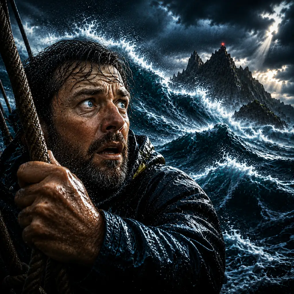
Why Cape Horn Has Some of the Worst Seas on Earth
FAQs

What is Cape Horn and where is it located?
Cape Horn is the southernmost headland of the Tierra del Fuego archipelago of southern Chile. It is located on Hornos Island in the Wollaston Islands, part of the Tierra del Fuego archipelago.
What is the significance of Cape Horn?
Cape Horn is significant because it marks the northern boundary of the Drake Passage and the southern boundary of the South Atlantic and South Pacific Oceans. It is also known for its notoriously hazardous sailing conditions, making it a major milestone for sailors navigating the treacherous waters of the Southern Ocean.
What is the geography of Cape Horn like?
Cape Horn is characterized by its steep cliffs, strong winds, and rough seas. The climate is cold and windy, with frequent storms and heavy precipitation. The surrounding waters are known for their unpredictable and dangerous conditions, with strong currents and large waves.
What wildlife can be found in the Cape Horn region?
The Cape Horn region is home to a variety of wildlife, including seabirds such as albatrosses, petrels, and penguins. Marine mammals such as seals and whales can also be found in the waters surrounding Cape Horn.
Are there any human settlements near Cape Horn?
There are no permanent human settlements on Cape Horn itself, but there are a few small Chilean navy stations and lighthouses in the vicinity. The nearest town is Puerto Williams, located on Isla Navarino, which serves as a base for tourists and researchers visiting the region.