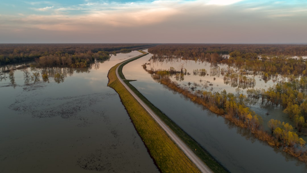
The Mississippi River, a serpentine titan weaving through the heartland of the United States, is more than just a geographical feature; it is a vital artery for commerce and a complex ecosystem. For those who traverse its waters, from colossal cargo ships to utilitarian towboats, understanding and navigating its ever-shifting channel depth is paramount. This article delves into the critical insights surrounding Mississippi River channel depths, exploring the factors that influence them, the methods employed to monitor and maintain them, and the profound implications for navigation, commerce, and the river’s ecological health.
The Mississippi River is not a static entity. Its channel, the navigable pathway carved by millennia of flowing water, is a dynamic landscape constantly remolded by a confluence of natural forces. Understanding these forces is the first step in grasping the nuances of channel depth.
The Relentless Pull of Gravity and Flow Dynamics
At its most fundamental level, the river’s depth is dictated by the volume and velocity of its water. Gravity, the invisible hand that draws water downhill, is the primary driver. However, the interaction of this flow with the riverbed creates intricate patterns.
Erosion: The River’s Sculpting Power
The sheer kinetic energy of flowing water possesses significant erosive power. As water rushes downstream, it carries sediment – sand, silt, and clay – along with it. Where the current is strongest, it can scour the riverbed, deepening the channel. Areas with swifter currents, often found on the outside bends of meanders, are typically deeper.
Velocity Gradients and Secondary Currents
Within the main flow, subtle variations in velocity exist. Faster water often hugs the deepest parts of the channel, while slower water may pool in shallower areas. Furthermore, secondary currents, swirling motions perpendicular to the main flow, can transfer sediment and influence scouring patterns. Understanding these micro-currents is key for precise navigation.
Deposition: The River’s Building Blocks
Conversely, where the river’s velocity slows, the sediment it carries begins to settle. This deposition can occur in gentler currents, behind obstructions, or in wider sections of the river. The accumulation of sediment is a primary cause of shoaling, the gradual reduction of channel depth.
Natural Levees and Oxbow Lakes as Indicators
The formation of natural levees along the riverbanks, built by floodwaters depositing sediment as they recede, is a testament to the river’s depositional power. Similarly, the remnants of old river channels, known as oxbow lakes, highlight the river’s tendency to change its course over time, leaving behind shallower, disconnected waterways.
The Mighty Influence of Hydrology and Seasonal Rhythms
The volume of water in the Mississippi River is not constant; it ebbs and flows with the seasons and the vagaries of weather patterns. This hydrological variability significantly impacts channel depth.
Seasonal Flow Regimes: The River’s Pulse
The Mississippi River experiences distinct seasonal flow regimes. Spring snowmelt from the northern states often leads to peak flows and higher water levels, which can scour deeper channels. Conversely, summer droughts can result in reduced flow and increased deposition, leading to shallower depths, particularly in areas with naturally limited water volume.
The Impact of Ice Jams and Breakup
In the northern reaches of the river, ice formation in winter and subsequent breakup in spring can have dramatic effects. Ice jams can act as temporary dams, significantly altering flow patterns and potentially causing localized flooding and erosion upstream, while creating unusually shallow conditions downstream as water is retained. The breakup of these jams can release a surge of water that dramatically reshapes the channel.
Precipitation Events and Flood Stages: The River Unleashed
Intense rainfall, particularly during storm events or prolonged periods of precipitation, can dramatically increase river discharge. Higher flood stages can temporarily deepen the channel in some areas due to increased erosive power, but they can also lead to widespread deposition as floodwaters recede and carry massive amounts of sediment.
Flash Floods vs. Gradual Rises
The rate at which water levels rise also matters. Flash floods, characterized by rapid and dramatic increases in water volume, can exert immense erosive force over a short period. Gradual rises, while less dramatic, can still contribute to significant sediment transport and deposition over extended periods.
The Ever-Present Hand of Human Intervention
While natural forces are the primary shapers of the Mississippi River’s channel, human intervention has profoundly altered its behavior and, consequently, its depth.
Dredging: The Constant Battle Against Shoaling
The U.S. Army Corps of Engineers (USACE) undertakes extensive dredging operations to maintain a navigable channel. This process involves removing accumulated sediment from the riverbed to ensure sufficient depth for commercial traffic. Dredging is a continuous effort, analogous to a gardener constantly tending to a plant to keep it healthy.
Types of Dredging: Mechanical and Hydraulic
Dredging can be achieved through various methods. Mechanical dredging utilizes excavators and barges to physically remove sediment. Hydraulic dredging employs powerful pumps to suck up water and sediment, which is then transported elsewhere for disposal. The choice of method depends on the type of sediment, the location, and environmental considerations.
Channelization and Structures: Guiding the Flow
The construction of dams, locks, levees, and other hydraulic structures has been instrumental in controlling the river’s flow and maintaining navigable depths. These structures are like carefully placed stitches in the river’s fabric, dictating its course and influencing its depth.
Locks and Dams: Creating Staircases of Water
Locks and dams are particularly prevalent on the Upper Mississippi River. Dams create reservoirs that regulate water levels, while locks allow vessels to ascend and descend the river by overcoming changes in elevation. These structures significantly alter natural flow patterns, creating deeper pools behind dams and influencing sediment deposition in lock chambers.
The Impact of Backwater Effect
The creation of reservoirs behind dams, known as the backwater effect, causes water to pool and slow down, leading to increased sediment deposition in these areas. This can necessitate more frequent dredging to maintain the desired channel depth within the navigation channel.
Revetments and Bank Stabilization: Protecting the Edges
Revetments, flexible mats of stone or concrete, and other bank stabilization techniques are employed to prevent erosion of the riverbanks. While these structures protect the integrity of the river system, they can also indirectly influence channel depth by altering flow patterns and sediment transport dynamics.
Sediment Loads: The River’s Burden
The amount of sediment the Mississippi River carries is a critical factor influencing its channel depth. This sediment load is a consequence of upstream land use, geology, and the river’s own erosive and depositional activities.
Agricultural Runoff: A Significant Contributor
Agricultural practices, particularly in the fertile river basin, contribute to increased sediment loads through soil erosion. When rain washes over cultivated fields, it can carry topsoil into tributaries that feed the Mississippi, adding to the river’s sediment burden.
Tillage Methods and Soil Health
Different tillage methods can significantly impact soil erosion rates. Practices that minimize soil disturbance, such as no-till farming, can help reduce the amount of sediment entering the river system. Promoting soil health is akin to bolstering the river’s resilience.
Urbanization and Development: Altering the Landscape
Urbanization and industrial development can also contribute to sediment loads through construction site runoff and the alteration of natural drainage patterns. Impervious surfaces in urban areas increase the speed and volume of runoff, leading to greater erosion in natural waterways.
Stormwater Management Practices
Effective stormwater management practices in urban areas, such as retention ponds and permeable pavements, can help reduce the amount of sediment and pollutants entering the river.
Natural Geological Processes: The Underlying Foundation
The underlying geology of the Mississippi River basin also plays a role in its sediment load. Different rock and soil types have varying degrees of susceptibility to erosion, influencing the amount of sediment released into the river system over geological timescales.
The Mississippi River navigation channel depth is a critical factor for the transportation of goods and maintaining the economic vitality of the region. For a more in-depth understanding of the challenges and developments related to this vital waterway, you can read the article titled “Navigating the Mississippi: Challenges and Solutions for Channel Depth” available at this link. This article explores the ongoing efforts to manage and improve the river’s navigation channels to accommodate larger vessels and ensure safe passage.
The Cartography of Currents: Measuring and Monitoring Depth
Knowing the depth of the Mississippi River is not a matter of guesswork; it is a science meticulously practiced by engineers and hydrographers. The accurate measurement and continuous monitoring of channel depth are vital for safe navigation.
Hydrographic Surveys: The River’s Annual Check-up
Regular hydrographic surveys are the bedrock of channel depth information. These surveys provide a detailed mapping of the riverbed, revealing the contours and depth of the navigable channel.
Sonar and Echo Sounders: Listening to the Riverbed
Modern hydrographic surveys rely heavily on sonar technology. Echo sounders emit sound pulses towards the riverbed and measure the time it takes for the echoes to return. This data is processed to generate precise depth measurements.
Single-Beam vs. Multi-Beam Echosounders
Single-beam echosounders provide depth measurements directly beneath the survey vessel. Multi-beam echosounders, a more advanced technology, can map a wider swath of the riverbed simultaneously, providing a more comprehensive picture of the channel’s topography.
GPS and DGPS: Pinpointing Location with Precision
Accurate positional data is crucial for hydrographic surveys. Global Positioning System (GPS) and Differential GPS (DGPS) are used to precisely track the location of the survey vessel and the sonar equipment, ensuring that depth measurements are accurately mapped.
Dredge Monitoring: Ensuring Depths are Maintained
Once dredging operations are complete, ongoing monitoring is essential to ensure that the desired channel depths have been achieved and are being maintained.
Post-Dredge Surveys: Confirming the Outcome
Immediately following dredging, post-dredge surveys are conducted to verify that the required depths have been met. These surveys compare the current depth to the established project depth.
Real-time Monitoring and Data Analysis
Modern approaches involve real-time monitoring of dredging operations. Data from the dredge’s own depth-sensing equipment is analyzed to provide immediate feedback to the dredge operators and supervisors.
Navigational Charts: The Lighthouses of Information
The data gathered from hydrographic surveys is translated into navigational charts, which serve as the essential roadmap for river operators.
Maintaining Chart Standards: A Constant Endeavor
Navigational charts are continuously updated to reflect changes in channel depth due to natural processes and maintenance activities. Maintaining these standards is an ongoing and crucial task.
Understanding Chart Datum and Soundings
Navigational charts depict depths as soundings, which are measurements below a specific water level known as the chart datum. Understanding the chart datum is essential for interpreting the navigability of the channel.
The Depth Dilemma: Implications for Navigation and Commerce

The depth of the Mississippi River channel is not merely a number; it is a tangible factor that directly impacts the efficiency and safety of riverine commerce.
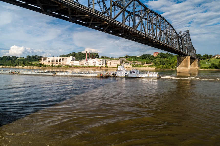
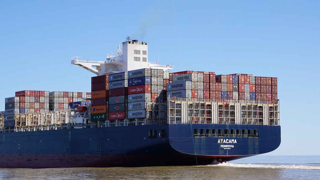
Vessel Draft Limitations: The River’s Capacity
The draft of a vessel, the depth of its hull below the waterline, directly limits the minimum channel depth it can safely traverse. A deeper channel allows for vessels with larger drafts, carrying more cargo.
Optimization of Cargo Capacity: The Economic Engine
Deeper channels translate directly to increased cargo capacity for vessels. This efficiency is a cornerstone of the economic viability of river transportation. A deeper channel is like a wider highway, allowing for larger, more efficient vehicles.
Economic Benefits of Deeper Channels
The ability to carry more cargo per ton-mile on the Mississippi River offers significant economic advantages, reducing transportation costs for goods and commodities throughout the nation.
Safety Concerns: Navigating the Narrow Margins
When channel depths are compromised, the margin for error for vessels diminishes, increasing the risk of grounding and accidents.
Grounding Incidents: The Cost of Insufficient Depth
Grounding incidents, where a vessel’s hull comes into contact with the riverbed, can lead to significant delays, cargo damage, environmental spills, and costly salvage operations.
The Role of Inland Waterways Navigation Aids
Aids to navigation, such as buoys and lights, are crucial for guiding vessels, particularly in areas where channel depths may vary. Their effective placement is dependent on accurate depth information.
Shipping Routes and Connectivity: The River’s Lifelines
The navigability of the Mississippi River and its tributaries, dictated by channel depth, determines the connectivity of inland communities and industries to national and international markets.
Access to Inland Ports: The River’s Warehouses
Sufficient channel depth is required for barges and towboats to access inland ports, facilitating the transfer of goods between river transportation and other modes of transport, such as rail and road.
The Mississippi River as a Transportation Corridor
The Mississippi River serves as a critical transportation corridor, linking agricultural producers in the Midwest to domestic and international markets, as well as connecting industrial centers.
The Ecological Echo: Channel Depth and River Health
The management of Mississippi River channel depth is not solely an economic concern; it has profound implications for the river’s ecological health and the biodiversity it supports.
Sediment Management: The Unintended Consequences
Dredging and other human interventions designed to maintain channel depth can have unintended consequences on the river’s sediment balance.
Dredged Material Disposal: Where Does It Go?
The disposal of dredged material is a significant environmental challenge. If not managed properly, it can smother benthic habitats, alter water quality, and impact aquatic life. Finding environmentally sound disposal sites is paramount.
Beneficial Use of Dredged Material
Increasingly, efforts are being made to find “beneficial uses” for dredged material, such as using it for wetland restoration, land reclamation, or as a component in construction materials.
Habitat Alteration: The Riverbed’s Inhabitants
Changes in channel depth and sediment composition can alter the habitats available for aquatic organisms. Dredging can remove substrate that is essential for spawning, foraging, and shelter for various species.
Impact on Benthic Organisms
Benthic organisms, those living on or in the riverbed, are particularly vulnerable to changes in sediment composition and availability. These organisms form the base of many aquatic food webs.
Water Quality and River Flow: A Delicate Balance
The management of channel depth can influence water quality and the overall flow dynamics of the river.
Suspended Sediment and Turbidity
Dredging operations can temporarily increase the amount of suspended sediment in the water, leading to increased turbidity. This can reduce light penetration, affecting aquatic vegetation and the feeding behavior of some fish.
The Link Between Flow and Dissolved Oxygen
The rate of water flow in the river is directly linked to the amount of dissolved oxygen available for aquatic life. Alterations in flow patterns due to channel management structures can impact dissolved oxygen levels.
Biodiversity and Ecosystem Resilience: A Complex Interdependency
The intricate web of life within the Mississippi River ecosystem is deeply intertwined with its physical characteristics, including channel depth and sediment dynamics.
Fish Spawning Grounds and Nursery Areas
Certain species of fish rely on specific depths and substrate types for spawning and as nursery areas for their young. Changes in channel depth can degrade or eliminate these critical habitats.
The Importance of Habitat Diversity
Maintaining a diverse range of depths and habitats within the river system is essential for supporting a healthy and resilient ecosystem. The river should not be a uniform, monotonous trench.
The Mississippi River plays a crucial role in the transportation of goods across the United States, and maintaining the navigation channel depth is essential for ensuring efficient shipping. Recent discussions have highlighted the challenges faced in keeping the channel adequately deep to accommodate larger vessels. For more insights on this topic, you can explore a related article that delves into the complexities of river navigation and its economic implications. To read more, visit this article for an in-depth analysis.
Technology and Innovation: Charting the Future of Depth Management
| Location | Navigation Channel Depth (feet) | Year Last Dredged | Maintaining Authority | Notes |
|---|---|---|---|---|
| Upper Mississippi River (St. Paul to St. Louis) | 9 | 2023 | U.S. Army Corps of Engineers | Maintained for barge traffic and commercial navigation |
| Lower Mississippi River (St. Louis to Gulf of Mexico) | 45 | 2022 | U.S. Army Corps of Engineers | Deep draft navigation channel for ocean-going vessels |
| Mississippi River Gulf Outlet (MRGO) | 36 | 2021 | U.S. Army Corps of Engineers | Channel depth maintained for shipping access to New Orleans |
| Atchafalaya River Navigation Channel | 12 | 2023 | U.S. Army Corps of Engineers | Supports barge traffic and regional commerce |
As technology advances, so too do the methods for managing and understanding Mississippi River channel depths, promising more efficient and environmentally conscious approaches.
Advanced Survey Technologies: A Sharper View
The development of more sophisticated hydrographic survey technologies is providing an unprecedented level of detail in mapping the riverbed.
Autonomous Survey Vehicles: Unmanned Exploration
The deployment of autonomous underwater vehicles (AUVs) and uncrewed surface vehicles (USVs) allows for more frequent and detailed surveys, especially in challenging or remote areas. These vehicles can operate for extended periods, gathering vast amounts of data.
Real-time Data Transmission and Analysis
The ability to transmit survey data in real-time to shore-based operators allows for immediate analysis and decision-making, enabling a more dynamic approach to channel management.
Predictive Modeling: Foresight into the River’s Behavior
Sophisticated computer models are being developed to predict how channel depths will change over time based on various factors, including flow, sediment load, and weather patterns.
Sediment Transport Modeling: Forecasting Shoaling Hotspots
These models can identify areas prone to shoaling, allowing for proactive dredging efforts and optimized resource allocation.
Impact Assessment of Infrastructure Projects
Predictive models can also be used to assess the potential impact of new infrastructure projects on channel depth and flow dynamics, enabling informed planning and mitigation strategies.
Integrated Data Management Systems: A Holistic View
The consolidation of diverse data streams – from hydrographic surveys, weather forecasts, and vessel traffic – into integrated data management systems provides a comprehensive view of the river’s status.
Decision Support Tools for River Operators
These systems empower river operators and managers with better-informed decision-making capabilities, leading to more efficient and safer navigation.
Towards Smart River Management
The ultimate goal is to achieve “smart river management,” where data-driven insights and advanced technologies work in concert to optimize channel depths, ensure safe navigation, and protect the ecological integrity of the Mississippi River.
Navigating the Mississippi River’s channel depth is a perpetual dance between the forces of nature and the ingenuity of humankind. As the river continues its journey, so too will the efforts to understand, manage, and maintain its vital depths, ensuring its continued role as a cornerstone of American commerce and a vibrant ecological system. The insights gleaned today will undoubtedly shape the navigability and health of this indispensable waterway for generations to come.
WATCH NOW ▶️ SHOCKING: Mississippi: The $12 Trillion Lie Revealed
FAQs
What is the current authorized depth of the Mississippi River navigation channel?
The authorized depth of the Mississippi River navigation channel varies by segment, but the main commercial navigation channel is generally maintained at a depth of 9 feet to accommodate barge traffic.
Why is maintaining the navigation channel depth important for the Mississippi River?
Maintaining the navigation channel depth is crucial for ensuring safe and efficient passage of commercial vessels, supporting the transportation of goods, and sustaining the economic activities dependent on river traffic.
Who is responsible for maintaining the Mississippi River navigation channel depth?
The U.S. Army Corps of Engineers is primarily responsible for maintaining the navigation channel depth through dredging and other river management activities.
How often is dredging performed to maintain the Mississippi River navigation channel depth?
Dredging frequency depends on sediment accumulation and river conditions but typically occurs regularly throughout the year to keep the channel at the authorized depth.
What challenges affect maintaining the Mississippi River navigation channel depth?
Challenges include sediment deposition, fluctuating water levels, weather events, and environmental regulations, all of which can impact the ability to maintain consistent channel depth.