
The Ganges-Brahmaputra Delta, a vast and intricate network of rivers, islands, and wetlands, stands as a testament to the immense power of hydrological processes. This colossal delta, one of the largest in the world, is the product of the confluence of three mighty rivers: the Ganges, the Brahmaputra, and the Meghna, along with their numerous tributaries. The interplay of these rivers, their sediment load, and the dynamic forces of the Bay of Bengal has sculpted a landscape of unparalleled complexity and ecological significance. Understanding the geography of this region, from its overarching structure to its fine-grained features, is crucial for appreciating its human and natural systems.
The Rivers: Lifeblood of the Delta
The foundation of the Ganges-Brahmaputra Delta lies in the colossal river systems that feed it. These rivers, originating in the Himalayas, carry immense volumes of water and sediment, shaping the delta’s landforms and sustaining its rich biodiversity.
The Ganges and its Tributaries
The Ganges, revered as a sacred river in India, is a dominant force in the delta’s formation. Its journey from the Himalayas is marked by extensive alluvial plains, which gradually transition into the deltaic environment. Along its course, numerous tributaries, such as the Yamuna, Ghaghara, Gandak, and Kosi, converge, significantly augmenting its flow and sediment transport. The Kosi, in particular, is known for its highly braided nature and its propensity for shifting its course, a characteristic that has profoundly influenced the delta’s morphology over millennia. The deposition of silt from these rivers creates fertile alluvial plains, supporting extensive agriculture.
The Brahmaputra: A Mighty Torrent
The Brahmaputra, known by different names in its journey through Tibet (Yarlung Tsangpo) and Assam (Jamuna), is characterized by its high discharge and significant sediment load. Unlike the Ganges, the Brahmaputra flows through a comparatively narrower valley before entering the delta. Its aggressive erosion and deposition patterns contribute substantially to the delta’s progradation, pushing its seaward boundary further into the Bay of Bengal. The confluence of the Brahmaputra and the Ganges in Bangladesh creates a massive braided river system, a spectacle of churning waters and constantly shifting sandbars.
The Meghna: The Final Confluence
The Meghna is the southernmost and final major river system that joins the Ganges and Brahmaputra before emptying into the Bay of Bengal. It acts as a vital outlet for the combined waters and sediments of the other two rivers, forming a vast, funnel-shaped estuary. The Meghna’s influence is crucial in shaping the lower deltaic regions, characterized by extensive tidal flats and marshlands. Its confluence with the other rivers creates a massive distributary network, making navigation challenging but also creating unique aquatic habitats.
The Ganges-Brahmaputra Delta, known for its vast and intricate network of rivers and wetlands, plays a crucial role in the ecology and economy of the region. For a deeper understanding of the geographical features and environmental challenges faced by this delta, you can explore a related article on this topic at My Geo Quest. This resource provides valuable insights into the delta’s formation, its significance in supporting biodiversity, and the impacts of climate change on this vital area.
Delta Formation and Evolution

The Ganges-Brahmaputra Delta is a prime example of a riverine delta, formed by the deposition of sediments carried by rivers into a standing body of water, in this case, the Bay of Bengal. Its evolution is a continuous process of deposition, erosion, and subsidence.
Sedimentation: The Building Blocks
The sheer volume of sediment transported by the Ganges and Brahmaputra rivers is staggering. Estimates suggest that billions of tons of silt are deposited annually. This sediment, primarily silt and clay, is the fundamental material from which the delta is constructed. As the rivers slow down upon entering the Bay of Bengal, their capacity to carry sediment diminishes, leading to its deposition. This continuous deposition builds up the land, causing the delta to expand seaward. The fertile alluvial soil deposited by these rivers is ideal for agriculture, supporting a dense human population.
Tectonics and Subsidence: The Underlying Forces
While sedimentation is the primary driver of delta growth, tectonic forces also play a significant role in its evolution. The region is tectonically active, situated near the Indo-Australian and Eurasian plates. This activity can lead to subsidence, or the sinking of land, which counteracts the rate of sedimentation. The interplay between uplift and subsidence, coupled with eustatic sea-level changes, influences the delta’s overall elevation and its vulnerability to inundation. In some areas, subsidence can outpace deposition, leading to the loss of land.
Sea-Level Fluctuations and Coastal Dynamics
The Bay of Bengal, with its monsoon-driven currents and storm surges, exerts significant influence on the delta’s coastal dynamics. Fluctuations in sea level, both long-term and short-term, impact the delta’s shape and extent. During high sea-level stands, the delta may recede, while during low sea-level periods, it can prograde further. The delta is also highly susceptible to tropical cyclones, which can cause immense erosion and flooding, reshaping coastlines and altering river courses. The constant battle between riverine deposition and marine erosion and inundation defines the delta’s dynamic coastal fringe.
Landscape Features: A Mosaic of Water and Land
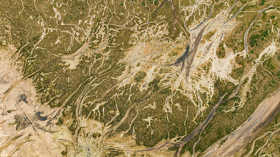
The Ganges-Brahmaputra Delta is characterized by an intricate and ever-changing landscape, dominated by a complex network of rivers, channels, islands, and wetlands. Its features are a direct result of the depositional processes and the relentless action of water.
Riverine Network: Arteries of the Delta
The delta is crisscrossed by an astonishingly dense network of rivers, distributaries, and channels. These waterways act as the lifeblood of the region, serving as crucial transportation routes, sources of water for irrigation, and habitats for aquatic life. The rivers are often wide and shallow, with constantly shifting sandbars and islands. Navigating this labyrinthine system can be challenging, relying on local knowledge and the understanding of seasonal water levels. The morphology of these channels, from braided to meandering, reflects the varying flow regimes and sediment loads.
Islands and Chars: Emerging and Disappearing Lands
A defining feature of the delta are its numerous islands, some of which are permanent and densely populated, while others are ephemeral, known as “chars” or “diara lands.” These chars are essentially newly formed landmasses created by sediment deposition. They are highly dynamic, constantly being built up by silt deposition during low flows and eroded by strong currents and tidal surges. The formation and erosion of chars are critical processes in the delta’s geomorphology and have significant implications for land settlement and resource management. Some chars are colonized by vegetation, which helps to stabilize them, while others remain barren sandbanks.
Wetlands and Sundarbans: Biodiversity Hotspots
The delta is dotted with extensive wetlands, including marshes, swamps, and floodplains, which are integral to its ecological functioning. The most iconic of these is the Sundarbans, the world’s largest mangrove forest, situated in the southwestern part of the delta. These mangroves play a vital role in protecting the coastline from erosion and storm surges, and they provide critical habitats for a rich diversity of flora and fauna, including the Bengal tiger. The wetlands are also crucial for nutrient cycling and water purification within the deltaic ecosystem. Seasonal flooding inundates vast areas, creating temporary wetlands that support diverse plant and animal life.
Human Geography: Adapting to a Dynamic Environment
The Ganges-Brahmaputra Delta is home to one of the most densely populated regions on Earth. Its human inhabitants have developed remarkable strategies to adapt to the challenges and opportunities presented by this dynamic landscape.
Agriculture: The Foundation of Livelihoods
Agriculture is the backbone of the delta’s economy. The fertile alluvial soils, replenished annually by floodwaters, are ideal for cultivating a variety of crops, with rice being the dominant staple. Farmers have developed sophisticated irrigation and drainage systems to manage the fluctuating water levels and ensure crop productivity. The delta’s agricultural output is crucial for feeding the vast populations of Bangladesh and parts of India. However, agricultural practices are constantly challenged by salinization in coastal areas and the unpredictability of monsoon rains.
Settlements and Infrastructure: Navigating the Waterways
Human settlements in the delta are deeply intertwined with its riverine landscape. Villages and towns are often located on higher ground or on levees to avoid flooding. Traditional settlements are built on stilts or raised platforms. Transportation relies heavily on the vast network of rivers, with boats and ferries being the primary modes of travel. The development of permanent infrastructure, such as roads and bridges, is often challenging due to the unstable land and the need to cross numerous waterways. This reliance on waterways shapes the spatial organization of settlements and the flow of goods and people.
Vulnerability and Adaptation: Living with the Risks
The delta’s low-lying topography and its exposure to natural hazards make its inhabitants particularly vulnerable. Flooding, cyclones, and riverbank erosion are recurrent threats. Salinity intrusion in coastal areas, exacerbated by sea-level rise, poses a significant challenge to agriculture and freshwater availability. Despite these challenges, the people of the delta have a long history of adaptation. They have developed traditional knowledge of flood forecasting, built elevated homes, and implemented community-based disaster management strategies. However, the increasing intensity of extreme weather events due to climate change is placing unprecedented strain on these adaptive capacities.
The Ganges-Brahmaputra Delta, known for its rich biodiversity and unique geographical features, plays a crucial role in the livelihoods of millions of people. This vast delta is not only significant for its ecological importance but also for its cultural heritage. For those interested in exploring more about the intricate dynamics of this region, you can read a related article that delves into the environmental challenges and opportunities faced by the delta. To learn more, visit this article which provides valuable insights into the geography of the Ganges-Brahmaputra Delta.
Ecological Significance and Challenges
| Metric | Value | Details |
|---|---|---|
| Location | India and Bangladesh | Spanning the states of West Bengal, Assam, and Bangladesh |
| Area | 105,000 km² | One of the largest river deltas in the world |
| Rivers | Ganges, Brahmaputra, Meghna | Main rivers forming the delta |
| Population | Over 140 million | Highly densely populated region |
| Elevation | 0 to 10 meters above sea level | Low-lying floodplain area |
| Soil Type | Alluvial soil | Fertile soil deposited by river sediments |
| Climate | Tropical monsoon | Heavy rainfall during monsoon season |
| Major Cities | Kolkata, Dhaka, Khulna | Important urban centers in the delta |
| Natural Hazards | Flooding, Cyclones, Riverbank erosion | Frequent environmental challenges |
| Biodiversity | Sundarbans Mangrove Forest | World’s largest mangrove forest and tiger habitat |
The Ganges-Brahmaputra Delta is an ecological marvel, supporting an astounding array of biodiversity. However, it faces significant environmental challenges, primarily driven by human activities and climate change.
Biodiversity Hotspot: A Rich Tapestry of Life
The delta’s diverse habitats, from the saline mangrove forests of the Sundarbans to the freshwater wetlands and agricultural fields, support a remarkable variety of life. The Sundarbans are a globally recognized biodiversity hotspot, home to numerous species of plants, fish, reptiles, birds, and the iconic Bengal tiger. The rivers and wetlands teem with fish, providing a vital source of food and income. The delta’s wetlands also serve as crucial stopover points for migratory birds. This ecological richness is a direct consequence of the abundant freshwater and nutrient input from the rivers.
Environmental Pressures: Pollution and Degradation
Despite its ecological importance, the delta is under immense pressure from human activities. Pollution from industrial waste, agricultural runoff, and untreated sewage is degrading water quality in the rivers and wetlands, threatening aquatic life and human health. Deforestation and unsustainable land-use practices are leading to soil erosion and habitat loss. The construction of dams and barrages upstream on the Ganges and Brahmaputra rivers can alter sediment flow and water levels within the delta, impacting its natural processes.
Climate Change Impacts: An Amplified Threat
Climate change presents a formidable threat to the future of the Ganges-Brahmaputra Delta. Rising sea levels are leading to increased coastal inundation and salinization, threatening agricultural land and freshwater resources. Changes in monsoon patterns, with more erratic rainfall and increased frequency of extreme weather events like cyclones and floods, further exacerbate the vulnerability of the delta and its inhabitants. The delicate balance of the delta’s ecosystems is being disrupted, with potential cascading effects on biodiversity and human livelihoods. Addressing these challenges requires a multi-faceted approach involving sustainable resource management, adaptation strategies, and global efforts to mitigate climate change.
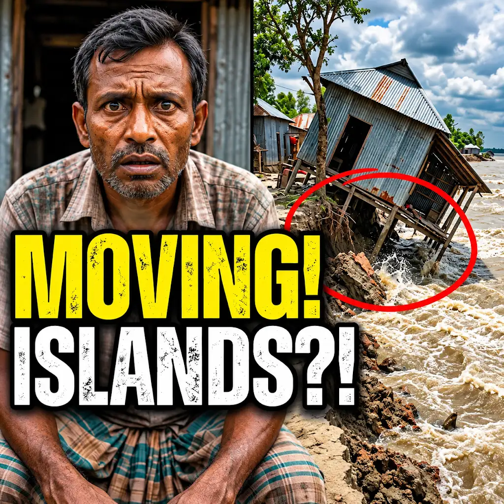
This River is Literally Erasing Islands
FAQs
What is the Ganges Brahmaputra Delta?
The Ganges Brahmaputra Delta, also known as the Bengal Delta, is the world’s largest delta formed by the confluence of the Ganges, Brahmaputra, and Meghna rivers in Bangladesh and West Bengal, India.
How large is the Ganges Brahmaputra Delta?
The Ganges Brahmaputra Delta covers an area of approximately 59,000 square kilometers, making it one of the most densely populated regions in the world.
What is the significance of the Ganges Brahmaputra Delta?
The delta is of great ecological importance as it is a biodiversity hotspot, home to various species of flora and fauna. It also plays a crucial role in agriculture, providing fertile land for rice cultivation.
What are the major challenges faced by the Ganges Brahmaputra Delta?
The delta is prone to natural disasters such as cyclones, flooding, and erosion. Climate change has exacerbated these issues, leading to increased salinity in the soil and water, affecting agriculture and livelihoods.
How is the Ganges Brahmaputra Delta adapting to climate change?
Efforts are being made to implement sustainable practices such as mangrove reforestation, building embankments, and promoting climate-resilient agriculture to help the delta communities adapt to the changing environment.