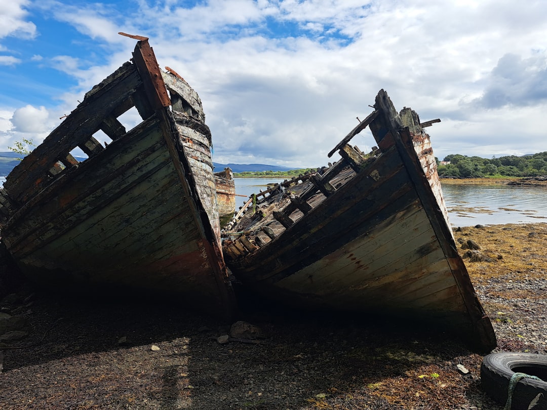
The ocean floor, an often-overlooked frontier, harbors a history as vast and deep as its waters. Beneath the surface, silent cities of steel and wood lie scattered, monuments to forgotten journeys and catastrophic events. These are the shipwrecks, the spectral remnants of maritime endeavors that have met their end, forming what can only be described as a colossal underwater graveyard. Recent efforts to map these submerged vestiges have yielded astonishing results, revealing a scale of loss that is both humbling and profoundly informative. Researchers have now meticulously charted an estimated 6,000 shipwrecks, a figure that represents only a fraction of the true number likely resting on the seabed but nonetheless provides an unprecedented glimpse into humanity’s long and often perilous relationship with the sea. This comprehensive mapping project is not merely an academic exercise; it is a crucial step in understanding naval history, environmental impacts, and the evolving challenges of maritime safety.
The Genesis of a Submerged Atlas
The monumental task of mapping such a vast number of shipwrecks is the culmination of years of dedicated effort, technological innovation, and collaborative data sharing. It is a testament to the growing recognition of the historical, scientific, and even economic value that these underwater sites hold. Traditionally, shipwreck discovery was largely accidental, a serendipitous encounter during fishing operations, cable laying, or the exploratory dives of a few intrepid individuals. However, the advent of advanced sonar technologies, remotely operated vehicles (ROVs), and sophisticated Geographic Information Systems (GIS) has revolutionized the field. These tools allow for systematic surveys of large ocean areas, enabling the identification of anomalies on the seabed that correspond to submerged vessels.
Technological Advancements Driving Discovery
The precision of modern sonar systems, such as side-scan sonar and multibeam echosounders, has been instrumental. These technologies can create detailed acoustic images of the seafloor, revealing the distinct shapes and outlines of shipwrecks even when they are partially buried by sediment or encrusted with marine life. ROVs, equipped with high-definition cameras and sampling tools, then provide visual confirmation and allow for closer inspection, gathering crucial data about the vessel’s condition, cargo, and potential historical significance. The integration of this data into GIS platforms creates a dynamic, layered map, allowing researchers to analyze spatial patterns, identify areas of high shipwreck density, and correlate findings with historical records and environmental factors.
Challenges of the Deep
Despite these advancements, the process is far from straightforward. The sheer scale of the world’s oceans presents a significant challenge, with vast areas remaining unexplored or poorly surveyed. The depth of the water, the corrosive nature of saltwater, and the often-turbulent underwater conditions can obscure wrecks or damage them to the point where identification becomes difficult. Furthermore, access to certain areas may be restricted due to geopolitical considerations or hazardous environmental conditions. The constant churn of the seabed, driven by currents and tectonic activity, can also bury or displace wrecks over time, making identification a moving target.
For those interested in exploring the fascinating world of maritime history, a related article can be found at this link, which delves into the intriguing details of the maritime graveyard that houses over six thousand shipwrecks. This comprehensive map not only highlights the locations of these sunken vessels but also provides insights into the stories behind them, offering a unique perspective on the challenges faced by sailors throughout history.
Categorizing the Fallen: Types and Eras of Shipwrecks
The 6,000 mapped shipwrecks represent a diverse tapestry of maritime history, spanning millennia and encompassing a wide array of vessel types and purposes. From ancient merchant ships to the hulks of modern naval vessels, each wreck tells a story of human ingenuity, trade, conflict, and vulnerability. Understanding these categories is crucial for interpreting the broader narrative of seafaring.
The Echoes of Ancient Mariners
The oldest shipwrecks in the mapped data offer invaluable insights into the earliest seafaring civilizations. These might include Phoenician trading vessels, Roman galleys, or Greek triremes. Their discovery and study provide tangible evidence of ancient trade routes, shipbuilding techniques, and the courage of early explorers who navigated unknown waters. Analyzing the amphorae, pottery, and other artifacts found within these wrecks can illuminate trade networks, cultural exchange, and the everyday lives of people living thousands of years ago. The preservation of organic materials in some deep-sea wrecks can also offer unparalleled glimpses into ancient shipbuilding practices.
The Age of Sail: A Symphony of Wood and Wind
The transition to the Age of Sail brought forth larger and more complex vessels, including towering carracks, nimble caravels, and mighty galleons. The mapped graveyards undoubtedly contain numerous examples of these iconic ships, many lost to storms, navigational errors, or the perils of piracy and naval warfare. These wrecks are crucial for understanding the development of shipbuilding, the evolution of rigging and sail plans, and the economic engines that powered global exploration and colonialism. The recovery of cannons, navigational instruments, and personal effects from these wrecks can paint a vivid picture of life aboard these vessels.
The Industrial Revolution and Beyond: Iron, Steam, and Modern Disasters
The advent of iron hulls, steam engines, and later, the diesel and electric propulsion systems of the 20th century, transformed maritime technology. This era also saw some of the most infamous maritime disasters. The mapped wrecks would include the remnants of early steamships, grand ocean liners, and the heavily armed warships of two World Wars. These modern wrecks are vital for understanding the evolution of naval architecture, the impact of industrialization on seafaring, and the devastating consequences of modern warfare at sea. The sheer scale of loss during major conflicts, such as the sinking of the Titanic or the U-boat campaigns of World War I and II, is starkly represented by the number of wrecks found in strategic wartime locations.
Geographic Distribution: Mapping the Hotspots of Maritime Loss
The spatial distribution of the 6,000 mapped shipwrecks is not random. Certain regions of the world’s oceans exhibit a significantly higher concentration of submerged vessels, revealing patterns of historical trade, naval activity, and susceptibility to environmental hazards. Analyzing these hotspots offers a unique perspective on maritime history and geography.
The Perils of Coastal Navigation
Coastal waters, particularly those with treacherous currents, reefs, and limited visibility, often become natural traps for vessels. Areas like the Outer Banks of North Carolina, known as the “Graveyard of the Atlantic,” are prime examples. Similarly, the labyrinthine coastlines of the British Isles and the shallow, reef-strewn waters of the Caribbean have claimed countless ships over centuries. These areas are characterized by a confluence of factors that make navigation particularly hazardous, including unpredictable weather, submerged obstacles, and busy shipping lanes. The mapping efforts confirm anecdotal evidence of these historically dangerous regions.
Strategic Waterways and Battlegrounds
Major shipping lanes and historically significant waterways also feature prominently in shipwreck maps. The English Channel, the Strait of Gibraltar, and the Suez Canal, for instance, are choke points where heavy traffic increases the risk of collision and accidental grounding. Furthermore, regions that have been sites of significant naval battles, such as the waters south of Cuba (site of the Battle of Santiago de Cuba) or the North Sea during World War I, will show a disproportionately high density of military wrecks. Understanding these concentrations helps in reconstructing naval history and identifying areas of ongoing archaeological and environmental concern.
Forgotten Trade Routes and Exploration Frontiers
Beyond the obvious danger zones, shipwreck maps also highlight forgotten trade routes and the outer edges of established exploration. The dispersion of wrecks across vast stretches of the open ocean can indicate past, less-documented trading voyages or the attempts of explorers to chart new territories. These scattered discoveries can reveal the reach of historical empires and the extent of early global connectivity, even in regions that may not be immediately recognized as hazardous. The analysis of these dispersed wrecks can rewrite or corroborate historical accounts of exploration and trade.
Beyond the Ghosts: The Environmental and Scientific Significance
The presence of thousands of shipwrecks is not merely a historical curiosity; it has significant environmental and scientific implications. These submerged structures act as artificial reefs, influencing marine ecosystems, and their decay can release various substances into the water column.
Artificial Reefs: New Havens for Marine Life
Over time, shipwrecks become colonized by a diverse array of marine organisms. The metal and wood structures provide shelter, substrate, and habitat for countless species, from corals and sponges to fish and crustaceans. These artificial reefs can create thriving ecosystems, often more diverse and abundant than the surrounding natural seabed. The mapping of shipwrecks allows scientists to study the processes of colonization and the ecological impact of these man-made structures on marine biodiversity, potentially informing strategies for artificial reef creation. The long-term ecological impact, both positive and negative, is a subject of ongoing research.
A Repository of Historical Pollution and Contamination Concerns
Many shipwrecks, particularly those from the industrial era and wartime, can contain hazardous materials. Fuel residues, batteries, and even weapons systems can pose a long-term environmental threat as they degrade and release contaminants into the marine environment. The mapping provides a crucial inventory of these potential pollution sources, allowing for targeted monitoring and remediation efforts. Understanding the composition of these wrecks and the rate of their decay is essential for assessing and mitigating these risks to marine life and human health. The study of corroding metals and the release of heavy metals is a significant area of research.
Windows into Past Climate and Ocean Conditions
The layers of sediment surrounding and within shipwrecks, along with the chemical composition of the preserved materials, can offer valuable clues about past ocean conditions and even climate. By analyzing sediment cores taken from wreck sites, scientists can reconstruct historical oceanographic data, such as temperature, salinity, and current patterns. Similarly, the isotopic analysis of materials from the wrecks themselves can provide insights into the prevailing environmental conditions at the time of their sinking. This historical data is crucial for understanding long-term climate change and oceanographic variability.
The fascinating world of maritime history is vividly illustrated in the six thousand shipwrecks map, which reveals the locations of countless vessels lost to the sea. This extensive map not only highlights the tragic stories behind these shipwrecks but also serves as a reminder of the challenges faced by sailors throughout the ages. Exploring such resources can deepen our understanding of maritime heritage and the impact of human activity on the oceans.
The Future of the Maritime Graveyard: Conservation, Research, and Interpretation
The comprehensive mapping of 6,000 shipwrecks marks a significant achievement, but it is not an endpoint. It is a foundation upon which future research, conservation efforts, and public engagement can be built. The ongoing study of these submerged sites promises to yield further revelations about our shared maritime past.
Prioritizing Archival and Archaeological Research
The mapped data will allow for more targeted archaeological research. Instead of relying on chance discoveries, researchers can now systematically investigate specific wreck sites based on their historical significance, potential for artifact recovery, or unique characteristics. This approach will lead to a deeper understanding of shipbuilding technology, maritime trade, and the human stories behind these lost vessels. The analysis of historical documents in conjunction with the surveyed data will be crucial for providing context and meaning.
Developing Strategies for Conservation and Protection
With a clearer picture of the distribution and nature of shipwrecks, stakeholders can develop more effective strategies for their conservation and protection. This includes identifying sites of significant historical or cultural value that may require special protection from salvage or disturbance. The mapping data can inform decisions about designating marine protected areas or developing regulations to safeguard these underwater heritage sites. The ethical considerations surrounding shipwreck exploration and artifact recovery are also paramount.
Enhancing Maritime Safety and Navigation
Beyond historical and environmental considerations, the mapping of shipwrecks can also contribute to future maritime safety. By identifying known hazards on the seabed, navigational charts can be updated, helping to prevent future accidents. Understanding the historical patterns of ship loss in certain areas can also inform risk assessments and maritime traffic management strategies, aiming to reduce the number of vessels that join the silent cities beneath the waves. The integration of this data into navigation systems is a logical next step.
FAQs
What is the Maritime graveyard six thousand shipwrecks map?
The Maritime graveyard six thousand shipwrecks map is a comprehensive map that displays the locations of over 6,000 shipwrecks around the world. It provides detailed information about each shipwreck, including the name of the ship, the date it sank, and the reason for its sinking.
How was the Maritime graveyard six thousand shipwrecks map created?
The Maritime graveyard six thousand shipwrecks map was created using data from various sources, including historical records, maritime archives, and underwater surveys. Researchers and experts in maritime history and archaeology collaborated to compile and verify the information for accuracy.
What can be learned from the Maritime graveyard six thousand shipwrecks map?
The Maritime graveyard six thousand shipwrecks map provides valuable insights into maritime history, navigation hazards, and the impact of shipwrecks on the environment. It can also be used for research, education, and conservation efforts related to underwater cultural heritage.
Is the Maritime graveyard six thousand shipwrecks map accessible to the public?
Yes, the Maritime graveyard six thousand shipwrecks map is accessible to the public through various online platforms and databases. It is a valuable resource for historians, archaeologists, divers, and anyone interested in maritime history and exploration.
How can the Maritime graveyard six thousand shipwrecks map be used for conservation efforts?
The Maritime graveyard six thousand shipwrecks map can be used to identify areas with a high concentration of shipwrecks, which may require protection and conservation measures. It can also help in assessing the environmental impact of shipwrecks and developing strategies for their preservation.