
## Navigating the Uncharted: Understanding the Darién Gap Road Network and Regional Routes
The Darién Gap, a formidable expanse of dense rainforest and rugged terrain situated between Panama and Colombia, presents one of the most significant logistical and ecological challenges on the Pan-American Highway. While the highway itself is a remarkable feat of engineering, its continuity is famously broken by this 66-mile (106-kilometer) stretch of impenetrable wilderness. Consequently, any discussion of a “Darién Gap Road Network” necessitates a nuanced understanding. It’s not about a cohesive, paved system connecting two continents, but rather a collection of existing, albeit often rudimentary, routes and tracks that traverse the fringes and accessible pockets of this vast region, alongside the planned and proposed pathways that have been debated for decades. Understanding this complex interplay of natural barriers, existing infrastructure, and aspirational projects is crucial for anyone seeking to comprehend the geography and connectivity of this critical land bridge. This article delves into the current state of the Darién Gap’s “road network,” exploring its components, the challenges it poses, and the implications of its incomplete nature.
The Darien Gap, a dense jungle region between Panama and Colombia, poses significant challenges for those attempting to traverse it. For a comprehensive understanding of the road network in this area, you can refer to a related article that provides detailed insights and maps. This resource can be found at My Geo Quest, which explores the complexities of navigating the Darien Gap and the implications for transportation and travel in this unique region.
## The Elusive Pan-American Highway Connection
The Pan-American Highway, a vast network of roads stretching from Prudhoe Bay, Alaska, to Ushuaia, Argentina, is an engineering marvel that symbolizes continental connectivity. However, its grand vision is fundamentally disrupted at the Darién Gap. The highway terminates at Turbo, Colombia, on its southern end, and Yatza, Panama, on its northern end. The absence of a direct vehicular link across the Darién Gap is not an oversight but a deliberate consequence of insurmountable natural obstacles and significant environmental and political considerations.
### The Breakpoint: Turbo and Yaviza
Yaviza, Panama, is the most southerly point reached by a paved road that is part of the Pan-American Highway system. From Yaviza, the road degrades into a rough track, eventually disappearing into the dense jungle. On the Colombian side, the highway’s progress halts at Turbo, a bustling port town on the Gulf of Urabá. The distance between these two endpoints is approximately 66 miles, but the terrain is unforgiving, characterized by swamplands, rivers, steep hills, and an extremely high rainfall. This geographical impediment has cemented the Darién Gap as the singular, notorious gap in what is otherwise a nearly continuous road network across the Americas.
### The Myth of a Completed Highway
The romantic notion of driving from North to South America without interruption is a persistent myth, fueled by the sheer ambition of the Pan-American Highway project. While various proposals and attempts to bridge the gap have been made over the decades, none have succeeded in creating a continuous, reliable road or bridge. The logistical, environmental, and political hurdles have proven too significant to overcome. The lack of a direct road connection means that vehicles wishing to travel between Panama and Colombia must be transported by sea or air, a costly and complex undertaking.
### Economic and Social Implications of the Gap
The absence of a road connection has profound economic and social implications for the region. It isolates communities within the Darién Gap itself, making trade and transportation difficult and expensive. For the broader economies of Panama and Colombia, it represents a lost opportunity for direct overland trade and tourism. However, it has also inadvertently preserved the pristine environment of the Darién Gap, acting as a natural barrier against unchecked development and deforestation that might otherwise accompany a completed highway. The socio-economic dynamics are further complicated by the fact that the undeveloped nature of the gap also makes it a pathway for illegal activities, including human trafficking and drug smuggling.
## Existing Infrastructure and Tracks in the Darién Region
While a continuous highway is absent, the Darién region is not entirely devoid of human-made pathways. These range from basic dirt tracks used by local communities and indigenous populations to more established, albeit unpaved, routes that serve specific purposes. Understanding these existing infrastructures is key to appreciating the fragmented nature of connectivity in the area. These routes are often seasonal, highly dependent on weather conditions, and require specialized vehicles and considerable expertise to navigate.
### Rural Roads and Access Tracks
Within the broader Darién region, particularly on the Panamanian and Colombian sides, a network of rural roads and access tracks exists. These are typically unpaved, often little more than cleared paths, and are primarily used for local access to agricultural lands, remote villages, and resource extraction sites. In Panama, the road system extends from Yaviza into areas where logging or subsistence farming takes place, becoming progressively more challenging as one moves deeper into the interior. Similarly, in Colombia, areas closer to Turbo and the agricultural fringes of the gap have rudimentary road networks. These tracks are not designed for high-volume traffic and are susceptible to erosion, flooding, and overgrowth, rendering them impassable during the rainy season.
### Indigenous Trails and Pathways
The indigenous communities of the Darién Gap, such as the Emberá and Wounaan, have historically navigated the dense jungle using intricate networks of trails. These pathways are often footpaths, honed over generations for efficiency and to minimize environmental impact. While not a “road network” in the conventional sense, these trails represent a vital form of human passage within the gap and are sometimes utilized by adventurers or researchers. These routes are rarely marked and require intimate knowledge of the terrain, flora, and fauna to follow safely. They are often ephemeral, disappearing and reappearing with the changing landscape.
### Logging and Mining Roads
Historically, logging and mining operations have carved out temporary roads and tracks into parts of the Darién region. These are typically rough, unmaintained, and often abandoned once the resource is depleted or operations cease. While these roads can provide limited access to otherwise inaccessible areas, they are not part of any planned or maintained transportation system. Their presence can also contribute to environmental degradation, opening up sensitive ecosystems to further exploitation. Navigating these former routes is often extremely hazardous due to their poor condition and the lack of ongoing maintenance.
## Proposed and Debated Bridging Projects
The desire to complete the Pan-American Highway and connect the two continents has led to numerous proposals and debates over the decades regarding how to overcome the Darién Gap. These proposals have ranged from ambitious bridge constructions to tunnel projects and even ferry services. However, each has faced significant opposition and insurmountable challenges.
### Historical Bridge Proposals
Several conceptual bridge designs have been put forth over the years, envisioning a monumental structure spanning the Gulf of Urabá or the narrowest points within the gap. These proposals often involve immense engineering feats, requiring foundations in challenging marshy environments and the ability to withstand extreme weather conditions. The sheer cost, environmental impact assessments, and political will required for such a project have always been prohibitive. The ecological sensitivity of the region, a vital biodiversity hotspot, has been a primary concern for environmental organizations, leading to widespread opposition to any large-scale construction that would fragment habitats or disrupt ecosystems.
### Tunneling and Ferry Options
Alternative ideas have included tunneling beneath the gap or establishing extensive ferry services to transport vehicles. Tunneling presents its own set of formidable engineering challenges, given the geological instability and water table of the region. The cost of such an undertaking would be astronomical. Ferry services, while logistically simpler than a fixed structure, would still require significant port infrastructure on both sides and would not represent a true road connection. The operational costs and potential security concerns associated with such a system have also been major deterrents.
### Environmental and Indigenous Opposition
A significant driving force behind the lack of progress in bridging the Darién Gap is the strong opposition from environmentalists and indigenous communities. The Darién Gap is recognized as one of the most biodiverse regions on Earth, home to numerous endangered species and critical ecosystems. Environmental organizations argue that a highway would lead to widespread deforestation, habitat fragmentation, and the introduction of invasive species, threatening this invaluable natural heritage. Indigenous communities, who rely on the forest for their sustenance and cultural practices, also vehemently oppose the development, fearing displacement and the destruction of their ancestral lands. Their voices have been instrumental in shaping policy and preventing large-scale infrastructure projects.
The Darien Gap remains one of the most challenging regions for establishing a continuous road network in Central America, and understanding its geography is crucial for any development plans. For those interested in exploring detailed maps and insights about this area, a related article can be found at My Geo Quest, which provides valuable information on the complexities of the Darien Gap and its potential impact on regional connectivity.
## Challenges and Considerations for Navigation
| Metric | Description | Value | Notes |
|---|---|---|---|
| Total Length of Darien Gap | Distance of the roadless area between Panama and Colombia | Approx. 160 km (100 miles) | Dense jungle and swamps make road construction difficult |
| Road Network Coverage | Percentage of road coverage in the Darien Gap region | 0% | No continuous road network exists through the gap |
| Nearest Road Endpoints | Locations where roads end on either side of the Darien Gap | Yaviza (Panama), Turbo (Colombia) | Roads exist up to these towns but not through the gap |
| Road Type | Type of roads near the Darien Gap | Mostly paved roads up to gap edges | Beyond gap, only trails and paths exist |
| Environmental Impact | Impact of potential road construction on local ecosystem | High | Threat to biodiversity and indigenous communities |
| Alternative Routes | Options for crossing the Darien Gap without roads | Boat, air travel, hiking trails | Used by travelers and transporters |
The Darién Gap’s terrain and climate present a unique set of challenges for any form of overland travel, even for those attempting to navigate its fringes or existing tracks. These challenges are not merely logistical but also deeply intertwined with safety, environmental impact, and the unpredictable nature of the environment.
### Geographical and Climatic Obstacles
The primary obstacles are the dense tropical rainforest, extensive swamps, and numerous rivers that crisscross the region. Rainfall is exceptionally high throughout the year, leading to constant humidity, frequent flooding, and the rapid growth of vegetation that quickly overtakes any cleared paths. The terrain itself is often steep and unstable, with a high risk of landslides. Navigating these conditions requires specialized vehicles, such as robust four-wheel drives with high ground clearance and powerful winches, along with extensive preparation and knowledge of survival techniques. The constant threat of becoming stranded due to mechanical failure or impassable conditions is a significant deterrent.
### Safety and Security Concerns
Beyond the environmental hazards, safety and security are paramount concerns in the Darién Gap. The region has, for decades, been a transit point for illegal activities, including drug trafficking and human smuggling. This has led to the presence of armed groups and increased risks for travelers. While the paved sections of the Pan-American Highway leading up to Yaviza and Turbo are generally considered safe, venturing into the interior of the Darién Gap carries significant risks. The absence of reliable communication networks and emergency services further amplifies these dangers. Independent travel through the more remote areas is strongly discouraged and undertaken only by highly experienced individuals or organized expeditions with robust security protocols.
### Environmental Impact of Passage
Any attempt to create or utilize a road network through the Darién Gap, however rudimentary, carries a significant environmental footprint. The construction and maintenance of even basic tracks can lead to deforestation, soil erosion, and the disruption of water systems. The introduction of vehicles can also lead to the spread of invasive species and pollution. The ecological fragility of the Darién Gap means that even small-scale disturbances can have disproportionately large and long-lasting negative impacts on its unique biodiversity. Therefore, any discussion of improving connectivity in the region must be balanced against the imperative to protect its invaluable natural resources.
## The Future of Connectivity in the Darién Region
The question of completing the Pan-American Highway through the Darién Gap remains a perennial topic of discussion, but the reality of its future connectivity is complex and multifaceted. It is unlikely that a full, paved highway will ever be constructed through the heart of the gap in the foreseeable future due to the overwhelming environmental, economic, and political hurdles. However, the concept of enhanced connectivity within and around the region continues to be explored.
### Sustainable Tourism and Ecotourism Initiatives
One avenue for increased connectivity that aligns with the region’s ecological value is the development of sustainable tourism and ecotourism. This approach focuses on appreciating the natural beauty and biodiversity of the Darién Gap while minimizing environmental impact and benefiting local communities. Initiatives might involve improving existing trails for hiking and wildlife observation, developing eco-lodges, and promoting responsible travel practices. This model prioritizes preservation over large-scale infrastructure development and can provide economic opportunities for the region without compromising its ecological integrity. Such initiatives would likely involve enhanced local transport options, such as improved river access and potentially very limited, low-impact track development for essential services.
### Regional Development and Localized Infrastructure
Instead of a continental highway, future development may focus on improving localized infrastructure within the Panamanian and Colombian portions of the Darién region. This could involve upgrading existing rural roads to facilitate trade and access for local communities, enhancing port facilities in Turbo and along the Panamanian coast to improve maritime transport, and potentially developing limited, environmentally sensitive transport links to support specific economic activities or research endeavors. The emphasis would be on serving the needs of the people who live in and around the gap, rather than creating a passage for long-distance overland travel.
### The Enduring Barrier: A Global Perspective
Ultimately, the Darién Gap is likely to remain a significant geographical and ecological barrier for the foreseeable future. Its role as a natural preserve and a critical ecological corridor for migratory species is globally recognized. While the dream of a fully connected Pan-American Highway persists, the practicalities of overcoming the Darién Gap are immense. The most probable future for connectivity in the region lies in a combination of enhanced maritime and air transport, coupled with carefully managed, low-impact local infrastructure and sustainable ecotourism initiatives. The gap serves as a powerful reminder of the limits of human engineering when confronted by the raw power and intricate balance of nature, and the importance of prioritizing environmental conservation in regional development. The “road network” of the Darién Gap, therefore, is less about paved surfaces and more about understanding the complex interplay of natural pathways, existing human tracks, and the profound limitations imposed by one of the world’s last great wildernesses.
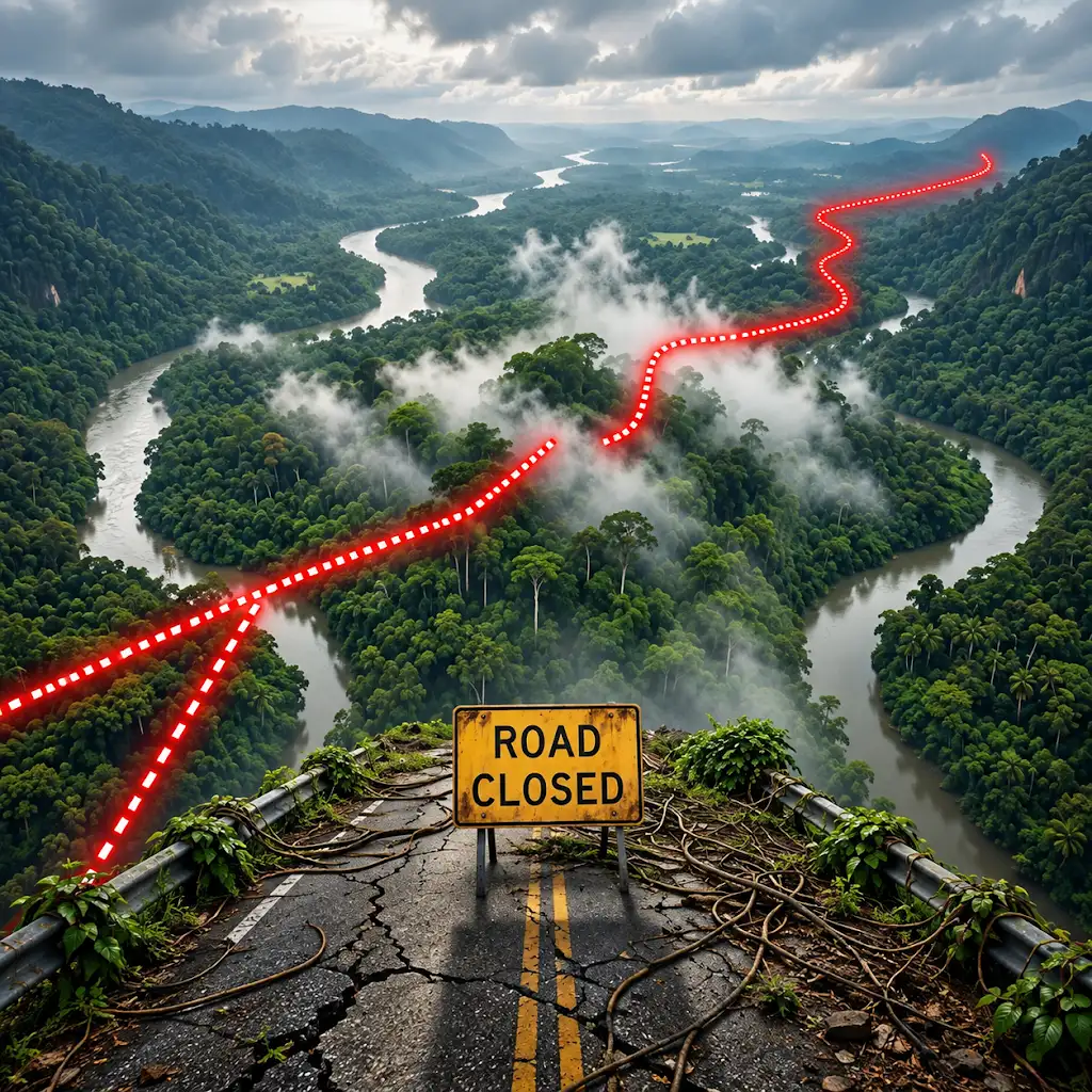
Why the World’s Longest Highway Stops Here
FAQs
What is the Darien Gap?
The Darien Gap is a dense, undeveloped jungle region between Panama and Colombia, known for its challenging terrain and lack of infrastructure.
Why is there no road network through the Darien Gap?
The Darien Gap’s difficult terrain, including swamps, rivers, and mountains, makes it extremely challenging to build a road network through the region.
Is there any way to travel through the Darien Gap by road?
As of now, there is no road that directly connects North and South America through the Darien Gap. Travelers typically have to rely on alternative methods such as boats or planes.
Are there any plans to build a road network through the Darien Gap?
There have been discussions and proposals over the years to build a road network through the Darien Gap, but environmental concerns and logistical challenges have so far prevented any significant progress.
What are the potential benefits and drawbacks of constructing a road through the Darien Gap?
A road through the Darien Gap could improve connectivity between North and South America, boost trade, and facilitate travel. However, it could also have negative impacts on the environment, local communities, and indigenous tribes living in the region.