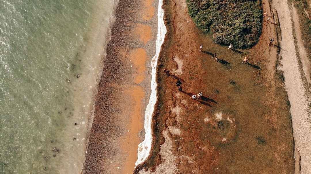
The Arctic, a vast and remote region experiencing amplified warming, faces significant environmental challenges. Among these, shoreline erosion stands out as a critical issue with far-reaching consequences for Arctic ecosystems, infrastructure, and Indigenous communities. Traditional methods of monitoring this erosion, while valuable, often prove insufficient in the face of the Arctic’s scale, remoteness, and harsh conditions. This is where the deployment of unmanned aerial vehicles, commonly known as drones, is revolutionizing the way these vital coastal changes are observed and understood. Arctic drone surveys represent a paradigm shift, offering unprecedented efficiency, detailed data collection, and enhanced safety for researchers and monitors.
The Arctic coast is a dynamic interface, constantly shaped by the interplay of oceanic forces, permafrost, and climate. However, the accelerating pace of climate change has tipped this delicate balance, leading to a dramatic increase in shoreline erosion rates across the region. Understanding the drivers and consequences of this erosion is paramount, as it directly impacts the very fabric of Arctic life.
Drivers of Accelerated Erosion
Several interconnected factors contribute to the heightened erosion observed along Arctic coastlines. These drivers, like pieces of a crumbling puzzle, are each critical to understanding the overall picture of coastal degradation.
Thawing Permafrost: The Weakening Foundation
Permafrost, the perennially frozen ground that underpins much of the Arctic landscape, is highly susceptible to warming temperatures. As permafrost thaws, the ice-rich soil loses its structural integrity, becoming soft, unstable, and prone to slumping. This degradation acts like the removal of stilts from a wooden house, making the entire structure vulnerable to collapse. The higher the ice content in the permafrost, the more significant the thaw-induced subsidence and subsequent erosion. This process is particularly pronounced in ice-rich yedoma deposits, common along Arctic coasts, which can experience rapid erosion rates once thawed.
Sea Ice Loss: Unveiling the Coastal Vulnerability
A symbiotic relationship has historically existed between Arctic shorelines and seasonal sea ice. Sea ice acts as a natural buffer, absorbing wave energy and protecting the coast from direct assault. The dramatic decline in Arctic sea ice extent and thickness, driven by rising global temperatures, has fundamentally altered this relationship. Without the protective embrace of sea ice, Arctic shorelines are now exposed to the full force of storm surges and wave action for longer periods. This loss of the ice shield is akin to removing armor from a warrior, leaving them exposed to every blow. Furthermore, the increased open water allows for larger and more powerful waves to form, which can then impact the unprotected coast with greater force.
Increased Storm Intensity and Frequency: The Relentless Assault
Climate models and observational data indicate a trend towards more intense and frequent storms in the Arctic. These storms bring with them higher wind speeds and amplified storm surges, which are temporary rises in sea level during a storm. When these powerful meteorological events coincide with the absence of protective sea ice, they can cause catastrophic erosion events, literally reshaping coastlines in a matter of hours or days. Imagine a blacksmith’s hammer striking an already weakened anvil; the impact is far more destructive. The combination of powerful waves and rising sea levels can inundate vast stretches of coastline, scouring away sediment and undermining even seemingly robust shorelines.
Consequences of Coastal Degradation
The erosion of Arctic shorelines is not merely a cosmetic change; it represents a profound disruption with cascading effects on the entire Arctic environment and its inhabitants.
Impact on Coastal Ecosystems: A Delicate Balance Upset
Arctic coastlines are vital habitats for a diverse array of flora and fauna. Erosion can lead to the loss of critical nesting sites for migratory birds, the destruction of intertidal zones essential for marine life, and the alteration of vegetation communities. The very foundations of these ecosystems are being washed away, disrupting food webs and impacting biodiversity. Think of the roots of a tree being systematically exposed and severed; the entire organism suffers. The loss of coastal wetlands, in particular, can have significant implications for carbon sequestration and nutrient cycling in the Arctic.
Threats to Infrastructure and Communities: Homes on Shifting Sands
Many Arctic communities, including Indigenous settlements, are situated directly on the coast, relying on the stability of the land for their homes, infrastructure, and cultural sites. Rapid erosion poses a direct threat to these communities, jeopardizing housing, roads, airports, and essential services. The risk of entire villages being displaced or even lost to the sea is a growing concern. This is akin to building a city on quicksand; its survival is constantly in question. The economic implications of relocating infrastructure and communities are immense, placing significant burdens on already vulnerable populations.
Alteration of Coastal Geomorphology: A Landscape in Flux
The long-term erosion of Arctic shorelines leads to significant alterations in coastal geomorphology. This includes changes in landform, such as the retreat of cliffs, the widening of bays, and the reshaping of deltas. These changes can affect sediment transport dynamics, influencing the distribution of marine resources and altering patterns of ice formation and melt. The Arctic coastline is a living map, and erosion is a constant redrawing of its contours. Understanding these geomorphic shifts is crucial for predicting future coastal evolution and managing associated risks.
Recent advancements in Arctic drone technology have significantly enhanced shoreline erosion surveys, providing researchers with critical data to understand the impacts of climate change on fragile ecosystems. For a deeper insight into the methodologies and findings related to these surveys, you can explore a related article on this topic at My GeoQuest. This resource offers valuable information on how drones are revolutionizing environmental monitoring in the Arctic region.
The Traditional Methods: Footprints in the Sand
For decades, scientists and local communities have employed various methods to monitor Arctic shoreline erosion. These approaches, while valuable, often grapple with the inherent challenges of the Arctic environment, including its vastness, inaccessibility, and extreme weather.
Ground-Based Surveys: The Human Touch
Direct observation and measurement on the ground have long been the cornerstone of shoreline monitoring. This involves physically visiting the coast and documenting changes.
Transect Surveys: Drawing Lines in the Erosion Zone
Transect surveys involve establishing fixed lines (transects) perpendicular to the shoreline. Measurements are taken at regular intervals along these transects to record the position of the shoreline, the height of the scarp (the steep face of the eroded bank), and other geomorphic features. Researchers meticulously record changes between surveys, building a historical record of erosion. This method provides detailed, localized data but can be labor-intensive and time-consuming.
Stake and Monument Installation: Anchors in the Shifting Ground
Geodetic markers, such as rebar stakes or concrete monuments, are often driven into the ground along the shoreline. Their positions are precisely recorded using GPS. Future surveys remeasure the position of these markers to detect any shoreline movement or ground subsidence. While effective for tracking localized changes and ground deformation, this method can be vulnerable to being lost or damaged by severe erosion events themselves.
Aerial Photography and Remote Sensing: Glimpses from Above
Early attempts to capture coastal changes from an elevated perspective involved aerial photography.
Traditional Aerial Photography: Capturing the Coastal Canvas
Regular aerial photography flights have been used to document shoreline changes over time. By comparing images taken at different times, researchers can delineate the extent of erosion. However, these flights are expensive to conduct and can be limited by weather conditions. The resolution of traditional aerial photography may also not be sufficient for detailed analysis of subtle erosion processes.
Satellite Imagery: A Broader Perspective
Satellite imagery offers a broader view of the Arctic coastline, allowing for the assessment of erosion over larger areas. Different types of satellite sensors can provide information on land cover, elevation, and even surface temperature, which can be indicative of permafrost thaw. However, cloud cover can be a significant impediment in the Arctic, and the resolution of readily available satellite data may not always be sufficient for detailed, site-specific erosion monitoring. Satellites offer a grand vista, but sometimes you need to zoom in to see the finer details of the coastline’s unraveling.
The Drone Revolution: Eyes in the Sky
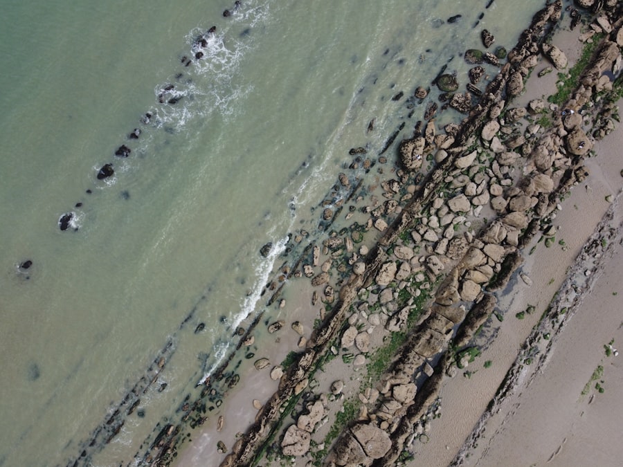
The advent of drone technology has ushered in a new era of Arctic shoreline monitoring, offering a potent combination of efficiency, cost-effectiveness, and unparalleled data quality. These unmanned aerial vehicles, equipped with advanced sensors, can navigate the challenging Arctic terrain with remarkable agility, providing researchers with a bird’s-eye view and a wealth of crucial information.
Advantages of Drone-Based Surveys: Precision and Reach
Drones are not merely a technological upgrade; they represent a fundamental shift in how we can observe and understand the dynamic Arctic coastline.
High-Resolution Data Acquisition: Unveiling Subtle Changes
Drones equipped with high-resolution cameras can capture aerial imagery with remarkable detail, allowing researchers to identify even subtle changes in shoreline morphology that might be missed by other methods. This level of detail is akin to transitioning from a broad newspaper photograph to a crystal-clear, high-definition image, revealing nuances previously unseen. This enables precise measurements of scarp height, shoreline retreat, and the identification of small-scale erosion features.
Cost-Effectiveness and Efficiency: Covering More Ground, Faster
Compared to traditional methods like manned aircraft surveys or extensive ground expeditions, drone surveys are significantly more cost-effective and time-efficient. Drones can be deployed rapidly and repeatedly, allowing for more frequent monitoring campaigns and the collection of larger datasets. This is like having a fleet of tireless scouts instead of relying on a single, slow-moving reconnaissance party. The ability to cover vast areas of coastline in a single mission dramatically enhances the efficiency of research efforts.
Enhanced Safety for Researchers: Minimizing Risks in a Hostile Environment
The Arctic is a region fraught with natural hazards, including extreme cold, unpredictable weather, and dangerous terrain. Drone surveys significantly enhance the safety of researchers by allowing them to collect data from a distance, minimizing their exposure to these risks. Instead of venturing onto treacherous ice or unstable coastal areas, drones can provide the necessary information from a safe altitude. This is like having a remote-controlled robotic arm to handle delicate and dangerous tasks, keeping the human operator out of harm’s way.
Accessibility to Remote and Difficult Terrain: Reaching the Unreachable
Many Arctic shorelines are remote, lacking established infrastructure and often inaccessible by conventional ground vehicles or boats. Drones can easily navigate these challenging landscapes, providing access to areas that were previously logistically difficult or impossible to survey. This opens up vast new frontiers for research and monitoring. Imagine being able to explore uncharted territories without the need for arduous expeditions; drones provide that capability for the Arctic coast.
Drone Technologies and Data Collection: The Digital Eyes of the Arctic
The data gathered by drones is as diverse as the challenges of Arctic erosion itself, with various sensors contributing to a comprehensive understanding of coastal processes.
Photogrammetry and Orthomosaic Mapping: Building a 3D Picture
Drones equipped with specialized cameras can capture overlapping aerial photographs. These images are then processed using photogrammetry software to create highly accurate 3D models and orthomosaic maps of the coastline.
Creating Digital Elevation Models (DEMs): Quantifying Topography
From the orthomosaic maps and 3D models, detailed Digital Elevation Models (DEMs) can be generated. These DEMs provide precise elevation data for the entire surveyed area, allowing for the calculation of topographic features, changes in land surface elevation due to permafrost thaw, and the measurement of scarp retreat with centimeter-level accuracy. The ability to generate DEMs is like having a highly detailed topographical map that can be updated with the precision of a surveyor’s level.
Time-Series Analysis of Coastal Change: Tracking the Retreat
By comparing DEMs and orthomosaic maps generated from surveys conducted at different times, researchers can perform detailed time-series analysis of coastal change. This allows for the precise quantification of shoreline retreat rates, the identification of areas undergoing rapid erosion, and the assessment of the effectiveness of any implemented mitigation strategies. This temporal comparison is the key to understanding the speed and patterns of erosion, like watching a time-lapse film of the coastline’s transformation.
LiDAR-Equipped Drones: Peering Through Vegetation
LiDAR (Light Detection and Ranging) technology emits laser pulses and measures the time it takes for them to return after reflecting off surfaces.
Mapping Bare-Earth Topography: Unveiling the Ground Beneath
LiDAR equipped drones can penetrate vegetation canopy, providing accurate mapping of the “bare-earth” topography. This is particularly important in vegetated coastal areas where dense plant cover can obscure ground features in optical imagery. LiDAR essentially allows researchers to “see through” the greenery to understand the underlying ground surface. This is crucial for precisely measuring the elevation changes and identifying erosion features hidden beneath the vegetation.
Identifying Ground Subsidence and Erosion Features: Detecting the Undermining
LiDAR data can effectively identify areas of ground subsidence caused by permafrost thaw and reveal subtle erosion features such as slumps, gullies, and active thaw slumps that might be difficult to discern with optical sensors alone. The detailed topographical information provided by LiDAR is invaluable for understanding the mechanisms of erosion and predicting future instability.
Multispectral and Hyperspectral Imaging: Decoding the Coastal Composition
Beyond just visual data, drones can be equipped with multispectral and hyperspectral sensors that capture light in various parts of the electromagnetic spectrum.
Assessing Vegetation Health and Type: Understanding the Cover
Multispectral imagery can differentiate between various types of vegetation and assess their health. This information is valuable for understanding how vegetation cover influences erosion rates and how climate change is impacting these plant communities. The spectral signatures of different plants act like fingerprints, allowing for their identification and classification.
Detecting Changes in Soil Moisture and Composition: Identifying Vulnerable Areas
Hyperspectral imaging can provide even more detailed information about the chemical composition of the ground surface, including soil moisture content and the presence of certain minerals. Areas with higher soil moisture or specific soil compositions might be more susceptible to erosion, and these sensors can help identify such vulnerable areas. This provides a deeper understanding of the material properties that govern erosion processes.
Applications and Case Studies: Drones in Action
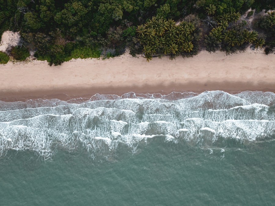
The efficacy of drone surveys in monitoring Arctic shoreline erosion is not merely theoretical; it is being demonstrated across numerous research initiatives and practical applications throughout the Arctic.
Documenting Erosion Rates in Key Regions: Quantifying the Retreat
Drone surveys are providing invaluable data on erosion rates at specific locations, helping to build a comprehensive picture of the problem.
Prudhoe Bay, Alaska: Monitoring Industrial and Environmental Impacts
In the Prudhoe Bay region of Alaska, a heavily industrialized area, drone surveys are being used to monitor the impact of erosion on both natural shorelines and infrastructure. The detailed topographical data collected by drones helps in assessing the risk to oil and gas facilities and in developing appropriate management strategies. The efficiency of drones allows for regular monitoring of these sensitive areas.
Herschel Island, Yukon Territory: Understanding Historical and Future Erosion
Herschel Island, a historically significant site in the Canadian Arctic, is experiencing rapid erosion. Drone surveys have been instrumental in documenting the dramatic retreat of the island’s coastline, providing crucial data for understanding past erosion dynamics and predicting future changes. This historical perspective is vital for understanding the long-term trends of coastal degradation.
Siberian Arctic Coastlines: Assessing Large-Scale Degradation
Drones are also being deployed along the vast Siberian Arctic coastlines to assess the scale of erosion resulting from permafrost thaw and sea ice loss. These surveys help in understanding regional patterns of erosion and identifying areas most at risk. The sheer expanse of the Siberian coast makes drone technology an indispensable tool for comprehensive monitoring.
Supporting Indigenous Communities: Empowering Local Knowledge
Drone technology is not just a tool for scientists; it is also becoming an empowering resource for Indigenous communities on the front lines of coastal change.
Community-Based Monitoring Programs: Integrating Traditional and Technological Expertise
Drone surveys can be integrated into community-based monitoring programs, allowing local residents to participate directly in data collection and analysis. This collaborative approach combines traditional ecological knowledge with modern technology, leading to a more holistic understanding of coastal erosion and its impacts. This synergy between traditional wisdom and cutting-edge technology is a powerful model for effective environmental stewardship.
Providing Data for Adaptation Planning: Informing Resilience Strategies
The high-resolution data generated by drone surveys provides communities with the crucial information needed to develop effective adaptation strategies. This includes identifying areas at risk, planning for infrastructure relocation, and documenting cultural heritage sites threatened by erosion. The data acts as a vital diagnostic tool, informing the prescription of effective remedies.
Advancing Scientific Understanding: Filling the Gaps in Arctic Science
The detailed and consistent data provided by drone surveys is significantly advancing the scientific understanding of Arctic coastal processes.
Improving Coastal Process Models: Refining Predictive Capabilities
The high-resolution topographical and geomorphological data collected by drones is essential for refining and validating numerical models of coastal erosion. This improved accuracy in modeling allows for better predictions of future erosion rates and the potential impacts of climate change. More accurate models are like better weather forecasts for the coastline, allowing for proactive planning.
Investigating the Role of Permafrost Thaw on Erosion: Linking Ground Conditions to Surface Changes
Drone surveys, particularly those combining optical and LiDAR data, are helping to unravel the complex relationship between permafrost thaw and shoreline erosion. By mapping ground subsidence, thaw slumps, and scarp retreat, scientists can better understand how changes in the subsurface directly influence the rate and pattern of coastal degradation. This direct linkage is a critical piece of the Arctic erosion puzzle.
Recent advancements in Arctic drone technology have significantly enhanced shoreline erosion surveys, providing researchers with invaluable data on the impacts of climate change. For a deeper understanding of how these drones are being utilized in environmental monitoring, you can explore a related article that discusses innovative techniques and their implications for coastal management. This insightful piece can be found here, offering a comprehensive overview of the subject.
Challenges and Future Directions: Navigating the Path Ahead
| Metric | Description | Value | Unit | Notes |
|---|---|---|---|---|
| Survey Area Coverage | Total length of shoreline surveyed using drones | 50 | km | Arctic coastal regions surveyed in summer 2023 |
| Drone Flight Duration | Average flight time per survey mission | 45 | minutes | Battery life optimized for cold conditions |
| Image Resolution | Spatial resolution of drone-captured images | 5 | cm/pixel | High-resolution imagery for detailed erosion analysis |
| Shoreline Change Detection | Average annual shoreline retreat measured | 1.2 | meters/year | Based on multi-year drone surveys |
| Data Processing Time | Time to process and analyze survey data | 3 | days | Includes photogrammetry and GIS analysis |
| Number of Survey Missions | Total drone flights conducted during study | 20 | missions | Conducted over two months in summer season |
| Environmental Conditions | Typical temperature range during surveys | -5 to 5 | °C | Cold weather operations with specialized equipment |
Despite the transformative potential of drone technology, several challenges remain in its widespread and effective application for Arctic shoreline monitoring. Addressing these challenges will pave the way for even more robust and comprehensive monitoring efforts in the future.
Overcoming Operational and Logistical Hurdles: Ensuring Consistent Coverage
The inherent difficulties of operating in the Arctic present ongoing challenges for drone deployment and data acquisition.
Battery Life and Cold Weather Performance: Powering Through the Chill
Drone batteries significantly lose efficiency in cold Arctic temperatures, limiting flight times and operational range. Developing more robust battery technology and implementing effective insulation strategies are crucial for extending mission duration. Imagine a smartphone struggling to hold a charge in freezing weather; drones face similar limitations. Continued research into cold-weather battery performance is vital.
Data Storage and Transmission: Moving the Mountain of Information
Drone surveys generate vast amounts of high-resolution data. Storing, processing, and transmitting this data efficiently from remote Arctic locations can be a significant logistical challenge, especially where internet connectivity is limited. Developing effective data management strategies and exploring satellite-based data transmission solutions are critical. This is akin to trying to move an entire library through a narrow doorway; efficient solutions are needed for data transfer.
Regulatory Frameworks and airspace Management: Navigating the Skies Responsibly
As drone usage proliferates, clear and consistent regulatory frameworks are needed for their operation in the Arctic. This includes addressing issues of airspace management, safety, and data privacy, particularly in shared operational areas with manned aviation and sensitive ecological zones. Responsible airspace management is like establishing clear traffic rules for a busy intersection, ensuring safety and efficiency for all users.
Enhancing Data Integration and Interoperability: Connecting the Dots
The true power of drone data lies not in its collection alone, but in its integration with other datasets and its accessibility to a wider audience.
Combining Drone Data with Ground-Based Measurements: Validation and Ground Truthing
Integrating drone-derived data with traditional ground-based measurements provides crucial validation and ground truthing. This ensures the accuracy and reliability of drone-based assessments and helps to refine the interpretation of the collected imagery and topographic data. This synergistic approach ensures that the digital observations are firmly anchored in the physical reality of the coastline.
Developing Standardized Protocols: Ensuring Comparability and Collaboration
Establishing standardized protocols for data collection, processing, and analysis across different research groups and regions is essential for ensuring the comparability of data and fostering effective collaboration. This is like creating a universal language for describing coastal changes, allowing researchers worldwide to share and understand each other’s findings.
Open Data Initiatives and Platforms: Sharing the Knowledge
Promoting open data initiatives and developing user-friendly platforms for data access and visualization can significantly accelerate scientific understanding and support applied decision-making. Sharing this vital information broadly can empower a wider range of stakeholders to address the challenges of Arctic erosion.
The Future of Arctic Drone Surveys: A Constantly Evolving Landscape
The evolution of drone technology and its applications in Arctic shoreline monitoring is an ongoing process. Future developments hold the promise of even greater capabilities and broader impact.
Autonomous Drone Swarms: Synchronized Observation at Scale
The development of autonomous drone swarms, capable of coordinated flight and data collection, could revolutionize the scale and efficiency of Arctic monitoring. These swarms could cover vast coastal areas simultaneously, providing a comprehensive and near real-time assessment of erosion. This is like deploying a highly organized and synchronized fleet of observers to cover an entire battlefield.
Integration with Artificial Intelligence (AI) and Machine Learning (ML): Automating Analysis
Integrating AI and ML algorithms with drone data has the potential to automate the analysis of vast datasets, identifying patterns, classifying erosion features, and predicting future erosion hotspots with unprecedented speed and accuracy. This would free up researchers to focus on interpretation and strategic decision-making, rather than manual data processing. AI can act as a tireless analyst, sifting through mountains of data to find the critical insights.
Long-Term, Sustained Monitoring Programs: A Persistent Watch
The development of sustained, long-term drone monitoring programs is crucial for tracking the cumulative impacts of climate change on Arctic shorelines. These programs will provide the essential long-term datasets needed to understand the trajectory of erosion and inform effective adaptation and mitigation strategies. A persistent, unwavering watch is needed to fully grasp the enduring consequences of a changing climate.
In conclusion, Arctic drone surveys are not merely a technological curiosity; they are an indispensable tool in the critical effort to understand and respond to the accelerating threat of shoreline erosion in the Arctic. As this technology continues to mature and its applications expand, it will play an increasingly vital role in safeguarding vulnerable ecosystems, supporting resilient communities, and advancing our scientific understanding of this rapidly changing polar frontier. The eyes in the sky, powered by innovation, are offering a clearer, more detailed vision of the Arctic’s unfolding transformation.
FAQs
What is the purpose of using drones for shoreline erosion surveys in the Arctic?
Drones are used in the Arctic to conduct shoreline erosion surveys because they provide a safe, efficient, and cost-effective way to collect high-resolution data in remote and harsh environments. They help monitor changes in the coastline caused by factors like melting permafrost, rising sea levels, and increased storm activity.
How do drones collect data for shoreline erosion studies?
Drones are equipped with cameras and sensors that capture aerial images and videos of the shoreline. These images can be processed to create detailed maps, 3D models, and measurements of erosion rates, sediment displacement, and changes in landforms over time.
What are the advantages of using drones over traditional methods for Arctic shoreline surveys?
Drones offer several advantages, including the ability to access difficult or dangerous areas without risking human safety, faster data collection over large areas, lower operational costs compared to manned aircraft or ground surveys, and the capability to conduct frequent monitoring to track rapid environmental changes.
What challenges do drones face when conducting shoreline erosion surveys in the Arctic?
Challenges include extreme cold temperatures that can affect battery life and drone electronics, unpredictable weather conditions such as strong winds and low visibility, limited GPS signal availability in some areas, and logistical difficulties in deploying and retrieving drones in remote locations.
How does shoreline erosion impact the Arctic environment and communities?
Shoreline erosion in the Arctic leads to loss of land, damage to infrastructure, and disruption of habitats for wildlife. It also threatens indigenous communities by affecting traditional hunting grounds, increasing vulnerability to flooding, and impacting local economies dependent on coastal resources. Monitoring erosion helps inform mitigation and adaptation strategies.