
The Caspian Sea, a vast inland body of water straddling the borders of five nations, has long been a subject of scientific inquiry. Its immense size and historical significance, coupled with unique ecological characteristics and strategic importance, have fueled decades of research. However, a comprehensive and precise understanding of its undersea topography, the very bedrock upon which its ecosystems and resources rest, has remained a persistent challenge. This article delves into the recent advancements in bathymetric surveying of the Caspian Sea, focusing on the methodologies, findings, and implications of achieving a more accurate depiction of its seabed.
Bathymetry, the measurement and mapping of the depth of bodies of water, serves as the fundamental blueprint of the underwater world. For the Caspian Sea, accurate bathymetric data is not merely an academic pursuit; it is a critical foundation for a multitude of applications that touch upon the economic, environmental, and geopolitical realities of the region. Imagine a doctor trying to understand a patient’s internal structure without an X-ray; that is analogous to the challenges faced when navigating, managing resources, or assessing environmental risks in the Caspian without precise depth information.
Understanding Oceanographic Processes
The shape of the seafloor, as revealed by bathymetry, directly influences the dynamics of water circulation, sediment transport, and the distribution of marine life. Subtle variations in seabed topography can act as invisible barriers or conduits, channeling currents and affecting temperature and salinity stratification.
Influence on Water Currents
The complex interplay of inflows from major rivers like the Volga and Ural, coupled with evaporation, creates intricate current patterns within the Caspian. Bathymetric features, such as underwater ridges or deep trenches, can significantly alter these flow patterns, potentially creating areas of stagnation or enhanced mixing. This, in turn, impacts the oxygen levels and nutrient distribution, crucial factors for the survival of many Caspian species.
Sediment Dynamics and Deposition
The seabed is not a static entity; it is constantly in flux, shaped by the deposition and erosion of sediments. Accurate bathymetry allows scientists to track the movement of these sediments, identifying areas of accumulation, such as deltas and canyons, and regions prone to erosion. This knowledge is vital for predicting the long-term stability of the seabed and understanding processes like siltation in navigation channels.
Resource Exploration and Management
The Caspian Sea is a treasure trove of hydrocarbons, and its seabed is a potential site for vast reserves of oil and natural gas. Precise bathymetric maps are indispensable tools for exploration companies, guiding seismic surveys and defining the locations for drilling platforms and pipelines.
Guiding Hydrocarbon Exploration
When geologists and geophysicists embark on the quest for oil and gas, bathymetry acts as their initial guide. It helps them understand the underlying geological structures that might trap hydrocarbons. Areas with specific seabed formations, revealed by detailed depth measurements, can be prioritized for further, more intensive geological investigation.
Infrastructure Planning and Safety
The construction of offshore infrastructure, including pipelines that traverse the seabed, requires meticulous bathymetric planning. Engineers need to understand the precise contours and gradients of the seafloor to ensure the stability and safety of these submerged arteries. Sudden drops or steep inclines can pose significant engineering challenges and risks of damage.
Environmental Monitoring and Conservation
The Caspian Sea hosts unique biodiversity, including iconic species like the Caspian seal and sturgeon. Understanding the bathymetry is crucial for mapping out critical habitats, identifying areas susceptible to pollution, and planning conservation efforts.
Mapping Marine Habitats
Different fish species and benthic organisms often prefer specific depth ranges and substrate types. Accurate bathymetric maps, when combined with habitat suitability models, can delineate areas that are most conducive to the survival and reproduction of these species. This is akin to a cartographer identifying fertile valleys or sheltered bays for settlement.
Pollution Fate and Transport
In the event of an oil spill or the release of other pollutants, bathymetry plays a role in predicting how these substances will spread and accumulate. Underwater depressions can act as traps for spilled materials, while currents, influenced by the seafloor topography, can distribute them over vast distances. This knowledge is critical for effective response and containment strategies.
Recent advancements in bathymetric scanning techniques have significantly improved the accuracy of underwater mapping in the Caspian Sea. A related article discusses the methodologies employed in these scans and their implications for marine research and environmental monitoring. For more detailed insights, you can read the article here: Caspian Sea Bathymetric Scan Accuracy.
Challenges in Caspian Sea Bathymetry
Historically, obtaining accurate bathymetric data for the Caspian Sea has been fraught with difficulties. Its sheer scale, coupled with a complex geopolitical landscape and at times, limited technological access, has contributed to a less-than-ideal understanding of its depths compared to many other major water bodies.
Vast Scale and Accessibility Issues
The Caspian Sea stretches for over 1,200 kilometers from north to south and spans a width of up to 436 kilometers. This immense surface area translates into a colossal effort required for comprehensive surveying. Furthermore, certain regions of the Caspian are more remote or less accessible due to political agreements or prevailing weather conditions, hindering continuous data collection.
Logistical Hurdles
Mobilizing survey vessels, maintaining consistent field operations, and processing enormous datasets across a large geographical expanse present significant logistical challenges. Each survey mission requires careful planning, resource allocation, and coordination among various stakeholders.
Boundary and Jurisdiction Complexities
The Caspian Sea is bordered by Russia, Kazakhstan, Turkmenistan, Iran, and Azerbaijan. The division of maritime zones and the need for international cooperation can add layers of complexity to large-scale survey projects, requiring agreements and shared methodologies.
Data Gaps and Inconsistencies
Previous bathymetric surveys, while valuable, often suffered from limitations in resolution, accuracy, and geographical coverage. This has resulted in data gaps and inconsistencies, making it difficult to create a seamless and reliable model of the entire seabed.
Older Survey Technologies
Early bathymetric surveys relied on less sophisticated technology, such as lead lines and single-beam echo sounders with limited accuracy and coverage. These methods were time-consuming and prone to errors, particularly in deeper or more complex underwater terrains.
Varying Survey Standards
Different nations or organizations may have employed varying survey standards and methodologies over time, leading to datasets that are not easily interoperable or directly comparable. This can be like trying to assemble a jigsaw puzzle with pieces from different boxes – the edges might not fit perfectly.
Environmental Factors
The Caspian Sea environment itself presents unique challenges for accurate surveying. Seasonal ice cover in the northern regions, strong currents, and fluctuating water levels can all impact the efficiency and precision of bathymetric data collection.
Ice Cover in the North
The northern part of the Caspian Sea is prone to extensive ice formation during winter months, rendering it inaccessible for open-water survey operations for significant periods. This necessitates specialized equipment and techniques for data acquisition in these challenging conditions.
Sediment Load and Water Clarity
High sediment loads in rivers can lead to turbid waters, which can affect the performance of acoustic surveying equipment. Sediment plumes can also introduce inaccuracies into depth measurements if not properly accounted for.
Advancements in Survey Technology
The past few decades have witnessed a revolution in bathymetric surveying technologies, moving from rudimentary methods to highly sophisticated, multi-beam systems capable of delivering unprecedented accuracy and coverage. These advancements have been instrumental in overcoming many of the historical challenges associated with mapping the Caspian Sea.
Multi-Beam Echosounders (MBES)
Multi-beam echosounders are the workhorses of modern bathymetric surveying. Unlike single-beam systems that transmit a single sound pulse, MBES emit a fan-shaped swath of sound beams, allowing them to acquire depth data across a wide area in a single pass.
Swath Width and Coverage
The ability of MBES to cover a significant swath of the seafloor in each transit dramatically increases survey efficiency. For the Caspian, this means that large areas can be mapped in a fraction of the time previously required, allowing for more comprehensive coverage.
Resolution and Detail
Modern MBES systems offer high-frequency sound pulses, resulting in remarkably high-resolution data. This allows for the detection of even small underwater features, such as submerged rocks, debris, or subtle changes in seabed morphology, which were previously invisible.
Advanced Navigation and Positioning Systems
Accurate bathymetry is intrinsically linked to precise positioning. The advent of Global Navigation Satellite Systems (GNSS), particularly robust RTK (Real-Time Kinematic) GPS systems, has been crucial in ensuring that every depth measurement is assigned an exact geographical coordinate.
Real-Time Kinematic (RTK) GPS
RTK GPS provides centimeter-level accuracy in positioning, which is essential for creating geometrically correct bathymetric maps. This ensures that the mapped features are precisely located on the Earth’s surface, eliminating positional drift that could compromise the integrity of the data.
Inertial Navigation Systems (INS)
Complementing GNSS, Inertial Navigation Systems provide continuous positioning data, especially in situations where satellite signals might be temporarily lost, such as under overhanging cliffs or during periods of atmospheric disturbance. This ensures uninterrupted positional accuracy throughout the survey.
Autonomous and Unmanned Survey Vehicles (AUVs/UUVs)
The deployment of Autonomous Underwater Vehicles (AUVs) and Unmanned Underwater Vehicles (UUVs) offers a new paradigm for bathymetric data acquisition. These vehicles can operate independently or semi-independently, reaching areas that are difficult or dangerous for human-crewed vessels.
Extended Deployment and Remote Access
AUVs can be programmed for long-duration missions, allowing them to survey vast tracts of the seabed without constant human intervention. They can also access remote or hazardous areas, such as the ice-bound northern Caspian, providing data where traditional methods are infeasible.
Cost-Effectiveness and Efficiency
While the initial investment in AUV technology can be significant, their ability to operate autonomously and with less personnel can lead to greater cost-effectiveness and efficiency in large-scale, long-term surveying projects.
Recent Bathymetric Survey Initiatives
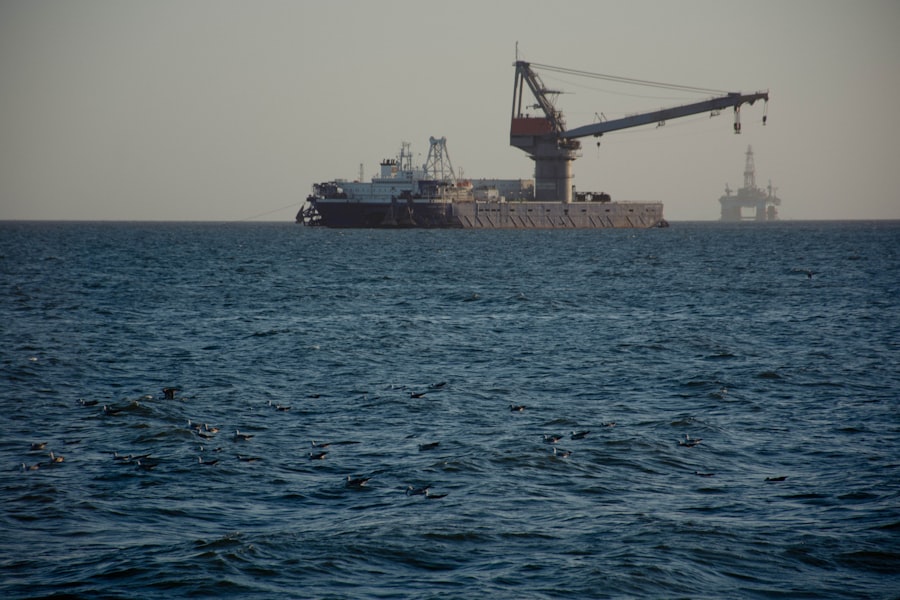
In recent years, a concerted effort has been made by various national and international organizations to improve the bathymetric understanding of the Caspian Sea. These initiatives often involve a combination of advanced technologies and collaborative approaches to address the scale and complexity of the task.
Collaborative International Projects
Recognizing the shared interest in the Caspian Sea, several international collaborations have emerged, pooling resources and expertise to conduct comprehensive bathymetric surveys. These projects often involve data sharing and standardized methodologies across participating nations.
Joint Research Expeditions
These expeditions bring together scientists and survey teams from different Caspian littoral states. Such collaborations not only facilitate the collection of data but also foster scientific exchange and build capacity in the region.
Data Integration and Harmonization
A key aspect of these international projects is the effort to integrate and harmonize data acquired using different systems and protocols. This involves rigorous quality control and the application of common geodetic frameworks to ensure the resulting map is a unified and reliable representation.
National Hydrographic Office Modernization
Several Caspian littoral states have been modernizing their national hydrographic offices, investing in new survey equipment, data processing software, and personnel training. This national-level effort is crucial for developing indigenous capabilities in hydrographic surveying.
Enhancing National Capabilities
By upgrading their infrastructure and expertise, these offices can conduct more frequent and detailed surveys, contributing vital data to national maritime safety and resource management efforts.
Contribution to Global Datasets
The modernized national hydrographic offices are increasingly contributing to global bathymetric databases, making their data accessible to the wider scientific community and international bodies.
Targeted Surveys for Specific Needs
Beyond broad, comprehensive surveys, targeted bathymetric initiatives are also being undertaken to address specific concerns, such as navigation channel maintenance, environmental impact assessments for infrastructure projects, or the identification of potential underwater geohazards.
Navigation Channel Depth Monitoring
Maintaining safe navigation channels for commercial shipping is a critical function of hydrography. Targeted surveys focus on regularly monitoring the depth of these channels to ensure they remain clear of obstructions and meet international safety standards.
Environmental Impact Assessments
When new infrastructure, such as pipelines or offshore platforms, is planned, detailed bathymetric surveys are conducted in the proposed construction areas. This helps to assess the potential environmental impact of the project on the seabed and surrounding marine life.
Recent advancements in bathymetric scanning techniques have significantly improved the accuracy of underwater mapping in the Caspian Sea. A related article discusses the innovative methods used to enhance data collection and analysis, which are crucial for understanding the sea’s unique geological features. For more insights on this topic, you can read the article on MyGeoQuest, where experts delve into the implications of these findings for environmental monitoring and resource management in the region.
Findings and Implications of Accurate Bathymetry
| Parameter | Value | Unit | Notes |
|---|---|---|---|
| Scan Resolution | 1.5 | meters | Horizontal resolution of bathymetric data |
| Depth Accuracy | ±0.3 | meters | Vertical accuracy of depth measurements |
| Survey Area Coverage | 371,000 | km² | Total area of Caspian Sea scanned |
| Data Collection Method | Multibeam Echo Sounder | N/A | Primary technology used for bathymetric scanning |
| Positioning Accuracy | ±2 | meters | GPS accuracy during data acquisition |
| Survey Date | 2023 | Year | Most recent bathymetric survey conducted |
The ongoing efforts to achieve accurate bathymetric scans of the Caspian Sea are yielding significant findings that have far-reaching implications for our understanding and management of this vital inland sea.
Unveiling Hidden Topographical Features
Advanced surveying techniques are revealing previously unknown or poorly mapped underwater features, painting a more detailed picture of the Caspian’s seafloor. This is akin to discovering previously unknown mountain ranges or canyons on land.
Identification of Novel Geological Structures
This includes the identification of submerged ridges, deep depressions, and potentially ancient riverbed channels that were not discernible with older survey methods. These features can offer clues about the Caspian’s geological history and its formation over millennia.
Understanding Sediment Transport Pathways
Detailed bathymetry helps in tracing the complex pathways of sediment transport across the seabed, identifying areas where deposition is occurring and where erosion is more prevalent. This is crucial for understanding the dynamic nature of the Caspian’s floor.
Improved Hydrodynamic Modeling
With a more accurate representation of the seabed topography, oceanographers can develop and refine hydrodynamic models of the Caspian Sea with greater precision. This leads to a better understanding of water circulation, temperature distribution, and salinity gradients.
Enhanced Predictive Capabilities
More accurate models allow for better predictions of water movement, which can inform shipping routes, the dispersal of pollutants, and the behavior of marine ecosystems under different environmental conditions. This can be like having a more precise weather forecast for the underwater world.
Impact on Ecosystem Dynamics
The distribution of temperature and salinity, heavily influenced by water circulation, directly impacts the habitats available for various species. Improved hydrodynamic models can help predict how these factors might change, aiding in conservation efforts for vulnerable Caspian fauna.
Enhanced Safety and Navigation
The most immediate and tangible benefit of accurate bathymetry is improved safety at sea. Removing ambiguities about water depths significantly reduces the risk of vessel grounding and navigational hazards.
Updated Nautical Charts
Accurate bathymetric data forms the backbone of updated and more reliable nautical charts. These charts are vital navigational tools for all vessels operating in the Caspian, from large cargo ships to smaller fishing boats.
Risk Mitigation for Offshore Operations
For the oil and gas industry, accurate bathymetry is paramount for the safe operation of drilling rigs, the laying of pipelines, and the deployment of subsea equipment. It directly contributes to the prevention of costly accidents and environmental damage.
Foundations for Future Scientific Research
The creation of comprehensive and accurate bathymetric datasets serves as a foundational resource for a wide range of future scientific investigations. It provides a reliable canvas upon which further research can be built.
Substrate Mapping and Benthic Habitat Analysis
When combined with acoustic backscatter data, bathymetry can assist in mapping different types of seabed substrates (e.g., sand, mud, rock). This information is crucial for understanding and mapping benthic habitats, the life that thrives on the seafloor.
Geophysical and Geological Studies
The detailed topography revealed by accurate bathymetry can guide further geophysical and geological studies of the Caspian basin, helping scientists to understand its tectonic history, potential seismic activity, and the distribution of subsurface resources. The seabed, after all, is the tip of a much larger geological iceberg.
The ongoing pursuit of accurate bathymetric scans of the Caspian Sea represents a critical step forward in understanding and managing this historically significant and ecologically unique body of water. The application of advanced technologies, coupled with collaborative international efforts, is gradually filling the data gaps and correcting historical inaccuracies, providing a clearer and more detailed picture of the Caspian’s submerged realm. The implications of this newfound knowledge extend from ensuring navigational safety and facilitating resource management to enhancing our ability to monitor and protect its precious marine ecosystems. As research continues, the comprehensive bathymetric map of the Caspian Sea will undoubtedly serve as an invaluable tool for generations to come, a testament to the power of scientific inquiry and technological advancement in unraveling the mysteries of our planet’s aquatic frontiers.
FAQs
What is bathymetric scanning in the context of the Caspian Sea?
Bathymetric scanning refers to the process of measuring the depth and mapping the underwater topography of the Caspian Sea. It involves using sonar, satellite data, and other remote sensing technologies to create detailed maps of the sea floor.
Why is accuracy important in Caspian Sea bathymetric scans?
Accuracy is crucial because precise depth measurements are essential for navigation safety, environmental monitoring, resource exploration, and scientific research. Inaccurate data can lead to navigation hazards, misinformed environmental assessments, and inefficient resource management.
What technologies are commonly used to improve the accuracy of Caspian Sea bathymetric scans?
Technologies such as multibeam echo sounders, side-scan sonar, satellite altimetry, and GPS positioning systems are commonly used. These tools help collect high-resolution data and improve the precision of underwater mapping.
What factors can affect the accuracy of bathymetric scans in the Caspian Sea?
Factors include water salinity and temperature variations, sea state and weather conditions, equipment calibration, data processing methods, and the complexity of the sea floor terrain. These can all influence the quality and reliability of the scan results.
How is bathymetric data from the Caspian Sea used in practical applications?
Bathymetric data supports maritime navigation, oil and gas exploration, environmental protection efforts, fisheries management, and scientific studies related to geology and marine ecosystems in the Caspian Sea region.