The Pamir Mountains, a remote and formidable range in Central Asia, have long been a region subject to significant seismic activity. Among the many tremors that have shaken this geologically volatile area, the 1911 Pamirs Earthquake stands out as a cataclysmic event. Its immense power, coupled with the extreme remoteness of the affected region, has made it a subject of enduring scientific interest and a somber reminder of the destructive potential of nature. Understanding the magnitude and far-reaching impact of this earthquake requires a detailed examination of its seismic characteristics, the geographical context, and the consequences for the inhabitants and the landscape.
The Magnitude of the 1911 Pamirs Earthquake
The sheer power of the 1911 Pamirs Earthquake is best understood by examining its estimated magnitude, the depth of its origin, and the seismic waves it generated. Determining these factors in the early 20th century presented considerable challenges, relying on a combination of available instrumental data and historical accounts. Nevertheless, scientific consensus points to an event of exceptional intensity.
Instrumental and Observational Data
In 1911, seismological instrumentation was still in its nascent stages. The global network of seismograph stations was sparse, particularly in the remote Central Asian region. Despite these limitations, data from the few existing observatories, though often rudimentary, provided crucial clues. Instruments like the Wiechert seismograph, which was becoming more widespread, were capable of detecting and recording ground motion from distant earthquakes. The arrival times of different seismic waves at these stations allowed seismologists to triangulate the approximate epicenter of the earthquake. Early studies, often conducted years after the event due to the logistical difficulties of communication and data collection in that era, analyzed these instrumental readings. For instance, observations from stations in Europe and Asia, however limited, indicated a powerful tremor originating from the Pamir region.
Beyond instrumental readings, qualitative observations from individuals who experienced the earthquake or heard accounts from those who did provided invaluable, albeit less precise, information. Reports of intense shaking, widespread destruction of buildings, and significant ground deformation, even in areas far from the epicenter, suggested a very high magnitude event. These accounts, painstakingly collected and compiled by geologists and historians studying the event, helped to corroborate and refine the instrumental estimates. The consistency of these reports across different locations and observers lent significant weight to the assessment of the earthquake’s immense force.
Estimated Magnitude and Intensity
The 1911 Pamirs Earthquake is generally estimated to have had a moment magnitude (Mw) of around 7.4 to 7.6. The moment magnitude scale, a more modern and accurate measure of earthquake size, considers the total energy released. However, in the early 20th century, the Richter scale was not yet developed. Early estimates often relied on the surface-wave magnitude (Ms) or body-wave magnitude (Mb), which could differ from the moment magnitude for very large earthquakes. Regardless of the specific scale used for initial estimations, the consensus points to an earthquake of great destructive potential. The intensity, a measure of the earthquake’s effects at a particular location, would have been extremely high in the immediate vicinity of the epicenter. This would translate to Modified Mercalli Intensity (MMI) VIII to X or even higher in the most affected areas, signifying devastating damage to structures and significant ground deformation.
Focal Depth and Seismic Waves
The focal depth of an earthquake plays a crucial role in its surface impact. Shallow earthquakes, with focal depths of less than 70 kilometers, tend to produce more intense shaking at the surface compared to deeper earthquakes of the same magnitude. While precise focal depth determination for the 1911 Pamirs Earthquake was challenging with the available technology, studies suggest it was a relatively shallow event. This shallowness would have amplified the ground motion experienced in the surrounding areas, contributing to the widespread devastation observed. The earthquake generated all types of seismic waves: P-waves (primary waves), S-waves (secondary waves), and surface waves (Love and Rayleigh waves). The arrival and characteristics of these waves, as recorded by seismographs, allowed for the estimation of the epicenter and magnitude. The prolonged duration of shaking, as described in historical accounts, is often indicative of the complex rupture process and the generation of strong surface waves, which travel along the Earth’s surface and can cause significant damage.
The 1911 earthquake in the Pamirs region, which registered a significant magnitude, has been a subject of extensive geological research due to its impact on the surrounding areas and its implications for understanding seismic activity in mountainous regions. For a deeper insight into the geological factors that contributed to this earthquake and its aftermath, you can read a related article that explores the seismic history of the Pamirs and its relevance to modern earthquake studies. For more information, visit this article.
Geographical Context and Tectonic Setting

The Pamir Mountains are a complex mountain system where several major tectonic plates converge. This convergence creates a highly active seismic zone, making large earthquakes a recurring phenomenon. Understanding the geological forces at play is fundamental to comprehending why the 1911 event occurred and its potential for future seismic activity.
The Pamir Knot and Plate Tectonics
The Pamir Mountains are often referred to as the “Pamir Knot,” a vast and intricate area where the Indian, Eurasian, and the smaller Central Asian microplates (such as the Tarim and Fergana blocks) interact. The Indian plate is colliding with the Eurasian plate, pushing northwards and causing immense crustal shortening and uplift that forms the Himalayas and the Pamirs. This collision is not a smooth process but rather a complex mosaic of faults and blocks that are constantly being deformed. The region is characterized by extensive thrust faults and strike-slip faults, which are the primary structures responsible for releasing accumulated stress through earthquakes. The 1911 earthquake is believed to have occurred on or near one of these major fault systems, likely a result of the ongoing compressional forces associated with the India-Eurasia plate collision. The precise fault mechanism, whether primarily thrust or strike-slip, is still debated, but it undoubtedly involved a significant rupture along a major geological structure.
Major Fault Systems in the Region
Several major fault systems traverse the Pamir region, and the 1911 earthquake is thought to have been associated with one of them. The main geological structures in the area include the Main Pamir Thrust, the Alai Fault, and various other regional thrust and strike-slip faults. The seismic activity in the Pamirs is not confined to a single linear fault but rather occurs within a broad zone of deformation. The 1911 earthquake likely involved the rupture of a significant segment of one or more of these interconnected fault systems. Studies of historical seismicity in the region indicate a pattern of seismic activity that migrates and evolves over time, suggesting that stress is continuously redistributed along these complex structures. The exact rupture plane and associated fault for the 1911 earthquake remain subjects of ongoing research, but its immense magnitude strongly suggests a rupture of a substantial fault segment.
Seismicity Patterns in Central Asia
Central Asia, as a whole, is one of the most seismically active regions on Earth. The Tien Shan, Pamir, and Hindu Kush mountain ranges are characterized by frequent and often powerful earthquakes. This high level of seismicity is directly linked to the ongoing collision between the Indian and Eurasian plates. The deformation caused by this collision is not localized but extends over a vast area, leading to a complex network of active faults. The Pamirs, being at the heart of this complex tectonic regime, experience a particularly high frequency of earthquakes, including major events. The 1911 earthquake is a prime example of the seismic potential inherent in this geologically active zone. Understanding the historical seismicity patterns, including the distribution and magnitude of past earthquakes, is crucial for assessing seismic hazard in the present day.
Impact on the Landscape
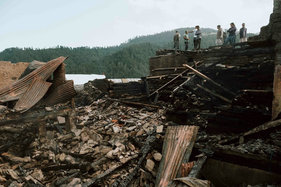
The immense energy released by the 1911 Pamirs Earthquake had a profound and lasting impact on the mountainous landscape, causing significant geological changes and triggering secondary hazards that further reshaped the terrain.
Landslides and Rockfalls
The intense shaking associated with a magnitude 7.4-7.6 earthquake is more than sufficient to destabilize steep mountain slopes. The 1911 Pamirs Earthquake triggered widespread landslides and rockfalls across the affected region. These phenomena are natural consequences of seismic waves passing through loose soil, fractured rock, and precariously balanced geological formations. The steep slopes and rugged terrain of the Pamirs are particularly susceptible to such events. Large volumes of rock and soil were dislodged, burying valleys, altering river courses, and creating new, unstable slopes. The sheer scale of these post-earthquake mass movements contributed significantly to the destruction and altered the topography of the region for decades to come. Evidence of these prehistoric landslides can still be observed today in the form of hummocky terrain and deposits.
Formation of New Lakes and Damming of Rivers
One of the most dramatic impacts of the 1911 Pamirs Earthquake was the formation of new lakes and the damming of rivers. Large landslides, particularly those occurring in narrow valleys, can effectively act as natural dams, blocking the flow of rivers and creating artificial lakes behind them. The Sarez Lake, one of the most spectacular and potentially hazardous outcomes of this earthquake, was formed by the rapid collapse of a massive natural dam. This event created a deep, expansive lake in the Murgab River valley. The formation of Sarez Lake, while creating a new and breathtaking natural feature, also posed a long-term risk to downstream communities due to the potential for dam failure. The seismic forces were so immense that they not only triggered the landslides but also likely deformed the underlying bedrock, contributing to the stability or instability of these newly formed natural dams.
Ground Deformation and Fissures
Beyond catastrophic landslides, the earthquake also caused significant ground deformation. This included the opening of fissures and cracks in the earth, subsidence in some areas, and uplift in others. The intensity of ground deformation would have been highest near the epicenter. These surface ruptures could have been several kilometers long and of varying widths. Such deformations would have rendered any structures in their path unstable and potentially destroyed. The ability of the ground to deform so drastically is a testament to the immense energy released and the brittle nature of the Earth’s crust in this tectonically active zone. The precise patterns of ground deformation are difficult to fully reconstruct due to the remote and largely uninhabited nature of many of the most affected areas, but historical accounts and geological surveys of similar events provide a strong basis for understanding these impacts.
Human Impact and Societal Consequences
While the natural landscape bore the brunt of the physical destruction, the human impact of the 1911 Pamirs Earthquake was also significant, despite the sparse population density of the region. The consequences rippled through the lives of those who inhabited the area, affecting their settlements, livelihoods, and overall well-being.
Destruction of Settlements and Infrastructure
The Pamir region, even in 1911, was sparsely populated, with settlements typically consisting of small villages and nomadic encampments. However, the earthquake’s intensity meant that even these modest structures were vulnerable. Villages were reduced to rubble, and any rudimentary infrastructure, such as irrigation channels or mountain passes, would have been severely damaged or destroyed. The remote nature of the settlements meant that rescue and aid efforts would have been extremely challenging, if not impossible, in the immediate aftermath. The destruction of homes and communal structures would have left survivors exposed to the harsh mountain climate, exacerbating the difficulties of survival. The loss of livestock and stored food supplies would have further compounded their plight.
Loss of Life and Displacement
Quantifying the exact loss of life from the 1911 Pamirs Earthquake is difficult due to the lack of precise census data and the remote nature of many of the affected communities. However, it is understood that lives were lost, particularly in areas where settlements were located in vulnerable positions, such as in narrow valleys prone to landslides. The earthquake would have caused significant displacement of the surviving population. People would have been forced to abandon their destroyed homes and seek safer ground, often in makeshift camps. The disruption to traditional ways of life, which were often tied to specific locations and agricultural practices, would have been profound. The long-term consequences of displacement would have included social disruption, loss of cultural heritage, and challenges in re-establishing livelihoods.
Long-Term Risks and Challenges
The formation of Sarez Lake, a direct consequence of the 1911 earthquake, presents a significant long-term risk. The dam holding back the lake, known as the Usoi Dam, is a natural formation and its stability is a constant concern. Should the dam fail, it would unleash a catastrophic flood downstream, threatening numerous communities and agricultural lands in Tajikistan and beyond. This poses a perpetual hazard that requires ongoing monitoring and mitigation efforts. Furthermore, the ongoing tectonic activity in the Pamirs means that the region remains vulnerable to future large earthquakes. This necessitates continuous seismic monitoring, the development of resilient infrastructure where possible, and preparedness strategies for the local populations. The memory of the 1911 event serves as a stark reminder of the inherent seismic hazard in this magnificent but unforgiving landscape.
The 1911 earthquake in the Pamirs region is a significant event in the study of seismic activity, showcasing the complex geological dynamics of the area. For those interested in exploring more about this earthquake and its implications, a related article can be found at My Geo Quest, which delves into the geological features that contribute to such powerful tremors. Understanding the magnitude and impact of this earthquake helps to shed light on the ongoing seismic risks in the region.
Legacy and Scientific Understanding
| Parameter | Details |
|---|---|
| Event | 1911 Pamirs Earthquake |
| Date | February 18, 1911 |
| Magnitude | 7.4 – 7.7 (Mw) |
| Location | Pamir Mountains, Central Asia |
| Depth | Approximately 33 km |
| Intensity (Max) | IX (Violent) on the Modified Mercalli Intensity Scale |
| Casualties | Unknown / Not well documented |
| Aftershocks | Several recorded in the following weeks |
| Tectonic Setting | Convergent boundary between the Indian and Eurasian Plates |
The 1911 Pamirs Earthquake, despite the challenges in studying it in its time, has left a significant legacy in terms of scientific understanding and has continued to inform research into earthquake dynamics, hazard assessment, and disaster preparedness.
Early Seismological Studies and Data Collection
The 1911 earthquake was one of the early major seismic events to be studied in a scientific context, albeit with the limitations of early 20th-century technology. The sparse but available instrumental data from observatories across the globe were crucial for initial estimations of magnitude and location. The collection and analysis of these early seismic records, however imperfect, contributed to the growing body of knowledge about earthquake phenomena. Historical accounts from travelers, geologists, and local populations were also vital in piecing together the extent of the destruction and the geographical distribution of its effects. These early efforts, though rudimentary by today’s standards, laid the groundwork for more sophisticated analyses that would follow as seismology advanced. The difficulties encountered in data collection highlighted the need for improved global communication and collaborative scientific efforts.
Contribution to Tectonic Theory and Hazard Assessment
The 1911 Pamirs Earthquake provided valuable data for understanding the complex tectonic processes occurring in Central Asia. It reinforced the understanding that the convergence of major tectonic plates is a driver of significant seismic activity. The observed landforms, such as the formation of Sarez Lake, offered tangible evidence of the immense forces at play and the dramatic landscape alterations that can result from large earthquakes. This event contributed to the broader scientific discourse on fault mechanics, rupture processes, and the potential for catastrophic events in seismically active zones. For hazard assessment, the 1911 earthquake serves as a critical historical benchmark for the Pamir region. It underscores the reality of high-magnitude seismic events and informs seismic building codes, land-use planning, and the development of early warning systems, where feasible.
Ongoing Research and Monitoring
Today, the Pamir region is the focus of extensive geological and seismological research. Advanced technologies, including GPS monitoring, satellite imagery, and a denser network of seismic stations, allow for more precise tracking of tectonic strain accumulation and real-time monitoring of seismic activity. The legacy of the 1911 earthquake continues to drive research into understanding the earthquake rupture process, the behavior of fault systems under immense stress, and the potential for large-scale landslides and their associated hazards. The study of past events like the 1911 Pamirs Earthquake is essential for improving our ability to forecast future seismic activity and to mitigate the risks posed to human populations and infrastructure in this geologically dynamic part of the world. The ongoing monitoring of Sarez Lake, for instance, is a direct consequence of the disaster it represents.

Could a Wave Push Lake Sarez Over This Natural Dam?
FAQs
1. What was the magnitude of the 1911 earthquake in the Pamirs?
The 1911 earthquake in the Pamirs had a magnitude of 7.4 on the Richter scale.
2. Where exactly did the 1911 earthquake in the Pamirs occur?
The earthquake in the Pamirs occurred in the mountainous region of Central Asia, near the border of Tajikistan and Kyrgyzstan.
3. What were some of the impacts of the 1911 earthquake in the Pamirs?
The earthquake caused significant damage to buildings and infrastructure in the region, resulting in casualties and displacements of local populations.
4. Was the 1911 earthquake in the Pamirs felt in neighboring countries?
Yes, the earthquake in the Pamirs was felt in neighboring countries such as Tajikistan, Kyrgyzstan, and Uzbekistan.
5. How did the 1911 earthquake in the Pamirs contribute to our understanding of seismic activity in the region?
The 1911 earthquake in the Pamirs provided valuable data for seismologists and researchers studying seismic activity in Central Asia, helping to improve our understanding of earthquake patterns in the region.