The story of human presence in Oregon is not a singular narrative of westward expansion, but a layered chronicle etched into the landscape over millennia. Unraveling Oregon’s modern settlement routes through deep time requires a shift in perspective, moving beyond the familiar trails of the 19th century to acknowledge the far older pathways and practices of Indigenous peoples. This journey into the past reveals a profound connection between human activity and the geological, ecological, and climatic forces that shaped the state, demonstrating that the routes we traverse today are but recent echoes of much older migrations and resource utilization patterns.
The initial human presence in what is now Oregon dates back at least 14,000 years, possibly even earlier. The evidence, pieced together through archaeological findings and paleoenvironmental research, points to migration across Beringia and subsequent dispersal southward.
Beringian Connection and Inland Routes
The dominant theory of human arrival in North America posits a migration across the Bering Land Bridge. From there, early peoples moved down through interior North America, eventually reaching the Pacific Northwest.
Early Migrations and Chronological Evidence
Radiocarbon dating of artifacts, such as Clovis and pre-Clovis projectile points found in southeastern Oregon, provides crucial chronological anchors, indicating human occupation during the late Pleistocene epoch. Sites like the Paisley Caves in Oregon’s high desert have yielded coprolites containing human DNA and artifacts, pushing back the timeline of human habitation significantly.
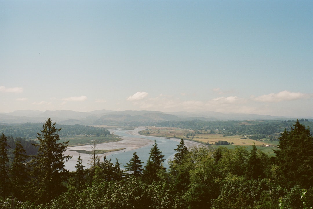
The Columbian River as a Corridor
The Columbia River, a mighty artery of the Pacific Northwest, likely served as a vital corridor for migration and dispersal. Its consistent water flow, abundant fish resources, and connection to the interior created a natural pathway for movement.
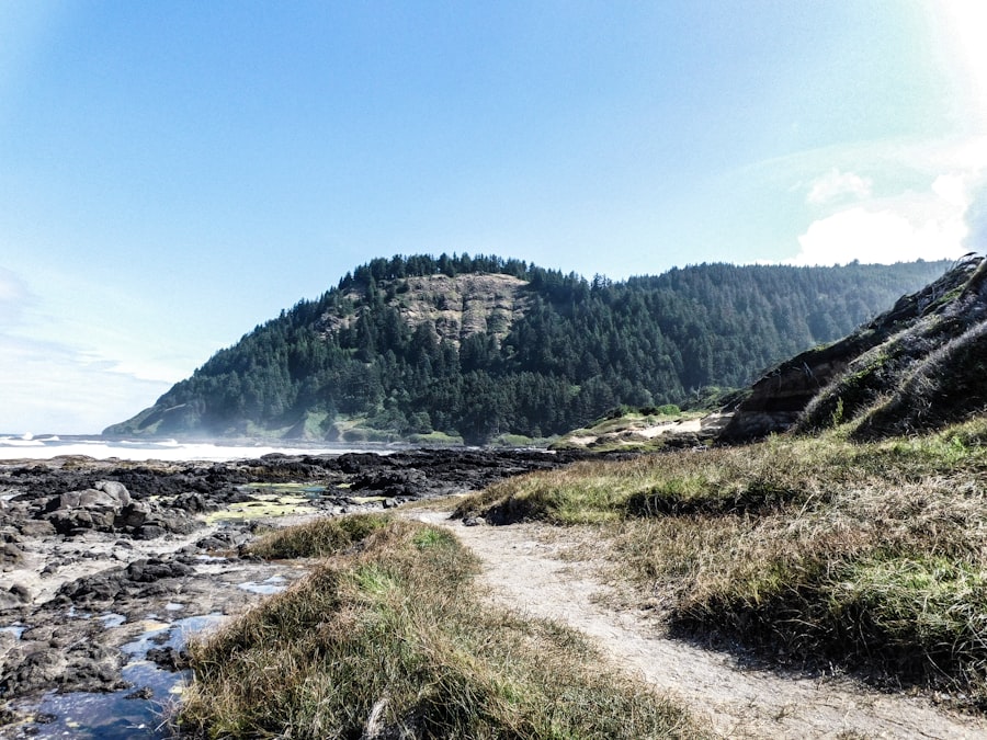
Coastal Access and Maritime Ventures
While inland routes were significant, the Pacific coastline also offered opportunities for movement and resource gathering. The ocean’s bounty and potential for seafaring played a role in early settlement patterns.
Coastal Adaptations and Resource Exploitation
Early coastal populations likely utilized a combination of terrestrial and marine resources. Shellfish beds, marine mammals, and accessible fishing grounds along the coast would have supported these groups.
Evidence of Coastal Movement
While direct evidence of extensive maritime travel by the earliest inhabitants is scarcer than inland evidence, the presence of obsidian sourced from inland volcanoes at coastal sites suggests some level of exchange and movement across broader distances, potentially involving watercraft.
The concept of deep time has significantly influenced the development of modern settlement routes in Oregon, as explored in the article “Understanding Oregon’s Landscape Through Deep Time.” This article delves into how geological processes over millions of years have shaped the terrain, ultimately guiding human settlement patterns and infrastructure development. For a comprehensive look at this fascinating intersection of geology and human geography, you can read more in the article available at Understanding Oregon’s Landscape Through Deep Time.
Adapting to Diverse Landscapes: Navigating Oregon’s Geography
Oregon’s diverse geography – from the arid high desert to the verdant Willamette Valley and the rugged coast – presented distinct challenges and opportunities for its earliest inhabitants. Their settlement patterns reflect a sophisticated understanding of these varied environments.
The Columbia Plateau: Desert Lifeways
The rain-shadowed Columbia Plateau, east of the Cascade Mountains, demanded specialized adaptations for survival. Resource scarcity and extreme temperature fluctuations shaped settlement strategies.
Nomadic Patterns and Seasonal Resource Use
Populations in the plateau likely followed nomadic or semi-nomadic lifeways, moving between seasonally available resources such as ripening berries, migrating game, and spawning salmon runs in rivers like the Deschutes and John Day.
Rock Shelters and Open Campsites
Archaeological evidence in this region includes rock shelters providing protection from the elements and open campsites indicating temporary encampments for resource procurement. The presence of projectile points, grinding stones, and lithic scatters reveals the tools and activities of these early peoples.
The Cascades and Blue Mountains: Highland Resources
The mountainous interior, including the Cascade and Blue Mountains, offered different resources, primarily related to hunting, gathering of arboreal resources, and access to obsidian.
Hunting Territories and Game Trails
These highlands were likely important hunting territories, with established game trails potentially influencing human movement. Evidence of hunting practices includes projectile points and tools associated with processing game.
Obsidian Procurement and Trade Networks
The Cascade Mountains, in particular, are home to significant obsidian sources, such as Glass Butte. The presence of this volcanic glass at distant archaeological sites confirms the existence of long-distance trade and travel networks.
The Willamette Valley and Coastal Ranges: Valley and Forest Abundance
West of the Cascades, the fertile Willamette Valley and the more temperate coastal ranges offered different ecological advantages, supporting larger and more settled populations.
Riverine Systems and Salmon Resources
The Willamette River and its tributaries, along with the coastal rivers, were critical sources of anadromous fish, particularly salmon. These rich fishing grounds supported sophisticated fishing technologies and likely allowed for more sedentary lifestyles.
Archaeological Sites and Village Locations
Archaeological sites in the Willamette Valley often reveal evidence of more permanent villages, situated near reliable food sources and defensible locations. Shell middens along the coast also indicate long-term occupation and reliance on marine resources.
The Rise of Complex Societies and Established Routes
Over thousands of years, Indigenous populations in Oregon developed increasingly complex social structures and established well-defined routes for trade, ceremony, and migration. These were not haphazard wanderings, but deliberate movements dictated by knowledge of the landscape and its resources.
The Importance of the Columbia River System
The Columbia River was a central hub for both local and inter-tribal interaction, facilitating the movement of people, goods, and ideas.
Salmon Fisheries as Social and Economic Centers
Major salmon fisheries, such as those at Celilo Falls, were not only crucial economic sites but also served as important social and ceremonial centers, attracting people from a wide geographic area.
Inter-tribal Trade Networks and Exchange Goods
Through the Columbia River system, goods such as dried salmon, roots, berries, baskets, tools, and raw materials were exchanged over vast distances, connecting communities across different ecological zones.
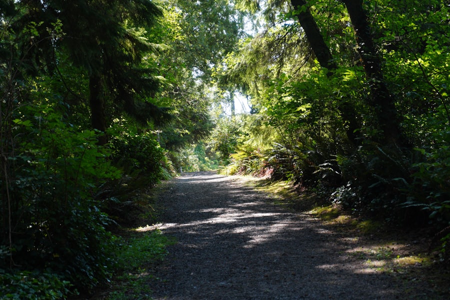
Trails as Arteries of Connection
Well-worn trails, often following natural features like river valleys or ridgelines, were the highways of ancient Oregon. These were not simply paths but often meticulously maintained routes incorporating knowledge of water sources and safe passage.
Following Topography: Rivers, Ridges, and Passes
Trail development invariably followed the path of least resistance, often paralleling rivers, utilizing high ground for visibility and safety, and traversing mountain passes to connect different regions.
Recognizing Natural Boundaries and Crossing Points
Indigenous peoples possessed an intimate knowledge of natural boundaries, such as canyons and mountain ranges, and established specific crossing points where rivers were fordable or bridges could be constructed.
Seasonal Migrations and Resource Calendars
Settlement patterns were also dictated by seasonal cycles, with regular movements between different resource areas as plants ripened, animals migrated, and fish spawned.
Tracking Flora and Fauna: A Deep Ecological Understanding
These migrations were guided by a profound understanding of the phenology of plants and the migratory patterns of animals, a sophisticated ecological calendar honed over generations.
Movement Between Summer and Winter Camps
Many groups likely maintained distinct summer and winter camps, with movements dictated by the availability of food, shelter, and protection from harsh weather.
The Impact of Post-Contact Shifts: New Routes and Altered Landscapes
The arrival of Europeans and later American settlers dramatically altered the established patterns of Indigenous life and the routes that had been used for millennia. Disease, displacement, and the imposition of new land use practices reshaped the Oregon landscape and its human geography.
Early European Exploration and Trade
Initial contact brought new technologies and trade goods, but also introduced devastating diseases that decimated Indigenous populations.
Fur Trade Routes and Their Influence
The fur trade, particularly in the early 19th century, established new trade routes and spurred the growth of trading posts, often influencing existing Indigenous travel patterns.
Introduction of New Technologies and their Impact on Mobility
Introductions like the horse significantly altered mobility for some groups, while the introduction of firearms changed hunting practices and inter-tribal relations.
The Oregon Trail and Westward Migration
The mid-19th century brought a massive influx of American settlers, primarily via the Oregon Trail, which followed some pre-existing Native American travel routes but also created new pathways across the continent.
Diverting and Disrupting Existing Routes
The Oregon Trail often passed through or near areas of Indigenous significance, sometimes disrupting traditional hunting grounds and seasonal resource access.
Settlement Patterns and Land Appropriation
The establishment of farms, towns, and later railroads, solidified new settlement patterns and inevitably led to the displacement and confinement of Indigenous peoples to reservations.
The Reservation System and Confined Movements
The establishment of reservations drastically restricted the mobility of many Indigenous groups, forcing them to adapt to new environments and economies, often far from ancestral lands and traditional routes.
Reconnecting with Ancestral Lands: A Persistent Desire
Despite confinement, the desire to maintain connections with ancestral lands and cultural sites remained, leading to specific efforts to traverse established routes for ceremonial purposes or to visit family.
The Loss and Rediscovery of Ancient Pathways
The imposition of new infrastructure and land management practices often obscured or erased the physical evidence of ancient trails, making their rediscovery a significant undertaking in modern ethnography and archaeology.
The concept of deep time has played a significant role in shaping Oregon’s modern settlement routes, as geological processes and ancient landscapes influenced where communities developed. For a deeper understanding of how these historical factors intertwine with contemporary geography, you can explore a related article that delves into the intricate relationship between geology and settlement patterns. This insightful piece highlights the ways in which Oregon’s unique terrain has guided human activity over millennia. To read more about this fascinating topic, visit this article.
Looking Forward: Contemporary Routes and Deep Time Connections
| Year | Event |
|---|---|
| 1804 | Lewis and Clark Expedition explores Oregon |
| 1843 | Oregon Trail opens for settlement |
| 1859 | Oregon becomes a state |
| 1887 | First transcontinental railroad reaches Oregon |
| 1956 | Interstate Highway System connects Oregon to the rest of the country |
Understanding Oregon’s modern settlement routes through deep time is not merely an academic exercise. It informs contemporary land use, conservation efforts, and the ongoing relationship between descendant communities and their ancestral territories.
The Legacy of Indigenous Place Names and Routes
Many of Oregon’s geographical features retain their Indigenous names, a testament to the deep historical connection of peoples to these places and the routes they developed.
Recognizing Cultural Landscapes
Acknowledging these ancient pathways and the cultural landscapes they traverse is crucial for understanding the full human history of Oregon, extending far beyond the 19th-century narrative.
Modern Indigenous Movements and Land Rights
Contemporary Indigenous movements often seek to reclaim or re-establish connections to ancestral lands and resources, sometimes involving the revitalization or re-tracing of ancient routes for cultural and political purposes.
The Role of Archaeology and Ethnography in Reconstruction
Archaeological excavations and ethnographic research continue to shed light on the complex network of ancient routes and the sophisticated knowledge systems that guided them.
GIS and Spatial Analysis: Mapping Ancient Journeys
Advanced technologies like Geographic Information Systems (GIS) are proving invaluable in mapping and analyzing potential ancient routes, using topographic data and archaeological site distributions.
Oral Histories and Intergenerational Knowledge
The preservation and study of oral histories are vital, as they often contain invaluable information about ancestral routes, resource use, and the cultural significance of specific places passed down through generations.
Sustainable Development and Respect for Deep Time
A profound appreciation for Oregon’s deep time human history, including its ancient settlement routes, is essential for sustainable development and respectful stewardship of the land. It fosters a more nuanced understanding of our place within a long and dynamic human story.
Integrating Traditional Ecological Knowledge into Modern Practices
Incorporating Traditional Ecological Knowledge (TEK) associated with ancient routes and resource management can offer insights into sustainable practices relevant to contemporary challenges.
Tourism and Education: Sharing a Deeper Narrative
Educational initiatives and responsible tourism can play a role in sharing this deeper narrative of Oregon’s human past, fostering greater appreciation for the state’s Indigenous heritage and the enduring significance of its ancient pathways.
FAQs
1. What is deep time and how does it relate to Oregon’s modern settlement routes?
Deep time refers to the concept of geological time, spanning millions to billions of years. In the case of Oregon’s modern settlement routes, deep time has shaped the landscape and natural features of the region, influencing the paths taken by early settlers.
2. How did deep time influence the formation of Oregon’s natural landscape?
Over millions of years, geological processes such as tectonic activity, erosion, and volcanic activity have shaped Oregon’s natural landscape. This includes the formation of mountain ranges, river valleys, and other geographical features that have influenced the routes taken by settlers.
3. What role did deep time play in the development of Oregon’s modern road and transportation networks?
The natural features and geological history of Oregon have influenced the development of modern road and transportation networks. Settlement routes often followed paths of least resistance, such as river valleys and low-lying areas, which were shaped by deep time geological processes.
4. How does an understanding of deep time help us better understand Oregon’s settlement history?
By understanding the long-term geological processes that have shaped Oregon’s landscape, we can gain insight into the factors that influenced the settlement patterns of early inhabitants. This knowledge can provide a deeper understanding of the historical and cultural development of the region.
5. What are some examples of how deep time has influenced specific settlement routes in Oregon?
Specific examples of how deep time has influenced settlement routes in Oregon include the formation of the Columbia River Gorge, which provided a natural pathway for early settlers, and the presence of volcanic landscapes that influenced the development of transportation networks in the region.