The quest to understand the ocean floor has a long and storied history, beginning with early navigators who relied on rudimentary methods to chart the depths of the seas. Ancient civilizations, such as the Greeks and Romans, made initial attempts to map the oceanic expanse, albeit with limited accuracy. They utilized simple tools like lead lines to measure depth, but their understanding of the ocean’s topography was largely speculative.
The vastness of the oceans and the limitations of their technology meant that these early maps were often filled with inaccuracies and misconceptions about what lay beneath the waves. As time progressed, the Age of Exploration in the 15th and 16th centuries brought about a renewed interest in ocean mapping. Explorers like Ferdinand Magellan and James Cook ventured into uncharted waters, contributing to a more comprehensive understanding of the ocean’s geography.
However, it wasn’t until the 19th century that systematic efforts began to take shape. The advent of more sophisticated navigational tools allowed for better depth measurements, leading to the first rudimentary maps of the ocean floor. These early endeavors laid the groundwork for future explorations and set the stage for more advanced technologies that would eventually revolutionize ocean mapping.
Key Takeaways
- Early attempts at mapping the ocean floor were limited to simple depth measurements using weighted ropes and lead lines.
- The invention of sonar technology revolutionized ocean floor mapping by allowing for more accurate and detailed measurements of the seafloor.
- The HMS Challenger Expedition made significant contributions to ocean floor mapping by using soundings and dredging to collect samples and data.
- The development of multibeam sonar systems has greatly improved the efficiency and accuracy of ocean floor mapping by allowing for simultaneous data collection across a wide swath of the seafloor.
- Satellite technology has played a crucial role in ocean floor mapping by providing global coverage and allowing for the monitoring of changes over time.
The Invention of Sonar Technology
The invention of sonar technology marked a significant turning point in the field of ocean floor mapping. Developed during World War I, sonar—an acronym for Sound Navigation and Ranging—utilizes sound waves to detect objects underwater. This technology was initially created for military purposes, primarily to locate submarines and underwater mines.
However, its potential for scientific exploration quickly became apparent. By emitting sound pulses and measuring the time it takes for them to return after bouncing off the ocean floor, researchers could create detailed maps of underwater topography. The application of sonar technology in oceanography opened new avenues for exploration.
Researchers could now gather data on seafloor features such as ridges, valleys, and trenches with unprecedented accuracy. This advancement not only enhanced navigation but also provided valuable insights into marine ecosystems and geological formations. As sonar technology evolved, so did its applications; it became an essential tool for marine scientists seeking to understand the complexities of oceanic environments.
The Contributions of the HMS Challenger Expedition
The HMS Challenger Expedition, which took place from 1872 to 1876, is often regarded as a landmark event in the history of oceanography. Commissioned by the British government, this expedition aimed to explore the depths of the world’s oceans and gather scientific data on marine life, water temperature, and seafloor geology. The voyage covered over 68,000 nautical miles and involved extensive sampling and measurement techniques that were revolutionary for their time.
One of the most significant contributions of the HMS Challenger Expedition was its systematic approach to data collection. The crew meticulously recorded observations and collected samples from various depths, leading to groundbreaking discoveries about oceanic life forms and geological structures. The expedition’s findings laid the foundation for modern oceanography, providing a wealth of information that would inform future research and exploration efforts.
The data collected during this expedition also contributed to the first comprehensive map of the ocean floor, revealing previously unknown features and deep-sea environments.
The Development of Multibeam Sonar Systems
| Year | Development |
|---|---|
| 1960s | Introduction of multibeam sonar systems for ocean mapping |
| 1980s | Advancements in multibeam technology for higher resolution and accuracy |
| 1990s | Integration of multibeam sonar with GPS for precise mapping and navigation |
| 2000s | Development of real-time multibeam systems for underwater surveys |
| 2010s | Enhancements in multibeam data processing and visualization software |
As technology advanced, so did the methods used for mapping the ocean floor. The development of multibeam sonar systems represented a significant leap forward in underwater mapping capabilities. Unlike traditional single-beam sonar, which only provides depth information at a single point directly beneath a vessel, multibeam sonar emits multiple sound beams simultaneously across a wide swath of the seafloor.
This allows for high-resolution mapping of large areas in a fraction of the time it would take using older methods. Multibeam sonar systems have revolutionized marine research by enabling scientists to create detailed three-dimensional maps of underwater landscapes. These systems can capture intricate details of seafloor features such as shipwrecks, coral reefs, and underwater volcanoes.
The ability to gather vast amounts of data quickly has transformed not only scientific research but also practical applications such as navigation, resource management, and environmental monitoring. As multibeam sonar technology continues to evolve, it promises even greater accuracy and detail in mapping the ocean floor.
The Role of Satellite Technology in Ocean Floor Mapping
In recent years, satellite technology has emerged as a powerful tool in the quest to map the ocean floor. While satellites cannot directly measure seafloor topography due to water’s opacity, they can provide valuable data on sea surface height variations caused by gravitational anomalies related to underwater features. By analyzing these variations, scientists can infer information about the underlying topography of the ocean floor.
Satellite altimetry has become an essential component of modern oceanographic research. It allows researchers to create global maps of seafloor features with remarkable precision, complementing data obtained from traditional sonar methods. This synergy between satellite technology and sonar has led to a more comprehensive understanding of oceanic processes and structures.
Furthermore, satellite data can be used to monitor changes in sea level and assess the impacts of climate change on marine environments.
The Impact of Submersibles on Ocean Floor Exploration
The advent of submersibles has significantly enhanced humanity’s ability to explore and study the ocean floor. These manned or unmanned vehicles are designed to withstand extreme pressures found at great depths, allowing researchers to access previously unreachable areas of the ocean. Submersibles have played a crucial role in deep-sea exploration, enabling scientists to observe marine life in its natural habitat and collect samples from the seafloor.
One notable example is the use of submersibles during expeditions like those conducted by the Alvin submersible, which has made numerous dives into deep-sea environments since its launch in 1964. These missions have led to groundbreaking discoveries, including hydrothermal vents and unique ecosystems that thrive in extreme conditions. The ability to conduct direct observations and collect samples has provided invaluable insights into biodiversity and geological processes occurring on the ocean floor.
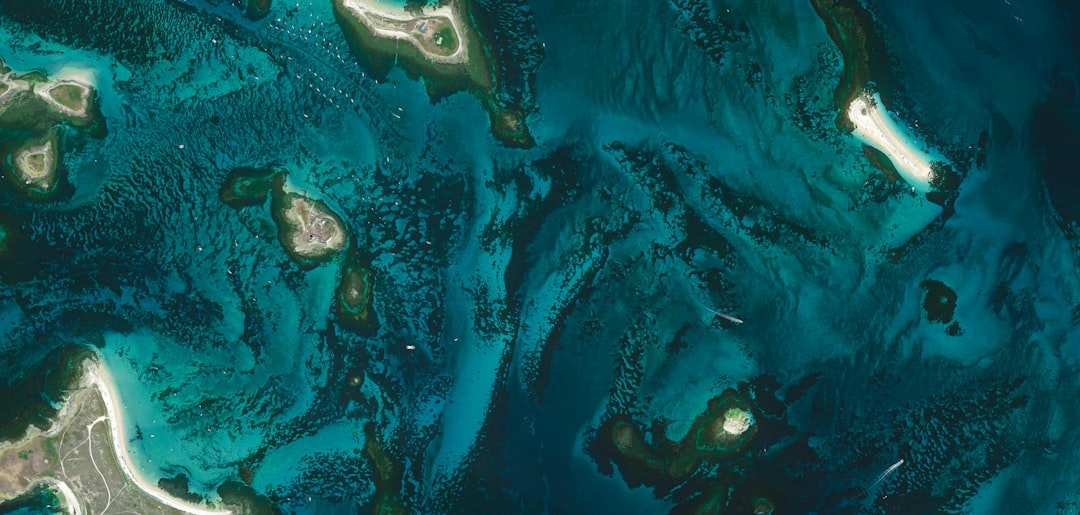
Mapping the Mid-Ocean Ridges and Trenches
Mid-ocean ridges and trenches are among the most significant geological features on Earth, playing a crucial role in understanding plate tectonics and oceanic processes. Mapping these structures has been a priority for scientists seeking to unravel the mysteries of Earth’s geology. The use of advanced sonar technology has allowed researchers to create detailed maps of these features, revealing their complex shapes and interactions.
Understanding these features is essential for comprehending how Earth’s crust is formed and recycled over geological time scales. Detailed mapping has also provided insights into volcanic activity associated with mid-ocean ridges and the unique ecosystems that thrive in these environments.
The Importance of Seafloor Mapping for Understanding Plate Tectonics
Seafloor mapping plays a pivotal role in advancing knowledge about plate tectonics—the theory that explains how Earth’s lithosphere is divided into tectonic plates that move over time. By mapping the ocean floor, scientists can identify plate boundaries, subduction zones, and other geological features that provide evidence for tectonic activity. This information is crucial for understanding earthquakes, volcanic eruptions, and other geological phenomena that impact human life.
The data obtained from seafloor mapping has led to significant advancements in understanding how tectonic plates interact with one another. For instance, researchers have been able to trace the movement of plates over millions of years by studying patterns in seafloor spreading and subduction processes. This knowledge not only enhances scientific understanding but also informs risk assessment and mitigation strategies for regions prone to seismic activity.
Challenges and Limitations of Ocean Floor Mapping
Despite significant advancements in technology, ocean floor mapping still faces numerous challenges and limitations. One major obstacle is the sheer scale of the oceans; covering vast areas with high-resolution data remains a daunting task. While advancements in sonar technology have improved efficiency, many regions remain poorly mapped due to logistical constraints and funding limitations.
Additionally, environmental factors such as strong currents, varying water temperatures, and biological interference can complicate data collection efforts. The deep-sea environment is also characterized by extreme conditions that pose risks to equipment and personnel involved in mapping efforts. As a result, many areas of the ocean floor remain unexplored or inadequately mapped, highlighting the need for continued investment in research and technology.
The Role of Ocean Floor Mapping in Environmental Conservation
Ocean floor mapping plays a critical role in environmental conservation efforts by providing essential data needed to protect marine ecosystems. Understanding seafloor habitats is vital for assessing biodiversity and identifying areas that require protection from human activities such as fishing, mining, and pollution. Detailed maps can help policymakers make informed decisions about marine protected areas (MPAs) and sustainable resource management.
Furthermore, mapping efforts contribute to monitoring changes in marine environments caused by climate change and human impact. For instance, understanding how seafloor features influence ocean currents can provide insights into how climate change affects marine ecosystems. By identifying vulnerable habitats and tracking changes over time, scientists can develop strategies to mitigate negative impacts on marine life.
Future Innovations in Ocean Floor Mapping Technology
The future of ocean floor mapping holds great promise as technological innovations continue to emerge. Advances in autonomous underwater vehicles (AUVs) are expected to revolutionize data collection capabilities by allowing for more extensive exploration without human intervention. These vehicles can be equipped with advanced sensors and imaging technologies that enhance mapping accuracy while reducing costs associated with manned missions.
Additionally, machine learning algorithms are being developed to analyze vast datasets generated by sonar systems more efficiently. By automating data processing and interpretation, researchers can gain insights faster than ever before.
In conclusion, the journey toward comprehensive ocean floor mapping has been marked by significant milestones driven by technological advancements and scientific exploration. From early attempts at charting depths using simple tools to sophisticated sonar systems and satellite technology today, each step has contributed to a deeper understanding of our planet’s underwater landscapes. As challenges persist and new innovations arise, continued efforts in ocean floor mapping will undoubtedly play a crucial role in advancing scientific knowledge and promoting environmental conservation efforts for generations to come.
The history of ocean floor mapping is a fascinating journey that highlights the evolution of technology and our understanding of the underwater world. For a deeper insight into this topic, you can explore the article on ocean mapping techniques and their significance in marine science at this link. This resource provides valuable information on how advancements in sonar and satellite technology have transformed our ability to chart the ocean’s depths.
WATCH THIS! The Map You Can’t See is Controlling the World
FAQs
What is ocean floor mapping?
Ocean floor mapping is the process of using various technologies and methods to create detailed maps and images of the ocean floor. This includes the topography, geology, and other features of the seabed.
Why is ocean floor mapping important?
Ocean floor mapping is important for a variety of reasons. It helps scientists understand the geology and topography of the ocean floor, which can provide insights into plate tectonics, underwater volcanoes, and other geological processes. It also helps in identifying potential hazards such as underwater landslides and can aid in the search for natural resources such as oil and gas.
What are some of the methods used for ocean floor mapping?
Some of the methods used for ocean floor mapping include multibeam sonar systems, which use sound waves to create detailed maps of the seabed, as well as satellite-based remote sensing techniques, and the use of autonomous underwater vehicles (AUVs) equipped with mapping sensors.
How has ocean floor mapping evolved over time?
Ocean floor mapping has evolved significantly over time, with advancements in technology leading to more detailed and accurate maps of the ocean floor. Early methods such as lead line sounding and single-beam echo sounding have been replaced by more advanced multibeam sonar systems and satellite-based mapping techniques.
What are some of the key discoveries made through ocean floor mapping?
Ocean floor mapping has led to a number of key discoveries, including the mapping of mid-ocean ridges, underwater volcanoes, and the identification of deep-sea trenches and canyons. It has also provided valuable insights into the distribution of marine habitats and the impact of human activities on the ocean floor.