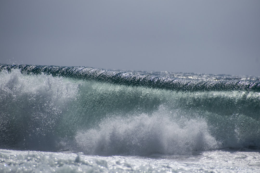
The Drake Passage, a body of water located between the southern tip of South America and Antarctica, is renowned for its tumultuous seas and unpredictable weather patterns. This narrow stretch of ocean, measuring approximately 800 kilometers (500 miles) wide, serves as a critical conduit for maritime traffic between the Atlantic and Pacific Oceans. Its unique geographical position contributes to the formation of some of the most challenging sea conditions in the world.
The convergence of the warm waters from the Atlantic and the cold currents from the Southern Ocean creates a dynamic environment that is both fascinating and perilous. Navigators and sailors have long been captivated by the Drake Passage, not only for its natural beauty but also for its reputation as a formidable challenge. The passage is often characterized by strong winds, powerful currents, and rapidly changing weather conditions.
These factors can lead to significant wave heights, making it essential for those traversing these waters to have a comprehensive understanding of the area. Knowledge of the Drake Passage is not merely academic; it is a practical necessity for ensuring safe navigation and successful voyages.
Key Takeaways
- The Drake Passage is a narrow stretch of water between South America’s Cape Horn and the South Shetland Islands of Antarctica, known for its challenging maritime conditions.
- Wave height forecasts are crucial for safe navigation in the Drake Passage, as they help vessels prepare for and navigate through potentially dangerous wave conditions.
- Factors affecting wave height in the Drake Passage include wind speed, wind duration, and the distance over which the wind blows (fetch), as well as the presence of storms and ocean currents.
- Types of wave height forecasts include numerical models, satellite altimetry, and wave buoys, each providing valuable data for predicting wave conditions in the Drake Passage.
- Wave height forecasts are used for safe navigation in the Drake Passage, helping vessels plan routes, adjust speeds, and take necessary precautions to avoid hazardous wave conditions.
Importance of Wave Height Forecast
Wave height forecasts play a crucial role in maritime navigation, particularly in challenging environments like the Drake Passage. Accurate predictions of wave heights can significantly influence a vessel’s route planning, safety measures, and overall operational efficiency. For sailors and shipping companies alike, understanding wave conditions is vital for avoiding dangerous situations that could jeopardize both crew and cargo.
The ability to anticipate wave heights allows mariners to make informed decisions about when to set sail or whether to alter their course. Moreover, wave height forecasts are not just about immediate safety; they also have economic implications. Shipping delays due to adverse sea conditions can lead to increased costs and logistical challenges.
By utilizing reliable wave height forecasts, maritime operators can optimize their schedules, reduce fuel consumption, and enhance overall efficiency. In an industry where time is often equated with money, having access to accurate wave height information can be a game-changer.
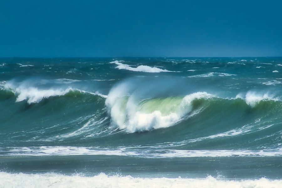
Factors Affecting Wave Height in the Drake Passage

Several factors contribute to the wave height experienced in the Drake Passage, making it a complex environment for navigators. One of the primary influences is wind speed and direction. Strong winds can generate large waves, particularly when they blow consistently over long distances—a phenomenon known as fetch.
In the Drake Passage, where winds can reach gale force, the potential for high waves increases dramatically. The interaction between wind and water is a critical element in understanding wave dynamics. Another significant factor is the ocean currents that flow through the passage.
The Antarctic Circumpolar Current, which flows from west to east around Antarctica, interacts with other currents in the region, creating areas of turbulence that can amplify wave heights. Additionally, local topography plays a role; underwater features such as ridges and valleys can influence how waves propagate and break. These combined factors create a unique and often unpredictable sea state that requires careful monitoring and analysis.
Types of Wave Height Forecasts
| Wave Height Forecast Type | Accuracy | Time Range | Availability |
|---|---|---|---|
| Global Forecast System (GFS) | Medium | 3-10 days | Global coverage |
| Regional Wave Models | High | 1-5 days | Regional coverage |
| Local Wave Buoy Data | High | Real-time | Specific locations |
Wave height forecasts come in various forms, each serving different purposes and audiences. Short-term forecasts typically provide predictions for the next few hours to a couple of days ahead, offering immediate guidance for vessels preparing to navigate through challenging waters. These forecasts are often generated using real-time data from buoys and satellite observations, allowing for quick adjustments based on current conditions.
Long-term forecasts, on the other hand, extend over several days or even weeks. These predictions are essential for planning longer voyages or for shipping companies looking to optimize their routes over extended periods. While long-term forecasts may not be as precise as short-term ones due to the inherent unpredictability of weather patterns, they still provide valuable insights into expected trends in wave activity.
Understanding both types of forecasts enables mariners to make informed decisions based on their specific needs and timelines.
Using Wave Height Forecasts for Safe Navigation
Navigators rely heavily on wave height forecasts to ensure safe passage through the Drake Passage. By consulting these forecasts before embarking on a journey, sailors can assess whether conditions are suitable for their vessel type and cargo. For instance, larger ships may be better equipped to handle rough seas compared to smaller vessels, which might be more vulnerable to high waves.
This knowledge allows captains to make strategic decisions about when to depart or whether to seek alternative routes.
Crews can prepare for potential rough seas by securing cargo, ensuring that safety equipment is readily available, and conducting drills for emergency situations.
By taking proactive measures based on forecasted conditions, mariners can mitigate risks and enhance their overall safety while navigating through one of the world’s most challenging maritime environments.
Technology and Tools for Monitoring Wave Height
Advancements in technology have significantly improved the ability to monitor wave height in the Drake Passage. Satellite imagery plays a crucial role in providing real-time data on sea conditions across vast areas of ocean. Satellites equipped with specialized sensors can capture information about wave heights, wind speeds, and other relevant parameters, allowing meteorologists to generate accurate forecasts.
In addition to satellite technology, buoys equipped with wave sensors are deployed throughout the passage to collect localized data. These buoys measure wave heights, periods, and directions, providing invaluable information that complements satellite observations. The integration of these technologies enables a more comprehensive understanding of wave dynamics in the Drake Passage, leading to improved forecasting accuracy and enhanced safety for mariners.
Tips for Navigating the Drake Passage in High Wave Conditions
Navigating the Drake Passage during high wave conditions requires careful planning and execution. One essential tip is to stay informed about current weather forecasts and sea conditions before setting sail. Mariners should regularly check updates from reliable sources and be prepared to adjust their plans accordingly.
Having contingency plans in place can make a significant difference in ensuring safety during unexpected weather changes. Another important consideration is vessel preparation. Ensuring that all equipment is in good working order and that safety gear is readily accessible can help crews respond effectively to challenging conditions.
Additionally, maintaining a steady course and avoiding sudden maneuvers can minimize the risk of capsizing or losing control in rough seas. By adhering to these guidelines, mariners can enhance their chances of safely navigating through the unpredictable waters of the Drake Passage.
Emergency Preparedness for High Wave Situations
Emergency preparedness is paramount when navigating through high wave conditions in the Drake Passage. Crews should conduct regular drills to familiarize themselves with emergency procedures, ensuring that everyone knows their roles in case of an incident. This includes practicing man-overboard procedures, securing loose items on deck, and knowing how to operate life-saving equipment.
Having an emergency kit onboard is also essential. This kit should include life jackets, flares, first aid supplies, and communication devices capable of reaching shore or other vessels in case of distress. Additionally, maintaining an open line of communication with other ships in the area can provide valuable support during emergencies.
By prioritizing preparedness and training, mariners can significantly enhance their safety while navigating through high waves.
Historical Wave Height Data in the Drake Passage
Historical wave height data provides valuable insights into the patterns and trends associated with sea conditions in the Drake Passage. Over the years, researchers have collected extensive data on wave heights through various means, including buoy measurements and satellite observations. This historical data serves as a foundation for understanding how wave patterns have changed over time due to natural variability and climate change.
Analyzing historical wave height data allows scientists to identify trends that may impact future navigation and marine operations in the region. For instance, shifts in wave patterns could indicate changes in weather systems or ocean currents that may affect maritime safety. By studying this data, researchers can better inform navigators about potential risks associated with high waves and contribute to more effective forecasting models.
Impact of Wave Height on Wildlife in the Drake Passage
The impact of wave height extends beyond human navigation; it also significantly affects wildlife inhabiting the waters of the Drake Passage. High waves can disrupt feeding patterns for marine animals such as seals, penguins, and various fish species that rely on stable conditions for hunting and breeding. The turbulence created by large waves can displace prey species or make it difficult for predators to locate food.
Additionally, extreme weather events associated with high waves can lead to habitat degradation for marine life. For example, strong currents may erode coastal areas or disrupt nesting sites for seabirds along rocky shores. Understanding these impacts is crucial for conservation efforts aimed at protecting marine ecosystems in the Drake Passage and ensuring that wildlife populations remain resilient in the face of changing environmental conditions.
Future Developments in Wave Height Forecasting for the Drake Passage
As technology continues to advance, future developments in wave height forecasting hold great promise for improving navigation safety in the Drake Passage. Enhanced satellite capabilities are expected to provide even more precise data on sea conditions, allowing meteorologists to refine their forecasting models further. Additionally, machine learning algorithms may be employed to analyze vast amounts of historical data alongside real-time observations, leading to more accurate predictions.
Collaboration between researchers, meteorologists, and maritime operators will also play a vital role in advancing forecasting techniques. By sharing data and insights across disciplines, stakeholders can develop more comprehensive models that account for various factors influencing wave height in the Drake Passage. As these developments unfold, mariners can look forward to improved forecasting tools that enhance safety and efficiency while navigating one of the world’s most challenging maritime environments.
For those planning a journey through the Drake Passage, understanding the wave height forecast is crucial for ensuring a safe and comfortable voyage. The Drake Passage is notorious for its challenging sea conditions, and accurate forecasts can help mariners prepare for the journey ahead. For more detailed insights into navigating this treacherous stretch of water, you can explore a related article on wave height forecasts and maritime safety at com/sample-page/’>MyGeoQuest’s sample page.
This resource provides valuable information for anyone looking to traverse this infamous passage with confidence.
WATCH NOW! Drake Passage: Earth’s Deadliest Waters Revealed
FAQs
What is the Drake Passage?
The Drake Passage is the body of water between the southern tip of South America and the northern tip of the Antarctic Peninsula. It is known for its rough seas and challenging sailing conditions.
What is wave height forecast?
Wave height forecast is a prediction of the height of waves in a particular area over a specific period of time. It is used by sailors, mariners, and other ocean-going vessels to plan their routes and prepare for potentially hazardous conditions.
Why is wave height forecast important for the Drake Passage?
The Drake Passage is notorious for its strong winds and high waves, making it one of the most challenging maritime routes in the world. A wave height forecast for the Drake Passage is crucial for the safety and navigation of ships and vessels passing through this region.
How is wave height forecast for the Drake Passage determined?
Wave height forecast for the Drake Passage is determined using a combination of meteorological data, oceanographic models, and historical wave patterns. This information is used to predict the height, direction, and frequency of waves in the area.
Where can I find wave height forecast for the Drake Passage?
Wave height forecast for the Drake Passage can be found through various sources, including national meteorological agencies, oceanographic research institutions, and maritime weather services. These forecasts are often available online and through specialized maritime communication channels.