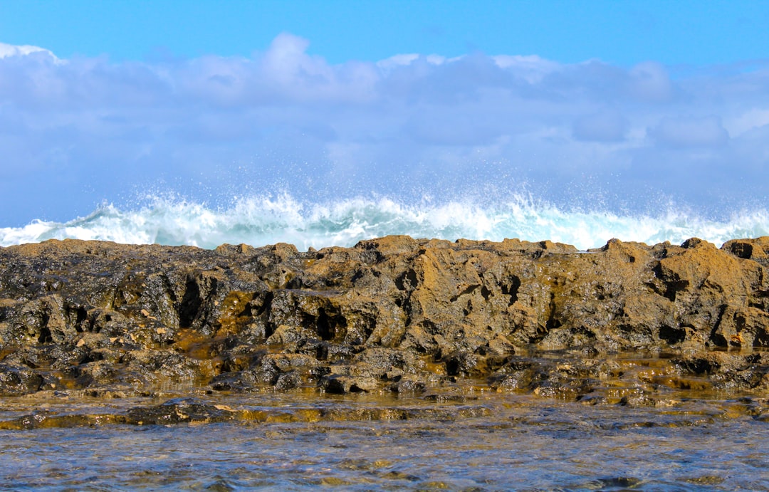
The Drake Passage, a body of water situated between the southern tip of South America and Antarctica, is renowned for its tumultuous seas and unpredictable weather patterns. This narrow stretch of ocean, measuring approximately 800 kilometers (500 miles) wide, serves as a critical conduit for maritime traffic between the Atlantic and Pacific Oceans. The passage is named after Sir Francis Drake, the English explorer who navigated these waters in the late 16th century.
Its significance extends beyond mere geography; it is a vital area for marine biodiversity and plays a crucial role in global oceanic currents. Navigating the Drake Passage is often considered one of the most challenging maritime endeavors due to its notorious wave heights and strong currents.
Sailors and researchers alike must possess a deep understanding of this region to ensure safe passage. The Drake Passage is not only a gateway to the Antarctic but also a testament to the power of nature, where the forces of wind and water can create awe-inspiring yet perilous conditions.
Key Takeaways
- The Drake Passage is a narrow stretch of water between South America’s Cape Horn and the South Shetland Islands of Antarctica, known for its challenging and unpredictable wave heights.
- Current wave heights in the Drake Passage are crucial for safe navigation, as they can impact the stability and safety of vessels crossing the passage.
- Factors affecting wave heights in the Drake Passage include wind speed, ocean currents, and the presence of icebergs, which can lead to rapidly changing and potentially hazardous conditions.
- Tools and resources such as satellite data, wave buoys, and oceanographic models are used to monitor wave heights in the Drake Passage and provide valuable information for safe passage planning.
- Interpreting wave height data is essential for planning a safe passage through the Drake Passage, and understanding the significance of wave height forecasts can help mariners make informed decisions.
The Importance of Current Wave Heights
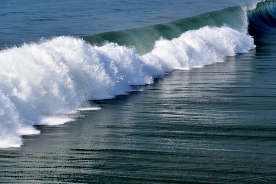
Wave heights in the Drake Passage are not merely a matter of interest for sailors; they are critical indicators of safety and navigational feasibility. Understanding current wave heights is essential for anyone planning to traverse this challenging waterway. High wave heights can pose significant risks, including capsizing vessels, damaging equipment, and endangering crew members.
Therefore, accurate and timely information about wave conditions is paramount for ensuring safe navigation. Moreover, wave heights can influence the overall experience of a journey through the Drake Passage. For researchers and tourists alike, the comfort and safety of their voyage can be significantly affected by the state of the sea.
High waves can lead to seasickness and discomfort, detracting from the enjoyment of witnessing the stunning landscapes and wildlife that this region has to offer.
Factors Affecting Wave Heights in the Drake Passage

Several factors contribute to the wave heights experienced in the Drake Passage, making it a complex environment for navigation. One primary factor is wind speed and direction. Strong winds can generate larger waves, while shifts in wind patterns can lead to sudden changes in wave conditions.
The open nature of the Drake Passage allows winds to travel unimpeded across vast distances, amplifying their impact on wave formation. Another significant factor is the oceanic currents that flow through the passage. The Antarctic Circumpolar Current, which flows from west to east around Antarctica, interacts with incoming swells from both the Atlantic and Pacific Oceans.
This interaction can create chaotic wave patterns and increase wave heights dramatically. Additionally, local weather systems, such as storms or low-pressure areas, can exacerbate these conditions, leading to even more unpredictable seas. Understanding these factors is crucial for anyone planning to navigate this challenging waterway.
Tools and Resources for Monitoring Wave Heights
| Tool/Resource | Description | Features |
|---|---|---|
| Buoy Data | Provides real-time wave height measurements from buoys deployed in the ocean. | Wave height, wave period, wave direction |
| Satellite Altimetry | Uses satellite technology to measure wave heights from space. | Global coverage, historical data |
| Wave Forecast Models | Utilizes mathematical models to predict future wave heights based on weather and ocean conditions. | Hourly, daily, and weekly forecasts |
| Coastal Webcams | Live video feeds from coastal webcams to visually monitor wave heights. | Real-time footage, multiple locations |
To navigate the Drake Passage safely, mariners rely on various tools and resources for monitoring wave heights. One of the most common methods involves using buoys equipped with sensors that measure wave height, frequency, and direction. These buoys transmit real-time data to meteorological agencies and maritime organizations, providing valuable information for vessels in transit.
In addition to buoys, satellite technology plays a pivotal role in monitoring ocean conditions. Satellites equipped with radar and altimetry instruments can capture large-scale wave patterns and provide forecasts that help sailors anticipate changing conditions. Weather forecasting services also offer specialized reports on wave heights, wind speeds, and other relevant data that are essential for safe navigation through the Drake Passage.
By utilizing these tools, mariners can make informed decisions about their routes and timing.
Planning for Safe Passage: Interpreting Wave Height Data
Interpreting wave height data is a critical skill for anyone planning to navigate the Drake Passage. Mariners must be able to assess not only current conditions but also forecasted changes that may occur during their journey. Understanding how to read wave height reports involves recognizing different measurement scales, such as significant wave height versus maximum wave height, which can provide different insights into sea conditions.
Additionally, mariners should consider other factors alongside wave height data, such as wind speed and direction, current patterns, and weather forecasts. A comprehensive understanding of these elements allows sailors to make informed decisions about their routes and timing. For instance, if high waves are predicted in conjunction with strong winds, it may be prudent to delay departure or seek alternative routes to ensure safety.
Strategies for Navigating High Wave Heights
When faced with high wave heights in the Drake Passage, sailors must employ specific strategies to navigate safely. One effective approach is to adjust the vessel’s speed and heading to minimize the impact of waves on the hull. Slowing down can reduce the risk of slamming into waves, which can cause damage or destabilize the vessel.
Additionally, navigating at an angle to incoming waves can help mitigate their effects. Another strategy involves utilizing advanced navigation technology that provides real-time data on wave conditions. By staying informed about changing weather patterns and sea states, mariners can make timely adjustments to their course.
Furthermore, maintaining open communication with other vessels in the area can provide valuable insights into current conditions and potential hazards. By employing these strategies, sailors can enhance their safety while traversing the challenging waters of the Drake Passage.
Preparing for Low Wave Heights
While high wave heights present significant challenges, low wave heights also require careful consideration when navigating the Drake Passage. Although calmer seas may seem more inviting, they can pose their own set of risks. For instance, low wave heights may indicate a lack of wind or unfavorable weather conditions that could lead to fog or reduced visibility.
Mariners must remain vigilant even in seemingly benign conditions. Additionally, low wave heights can affect vessel performance and maneuverability. Sailors should be aware that certain vessels may not handle well in calm seas due to reduced hydrodynamic lift or sluggish responses to steering inputs.
It is essential for mariners to understand their vessel’s characteristics and adjust their navigation strategies accordingly when faced with low wave heights.
The Role of Technology in Predicting Wave Heights
Technology has revolutionized the way mariners predict wave heights in the Drake Passage and other challenging waterways. Advanced computer models utilize vast amounts of data from buoys, satellites, and historical records to generate accurate forecasts of wave conditions. These models take into account various factors such as wind patterns, ocean currents, and atmospheric pressure systems to provide reliable predictions.
Moreover, mobile applications have emerged as valuable tools for sailors seeking real-time information on wave heights and weather conditions. These apps often integrate data from multiple sources, allowing users to access comprehensive forecasts at their fingertips. By leveraging technology in this way, mariners can enhance their situational awareness and make informed decisions about their voyages through the unpredictable waters of the Drake Passage.
Safety Considerations for Extreme Wave Heights
Extreme wave heights present some of the most significant safety challenges for those navigating the Drake Passage. Mariners must be prepared for sudden changes in sea conditions that can lead to dangerous situations. It is crucial for sailors to have contingency plans in place for extreme weather events, including protocols for seeking shelter or altering course if necessary.
Additionally, crew training plays a vital role in ensuring safety during extreme conditions. Crew members should be well-versed in emergency procedures and equipped with knowledge about how to respond effectively in high-stress situations. Regular drills can help reinforce these skills and ensure that everyone on board knows their responsibilities during adverse weather events.
Case Studies: Navigating the Drake Passage in Varied Wave Heights
Numerous case studies illustrate the challenges faced by mariners navigating the Drake Passage under varying wave heights. One notable example involved a research vessel caught in unexpectedly high waves during a scientific expedition. Despite having prepared extensively with weather forecasts and navigational tools, the crew found themselves battling towering swells that threatened their safety.
Their ability to adapt quickly by adjusting speed and heading ultimately allowed them to navigate through safely. Conversely, another case study highlighted a vessel that encountered low wave heights but faced challenges due to foggy conditions that obscured visibility. The crew relied heavily on radar technology and communication with nearby vessels to navigate safely through these treacherous waters despite calm seas.
These case studies underscore the importance of being prepared for a range of conditions when traversing the Drake Passage.
Navigating the Drake Passage with Wave Height Awareness
Navigating the Drake Passage requires a comprehensive understanding of wave heights and their implications for safety and comfort at sea. Mariners must remain vigilant in monitoring current conditions while also being prepared for sudden changes that can arise due to various environmental factors. By utilizing advanced tools and resources for monitoring wave heights, interpreting data effectively, and employing strategic navigation techniques, sailors can enhance their chances of safely traversing this challenging waterway.
Ultimately, awareness of wave height dynamics is essential for anyone venturing into the Drake Passage—whether they are seasoned sailors or first-time explorers seeking adventure in one of nature’s most awe-inspiring regions. With careful planning and respect for the power of the sea, mariners can navigate these waters with confidence while appreciating the beauty and complexity of this remarkable maritime environment.
The Drake Passage, known for its turbulent waters and challenging navigation conditions, often experiences significant wave heights that can impact maritime travel. For those interested in understanding more about the current wave conditions in this notorious stretch of ocean, a related article can be found on MyGeoQuest. This article provides insights into the dynamic nature of the Drake Passage and how it affects oceanic currents and wave patterns. To explore this topic further, you can visit the article by clicking on this link: Drake Passage Wave Conditions.
WATCH NOW! Drake Passage: Earth’s Deadliest Waters Revealed
FAQs
What is the Drake Passage?
The Drake Passage is the body of water between the southern tip of South America and the northern tip of the Antarctic Peninsula. It is known for its rough seas and strong winds.
What is the Drake Passage current?
The Drake Passage current is a powerful and continuous eastward flow of water that circulates around the Antarctic continent. It is one of the most significant ocean currents in the world.
What is the wave height in the Drake Passage?
The wave height in the Drake Passage can vary greatly, but it is known for its rough and stormy conditions, with waves often reaching heights of 30 feet or more.
Why are the waves in the Drake Passage so high?
The high waves in the Drake Passage are a result of the strong and persistent winds that sweep across the open ocean, as well as the convergence of different ocean currents in the region.
Are there specific times of year when the wave height is particularly high in the Drake Passage?
The wave height in the Drake Passage tends to be highest during the austral winter months (June-August) when strong storms and gale-force winds are more common in the region.