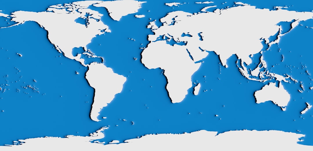
Mapping the ocean is a critical endeavor that holds immense significance for humanity. Covering over 70% of the Earth’s surface, the oceans are not only vital for global climate regulation but also serve as a rich source of biodiversity and resources.
The depths of the ocean remain largely unexplored, with estimates suggesting that more than 80% of the ocean floor is still unmapped. This lack of knowledge poses challenges for marine ecosystems and human activities alike, making comprehensive ocean mapping an urgent priority. Furthermore, accurate ocean mapping is crucial for predicting and mitigating the impacts of natural disasters such as tsunamis and hurricanes.
By understanding underwater topography and current patterns, scientists can better forecast how these events will unfold and potentially save lives. Additionally, mapping the ocean aids in the identification of marine habitats, which is essential for conservation efforts. As human activities increasingly threaten marine ecosystems, having detailed maps allows for informed decision-making regarding marine protected areas and sustainable resource management.
Thus, the importance of mapping the ocean cannot be overstated; it is a foundational step toward ensuring the health of our planet and its inhabitants.
Key Takeaways
- Mapping the ocean is crucial for understanding and preserving marine ecosystems
- Satellite altimetry is a technology that measures the height of the ocean surface from space
- Satellite altimetry works by sending radar pulses to the ocean surface and measuring the time it takes for the signal to return
- Using satellite altimetry for ocean mapping provides valuable data for climate research, marine navigation, and disaster management
- Satellite altimetry has applications in oceanography such as monitoring sea level rise, ocean circulation, and wave height
What is Satellite Altimetry?
Satellite altimetry is a sophisticated technology that has revolutionized the way scientists measure the Earth’s surface, particularly the oceans. This technique involves using satellites equipped with radar altimeters to measure the distance between the satellite and the ocean surface. By sending radar pulses down to the water and recording the time it takes for them to bounce back, scientists can calculate sea surface heights with remarkable precision.
This data is invaluable for understanding various oceanographic phenomena, including currents, tides, and sea level rise. The advent of satellite altimetry has provided a new perspective on ocean mapping that was previously unattainable through traditional methods. Before its implementation, oceanographers relied heavily on ship-based surveys, which were time-consuming and limited in scope.
Satellite altimetry allows for global coverage and continuous monitoring, making it possible to gather data over vast areas of the ocean in a fraction of the time. This technology has become an indispensable tool in oceanography, enabling researchers to track changes in sea level and understand the dynamics of ocean circulation on a global scale.
How Satellite Altimetry Works
The operation of satellite altimetry is grounded in principles of physics and engineering that allow for precise measurements of distance. A satellite equipped with a radar altimeter emits microwave signals toward the ocean surface. When these signals hit the water, they are reflected back to the satellite.
By measuring the time it takes for the signals to return, scientists can calculate the distance to the ocean surface using the speed of light as a constant. This process is repeated thousands of times per second, allowing for high-resolution data collection across extensive areas. In addition to measuring sea surface height, satellite altimetry also accounts for various factors that can affect readings, such as atmospheric conditions and wave heights.
Advanced algorithms are employed to correct for these variables, ensuring that the data collected is as accurate as possible. The resulting information is then processed and analyzed to create detailed maps of sea surface heights and other oceanographic features. This capability not only enhances our understanding of ocean dynamics but also provides critical insights into climate change and its effects on sea levels.
The Benefits of Using Satellite Altimetry for Ocean Mapping
| Benefits of Using Satellite Altimetry for Ocean Mapping |
|---|
| 1. Accurate measurement of sea surface height |
| 2. Monitoring of ocean circulation patterns |
| 3. Detection of sea level rise and its impact on coastal areas |
| 4. Study of ocean tides and their variations |
| 5. Assessment of marine gravity and geoid variations |
The benefits of utilizing satellite altimetry for ocean mapping are manifold. One of the most significant advantages is its ability to provide comprehensive data over large areas of the ocean with minimal human intervention. Unlike traditional methods that require extensive ship-based surveys, satellite altimetry can cover vast expanses of water in a relatively short time frame.
This efficiency allows researchers to gather data on a global scale, leading to a more complete understanding of oceanic processes. Moreover, satellite altimetry offers high-resolution measurements that are crucial for monitoring changes in sea level and understanding ocean circulation patterns. These measurements are essential for predicting climate-related phenomena such as El Niño and La Niña events, which have far-reaching impacts on weather patterns worldwide.
Additionally, satellite altimetry contributes to improved navigation safety by providing accurate information about sea surface heights, which is vital for shipping routes and coastal management. Overall, the use of satellite altimetry represents a significant advancement in ocean mapping technology, enabling more effective research and management of marine resources.
Applications of Satellite Altimetry in Oceanography
The applications of satellite altimetry in oceanography are diverse and impactful. One primary application is in monitoring sea level rise, a critical issue exacerbated by climate change. By providing precise measurements of sea surface height over time, satellite altimetry allows scientists to track changes in sea levels globally.
This information is vital for understanding how rising seas may affect coastal communities and ecosystems, informing policy decisions related to climate adaptation and mitigation. In addition to sea level monitoring, satellite altimetry plays a crucial role in studying ocean currents and circulation patterns. By analyzing variations in sea surface height, researchers can infer information about current speeds and directions.
This data is essential for understanding how heat and nutrients are distributed throughout the oceans, which has implications for marine life and global climate systems. Furthermore, satellite altimetry aids in identifying underwater features such as seamounts and ridges by measuring their influence on sea surface height, contributing to a more comprehensive understanding of ocean topography.
Challenges and Limitations of Satellite Altimetry

Despite its many advantages, satellite altimetry does face several challenges and limitations that researchers must navigate. One significant challenge is related to atmospheric conditions that can affect radar signal propagation. Factors such as humidity, temperature variations, and atmospheric pressure can introduce errors in measurements if not properly accounted for.
While advanced algorithms exist to correct these discrepancies, they may not always be entirely effective, leading to potential inaccuracies in data interpretation. Another limitation lies in the resolution of satellite altimetry data. While it provides valuable information over large areas, it may not capture fine-scale features or localized phenomena effectively.
For instance, small-scale currents or coastal processes may be difficult to discern from satellite data alone. As a result, researchers often need to complement satellite altimetry with other observational methods, such as in-situ measurements or ship-based surveys, to obtain a more comprehensive understanding of specific areas or phenomena.
The Role of Satellite Altimetry in Understanding Climate Change
Satellite altimetry plays a pivotal role in advancing our understanding of climate change and its impacts on the oceans. One of its primary contributions is in monitoring global sea level rise—a key indicator of climate change effects. As polar ice melts and thermal expansion occurs due to rising temperatures, accurate measurements of sea level changes become essential for assessing future risks to coastal communities and ecosystems.
Satellite altimetry provides long-term datasets that allow scientists to analyze trends in sea level rise over decades. Moreover, satellite altimetry contributes to understanding how climate change affects ocean circulation patterns. Changes in temperature and salinity can alter currents that regulate heat distribution across the globe.
By tracking variations in sea surface height associated with these changes, researchers can gain insights into how climate change may influence weather patterns and marine ecosystems. This information is crucial for developing predictive models that inform climate adaptation strategies and conservation efforts.
Future Developments in Satellite Altimetry Technology
The future of satellite altimetry technology holds great promise for enhancing our understanding of the oceans and their dynamics. Ongoing advancements aim to improve measurement accuracy and resolution while expanding coverage capabilities. For instance, new missions are being developed that incorporate advanced radar systems capable of capturing finer details in sea surface height variations.
These innovations will enable scientists to monitor smaller-scale phenomena that are critical for understanding localized ocean processes. Additionally, there is a growing emphasis on integrating satellite altimetry data with other remote sensing technologies and in-situ observations. By combining datasets from various sources—such as satellites measuring ocean color or temperature—researchers can create more comprehensive models that capture complex interactions within marine systems.
This integrative approach will enhance our ability to monitor changes in real-time and respond effectively to emerging challenges related to climate change and marine conservation.
Collaborative Efforts in Ocean Mapping Using Satellite Altimetry
Collaboration among international organizations, research institutions, and governmental agencies has been instrumental in advancing ocean mapping efforts using satellite altimetry. Initiatives such as the European Space Agency’s Copernicus program exemplify how collaborative frameworks can facilitate data sharing and enhance research capabilities across borders. By pooling resources and expertise, these partnerships enable scientists to tackle complex questions related to ocean dynamics and climate change more effectively.
Furthermore, collaborative efforts extend beyond data collection; they also encompass capacity building and knowledge sharing among nations with varying levels of technological resources. Developing countries often face challenges in accessing advanced technologies like satellite altimetry; thus, partnerships can help bridge these gaps by providing training and support for local researchers. Such collaborative endeavors not only enhance scientific understanding but also promote equitable access to valuable oceanographic data.
The Impact of Satellite Altimetry on Marine Navigation and Safety
The impact of satellite altimetry on marine navigation and safety cannot be overstated. Accurate measurements of sea surface height are crucial for ensuring safe navigation through busy shipping lanes and coastal waters. By providing real-time data on tidal variations and potential hazards such as underwater obstructions or shallow areas, satellite altimetry enhances navigational safety for vessels operating in diverse marine environments.
Moreover, satellite altimetry contributes to improved maritime operations by enabling better route planning based on current conditions. Shipping companies can utilize this information to optimize fuel efficiency and reduce transit times while minimizing environmental impacts.
The Role of Satellite Altimetry in Advancing Ocean Research and Conservation
In conclusion, satellite altimetry has emerged as a transformative tool in advancing ocean research and conservation efforts worldwide. Its ability to provide precise measurements over vast areas has revolutionized our understanding of ocean dynamics, climate change impacts, and marine ecosystems. As scientists continue to explore the depths of our oceans through this innovative technology, they gain invaluable insights that inform policy decisions related to resource management and environmental protection.
Looking ahead, ongoing advancements in satellite altimetry technology promise even greater contributions to our understanding of the oceans’ complexities. Collaborative efforts among nations will further enhance data accessibility and foster a global commitment to sustainable ocean stewardship. Ultimately, satellite altimetry stands at the forefront of efforts to protect our oceans—an essential resource that sustains life on Earth—and ensure their health for future generations.
Satellite altimetry plays a crucial role in mapping the ocean’s surface, providing valuable data on sea level rise, ocean currents, and the topography of the seafloor. For a deeper understanding of how this technology works and its implications for oceanography, you can read a related article on this topic at this link. This resource offers insights into the methodologies used in satellite altimetry and its significance in monitoring global climate change.
WATCH THIS! The Map You Can’t See is Controlling the World
FAQs
What is satellite altimetry?
Satellite altimetry is a technique used to measure the height of the sea surface from space using radar or laser instruments on satellites.
How does satellite altimetry map the ocean?
Satellite altimetry maps the ocean by measuring the height of the sea surface at different points and combining these measurements to create a detailed map of the ocean’s surface topography.
What can satellite altimetry tell us about the ocean?
Satellite altimetry can provide information about ocean currents, tides, sea level rise, and the topography of the ocean floor.
What are the benefits of using satellite altimetry to map the ocean?
Using satellite altimetry to map the ocean provides valuable data for understanding and monitoring ocean circulation, climate change, and the impact of natural disasters such as tsunamis.
How is satellite altimetry data used in oceanography and climate research?
Satellite altimetry data is used in oceanography and climate research to study ocean circulation patterns, monitor sea level rise, and improve our understanding of the Earth’s climate system.
What are some of the limitations of satellite altimetry in mapping the ocean?
Some limitations of satellite altimetry in mapping the ocean include the presence of clouds and atmospheric interference, which can affect the accuracy of the measurements, as well as the inability to measure ocean properties below the sea surface.