Central Asia, a vast and diverse region, presents a fascinating case study for demographic analysis. Historically a crossroads of civilizations, its modern population distribution is a complex tapestry woven from centuries of nomadic traditions, geopolitical shifts, and environmental realities. Understanding the spatial patterns of human habitation across Kazakhstan, Kyrgyzstan, Tajikistan, Turkmenistan, and Uzbekistan is not merely an academic exercise; it provides critical insights for regional development, resource management, and geopolitical stability. This article delves into the methodologies and findings associated with mapping Central Asia’s population density, offering a comprehensive overview of its unique demographic landscape.
Accurate and up-to-date population density maps serve as the foundational bedrock for evidence-based decision-making across a multitude of sectors. For Central Asia, a region characterized by significant variations in topography, climate, and economic development, generalized population statistics often obscure critical local nuances. High-resolution mapping, therefore, becomes indispensable.
Beyond Administrative Boundaries
Traditional demographic data often relies on administrative boundaries, such as provinces or districts. While useful for certain applications, these boundaries seldom reflect the true granularity of human settlement patterns. Imagine trying to understand the intricate network of veins in a leaf by only examining its main stem; you would miss the crucial details. High-resolution maps, conversely, disaggregate populations to much finer spatial units, often down to grid cells of a few hundred meters. This allows for a more precise understanding of where people actually live, rather than where they are administratively counted. For instance, a large administrative district might appear sparsely populated on average, but high-resolution maps could reveal concentrated urban centers within it, surrounded by vast uninhabited areas.
Informing Infrastructure Development
Consider the challenge of planning new infrastructure, such as roads, schools, or healthcare facilities. Without detailed population density maps, decision-makers are operating in the dark. Misplaced investments can lead to underutilized facilities in sparsely populated areas or insufficient capacity in crowded zones. By overlaying proposed infrastructure projects onto high-resolution population maps, planners can optimize locations to maximize accessibility and service delivery, ensuring that resources reach those who need them most.
Disaster Preparedness and Response
Central Asia is susceptible to various natural hazards, including earthquakes, floods, and droughts. In the event of a disaster, rapid and accurate information about affected populations is paramount for effective relief efforts. High-resolution density maps allow humanitarian organizations and government agencies to swiftly identify the most vulnerable and densely populated areas, facilitating targeted aid distribution, evacuation planning, and resource allocation. This granular understanding can mean the difference between life and death in a crisis.
Central Asia’s population density presents a fascinating study of geography, as the region is characterized by vast steppes, mountains, and deserts, which significantly influence settlement patterns. For a deeper understanding of how these geographical features affect population distribution and density in Central Asia, you can refer to a related article that explores these dynamics in detail. To read more, visit this article.
Methodologies for Mapping Population Density
The creation of sophisticated population density maps relies on a blend of traditional demographic techniques and cutting-edge geospatial technologies. No single method provides a complete picture; rather, it is the synergistic combination of various data sources and analytical approaches that yields robust results.
Census Data as the Baseline
The bedrock of any population mapping effort remains the national census. These periodic undertakings meticulously count and enumerate individuals, providing essential demographic attributes such as age, gender, and household composition. While censuses offer the most comprehensive snapshot of a nation’s population at a specific point in time, they are conducted infrequently, often every decade, and their spatial resolution is typically limited to administrative units.
Challenges of Census Data in Central Asia
In Central Asia, as in many parts of the world, census enumeration can face unique challenges. Vast rural areas, nomadic populations, and transboundary migration patterns can complicate data collection. Furthermore, political sensitivities or resource constraints can sometimes affect the timing and thoroughness of a census. For example, some regions might experience undercounting due to remote locations or reluctance to participate. Therefore, while crucial, census data alone is insufficient for generating dynamic and high-resolution maps.
Leveraging Remote Sensing and Satellite Imagery
The advent of remote sensing technology has revolutionized population mapping. Satellite imagery, from high-resolution panchromatic images to multi-spectral data, provides an invaluable bird’s-eye view of the Earth’s surface. This allows researchers to identify and categorize different land cover types, which are often highly correlated with human settlement.
Proxy Indicators of Population
Satellite imagery helps to identify proxy indicators of population density, such as built-up areas, road networks, and nighttime lights. Areas with a higher concentration of buildings and roads typically indicate denser human habitation. Similarly, the intensity of nighttime lights, as captured by sensors like those on the Visible Infrared Imaging Radiometer Suite (VIIRS), provides a strong surrogate for human activity and, by extension, population distribution. Imagine looking at an astronaut’s view of Earth at night; the glowing constellations of cities and towns immediately reveal population clusters. These indicators, when combined with sophisticated algorithms, can distribute aggregated census figures to finer spatial units.
Incorporating Geospatial Data and Modeling
Geographic Information Systems (GIS) play a pivotal role in integrating and analyzing diverse datasets, enabling the creation of spatially explicit population models. This involves combining census data with satellite imagery, elevation models, road networks, and other relevant geospatial information.
Disaggregation Techniques
One common technique is “areal interpolation” or “dasymetric mapping,” which intelligently disaggregates population data from larger enumeration units (e.g., administrative districts) to smaller, more homogenous ones. This process uses ancillary information (like land cover or building footprints) to refine the spatial distribution. For example, if a census block contains both urban areas and a large, uninhabited desert portion, dasymetric mapping would allocate the majority of the population to the built-up areas, rather than distributing it evenly across the entire block. This is akin to understanding that while a bucket contains water, the water itself might be concentrated in one corner, not spread perfectly flat.
Key Findings and Patterns of Population Density

The mapping of Central Asia’s population density reveals distinct patterns shaped by geography, history, and economic development. The region’s vast expanse encompasses towering mountain ranges, sprawling deserts, fertile river valleys, and arid steppes, each leaving its indelible mark on human settlement.
The Allure of Oases and River Valleys
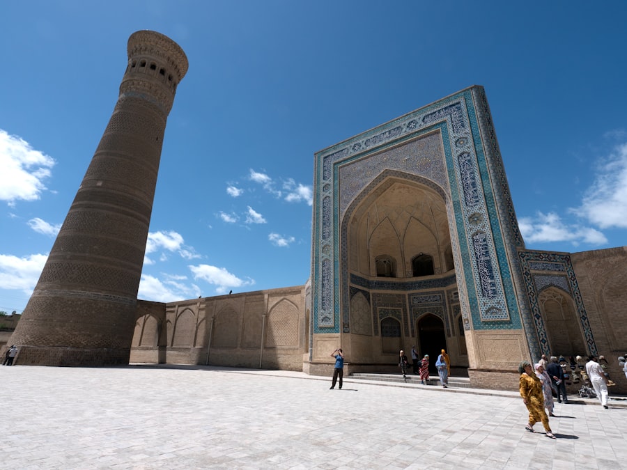
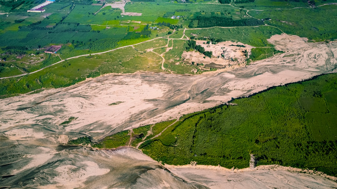
A dominant pattern observed across Central Asia is the concentration of populations around water sources – rivers, oases, and irrigation systems. The Amu Darya and Syr Darya river basins, particularly in Uzbekistan and Tajikistan, serve as vibrant arteries of life, supporting dense agricultural populations and major urban centers. Cities such as Tashkent, Samarkand, and Bukhara owe their historical prominence and continued growth to their proximity to these vital water resources. The fertile Fergana Valley, shared by Uzbekistan, Kyrgyzstan, and Tajikistan, stands out as one of the most densely populated agricultural regions in the world, a testament to its rich soils and abundant water.
Historical Influences on Settlement
This pattern is deeply rooted in Central Asia’s history. Ancient trade routes, such as the Silk Road, naturally converged at oases and river crossings, fostering the growth of towns and cities that served as centers of commerce and culture. The challenges of arid environments necessitated a concentrated effort to harness water, leading to the development of sophisticated irrigation systems that further solidified settlement patterns along these lifelines.
Urbanization and Regional Disparities
While rural populations remain significant, Central Asia is experiencing a steady trend of urbanization, with an increasing proportion of its inhabitants residing in cities and towns. These urban centers act as magnets for economic opportunity, education, and services, drawing people from surrounding rural areas. However, the level and pace of urbanization vary significantly across the five republics.
Capital Cities as Population Magnets
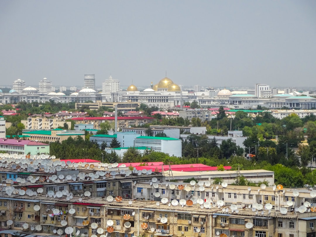
The capital cities of each Central Asian nation—Astana and Almaty in Kazakhstan, Bishkek in Kyrgyzstan, Dushanbe in Tajikistan, Ashgabat in Turkmenistan, and Tashkent in Uzbekistan—exhibit the highest population densities. These cities are economic powerhouses, political centers, and cultural hubs, attracting internal migration and experiencing rapid growth. This creates a striking contrast between the bustling urban cores and the often sparsely populated hinterlands. For instance, Kazakhstan’s vast steppe and desert regions outside its major cities remain lightly populated, while Tashkent, as the largest city in Central Asia, is a sprawling metropolis.
The Influence of Topography and Climate
The rugged topography of Central Asia, particularly the Tian Shan and Pamir mountain ranges, profoundly shapes population distribution. These formidable natural barriers limit settlement to valleys, intermontane basins, and lower foothills. Conversely, the vast deserts, such as the Kyzylkum and Karakum, represent significant demographic voids, with only scattered nomadic or semi-nomadic populations and settlements associated with resource extraction.
Arid Regions: Sparse and Decentralized
The arid and semi-arid plains of Kazakhstan and Turkmenistan, while geographically expansive, support much lower population densities compared to the fertile river valleys. Here, settlement is often tied to isolated water sources, mining operations, or small agricultural plots that rely on deep wells or limited irrigation. The challenge of water availability acts as a powerful brake on population growth and density in these regions, making them the vast empty canvases of the demographic map.
Applications and Policy Implications
The insights gleaned from mapping Central Asia’s population density have profound implications for policy-making across a spectrum of governmental and non-governmental domains. These maps are not merely static representations but dynamic tools that can inform strategic planning and resource allocation.
Targeted Development Initiatives
Understanding where people live, down to a fine spatial resolution, enables governments and development organizations to design and implement targeted interventions. For example, programs aimed at improving access to healthcare, education, or economic opportunities can be specifically directed to areas identified as having high population density but inadequate service provision. Conversely, initiatives focused on sustainable resource management or environmental protection can be prioritized in sparsely populated but ecologically sensitive regions. Imagine trying to throw a dart at a board blindfolded; these maps remove the blindfold, allowing for precise aim.
Resource Management and Environmental Planning
Central Asia faces significant challenges related to water scarcity, land degradation, and the impacts of climate change. Population density maps are crucial for effective resource management. They can help identify areas where human pressure on natural resources (e.g., water, pastures) is highest, allowing for the implementation of sustainable management practices. For instance, areas with dense agricultural populations near shrinking water sources can be prioritized for water-efficient irrigation technologies or alternative livelihoods.
Regional Cooperation and Stability
Given the transboundary nature of many of Central Asia’s challenges, including shared water resources and ethnic populations, high-resolution population maps can foster regional cooperation. By providing a common and objective picture of demographic realities, these maps can facilitate evidence-based discussions on shared resource management, cross-border infrastructure projects, and mechanisms for addressing population movements. A shared understanding of the demographic landscape is a prerequisite for harmonious coexistence and collaborative problem-solving in a region interlinked by geography and history.
Central Asia’s population density presents a fascinating aspect of its geography, reflecting the diverse landscapes and cultural influences in the region. For those interested in exploring this topic further, the article on My Geo Quest provides an in-depth analysis of how geography shapes population distribution and density in Central Asia. You can read more about it in this insightful piece here. Understanding these dynamics is crucial for grasping the socio-economic challenges and opportunities faced by the countries in this part of the world.
Future Directions in Population Mapping
| Country | Area (sq km) | Population (millions) | Population Density (people per sq km) | Geographical Features |
|---|---|---|---|---|
| Kazakhstan | 2,724,900 | 19.0 | 7 | Steppe, deserts, mountains |
| Uzbekistan | 448,978 | 36.0 | 80 | Deserts, river valleys, mountains |
| Turkmenistan | 491,210 | 6.0 | 12 | Deserts, Karakum Desert, mountains |
| Kyrgyzstan | 199,951 | 7.0 | 35 | Mountainous, Tien Shan range |
| Tajikistan | 143,100 | 10.0 | 70 | Mountainous, Pamir Mountains |
The field of population mapping is continuously evolving, driven by advancements in data collection, processing power, and analytical techniques. For Central Asia, several future directions promise to enhance the accuracy, timeliness, and utility of population density maps.
Integration of Mobile Phone Data
The widespread adoption of mobile phones across Central Asia presents a revolutionary opportunity for real-time population mapping. Anonymized and aggregated mobile network data, capturing call detail records, cell tower connections, and movement patterns, can provide highly dynamic insights into population distribution and mobility. While privacy concerns must be rigorously addressed, the potential of this data to offer near real-time updates on population movements, particularly during crises or large-scale events, is immense. Think of it as a constantly updating pulse of human activity across the landscape.
Advancements in Machine Learning and AI
Machine learning and artificial intelligence algorithms are increasingly being employed to process vast quantities of satellite imagery and other geospatial data. These algorithms can identify complex patterns in land cover and human settlement with unprecedented accuracy and efficiency. For example, AI can be trained to automatically detect and delineate individual buildings from very high-resolution satellite imagery, providing a highly granular basis for distributing population. Such advancements promise to refine dasymetric mapping techniques even further, moving beyond broad land cover classifications to detailed building footprints.
Collaborative Data Sharing Initiatives
The fragmentation of data across different agencies and national boundaries can hinder comprehensive mapping efforts. Future initiatives in Central Asia will benefit greatly from enhanced data sharing protocols and collaborative platforms among the various national statistical offices, academic institutions, and international organizations. A unified approach to data collection, standardization, and dissemination would ensure consistency and maximize the utility of population density maps for regional planning and development. This cooperative spirit is essential to build a truly comprehensive demographic picture of the entire region.
In conclusion, mapping Central Asia’s population density is a multifaceted endeavor that synthesizes traditional demographic methods with cutting-edge geospatial technologies. The resulting high-resolution maps are invaluable assets for understanding the region’s demographic dynamics, informing sustainable development strategies, enhancing disaster preparedness, and fostering regional cooperation. As the region continues its trajectory of economic and social change, the ongoing refinement and application of these sophisticated mapping techniques will remain critical for navigating its complex and diverse demographic landscape.
▶️ STOP: The Middle Corridor Is A Death Trap
FAQs
What is the general population density trend in Central Asia?
Central Asia generally has a low population density due to its vast deserts, mountains, and steppe regions. Most of the population is concentrated in urban areas and river valleys where conditions are more favorable for living and agriculture.
Which countries are included in Central Asia for population density studies?
Central Asia typically includes Kazakhstan, Uzbekistan, Turkmenistan, Kyrgyzstan, and Tajikistan. These countries vary in population density due to differences in geography, climate, and urban development.
How does geography affect population distribution in Central Asia?
Geography plays a significant role in population distribution. Mountainous areas and deserts have sparse populations, while fertile river valleys and oases support higher population densities. For example, the Fergana Valley is one of the most densely populated areas in the region.
What are some of the most densely populated areas in Central Asia?
The most densely populated areas in Central Asia include the Fergana Valley (spanning parts of Uzbekistan, Kyrgyzstan, and Tajikistan), the Syr Darya and Amu Darya river basins, and major cities like Almaty, Tashkent, and Bishkek.
How does population density impact economic activities in Central Asia?
Population density influences economic activities by concentrating labor and markets in urban and fertile areas, facilitating agriculture, trade, and industry. Sparse populations in desert and mountainous regions limit economic development and infrastructure expansion.