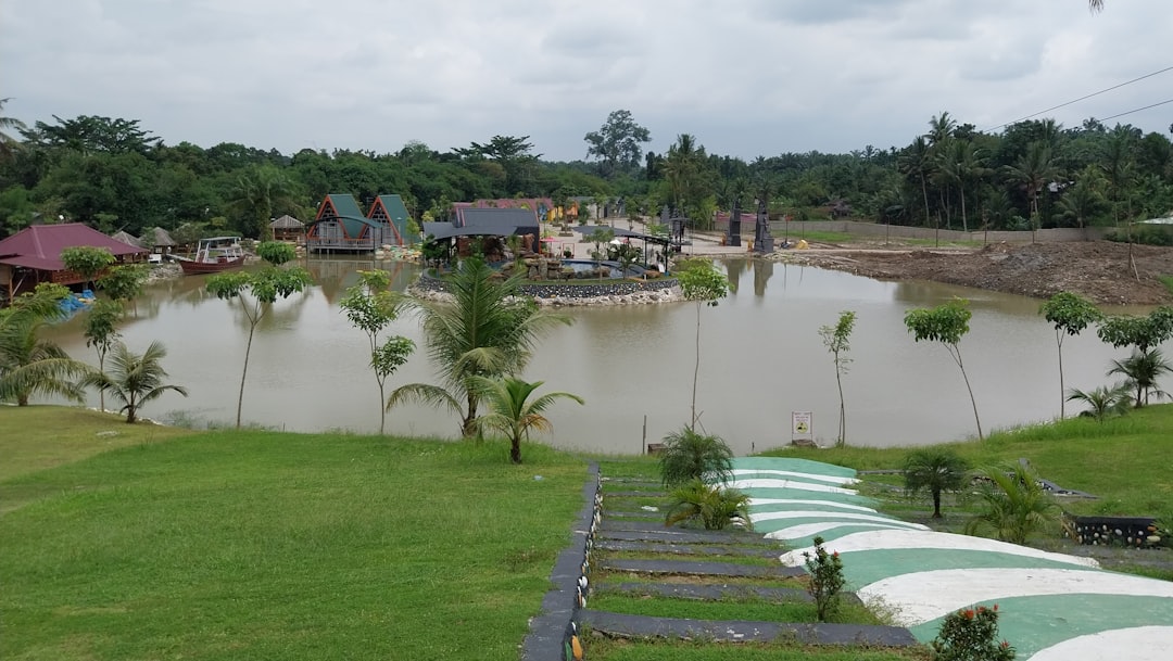
The Great Lakes region, encompassing parts of the United States and Canada, is a vast and diverse area characterized by its unique geography, rich natural resources, and vibrant communities. Comprising five lakes—Superior, Michigan, Huron, Erie, and Ontario—this region is not only the largest group of freshwater lakes in the world by total area but also serves as a crucial ecological and economic hub. The lakes are interconnected by rivers and straits, creating a complex hydrological system that supports a variety of ecosystems and wildlife.
The surrounding areas are home to millions of residents who rely on the lakes for drinking water, recreation, and economic activities such as fishing, shipping, and tourism. The Great Lakes region is also marked by its varied climate, which ranges from humid continental in the north to humid subtropical in the south. This climatic diversity contributes to the region’s rich biodiversity, with numerous species of plants and animals thriving in its forests, wetlands, and shorelines.
However, this ecological wealth is increasingly threatened by human activities and environmental changes. Urbanization, industrialization, and agricultural practices have all contributed to pollution and habitat loss, while climate change poses additional challenges that exacerbate existing vulnerabilities. Understanding the intricate balance of this region’s ecosystems is essential for effective flood risk management and long-term sustainability.
Key Takeaways
- The Great Lakes region is vulnerable to flooding due to its geography and climate.
- Climate change is increasing flood risk in the Great Lakes, leading to more frequent and severe flooding events.
- Infrastructure and flood management strategies are crucial for mitigating flood risk in the Great Lakes region.
- Government policies play a key role in managing flood risk and implementing effective flood management measures.
- Community engagement and preparedness are essential for reducing the impact of flooding in the Great Lakes region.
The Impact of Climate Change on Flood Risk
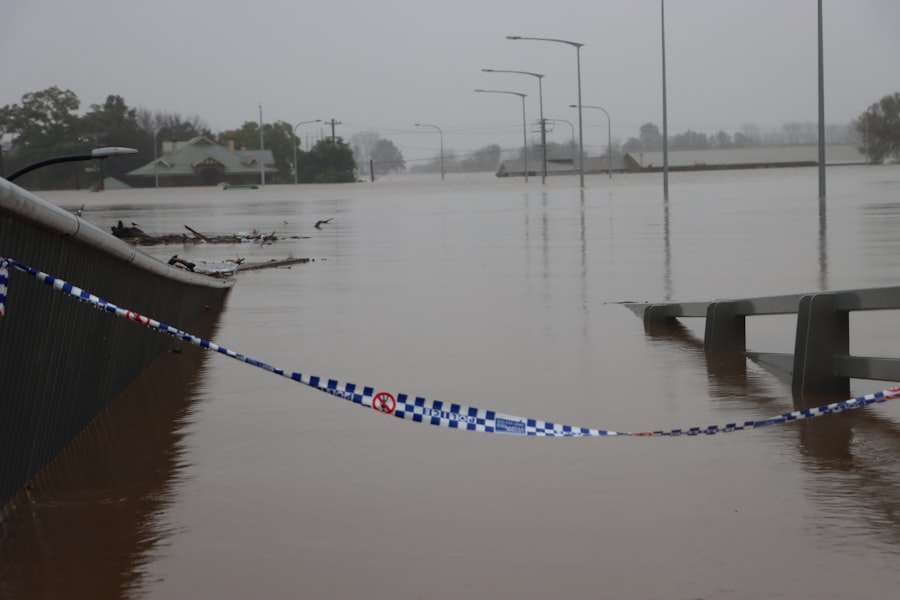
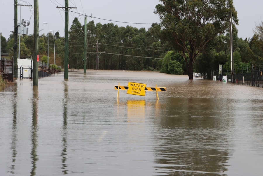
Climate change has emerged as a significant factor influencing flood risk in the Great Lakes region. Rising temperatures have led to altered precipitation patterns, resulting in more intense rainfall events and increased runoff into the lakes. This phenomenon not only raises water levels but also heightens the likelihood of flooding in adjacent communities.
The frequency and severity of extreme weather events have increased over recent decades, with heavy storms becoming more common. As a result, many areas that were once considered safe from flooding are now facing unprecedented risks. Moreover, the effects of climate change extend beyond immediate weather patterns.
Warmer temperatures can lead to earlier snowmelt in spring, contributing to higher water levels during a time when many communities are already vulnerable due to seasonal thawing. Additionally, changes in lake ice cover can affect water levels and flow patterns, further complicating flood management efforts. The interplay between these factors creates a complex landscape where traditional flood risk assessments may no longer suffice.
As climate change continues to evolve, it is imperative for stakeholders to adapt their strategies to address these emerging challenges effectively.
Infrastructure and Flood Management in the Great Lakes
Infrastructure plays a critical role in managing flood risk within the Great Lakes region. Dams, levees, and drainage systems are designed to control water flow and mitigate flooding impacts. However, many of these structures are aging and may not be equipped to handle the increased water levels associated with climate change.
In some cases, outdated infrastructure can exacerbate flooding rather than alleviate it. For instance, poorly maintained levees may fail during extreme weather events, leading to catastrophic consequences for nearby communities. Investment in modernizing infrastructure is essential for enhancing flood resilience.
This includes not only repairing existing structures but also implementing innovative designs that can adapt to changing conditions. Green infrastructure solutions, such as permeable pavements and rain gardens, can help absorb excess rainwater and reduce runoff into waterways. Additionally, improving stormwater management systems can alleviate pressure on traditional drainage systems during heavy rainfall events.
By prioritizing infrastructure upgrades that incorporate sustainability principles, communities can better prepare for future flooding challenges while also promoting environmental health.
The Role of Government and Policy in Flood Risk Management
| Government Role | Policy | Flood Risk Management |
|---|---|---|
| Regulation | Land-use planning | Floodplain zoning |
| Investment | Flood insurance | Infrastructure development |
| Emergency response | Disaster relief | Evacuation planning |
| Research | Climate change adaptation | Early warning systems |
Government agencies at various levels play a pivotal role in flood risk management within the Great Lakes region. Federal, state, and local governments collaborate to develop policies and regulations aimed at reducing vulnerability to flooding. These efforts often involve comprehensive planning processes that assess risks, identify vulnerable areas, and establish guidelines for land use and development.
Effective policy frameworks are essential for ensuring that communities are equipped to respond to flooding events while also promoting sustainable growth. In recent years, there has been a growing recognition of the need for integrated approaches to flood risk management that consider both environmental and social factors. Policymakers are increasingly focusing on community engagement and stakeholder participation in decision-making processes.
This collaborative approach helps ensure that policies reflect the needs and concerns of local residents while fostering a sense of ownership over flood preparedness initiatives. By prioritizing inclusive governance models, governments can enhance resilience against flooding while building stronger community ties.
Community Engagement and Flood Preparedness
Community engagement is a cornerstone of effective flood preparedness in the Great Lakes region. Local residents possess invaluable knowledge about their environment and can provide insights into historical flooding patterns and vulnerabilities. Engaging communities in flood risk assessments allows for a more comprehensive understanding of local conditions and helps identify specific needs for preparedness initiatives.
Workshops, public meetings, and outreach programs can facilitate dialogue between residents and decision-makers, fostering collaboration in developing flood management strategies. Moreover, community engagement extends beyond planning; it also involves empowering residents with the tools and resources necessary for effective preparedness. Educational programs that inform individuals about flood risks, emergency response protocols, and available resources can significantly enhance community resilience.
Initiatives such as neighborhood watch groups or local emergency response teams can further strengthen community ties while ensuring that residents are prepared to respond effectively during flooding events. By prioritizing community involvement in flood preparedness efforts, stakeholders can create a culture of resilience that benefits everyone.
The Importance of Ecosystems in Flood Mitigation
Ecosystems play a vital role in mitigating flood risks within the Great Lakes region. Wetlands, forests, and natural landscapes act as buffers against flooding by absorbing excess rainfall and reducing runoff into waterways. These ecosystems not only provide critical habitat for wildlife but also contribute to water quality improvement by filtering pollutants from stormwater.
Preserving and restoring natural habitats is essential for maintaining these ecological functions while enhancing overall resilience to flooding. In addition to their direct benefits for flood mitigation, healthy ecosystems also support community well-being by providing recreational opportunities and enhancing quality of life. Parks, green spaces, and waterfront areas contribute to mental health and social cohesion while serving as vital resources during emergencies.
Integrating ecosystem-based approaches into flood risk management strategies can yield multiple benefits—protecting both human communities and natural environments from the impacts of flooding.
The Economic Costs of Flood Damage in the Great Lakes
The economic costs associated with flood damage in the Great Lakes region are substantial and far-reaching. Flooding can lead to significant property damage, loss of infrastructure, and disruption of local economies. Businesses may face temporary closures or permanent losses due to flooding events, while homeowners may incur costly repairs or experience decreased property values.
The financial burden extends beyond immediate damages; recovery efforts often require substantial investments from both public agencies and private entities. Moreover, the economic implications of flooding are not limited to direct damages; they also encompass long-term consequences such as increased insurance premiums and reduced investment in vulnerable areas. Communities that experience repeated flooding may struggle to attract new businesses or residents due to perceived risks.
As climate change continues to exacerbate flooding events, it is crucial for stakeholders to consider the economic ramifications of inaction. Investing in proactive flood risk management strategies can ultimately save communities money while safeguarding their economic futures.
Innovative Technologies for Flood Monitoring and Prediction
Advancements in technology have revolutionized flood monitoring and prediction capabilities within the Great Lakes region. Remote sensing technologies, such as satellite imagery and aerial drones, enable real-time data collection on water levels, precipitation patterns, and land use changes. These tools provide valuable insights into emerging flood risks while enhancing situational awareness during extreme weather events.
Additionally, predictive modeling software allows stakeholders to simulate various scenarios based on historical data and current conditions. By analyzing potential outcomes under different circumstances—such as varying rainfall intensities or land use changes—decision-makers can develop more effective flood management strategies tailored to specific vulnerabilities. Integrating innovative technologies into flood risk assessments not only improves preparedness but also fosters collaboration among agencies by providing a shared platform for data analysis.
Cross-Border Collaboration in Managing Flood Risk
The Great Lakes region spans international borders between the United States and Canada, necessitating cross-border collaboration in managing flood risk effectively. Both countries share responsibility for protecting shared water resources while addressing common challenges posed by climate change and urban development. Collaborative efforts often involve joint research initiatives, data sharing agreements, and coordinated response plans during flooding events.
International agreements such as the Great Lakes Water Quality Agreement exemplify successful cross-border partnerships aimed at safeguarding water quality and ecosystem health across jurisdictions. These collaborative frameworks facilitate information exchange between governments while fostering public engagement initiatives that promote awareness of shared risks. By working together across borders, stakeholders can enhance resilience against flooding while ensuring sustainable management of the Great Lakes’ invaluable resources.
Balancing Development and Flood Risk in the Great Lakes
As communities within the Great Lakes region continue to grow and develop, balancing economic growth with flood risk management becomes increasingly challenging. Urbanization often leads to increased impervious surfaces that exacerbate runoff during heavy rainfall events. Striking a balance between development needs and environmental protection requires thoughtful planning that considers both immediate economic benefits and long-term sustainability.
Implementing smart growth principles can help guide development decisions that prioritize resilience against flooding while promoting economic vitality.
Engaging stakeholders—including developers, local governments, and residents—in discussions about land use planning fosters collaboration toward achieving shared goals of growth without compromising safety.
Long-Term Strategies for Resilience in the Face of Increasing Flood Risk
In light of escalating flood risks due to climate change, developing long-term strategies for resilience is paramount for communities within the Great Lakes region. These strategies should encompass a holistic approach that integrates infrastructure improvements, ecosystem restoration efforts, community engagement initiatives, and policy reforms aimed at reducing vulnerability over time. Investing in adaptive infrastructure—such as elevated roadways or flood-resistant buildings—can enhance community resilience while minimizing future damages from flooding events.
Additionally, prioritizing ecosystem restoration projects that enhance natural buffers against floods contributes to both environmental health and community well-being. By fostering collaboration among stakeholders at all levels—government agencies, community organizations, businesses—communities can build a comprehensive framework for resilience that addresses current challenges while preparing for future uncertainties. In conclusion, addressing flood risk within the Great Lakes region requires a multifaceted approach that considers environmental sustainability alongside economic development needs.
By understanding the complexities of this unique area—its ecosystems, communities, infrastructure—and leveraging innovative technologies alongside collaborative governance models, stakeholders can work together toward building resilient futures capable of withstanding increasing challenges posed by climate change.
Effective flood risk management in the Great Lakes region is crucial for protecting communities and ecosystems. A related article that delves into innovative strategies and approaches for managing these risks can be found at com/’>My GeoQuest.
This resource provides valuable insights into the challenges posed by climate change and the importance of sustainable practices in mitigating flood impacts.
WATCH THIS! The Great Lakes Are Dying: The $6 Trillion Lie That’s Killing America’s Water
FAQs
What are the Great Lakes?
The Great Lakes are a group of five interconnected freshwater lakes located in North America. They include Lake Superior, Lake Michigan, Lake Huron, Lake Erie, and Lake Ontario.
What is flood risk management?
Flood risk management involves the planning, coordination, and implementation of measures to reduce the risk of flooding and its impacts on communities and infrastructure.
Why is flood risk management important for the Great Lakes?
The Great Lakes region is prone to flooding due to factors such as heavy rainfall, snowmelt, and storm surges. Flood risk management is crucial for protecting the communities, ecosystems, and infrastructure around the Great Lakes from the impacts of flooding.
What are some flood risk management measures used in the Great Lakes region?
Some flood risk management measures used in the Great Lakes region include the construction of levees and floodwalls, the implementation of stormwater management systems, the restoration of wetlands and natural floodplains, and the development of flood forecasting and warning systems.
Who is responsible for flood risk management in the Great Lakes region?
Flood risk management in the Great Lakes region is a collaborative effort involving various federal, state, and local agencies, as well as tribal governments, non-profit organizations, and private sector partners.
How does climate change impact flood risk management in the Great Lakes region?
Climate change is expected to increase the frequency and intensity of precipitation events in the Great Lakes region, leading to a higher risk of flooding. This requires adaptation and resilience measures to be integrated into flood risk management strategies.