
Geotechnical surveys are a fundamental pillar upon which successful underground construction rests. Just as a ship needs a detailed chart and knowledge of the currents to navigate treacherous waters, so too do underground construction projects require a thorough understanding of the earth’s subsurface conditions to avoid costly errors and ensure safety. These surveys, often referred to as geotechnical investigations or site investigations, are not merely a formality but a critical precursor to any excavation, tunneling, or foundation work beneath the surface. They provide the essential data that informs design, planning, and execution, acting as the unseen guardian of these complex endeavors.
Geotechnical surveys are systematic investigations designed to gather information about the physical properties of the earth’s surface and subsurface. This encompasses the soil, rock, and groundwater conditions that will be encountered during construction. The primary objective is to identify potential hazards, assess the suitability of the ground for the proposed construction, and provide data necessary for the design of foundations, retaining structures, tunnels, and other underground elements. Without this diligent exploration, a construction project is akin to building a skyscraper on sand without checking its stability; the risks are immense and the potential for catastrophic failure is high.
The Purpose and Importance of Geotechnical Investigations
The purpose of a geotechnical survey extends far beyond simply identifying different soil types. It delves into crucial aspects like:
- Strength and Compressibility: How much load can the ground bear before deforming or failing? Understanding this is paramount for designing stable foundations and preventing settlement.
- Permeability and Drainage: How easily does water flow through the ground? This influences dewatering strategies, the risk of groundwater ingress, and the stability of excavations.
- Seismic Activity: Is the site prone to earthquakes? Geotechnical data informs seismic design requirements to ensure structures can withstand ground motion.
- Presence of Contaminants: Are there any hazardous materials in the ground that need special handling and disposal?
- Variability of Ground Conditions: The subsurface is rarely uniform. Geotechnical surveys map out these variations, revealing pockets of weak soil or hard rock that can significantly impact construction methods and costs.
The importance of these investigations cannot be overstated. They are the bedrock of informed decision-making, directly influencing:
- Project Feasibility: Identifying insurmountable geological challenges early on might prevent a project from proceeding, saving significant resources.
- Economic Viability: Accurate geotechnical data allows for precise material estimations, more efficient construction methods, and avoidance of unforeseen costs associated with ground conditions.
- Safety and Risk Management: Understanding potential hazards like landslides, subsidence, or groundwater inundation is crucial for implementing appropriate safety measures and mitigating risks for workers and the public.
- Design Optimization: The depth and type of foundations, the need for shoring or bracing, and the selection of tunneling techniques are all dictated by geotechnical findings.
The Stages of a Geotechnical Survey
A comprehensive geotechnical survey typically involves several distinct stages, each building upon the information gathered in the previous one.
Desk Study and Preliminary Investigation
This initial phase involves gathering existing information about the site. It’s like a detective gathering witness testimonies and initial clues before venturing out to the crime scene. This includes reviewing:
- Geological Maps and Reports: Understanding the broader geological history and rock formations of the region.
- Topographical Maps: Identifying existing ground contours and features.
- Aerial Photographs and Satellite Imagery: Detecting anomalies or patterns on the surface that might indicate subsurface conditions.
- Previous Site Investigations: If available, data from nearby sites can provide valuable insights.
- Hydrological Data: Information on surface water bodies, groundwater levels, and drainage patterns.
This desk study helps to refine the scope of subsequent fieldwork, focusing the investigation on the most probable areas of concern.
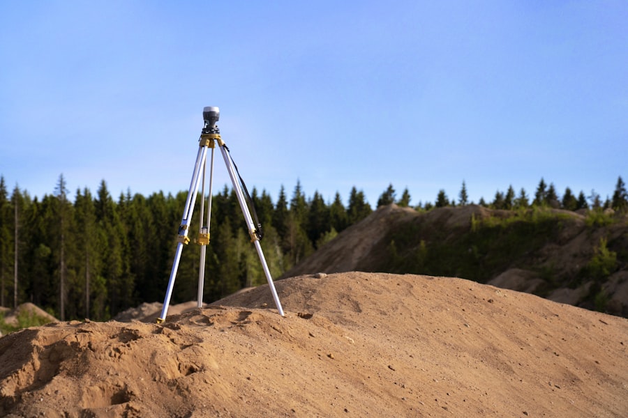
Site Reconnaissance and Visual Inspection
This phase involves a direct, on-site examination of the ground conditions. Geotechnical engineers visit the site to observe:
- Surface Geology: Visible rock outcrops, soil exposures, and evidence of erosion or previous land movements.
- Existing Structures: Assessing the condition of any nearby structures and their foundations for clues about ground behavior.
- Vegetation: The type and health of vegetation can sometimes indicate soil conditions or groundwater presence.
- Water Bodies: Observing rivers, lakes, or wetlands and their proximity to the proposed construction.
This visual inspection provides a qualitative understanding of the site, complementing the quantitative data that will be gathered later.
Geotechnical surveys play a crucial role in underground construction, providing essential data about soil properties and stability. For a deeper understanding of the methodologies and technologies involved in these surveys, you can refer to a related article that discusses various techniques and their applications in the field. This informative resource can be found at My GeoQuest, where you will discover valuable insights into the importance of geotechnical investigations for successful underground projects.
Methods and Techniques: Unearthing Subsurface Secrets
The heart of a geotechnical survey lies in the various methods and techniques employed to physically investigate the subsurface. These range from simple, non-invasive approaches to more intrusive drilling and sampling procedures. The selection of these methods is guided by the project’s scale, complexity, anticipated ground conditions, and budget. Each technique acts as a different tool in the geotechnical engineer’s toolkit, allowing them to probe the earth’s depths with increasing precision.
In-Situ Testing: Direct Measurement of Ground Properties
In-situ testing refers to methods that measure the properties of soil and rock directly in their natural environment without extracting samples. These tests are invaluable for obtaining real-time data on the behavior of the ground under load.
Standard Penetration Test (SPT)
The SPT is a widely used and relatively simple field test. A standardized split-spoon sampler is driven into the ground at the bottom of a borehole using a hammer of a specific weight and fall. The number of blows required to drive the sampler a specific distance (usually 150 mm after an initial seating drive) is recorded. This “N-value” provides an indication of the soil’s relative density and consistency, as well as its shear strength. While its accuracy can be debated for certain soil types, its widespread use and established correlations make it a fundamental investigative tool.
Cone Penetration Test (CPT)
The CPT is a more advanced and continuous testing method. A cone-shaped probe is pushed into the ground at a constant rate. Sensors on the cone measure the resistance to penetration (tip resistance) and the friction along the cone’s shaft (sleeve friction). These measurements can be correlated with various soil properties, including strength, density, and stratigraphy. The CPT is particularly useful for soft soils and for detecting thin layers. Modern CPT equipment can also be equipped with additional sensors to measure pore water pressure (CPTU) or seismic wave velocities (SCPT), providing even richer datasets.
Vane Shear Test (VST)
The VST is used primarily to determine the undrained shear strength of soft, cohesive soils such as clay and silt. A cross-shaped vane is inserted into the soil and rotated. The torque required to shear the soil is measured, which is then directly related to the undrained shear strength. This is a crucial parameter for assessing the stability of slopes and excavations in these types of soils.
Pressuremeter Test (PMT)
The PMT involves inserting a cylindrical probe with a flexible membrane into a pre-drilled borehole. The membrane is then inflated, applying pressure to the surrounding soil or rock. The resulting expansion of the borehole is measured. This test provides information about the stress-strain behavior and strength of the soil or rock, yielding parameters like the limit pressure and the modulus of deformation.
Laboratory Testing: Analyzing Extracted Samples
While in-situ tests offer direct measurements, laboratory testing provides more precise characterization of soil and rock samples extracted from the site. The samples serve as small ambassadors from the subsurface, revealing their secrets under controlled conditions.
Soil Classification and Index Properties
Collected soil samples are subjected to tests to determine their:
- Grain Size Distribution (Sieve Analysis and Hydrometer Analysis): This identifies the proportions of gravel, sand, silt, and clay, which is fundamental to understanding soil behavior.
- Atterberg Limits (Liquid Limit, Plastic Limit, Shrinkage Limit): These tests characterize the plasticity of fine-grained soils, influencing their behavior when wet or dry.
- Moisture Content: The amount of water present in the soil, which significantly affects its strength and compressibility.
- Unit Weight: The weight of the soil per unit volume, an important factor in load calculations.
These tests allow for the classification of soils according to established systems (e.g., Unified Soil Classification System – USCS, AASHTO classification), providing a standardized way to describe and compare different soil types.
Strength and Deformation Tests
These tests are critical for determining how the soil will behave under load:
- Unconfined Compressive Strength (UCS) Test: For cohesive soils, this measures the maximum compressive stress the soil can withstand before failure without any lateral support.
- Triaxial Compression Test: This is a more comprehensive test that measures the strength of soil under various confining pressures, simulating different stress conditions in the ground. It provides valuable parameters like the angle of internal friction and cohesion.
- Consolidation Test: This test assesses the compressibility of fine-grained soils. It measures how much a soil sample will settle under a given load over time due to the expulsion of pore water. This is vital for predicting long-term settlement of structures.
- Direct Shear Test: This test measures the shear strength of soil by applying a shear force to a soil sample. It is often used for granular soils.
Rock Mechanics Testing
For projects involving rock excavation or tunneling, tests on rock samples are essential:
- Unconfined Compressive Strength (UCS) of Rock: Similar to soil, this determines the strength of intact rock specimens.
- Point Load Index Test: A simple and rapid test to estimate the compressive strength of rock.
- Brazilian Tensile Strength Test: Measures the tensile strength of rock.
- Triaxial Compression Test on Rock: Provides detailed information on the rock mass’s strength and deformation characteristics under various stress states.
- Slake Durability Test: Assesses the resistance of some rock types (like shales) to degradation when exposed to wetting and drying cycles.
Geophysical Methods: Non-Intrusive Exploration
Geophysical methods allow for the investigation of subsurface conditions without the need for extensive drilling or excavation. They are like using radar or sonar to peer beneath the surface. These methods are often used in conjunction with intrusive techniques to provide a broader understanding of the site.
Seismic Refraction and Reflection
These methods measure the travel times of seismic waves (generated by a source on the surface, like a hammer blow or small explosive charge) as they travel through the ground. Different materials have different seismic velocities, allowing geophysicists to map out layers of soil and rock and identify changes in stiffness. Reflection methods are particularly useful for identifying subsurface structures and anomalies.
Electrical Resistivity
This technique measures the electrical resistance of the ground. Different materials have different electrical properties. For example, saturated soils and clay generally have lower resistivity than dry sands and gravels. This method can be used to delineate groundwater tables and identify variations in soil composition.
Ground Penetrating Radar (GPR)
GPR uses electromagnetic waves to create a profile of the subsurface. It is most effective in shallow investigations and can detect buried utilities, rebar in concrete, and changes in soil layering. However, its penetration depth is limited and is significantly affected by soil moisture content and conductivity.
Interpreting the Data: Translating Subsurface Findings into Actionable Insights
The collection of raw data from geotechnical surveys is only half the battle. The true value lies in the interpretation and analysis of this information by experienced geotechnical engineers. They act as translators, converting geological jargon and numerical values into practical advice that guides construction decisions. This analytical phase is where the abstract becomes concrete, informing the tangible reality of the construction site.
Geotechnical Reporting: The Blueprint for Construction
The findings of a geotechnical survey are compiled into a comprehensive report. This document is the cornerstone of the design process and a vital reference throughout construction. A typical geotechnical report will include:
- Introduction and Site Description: Details about the project and the investigated site.
- Scope of Investigation: A description of the methods and techniques used.
- General Geology and Hydrogeology: An overview of the regional and local geological and hydrological conditions.
- Subsurface Soil and Rock Stratigraphy: Detailed descriptions of the different layers encountered, their characteristics, and thicknesses.
- Groundwater Conditions: Information on groundwater levels, fluctuations, and potential for seepage.
- Laboratory and In-Situ Test Results: Presentation of all test data and their interpretation.
- Engineering Properties of Soil and Rock: Derived properties such as shear strength, compressibility, permeability, and bearing capacity.
- Engineering Recommendations: Crucial advice for the design and construction phases.
Engineering Recommendations: Guiding Design and Construction
The engineering recommendations section is arguably the most critical part of the geotechnical report. It translates the factual data into practical guidance for engineers and contractors. These recommendations can include:
- Foundation Design: Specific advice on the type, depth, and dimensions of foundations required to support the proposed structures. This might include recommendations for shallow foundations (spread footings, mat foundations) or deep foundations (piles, caissons).
- Earth Retaining Structures: Guidance on the design of retaining walls, sheet piling, or other structures needed to support excavations.
- Slope Stability Analysis: Assessment of the stability of natural or excavated slopes and recommendations for stabilization measures if required.
- Excavation and Dewatering: Advice on safe excavation practices, shoring requirements, and strategies for managing groundwater.
- Tunneling and Underground Space Design: Specific considerations for tunnel lining, support systems, excavation methods, and potential ground settlement.
- Pavement Design: For any surface pavements, recommendations on subgrade preparation and material selection.
- Earthworks and Compaction: Guidance on the suitability of on-site materials for fill and compaction requirements.
- Seismic Design Considerations: Recommendations for seismic design parameters based on site-specific seismic hazard.
- Environmental Considerations: Identification of any potentially hazardous materials requiring special handling and disposal.
The recommendations are often accompanied by specific design parameters and acceptable stress/strain values, directly informing the structural engineers and contractors responsible for implementing the project.
Addressing Geological Hazards: Proactive Risk Mitigation
Geotechnical surveys play a crucial role in identifying and mitigating potential geological hazards that could impact underground construction. These hazards, if not properly addressed, can lead to significant delays, cost overruns, and even catastrophic failures.
Landslides and Slope Instability
Investigations are vital for understanding the stability of natural or man-made slopes, particularly in areas prone to rainfall or seismic activity. Geotechnical engineers assess factors like soil shear strength, slope geometry, and groundwater conditions to predict potential landslide zones. Recommendations might include regrading slopes, installing retaining structures, or implementing drainage systems.
Subsidence and Ground Collapse
Certain soil types, like karstic limestone or collapsible soils, are susceptible to subsidence. Geotechnical surveys help identify these formations and assess the risk of ground collapse, especially when subjected to changes in groundwater levels or excavation loads. Grouting or the use of robust foundation systems might be recommended.
Groundwater Challenges
High groundwater tables or the presence of artesian conditions can pose significant challenges for underground construction. Surveys characterize groundwater flow patterns, predict its impact on excavation stability, and inform the design of effective dewatering systems or waterproof structures.
Rockfall and Tunnel Stability
For tunneling and underground excavation in rock, geotechnical surveys assess rock mass quality, identify discontinuities (faults, joints), and evaluate the risk of rockfall or tunnel collapse. This data is crucial for determining the appropriate excavation method and the type and extent of rock support required.
The Role of Geotechnical Engineers: Navigators of the Subsurface Realm

Geotechnical engineers are the skilled navigators who chart the course through the complex and often unpredictable subsurface. Their expertise is indispensable, transforming raw geological data into the practical blueprints that underpin safe and efficient underground construction. They are the silent guardians overseeing the hidden world beneath our feet.
Expertise in Data Analysis and Interpretation
The core competency of a geotechnical engineer lies in their ability to analyze and interpret the vast amounts of data generated by surveys. This requires a deep understanding of soil and rock mechanics, geology, hydrogeology, and engineering principles. They can discern subtle clues from test results, correlate findings from different methods, and develop a coherent picture of the subsurface environment. This analytical prowess is akin to a master diagnostician interpreting a complex set of medical tests to understand a patient’s condition.
Developing Appropriate Construction Solutions
Armed with their interpretations, geotechnical engineers engineer solutions. They don’t just identify problems; they propose practical and cost-effective methods to overcome them. This involves selecting appropriate foundation types, designing retaining walls, specifying excavation support systems, and recommending construction sequences. Their recommendations are a direct response to the earth’s challenges, tailored to the specific demands of the project.
Collaboration with Other Disciplines
Geotechnical engineers rarely work in isolation. They are integral members of the broader design and construction team, collaborating closely with civil engineers, structural engineers, architects, and construction managers. Effective communication and collaboration are vital to ensure that geotechnical constraints and recommendations are fully integrated into the overall project plan. This interdisciplinary teamwork ensures that the entire project moves forward in harmony, with the subsurface conditions considered at every stage.
Continuous Learning and Advancements
The field of geotechnical engineering is constantly evolving with new research, technologies, and construction techniques. Geotechnical engineers are committed to continuous learning, staying abreast of the latest advancements in site investigation methods, laboratory testing, analytical modeling, and software applications. This ensures that they are equipped with the most effective tools and knowledge to tackle the challenges of modern underground construction.
Geotechnical surveys play a crucial role in underground construction projects, providing essential data about soil and rock properties that inform design and safety measures. For those interested in exploring this topic further, a related article can be found at MyGeoQuest, which delves into the methodologies and technologies used in geotechnical investigations. Understanding these surveys is vital for engineers and developers to ensure the stability and success of their projects.
The Economic and Safety Imperative: Why Geotechnical Surveys are Non-Negotiable
| Metric | Description | Typical Value/Range | Unit | Importance |
|---|---|---|---|---|
| Borehole Depth | Depth to which soil or rock samples are collected | 10 – 50 | meters | High |
| Standard Penetration Test (SPT) N-Value | Number of blows required to drive a sampler 30 cm into soil | 5 – 50 | blows/30cm | High |
| Soil Cohesion (c) | Shear strength parameter of soil without normal stress | 0 – 100 | kPa | High |
| Soil Friction Angle (φ) | Angle of internal friction of soil | 20 – 45 | degrees | High |
| Groundwater Table Depth | Depth from surface to groundwater level | 1 – 20 | meters | Medium |
| Soil Permeability | Rate at which water can flow through soil | 10^-6 to 10^-2 | cm/sec | Medium |
| Rock Quality Designation (RQD) | Percentage of intact core pieces longer than 10 cm | 0 – 100 | % | High |
| Unconfined Compressive Strength (UCS) | Maximum axial compressive stress that a rock sample can withstand | 1 – 250 | MPa | High |
| Seismic Velocity (Vp) | Velocity of primary waves through soil or rock | 200 – 6000 | m/s | Medium |
| Soil Density | Mass per unit volume of soil | 1.5 – 2.2 | g/cm³ | Medium |
Investing in thorough geotechnical surveys is not an optional expense; it is a fundamental necessity that safeguards both the financial viability and the safety of underground construction projects. Ignoring this crucial step is akin to buying a lottery ticket with your project’s future – the odds are stacked against success.
Minimizing Unforeseen Costs and Delays
The most compelling economic argument for geotechnical surveys is their ability to prevent costly surprises. Underground conditions are rarely as straightforward as they appear on the surface. Encountering unexpected soft ground, large boulders, high groundwater, or buried obstructions during excavation can lead to significant delays, require costly design changes, and necessitate the use of specialized and expensive equipment. A well-executed geotechnical investigation acts as a proactive risk management tool, identifying these potential pitfalls in advance, allowing for appropriate planning and budgeting. This early identification saves money that would otherwise be spent on reactive problem-solving.
Ensuring Structural Integrity and Longevity
The performance and lifespan of any underground structure, whether it be a tunnel, a deep foundation, or an underground utility, are directly dependent on the ground it is built upon. Geotechnical surveys provide the essential data to ensure that the ground can adequately support the intended loads without excessive settlement or failure. This translates into structures that are safe, stable, and durable, minimizing the need for future repairs or remediation. A sound foundation, informed by geotechnical data, is the silent promise of longevity.
Safeguarding Human Lives
The safety aspect of geotechnical investigations is paramount. Underground construction inherently involves significant risks due to the confined spaces, potential for ground movement, and the presence of hazards like methane gas or water ingress. Thorough geotechnical surveys help to identify these risks, enabling the implementation of appropriate safety measures, such as:
- Proper shoring and bracing techniques to prevent collapses.
- Effective dewatering systems to manage groundwater.
- Ventilation strategies to mitigate gas hazards.
- Emergency response plans informed by potential ground failure scenarios.
By understanding and anticipating the subsurface conditions, geotechnical engineers contribute directly to creating a safer working environment for construction personnel and a safer outcome for the public. The absence of a proper geotechnical assessment is a gamble with human lives.
Conclusion
Geotechnical surveys are the unsung heroes of underground construction. They are the meticulous explorers who delve into the earth’s hidden complexities, providing the vital knowledge that underpins successful project delivery. From the initial desk study to the final engineering recommendations, each step of a geotechnical investigation is designed to illuminate the subsurface, revealing its strengths, weaknesses, and potential challenges. By embracing the insights offered by these surveys, engineers and contractors can build with confidence, minimizing risks, optimizing designs, and ultimately delivering structures that are safe, durable, and economically sound. In the realm of underground construction, a robust geotechnical survey is not just a preliminary step; it is the bedrock upon which all subsequent success is built.
FAQs
What is a geotechnical survey in underground construction?
A geotechnical survey is an investigation conducted to assess the physical properties of soil, rock, and groundwater at a construction site. It helps engineers understand the subsurface conditions to design safe and effective underground structures.
Why are geotechnical surveys important for underground construction projects?
Geotechnical surveys provide critical information about soil stability, load-bearing capacity, and potential hazards such as groundwater or soil contamination. This data is essential to prevent structural failures, optimize design, and ensure the safety of underground construction.
What methods are commonly used in geotechnical surveys?
Common methods include drilling boreholes, soil sampling, standard penetration tests (SPT), cone penetration tests (CPT), geophysical surveys, and laboratory testing of soil and rock samples to determine their properties.
At what stage of an underground construction project is a geotechnical survey conducted?
Geotechnical surveys are typically conducted during the planning and design phase before construction begins. Early investigation allows engineers to incorporate findings into the design and address any potential issues proactively.
How does groundwater affect underground construction and how is it assessed?
Groundwater can impact the stability and safety of underground structures by causing soil erosion, increasing pressure on walls, or leading to flooding. Geotechnical surveys assess groundwater levels and flow through monitoring wells and hydrogeological studies to inform appropriate design and drainage solutions.