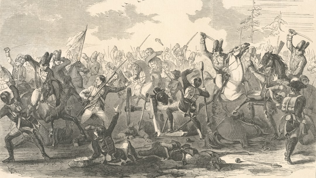
The Battle of Vicksburg, fought from May 18 to July 4, 1863, stands as one of the pivotal moments in the American Civil War. This confrontation was not merely a clash of arms but a strategic contest that would determine control over the Mississippi River, a vital artery for transportation and supply. The Union, under the command of General Ulysses S.
Grant, sought to capture this fortified city, which was held by Confederate forces led by Lieutenant General John Pemberton. The outcome of this battle would not only influence the course of the war but also reshape the political landscape of the nation. Vicksburg’s significance extended beyond its military value; it was a symbol of Southern resilience and determination.
The city’s strategic location on a high bluff overlooking the Mississippi River made it a formidable stronghold. The Union’s success in capturing Vicksburg would effectively split the Confederacy in two, severing supply lines and communication routes. As such, the battle was not just about territory; it was about the very survival of the Confederate cause.
The stakes were high, and both sides understood that the outcome would have lasting repercussions.
Key Takeaways
- The Battle of Vicksburg was a pivotal event in the American Civil War, with its outcome significantly impacting the course of the conflict.
- Vicksburg’s topography and geography, including its location on the Mississippi River, played a crucial role in shaping the military strategy and outcome of the battle.
- The control of the Mississippi River was of immense strategic importance in the Civil War, and Vicksburg’s position as a key stronghold made it a highly contested target for both the Union and Confederate forces.
- The geography of Vicksburg, including its high bluffs and surrounding waterways, presented significant challenges and opportunities for military operations during the campaign and siege.
- The environmental factors, such as the hot and humid climate, disease, and scarcity of resources, had a profound impact on the soldiers and civilians involved in the Vicksburg Campaign.
Topography and Geography of Vicksburg
The topography of Vicksburg played a crucial role in shaping the events of the battle. Nestled on a series of steep hills along the eastern bank of the Mississippi River, Vicksburg was naturally fortified. The city’s elevation provided an advantageous position for artillery placements, allowing Confederate forces to dominate the river and its approaches.
The bluffs surrounding Vicksburg created a natural barrier that made direct assaults challenging for Union troops, who had to contend with both the terrain and well-prepared defenders. In addition to its elevation, Vicksburg was surrounded by a network of creeks and ravines that further complicated military maneuvers. These geographical features not only provided cover for Confederate troops but also hindered Union advances.
The dense vegetation and rugged landscape made it difficult for soldiers to navigate, often leading to confusion and disarray during engagements. Understanding these topographical elements was essential for both sides as they devised their strategies for the campaign.
Importance of the Mississippi River in the Civil War
The Mississippi River was often referred to as the “lifeblood” of the Confederacy, serving as a critical transportation route for troops, supplies, and trade. Control over this waterway was essential for both sides during the Civil War, as it facilitated movement across vast distances and connected various regions of the country. For the Union, capturing the Mississippi meant cutting off Confederate access to resources and isolating states west of the river from those in the east.
The significance of the river extended beyond mere logistics; it was also a symbol of economic power. The Confederacy relied heavily on river transport for cotton exports and other goods vital to its economy. By gaining control of the Mississippi River through victories like that at Vicksburg, the Union aimed to cripple Southern trade and diminish its ability to sustain the war effort.
Thus, the battle for Vicksburg was not just a military engagement; it was a strategic maneuver in a larger campaign to secure dominance over this crucial waterway.
Impact of Vicksburg’s Geography on Military Strategy
| Geographical Factor | Impact on Military Strategy |
|---|---|
| Location on the Mississippi River | Control of Vicksburg would provide a strategic advantage in controlling the river and cutting off Confederate supply lines. |
| Bluffs and River Bend | Provided natural defenses, making it difficult for Union forces to attack Vicksburg directly. |
| Surrounding Swamps and Marshes | Made it challenging for troops to maneuver and launch effective attacks, adding to the defensive advantage of Vicksburg. |
| Strategic Location between the North and South | Control of Vicksburg was crucial for both Union and Confederate forces to maintain communication and supply lines. |
The geography surrounding Vicksburg significantly influenced military strategy for both Union and Confederate forces. For General Grant, understanding the terrain was paramount in planning his approach to besiege the city. He had to consider not only how to navigate the challenging landscape but also how to effectively position his troops to counteract Confederate defenses.
The natural barriers created by hills and ravines necessitated innovative tactics, including flanking maneuvers and siege warfare.
The city’s elevated position allowed him to establish artillery placements that could cover key approaches and deter Union advances.
Pemberton’s strategy relied heavily on utilizing the natural landscape to create strong defensive positions while also maintaining supply lines from other Confederate territories. The interplay between geography and military strategy became a defining characteristic of the Vicksburg Campaign.
Union and Confederate Positions in the Vicksburg Campaign
As the Vicksburg Campaign unfolded, both Union and Confederate forces established their positions with careful consideration of geography. The Union Army, numbering around 77,000 troops, encircled Vicksburg from multiple directions, seeking to cut off supplies and reinforcements while preparing for a prolonged siege.
Conversely, Confederate forces were entrenched within Vicksburg’s defenses, numbering approximately 33,000 soldiers. Pemberton’s position was precarious; while he had the advantage of fortified positions within the city, he faced significant challenges due to dwindling supplies and increasing pressure from Union forces. The geography of Vicksburg allowed Pemberton to hold out for an extended period, but as time passed and resources became scarce, his ability to maintain a defensive posture weakened.
Role of Vicksburg’s Geography in the Siege
The geography surrounding Vicksburg played an instrumental role in shaping the dynamics of the siege itself. As Grant initiated his siege tactics in late May 1863, he faced numerous challenges posed by the city’s natural defenses. The steep bluffs provided an excellent vantage point for Confederate artillery, making it difficult for Union forces to approach without suffering heavy casualties.
Grant’s troops had to dig trenches and establish siege works while navigating these obstacles, demonstrating their adaptability in response to geographic challenges. Moreover, Vicksburg’s location along the Mississippi River added another layer of complexity to the siege. The river served as both a lifeline for Confederate resupply efforts and a barrier that Grant had to consider in his planning.
As Union forces tightened their grip around Vicksburg, they sought to control river access points to prevent any potential reinforcements from reaching Pemberton’s beleaguered troops. This strategic maneuvering underscored how geography dictated military operations during this critical phase of the campaign.
Key Geographic Features in the Battle of Vicksburg
Several key geographic features played pivotal roles during the Battle of Vicksburg, influencing both strategy and outcomes. One such feature was Walnut Hill, which provided an elevated position for Union artillery that could target Confederate positions within the city. This hill became a focal point for Union attacks as they sought to gain control over vantage points that would allow them to bombard Vicksburg effectively.
Another significant feature was Graveyard Road, which served as a critical supply route for both sides during the campaign. Control over this road allowed Grant’s forces to move troops and supplies efficiently while simultaneously denying Pemberton access to reinforcements and resources from outside Vicksburg. The interplay between these geographic features and military strategy underscored how terrain could dictate operational success or failure in warfare.
Environmental Factors in the Vicksburg Campaign
Environmental factors also played a crucial role in shaping the course of the Vicksburg Campaign. The summer heat in Mississippi posed significant challenges for both Union and Confederate soldiers as they endured sweltering temperatures while engaged in combat operations. Dehydration and heat-related illnesses became common issues that affected troop morale and combat effectiveness.
Additionally, rainstorms frequently disrupted military movements during this period, turning roads into muddy quagmires that hindered troop movements and logistics. These environmental conditions forced commanders on both sides to adapt their strategies continually, often leading to delays in planned assaults or resupply efforts. The harsh realities of weather conditions highlighted how environmental factors could influence military outcomes in ways that extended beyond mere tactics.
Aftermath of the Battle: Geopolitical and Economic Implications
The aftermath of the Battle of Vicksburg had profound geopolitical and economic implications for both the Union and Confederacy. With Grant’s victory on July 4, 1863, control over the Mississippi River shifted decisively into Union hands, effectively splitting the Confederacy into two distinct regions. This division hampered communication and resource sharing between Southern states, weakening their overall war effort.
Economically, losing access to this vital waterway dealt a significant blow to Southern trade routes that relied on river transport for cotton exports and other goods. The blockade imposed by Union naval forces further exacerbated these challenges, leading to shortages of essential supplies within Confederate territories. The consequences of this battle reverberated throughout the South, contributing to declining morale among troops and civilians alike as they faced increasing hardships.
Vicksburg’s Geography in Modern Context
In modern times, Vicksburg remains a site of historical significance that continues to draw attention from scholars and tourists alike. The geographic features that once shaped military strategies during the Civil War are now preserved within national parks and historical sites that commemorate this pivotal battle. Visitors can explore remnants of fortifications and trenches that tell stories of resilience and sacrifice.
Moreover, understanding Vicksburg’s geography offers valuable lessons for contemporary military strategists who study historical battles for insights into terrain analysis and operational planning. The interplay between geography and military strategy remains relevant today as modern conflicts continue to unfold across diverse landscapes worldwide.
Lessons from the Geographical Analysis of Vicksburg Battle
The Battle of Vicksburg serves as a compelling case study in how geography can shape military outcomes in warfare. From its elevated bluffs overlooking the Mississippi River to its intricate network of creeks and ravines, Vicksburg’s topography influenced every aspect of military strategy during this critical campaign. Both Union and Confederate commanders had to navigate these geographical challenges while adapting their tactics accordingly.
Ultimately, Vicksburg’s capture marked a turning point in the Civil War that underscored not only the importance of strategic planning but also how environmental factors can impact human endeavors on a grand scale. As historians continue to analyze this battle through various lenses—military strategy, geography, economics—the lessons learned from Vicksburg remain relevant today, reminding us that understanding our environment is crucial in any endeavor we undertake.
In exploring the geographical intricacies of the Battle of Vicksburg, one can gain a deeper understanding of how terrain and location played pivotal roles in the outcome of this significant Civil War confrontation. The strategic positioning along the Mississippi River provided the Union forces with a crucial advantage, effectively splitting the Confederacy and controlling a vital supply route. For those interested in a more detailed geographical analysis of historical battles, an insightful article can be found on MyGeoQuest. This article delves into various aspects of geographical strategy and its impact on historical events. You can read more about it by visiting this page.
WATCH THIS! The Hidden Reason No One Can Invade America | A Geographical Analysis
FAQs
What was the significance of the Battle of Vicksburg?
The Battle of Vicksburg was a crucial turning point in the American Civil War, as it gave the Union control of the Mississippi River and split the Confederacy in two.
Where did the Battle of Vicksburg take place?
The Battle of Vicksburg took place in and around the city of Vicksburg, Mississippi, from May 18 to July 4, 1863.
What geographical features played a role in the Battle of Vicksburg?
The city of Vicksburg is situated on a high bluff overlooking the Mississippi River, making it a strategic stronghold. The surrounding terrain also included swamps, bayous, and rugged hills, which presented significant challenges for both Union and Confederate forces.
How did the geography of Vicksburg impact the outcome of the battle?
The rugged terrain and natural defenses of Vicksburg made it difficult for Union forces to capture the city. The Confederates were able to use the geography to their advantage, making it a formidable stronghold.
What were the key military strategies employed during the Battle of Vicksburg?
Union General Ulysses S. Grant utilized a combination of naval and land forces to lay siege to Vicksburg, cutting off its supply lines and bombarding the city from both the river and the surrounding high ground.
What was the ultimate outcome of the Battle of Vicksburg?
After a 47-day siege, Confederate General John C. Pemberton surrendered Vicksburg to Union forces on July 4, 1863. This victory gave the Union control of the Mississippi River and was a major turning point in the Civil War.