The Mississippi River, a colossal artery of North America, carves a formidable path through the continent, shaping history, ecology, and culture. This article embarks on an exploration of a particularly historically and geologically significant segment: the journey from Baton Rouge to New Orleans. This stretch, often referred to as the Lower Mississippi, offers a unique opportunity to witness the profound interplay between human civilization and a dynamic natural force. Here, the river’s character shifts notably, transitioning from a more untamed state upstream to a highly engineered and industrialized waterway as it approaches the Gulf of Mexico.
The Mississippi River’s journey from Baton Rouge to New Orleans encompasses approximately 130 river miles (210 kilometers) and presents a fascinating case study in fluvial geomorphology and human adaptation. This region lies entirely within the Mississippi River Deltaic Plain, a vast, low-lying landform created over millennia by the river’s deposition of sediment. The recent developments in the Mississippi River infrastructure have significantly improved transportation and trade efficiency.
Alluvial Plain Formation
The alluvial plain is a testament to the river’s power as a sculptor of landscapes. For millennia, the Mississippi has transported enormous quantities of sediment, eroded from the heart of the continent, and deposited it as it slowed upon reaching the Gulf. This process, akin to a colossal conveyer belt continuously laying down new ground, has built the fertile lands that define this region. The river’s meandering tendencies, evident in abandoned oxbow lakes and natural levees, are intrinsic to this creation. These features, though seemingly minor, are crucial indicators of the river’s historical course and its relentless search for the path of least resistance.
The Dynamics of Sedimentation and Erosion
The Mississippi River is a living entity, constantly engaged in a dance of sedimentation and erosion. While upstream forces push a relentless tide of silt, sand, and clay downstream, the river within this segment also carves and reworks its banks. This dynamic balance is influenced by factors such as discharge rates, human interventions, and the underlying geology. Navigating this segment of the river, one witnesses ongoing bank stabilization projects, a clear indication of humanity’s continuous battle to contain and control this powerful natural process. The river’s historical tendency to switch its course, known as ‘avulsion,’ is a geological constant that human engineering, particularly the Old River Control Structure upstream of Baton Rouge, now largely mitigates.
The Mississippi River serves as a vital artery for commerce and culture between Baton Rouge and New Orleans, showcasing the rich history and vibrant life along its banks. For a deeper understanding of the significance of this region, you can explore a related article that delves into the economic and environmental aspects of the river’s influence on these two cities. Check it out here: Mississippi River: Baton Rouge to New Orleans.
Economic Lifeline: Commerce and Industry on the River
The Mississippi River within this segment is not merely a natural wonder; it is a vital economic corridor, a pulsating artery of commerce that underpins regional and national economies. This stretch is a hive of industrial activity, reflecting the river’s role as a cost-effective and efficient transportation route for bulk commodities.
Port Operations and Commodities
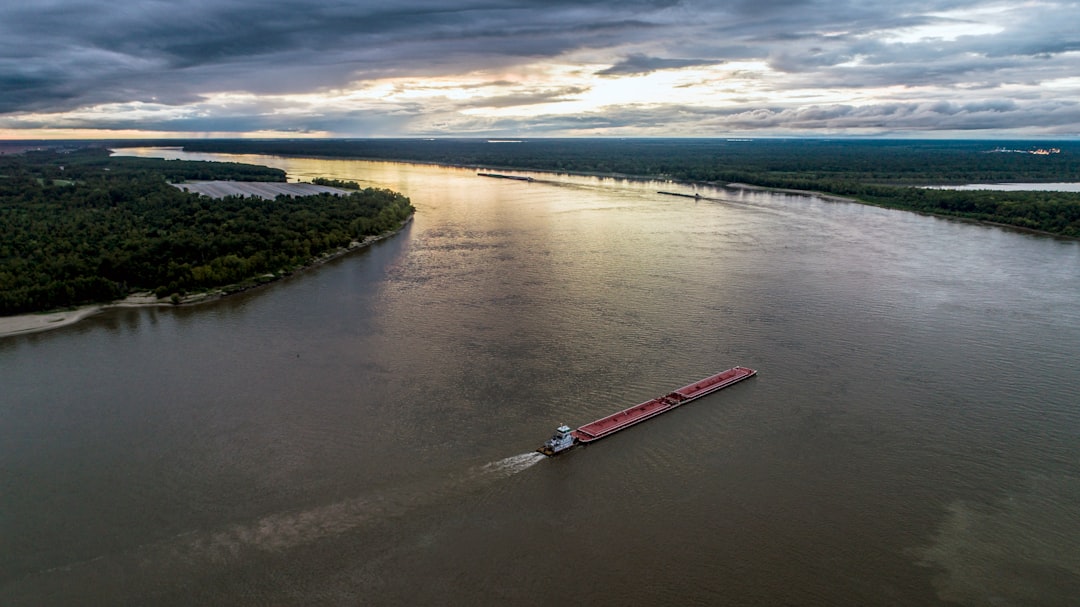
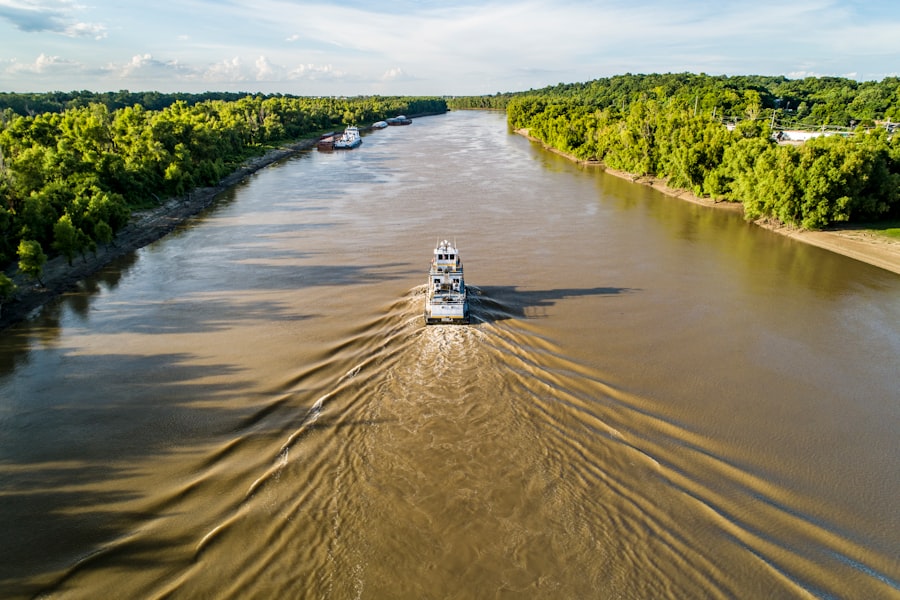
The ports along this stretch of the Mississippi, particularly the Port of New Orleans and the Port of South Louisiana (which stretches for 54 miles between Baton Rouge and New Orleans), are among the busiest in the world by tonnage. The sheer volume of goods transported here is staggering. Readers should consider the diverse array of commodities that traverse this waterway: grain from the Midwest, petrochemicals produced in the numerous refineries lining the banks, coal, steel, and countless other raw materials and finished goods. Barges, often linked together in formidable tows, become floating warehouses, each carrying the equivalent of hundreds of truckloads of cargo.
Petrochemical Corridor
Between Baton Rouge and New Orleans lies an intensely industrialized zone, often referred to as “Cancer Alley” due to environmental concerns, but also recognized as a cornerstone of the nation’s petrochemical industry. Here, oil refineries, chemical plants, and manufacturing facilities line the riverbanks, drawing enormous quantities of water for their operations and using the river as a conduit for both raw materials and finished products. This concentration of heavy industry is a direct result of the river’s navigability, access to abundant water, and proximity to the Gulf of Mexico, providing easy access to global markets. The visible infrastructure—towering smokestacks, complex piping networks, and vast storage tanks—serves as a stark reminder of the river’s indispensable role in this industrial ecosystem.
Engineering the River: Taming the Mighty Mississippi
The Lower Mississippi River is a showcase of human ingenuity and our persistent efforts to control and harness natural forces. From Baton Rouge to New Orleans, the river is not merely a natural channel but a highly engineered waterway, shaped by centuries of ambitious projects.
Levee Systems
Perhaps the most visible and pervasive aspect of river engineering is the extensive levee system. These earthen embankments, acting as artificial walls, protect communities, agricultural lands, and industrial infrastructure from the river’s seasonal floods. For generations, communities have invested immense resources in constructing and maintaining these levees, a critical bulwark against the river’s inherent tendency to spread laterally. While offering protection, these levees also disconnect the river from its natural floodplains, altering ecological processes and contributing to wetland loss by preventing the deposition of sediment outside the main channel.
Navigation Channels and Dredging
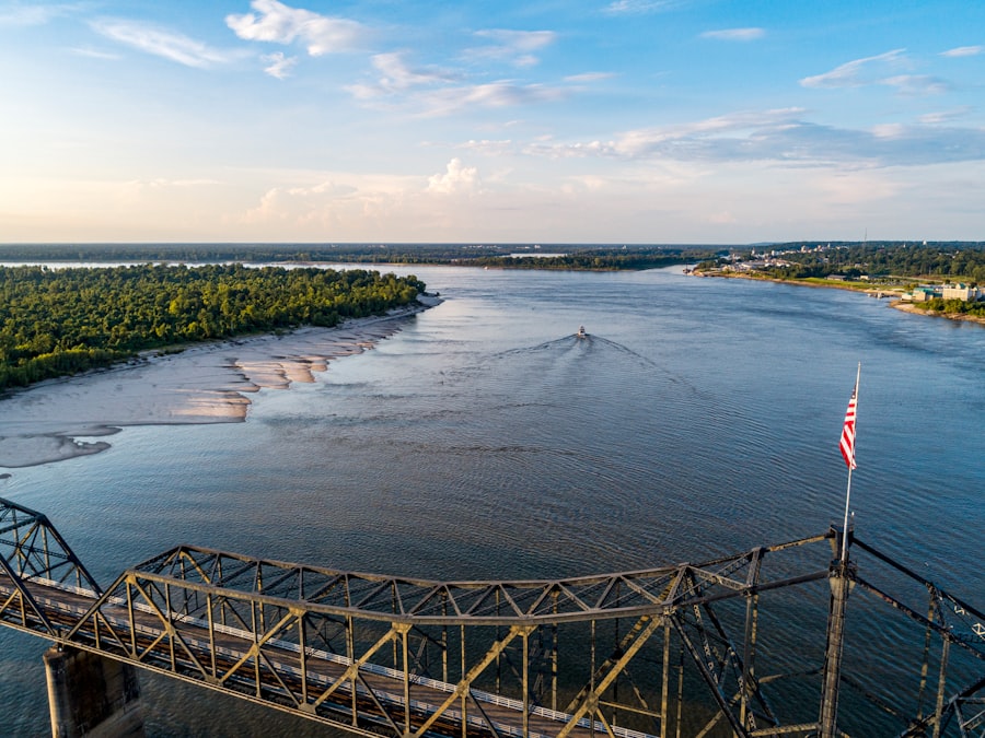
To ensure uninterrupted passage for deep-draft vessels, continuous dredging operations are conducted throughout this segment. Dredges, specialized vessels designed to excavate sediment from the riverbed, maintain the necessary depth and width of the navigation channel. Without this constant intervention, the river’s natural sedimentation processes would quickly render sections impassable for large ships, choking off the economic lifeblood of the region. This is a perpetual battle, a Sisyphean task against the river’s natural inclination to deposit its load.
Locks and Dams (Upstream Context)
While locks and dams are not a prominent feature in the free-flowing segment between Baton Rouge and New Orleans, it is crucial to understand their role higher upstream. The Old River Control Structure, located further north, plays a critical role in preventing the Mississippi from changing its course and flowing down the Atchafalaya River. This monumental hydraulic engineering project ensures that the bulk of the Mississippi’s flow continues past Baton Rouge towards New Orleans, a testament to humanity’s determination to preserve existing infrastructure and economic patterns. This structure is a constant reminder that the character of the river in this segment is, in part, a consequence of engineering feats further upstream.
Cultural Tapestry: Life Along the River
The Mississippi River is more than a geographical feature or an economic conduit; it is a profound cultural artery, shaping the lives, traditions, and narratives of the people who have settled along its banks. From Baton Rouge to New Orleans, the river’s influence is woven into the very fabric of society.
Plantation History and Legacy
The fertile alluvial soils of the Mississippi River Delta provided ideal conditions for agriculture, particularly sugar cane and cotton. This led to the establishment of numerous plantations, many of which still stand today, albeit repurposed as museums or private residences. These historic estates, characterized by their grand architecture and sprawling grounds, serve as tangible reminders of a complex and often painful past, intrinsically linked to the institution of slavery. Exploring these sites offers insight into the social, economic, and political structures that defined antebellum Louisiana and the enduring legacy of that era on the region’s cultural landscape.
River Communities and Urban Centers
The river has historically dictated the location and development of communities along its banks. Baton Rouge, the state capital, and New Orleans, the vibrant cultural heart of Louisiana, both owe their very existence and prosperity to their strategic positions on the Mississippi. These cities, along with smaller towns like Plaquemine and Donaldsonville, bear the indelible mark of the river in their architecture, their economic activities, and their cultural expressions. The river is not just a backdrop; it is an active participant in the daily lives of their inhabitants, offering both opportunities and challenges. Consider the Mardi Gras Indians of New Orleans, whose elaborate costumes often incorporate riverine imagery and symbolism, a subtle yet powerful testament to the river’s enduring influence.
The journey along the Mississippi River from Baton Rouge to New Orleans is not only a scenic experience but also a rich exploration of history and culture. Travelers can immerse themselves in the vibrant atmosphere of both cities, discovering unique attractions and local cuisine. For those interested in learning more about the fascinating dynamics of this iconic river and its significance to the region, a related article can be found here. This resource provides insights into the environmental and economic importance of the Mississippi River, enhancing the understanding of its role in shaping the communities along its banks.
Environmental Challenges and Conservation Efforts
| Metric | Baton Rouge | New Orleans |
|---|---|---|
| Location on Mississippi River (miles from mouth) | 130 miles | 95 miles |
| Average River Discharge (cubic feet per second) | ~600,000 cfs | ~600,000 cfs |
| Population (City) | ~220,000 | ~390,000 |
| Elevation above sea level | 56 feet | 1-2 feet |
| Primary Economic Activities | Petrochemical, Port, Manufacturing | Port, Tourism, Oil & Gas |
| Flood Control Infrastructure | Levees, Floodwalls | Levees, Floodwalls, Pumping Stations |
| Average Annual Precipitation | 60 inches | 62 inches |
While the Mississippi River offers immense benefits, its intensive human use has also created significant environmental challenges. The delicate balance of this ecosystem is constantly under pressure, necessitating ongoing conservation efforts.
Pollution and Water Quality
The concentration of industrial activity along the petrochemical corridor, coupled with agricultural runoff from upstream, contributes to water quality issues in the Lower Mississippi. Readers should consider the sheer volume of effluent discharged into the river and the cumulative impact of these processes on aquatic life and human health. While regulations are in place, the scale of the challenge is immense, demanding continuous monitoring and adherence to stricter environmental standards. The river, as a recipient of myriad discharges, acts as a barometer of human activity across its entire vast watershed.
Wetland Loss and Coastal Erosion
The most pressing environmental issue in coastal Louisiana, directly linked to the management of the Mississippi River, is the catastrophic rate of wetland loss and coastal erosion. The leveeing of the river, while protecting communities, has starved the coastal wetlands of the nourishing sediment that historically built and sustained them. Without the natural riverine sediment deposition, these wetlands are vulnerable to subsidence and erosion from storm surges and rising sea levels. This loss of protective wetlands exacerbates flood risk for inland communities and diminishes critical habitats for a vast array of wildlife.
Restoration Projects and Sustainability
Recognizing the urgency of this crisis, numerous federal and state projects are underway to restore and protect Louisiana’s rapidly disappearing coast. These efforts include diversion projects designed to reintroduce sediment and fresh water from the Mississippi into degraded wetlands, barrier island restoration, and marsh creation. The challenge is monumental, requiring significant investment, innovative solutions, and a long-term commitment to working with, rather than against, the natural dynamics of the river. The aim is to find a sustainable equilibrium where human needs can be met without irrevocably compromising the ecological integrity of this vital deltaic system.
In conclusion, the journey along the Mississippi River from Baton Rouge to New Orleans offers a comprehensive vista into a region defined by its grand fluvial artery. It is a testament to the river’s enduring power, its role as a bedrock of industry and commerce, and its profound cultural impact. Simultaneously, it serves as a powerful reminder of the intricate relationship between humanity and nature, a dynamic interplay of engineering triumphs, environmental challenges, and the ongoing quest for sustainability in the face of an ever-changing landscape.
WATCH THIS! 🚨CRACKING: Why America’s $5 Trillion Dam is Failing Right Now
FAQs
What is the Mississippi River?
The Mississippi River is one of the longest rivers in North America, flowing approximately 2,320 miles from northern Minnesota to the Gulf of Mexico. It serves as a major waterway for transportation, commerce, and recreation.
Where is Baton Rouge located along the Mississippi River?
Baton Rouge is the capital city of Louisiana and is situated on the eastern bank of the Mississippi River. It lies about 130 miles upriver from New Orleans.
How far is New Orleans from Baton Rouge along the Mississippi River?
New Orleans is located approximately 130 miles downstream from Baton Rouge along the Mississippi River.
What is the significance of the Mississippi River to Baton Rouge and New Orleans?
The Mississippi River is vital to both Baton Rouge and New Orleans for commerce, transportation, industry, and tourism. It supports port activities, shipping, and provides water resources for the cities.
Are there any major ports on the Mississippi River in Baton Rouge and New Orleans?
Yes, both Baton Rouge and New Orleans have major ports. The Port of New Orleans is one of the largest and busiest in the United States, while the Port of Baton Rouge is a significant inland port handling various cargo types.
Can you travel by boat between Baton Rouge and New Orleans on the Mississippi River?
Yes, it is possible to travel by boat between Baton Rouge and New Orleans. The river is navigable for commercial and recreational vessels, and there are ferry services and private boat options available.
What are some notable landmarks along the Mississippi River between Baton Rouge and New Orleans?
Notable landmarks include the Old State Capitol in Baton Rouge, the industrial and port facilities along the river, and in New Orleans, the French Quarter, the riverfront, and the historic levees.
How does the Mississippi River impact the environment in Baton Rouge and New Orleans?
The river provides important habitats for wildlife and supports ecosystems in the region. However, it also poses flood risks, which are managed through levees, floodwalls, and other infrastructure.
What recreational activities are popular on the Mississippi River near Baton Rouge and New Orleans?
Popular activities include boating, fishing, river cruises, sightseeing, and bird watching. Both cities offer riverfront parks and attractions that highlight the river’s cultural and natural significance.
How has the Mississippi River influenced the culture of Baton Rouge and New Orleans?
The river has shaped the history, economy, and culture of both cities, influencing their music, cuisine, festivals, and lifestyles. It remains a central element of local identity and heritage.