
The Sunda Strait, a vital maritime passage connecting the Indian Ocean and the Java Sea, lies within a geologically active zone susceptible to significant seismic and volcanic events. The catastrophic tsunami of December 2018, triggered by the flank collapse of the Anak Krakatau volcano, underscored the critical need for robust and effective tsunami early warning systems in this region. This article examines existing challenges and proposes enhancements to the tsunami early warning infrastructure and operational procedures in the Sunda Strait.
Geological Context of the Region
The Sunda Strait is situated on the boundary between the Indo-Australian Plate and the Eurasian Plate. This convergent plate boundary is characterized by subduction, where the oceanic Indo-Australian Plate is forced beneath the continental Eurasian Plate. This process generates significant seismic activity, with frequent earthquakes occurring along the Sunda megathrust. While the megathrust earthquakes are a primary source of large tsunamis globally, the Sunda Strait faces an additional, less predictable threat: volcanic activity.
The Sunda Strait is home to several active volcanoes, most notably the Krakatoa archipelago, which includes the persistently active Anak Krakatau (Child of Krakatoa). Volcanic eruptions, particularly those involving explosive collapses of the edifice into the sea or underwater, can displace vast volumes of water, generating tsunamis. The 2018 event demonstrated that these volcanic tsunamis, while potentially more localized than megathrust tsunamis, can be rapid in onset and devastating in their impact, leaving little time for traditional warning systems to initiate a response. The limited seismicity immediately preceding the 2018 tsunami meant that seismic-based warnings were not issued, highlighting a critical gap in the warning paradigm for this specific type of event.
Historical Tsunami Events
The Sunda Strait has a history of devastating tsunamis. The most infamous, of course, is the 1883 eruption of Krakatoa, which generated tsunamis that killed tens of thousands of people along the surrounding coastlines. While the precise mechanisms and run-up heights are debated, the event serves as a stark reminder of the region’s vulnerability. More recently, the December 22, 2018, tsunami, which caused widespread destruction and loss of life in Banten and Lampung provinces, serves as a contemporary and tragic testament to the recurring threat. This tsunami was not preceded by a significant earthquake, but rather by a large landslide on the flank of Anak Krakatau volcano. This lack of clear seismic precursors is a significant challenge for existing early warning systems that primarily rely on seismic data.
The recurrence intervals of such devastating events, while not precisely predictable, suggest a persistent and inherent risk. Understanding the frequency and characteristics of past events is crucial for informing the design and implementation of effective warning strategies. This includes not only the magnitude of the tsunami but also its speed of arrival, wave height, inundation extent, and the geographical areas most affected. The differential impact of the 2018 tsunami, with some areas experiencing higher wave run-ups than others, suggests complex bathymetric and coastal interaction dynamics that need to be further investigated and incorporated into modeling efforts.
Vulnerability of Coastal Communities
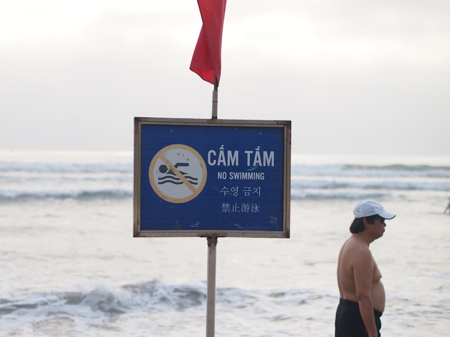
The coastal areas bordering the Sunda Strait are densely populated and economically significant. Many communities rely on fishing, tourism, and agriculture, making them highly vulnerable to the economic and social disruption caused by tsunami events. The destructive power of tsunamis can obliterate infrastructure, displace populations, and have long-lasting impacts on livelihoods and the environment. The lack of adequate infrastructure in some of the more remote coastal villages, such as robust evacuation routes and safe shelters, exacerbates their vulnerability.
Furthermore, a significant portion of the population living in these areas may have limited awareness of tsunami risks and the procedures to follow during an alert. This lack of preparedness can lead to delayed or disorganized evacuation efforts, increasing casualties. The informal nature of settlement in many coastal zones also presents challenges for targeted warning dissemination and evacuation planning. The proximity of residential areas to the immediate coastline, often built without adequate setbacks, further amplifies the risk of direct impact. Rebuilding efforts after such disasters are often slow and resource-intensive, placing a significant burden on national and local governments.
In recent years, the importance of tsunami early warning systems in the Sunda Strait has gained significant attention, especially following natural disasters that have impacted the region. A related article that delves into the advancements and challenges of these systems can be found at MyGeoQuest. This article explores the technological innovations aimed at improving response times and enhancing public safety in coastal communities vulnerable to tsunamis.
Current Tsunami Early Warning Systems in Indonesia
The Indonesian Tsunami Early Warning System (InaTEWS)
Indonesia operates the Indonesian Tsunami Early Warning System (InaTEWS), a multi-agency effort aimed at detecting and alerting the public to potential tsunamis. InaTEWS relies on a network of seismic monitoring stations, tide gauges, and buoys equipped with pressure sensors to detect variations in sea level. The system integrates data from these sources to assess the likelihood of a tsunami being generated and to estimate its potential impact. Seismic data is the primary trigger for system alerts, with earthquakes above a certain magnitude initiating a rapid analysis of potential tsunami generation. Real-time data from deep-ocean buoys provides crucial information about actual sea level changes, which are the definitive indicators of a tsunami’s presence.
However, the effectiveness of InaTEWS is contingent on the reliability and coverage of its sensor network, as well as the speed and accuracy of data processing and alert dissemination. The December 2018 event highlighted potential limitations in the system’s ability to rapidly detect and alert for tsunamis generated by non-seismic sources, such as volcanic flank collapses. The system’s alert levels are communicated through various channels, including radio, television, mobile phone networks, and local disaster management agencies. The effectiveness of these dissemination channels in reaching all at-risk populations, especially in remote or underserved areas, is a constant area of concern.
Limitations and Challenges
Despite the advancements made in developing InaTEWS, several limitations and challenges hinder its optimal effectiveness, particularly in the context of the Sunda Strait.
Reliance on Seismic Data
As previously mentioned, the primary reliance on seismic data presents a significant vulnerability for volcanic tsunamis. The 2018 Anak Krakatau event demonstrates that substantial tsunamis can be generated without significant preceding seismic activity. This necessitates a diversification of the detection methods beyond solely seismic monitoring.
Detection of Non-Seismic Tsunami Triggers
The challenge lies in developing and integrating methods to detect other tsunami triggers, such as undersea landslides, volcanic collapses, and submarine volcanic eruptions. These events often occur with little to no seismic precursor, making them difficult to anticipate with traditional seismic networks. Research into acoustic monitoring, infrasound detection, and advanced geological surveying techniques could offer alternative avenues for early detection. The rapid assessment of geological stability on volcanic islands, particularly those in close proximity to populated areas, is also crucial.
Real-time Volcanic Activity Monitoring
Enhanced real-time monitoring of volcanic activity in the Sunda Strait is essential. This includes deploying more sophisticated sensors to measure ground deformation, gas emissions, and thermal anomalies. The integration of data from satellite-based radar interferometry (InSAR) and thermal imaging could provide crucial insights into the immediate risks posed by volcanic instability.
Sensor Network Coverage and Maintenance
The spatial coverage of the existing sensor network, including seismic stations and tsunami buoys, may be insufficient to provide comprehensive monitoring across the entire Sunda Strait. Many areas, particularly in the open ocean and along less accessible coastlines, may have limited or no monitoring capabilities. Furthermore, the maintenance and operational readiness of these sensors can be challenging, especially in remote locations and in the face of harsh environmental conditions. The cost and logistical complexities associated with deploying and maintaining a dense network of sensors are significant considerations.
Geographic Gaps in Monitoring
Identifying and addressing geographic gaps in the current network is paramount. This would involve strategically deploying additional seismic stations, tide gauges, and crucially, acoustic and pressure sensors capable of detecting tsunamis generated by non-seismic events. Collaboration with neighboring countries might also be beneficial to expand the monitoring footprint.
Sensor Redundancy and Resilience
Ensuring redundancy and resilience within the sensor network is vital. This means having multiple sensors in key locations and implementing systems that can identify and compensate for malfunctioning or damaged equipment. Regular calibration and maintenance schedules are indispensable for maintaining the accuracy and reliability of the data.
Data Processing and Alert Dissemination Speed
The speed at which data is processed and alerts are disseminated significantly impacts the effectiveness of any early warning system. Delays in any part of this chain can reduce the precious time available for evacuation. This includes the speed of data transmission from sensors to processing centers, the efficiency of analytical algorithms, and the rapidity of communication channels to the public.
Automation and Artificial Intelligence Integration
Leveraging advanced technologies like artificial intelligence (AI) and machine learning can automate data analysis and speed up the detection and prediction of tsunami events. AI algorithms can process vast amounts of data from multiple sources simultaneously, identifying potential threats more rapidly than manual analysis.
Multi-channel Communication Strategies
Developing and refining multi-channel communication strategies is crucial to ensure that warnings reach all segments of the population. This includes utilizing traditional media, but also exploring more effective modern approaches such as targeted mobile alerts, community-based warning systems, and public address systems in vulnerable areas.
Enhancing Tsunami Early Warning Strategies for the Sunda Strait
Addressing the multifaceted challenges requires a comprehensive and integrated approach to enhancing tsunami early warning strategies in the Sunda Strait. This involves a combination of technological advancements, improved operational procedures, and heightened community engagement.
Diversifying Detection and Monitoring Technologies
Moving beyond a solely seismically-focused warning system is paramount. The goal is to develop a multi-hazard approach that can detect and alert for tsunamis originating from various sources.
Implementation of Deep-Ocean Tsunami Buoys
While some buoys exist, expanding the network of deep-ocean tsunami buoys equipped with state-of-the-art pressure sensors is crucial for directly measuring tsunami waves in the open ocean. These buoys can detect the passage of a tsunami wave regardless of its origin, providing a crucial confirmation of tsunami generation.
Real-time Data Transmission
Ensuring that these buoys transmit data in real-time is critical. This requires robust communication systems, often relying on satellite technology, to relay information immediately to the warning center. The buoy network should be strategically placed to cover potential tsunami generation zones and key propagation paths towards the Sunda Strait.
Deployment in Strategic Locations
The placement of these buoys should be informed by bathymetric data and historical tsunami modeling. Locations that are likely to experience the initial formation of tsunamis from submarine landslides or volcanic activity should be prioritized. This might involve deploying buoys closer to active volcanic centers.
Acoustic and Infrasound Monitoring Systems
Investing in acoustic and infrasound monitoring systems can provide early indications of underwater volcanic activity and submarine landslides. Underwater acoustic sensors can detect the sound waves generated by these events, while infrasound sensors can pick up low-frequency atmospheric waves produced by volcanic explosions or large-scale ground movements.
Underwater Acoustic Sensors
Deploying a network of underwater acoustic sensors across the Sunda Strait could provide crucial real-time data on submarine geological activity. These sensors can differentiate between various underwater noises and identify events likely to generate tsunamis. Integration with other monitoring systems will be key to avoid false alarms.
Infrasound Networks for Volcanic Activity
Establishing infrasound monitoring stations in strategic locations around volcanic islands in the Sunda Strait can provide advance warning of explosive volcanic eruptions and flank collapses. These networks can capture the characteristic low-frequency sound waves produced by such events, even if they are not immediately visible from land.
Improving Tsunami Modeling and Forecasting Capabilities
Accurate modeling and forecasting are essential for translating raw data into actionable warnings. This involves developing sophisticated models that can simulate tsunami propagation and inundation with high spatial and temporal resolution.
High-Resolution Bathymetry and Topography Data
Acquiring and maintaining high-resolution bathymetry (underwater terrain) and topography (land surface) data for the Sunda Strait is fundamental for accurate tsunami modeling. This detailed data allows for the precise simulation of how tsunami waves interact with the seabed and coastlines, influencing wave height and inundation patterns.
Integration of New Survey Data
Regularly updating and integrating new survey data from sonar mapping and airborne lidar surveys is crucial. This ensures that the models reflect the most current coastal morphology and any changes due to erosion, sedimentation, or post-disaster reconstruction. The complex and dynamic nature of the Sunda Strait’s seafloor necessitates continuous data acquisition.
Importance for Inundation Mapping
Accurate bathymetry is particularly vital for precisely predicting inundation zones. Without it, models may overestimate or underestimate the extent of flooding, leading to either unnecessary evacuations or a false sense of security.
Advanced Tsunami Propagation and Inundation Models
Developing or adopting advanced tsunami propagation and inundation models capable of simulating various tsunami scenarios, including those generated by volcanic activity and landslides, is critical. These models should be capable of running in near real-time to provide timely forecasts.
Scenario-Based Modeling
Running pre-determined scenario-based models for different types of tsunami events (e.g., megathrust earthquakes, flank collapses, submarine landslides) allows for rapid response once an event is detected. These pre-computed scenarios can significantly reduce the time needed to issue an alert.
Real-time Data Assimilation
The ability to assimilate real-time data from sensors into these models is crucial for refining forecasts as events unfold. This dynamic adjustment of model parameters based on incoming observations enhances prediction accuracy and reduces uncertainty.
Strengthening Alert Dissemination and Community Engagement
Even the most sophisticated warning system is ineffective if alerts do not reach vulnerable populations in a timely and understandable manner, and if the public is not prepared to act upon them.
Multi-channel Alert Dissemination Network
Establishing a robust multi-channel alert dissemination network that can reach diverse communities, including those in remote areas and with limited access to traditional media, is essential. This involves leveraging a combination of technologies and community-based approaches.
Mobile Alert Systems (e.g., Cell Broadcast)
Utilizing mobile alert systems, such as cell broadcast technology, can ensure that warnings reach a large number of people instantaneously, regardless of their location within the service area. This technology can overcome the limitations of individual SMS messaging.
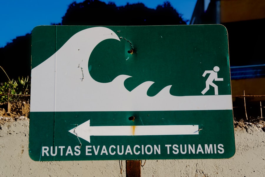
Localized Warning Systems (Sirens, Loudspeakers)
Deploying and maintaining localized warning systems, such as tsunami sirens and public address systems in high-risk coastal areas, provides an audible alert that is independent of mobile network availability. Regular testing and maintenance of these systems are crucial for their reliability.
Public Awareness and Education Programs
Regular and comprehensive public awareness and education programs are vital for building community resilience. These programs should focus on educating people about tsunami risks, warning signals, and appropriate evacuation procedures.
Evacuation Drills and Exercises
Conducting regular evacuation drills and community exercises in coastal areas helps to familiarize residents with evacuation routes, safe assembly points, and the importance of prompt action. These exercises should include participation from local authorities, schools, and community leaders.
Risk Communication and Preparedness Messaging
Developing clear and consistent risk communication messages that emphasize the specific threats in the Sunda Strait, including volcanic tsunamis, is important. Preparedness messaging should empower individuals and families to develop their own household emergency plans and to be self-sufficient for a period after an event.
Operational Enhancements and Inter-Agency Coordination
Improving the operational efficiency and coordination among all stakeholders involved in tsunami early warning is critical for effective disaster response.
Streamlining Data Integration and Analysis Workflows
The efficient integration and analysis of data from diverse sources are crucial for rapid decision-making. This requires standardized data formats and seamless communication protocols between different monitoring agencies and the warning center.
Centralized Data Hub and Real-time Dashboards
Establishing a centralized data hub where all relevant information from seismic stations, tsunamis buoys, meteorological data, and volcanic monitoring can be accessed and visualized in real-time through interactive dashboards is essential. This provides a comprehensive situational awareness for decision-makers.
Automated Data Quality Checks
Implementing automated data quality checks upon ingestion into the hub helps to identify and flag erroneous data at an early stage, preventing it from influencing the analysis and potentially leading to false alarms or delayed warnings.
Interoperable Data Standards
Adopting interoperable data standards across all contributing agencies ensures that data can be seamlessly exchanged and processed without the need for complex and time-consuming conversions. This promotes collaboration and reduces technical barriers.
Enhancing the Role of Voluntary Observers and Community Networks
Leveraging local knowledge and the eyes and ears of individuals within affected communities can significantly augment official monitoring capabilities, especially for rapidly developing events.
Citizen Science Initiatives for Tsunami Observation
Encouraging and training citizen scientists in coastal communities to report unusual observations, such as rapid changes in sea level, unusual wave behavior, or precursory sounds, can provide valuable ground-truth information. These reports can corroborate or challenge automated system alerts.
Structured Reporting Mechanisms
Developing simple and accessible structured reporting mechanisms, such as mobile applications or dedicated hotlines, allows these observations to be easily relayed to the warning center for assessment. Clear guidelines on what constitutes a significant observation are crucial for effective data collection.
Integration with Official Warning Procedures
Establishing clear protocols for how these citizen-reported observations are integrated into the official warning procedures ensures that they are taken seriously and contribute to the overall decision-making process.
Strengthening Collaboration with International Partners
International collaboration can provide access to advanced technologies, expertise, and resources that may not be available domestically, significantly enhancing the Sunda Strait’s tsunami early warning capabilities.
Sharing of Best Practices and Technological Advancements
Engaging in regular knowledge exchange with international organizations and countries with advanced tsunami early warning systems allows Indonesia to benefit from their experiences, adopting best practices and integrating the latest technological advancements into InaTEWS.
Joint Research and Development Initiatives
Collaborating on joint research and development initiatives to address specific challenges, such as improving the detection of volcanic tsunamis or refining tsunami inundation models for complex coastal environments, can accelerate progress and innovation.
Access to Advanced Monitoring Equipment
International partnerships can facilitate access to advanced monitoring equipment, such as state-of-the-art seismic sensors, deep-sea observation platforms, and sophisticated data processing software, which can be costly to procure independently.
In recent years, the importance of tsunami early warning systems in the Sunda Strait has gained significant attention, especially following the devastating events that have affected coastal communities. A related article discusses the advancements in technology and strategies aimed at improving these warning systems, which are crucial for minimizing loss of life and property during such natural disasters. For more insights on this topic, you can read the full article on MyGeoQuest.
Future Directions and Sustainability
| Location | Number of Early Warning Systems | Population Covered | Operational Status |
|---|---|---|---|
| Sunda Strait | 15 | 2 million | Operational |
Ensuring the long-term effectiveness and sustainability of tsunami early warning systems requires continuous adaptation, investment, and a commitment to ongoing improvement.
Research and Development in Tsunami Science
Continued investment in fundamental and applied research in tsunami science is essential to deepen our understanding of the complex processes that generate and propagate these destructive waves, particularly in geologically active regions like the Sunda Strait.
Focus on Volcanic Tsunami Mechanisms
Specific research efforts should focus on understanding the dynamics of volcanic flank collapses, submarine volcanic eruptions, and large-scale underwater landslides as tsunami triggers. This includes detailed geological surveys of volcanic structures, high-resolution modeling of debris flows, and experimental studies.
Improved Understanding of Wave Generation Processes
A deeper understanding of the complex wave generation processes associated with volcanic events is crucial to develop more accurate predictive models. This involves analyzing the impact of water displacement due to caldera collapse, pyroclastic flows entering the sea, and the release of gases.
Statistical Analysis of Volcanic Tsunami Recurrence
Conducting statistical analyses of past volcanic tsunami events in the region can help to estimate their frequency and potential magnitude, providing valuable input for risk assessment and preparedness planning.
Long-Term Funding and Maintenance Strategies
Sustained and adequate funding is critical for the ongoing operation, maintenance, and upgrading of tsunami early warning systems. Without a reliable funding stream, even the most advanced systems can degrade over time.
Dedicated Government Budgetary Allocations
Advocating for dedicated government budgetary allocations specifically for tsunami early warning infrastructure, maintenance, and operational costs is paramount. This ensures a consistent and predictable financial resource for the system.
Public-Private Partnerships and International Aid
Exploring opportunities for public-private partnerships and leveraging international aid, grants, and donor funding can supplement governmental resources and support specific development projects or technology upgrades.
Periodic Review and Adaptation of Warning Systems
The threat landscape is not static; therefore, tsunami early warning systems must be periodically reviewed and adapted to evolving scientific understanding, technological advancements, and changing environmental conditions.
Regular Performance Audits and Simulations
Conducting regular performance audits of the entire warning system, including realistic simulations of various tsunami scenarios, helps to identify any weaknesses or inefficiencies in the detection, analysis, and dissemination processes.
Incorporating Lessons Learned from Tsunami Events
Thoroughly analyzing and incorporating lessons learned from every tsunami event, whether local or regional, into the system’s design, operation, and training procedures is essential for continuous improvement. This feedback loop ensures that the system becomes more robust with each event.
The Sunda Strait’s unique geological setting, characterized by both seismic and volcanic hazards, demands a sophisticated and adaptable tsunami early warning system. By diversifying detection technologies, enhancing modeling capabilities, strengthening community engagement, and fostering robust inter-agency and international collaboration, Indonesia can significantly improve its preparedness and resilience against the devastating impact of tsunamis. The ongoing commitment to research, development, and sustained investment will be pivotal in safeguarding the coastal communities of the Sunda Strait for generations to come.
FAQs
What is a tsunami early warning system?
A tsunami early warning system is a set of tools and procedures designed to detect and alert people about the occurrence of a tsunami, allowing them to take necessary precautions and evacuate to safer areas.
How do tsunami early warning systems work?
Tsunami early warning systems typically use a network of seismographs, buoys, and tide gauges to detect earthquakes and monitor sea level changes. When an earthquake occurs, the system analyzes the data to determine if a tsunami is likely and issues alerts to at-risk communities.
What is the significance of tsunami early warning systems in the Sunda Strait?
The Sunda Strait is a region prone to volcanic activity and earthquakes, making it vulnerable to tsunamis. Early warning systems in this area are crucial for providing timely alerts to the densely populated coastal communities, potentially saving lives and minimizing damage.
What are the challenges in implementing tsunami early warning systems in the Sunda Strait?
Challenges in implementing tsunami early warning systems in the Sunda Strait include the need for adequate funding, infrastructure, and public awareness. Additionally, the complex geological and oceanographic conditions in the region can make it difficult to accurately predict and detect tsunamis.
What are some examples of tsunami early warning systems in the Sunda Strait region?
Examples of tsunami early warning systems in the Sunda Strait region include the Indonesian Tsunami Early Warning System (InaTEWS) and the development of community-based early warning systems in collaboration with local authorities and organizations.