The Mississippi River, a colossal artery of North America, embodies both life and immense destructive potential. Its vast watershed, spanning over 31 U.S. states and two Canadian provinces, funnels an immense volume of water through its channels, particularly during periods of heavy precipitation. Consequently, managing the river’s inherent tendency to flood has been an ongoing engineering challenge for centuries, evolving from localized interventions to sophisticated, integrated systems. This article explores the multifaceted engineering solutions implemented along the Mississippi River for flood control, examining their historical development, present-day applications, and the ongoing dialogue surrounding their efficacy and environmental impact.
The struggle against the Mississippi’s floods is interwoven with the very settlement and development of the American interior. Early attempts at flood control were often localized and reactive, reflecting the nascent understanding of hydrological processes and the limited technological capabilities of the time. The recent developments in the Mississippi River infrastructure have significantly improved transportation and trade efficiency.
Early Settler Interventions
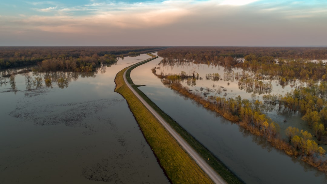
In the nascent stages of American expansion, individual farmers and small communities along the Mississippi River basin primarily relied on rudimentary methods to protect their lands. These often involved the construction of small, earthen levees around individual properties. These early levees, built with local materials and manual labor, were rarely interconnected and therefore susceptible to overtopping or breaching during significant flood events. They served as temporary barriers, offering psychological comfort more than robust protection.
The Levee-Only Approach and Its Limitations
Following the devastating floods of the 19th century, particularly the Great Mississippi Flood of 1844, a more systematic approach began to emerge. The understanding at the time largely favored a “levee-only” strategy, driven by the belief that containing the river within increasingly higher and stronger embankments was the most effective solution. The Mississippi River Commission, established in 1879, spearheaded this effort, leading to the construction of a vast network of federally sponsored levees. While these levees initially provided a heightened sense of security and enabled agricultural development on previously flood-prone lands, they also presented a critical hydrological dilemma. By confining the river, they reduced the floodplain’s natural storage capacity, thereby increasing the velocity and height of the floodwaters within the constricted channel. This often exacerbated flooding in downstream areas, as the water, having nowhere to spread, surged with intensified force. The limitations of this approach were starkly revealed in the catastrophic Great Mississippi Flood of 1927, which overwhelmed extensive sections of the levee system, causing widespread destruction and loss of life.
The challenges of flood control along the Mississippi River have been a topic of extensive research and engineering innovation. For a deeper understanding of the various strategies employed in flood management, you can explore the article on Mississippi River flood control engineering at this link. This resource provides valuable insights into the historical context, current practices, and future developments in the field.
Post-1927 Paradigm Shift: The “Working with the River” Philosophy
The profound lessons learned from the 1927 flood prompted a fundamental reevaluation of flood control strategies. The singular focus on levees proved inadequate; a more comprehensive and adaptive approach was urgently needed. This led to the passage of the Flood Control Act of 1928, marking a pivotal moment in American hydrological engineering.
Diversion and Spillway Systems
Recognizing the river’s immense power and the futility of absolute containment, engineers began to conceptualize ways to divert and manage floodwaters rather than solely restrain them. This paradigm shift gave rise to the development of sophisticated diversion and spillway systems.
The Bonnet Carré Spillway
A prime example of this new philosophy is the Bonnet Carré Spillway, located upstream from New Orleans. Constructed between 1929 and 1932, this structure functions as a colossal pressure relief valve for the Mississippi. When activated, a series of movable weirs allow excess floodwaters to flow from the Mississippi River into Lake Pontchartrain, subsequently draining into the Gulf of Mexico. This strategic diversion significantly reduces the flood crest flowing through New Orleans, protecting the city from inundation. Its deployment is a testament to the engineering foresight that recognized the need to provide the river with an escape route during extreme conditions.
The Morganza Control Structure
Further upriver, the Morganza Control Structure, completed in 1954, serves a similar but even more critical function. It provides a means to divert Mississippi River floodwaters into the Atchafalaya Basin, thereby reducing the hydraulic pressure on the levees protecting Baton Rouge and New Orleans. Critically, the Morganza structure also protects the lower reaches of the Mississippi from the serious risk of the river “avulsing” – permanently changing its course – to flow down the Atchafalaya River. Such an event would have catastrophic economic and environmental consequences for the entire region. The activation of these structures is a carefully orchestrated event, often undertaken with significant public awareness campaigns due to their profound impact on the landscape and downstream communities.
Channel Improvement and Dredging
Beyond managing the river’s lateral movement, engineers also focused on enhancing its efficiency as a conduit for water and sediment. This involved significant efforts in channel improvement and dredging.
Deepening and Widening the Main Channel
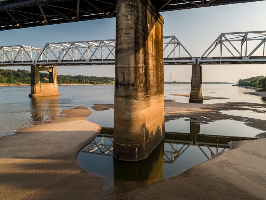
The river’s main navigation channel is systematically deepened and widened through continuous dredging operations. This serves a dual purpose: it facilitates commercial navigation by allowing larger vessels to traverse the river, and it increases the channel’s cross-sectional area, thereby enhancing its capacity to convey floodwaters more effectively. The removal of sediment deposits and the straightening of certain bends contribute to a smoother flow and reduced hydraulic resistance.
Bank Stabilization Techniques
To prevent erosion and maintain the desired channel alignment, various bank stabilization techniques are employed. These include the placement of revetments (such as articulated concrete mats or rock riprap) along the riverbanks, as well as the use of vegetated buffer strips. These measures combat the river’s erosive power, preserving the integrity of the channel and the adjacent infrastructure.
Reservoirs and Detention Basins: Upstream Flood Mitigation

While downstream interventions are crucial, a holistic flood control strategy also necessitates managing water closer to its source. Upstream reservoirs and detention basins play a vital role in attenuating flood peaks before they reach the main stem of the Mississippi.
Large-Scale Dam Construction
Across the vast Mississippi watershed, numerous large-scale dams have been constructed on tributaries to the main river. These dams create reservoirs that can impound significant volumes of water during periods of heavy rainfall.
The Missouri River Mainstem Reservoir System
A prime example is the Missouri River Mainstem Reservoir System, a series of six large dams and reservoirs in the Upper Missouri River Basin. These reservoirs, including Fort Peck, Garrison, and Oahe, collectively provide an immense storage capacity for floodwaters. They are operated as an integrated system, allowing engineers to release water gradually over extended periods, thereby reducing peak flows downstream and mitigating the risk of flooding along the Missouri and subsequently, the Mississippi River. This system acts as a giant sponge, absorbing and slowly releasing precipitation to prevent a downstream inundation.
Smaller, Localized Detention Basins
In addition to mega-reservoirs, smaller, localized detention basins are increasingly being incorporated into urban and agricultural landscapes. These basins, often designed to temporarily hold stormwater runoff, serve to reduce immediate peak flows and allow for infiltration into the ground. While individually less impactful than large reservoirs, their cumulative effect across a broad area can significantly contribute to overall watershed management.
Non-Structural Measures and Integrated Floodplain Management
Recognizing that purely engineering solutions may have limitations and unintended consequences, modern flood control increasingly emphasizes non-structural measures and an integrated approach to floodplain management.
Floodplain Zoning and Land Use Regulations
A fundamental non-structural approach involves guiding development away from high-risk floodplains. Through floodplain zoning ordinances and land use regulations, communities can restrict construction in areas prone to inundation, or mandate flood-resilient building practices. This proactive strategy seeks to reduce the exposure of people and property to flood hazards, acting as a preventative measure rather than a reactive defense.
Early Warning Systems and Emergency Preparedness
Sophisticated hydro-meteorological forecasting models and real-time monitoring systems now provide advanced warning of impending flood events. This allows for crucial lead time for communities to implement emergency preparedness plans, including evacuations, deployment of temporary flood barriers, and resource mobilization. The ability to predict and communicate flood risks effectively is paramount in minimizing casualties and property damage.
Wetland Restoration and Nature-Based Solutions
There is a growing recognition of the ecological benefits of wetlands in flood mitigation. Wetlands act as natural sponges, absorbing and storing floodwaters, slowing down their flow, and filtering pollutants. Consequently, efforts are underway to restore degraded wetlands and create new ones within the Mississippi River basin. These nature-based solutions, often more cost-effective and environmentally friendly than traditional grey infrastructure, work in concert with engineering solutions to create a more resilient floodplain. They represent a philosophical shift towards working with natural processes rather than solely attempting to conquer them.
In recent discussions about Mississippi River flood control engineering, a fascinating article highlights innovative approaches to managing water flow and preventing devastating floods. This piece delves into the challenges faced by engineers and the solutions being implemented to protect communities along the river. For more insights on this critical topic, you can read the full article here. Understanding these advancements is essential for anyone interested in environmental engineering and disaster management.
Future Challenges and Evolving Engineering Paradigms
| Metric | Value | Unit | Description |
|---|---|---|---|
| Length of Levees | 3,500 | miles | Total length of levees constructed along the Mississippi River for flood control |
| Number of Floodways | 3 | count | Major floodways designed to divert excess floodwater |
| Maximum Levee Height | 30 | feet | Maximum height of levees in critical flood-prone areas |
| Reservoir Storage Capacity | 15,000,000 | acre-feet | Total floodwater storage capacity in upstream reservoirs |
| Number of Floodgates | 50 | count | Floodgates installed to control water flow and prevent flooding |
| Annual Flood Control Maintenance Cost | 120 | million | Estimated yearly cost for maintenance of flood control infrastructure |
| Flood Control Project Start Year | 1928 | year | Year when major flood control engineering projects began after the Great Flood |
| Average Floodwater Diversion | 500,000 | cfs (cubic feet per second) | Average volume of floodwater diverted during peak flood events |
Despite the impressive array of engineering solutions in place, the challenge of Mississippi River flood control is dynamic and ever-evolving. Climate change, with its potential for increased frequency and intensity of extreme weather events, presents a formidable new frontier.
Adapting to Climate Change Impacts
The scientific consensus points to an increase in heavy precipitation events and potentially more severe floods in certain regions of the Mississippi River basin due to climate change. This necessitates a proactive approach to re-evaluating and potentially upgrading existing infrastructure. Engineers are exploring strategies such as raising levee heights, increasing spillway capacities, and developing more robust forecasting models that integrate climate projections. The “design flood” – the theoretical flood event for which infrastructure is built – may need to be recalibrated to account for these changing climatic realities.
Balancing Ecological Restoration with Flood Control
The historical emphasis on channelization and levee construction has profoundly altered the ecological character of the Mississippi River and its floodplain. There is an ongoing effort to strike a better balance between flood control objectives and ecological restoration. This involves exploring opportunities for reconnecting the river with its historic floodplains, promoting sediment deposition in beneficial ways, and designing infrastructure that minimizes environmental harm. The aim is to achieve “room for the river” – allowing the river to expand naturally in designated areas during floods, thereby reducing pressure on engineered structures and restoring valuable wetland habitats.
The engineering solutions for Mississippi River flood control represent a continuous testament to human ingenuity and perseverance. From rudimentary earthen berms to complex hydraulic structures and sophisticated forecasting systems, the journey has been one of adaptation, learning, and constant innovation. As the river continues its powerful flow, so too will the efforts to manage its immense power, ensuring the safety and prosperity of the communities that call its vast basin home. The river, a living entity, demands dynamic and evolving solutions, a delicate dance between human intervention and natural processes.
WATCH THIS! 🚨CRACKING: Why America’s $5 Trillion Dam is Failing Right Now
FAQs
What is the primary purpose of Mississippi River flood control engineering?
The primary purpose of Mississippi River flood control engineering is to manage and reduce the risk of flooding along the river and its surrounding areas. This involves constructing levees, dams, reservoirs, and spillways to control water flow and protect communities, agriculture, and infrastructure.
What are some key structures used in Mississippi River flood control?
Key structures include levees, floodwalls, dams, reservoirs, and spillways. Levees and floodwalls act as barriers to prevent water from overflowing into populated areas, while dams and reservoirs help regulate water flow and store excess water during heavy rainfall or snowmelt.
Who is responsible for flood control engineering on the Mississippi River?
The U.S. Army Corps of Engineers is the primary federal agency responsible for flood control engineering on the Mississippi River. They design, construct, and maintain flood control infrastructure in coordination with state and local agencies.
How does flood control engineering impact the environment along the Mississippi River?
Flood control engineering can alter natural river flow, affect wetlands, and impact wildlife habitats. While it protects human communities, it may also reduce the natural flooding that replenishes soil nutrients and supports ecosystems. Environmental considerations are increasingly integrated into flood control projects to balance protection and ecological health.
What historical events led to the development of flood control systems on the Mississippi River?
Major floods, such as the Great Mississippi Flood of 1927, highlighted the need for comprehensive flood control measures. This disaster prompted the Flood Control Act of 1928, which authorized extensive flood control projects along the river, including levee construction and reservoir development.
Can flood control engineering completely prevent flooding on the Mississippi River?
No, flood control engineering cannot completely prevent flooding but aims to reduce its frequency and severity. Extreme weather events or unprecedented water volumes can overwhelm flood control systems, leading to flooding despite engineering efforts.
How does the Mississippi River flood control system benefit local communities?
The system protects lives, property, and economic activities by reducing flood risk. It supports agriculture by preventing crop damage, safeguards infrastructure such as roads and bridges, and helps maintain navigation channels for commerce.
Are there ongoing improvements or modernizations in Mississippi River flood control engineering?
Yes, ongoing efforts include upgrading levees, incorporating advanced monitoring technologies, and implementing more sustainable and adaptive flood management practices. These improvements aim to enhance resilience against climate change and increasing flood risks.