
The Amu Darya, a river that has shaped the history and geography of Central Asia for millennia, presents a complex case study in water resource management. Its flow rate is not merely a number; it represents the lifeblood of millions and a critical factor in the geopolitical stability of the region. Understanding the Amu Darya’s volumetric discharge, its historical fluctuations, and the contemporary drivers influencing it is paramount for sound water policy and sustainable development. This article delves into the key data surrounding the Amu Darya’s flow rate, examining its measurement, drivers, impacts, and the challenges inherent in its shared management.
The Amu Darya’s journey, stretching from its headwaters in the Pamir Mountains to its historical delta in the Aral Sea basin, has been intimately intertwined with human civilization. For centuries, its waters have nurtured flourishing empires and sustained agricultural societies. This long history provides an essential backdrop against which to assess contemporary flow data.
Early Observations and Ancient Irrigation
Early civilizations, like those in Bactria and Khorezm, developed sophisticated irrigation systems drawing from the Amu Darya. While precise flow measurements were non-existent, historical texts and archaeological evidence attest to the river’s consistent bounty, forming the foundation for these societies. Records, often anecdotal or inferred from the scale of settlements and agricultural output, suggest a robust and relatively stable flow, prior to the extensive abstractions of the 20th century. This era serves as a baseline, a testament to the river’s natural state before intensive anthropogenic pressures.
Soviet-Era Diversions and Agricultural Expansion
The 20th century marked a profound shift in the Amu Darya’s regime. The Soviet Union embarked on ambitious irrigation projects, most notably the Karakum Canal, to cultivate vast tracts of land for cotton production. These projects, often championed as triumphs of human engineering, dramatically altered the river’s natural course and significantly reduced its downstream flow. Accurate hydrological data collection intensified during this period, driven by the need to manage these large-scale diversions. Flow measuring stations were established, and systematic records began to accumulate, providing a quantitative basis for understanding the impacts of these grand designs. The data from this period reveal a stark decline in the river’s discharge as it progressed towards its delta, a direct consequence of upstream withdrawals.
For those interested in the flow rate data of the Amu Darya River, a related article can be found at this link: My Geo Quest. This resource provides valuable insights into the hydrological patterns and environmental factors affecting the river, making it a useful reference for researchers and enthusiasts alike.
Current Measurement Techniques and Methodologies
Accurate measurement of the Amu Darya’s flow rate is fundamental to effective water management. Without reliable data, policy decisions become exercises in speculation. Various techniques, both traditional and modern, are employed to monitor this vital metric.
Hydrometric Stations and Conventional Gauging
The most common approach involves a network of hydrometric stations strategically located along the river’s main stem and its tributaries. These stations typically utilize conventional gauging techniques, employing instruments such as current meters to measure water velocity at various depths and across the river’s cross-section. The cross-sectional area multiplied by the average velocity yields the discharge rate. These stations provide continuous or near-continuous data, forming the backbone of long-term hydrological records. However, their effectiveness can be hampered by ice cover in winter, sediment transport altering the riverbed, and accessibility issues in remote areas.
Satellite Remote Sensing and Modeling Approaches
In recent decades, satellite remote sensing has emerged as a powerful complement to traditional ground-based measurements, particularly in vast and often politically sensitive transboundary river basins like the Amu Darya. Satellites equipped with altimeters can measure the water surface elevation, while SAR (Synthetic Aperture Radar) can determine river width. Combining these data with hydraulic models and, in some cases, empirical relationships, allows for the estimation of discharge, especially in reaches where ground-based stations are scarce or inaccessible. Additionally, gravimetric satellites like GRACE (Gravity Recovery and Climate Experiment) provide insights into changes in total water storage across the basin, offering a broader perspective on hydrological trends that influence river flow. These methods offer a crucial ability to monitor trends and identify anomalies on a large scale, transcending national borders.
Data Sharing Protocols and Challenges
While various methodologies exist, the utility of the collected data is contingent upon effective data sharing among riparian states. The Amu Darya basin is shared by Afghanistan, Kyrgyzstan, Tajikistan, Turkmenistan, and Uzbekistan. Historically, data sharing has been inconsistent and often politicized, hindering a comprehensive real-time understanding of basin-wide flow. Lack of transparency and standardized protocols can lead to suspicion and complicate coordinated management efforts. Addressing these challenges through robust, mutually agreed-upon data sharing mechanisms is a critical prerequisite for sustainable water management.
Key Factors Influencing Amu Darya’s Flow Rate
The Amu Darya’s flow is a delicate symphony orchestrated by a range of natural and anthropogenic factors. Understanding these drivers is crucial for predicting future trends and formulating adaptive management strategies.
Glacial Meltwater Contribution
The Pamir Mountains, often referred to as the “Roof of the World,” are the primary source of the Amu Darya’s waters. Glacial meltwater constitutes a significant portion of its total discharge, particularly during the warmer months. The health of these glaciers, therefore, directly impacts the river’s flow. Climate change, with its associated rise in global temperatures, is accelerating glacial melt. While initially leading to increased flow, this phenomenon is a double-edged sword: a finite resource being consumed at an unsustainable rate. Future projections indicate a potential peak in glacial melt, followed by a decline as glacier mass diminishes, leading to reduced river flow in the long term. This slow-motion retreat of ice will inevitably alter the hydrological regime of the Amu Darya.
Snowpack Accumulation and Seasonal River Regimes
Complementary to glacial melt, seasonal snowpack accumulation in the mountainous headwaters plays an equally vital role. Winter snowfall acts as a natural reservoir, slowly releasing water during the spring and early summer melt. The depth and extent of this snowpack directly correlate with the subsequent year’s flow. Variations in winter precipitation, influenced by atmospheric circulation patterns like the North Atlantic Oscillation or El Niño-Southern Oscillation, can lead to significant inter-annual fluctuations in the Amu Darya’s discharge. Understanding these seasonal patterns is essential for operational water management, allowing for better allocation and flood control strategies.
Anthropogenic Withdrawals for Irrigation and Other Uses
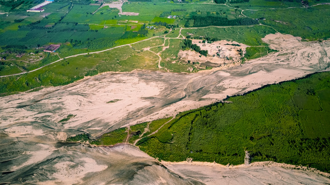
As previously mentioned, human activities, particularly large-scale irrigation for agriculture, are the most significant anthropogenic factor influencing the Amu Darya’s flow. The numerous canals diverting water from the main stem and its tributaries have a profound impact, especially in the downstream reaches. These withdrawals are driven by the agricultural demands of a growing population and economic imperatives. While essential for food security and livelihoods, uncontrolled or inefficient irrigation practices can exacerbate water scarcity. The data clearly shows a “diminishing returns” effect as one moves downstream, with each subsequent diversion reducing the river’s volume further. Other uses, such as industrial and municipal water supply, also contribute to the overall abstraction, though typically to a lesser extent than agriculture.
Climate Change Impacts on Precipitation and Evaporation
Beyond glacial melt, climate change exerts a broader influence on the Amu Darya basin’s hydrology. Altered precipitation patterns, including changes in the timing, intensity, and form (rain vs. snow), are projected. An increase in extreme weather events, such as droughts and floods, is also anticipated. Furthermore, rising temperatures lead to increased evaporation from reservoirs, irrigation canals, and land surfaces, effectively reducing the amount of water available in the river system. These complex interplay of factors necessitates a climate-informed approach to water management, moving beyond historical averages and embracing predictive modeling to anticipate future hydrological stresses.
Observed Flow Rate Trends and Variability
Analyzing historical flow rate data reveals critical trends and highlights the inherent variability of the Amu Darya, underscoring the challenges in consistent water supply.
Long-Term Declines and the Aral Sea Catastrophe
The most prominent and tragic trend in the Amu Darya’s flow history is the dramatic long-term decline in its discharge to the Aral Sea. Prior to the extensive Soviet-era diversions, the river consistently delivered significant volumes of water to the inland sea. However, over the latter half of the 20th century, the flow reaching the Aral Sea dwindled to a trickle, and often ceased entirely. This reduction, directly attributable to upstream abstractions, led to the catastrophic desiccation of the Aral Sea, one of the most severe environmental disasters of the modern era. The flow data paints a stark picture of this human-induced ecological collapse, serving as a cautionary tale for river basin management globally. While efforts have been made to restore portions of the Aral Sea, the Amu Darya’s downstream flow remains significantly curtailed compared to historical levels.
Inter-Annual and Intra-Annual Fluctuations
Even with the overarching trend of decline, the Amu Darya exhibits significant inter-annual and intra-annual variability. Some years bring abundant rainfall and snowmelt, leading to higher flow rates, while others are characterized by drought, resulting in substantially reduced discharge. These fluctuations are primarily driven by variations in precipitation and temperature in the headwater regions. Intra-annually, the flow rate follows a distinct seasonal pattern, peaking in late spring and early summer due to snowmelt and glacial melt, and reaching its lowest in winter. This seasonal rhythm dictates agricultural calendars and hydropower operations across the basin. Managing these natural variations, superimposed upon the long-term anthropogenic reductions, is a constant challenge for water managers.
Impact of Upstream Reservoir Operations
The construction and operation of numerous reservoirs in the upstream riparian states, particularly in Tajikistan and Uzbekistan, significantly influence the natural flow regime of the Amu Darya. Reservoirs serve multiple purposes, including hydropower generation, irrigation storage, and flood control. While they can help regulate flow and provide a more consistent supply during dry periods, their operation can also alter the natural timing and magnitude of downstream flows. For instance, holding back water for electricity generation in winter can reduce downstream flow, potentially impacting irrigation in lower riparian states. Conversely, sudden releases can contribute to flood risks. The complex interplay between natural variability and managed reservoir operations adds another layer of complexity to understanding and predicting the Amu Darya’s flow rate.
The flow rate of the Amu Darya River is a critical factor in understanding the hydrology of Central Asia, and for those interested in exploring this topic further, a related article can provide valuable insights. This article discusses various aspects of river management and environmental impact, which can be found at this link. By examining the data on the Amu Darya’s flow rate, researchers can better assess the challenges faced by the region in terms of water resources and ecological sustainability.
Implications for Water Resource Management and Geopolitics
| Year | Month | Flow Rate (m³/s) | Measurement Location | Notes |
|---|---|---|---|---|
| 2023 | January | 450 | Kelif | Winter low flow period |
| 2023 | April | 1200 | Kelif | Spring snowmelt increase |
| 2023 | July | 1800 | Kelif | Peak summer flow |
| 2023 | October | 900 | Kelif | Post-summer decrease |
| 2022 | July | 1700 | Kelif | Typical peak flow |
| 2022 | January | 400 | Kelif | Winter low flow |
The specific data points and trends in the Amu Darya’s flow rate ripple outward, profoundly impacting water resource management practices, environmental sustainability, and regional geopolitics.
Challenges of Transboundary Water Allocation
The Amu Darya is a transboundary river, meaning its waters are shared by multiple sovereign nations. This shared resource presents inherent challenges in water allocation. Upstream countries, primarily Kyrgyzstan and Tajikistan, control the headwaters and the large storage reservoirs that regulate flow. Downstream countries, principally Uzbekistan and Turkmenistan, are heavily reliant on the Amu Darya for agriculture and have historically been the primary abstractors. The differing national interests, development priorities, and water demands create a complex geopolitical landscape. Establishing equitable and mutually beneficial water allocation agreements, often based on historical use and specific quotas, is a perpetual challenge, particularly during periods of water scarcity. Flow rate data becomes a critical, and often contentious, input in these negotiations.
Environmental Sustainability and Ecosystem Health
The quantity and quality of the Amu Darya’s flow are fundamental to the environmental sustainability of the basin. Reduced flow rates exacerbate water quality issues, concentrating pollutants and leading to increased salinity, especially in the downstream reaches. The decline in flow has devastated aquatic ecosystems, leading to biodiversity loss and the degradation of wetland habitats. The health of riparian forests and natural floodplains, which provide crucial ecological services, is also directly linked to the river’s flow regime. Reversing some of the environmental damage requires ensuring sufficient environmental flows, a concept that recognizes the intrinsic water needs of ecosystems, often in direct competition with human demands.
Agricultural Productivity and Food Security
The vast agricultural sectors of Uzbekistan and Turkmenistan, heavily geared towards cotton and wheat production, are critically dependent on the Amu Darya’s waters. Variations in flow rate directly translate into fluctuations in agricultural productivity. Reduced flows can lead to crop failures, decreased yields, and saline intrusion into agricultural lands, threatening food security and rural livelihoods. Conversely, effective management of available water, optimized based on reliable flow data, can enhance irrigation efficiency and support sustainable agricultural practices. The data serves as a barometer of agricultural health in the region.
Hydropower Generation and Energy Security
For upstream countries like Tajikistan and Kyrgyzstan, the Amu Darya and its tributaries represent a vital source of hydropower, crucial for national energy security and economic development. The amount of water stored in reservoirs and released through turbines directly determines electricity generation capacity. Lower flow rates, particularly during dry years, can lead to energy shortages and economic disruption. Balancing the demands of hydropower generation with downstream irrigation needs is a perennial challenge, often becoming a source of contention between upstream energy producers and downstream agricultural users.
Adaptation Strategies and Future Projections
Given the observed trends and the projected impacts of climate change, adaptation strategies are paramount for the Amu Darya basin. These include improving irrigation efficiency through modern techniques, promoting water-saving crops, rehabilitating existing infrastructure, and exploring alternative water sources. Crucially, future projections, leveraging robust flow rate data and climate models, are essential for developing proactive rather than reactive management policies. These projections serve as a warning light, indicating potential future stresses and demanding urgent attention and cooperative action from all riparian states. The future of the Amu Darya depends on the collective will to adapt and manage this precious resource sustainably.
The Amu Darya’s flow rate is more than a simple hydrological parameter; it is a nexus where environmental science, human development, and geopolitical realities converge. The data, meticulously collected over decades, paints a clear picture of a river under immense pressure, yet still holding the potential for sustainable management through informed decision-making and genuine regional cooperation.
▶️ STOP: The Middle Corridor Is A Death Trap
FAQs
What is the Amu Darya river?
The Amu Darya is a major river in Central Asia, flowing through countries such as Afghanistan, Tajikistan, Turkmenistan, and Uzbekistan. It is one of the longest rivers in the region and plays a crucial role in irrigation and water supply.
Why is monitoring the flow rate of the Amu Darya important?
Monitoring the flow rate of the Amu Darya is essential for managing water resources, predicting floods, supporting agriculture, and maintaining ecological balance. It helps governments and organizations plan water usage and address environmental challenges.
How is the flow rate of the Amu Darya measured?
The flow rate of the Amu Darya is typically measured using hydrological stations equipped with instruments such as flow meters, gauges, and remote sensing technology. These tools record the volume of water passing a specific point over time.
What factors influence the flow rate of the Amu Darya?
The flow rate of the Amu Darya is influenced by seasonal precipitation, snowmelt from surrounding mountains, water withdrawals for irrigation, dam operations, and climate change. These factors can cause significant variations in water volume throughout the year.
Where can one access Amu Darya flow rate data?
Amu Darya flow rate data can be accessed through national hydrological services of the countries it flows through, international water management organizations, and scientific research publications. Some data may also be available via online databases and environmental monitoring platforms.