The Cape of Good Hope Route is a scenic coastal road located at the southwestern tip of South Africa. This route extends along the Atlantic coastline and encompasses dramatic cliffs, beaches, and ocean views. The area attracts numerous visitors annually due to its combination of natural landscapes, historical importance, and cultural heritage.
The Cape of Good Hope holds significant historical value as a major maritime landmark. For centuries, it served as a crucial navigation point for sea routes between Europe and Asia. The region has been inhabited by the indigenous Khoisan peoples and later became an important stopover for European explorers and traders from the 15th century onward.
Portuguese navigator Bartolomeu Dias first rounded the cape in 1488, followed by Vasco da Gama in 1497 during his voyage to India. The area subsequently developed into a vital supply station for ships traveling along the sea route to the East Indies, contributing to its role in global trade and cultural exchange.
Key Takeaways
- The Cape of Good Hope Route is rich in history, maritime significance, and natural beauty.
- Iconic landmarks include Cape Point, historic lighthouses, and numerous shipwreck sites.
- The region boasts diverse biodiversity, including unique flora from the Cape Floral Kingdom and abundant wildlife.
- Visitors can enjoy outdoor activities such as hiking in the Cape of Good Hope Nature Reserve and exploring charming coastal towns.
- Planning tips emphasize scenic drives, wildlife viewing, and appreciating the stunning ocean vistas along the route.
History and significance of the Cape of Good Hope
The history of the Cape of Good Hope is as tumultuous as it is fascinating. Discovered by Portuguese explorer Bartolomeu Dias in 1488, it was initially seen as a critical waypoint for ships sailing to India and beyond. The name “Cape of Good Hope” reflects the optimism that this discovery brought to European navigators, who viewed it as a gateway to new trade routes and opportunities.
Over time, the cape became a vital stop for ships, providing fresh water and supplies for weary sailors on their long voyages. The significance of the Cape extends beyond its role in maritime navigation. It has been a site of cultural convergence, where diverse peoples have interacted and exchanged ideas.
The arrival of Dutch settlers in the 17th century marked the beginning of colonial influence in the region, leading to profound changes in the local landscape and society. The legacy of these historical events can still be felt today, as visitors explore the remnants of colonial architecture and engage with the rich tapestry of cultures that define the area.
The iconic Cape Point and Cape of Good Hope
Cape Point, often mistakenly referred to as the southernmost point of Africa, is one of the most iconic landmarks along the Cape of Good Hope Route. Rising dramatically from the ocean, this rugged promontory offers breathtaking views that captivate all who visit. The journey to Cape Point is an adventure in itself, with winding roads that reveal stunning vistas at every turn.
As travelers approach, they are greeted by the sight of sheer cliffs plunging into the turbulent waters below, creating a dramatic contrast that is both awe-inspiring and humbling. At Cape Point, visitors can explore a variety of attractions, including the historic lighthouse that has guided countless ships safely past these treacherous waters. The lighthouse, perched high above the ocean, provides panoramic views that stretch for miles along the coastline.
For those willing to hike to its base, the experience is even more rewarding, as they encounter diverse flora and fauna along the way. The surrounding area is rich in biodiversity, making it a haven for nature enthusiasts and photographers alike.
Biodiversity and wildlife along the route
The Cape of Good Hope Route is renowned for its incredible biodiversity, which is a testament to its unique ecosystems. The region is home to an array of wildlife, including various species of birds, mammals, and marine life. Visitors may spot baboons frolicking on the cliffs or see ostriches roaming freely in the grasslands.
The area is also a sanctuary for endangered species such as the African penguin, which can be observed at nearby Boulders Beach. Marine life thrives in the waters surrounding the Cape, making it a prime location for whale watching during migration seasons. Southern right whales can often be seen breaching just off the coast, providing an unforgettable spectacle for onlookers.
Additionally, the rich underwater ecosystems support vibrant coral reefs and schools of colorful fish, attracting divers and snorkelers eager to explore this underwater paradise. The biodiversity along this route not only enhances its natural beauty but also underscores its importance as a conservation area.
Exploring the charming coastal towns along the route
| Metric | Value | Unit | Description |
|---|---|---|---|
| Distance | 7,000 | nautical miles | Approximate distance from Europe to Asia via the Cape of Good Hope |
| Average Transit Time | 20-30 | days | Typical duration for cargo ships to complete the route |
| Major Ports | Durban, Cape Town, Port Elizabeth | — | Key South African ports along the route |
| Historical Significance | 15th Century | century | Period when the route was first navigated by Europeans |
| Alternative Route | Suez Canal | — | Shorter route connecting the Mediterranean Sea to the Red Sea |
| Risk Factors | Storms, piracy | — | Common hazards faced by vessels on the route |
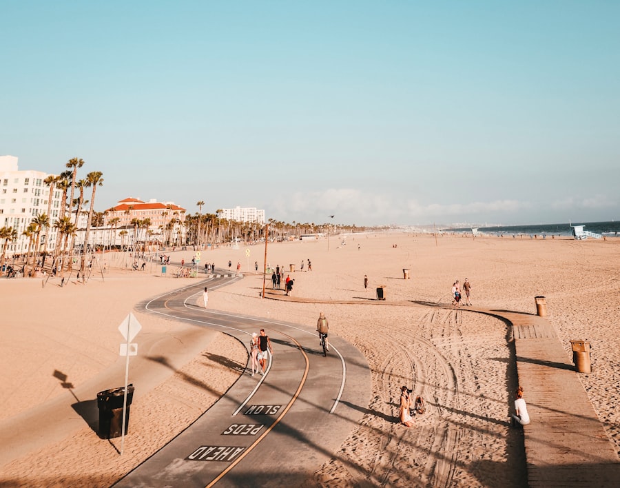
As travelers journey along the Cape of Good Hope Route, they encounter several charming coastal towns that each offer their own unique character and attractions. One such town is Simon’s Town, known for its naval history and picturesque harbor. Visitors can stroll along its waterfront promenade, explore quaint shops and cafes, or visit the South African Naval Museum to learn about the town’s maritime heritage.
The nearby Boulders Beach is famous for its resident colony of African penguins, providing an opportunity for close encounters with these delightful creatures. Another gem along the route is Kalk Bay, a vibrant fishing village that boasts a lively arts scene and an array of trendy boutiques and eateries. The harbor is often bustling with fishermen bringing in their daily catch, while local restaurants serve up fresh seafood dishes that delight visitors’ palates.
Kalk Bay’s scenic charm is further enhanced by its stunning views of False Bay and the surrounding mountains, making it a perfect spot for relaxation or exploration.
Hiking and outdoor activities in the Cape of Good Hope Nature Reserve
The Cape of Good Hope Nature Reserve offers an abundance of outdoor activities for adventure seekers and nature lovers alike. With its diverse landscapes ranging from rugged cliffs to sandy beaches and lush fynbos vegetation, there are numerous hiking trails that cater to all skill levels. One popular trail leads to Cape Point itself, where hikers are rewarded with breathtaking views at every turn.
The well-marked paths allow visitors to immerse themselves in nature while observing local wildlife along the way. In addition to hiking, visitors can partake in various outdoor activities such as birdwatching, cycling, and picnicking in designated areas within the reserve. The tranquil surroundings provide an ideal setting for relaxation or exploration.
For those seeking a more adrenaline-fueled experience, guided tours offer opportunities for kayaking or even surfing in some areas along the coast. The combination of stunning scenery and outdoor adventure makes this reserve a must-visit destination for anyone traveling along the Cape of Good Hope Route.
The shipwrecks and maritime history of the Cape of Good Hope
The waters surrounding the Cape of Good Hope are notorious for their treacherous conditions, leading to numerous shipwrecks throughout history. These maritime disasters have left behind a rich tapestry of stories that contribute to the area’s historical significance. Many shipwrecks can still be found along the coastline, some visible from shore while others lie submerged beneath the waves.
These remnants serve as poignant reminders of the dangers faced by sailors navigating these perilous waters. One notable shipwreck is that of the Lusitania, which ran aground in 1911 near Cape Point. Today, divers can explore its remains while learning about its tragic history through guided tours offered by local dive operators.
For history enthusiasts, exploring these sites provides a fascinating glimpse into the past while honoring those who lost their lives at sea.
Visiting the lighthouses and historical landmarks along the route
The Cape of Good Hope Route is dotted with historical landmarks and lighthouses that tell tales of maritime navigation and exploration. The most famous among them is undoubtedly the Cape Point Lighthouse, which has stood sentinel over these waters since 1859. Its striking white structure contrasts beautifully with the surrounding landscape and serves as a vital navigational aid for passing ships.
Visitors can climb to its viewing platform for panoramic vistas that showcase both land and sea. In addition to Cape Point Lighthouse, travelers can explore other significant sites such as the historic lighthouse at Slangkop Point in Kommetjie or visit Simon’s Town’s iconic clock tower. Each landmark carries its own story and significance within South Africa’s maritime history.
By visiting these sites, travelers gain insight into how navigation has evolved over centuries while appreciating the architectural beauty that accompanies these historical structures.
The unique flora and fauna of the Cape Floral Kingdom
The Cape Floral Kingdom is recognized as one of six floral kingdoms worldwide and boasts an astonishing diversity of plant species found nowhere else on Earth. This UNESCO World Heritage Site encompasses various ecosystems within its boundaries, including fynbos—a unique vegetation type characterized by its hardy shrubs and vibrant flowers. Visitors traveling along the Cape of Good Hope Route will encounter an array of colorful blooms throughout different seasons, making each visit a unique experience.
Among its many treasures are species such as proteas, ericas (heaths), and restios (reeds), which thrive in this Mediterranean climate characterized by wet winters and dry summers. The region’s rich biodiversity extends beyond plants; it also supports numerous animal species that rely on these habitats for survival. Birdwatchers will delight in spotting endemic species like the Cape sugarbird or even rare sightings of mammals such as bontebok or eland grazing peacefully among wildflowers—a true testament to nature’s resilience.
Enjoying the stunning ocean views and scenic drives
One cannot discuss the Cape of Good Hope Route without mentioning its breathtaking ocean views and scenic drives that leave travelers spellbound at every turn. The winding roads offer glimpses of dramatic cliffs plunging into azure waters while providing ample opportunities for photo stops along the way. As one drives through this stunning landscape, they are treated to ever-changing vistas that showcase nature’s artistry—each curve revealing new perspectives on both land and sea.
The Chapman’s Peak Drive is particularly renowned for its spectacular scenery; this coastal road hugs steep cliffs while offering panoramic views over Hout Bay and beyond. Travelers often find themselves stopping at designated viewpoints to capture photographs or simply soak in their surroundings—an experience that evokes feelings of awe and appreciation for nature’s beauty. Whether basking under sunny skies or witnessing stormy seas crashing against rocky shores, every moment spent along this route becomes etched into memory.
Tips for planning a trip along the Cape of Good Hope Route
Planning a trip along the Cape of Good Hope Route requires careful consideration to ensure an enjoyable experience filled with exploration and discovery. First and foremost, travelers should allocate sufficient time to fully appreciate all that this region has to offer—ideally several days—to allow for leisurely exploration without feeling rushed between attractions. Additionally, it is advisable to check weather conditions before embarking on outdoor activities such as hiking or whale watching; conditions can change rapidly along this coastline due to its proximity to ocean currents.
Booking accommodations in advance during peak tourist seasons will also help secure preferred lodging options while avoiding last-minute hassles. Lastly, visitors should consider joining guided tours or hiring local guides who possess extensive knowledge about both natural history and cultural heritage—enhancing their understanding while providing insights into hidden gems off-the-beaten-path that may not be readily accessible otherwise. In conclusion, traversing along the Cape of Good Hope Route offers an unforgettable journey through one of South Africa’s most captivating regions—a place where natural beauty meets rich history amidst diverse cultures waiting to be explored by all who venture forth into this remarkable landscape.
The Cape of Good Hope route is not only a stunning journey through breathtaking landscapes but also a significant historical landmark. For those interested in exploring more about this iconic destination, you can read a related article on My Geo Quest that delves into the rich history and natural beauty of the area. Check it out here: My Geo Quest.
WATCH THIS! 🌍 THE $15 TRILLION GAMBLE: What Happens If The Strait of Malacca Closes For One Week?
FAQs
What is the Cape of Good Hope Route?
The Cape of Good Hope Route refers to the maritime path that ships take around the southern tip of Africa, near the Cape of Good Hope. It is a significant shipping route connecting the Atlantic and Indian Oceans.
Where is the Cape of Good Hope located?
The Cape of Good Hope is located on the Atlantic coast of the Cape Peninsula in South Africa, near the city of Cape Town.
Why is the Cape of Good Hope Route important?
The route is important because it serves as a key passage for international maritime trade, especially for vessels traveling between Europe, Asia, and the Americas. It is an alternative to the Suez Canal route.
Is the Cape of Good Hope Route still widely used today?
Yes, the route is still used, particularly by ships that cannot pass through the Suez Canal due to size restrictions or geopolitical issues. However, many vessels prefer the shorter Suez Canal route when possible.
What are the navigational challenges of the Cape of Good Hope Route?
The route is known for rough seas, strong winds, and unpredictable weather conditions, which can make navigation difficult and hazardous for ships.
How long does it take to travel the Cape of Good Hope Route?
The duration varies depending on the vessel’s speed and weather conditions, but traveling around the Cape of Good Hope generally adds several days to a voyage compared to the Suez Canal route.
Are there any historical significances associated with the Cape of Good Hope Route?
Yes, the route was historically significant during the Age of Exploration as it was a major milestone for sailors seeking a sea route to India and the East Indies. It was first rounded by Portuguese explorer Bartolomeu Dias in 1488.
What types of vessels commonly use the Cape of Good Hope Route?
The route is used by a variety of vessels, including cargo ships, oil tankers, bulk carriers, and cruise ships.
Are there any environmental concerns related to the Cape of Good Hope Route?
Yes, environmental concerns include the risk of oil spills, marine pollution, and the impact of shipping traffic on marine ecosystems in the region.
Can tourists visit the Cape of Good Hope?
Yes, the Cape of Good Hope is a popular tourist destination known for its scenic beauty, wildlife, and hiking trails. It is part of the Table Mountain National Park in South Africa.