
The Drake Passage, a body of water situated between the southern tip of South America and Antarctica, is renowned for its tumultuous seas and unpredictable weather patterns. This narrow stretch of ocean, measuring approximately 800 kilometers (500 miles) wide, serves as a critical conduit for maritime traffic between the Atlantic and Pacific Oceans. Named after the English explorer Sir Francis Drake, who navigated these waters in the late 16th century, the passage has long been a focal point for adventurers, researchers, and commercial vessels alike.
Its unique geographical position not only makes it a vital route for shipping but also a challenging one, as it is often characterized by high winds, large swells, and rapidly changing conditions. The significance of the Drake Passage extends beyond its role as a navigational route; it is also a region of immense ecological importance. The waters are rich in marine life, serving as a feeding ground for various species of whales, seals, and seabirds.
The confluence of the Atlantic and Pacific Oceans creates a dynamic environment that supports diverse ecosystems. However, this ecological richness is juxtaposed with the inherent dangers posed by the passage’s unpredictable nature. As such, navigating the Drake Passage requires not only skill and experience but also the right tools to ensure safety and efficiency.
Key Takeaways
- The Drake Passage is a treacherous body of water located between South America’s Cape Horn and the South Shetland Islands of Antarctica.
- Navigating the Drake Passage presents numerous challenges, including strong winds, high waves, and unpredictable weather conditions.
- Google Earth can be used as a valuable navigational tool for planning routes and identifying potential hazards in the Drake Passage.
- Google Earth offers features such as satellite imagery, 3D mapping, and real-time weather and oceanographic data for maritime navigation.
- When navigating the Drake Passage with Google Earth, it is important to utilize satellite imagery and 3D mapping to identify potential hazards and obstacles, as well as access real-time weather and oceanographic data for planning purposes.
Understanding the challenges of navigating the Drake Passage
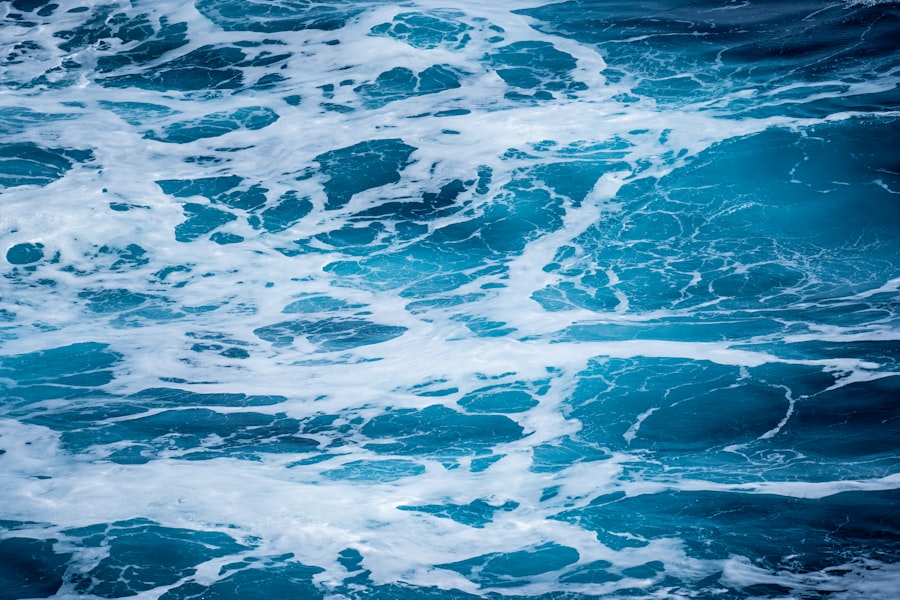
Navigating the Drake Passage presents a myriad of challenges that can test even the most seasoned mariners. One of the primary difficulties lies in the passage’s notorious weather conditions. The region is known for its fierce storms and high winds, which can arise suddenly and without warning.
These unpredictable weather patterns can create treacherous waves that reach heights of up to 15 meters (50 feet), making navigation perilous. Mariners must be prepared to adapt quickly to changing conditions, often requiring them to alter their course or delay their journey altogether. In addition to the weather, the Drake Passage is also home to various navigational hazards.
Icebergs and growlers—small ice chunks that can be difficult to detect—pose significant risks to vessels traversing these waters. The presence of strong currents further complicates navigation, as they can affect a ship’s speed and direction. Mariners must possess a deep understanding of these challenges and employ effective strategies to mitigate risks while ensuring safe passage through this formidable stretch of ocean.
Using Google Earth as a navigational tool

In recent years, technological advancements have transformed the way mariners approach navigation, with tools like Google Earth emerging as invaluable resources. Google Earth offers a comprehensive platform that allows users to explore geographical features in detail, providing an interactive experience that enhances situational awareness. For those navigating the Drake Passage, Google Earth can serve as an essential tool for planning routes, assessing potential hazards, and monitoring environmental conditions.
The platform’s user-friendly interface enables mariners to visualize their surroundings in three dimensions, offering a unique perspective on topography and oceanographic features. By utilizing Google Earth’s extensive satellite imagery and mapping capabilities, navigators can gain insights into the complexities of the Drake Passage, allowing them to make informed decisions while at sea. This technological innovation not only enhances safety but also empowers mariners to navigate with greater confidence in one of the world’s most challenging maritime environments.
Exploring the features of Google Earth for maritime navigation
| Feature | Description |
|---|---|
| 3D Ocean | Provides detailed underwater terrain and data for maritime navigation |
| Ship Tracking | Real-time tracking of ships and vessels for monitoring and navigation |
| Weather Overlay | Displays real-time weather information and forecasts for maritime planning |
| Port Information | Access to detailed information about ports, including facilities and services |
| Marine Traffic | Shows the density of marine traffic in specific areas for route planning |
Google Earth boasts a range of features specifically designed to aid maritime navigation. One of its most notable attributes is its high-resolution satellite imagery, which provides detailed views of coastlines, islands, and underwater topography. This level of detail is particularly beneficial for mariners navigating the Drake Passage, as it allows them to identify key landmarks and potential hazards along their route.
Additionally, Google Earth offers various layers that can be overlaid on the map, including bathymetric data that reveals underwater features such as seamounts and trenches. This information is crucial for understanding the seafloor’s contours and potential obstacles that may not be visible from the surface. Furthermore, users can access historical imagery to analyze changes in the environment over time, providing valuable context for navigation decisions.
By leveraging these features, mariners can enhance their situational awareness and improve their overall navigation strategies.
Planning a route through the Drake Passage with Google Earth
Effective route planning is essential for successful navigation through the Drake Passage, and Google Earth provides an array of tools to facilitate this process. Mariners can utilize the platform’s measuring tools to calculate distances between waypoints, ensuring they maintain an efficient course while accounting for potential obstacles. By plotting their intended route on Google Earth, navigators can visualize their journey and make adjustments as needed based on real-time data.
Moreover, Google Earth’s ability to integrate various data sources allows mariners to consider multiple factors when planning their route. For instance, they can overlay weather forecasts and oceanographic data onto their map to identify optimal sailing conditions.
By harnessing these planning tools, mariners can enhance their chances of safely traversing the challenging waters of the Drake Passage.
Utilizing satellite imagery and 3D mapping for navigation
The integration of satellite imagery and 3D mapping in Google Earth significantly enhances maritime navigation capabilities. Satellite imagery provides real-time visual data that allows mariners to assess current conditions in the Drake Passage accurately. This information is invaluable for identifying potential hazards such as ice formations or shallow areas that may pose risks to vessels.
3D mapping further enriches this experience by offering a realistic representation of the terrain both above and below water. Mariners can visualize how waves interact with underwater features and understand how these dynamics may affect their vessel’s stability and speed. This three-dimensional perspective enables navigators to anticipate challenges they may encounter during their journey and adjust their strategies accordingly.
Identifying potential hazards and obstacles with Google Earth
One of the most critical aspects of navigating the Drake Passage is identifying potential hazards that could jeopardize a vessel’s safety. Google Earth excels in this regard by providing detailed visualizations that highlight various obstacles within the passage. Mariners can use the platform to pinpoint locations of icebergs, rocky outcrops, and other navigational challenges that may not be readily apparent from traditional charts.
Additionally, Google Earth’s ability to display real-time data allows mariners to stay informed about changing conditions in the passage. For example, they can monitor ice movements or shifting currents that could impact their route. By proactively identifying these hazards through Google Earth, navigators can make informed decisions that enhance safety and minimize risks during their journey through this treacherous stretch of water.
Accessing real-time weather and oceanographic data with Google Earth
Real-time weather and oceanographic data are crucial components of safe navigation in the Drake Passage. Google Earth provides users with access to various layers that display current weather conditions, including wind speed, wave height, and precipitation forecasts. This information allows mariners to assess whether it is safe to proceed or if they should delay their journey due to adverse conditions.
In addition to weather data, Google Earth also offers oceanographic information such as sea surface temperatures and currents. Understanding these factors is essential for navigating effectively through the Drake Passage, as they can significantly influence a vessel’s performance and safety. By integrating this real-time data into their navigation strategies, mariners can make informed decisions that enhance their chances of successfully traversing this challenging maritime environment.
Navigating the Drake Passage with Google Earth: Tips and best practices
To maximize the benefits of using Google Earth for navigation in the Drake Passage, mariners should adhere to several best practices. First and foremost, it is essential to familiarize oneself with the platform’s features before embarking on a journey. Understanding how to access satellite imagery, overlay data layers, and utilize measuring tools will empower navigators to make informed decisions while at sea.
Additionally, mariners should regularly update their data sources to ensure they have access to the latest information regarding weather conditions and potential hazards. This proactive approach will enable them to adapt quickly to changing circumstances and maintain safe navigation throughout their journey. Finally, maintaining open communication with other vessels in the area can provide valuable insights into current conditions and potential challenges ahead.
Case studies of successful navigation through the Drake Passage using Google Earth
Several case studies illustrate how mariners have successfully navigated the Drake Passage using Google Earth as a key tool in their arsenal. One notable example involved a research vessel conducting scientific studies in Antarctic waters. By utilizing Google Earth’s satellite imagery and real-time weather data, the crew was able to plot an efficient route that minimized exposure to hazardous conditions while maximizing research opportunities.
Another case study involved a commercial shipping vessel transporting goods between South America and Antarctica. The captain relied heavily on Google Earth’s mapping capabilities to identify potential ice hazards along their route. By adjusting their course based on real-time data from Google Earth, they successfully navigated through challenging conditions without incident.
The future of maritime navigation with Google Earth
As technology continues to evolve, so too does the landscape of maritime navigation. The integration of tools like Google Earth into navigational practices represents a significant advancement in enhancing safety and efficiency at sea. For those navigating challenging waters like the Drake Passage, these innovations offer new opportunities for improved situational awareness and risk management.
Looking ahead, it is likely that further advancements in satellite technology and data integration will continue to enhance maritime navigation capabilities. As more mariners embrace digital tools like Google Earth, they will be better equipped to navigate complex environments while ensuring safety for themselves and their vessels. The future of maritime navigation promises exciting possibilities as technology continues to reshape how seafarers approach their journeys across some of the world’s most challenging waters.
The Drake Passage, a crucial waterway connecting the Atlantic and Pacific Oceans, is renowned for its challenging navigation conditions and rich biodiversity. For those interested in exploring this fascinating region further, Google Earth offers a unique perspective on its vast expanse and dynamic environment. A related article that delves into the intricacies of the Drake Passage and its significance in global ocean currents can be found on MyGeoQuest. This resource provides valuable insights into the geographical and ecological aspects of the passage. To learn more, visit the article on MyGeoQuest.
WATCH NOW! Drake Passage: Earth’s Deadliest Waters Revealed
FAQs
What is Google Earth?
Google Earth is a virtual globe, map, and geographical information program that was originally called EarthViewer 3D. It allows users to explore the world through satellite imagery, maps, terrain, and 3D buildings.
What is the Drake Passage?
The Drake Passage is the body of water between the southern tip of South America at Cape Horn and the South Shetland Islands of Antarctica. It is known for its rough seas and challenging sailing conditions.
How can Google Earth be used to explore the Drake Passage?
Google Earth allows users to virtually explore the Drake Passage by using satellite imagery and 3D mapping. Users can zoom in and out, tilt and rotate the view, and explore the surrounding areas and landmarks.
Can Google Earth be used for navigation in the Drake Passage?
While Google Earth provides detailed satellite imagery and mapping, it is not recommended for navigation in the Drake Passage or any other body of water. It is always best to use official nautical charts and navigation tools when sailing in challenging conditions.
Are there any specific features or points of interest in the Drake Passage on Google Earth?
Google Earth may display points of interest such as research stations, wildlife habitats, and historical landmarks in the Drake Passage. Users can explore these features and learn more about the area through the platform.