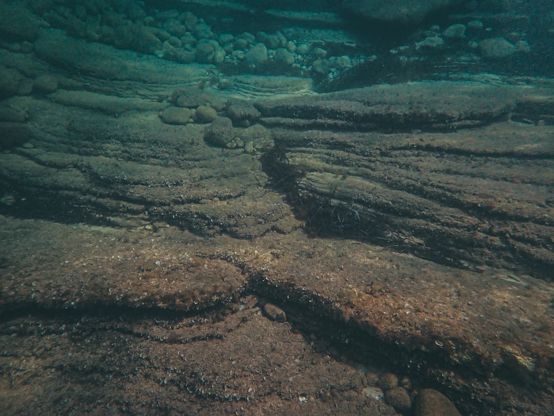
Ocean floor mapping is a critical endeavor that holds significant implications for various sectors, including environmental science, resource management, and national security. The ocean covers more than 70% of the Earth’s surface, yet much of its floor remains unexplored and poorly understood. Mapping the ocean floor provides essential data that can inform decisions about marine conservation, resource extraction, and navigation safety.
Understanding the topography and geological features of the seabed can also help in predicting natural disasters such as tsunamis and earthquakes, thereby enhancing preparedness and response strategies. Moreover, ocean floor mapping plays a vital role in understanding marine ecosystems. The seabed is home to a diverse array of species and habitats that are often sensitive to human activities.
By mapping these areas, scientists can identify critical habitats and biodiversity hotspots, which are essential for conservation efforts. This knowledge is crucial not only for protecting marine life but also for ensuring sustainable use of ocean resources. As climate change continues to impact oceanic conditions, the importance of comprehensive mapping becomes even more pronounced, as it allows for better management of marine environments.
Key Takeaways
- Accurate ocean floor mapping is crucial for understanding the Earth’s geology, ecosystems, and potential mineral resources.
- National security relies on ocean floor mapping to identify potential threats, monitor maritime activity, and protect underwater communication cables.
- Advanced technology such as multibeam sonar, autonomous underwater vehicles, and satellite imaging is used for ocean floor mapping.
- Challenges in ocean floor mapping include the vastness of the ocean, extreme depths, and the high cost of equipment and data analysis.
- Ocean floor mapping plays a critical role in national security by providing valuable intelligence on underwater terrain, potential military threats, and strategic navigation routes.
The Role of National Security in Ocean Floor Mapping
National security is increasingly intertwined with the need for comprehensive ocean floor mapping. As nations vie for control over maritime territories and resources, understanding the underwater landscape becomes a strategic imperative. The ocean floor is not just a physical space; it is a domain where geopolitical interests converge, particularly in areas rich in natural resources such as oil, gas, and minerals.
Countries invest in mapping their territorial waters to assert claims and protect their interests against potential adversaries. Furthermore, the ocean floor serves as a critical arena for military operations. Submarines, naval vessels, and underwater drones rely on accurate maps to navigate safely and effectively.
In times of conflict, having detailed knowledge of the ocean floor can provide a tactical advantage, allowing for stealthy movements and strategic positioning. As such, national security agencies prioritize ocean floor mapping to enhance their operational capabilities and ensure the safety of their maritime assets.
The Technology Used for Ocean Floor Mapping
The technology employed in ocean floor mapping has advanced significantly over the years, enabling more precise and efficient exploration of underwater terrains. One of the primary tools used is sonar technology, which employs sound waves to create detailed images of the seabed. Multibeam sonar systems can cover large areas quickly, providing high-resolution data that reveals the intricate features of the ocean floor.
This technology has revolutionized the way researchers and military personnel gather information about underwater landscapes. In addition to sonar, satellite altimetry has emerged as a valuable tool for mapping the ocean floor from space. By measuring variations in sea surface height, scientists can infer the underlying topography of the seabed.
This method allows for large-scale mapping of remote areas that are difficult to access with traditional methods. Coupled with advancements in data processing and visualization techniques, these technologies have made it possible to create comprehensive maps that are essential for both scientific research and national security applications.
The Challenges of Mapping the Ocean Floor
| Challenges | Details |
|---|---|
| Depth | The ocean floor is extremely deep in some areas, making it difficult to accurately map the bottom. |
| Technological Limitations | Current technology has limitations in accurately mapping the ocean floor, especially in remote or deep areas. |
| Cost | Mapping the ocean floor can be expensive due to the need for specialized equipment and vessels. |
| Underwater Features | The presence of underwater mountains, trenches, and other features can make mapping challenging. |
| Environmental Factors | Environmental conditions such as tides, currents, and weather can impact the accuracy of mapping efforts. |
Despite the advancements in technology, mapping the ocean floor remains a formidable challenge. One of the primary obstacles is the sheer scale of the task; the ocean covers vast areas that are often difficult to access due to depth and harsh conditions. Many regions remain unmapped or poorly mapped, leading to gaps in knowledge that can hinder effective management and conservation efforts.
Additionally, the dynamic nature of underwater environments poses challenges, as sediment movement, tectonic activity, and changing ocean currents can alter the seabed over time. Another significant challenge is the cost associated with ocean floor mapping initiatives. High-resolution mapping requires substantial investment in technology, personnel, and resources.
Many countries may lack the funding or infrastructure necessary to conduct comprehensive surveys, leading to disparities in data availability across different regions. Furthermore, political considerations can complicate collaborative efforts between nations, as competing interests may hinder joint mapping initiatives that could benefit global understanding of oceanic environments.
The Impact of Ocean Floor Mapping on National Security
The implications of ocean floor mapping for national security are profound and multifaceted. Accurate maps provide critical intelligence that informs military strategy and operational planning. For instance, understanding underwater topography can aid in identifying potential hiding spots for submarines or other naval assets, enhancing surveillance capabilities.
Additionally, detailed maps can assist in planning naval exercises or humanitarian missions by ensuring safe navigation through complex underwater terrains. Moreover, ocean floor mapping contributes to maritime domain awareness, which is essential for monitoring illegal activities such as smuggling or unauthorized fishing. By having a clear understanding of maritime boundaries and underwater features, nations can better enforce their laws and protect their resources.
This capability is particularly important in contested regions where multiple countries have overlapping claims. In this context, ocean floor mapping serves not only as a tool for defense but also as a means of asserting sovereignty over maritime territories.
The Connection Between Ocean Floor Mapping and Submarine Navigation
Submarine navigation is intricately linked to the accuracy of ocean floor mapping.
Detailed maps of the ocean floor enable submarines to navigate safely while avoiding hazards such as underwater mountains or trenches that could pose risks during operations.
Furthermore, accurate mapping enhances situational awareness for submarine crews. By understanding the topography of their surroundings, submarines can plan routes that optimize stealth and minimize detection by adversaries. This capability is crucial during military operations where stealth is paramount.
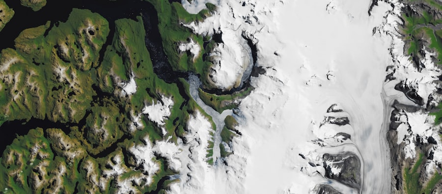
The Role of Satellite Technology in Ocean Floor Mapping
Satellite technology has revolutionized many fields, including oceanography and marine studies. In the context of ocean floor mapping, satellites play a crucial role by providing data that complements traditional surveying methods. Satellite altimetry allows scientists to measure sea surface heights with remarkable precision, enabling them to infer the underlying topography of the seabed over vast areas.
Additionally, satellites equipped with synthetic aperture radar (SAR) can monitor changes in sea ice cover and surface currents, providing valuable context for understanding how these factors interact with underwater features. This information is essential for predicting how climate change may impact marine environments and ecosystems. By integrating satellite data with other mapping technologies, researchers can create comprehensive models that enhance our understanding of ocean dynamics and contribute to more effective management strategies.
The Collaboration Between Government Agencies and Research Institutions
Collaboration between government agencies and research institutions is vital for advancing ocean floor mapping initiatives. Many countries recognize that comprehensive mapping requires expertise from various fields, including geology, marine biology, and engineering. By pooling resources and knowledge, these entities can undertake large-scale mapping projects that would be challenging for any single organization to accomplish alone.
Such collaborations often lead to innovative approaches to data collection and analysis. For instance, joint expeditions may combine advanced sonar technology with ecological assessments to create maps that not only depict physical features but also highlight important biological habitats. This interdisciplinary approach enhances the quality of data collected while fostering partnerships that can lead to future research opportunities and funding initiatives.
The Future of Ocean Floor Mapping for National Security
The future of ocean floor mapping holds great promise for enhancing national security efforts worldwide. As technology continues to advance, new methods will emerge that allow for even more detailed and efficient mapping of underwater environments. Autonomous underwater vehicles (AUVs) equipped with advanced sensors are likely to play a significant role in this evolution, enabling continuous monitoring of critical areas without requiring human intervention.
Moreover, as geopolitical tensions persist in various regions around the globe, nations will increasingly recognize the strategic importance of comprehensive ocean floor mapping. Investments in this area will likely grow as countries seek to bolster their maritime capabilities and protect their interests in contested waters. The integration of artificial intelligence (AI) into data analysis processes will further enhance decision-making capabilities by providing insights derived from vast amounts of mapping data.
The Potential for Discoveries in Ocean Floor Mapping
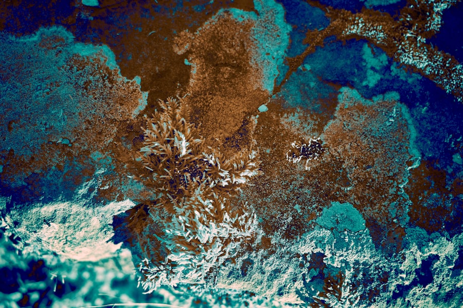
Beyond its implications for national security, ocean floor mapping holds immense potential for scientific discoveries that could reshape our understanding of marine environments. The seabed is a treasure trove of geological formations, shipwrecks, and unique ecosystems that have yet to be fully explored. Each new map generated has the potential to reveal previously unknown features or habitats that could contribute to scientific knowledge.
For instance, deep-sea hydrothermal vents have been discovered through targeted mapping efforts, leading to groundbreaking research on extremophiles—organisms that thrive in extreme conditions—and their potential applications in biotechnology. Additionally, uncovering ancient shipwrecks can provide insights into historical trade routes and maritime practices. As exploration continues, each new discovery adds depth to humanity’s understanding of its oceans and their significance.
The Ethical and Environmental Considerations of Ocean Floor Mapping for National Security
While ocean floor mapping offers numerous benefits for national security and scientific discovery, it also raises ethical and environmental considerations that must be addressed. The process of mapping can disrupt delicate marine ecosystems if not conducted responsibly. Disturbances caused by sonar surveys or other invasive techniques may harm sensitive habitats or species already threatened by climate change and human activity.
Furthermore, there are ethical implications surrounding territorial claims based on mapped data. As nations assert control over newly discovered resources or territories revealed through mapping efforts, conflicts may arise over ownership rights and environmental stewardship responsibilities. It is essential for governments and organizations involved in ocean floor mapping to prioritize sustainable practices that minimize ecological impact while fostering international cooperation aimed at preserving marine environments for future generations.
In conclusion, ocean floor mapping is an essential endeavor with far-reaching implications for national security, scientific discovery, and environmental stewardship. As technology advances and collaboration between various stakeholders increases, the potential for enhanced understanding of our oceans grows exponentially. However, it is crucial to navigate this complex landscape with an awareness of ethical considerations and environmental impacts to ensure that future generations inherit a healthy and well-mapped marine environment.
Ocean floor mapping is a critical aspect of understanding our planet’s underwater landscapes, yet it is often classified due to national security concerns and the potential for resource exploitation. For a deeper insight into the implications of ocean mapping and its classification, you can read more in this related article on MyGeoQuest: MyGeoQuest. This resource provides valuable information on the technologies used in mapping the ocean floor and the reasons behind the restrictions placed on such data.
WATCH THIS! The Map You Can’t See is Controlling the World
FAQs
What is ocean floor mapping?
Ocean floor mapping is the process of using various technologies to create detailed maps and images of the ocean floor. This can include the use of sonar, satellite imagery, and other remote sensing techniques.
Why is ocean floor mapping important?
Ocean floor mapping is important for a variety of reasons. It helps scientists and researchers better understand the geology and topography of the ocean floor, which can in turn provide valuable information for marine conservation, resource exploration, and disaster prevention.
How is ocean floor mapping classified?
Ocean floor mapping is often classified due to national security concerns. The detailed information about the ocean floor can be sensitive and may have military implications, so access to certain data and technologies used for ocean floor mapping may be restricted.
What are some of the technologies used for ocean floor mapping?
Some of the technologies used for ocean floor mapping include multibeam sonar systems, satellite-based radar altimetry, and autonomous underwater vehicles (AUVs). These technologies allow for the collection of high-resolution data and imagery of the ocean floor.
Who uses ocean floor mapping data?
Ocean floor mapping data is used by a wide range of stakeholders, including government agencies, research institutions, environmental organizations, and industries such as oil and gas exploration, telecommunications, and undersea cable laying.