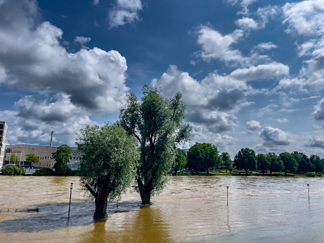
New York City, with its unique geography, is particularly vulnerable to flooding. The city is situated on a series of islands, including Manhattan, Staten Island, and parts of Brooklyn and Queens, which are bordered by the Atlantic Ocean and various waterways. This coastal positioning exposes the city to storm surges and rising sea levels, making certain areas more susceptible to flooding than others.
The topography of the city also plays a significant role in flood risk; low-lying neighborhoods, especially those near the waterfront, are at a heightened risk during heavy rainfall or storm events. In addition to its coastal vulnerabilities, New York City has a complex network of rivers and bays that can exacerbate flooding. The East River, Hudson River, and Jamaica Bay are just a few of the bodies of water that surround the city.
These waterways can overflow during extreme weather events, leading to significant flooding in adjacent neighborhoods. Furthermore, urban development has altered natural drainage patterns, increasing the likelihood of flooding in areas that were once less prone to such events. As climate change continues to impact weather patterns, understanding the geography of flood risk zones in New York City becomes increasingly critical for residents and policymakers alike.
Key Takeaways
- NYC flood risk zones are primarily located in low-lying coastal areas and areas near rivers and streams.
- Historical flooding events in NYC include Hurricane Sandy in 2012, which caused widespread damage and devastation.
- Climate change is exacerbating NYC flood risk through sea level rise and more intense storms.
- FEMA flood maps are important tools for understanding flood risk and determining flood insurance requirements.
- Infrastructure such as seawalls, levees, and stormwater management systems play a crucial role in mitigating NYC flood risk.
Historical Flooding Events in NYC
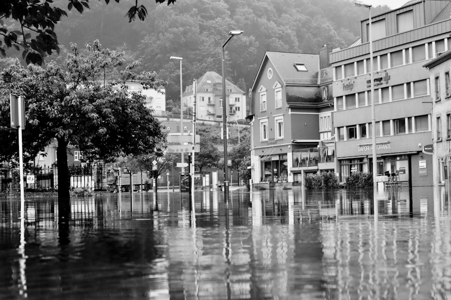
New York City has a long history of flooding events that have shaped its development and response strategies. One of the most notable incidents occurred in 1938 when a powerful hurricane struck the region, causing extensive damage and flooding in various neighborhoods. This event served as a wake-up call for city planners and emergency responders, highlighting the need for improved infrastructure and preparedness measures.
Over the decades, other significant flooding events have occurred, including Hurricane Sandy in 2012, which inundated large portions of the city and caused billions of dollars in damages. Hurricane Sandy was particularly devastating due to its combination of high winds and storm surges that overwhelmed the city’s defenses. The storm resulted in widespread power outages, transportation disruptions, and loss of life.
The aftermath of Sandy prompted a reevaluation of the city’s flood risk management strategies and led to increased investment in infrastructure improvements. Historical flooding events like these have not only shaped public perception of flood risk but have also influenced policy decisions aimed at enhancing resilience against future disasters.
The Impact of Climate Change on NYC Flood Risk
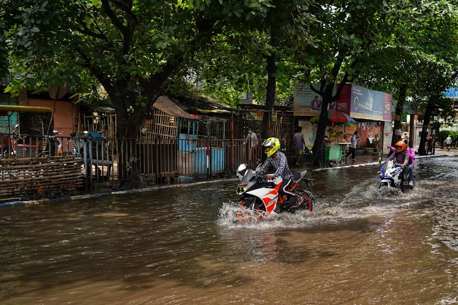
Climate change has emerged as a significant factor influencing flood risk in New York City. Rising global temperatures contribute to melting ice caps and glaciers, leading to higher sea levels that threaten coastal communities. In addition to rising seas, climate change is associated with more intense and frequent storms, which can result in increased rainfall and storm surges.
As a result, New York City faces an elevated risk of flooding that could have dire consequences for its residents and infrastructure. The implications of climate change extend beyond immediate flooding risks; they also affect long-term planning and development strategies. As sea levels continue to rise, city planners must consider how to adapt existing infrastructure to withstand future flooding events.
This may involve investing in seawalls, green spaces that absorb excess water, and improved drainage systems. The urgency of addressing climate change’s impact on flood risk cannot be overstated, as it poses a threat not only to the physical landscape but also to the economic stability and safety of New York City’s residents.
Understanding FEMA Flood Maps
| Metrics | Data |
|---|---|
| Number of FEMA Flood Maps | Over 20,000 |
| Scale of FEMA Flood Maps | 1:12,000 to 1:100,000 |
| Types of Flood Zones | AE, VE, X, etc. |
| Effective Date of Maps | Varies by location |
FEMA flood maps are essential tools for understanding flood risk in New York City. These maps provide detailed information about flood zones, indicating areas that are at high risk for flooding during a 100-year flood event or other significant weather occurrences. By categorizing areas into different flood zones—such as Special Flood Hazard Areas (SFHAs) and non-SFHAs—FEMA helps residents and businesses assess their vulnerability to flooding.
Understanding these maps is crucial for homeowners and renters alike, as they inform decisions about flood insurance requirements and property investments. Properties located within SFHAs are typically required to carry flood insurance if they have federally backed mortgages.
By familiarizing themselves with FEMA flood maps, New Yorkers can make informed choices about their properties and take proactive measures to mitigate potential flood damage.
The Role of Infrastructure in NYC Flood Risk
Infrastructure plays a pivotal role in managing flood risk in New York City. The city’s extensive network of drainage systems, levees, and seawalls is designed to protect against flooding; however, many of these systems were built decades ago and may not be equipped to handle the increased intensity of modern storms exacerbated by climate change. Aging infrastructure can lead to inadequate drainage during heavy rainfall, resulting in localized flooding that disrupts daily life.
In response to these challenges, city officials have begun investing in innovative infrastructure solutions aimed at enhancing resilience against flooding. Projects such as the East Side Coastal Resiliency Project seek to create barriers against storm surges while also providing public green spaces for residents. Additionally, initiatives like green roofs and permeable pavements are being implemented to improve water absorption and reduce runoff during heavy rain events.
By prioritizing infrastructure improvements that account for future climate scenarios, New York City aims to better protect its residents from the growing threat of flooding.
The Economic Impact of Flooding in NYC
The economic ramifications of flooding in New York City are profound and far-reaching. Flooding can lead to significant property damage, loss of business revenue, and costly repairs that strain both individual households and the city’s economy as a whole. For instance, Hurricane Sandy resulted in an estimated $19 billion in damages across the region, affecting thousands of businesses and displacing countless residents.
Such financial losses can take years to recover from, impacting local economies and employment rates. Moreover, the economic impact extends beyond immediate damages; it also includes long-term effects on property values and insurance premiums. Areas that experience frequent flooding may see a decline in property values as potential buyers become wary of investing in high-risk zones.
This can lead to decreased tax revenues for the city, further complicating efforts to fund necessary infrastructure improvements and emergency response initiatives. As climate change continues to heighten flood risks, understanding the economic implications becomes essential for both residents and policymakers seeking sustainable solutions.
Community Resilience and Preparedness
Community resilience is vital for mitigating the impacts of flooding in New York City. Local organizations and neighborhood groups play an essential role in fostering preparedness among residents by providing resources, training, and support during emergencies. Initiatives such as community workshops on emergency preparedness equip individuals with knowledge about evacuation routes, emergency supplies, and communication strategies during flooding events.
Furthermore, community engagement is crucial for building a culture of resilience that empowers residents to take proactive measures against flooding risks. Collaborative efforts between local governments and community organizations can lead to the development of neighborhood-specific plans that address unique vulnerabilities while promoting collective action during emergencies. By fostering strong community ties and encouraging preparedness efforts, New Yorkers can enhance their ability to respond effectively to flooding events.
The Importance of Flood Insurance in NYC
Flood insurance is an essential consideration for residents living in New York City’s flood-prone areas. While standard homeowners’ insurance policies typically do not cover flood damage, obtaining separate flood insurance can provide critical financial protection against potential losses. For homeowners located within Special Flood Hazard Areas (SFHAs), flood insurance is often a requirement for federally backed mortgages; however, even those outside these zones should consider purchasing coverage due to the unpredictable nature of flooding.
The National Flood Insurance Program (NFIP) offers policies designed specifically for homeowners in flood-prone areas, providing coverage for both structural damage and personal property loss. Understanding the terms and conditions of these policies is crucial for ensuring adequate protection against potential flooding events. As climate change continues to increase the frequency and severity of storms, investing in flood insurance becomes an increasingly important aspect of financial planning for New Yorkers.
Mitigation and Adaptation Strategies for NYC Flood Risk
Mitigation and adaptation strategies are essential components of New York City’s approach to managing flood risk. Mitigation efforts focus on reducing vulnerability through proactive measures such as improving drainage systems, restoring wetlands that absorb excess water, and implementing zoning regulations that discourage development in high-risk areas. These strategies aim to minimize the impact of flooding before it occurs.
Adaptation strategies involve adjusting existing infrastructure and practices to better cope with changing conditions brought about by climate change. This may include elevating buildings in flood-prone areas or retrofitting existing structures with flood-resistant materials. Additionally, creating green spaces that can absorb stormwater helps reduce runoff during heavy rain events while enhancing urban aesthetics.
By combining mitigation and adaptation efforts, New York City aims to create a more resilient urban environment capable of withstanding future flooding challenges.
Government Response to NYC Flood Risk
The government response to flood risk in New York City has evolved significantly over the years, particularly following major flooding events like Hurricane Sandy. In the aftermath of such disasters, city officials have prioritized investments in infrastructure improvements aimed at enhancing resilience against future storms.
Moreover, collaboration between local, state, and federal agencies has become increasingly important in addressing flood risk comprehensively. Programs like Build It Back aim to assist homeowners affected by flooding through financial support for repairs or rebuilding efforts while also promoting resilient construction practices. By fostering partnerships across various levels of government and engaging with community stakeholders, New York City seeks to create a coordinated response that effectively addresses the multifaceted challenges posed by flooding.
Future Outlook for NYC Flood Risk Zones
The future outlook for flood risk zones in New York City remains uncertain as climate change continues to pose significant challenges. Rising sea levels and increasing storm intensity will likely exacerbate existing vulnerabilities while creating new ones across different neighborhoods. As such, ongoing efforts to enhance resilience through infrastructure improvements, community engagement, and policy changes will be crucial in mitigating future risks.
Looking ahead, it is imperative for city planners and policymakers to adopt a proactive approach that anticipates potential changes rather than merely reacting after disasters occur. This may involve investing in innovative technologies that monitor weather patterns or developing comprehensive evacuation plans tailored to specific neighborhoods’ needs. By prioritizing long-term sustainability over short-term fixes, New York City can work towards creating a safer environment for its residents while addressing the realities of an evolving climate landscape.
In conclusion, understanding the complexities surrounding NYC’s flood risk zones requires a multifaceted approach that considers geography, historical context, climate change impacts, infrastructure needs, economic implications, community resilience efforts, insurance considerations, mitigation strategies, government responses, and future outlooks. As New Yorkers navigate these challenges together—armed with knowledge and preparedness—they can build a more resilient city capable of weathering whatever storms lie ahead.
In recent years, the increasing frequency and intensity of storms have heightened concerns about flood risks in urban areas, particularly in cities like New York. Understanding the flood risk zones in NYC is crucial for residents and city planners alike to mitigate potential damage and enhance preparedness. A related article that delves into the intricacies of flood risk zones and offers valuable insights can be found on MyGeoQuest. For more detailed information, you can read the article by visiting this link.
WATCH THIS! The Real Cost of NYC Living: Your Wallet, Sanity, and Subway Survival Skills
FAQs
What are NYC flood risk zones?
NYC flood risk zones are areas within New York City that are at a higher risk of flooding during extreme weather events, such as hurricanes or heavy rainfall. These zones are identified based on factors such as elevation, proximity to bodies of water, and historical flood data.
How are NYC flood risk zones determined?
NYC flood risk zones are determined using a combination of factors, including elevation data, proximity to coastal areas and water bodies, historical flood data, and the potential impact of storm surges. The city uses this information to create flood risk maps that identify areas at higher risk of flooding.
What are the different flood risk zones in NYC?
NYC has several flood risk zones, including high-risk flood zones, moderate-risk flood zones, and low-risk flood zones. High-risk zones are areas that are most susceptible to flooding and are typically located near the coast or in low-lying areas. Moderate-risk zones are areas that have a lower but still significant risk of flooding, while low-risk zones have a minimal risk of flooding.
What measures are in place to mitigate flood risk in NYC?
NYC has implemented various measures to mitigate flood risk, including the construction of coastal protection infrastructure such as seawalls and levees, the implementation of building codes and regulations for flood-resistant construction, and the development of emergency response plans for flooding events. The city also provides resources and guidance to property owners to help them reduce their flood risk.
How can residents and property owners in NYC prepare for potential flooding?
Residents and property owners in NYC can prepare for potential flooding by staying informed about their flood risk, obtaining flood insurance, implementing flood-resistant measures in their properties, and creating emergency plans for evacuation and protection of their belongings. The city also provides resources and guidance on flood preparedness.