The cyclical deluge, a force of nature deeply ingrained in the lives of millions, has once again unleashed its destructive power. Annual monsoon flooding, a recurring event in many parts of the world, is not merely a temporary inconvenience; it is a relentless driver of severe land loss, particularly in regions already grappling with vulnerability. As the monsoon season intensifies, driven by complex climatic shifts and exacerbated by human activity, the consequences are becoming increasingly dire, reshaping landscapes and displacing communities with alarming regularity. This article delves into the multifaceted phenomenon of monsoon flooding and its devastating impact on land, exploring the contributing factors, the most affected areas, and the urgent need for adaptive strategies.
The Intricate Dance of Monsoon and Landscape
The monsoon, a seasonal reversal of wind patterns, is a vital climatic feature for many agricultural economies, bringing essential rainfall after long dry spells. However, this life-giving rain can transform into a destructive force when rainfall exceeds the land’s capacity to absorb or channel it. The intensity and duration of monsoon downpours, coupled with geographical factors, determine the severity of flooding.
The Anatomy of Monsoon Rainfall
Monsoon systems are characterized by vast amounts of precipitation concentrated over specific periods. This phenomenon is driven by the differential heating of land and sea. During the summer months, land heats up more rapidly than the ocean, causing air above the land to rise, creating a low-pressure area. This draws moist air from the cooler, high-pressure ocean towards the land, resulting in heavy rainfall. The intricate interplay of atmospheric pressure, humidity, and wind currents dictates the trajectory and intensity of these rain-bearing systems.
Seasonal Predictability and Aberrations
Traditionally, monsoon patterns have exhibited a degree of predictability, allowing communities to prepare for the wet season. However, in recent decades, climate change has introduced significant unpredictability and increased variability. We are witnessing more intense rainfall events occurring over shorter durations, leading to flash floods. Conversely, some regions might experience prolonged dry spells followed by catastrophic deluges. This unpredictability makes planning and mitigation efforts increasingly challenging. El Niño and La Niña phenomena, significant drivers of global weather patterns, also play a crucial role in modulating monsoon strength and distribution, further complicating long-term forecasts.
Topographical Triggers for Catastrophe
The physical characteristics of a region play a pivotal role in how it experiences monsoon flooding. Low-lying coastal areas, river deltas, and floodplains are inherently more susceptible to inundation. The confluence of major river systems can create vast expanses of waterlogged land, while coastal regions are vulnerable to storm surges that push seawater inland, compounding the effects of riverine flooding.
The Role of Elevation and Drainage
Areas with minimal elevation are obvious candidates for inundation. However, even seemingly higher ground can be affected by poor drainage. In regions with impermeable soil layers or inadequate natural or artificial drainage systems, water accumulates rapidly, leading to prolonged waterlogging and eventually land loss. Natural depressions and ancient riverbeds, often fertile and previously inhabited, can become treacherous traps during periods of heavy rainfall. The natural flow of water is paramount, and any obstruction or alteration can have cascading negative effects downstream.
Sedimentation and Riverbed Elevation
Rivers carrying heavy sediment loads, common in monsoon-fed river systems, can experience a gradual elevation of their riverbeds. Over time, this reduces the channel’s capacity to carry water, making it more prone to overflowing its banks during heavy rainfall. Deforestation upstream exacerbates this problem by increasing soil erosion, leading to a greater influx of sediment into rivers. This continuous siltation transforms once-manageable rivers into agents of destruction.
Annual monsoon flooding has become a critical issue, leading to significant land loss and affecting countless communities. For a deeper understanding of the impacts of these floods and the ongoing challenges faced by affected regions, you can read a related article that explores the environmental and socio-economic consequences of monsoon seasons. This article provides valuable insights into the strategies being implemented to mitigate land loss and adapt to changing climate patterns. To learn more, visit this article.
The Insidious Erosion of Land
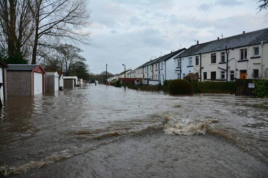
Annual monsoon flooding is not merely about temporary inundation; it is a primary driver of permanent land loss through erosion. The sheer force of moving water can scour away topsoil, undermine riverbanks, and reshape coastlines, leaving behind altered landscapes and rendering land infertile or unusable.
Riverine Erosion: The Undermining Force
The relentless flow of swollen rivers is a powerful erosive agent. As water speeds up and gains volume during monsoons, it exerts immense pressure on riverbanks, dislodging soil and rock. This process can lead to the gradual widening of river channels and, in extreme cases, to the sudden collapse of large sections of land.
Cut-off Meanders and Channel Shifting
Rivers often exhibit meanders, or curves, which can be slowly carved away by the current. During intense floods, these meanders can be cut off, forming oxbow lakes and permanently altering the river’s course. This channel shifting can directly impact adjacent land, sometimes cutting off fertile agricultural fields from their water source or, conversely, inundating land that was previously dry. The dynamic nature of rivers is amplified during monsoon events.
Undermining of Infrastructure and Settlements
The erosion caused by flooding poses a significant threat to human settlements and infrastructure located near riverbanks. Homes, roads, bridges, and other vital structures can be undermined, leading to their collapse and the loss of valuable land that supported them. The economic and social costs of such destruction are immense, often forcing communities to relocate.
Coastal Erosion: The Sea’s Inroads
Coastal regions face a dual threat during monsoon seasons: rising sea levels and intensified storm surges. These forces combine to accelerate coastal erosion, a process that eats away at shorelines and leads to the permanent loss of land.
Storm Surges and Wave Action
The powerful winds associated with monsoon storms can generate significant storm surges, pushing seawater far inland. This elevated water level, combined with the relentless action of waves, can rapidly erode beaches, dunes, and coastal cliffs. The increased frequency and intensity of such events, linked to climate change, are accelerating the retreat of coastlines globally.
Salinization of Coastal Lands
As seawater inundates coastal land, it leaves behind a saline residue. This salinization renders the soil infertile for most agricultural crops, transforming once-productive land into unusable salt marshes or barren expanses. The long-term impact on livelihoods and food security in these regions is profound, as traditional farming practices become untenable.
Land Degradation: Beyond Simple Erosion
Beyond the immediate physical removal of land, monsoon flooding contributes to a broader degradation of land quality, making it less productive and resilient.
Waterlogging and Soil Compaction
Prolonged periods of inundation can lead to waterlogging, where the soil remains saturated for extended durations. This suffocates plant roots, hindering growth and leading to crop failure. Furthermore, the impact of heavy water flow and debris can compact the soil, reducing its permeability and aeration, making it harder for future vegetation to establish.
Loss of Topsoil and Fertility
The most fertile layer of soil is the topsoil, rich in organic matter and nutrients. Monsoon floods, with their erosive power, often strip away this precious topsoil, leaving behind less fertile subsoil. This loss of fertility necessitates increased reliance on artificial fertilizers, which can have their own environmental consequences, and significantly reduces the land’s long-term agricultural potential.
Vulnerable Regions: Where the Impact is Deepest
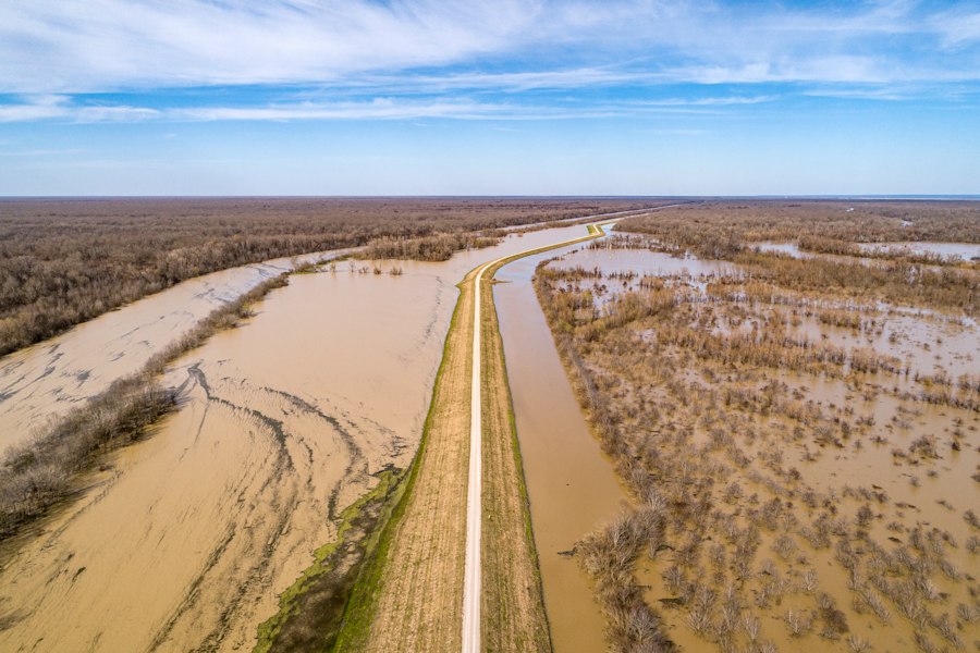
The consequences of annual monsoon flooding are not evenly distributed. Certain geographical and socio-economic factors render specific regions disproportionately vulnerable to severe land loss and its associated impacts.
Low-Lying Deltas and Coastal Plains: The Frontlines
The world’s major river deltas and low-lying coastal plains are the most acutely affected by monsoon flooding. These areas are characterized by flat topography, proximity to the sea, and often a high population density due to their historical agricultural productivity and access to trade routes.
The Ganges-Brahmaputra Delta: A Case Study in Peril
The Ganges-Brahmaputra Delta, shared by Bangladesh and parts of India, is a stark example of a region facing existential threats from monsoon flooding and sea-level rise. Millions of people inhabit this densely populated area, heavily reliant on agriculture. The delta’s low elevation, combined with its intricate network of rivers, makes it extremely susceptible to both riverine flooding and tidal surges. Land loss in this region is not just an environmental issue; it is a humanitarian crisis, driving displacement and increasing poverty.
Southeast Asian Rice Bowl: Yields Under Threat
Vast swathes of Southeast Asia, including Vietnam’s Mekong Delta and parts of Thailand and Myanmar, are also low-lying deltas that serve as vital agricultural hubs, particularly for rice production. These regions experience intense monsoon rainfall and are vulnerable to river overflow and coastal inundation. The recurring flooding threatens the food security of millions, both regionally and globally, as these areas are significant food exporters.
Inland Floodplains and River Basins: Inland Threats
While coastal regions often receive the most attention, vast inland floodplains and river basins are also critically vulnerable. These areas are characterized by expansive flat lands situated alongside major river systems, making them prone to widespread inundation during prolonged periods of heavy rainfall.
The Yangtze River Basin: Cycles of Catastrophe
China’s Yangtze River basin, the country’s most important agricultural and economic region, has a long history of devastating floods. While extensive flood control infrastructure has been built, the sheer scale of monsoon rainfall, coupled with upstream deforestation and urbanization, continues to pose a significant threat. Land loss in these areas can occur through extensive siltation, soil erosion, and the permanent alteration of arable land due to waterlogging.
The African Great Lakes Region: Shifting Landscapes
Countries around the African Great Lakes, such as Uganda, Kenya, and Tanzania, experience significant monsoon rainfall. While often associated with droughts, these regions also face severe flooding, particularly in lowland areas and along river systems. Erosion caused by these floods can lead to significant land degradation, impacting agricultural productivity and displacing rural communities.
Areas Impacted by Deforestation and Unsustainable Land Use: Compounding Vulnerabilities
Regions that have experienced extensive deforestation and unsustainable land-use practices are often more vulnerable to the impacts of monsoon flooding. The removal of tree cover reduces the land’s ability to absorb rainwater, increasing surface runoff and the likelihood of erosion and flooding downstream.
Upland Erosion and Downstream Sedimentation
When forests are cleared in upland areas, the exposed soil becomes highly susceptible to erosion during heavy rainfall. This eroded soil is then carried downstream, silting up rivers and reservoirs, exacerbating flooding in downstream plains and deltas. This interconnectedness highlights how actions in one region can have devastating consequences in another.
Urbanization and Impermeable Surfaces
The rapid pace of urbanization in many developing countries often involves replacing permeable land with concrete and asphalt. These impermeable surfaces prevent rainwater from infiltrating the ground, leading to increased surface runoff and a higher risk of flash flooding, even in areas not traditionally prone to widespread inundation. This can also lead to localized land loss through severe scouring and erosion around newly built structures.
The Human Cost: Displacement and Livelihood Erosion
The land loss driven by annual monsoon flooding has profound and devastating consequences for human populations, leading to displacement, loss of livelihoods, and increased poverty.
Forced Migration and Climate Refugees
When land becomes permanently submerged, infertile, or eroded, communities are often forced to abandon their homes and ancestral lands. This displacement can lead to significant social disruption, the breakdown of communities, and the emergence of “climate refugees” seeking safer havens. These migrations can place immense pressure on host communities and create new challenges for governments.
The Plight of Island Nations and Coastal Communities
Small island developing states and low-lying coastal communities are particularly at risk. As sea levels rise and storm surges intensify, entire islands and coastal regions can become uninhabitable. The loss of land means the loss of homes, livelihoods, and cultural heritage. For these communities, the threat of losing their nation is a stark reality.
Loss of Agricultural Lands and Food Insecurity
Agriculture is the primary livelihood for a vast proportion of the population in monsoon-dependent regions. The permanent loss of fertile agricultural land due to erosion, salinization, and waterlogging directly undermines food production, leading to food insecurity at local, regional, and sometimes global levels. Farmers face the devastating prospect of losing their source of income and their ability to feed their families.
Shifting Livelihood Strategies and Economic Hardship
When traditional agricultural livelihoods become unsustainable, communities are forced to adapt. This often involves shifting to less productive land, migrating to urban areas in search of work, or engaging in more precarious informal economies. These transitions are often accompanied by significant economic hardship and increased vulnerability.
Impact on Infrastructure and Access to Basic Services
The destruction of infrastructure—roads, bridges, schools, and healthcare facilities—due to flooding isolates communities, hindering access to essential services. This disruption exacerbates existing inequalities and makes recovery efforts more challenging. The long-term economic development of affected regions is severely hampered.
Annual monsoon flooding has become a pressing issue, leading to significant land loss in various regions. The impact of these floods not only devastates local communities but also alters the landscape, making recovery a challenging endeavor. For a deeper understanding of how these environmental changes are interconnected, you can read a related article that explores the implications of climate change on monsoon patterns and their effects on land stability. This insightful piece can be found here.
Towards Resilience: Adaptation and Mitigation Strategies
| Year | Region | Annual Monsoon Rainfall (mm) | Flooded Area (sq km) | Land Loss (sq km) | Population Affected |
|---|---|---|---|---|---|
| 2020 | Bangladesh | 2500 | 15000 | 120 | 5,000,000 |
| 2021 | India (Assam) | 2200 | 13000 | 90 | 3,500,000 |
| 2022 | Vietnam (Mekong Delta) | 1800 | 8000 | 150 | 2,000,000 |
| 2023 | Pakistan (Sindh) | 2100 | 10000 | 110 | 4,000,000 |
| 2024 | Bangladesh | 2600 | 16000 | 130 | 5,200,000 |
Addressing the escalating problem of land loss due to monsoon flooding requires a multi-pronged approach that combines immediate adaptation measures with long-term mitigation strategies aimed at building resilience.
Nature-Based Solutions: Working with the Environment
Embracing nature-based solutions offers a sustainable and often cost-effective way to manage floodwaters and reduce erosion. These approaches leverage natural processes to protect communities and landscapes.
Mangrove Restoration and Coastal Protection
Mangrove forests along coastlines act as natural buffers against storm surges and coastal erosion. Their intricate root systems trap sediment and dissipate wave energy, providing invaluable protection for inland communities. Restoring and protecting these vital ecosystems is a crucial strategy for coastal resilience.
Wetland Conservation and Floodplain Management
Wetlands and floodplains serve as natural sponges, absorbing excess rainwater and releasing it slowly, thereby reducing the severity of floods downstream. Conserving these areas and implementing sustainable floodplain management practices can significantly mitigate flood risks and protect agricultural land.
Infrastructure Upgrades and Flood Defenses
While nature-based solutions are vital, engineered infrastructure also plays a role in flood management, particularly in densely populated areas.
Improved Drainage Systems and Water Management
Investing in robust and efficient drainage systems, both natural and artificial, is essential for channeling excess water away from settlements and agricultural lands. Integrated water resource management plans that consider the entire river basin are crucial for effective flood control.
Sea Walls and Levees: Protective Barriers
In some high-risk coastal areas, sea walls and levees can provide essential protection against inundation from storm surges and tidal flooding. However, these hard engineering solutions can be expensive to build and maintain and can sometimes have unintended ecological consequences. Their effectiveness needs to be carefully assessed in conjunction with other strategies.
Climate Change Mitigation and Policy Interventions
Ultimately, the root cause of increasing monsoon intensity and variability is climate change. Therefore, global efforts to mitigate greenhouse gas emissions are paramount. At the national and local levels, robust policies are needed to address land-use planning, disaster preparedness, and support for vulnerable communities.
Sustainable Land-Use Planning and Zoning
Implementing strict land-use regulations that restrict development in flood-prone areas and promote sustainable practices can significantly reduce vulnerability. This includes discouraging construction in riverine areas and coastal zones vulnerable to erosion and inundation.
Early Warning Systems and Disaster Preparedness
Developing and strengthening early warning systems for floods allows communities to prepare for impending events, saving lives and reducing property damage. Comprehensive disaster preparedness plans, including evacuation procedures and relief efforts, are crucial for minimizing the human cost of flooding.
International Cooperation and Financial Support
The scale of the challenge demands international cooperation and financial support. Developed nations, which have historically contributed more to climate change, have a responsibility to assist vulnerable countries in adapting to its impacts, including providing financial and technical assistance for flood management and land restoration projects.
The relentless cycle of monsoon flooding continues to reshape the physical and human geography of vulnerable regions. The land loss it drives is not a distant threat but a present reality, demanding urgent and comprehensive action. By understanding the intricate interplay of natural forces and human activities, and by embracing a combination of nature-based solutions, improved infrastructure, and robust policy interventions, the international community can strive to build greater resilience and protect the lives and livelihoods of those most exposed to the fury of the monsoon. The battle against land loss is a fight for the future of these communities and for the planet’s most cherished ecosystems.
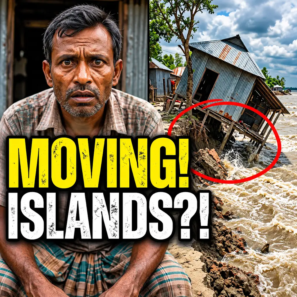
This River is Literally Erasing Islands
FAQs
What causes annual monsoon flooding?
Annual monsoon flooding is caused by heavy rainfall during the monsoon season, which typically lasts for several months. The excessive rainfall leads to overflowing rivers, flash floods, and waterlogging in low-lying areas.
How does annual monsoon flooding contribute to land loss?
Annual monsoon flooding contributes to land loss by eroding soil, washing away topsoil, and causing landslides. The force of the floodwaters can also lead to the collapse of riverbanks and embankments, further exacerbating land loss.
What are the impacts of annual monsoon flooding on communities?
Annual monsoon flooding can have devastating impacts on communities, including displacement of residents, destruction of homes and infrastructure, loss of livelihoods, and disruption of essential services such as water and sanitation. The flooding can also result in loss of lives and injuries.
How can communities prepare for annual monsoon flooding?
Communities can prepare for annual monsoon flooding by implementing early warning systems, conducting evacuation drills, building flood-resistant infrastructure, and creating emergency response plans. It is also important for communities to raise awareness about flood risks and to have access to emergency supplies.
What measures can be taken to mitigate land loss due to annual monsoon flooding?
To mitigate land loss due to annual monsoon flooding, measures such as afforestation, construction of retaining walls, dredging of rivers, and proper land use planning can be implemented. Additionally, restoring wetlands and natural buffers can help absorb excess water and reduce the impact of flooding on land.