
The Ever-Shifting Embrace: Understanding Riverbank Line Migration
Rivers are dynamic entities, constantly reshaping the landscapes they traverse. This ceaseless evolution, particularly the movement of their banks, is a phenomenon known as riverbank line migration. Understanding and quantifying this migration is not merely an academic pursuit; it holds profound implications for infrastructure planning, flood risk assessment, ecological preservation, and water resource management. Historically, tracking such changes relied on laborious field surveys and manual analysis of aerial photographs. However, the advent and widespread availability of satellite imagery have revolutionized our ability to monitor these subtle yet significant geological processes with unprecedented detail and scale. This article delves into the methodologies, applications, and challenges of using satellite imagery to track riverbank line migration.
Monitoring riverbank line migration from space has become an increasingly important topic in environmental science, as it helps to understand the dynamics of river systems and their impact on surrounding ecosystems. A related article that delves into this subject can be found on MyGeoQuest, which discusses the innovative techniques used in satellite imagery to track changes in riverbanks over time. For more insights, you can read the article here: MyGeoQuest.
Harnessing the Vantage Point: Satellite Imagery as a Monitoring Tool
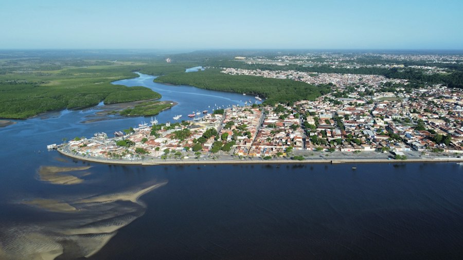
Satellite imagery offers a unique vantage point, providing a synoptic view of large geographical areas over extended periods. This characteristic makes it an invaluable tool for observing natural processes that unfold gradually, such as the lateral movement of river channels. Different types of satellite sensors capture data across various parts of the electromagnetic spectrum, each offering distinct advantages for delineating riverbanks and detecting changes.
Delving into the Data Spectrum: Optical vs. Radar Imagery
The choice of satellite imagery depends heavily on the specific requirements of the study and the prevailing environmental conditions. Optical sensors, which capture reflected sunlight, are the most common type. They provide visually intuitive images that are analogous to what the human eye sees.
Optical Sensors: Capturing the Visual Narrative
Optical satellite imagery, such as that from Landsat, Sentinel-2, or commercial high-resolution satellites like WorldView, is excellent for distinguishing between land and water. The stark contrast between the spectral reflectance of vegetation-covered banks and the water of the river channel allows for clear delineation. Water bodies typically absorb most visible and near-infrared light, appearing dark in these images, while vegetation reflects strongly in the near-infrared, appearing bright. By analyzing a time series of optical images, researchers can identify the historical positions of the riverbank and precisely measure the extent of its movement. The spatial resolution of optical sensors varies significantly. While medium-resolution sensors like Landsat (30 meters) are suitable for regional-scale studies and historical analysis, high-resolution sensors (sub-meter) are crucial for accurately mapping fine-scale erosion and deposition features along riverbanks, particularly in densely vegetated areas where spectral signatures can be similar.
Radar Imagery: Peering Through the Veil
Synthetic Aperture Radar (SAR) imagery, such as that from Sentinel-1, offers a distinct advantage: it can penetrate clouds and operate day or night. This makes it indispensable in regions with frequent cloud cover, which often coincides with river-dominated landscapes and high rainfall. SAR sensors emit microwave pulses and record the backscattered signal. The interaction of these pulses with the Earth’s surface is influenced by factors like surface roughness, moisture content, and geometric structure. Water bodies, due to their smooth surfaces, tend to appear dark in SAR images as they reflect the radar signal away from the sensor. Conversely, vegetated land surfaces and rougher terrain exhibit higher backscatter. Advanced SAR processing techniques, such as interferometry (InSAR), can even detect millimeter-level ground deformation, which can be indicative of subtle bank subsidence or uplift contributing to migration. The ability of SAR to detect moisture content can also be useful in differentiating saturated bank soils from drier inland areas, indirectly aiding in boundary definition.
From Pixels to Polygons: Preprocessing and Feature Extraction
Raw satellite imagery is rarely ready for direct analysis. A series of preprocessing steps are essential to ensure accuracy and comparability across different images and time periods. These steps aim to correct for geometric distortions, radiometric variations, and atmospheric effects.
Geometric Correction and Orthorectification: Ensuring Spatial Accuracy
Raw satellite images contain geometric distortions due to the sensor’s perspective, the Earth’s curvature, and variations in terrain elevation. Geometric correction involves warping the image to align with a known geographic coordinate system. Orthorectification takes this a step further by removing topographic distortions, ensuring that all features are represented in their true planimetric position. This is critical for accurate distance and area measurements, which are fundamental to quantifying riverbank migration. High-precision digital elevation models (DEMs) are often used in the orthorectification process, especially for mountainous or hilly river valleys.
Radiometric Calibration and Atmospheric Correction: Standardizing the Brightness
Radiometric calibration converts raw digital numbers from the sensor into physically meaningful radiance or reflectance values. This process accounts for variations in sensor sensitivity and illumination conditions. Atmospheric correction removes the effects of atmospheric scattering and absorption, which can alter the spectral signatures of surface features. By standardizing the brightness values, these corrections ensure that changes observed over time are due to actual land cover changes rather than variations in illumination or atmospheric conditions. This is particularly important when comparing images acquired on different dates or under different atmospheric states.
Water Masking and Land Cover Classification: Isolating the Riverine Zone
Once the imagery is preprocessed, the next critical step is to isolate the river channel and its immediate banks. This is typically achieved through water masking, a process that distinguishes water pixels from land pixels. Algorithms utilize spectral thresholds, texture analysis, or machine learning classifiers to create a binary mask where water is represented by one value and land by another. For more nuanced analysis, land cover classification can be employed to differentiate between various riparian vegetation types, bare soil, or human infrastructure along the riverbanks. This provides a richer understanding of the processes driving migration, such as vegetation encroachment or erosion of specific soil types.
Quantifying Movement: Measuring Migration Over Time
With the riverbank line precisely delineated, the core task of measuring migration can begin. This involves comparing the position of the bank across multiple time points and calculating the distance and direction of movement.
Temporal Series Analysis: Stitching Together the Past
The power of satellite imagery lies in its ability to provide a historical archive. By acquiring images from different dates, researchers can construct a temporal series of riverbank positions. Comparing successive images allows for the direct measurement of bank line displacement. Algorithms can then analyze these displacements to identify patterns of erosion (movement away from the channel) and accretion (deposition of sediment and outward growth of the bank). The frequency of data acquisition is crucial; higher temporal resolution allows for the capture of more rapid migration events and a more continuous understanding of the process.
Change Detection Algorithms: Highlighting the Shifts
Various change detection algorithms are employed to highlight the differences between riverbank lines from different dates. These range from simple image differencing, where the pixel values of two images are subtracted, to more sophisticated techniques like the Normalized Difference Vegetation Index (NDVI) differencing, which is sensitive to changes in vegetation cover, often an indicator of bank stabilization or erosion. Object-based image analysis (OBIA) is also increasingly used, treating image segments (objects) rather than individual pixels, allowing for more contextual analysis and the identification of changes in entire river sections or features like point bars.
Measuring Erosion and Accretion Rates: The Quantitative Output
The ultimate goal is to quantify the rates of erosion and accretion. This is typically done by measuring the perpendicular distance between the riverbank lines at different time points. Statistical methods can then be used to calculate average migration rates, directional biases (e.g., predominantly erosion on one bank and accretion on the other), and the total area of land lost or gained. This quantitative data is essential for informing land-use planning and engineering decisions. For instance, predicting the future location of a riverbank based on historical rates can guide the placement of flood defenses or critical infrastructure.
Illuminating the Landscape: Applications of Riverbank Migration Monitoring
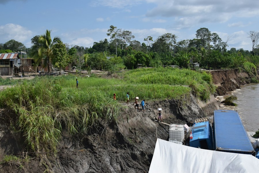
The insights gained from tracking riverbank line migration using satellite imagery have far-reaching implications across various sectors, impacting human societies and natural ecosystems alike.
Safeguarding Communities and Infrastructure: Flood Risk and Land Use Planning
Uncontrolled riverbank migration can pose significant threats to human settlements and vital infrastructure located in proximity to rivers. Understanding the patterns and rates of erosion is paramount for effective flood risk management and land-use planning.
Predicting Flood Hazards: Proactive Measures for Protection
By mapping areas prone to bank erosion and predicting future channel shifts, authorities can identify high-risk zones for flooding. This allows for the implementation of proactive measures such as early warning systems, evacuation plans, and the strategic relocation of vulnerable populations and assets. For example, if satellite analysis shows a river is aggressively eroding its banks towards a town, authorities can initiate reinforced flood defenses or even consider phased relocation of residents from the most exposed areas. The ability to quantify the volume of land lost to erosion also helps in estimating the potential impact on downstream sediment loads, which can influence channel morphology and flood dynamics further afield.
Informing Development Decisions: Sustainable Land Management
Satellite-derived riverbank migration data provides crucial information for sustainable land management and development decisions. Planners can use this information to establish appropriate buffer zones along rivers, preventing new construction in areas susceptible to erosion. This helps to minimize future losses and avoid costly interventions. Furthermore, understanding how rivers naturally evolve can inform the design of bridges, pipelines, and other infrastructure, ensuring their longevity and resilience in dynamic environments. For instance, knowing that a river migrates significantly over a 50-year period might dictate a wider setback for a proposed industrial facility compared to a river with a stable course.
Nurturing Ecosystems: Biodiversity and Habitat Dynamics
Riverbanks are critical ecological corridors, supporting a unique array of flora and fauna. Riverbank migration, while a natural process, profoundly influences these ecosystems, creating and destroying habitats.
Tracking Habitat Change: Preserving Riparian Biodiversity
The lateral movement of rivers creates and destroys riparian habitats at different rates. Erosion can expose new soil for pioneer species, while accretion can lead to the formation of new wetlands and floodplains. Satellite imagery allows ecologists to monitor these changes in habitat availability and quality over time. This is invaluable for conservation efforts, enabling the identification of critical habitats that need protection and the assessment of the impact of human interventions on riverine ecosystems. For example, tracking the expansion of river channels into forests can reveal loss of terrestrial habitat, while the creation of new sandbars might indicate opportunities for nesting bird species.
Understanding Ecological Connectivity: The Flow of Life
Riverbanks serve as corridors for the movement of wildlife. Changes in their position can affect the connectivity between different habitat patches, influencing gene flow and species dispersal. By analyzing how riverbank migration alters the landscape, scientists can better understand the patterns of ecological connectivity and identify potential barriers or corridors for wildlife movement. This knowledge is crucial for designing effective conservation strategies that maintain functional ecological networks. A widening river might fragment a forest, isolating populations, while a meandering river could connect previously separated wetland areas.
Managing Resources: Water Quality and Sediment Dynamics
Riverbank erosion is a significant source of sediment and nutrients entering river systems. Understanding and monitoring these processes is essential for managing water quality and the ecological health of rivers.
Assessing Sediment Loads: Impact on Waterways
Bank erosion is a primary contributor to sediment load in rivers. Excessive sediment can lead to turbidity, reduced light penetration for aquatic plants, and sedimentation of reservoirs and navigation channels. Satellite imagery can help estimate the extent of bank erosion and, when combined with other data, infer potential increases in sediment loads. This information is vital for water resource managers who need to maintain water quality for drinking, agriculture, and industrial uses. Quantifying the spatial extent of actively eroding banks can help prioritize areas for erosion control measures.
Nutrient Cycling: The River’s Chemical Footprint
Bank erosion not only contributes sediment but also releases nutrients, such as nitrogen and phosphorus, from soils into the river. While some nutrient input is natural and beneficial, excessive amounts can lead to eutrophication and algal blooms. Satellite imagery, particularly when combined with spectral analysis that can infer soil type and vegetation cover, can help identify areas of significant erosion and thus potential hotspots for nutrient loading. This aids in developing targeted strategies for managing non-point source pollution.
Navigating the Challenges: Limitations and Future Directions
Despite its immense power, the use of satellite imagery for tracking riverbank line migration is not without its challenges. Overcoming these limitations will be crucial for advancing the field.
The Nuances of Detection: Obstacles and Uncertainties
Achieving accurate and reliable measurements of riverbank migration requires careful consideration of various factors that can influence the detection process.
Vegetation Cover: The Green Veil
Dense riparian vegetation can obscure the actual position of the riverbank, making it difficult to delineate the water-land interface. Spectral confusion between different types of vegetation and saturated soils can also pose challenges. Advanced image processing techniques, including the use of multi-spectral and hyperspectral data, as well as object-based analysis, are being developed to overcome these issues. Combining optical imagery with SAR data can also be beneficial, as SAR’s sensitivity to moisture can help differentiate between saturated banks and dry land.
Cloud Cover and Atmospheric Interference: The Unseen Barriers
As mentioned earlier, cloud cover is a significant impediment for optical satellite imagery, especially in tropical and temperate regions with high rainfall. This can lead to temporal gaps in the data, making it difficult to capture rapid migration events or to construct continuous time series. The development of all-weather sensors like SAR is a critical advancement in this regard. However, even SAR imagery can be affected by factors like speckle noise and surface roughness variations that can complicate water delineation.
Spatial and Temporal Resolution: The Trade-offs
The spatial resolution of satellite imagery dictates the level of detail that can be observed. While high-resolution imagery is ideal for precise mapping of individual erosion features, it often comes with higher costs and less frequent revisit times. Medium-resolution imagery, on the other hand, offers more frequent coverage but may not capture fine-scale migration. Similarly, temporal resolution is crucial. If a riverbank is migrating rapidly, a low temporal resolution might miss significant changes between image acquisition dates. Balancing the need for detail with the availability and cost of data is an ongoing consideration.
Refining the Tools: Advancements in Methodology and Technology
The field of remote sensing is constantly evolving, with new technologies and methodologies emerging that promise to enhance our ability to track riverbank line migration.
Machine Learning and Artificial Intelligence: Empowering Analysis
Machine learning (ML) and artificial intelligence (AI) are revolutionizing image analysis. These techniques can be trained to automatically delineate riverbanks with high accuracy, classify land cover types along the banks, and even predict future migration patterns based on historical data. ML algorithms can learn complex relationships between spectral characteristics, textural patterns, and ground truth data, leading to more robust and efficient analysis pipelines. For example, deep learning models can be trained to recognize subtle visual cues indicative of erosion or deposition.
Unmanned Aerial Vehicles (UAVs): Complementary Perspectives
While satellites provide a broad overview, Unmanned Aerial Vehicles (UAVs), or drones, offer a highly flexible and cost-effective means of obtaining very high-resolution imagery at a local scale. UAVs can be deployed rapidly to capture detailed information about specific river sections undergoing rapid erosion or to validate satellite-derived measurements. Their ability to collect data on demand makes them an excellent tool for supplementing satellite observations and for detailed site investigations.
Integration of Multi-Sensor Data: A Holistic View
The future likely lies in the integration of data from multiple satellite sensors, as well as other data sources like ground-based monitoring networks and hydrological models. By fusing information from optical, SAR, and even LiDAR sensors, researchers can create a more comprehensive and accurate understanding of riverbank dynamics. For instance, combining optical imagery for vegetation mapping with SAR data for surface roughness and InSAR for ground deformation could provide a more complete picture of the complex processes at play.
Monitoring riverbank line migration from space has become increasingly important for understanding environmental changes and managing natural resources. A related article discusses innovative satellite technologies that allow researchers to track these shifts with remarkable precision. By utilizing remote sensing data, scientists can analyze the dynamics of riverbanks over time, providing valuable insights for conservation efforts. For more information on this topic, you can read the full article here: innovative satellite technologies.
Conclusion: A Dynamic Dialogue Between Rivers and Observation
| Metric | Description | Unit | Typical Range | Data Source |
|---|---|---|---|---|
| Riverbank Line Displacement | Distance the riverbank has moved from its original position | meters | 0 – 50 | Satellite imagery (e.g., Landsat, Sentinel) |
| Rate of Migration | Speed at which the riverbank line shifts over time | meters/year | 0 – 10 | Time-series satellite data |
| Area of Erosion | Surface area lost due to riverbank erosion | square meters | 0 – 10,000 | Remote sensing change detection |
| Vegetation Cover Change | Change in vegetation along the riverbank indicating stability | percentage (%) | -100 to +100 | NDVI from satellite data |
| Water Level Variation | Fluctuation in river water level affecting bank stability | meters | 0 – 5 | Satellite altimetry / in-situ sensors |
| Bank Slope Change | Alteration in the slope angle of the riverbank | degrees | 0 – 30 | Digital Elevation Models (DEMs) from satellite data |
The study of riverbank line migration using satellite imagery has moved from a niche scientific endeavor to a vital tool for understanding and managing our planet’s dynamic waterways. The ability to remotely observe and quantify the ceaseless reshaping of river channels provides invaluable insights for protecting communities, preserving biodiversity, and ensuring sustainable resource management. As satellite technology continues to advance, offering higher resolutions, more frequent revisits, and new sensor capabilities, our capacity to monitor and comprehend these ever-shifting landscapes will only grow, fostering a more informed and resilient relationship with the rivers that define our world. The dialogue between the earth observation community and the natural world is deepening, offering a clearer view into the complex and beautiful dance of geological change.
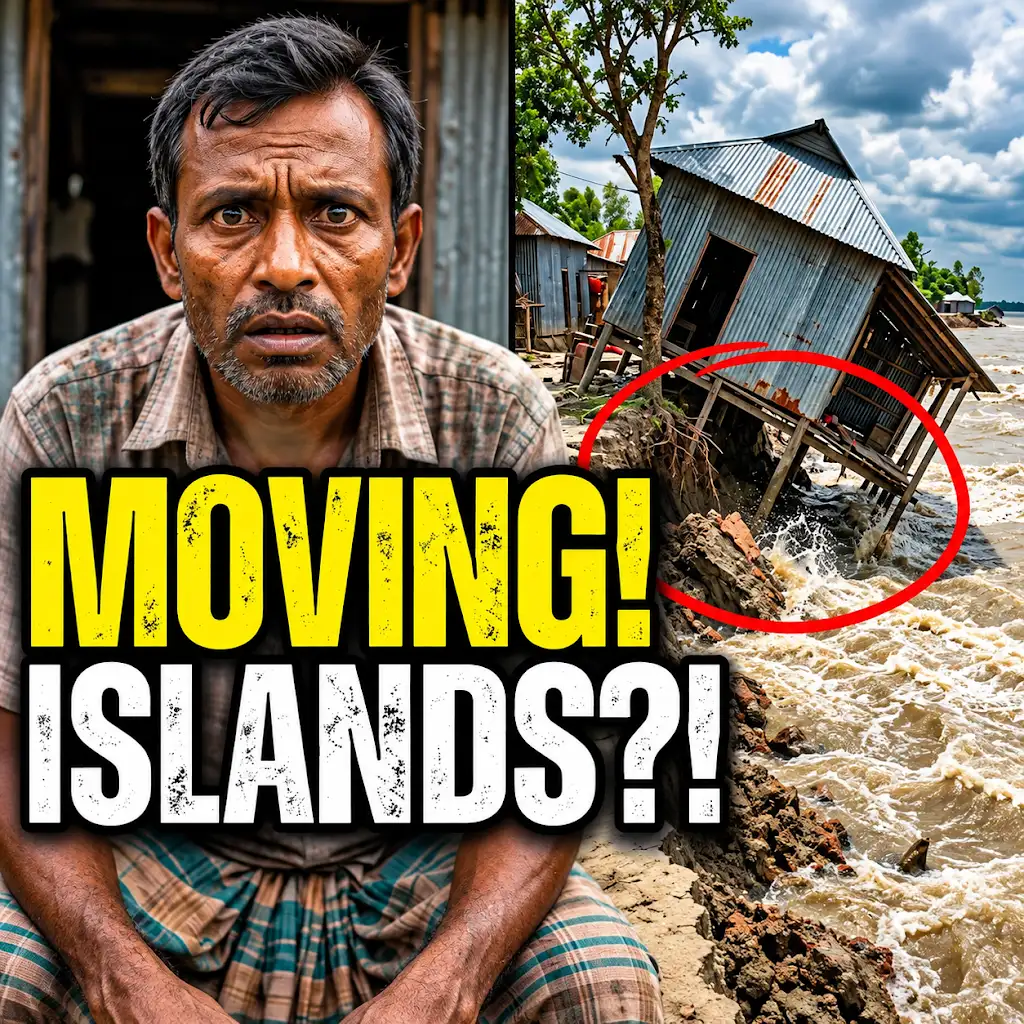
This River is Literally Erasing Islands
FAQs
What is riverbank line migration?
Riverbank line migration refers to the gradual movement of the edge of a riverbank over time due to various factors such as erosion, sediment deposition, and changes in water flow.
How can riverbank line migration be monitored from space?
Riverbank line migration can be monitored from space using satellite imagery and remote sensing technologies that capture high-resolution images of the Earth’s surface. These images can be analyzed to track changes in the position of the riverbank over time.
What are the benefits of monitoring riverbank line migration from space?
Monitoring riverbank line migration from space allows for a comprehensive and cost-effective way to assess changes in river morphology, identify areas at risk of erosion or flooding, and inform land use planning and management decisions.
Which satellite missions are commonly used for monitoring riverbank line migration?
Satellite missions such as Landsat, Sentinel-1, and TerraSAR-X are commonly used for monitoring riverbank line migration due to their high spatial resolution, frequent revisit times, and ability to capture images in different wavelengths.
How can the data obtained from monitoring riverbank line migration be used for environmental management?
The data obtained from monitoring riverbank line migration can be used to assess the impact of human activities on river ecosystems, develop strategies for mitigating erosion and flooding risks, and support sustainable riverbank management practices.