Unraveling the Enigma of Massive Earth Movements
Voluminous landslide deposits represent some of the most dramatic and impactful geological phenomena on Earth’s surface. These colossal accumulations of rock, soil, and debris, often stretching for kilometers and burying vast areas, are not merely random acts of nature. They are the product of complex interactions between geological, environmental, and, increasingly, anthropogenic factors. Understanding the causes, impacts, and geological significance of these prodigious events is crucial for hazard assessment, resource management, and comprehending the dynamic evolution of our planet’s landscapes. The sheer scale of these deposits hints at immense energies released and profound transformations of the terrain. Geologists have long been fascinated by these features, meticulously dissecting their origins and consequences to decipher Earth’s ongoing narrative.
Voluminous landslide deposits are fascinating geological phenomena that can significantly alter landscapes and impact ecosystems. For those interested in exploring this topic further, a related article provides in-depth insights into the mechanisms and consequences of such landslides. You can read more about it by visiting this link: here.
Triggers and Drivers of Gargantuan Slopes’ Collapse
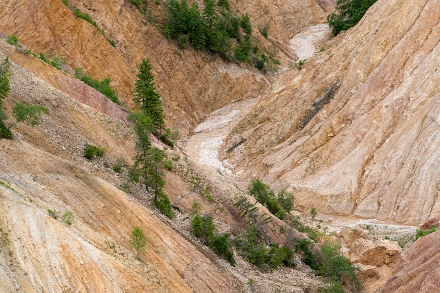
The genesis of a voluminous landslide is rarely a singular event but rather a confluence of predisposing factors and a specific trigger. Predisposing factors weaken the slope’s stability over time, making it more susceptible to failure. Triggers, on the other hand, are the immediate events that push the weakened slope past its breaking point. Identifying these elements is paramount for predicting and mitigating landslide risk.
Underlying Geological Weaknesses
The inherent geological makeup of a region plays a fundamental role in determining its susceptibility to large-scale mass wasting. Certain rock types and geological structures are intrinsically less stable than others, creating zones of weakness that can eventually lead to catastrophic failure.
Stratigraphy and Rock Strength
The layering of different rock types, known as stratigraphy, is a critical factor. Layers of weak, deformable rocks like shales, clays, or salt can act as basal sliding surfaces. When subjected to stress, these weak layers can shear, allowing overlying, more competent rock masses to detach and move downslope. The strength of individual rock units, their resistance to fracturing and deformation, also dictates how well they can withstand gravitational forces. Massive, unfractured igneous and metamorphic rocks might resist failure for millennia, while highly fractured sedimentary rocks or those with pervasive bedding planes are far more prone to instability.
Structural Discontinuities
Faults, joints, and bedding planes are natural planes of weakness within rock masses. These discontinuities reduce the overall shear strength of the rock and can facilitate movement along specific surfaces. In mountainous regions, steep geological structures, such as tilted strata or overturned beds, can create configurations where gravity exerts a powerful downslope pull. The orientation and density of these discontinuities are crucial. When they are favorably oriented to the slope face, they dramatically increase the likelihood of a large-scale slide.
Geomorphological Factors and Slope Geometry
The shape and steepness of a slope are directly related to the forces acting upon it. Very steep slopes, by definition, have a greater gravitational component pulling material downwards. However, it’s not just extreme steepness; subtle changes in slope angle over long distances, the presence of convexities, or undercutting at the toe of a slope can all contribute to instability. The overall geomorphology of a region, including the presence of existing valleys and scarps, can concentrate stresses and create favorable conditions for large slides.
The Role of Water: The Ubiquitous Lubricant and Load
Water is arguably the most common and potent trigger for landslides, especially for voluminous events. Its presence can significantly alter the mechanical properties of soils and rocks, making them far more susceptible to movement.
Pore Water Pressure and Effective Stress
The presence of water within the pore spaces of soil and rock is a critical factor. As water infiltrates, it increases pore water pressure. This increased pressure acts to push the soil or rock grains apart, reducing the frictional resistance between them. The effective stress, which is the stress carried by the solid framework of the material, decreases as pore water pressure increases. When effective stress drops below a critical threshold, the material can no longer support the overlying load, and failure occurs. This is particularly significant in materials like clay, which can absorb large amounts of water and swell, further weakening their structure.
Hydrostatic Forces and Increased Loading
Rainfall, snowmelt, or changes in groundwater levels can saturate the ground, increasing its weight. This added load further stresses the slope. In some cases, water can accumulate in impermeable layers, creating perched water tables that generate localized zones of high pore water pressure. The weight of saturated soil or rock can be significantly greater than its dry equivalent, acting as a potent destabilizing force.
Erosion and Undercutting
Water plays a crucial role in erosion. Rivers and streams can undercut the base of slopes, removing support and creating steeper, more unstable faces. Coastal erosion, driven by wave action, can similarly destabilize cliff bases. This undercutting removes the material that holds the slope in place, leaving the overlying mass prone to collapse.
External Perturbations: The Final Push
While geological conditions and water are the primary predispositions, external events often provide the final impetus for a landslide. These triggers can be natural or human-induced.
Seismic Activity
Earthquakes are powerful triggers for landslides. The ground shaking associated with seismic events can cause significant accelerations that exceed the shear strength of the ground. The intensity and duration of shaking, as well as the geological conditions of the affected area, determine the magnitude of the landslide response. Large earthquakes have been responsible for some of the most catastrophic and voluminous landslides in history, often creating widespread devastation.
Volcanic Eruptions
Volcanic activity can trigger landslides through several mechanisms. Volcanic edifices themselves are often steep and inherently unstable. Eruptions can cause ground deformation, the expulsion of hot ash and gases that can destabilize slopes, and lahars (volcanic mudflows) which are essentially catastrophic landslides. Pyroclastic flows, another volcanic hazard, can also strip away material and trigger secondary landslides.
Intense Rainfall and Snowmelt Events
Periods of exceptionally heavy rainfall or rapid snowmelt can saturate slopes, leading to increased pore water pressure and overloading. These events are particularly dangerous when they follow a period of drought, as dry, brittle soils can absorb water rapidly, leading to sudden instability. Prolonged rainfall, even at moderate intensities, can also lead to gradual saturation and progressive weakening of slopes over time.
Human Activities: A Growing Factor
Human intervention in natural slopes has become an increasingly significant cause of landslides.
Deforestation and Land Use Changes
Removing vegetation through deforestation or agricultural practices can destabilize slopes. Tree roots bind soil together, increasing its shear strength. Their removal exposes the soil to erosion and reduces its ability to absorb water, leading to increased runoff and saturation.
Construction and Excavation
The construction of roads, buildings, and other infrastructure often involves cutting into hillsides or altering natural drainage patterns. Excavation at the toe of a slope removes lateral support, while overloading the crest of a slope with fill material can introduce an excessive load. Improperly designed drainage systems can also exacerbate water-related issues.
Mining and Quarrying
Open-pit mining and quarrying operations can create extremely steep artificial slopes that are highly susceptible to failure. The removal of large volumes of rock and soil can significantly alter the stress regime in the surrounding area, leading to instability.
Reservoir Impoundment
The creation of large reservoirs behind dams can introduce new sources of water that saturate underlying geological formations. This can lead to increased pore water pressure and, in some cases, induce seismicity, both of which can trigger landslides.
The Far-Reaching Repercussions of Catastrophic Earth Slides

Voluminous landslides are not merely geological events; they are powerful forces that can dramatically reshape landscapes and inflict devastating consequences on human populations and ecosystems. Their impacts range from immediate destruction to long-term environmental and economic disruptions.
Immediate Devastation and Loss of Life
The most immediate and tragic impact of a large-scale landslide is the catastrophic destruction it can cause. When a massive volume of material moves downslope at high speed, it possesses immense kinetic energy.
Burial and Obliteration
Homes, infrastructure, and entire communities can be swiftly buried or completely obliterated by the advancing debris. The sheer force of a voluminous landslide can pulverize structures, leaving little trace of what once existed. This rapid burial can trap and kill people, animals, and livestock with little warning.
Impact Waves and Air Blasts
Large landslides entering bodies of water, such as lakes or fjords, can generate enormous impact waves that can inundate coastal areas and cause significant damage far inland. Similarly, the rapid displacement of air by a fast-moving landslide can create powerful air blasts that can flatten trees and damage structures even beyond the main deposit zone.
Long-Term Environmental Transformations
Beyond the immediate destruction, voluminous landslides leave indelible marks on the environment, altering landscapes and ecological systems for centuries.
Landscape Alteration and Habitat Destruction
The scale of these events dramatically reshapes the topography. Entire valleys can be blocked, creating new lakes or altering river courses. Existing habitats are destroyed, and new ones are formed on the fresh landslide deposits. The loss of mature forests and the disruption of soil profiles can take decades or even centuries to recover.
Sedimentation and Water Quality Issues
The massive influx of sediment into rivers and lakes from landslide deposits can have profound effects on aquatic ecosystems. Increased turbidity can reduce sunlight penetration, impacting plant life. Sediment can smother spawning grounds for fish and clog water intakes for human consumption and agriculture. River channels can become aggraded (filled with sediment), leading to increased flood risk upstream of the deposit.
Soil Formation and Succession
While initially devastating, landslide deposits eventually become substrates for new soil formation. Over time, pioneer plant species colonize the fresh debris, initiating ecological succession. This process of soil development and the re-establishment of plant communities can provide valuable insights into ecological resilience and recovery.
Economic and Societal Disruptions
The economic and societal consequences of voluminous landslides can be far-reaching and long-lasting.
Infrastructure Damage and Reconstruction Costs
The destruction of roads, bridges, railways, and utility lines by landslides can cripple transportation networks and isolate communities. The cost of repairing or rebuilding this vital infrastructure can be enormous, often requiring significant government investment and delaying economic development.
Agricultural Land Loss and Food Security
Landslides can bury valuable agricultural land, rendering it unusable for cultivation. This loss of productive land can impact local food security and livelihoods, particularly in regions heavily reliant on agriculture.
Displacement of Populations and Social Impacts
Survivors of landslides may be displaced from their homes, leading to social disruption and the need for temporary or permanent relocation. The psychological impact of experiencing such a catastrophic event can also be profound, requiring long-term support and recovery efforts.
Impact on Tourism and Recreation
Landslides can significantly impact tourism and recreational activities. The destruction of natural attractions, the closure of access routes, and the visual scar of a landslide can deter visitors, impacting local economies that depend on tourism revenue.
Geological Fingerprints: The Enduring Significance of Landslide Deposits
Voluminous landslide deposits are not just scars on the landscape; they are invaluable geological archives that provide critical insights into Earth’s past processes, tectonic history, and climatic fluctuations. Their study allows geologists to reconstruct ancient environments and understand the dynamic forces that have shaped our planet.
Reconstructing Paleoseismic Events
Large landslides, particularly those triggered by earthquakes, can preserve crucial evidence of past seismic activity. The size and distribution of landslide deposits can be used to infer the magnitude and location of ancient earthquakes that occurred long before written records. By dating these deposits using techniques like radiocarbon dating or cosmogenic nuclide dating, scientists can build detailed paleoseismic catalogs.
Identifying Earthquake Magnitude and Location
The spatial extent of seismically induced landslides, known as landslide scarps, and the characteristics of the landslide deposits themselves provide clues about the intensity of ground shaking. Areas with a high density of landslides are indicative of strong shaking. The pattern of landslide distribution can also help pinpoint the epicenter or rupture zone of ancient earthquakes.
Determining Recurrence Intervals
By dating multiple landslide events within a specific region, geologists can estimate the frequency with which large earthquakes have occurred in the past. This information is vital for seismic hazard assessments and understanding the long-term behavior of fault systems.
Evidence of Past Climatic and Environmental Conditions
The composition and characteristics of landslide deposits can also reveal information about the environmental conditions that prevailed at the time of their formation.
Paleobotanical and Paleoclimatic Proxies
Fossilized plant material or pollen trapped within landslide deposits can offer clues about past vegetation and, by extension, past climate. For instance, the presence of temperate forest species in a deposit formed in a currently arid region would indicate a past period of increased rainfall.
Debris Flow Characteristics and Rainfall Intensity
The internal structure and composition of debris flow deposits, a common type of landslide deposit, can provide information about the volume of water involved and the intensity of rainfall that triggered the event. Finer grain sizes might indicate more sustained, less intense rainfall, while coarser materials suggest a more rapid, high-energy event.
Understanding Tectonic Uplift and Erosion Rates
The presence and evolution of large landslide deposits are intimately linked to tectonic processes and erosion rates in mountainous regions.
Tectonic Activity and Slope Instability
Areas undergoing rapid tectonic uplift often experience increased erosion and the development of steep slopes, making them prone to large landslides. The rate at which landslide deposits accumulate can, in some cases, provide a proxy for the rate of tectonic uplift and the intensity of erosional processes.
Erosion Dynamics and Landscape Evolution
The study of landslide deposits helps geologists understand how erosion shapes landscapes over geological timescales. The removal of vast quantities of material through landslides is a significant component of the erosional budget of mountainous regions, influencing the evolution of river systems and the overall topography.
Analogs for Other Planetary Bodies
The study of landslides on Earth provides valuable insights and analogs for understanding geological processes on other celestial bodies. Features interpreted as landslides have been identified on Mars and other planets and moons.
Martian Landslides and Water History
The discovery of numerous landslide-like features on Mars has fueled scientific debate about the role of water in Martian geological history. Understanding the triggers and mechanisms of Earth landslides helps scientists interpret these extraterrestrial features and infer past environmental conditions on Mars, particularly regarding the presence and movement of water.
Slope Stability on Extraterrestrial Worlds
The principles of slope stability and mass wasting are universal. By studying terrestrial landslides, geologists can develop models to predict slope stability on other planets, considering factors like gravity, atmospheric pressure, and the composition of surface materials.
Voluminous landslide deposits can provide valuable insights into geological processes and landscape evolution. For a deeper understanding of how these deposits form and their implications for surrounding environments, you may find it interesting to explore a related article on this topic. This article discusses various case studies and the factors contributing to large-scale landslides. You can read more about it here.
Mitigating the Menace: Strategies for Managing Landslide Risk
| Metric | Description | Typical Range | Units |
|---|---|---|---|
| Volume | Total volume of landslide deposits | 10,000 – 1,000,000 | cubic meters (m³) |
| Area Covered | Surface area covered by the landslide deposits | 0.1 – 10 | square kilometers (km²) |
| Deposit Thickness | Average thickness of the landslide deposit layer | 1 – 50 | meters (m) |
| Runout Distance | Distance traveled by the landslide material from the source | 100 – 5,000 | meters (m) |
| Slope Angle | Initial slope angle where landslide occurred | 20 – 45 | degrees (°) |
| Material Composition | Dominant material types in the deposit | Rock, soil, debris | n/a |
| Density | Bulk density of the landslide deposits | 1.5 – 2.5 | grams per cubic centimeter (g/cm³) |
| Shear Strength | Resistance to shear stress of the deposit material | 10 – 100 | kPa |
Given the destructive potential of voluminous landslides, developing effective mitigation and management strategies is paramount for protecting communities and infrastructure. These strategies encompass a range of approaches, from understanding and monitoring to engineering solutions.
Early Warning Systems and Hazard Mapping
Proactive measures focused on identifying and warning about potential landslide threats are crucial for saving lives and minimizing damage.
Geological and Geotechnical Investigations
The cornerstone of landslide mitigation is a thorough understanding of the geological and geotechnical conditions of an area. This involves detailed mapping of rock and soil types, identifying existing faults and discontinuities, and assessing the hydrological regime. Geotechnical investigations use specialized equipment and techniques to measure the strength, stability, and deformability of the ground.
Monitoring and Instrumentation
Sophisticated monitoring systems are employed to detect subtle movements and changes in slope stability. These can include:
- InSAR (Interferometric Synthetic Aperture Radar): This satellite-based technology can measure ground deformation with millimeter precision over large areas, identifying slow-moving slopes that may be precursors to larger failures.
- GPS and Total Stations: Ground-based GPS receivers and total stations can provide continuous or intermittent measurements of the movement of specific points on a slope.
- Extensometers and Inclinometers: These instruments are installed within boreholes to measure the deformation and lateral movement of soil and rock layers.
- Piezometers: These devices measure groundwater levels and pore water pressure, which are critical indicators of slope saturation and potential instability.
- Seismic Monitoring: Sensitive seismometers can detect small ground movements or vibrations that might indicate the initiation of a landslide.
Landslide Hazard Zonation and Mapping
Based on geological, geomorphological, and monitoring data, areas are classified according to their landslide hazard. This hazard zonation maps identify regions with low, moderate, high, or very high susceptibility to landslides. These maps are essential tools for land-use planning, guiding development away from the most dangerous zones.
Engineering and Structural Interventions
When natural mitigation is insufficient or when critical infrastructure is threatened, engineering solutions are employed to stabilize slopes or protect against landslide impacts.
Slope Reinforcement and Stabilization
Various techniques are used to improve the stability of a slope:
- Retaining Walls: These structures are built to support the face of an excavation or embankment, preventing the downslope movement of soil or rock. They can be made of concrete, gabions (wire cages filled with stones), or interlocking blocks.
- Soil Nailing and Anchoring: Steel rods (soil nails) are driven or drilled into the slope, and anchors (tendons) are installed and tensioned to provide internal support and resist lateral forces.
- Geotextiles and Geosynthetics: These materials can be used to reinforce soil, improve drainage, and prevent erosion.
- Terracing and Benching: Creating step-like platforms on a slope can reduce its effective steepness and provide a surface for vegetation establishment, which helps stabilize the soil.
Drainage Control
Managing water is fundamental to landslide mitigation. Effective drainage systems are designed to:
- Reduce Pore Water Pressure: Intercepting and diverting surface and groundwater away from the unstable zone is critical. This can involve installing surface drains, subsurface drainage galleries, or horizontal drains.
- Prevent Saturation: Preventing water from infiltrating the slope in the first place through impermeable caps or vegetation cover.
Real-time Monitoring and Emergency Response Planning
Integrating monitoring data with pre-defined emergency response plans allows for timely evacuation and intervention when a landslide is imminent.
- Automated Triggering of Alarms: When monitoring data indicates that a critical threshold has been reached, automated alarms can be triggered, alerting authorities and nearby communities.
- Evacuation Routes and Shelters: Establishing clear evacuation routes and identifying safe shelter locations are vital components of emergency preparedness.
- Communication Protocols: Robust communication systems are essential for coordinating response efforts between different agencies and disseminating information to the public.
Land-Use Planning and Regulatory Measures
Effective land-use planning and strong regulatory frameworks are essential for preventing new landslide hazards and managing existing risks.
Zoning and Building Codes
Land-use planning regulations can restrict or prohibit development in high-hazard landslide zones. Building codes can mandate specific design and construction standards for structures built in areas with known landslide susceptibility, ensuring they are resilient to ground movement.
Environmental Impact Assessments
Thorough environmental impact assessments are crucial for any new development project that might affect slope stability. These assessments should identify potential landslide risks and propose mitigation measures to be implemented during construction and operation.
Public Awareness and Education
Educating the public about landslide risks, warning signs, and appropriate safety measures is a critical aspect of community preparedness. This includes providing information on what to do before, during, and after a landslide event.
Collaborative Approaches and Research
Addressing the complex challenges of voluminous landslides requires a collaborative effort involving scientists, engineers, policymakers, and communities. Continuous research and the sharing of knowledge are essential for improving our understanding and developing more effective mitigation strategies. This includes developing advanced modeling techniques, exploring innovative materials and construction methods, and refining early warning systems.

Could a Wave Push Lake Sarez Over This Natural Dam?
FAQs
What are voluminous landslide deposits?
Voluminous landslide deposits are large accumulations of material that result from the movement of rock, soil, and debris down a slope due to gravity.
How do voluminous landslide deposits form?
Voluminous landslide deposits form when the stability of a slope is compromised, leading to a rapid and significant movement of material downslope.
Where are voluminous landslide deposits commonly found?
Voluminous landslide deposits are commonly found in mountainous regions, areas with steep slopes, and locations prone to heavy rainfall or seismic activity.
What are the potential impacts of voluminous landslide deposits?
The impacts of voluminous landslide deposits can include destruction of infrastructure, loss of life, disruption of ecosystems, and alteration of landscapes.
How are voluminous landslide deposits studied and monitored?
Voluminous landslide deposits are studied and monitored using various techniques such as remote sensing, field surveys, and geotechnical investigations to understand their behavior and mitigate potential risks.