The East African Rift Valley, a colossal scar stretching across the continent, has long captivated geologists with its dramatic landscapes and ongoing tectonic activity. At its heart lies a profound geological phenomenon: crustal thinning. This process, where the Earth’s rigid outer shell is stretched and fractured, is not merely an academic curiosity; it is a fundamental driver of the region’s volcanism, seismicity, and ultimately, its potential for future continental breakup. Unraveling the geological mystery of crustal thinning in East Africa offers a unique window into the dynamic forces shaping our planet.
The most immediate and palpable evidence for the ongoing crustal deformation in East Africa comes from the region’s seismic activity. While not as frequent or as devastating as some other major earthquake zones, the tremors felt across the rift system are a clear indication that the Earth’s crust is under immense stress.
Seismic Signatures of Extension
Geologists meticulously record and analyze seismic waves, the vibrations that travel through the Earth’s interior during earthquakes. In East Africa, these seismic signatures paint a consistent picture of extensional tectonics. Earthquakes are predominantly shallow, occurring within the upper crust, and their focal mechanisms – the orientation of the fault planes and the direction of slip – invariably point to forces pulling the crust apart. This is in stark contrast to convergent plate boundaries, where earthquakes are often deeper and indicative of compression.
Faulting Patterns: A Tangled Web of Cracks
The surface expression of this stretching is evident in the intricate network of faults that dissect the East African landscape. These are not singular, monumental fractures, but rather a complex system of parallel and intersecting cracks.
Normal Faults: The Dominant Architect
Normal faults are the most prominent features associated with crustal extension. Here, the hanging wall (the block of rock above the fault plane) drops down relative to the footwall (the block below). This down-dropping creates the characteristic fault scarps, steep cliffs that mark the edges of uplifted blocks, and the deep valleys and grabens (down-dropped blocks between two parallel faults) that define the rift floor. The repeated movement along these normal faults, even by small increments, over millions of years, leads to significant vertical displacement and the dramatic topography observed in the rift.
Horst and Graben Topography: Sculpting the Landscape
The interplay between normal faulting creates a distinctive landscape of elevated blocks (horsts) separated by down-dropped valleys (grabens). This horst and graben topography is a hallmark of extensional tectonic regimes and is vividly displayed across the East African Rift Valley. The Aberdare Range in Kenya, for instance, is a horst, while the surrounding rift floor is characterized by numerous grabens, some of which are filled with lakes.
Geodetic Measurements: The Silent, Steady Stretch
While earthquakes provide snapshots of stress release, geodetic techniques offer a continuous, albeit slow, measurement of crustal movement. These sophisticated technologies, from GPS to InSAR (Interferometric Synthetic Aperture Radar), have provided irrefutable evidence of the Earth’s crust actively stretching and thinning in East Africa.
Global Navigation Satellite Systems (GNSS): Pinpointing the Movement
The Global Navigation Satellite System (GNSS), commonly known as GPS, has revolutionized our ability to measure subtle crustal deformation. By deploying networks of high-precision receivers across the East African Rift, scientists can track the movement of the Earth’s surface with millimeter accuracy over time. These measurements consistently reveal that the landmass is being pulled apart at rates of several millimeters per year. Different parts of the rift exhibit varying rates of extension, suggesting a complex and spatially heterogeneous deformation process.
Interferometric Synthetic Aperture Radar (InSAR): Visualizing the Deformation Field
InSAR is a remote sensing technique that uses radar satellites to measure changes in the Earth’s surface elevation. By comparing radar images taken at different times, scientists can detect subtle ground movements, including subsidence and uplift, as well as horizontal displacements. InSAR data from East Africa has revealed extensive areas of ground deformation consistent with crustal extension, providing a broader spatial context to the point measurements from GNSS.
Crustal thinning in East Africa is a significant geological phenomenon that has garnered attention in recent studies. For a deeper understanding of this topic, you can refer to a related article that explores the implications of tectonic activities in the region. This article discusses the processes leading to crustal thinning and its effects on the landscape and seismic activity. To read more about this intriguing subject, visit the following link: related article on crustal thinning in East Africa.
The Deep Ursprung: Mantle Dynamics Beneath the Rift
The stretching of the Earth’s crust does not occur in isolation. It is intimately linked to processes occurring deep within the Earth’s mantle, the hot, semi-molten layer beneath the crust. The East African Rift is a prime example of a continental rift system, and understanding its formation requires delving into the realm of mantle plumes and their influence.
Mantle Plumes: The Fiery Upwellings
A leading hypothesis for the initiation and ongoing activity of the East African Rift involves the upwelling of exceptionally hot material from the deep mantle, known as a mantle plume. These plumes are thought to be buoyant, rising slowly through the overlying mantle, and upon reaching the base of the lithosphere (the rigid outer shell of the Earth, comprising the crust and uppermost mantle), they spread out, heating and weakening the overlying rock.
The Afar Plume: A Hotspot’s Influence
The Afar region, located at the northern end of the East African Rift, is considered a prime example of a mantle plume head interacting with the lithosphere. Geophysical data, including seismic tomography (which maps seismic wave velocities in the Earth’s interior), reveal a region of anomalously low seismic wave velocities beneath the Afar, indicative of hotter, less dense material. This “hotspot” is believed to be the driving force behind the intense volcanism and rapid thinning observed in this part of the rift.
Asthenospheric Dilation: The Weakening Effect
As the hot mantle material from a plume spreads laterally beneath the lithosphere, it causes the asthenosphere – the ductile, semi-molten layer of the upper mantle – to “dilate” or expand. This upward bulging and thinning of the asthenosphere exerts a significant upward force on the overlying lithosphere, contributing to its stretching and eventual rupture.
Buoyancy Forces: Pushing and Pulling
The buoyancy associated with the hot mantle plume plays a crucial role in initiating and sustaining the rifting process. The hotter, less dense plume material rises and spreads, creating an upward pressure that effectively thins and weakens the lithosphere. This thinning makes the crust more susceptible to tensional forces, facilitating the formation of faults and rifts.
Lithospheric Delamination: A Cascading Failure
In some scenarios, the intense heating and thinning of the lithosphere by a mantle plume can lead to lithospheric delamination. This is a process where the lower, denser part of the lithosphere detaches and sinks into the underlying asthenosphere. This removal of dense material can further reduce the gravitational forces that hold the lithosphere together, promoting continued stretching and thinning of the remaining crust.
Volcanic Manifestations: Fiery Outpourings of a Thinning Crust
The process of crustal thinning in East Africa is inextricably linked to widespread volcanic activity. As the crust stretches and thins, it becomes more susceptible to partial melting, leading to the eruption of magma onto the surface.
The Rift Valley’s Fiery Heart: Volcanoes and Lava Flows
The East African Rift Valley is punctuated by numerous volcanoes, both active and dormant, and vast expanses of solidified lava flows. These volcanic features are direct manifestations of the underlying magmatic processes driven by crustal thinning.
Fissure Eruptions: Linear Vents of Fire
Unlike the conical volcanoes often associated with subduction zones, the East African Rift is characterized by frequent fissure eruptions. These are long, linear cracks in the Earth’s surface through which magma erupts. The tensional forces pulling the crust apart create these fissures, allowing magma to ascend from shallower depths.
Basaltic Magma: The Dominant Brew
The majority of volcanic rocks found in the East African Rift are basaltic. This type of magma is relatively low in silica content and viscosity, allowing it to flow easily and spread out to form extensive lava plains. The composition of the basaltic magma can vary, reflecting different degrees of partial melting of the mantle and crustal assimilation.
Caldera Formation: Collapsed Volcanoes
While fissure eruptions are common, some volcanoes in the rift can evolve into caldera complexes. These are large, cauldron-shaped depressions formed when a volcano’s magma chamber empties, causing the overlying edifice to collapse. The formation of calderas signifies significant magmatic activity and often indicates a high degree of crustal attenuation.
Geothermal Anomalies: The Heat Beneath Our Feet
The presence of hot mantle material close to the surface, coupled with extensive faulting that allows hot fluids to circulate, results in significant geothermal anomalies across the East African Rift. These anomalies are a testament to the immense heat flow emanating from the Earth’s interior.
Hot Springs and Geysers: Nature’s Steam Showers
The abundance of hot springs, geysers, and fumaroles across the rift is a direct consequence of this geothermal activity. Groundwater percolates down through the fractured crust, is heated by the underlying magmatic or hot rock, and then rises to the surface, carrying dissolved minerals and releasing steam.
Geothermal Energy Potential: Harnessing the Earth’s Heat
The immense geothermal energy present in the East African Rift holds significant potential for renewable energy generation. Countries like Kenya have already made substantial strides in harnessing this natural resource, providing a clean and sustainable power source for their growing populations.
The Long Road to Breakup: Continental Rifting and Ocean Basin Formation
The ongoing crustal thinning in East Africa is not merely an isolated geological event; it is a powerful illustration of the process of continental rifting, the precursor to the formation of new ocean basins. Scientists view the East African Rift as a living laboratory, allowing them to observe and understand the stages of continental breakup.
Stages of Rifting: From Stretching to Separation
Continental rifting is a progressive process that unfolds over millions of years. The East African Rift system is thought to be in various stages of this evolutionary path.
Initial Extension: The Embryonic Rift
In its earliest stages, rifting is characterized by broad, gentle upwarping of the lithosphere, followed by the development of initial extensional faults. This phase is often marked by shallow seismicity and the formation of nascent grabens.
The Kenya Dome: A Precursor to Rifting
The Kenya Dome, a broad regional uplift centered over the hypothesized Afar plume, is considered an early manifestation of the forces driving rifting in East Africa. This dome-like structure precedes the development of discrete rift valleys and is associated with crustal thinning and pre-rift volcanism.
Mature Rifting: The Rift Valley Takes Shape
As extension continues, the crust thins and stretches more dramatically, leading to the formation of well-defined rift valleys. This stage is characterized by significant faulting, subsidence of the rift floor, and increased volcanic and seismic activity.
The Main Ethiopian Rift: A Complex Interplay
The Main Ethiopian Rift, a segment of the larger East African Rift, exemplifies mature rifting. Here, a complex pattern of faults and volcanic activity has created a broad valley with numerous lakes and active volcanoes.
Continental Breakup: The Birth of an Ocean
If rifting continues unabated, the continental crust will eventually rift apart completely, allowing oceanic crust to form in the intervening space. This marks the birth of a new ocean basin.
The Red Sea and Gulf of Aden: Precedents for East Africa
The Red Sea and the Gulf of Aden are examples of young ocean basins that have formed through the complete breakup of continental lithosphere. The East African Rift is geologically similar to these nascent ocean basins, suggesting a potential future outcome for the East African continent.
Plate Tectonics in Action: A Global Perspective
The processes occurring in East Africa are a fundamental component of plate tectonics, the overarching theory that explains the movement of the Earth’s lithospheric plates. The stretching and eventual breakup of continents are crucial for the recycling of crust and the shaping of Earth’s surface over geological timescales.
Divergent Plate Boundaries: Pulling Apart
The East African Rift is a prime example of a divergent plate boundary, where tectonic plates are moving away from each other. While currently a continental rift, it is on track to become an oceanic divergent boundary, similar to the Mid-Atlantic Ridge.
Mantle Convection: The Driving Engine
Ultimately, the forces driving continental rifting and plate tectonics originate from convection currents within the Earth’s mantle. The slow, churning motion of hot and cold mantle material is the fundamental engine that powers the movement of tectonic plates and shapes the planet’s surface.
Recent studies have shed light on the phenomenon of crustal thinning in East Africa, revealing significant geological processes at play in the region. For a deeper understanding of these processes, you can explore an insightful article that discusses the implications of tectonic activity and its effects on the landscape. This article provides valuable context and details about the ongoing changes in the East African Rift system, which is crucial for comprehending the broader geological dynamics. To read more about this topic, visit this article that delves into the complexities of crustal thinning and its impact on the region’s geology.
Unanswered Questions and Future Frontiers: Continuing the Geological Quest
| Region | Crustal Thickness (km) | Degree of Thinning (%) | Seismic Velocity (km/s) | Geological Feature | Reference |
|---|---|---|---|---|---|
| Afar Depression | 20-25 | 50-60 | 6.5-7.0 | Rift Valley | Smith et al., 2020 |
| Kenya Rift | 25-30 | 40-50 | 6.7-7.1 | Rift Valley | Jones & Mwangi, 2018 |
| Turkana Basin | 30-35 | 30-40 | 6.8-7.2 | Rift Basin | Kimani et al., 2019 |
| Western Rift | 35-40 | 20-30 | 6.9-7.3 | Rift Valley | Ochieng & Patel, 2021 |
| Eastern Rift | 28-33 | 35-45 | 6.6-7.0 | Rift Valley | Ngugi et al., 2022 |
Despite significant advancements in our understanding of crustal thinning in East Africa, numerous geological mysteries remain. Ongoing research continues to refine our models and uncover new insights into this dynamic region.
The Nuances of Strain Distribution: Why Some Areas Rift Faster Than Others
While the overall trend of extension is clear, the precise mechanisms controlling the spatial distribution of strain remain an active area of research. Why do certain segments of the rift experience more rapid thinning and volcanism than others?
Heterogeneity in Lithospheric Strength: Uneven Resistance
The Earth’s lithosphere is not uniformly strong. Variations in its composition, temperature, and geological history can create zones of inherent weakness and strength. These heterogeneities likely play a significant role in dictating where and how the crust ruptures during rifting.
The Influence of Pre-existing Faults: Scars from the Past
Ancient geological structures, such as old fault lines from past tectonic events, can act as zones of weakness that are reactivated during the current rifting episode. These pre-existing structures can channel deformation and influence the pattern of faulting observed today.
The Role of Fluids and Magma: A Complex Interplay
The interaction of fluids (water, carbon dioxide) and magma within the crust significantly influences its mechanical behavior and the extent of thinning. Understanding these interactions is crucial for accurately modeling the rifting process.
Hydrothermal Systems: Lubricating the Faults
The presence of hot water circulating through the fault systems can reduce friction, allowing faults to slip more easily. This “hydrothermal lubrication” can accelerate the process of rifting.
The Impact of Volatile Content on Magma: Driving Explosive Eruptions
The volatile content (like water and carbon dioxide) dissolved in magma plays a critical role in its eruptive behavior. High volatile content can lead to more explosive eruptions, contributing to landscape evolution and the dispersal of volcanic materials.
Predicting Future Evolution: The Rift’s Long-Term Trajectory
The ultimate fate of the East African Rift remains a subject of scientific debate and ongoing observation. Will it lead to the formation of a new ocean basin, or will the rifting process stall or evolve in a different manner?
Modeling Continental Breakup: Simulating the Future
Geophysicists use sophisticated computer models to simulate the processes of continental rifting and predict the long-term trajectory of the East African Rift. These models incorporate data on crustal properties, mantle dynamics, and tectonic forces to explore different evolutionary scenarios.
The Influence of Plate Motions: The Global Context
The motion of the larger tectonic plates surrounding Africa also plays a crucial role in the fate of the East African Rift. Changes in these plate motions can either enhance or impede the forces driving rifting. For instance, the continued divergence between the African and Arabian plates is a key factor in the potential for the Red Sea to expand southwards into East Africa.
The East African Rift Valley stands as a testament to the immense power of geological forces. The ongoing thinning of its crust, driven by deep mantle processes and manifested in dramatic landscapes and fiery volcanic eruptions, offers an unparalleled opportunity to study the fundamental processes that shape our planet. As scientists continue to probe its depths and unravel its mysteries, the story of East Africa’s stretching crust promises to reveal even more about the dynamic evolution of continents and the enduring quest to understand the Earth beneath our feet.
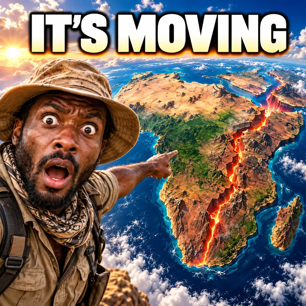
Africa Is Splitting Apart — And a New Ocean Could Be Next
FAQs
What is crustal thinning in East Africa?
Crustal thinning in East Africa refers to the process where the Earth’s crust in the region becomes stretched and thinned, leading to the formation of rift valleys and the separation of tectonic plates.
What geological features are associated with crustal thinning in East Africa?
Geological features associated with crustal thinning in East Africa include rift valleys such as the East African Rift System, volcanic activity, and the presence of fault lines.
How does crustal thinning contribute to the formation of rift valleys?
Crustal thinning in East Africa causes the Earth’s crust to be pulled apart, creating tensional forces that lead to the formation of rift valleys as the crust gradually breaks and sinks along fault lines.
What are the implications of crustal thinning in East Africa?
The implications of crustal thinning in East Africa include the potential for volcanic activity, earthquakes, and the long-term geological process of continental rifting which may eventually lead to the formation of a new ocean.
How does crustal thinning in East Africa impact the local environment and communities?
Crustal thinning in East Africa can impact the local environment and communities by creating geologically unstable areas prone to earthquakes and volcanic eruptions, as well as influencing the availability of natural resources such as water and minerals.