
Navigating the treacherous geography of Cape Horn is a feat that has tested the mettle of sailors for centuries. This legendary promontory, jutting defiantly into the Southern Ocean at the southernmost tip of South America, is not merely a geographical marker but a formidable adversary. Its reputation is forged in the unforgiving embrace of violent weather, colossal waves, and a relentless, biting wind that seems to carry the very fury of the Antarctic. To round Cape Horn is to confront a tempestuous realm where the raw power of nature reigns supreme, demanding respect, unwavering seamanship, and a profound understanding of its perilous contours.
The very name “Cape Horn” evokes images of shipwrecks and heroic struggles against the elements. Its notorious reputation is not an exaggeration but a sober testament to the brutal realities faced by mariners who dared to traverse its waters. The confluence of two mighty oceans, the Atlantic and the Pacific, in this southerly latitude creates a volatile meteorological stage. Here, weather systems collide and intensify, unleashing a torrent of challenges upon those who seek to navigate its passage.
The Roaring Forties and Furious Fifties: An Unceasing Barrage
The latitudes surrounding Cape Horn are notoriously known as the “Roaring Forties” and “Furious Fifties.” These appellations are not mere poetic descriptions but rather accurate portrayals of the prevailing wind conditions. Within these zones, westerly winds blow with an almost unbroken ferocity, frequently reaching gale force and often escalating into hurricane-strength gusts. These winds are not only powerful but also incredibly consistent, meaning sailors cannot rely on any significant respite. The constant buffeting and straining of sails and rigging are a continuous stress on both the vessel and its crew.
The Drake Passage: A Gateway to Fury
The stretch of ocean between the southern tip of South America and the Antarctic Peninsula is known as the Drake Passage. This body of water is a direct conduit for the powerful westerly winds and the vast, unimpeded swell generated by the Southern Ocean. There are no landmasses to break the force of these storms as they sweep across thousands of miles of open water. Consequently, the Drake Passage is renowned for its exceptionally rough seas, characterized by steep, breaking waves that can dwarf even the largest vessels. The sheer volume of water in motion generates a powerful and unpredictable oceanographic environment.
The Confluence of Currents: A Destabilizing Force
Beyond the wind and waves, the meeting of the Atlantic and Pacific currents at Cape Horn further contributes to the region’s nautical hazards. These currents, influenced by global oceanic circulation patterns, can create complex and unpredictable tidal streams. When these opposing currents meet, they can generate eddies, whirlpools, and confused seas, making navigation exceptionally challenging. The interplay of these forces can catch ships unawares, pushing them off course or into dangerous proximity to the coastline.
Cape Horn, located at the southern tip of South America, is a significant geographical landmark known for its treacherous waters and dramatic landscapes. For those interested in exploring more about the geography and history of this iconic region, you can read a related article that delves into its unique features and the challenges it presents to sailors. To learn more, visit this link: Geography of Cape Horn.
The Geography of Danger: Navigational Nightmares
The physical geography of Cape Horn itself presents a series of formidable obstacles for any vessel attempting to round it. The coastline is rugged and unforgiving, characterized by sheer cliffs, submerged rocks, and a labyrinth of small, often uncharted islands. The waters in the immediate vicinity are treacherous, with a shallow continental shelf in some areas and a dramatic drop-off in others, creating unpredictable depths and the potential for grounding.
The Jagged Shoreline: A Mariner’s Bane
The coastline of the islands that comprise the Cape Horn archipelago is predominantly rocky and precipitous. Steep cliffs plunge directly into the sea, offering no safe haven for vessels caught in distress. This rugged terrain is often shrouded in mist and fog, obscuring the view and making it difficult to judge distances or identify landmarks. The absence of natural harbors and the sheer unforgiving nature of the land mean that any navigational error can have catastrophic consequences.
Submerged Perils: The Silent Threat
Beneath the turbulent surface of the waters surrounding Cape Horn lie hidden dangers in the form of submerged rocks, reefs, and other underwater obstructions. Many of these are not well-charted, if at all, making them a constant threat to vessels. The powerful currents and the churning of the sea can obscure these hazards, making them difficult to detect even with the most advanced sonar equipment. Ancient shipwrecks serve as grim reminders of the price paid for underestimating these silent, submerged perils.
The Mythical “Horn”: A Defining Obstacle
The iconic “Horn” itself is a rocky promontory that forms the southernmost point. While appearing as a singular landmark from a distance, its approach is complicated by a complex network of smaller islets and submerged rocks. The prevailing winds and currents often force vessels to make their passage at a considerable distance from the shore, but even this does not guarantee safety. The proximity to the land, however distant, creates a constant psychological and navigational pressure.
The Unpredictable Weather: A Constant State of Alert
While the prevailing winds are a constant factor, the weather around Cape Horn is also characterized by extreme and rapid changes. A seemingly calm day can quickly transform into a raging storm, catching unprepared crews off guard. The ability to anticipate, interpret, and react to these swift meteorological shifts is paramount for survival.
Fog and Mist: Obscuring the Path
Dense fog and mist are frequent visitors to the Cape Horn region, significantly reducing visibility to mere meters. This makes it incredibly difficult to maintain a visual watch, identify hazards, or navigate by traditional methods. Compounding the problem, the fog often rolls in with little warning, descending upon vessels like a suffocating blanket. The chilling dampness of the fog also contributes to the overall misery and discomfort of the crew.
Sudden Squalls and Whiteouts: A Tempestuous Embrace
The region is also prone to sudden, violent squalls that can appear out of nowhere. These are characterized by sudden increases in wind speed and often accompanied by torrential rain or hail. In extreme cases, these squalls can create “whiteout” conditions, where the spray from the waves and the driving rain or snow render visibility almost zero, creating a terrifying sense of disorientation. The suddenness of these events demands immediate and decisive action from the helmsman and the entire crew.
The Chill Factor: The Pervasive Cold
The proximity to the Antarctic means that the waters around Cape Horn are frigid, and the air temperature is consistently low, even in the austral summer. This pervasive cold is not merely uncomfortable; it poses a significant threat to the crew. Hypothermia is a constant danger, especially for those who are forced to work on deck in harsh conditions. The cold can impair judgment, slow reaction times, and increase the risk of accidents.
Historical Accounts and Tragedies: Lessons from the Past
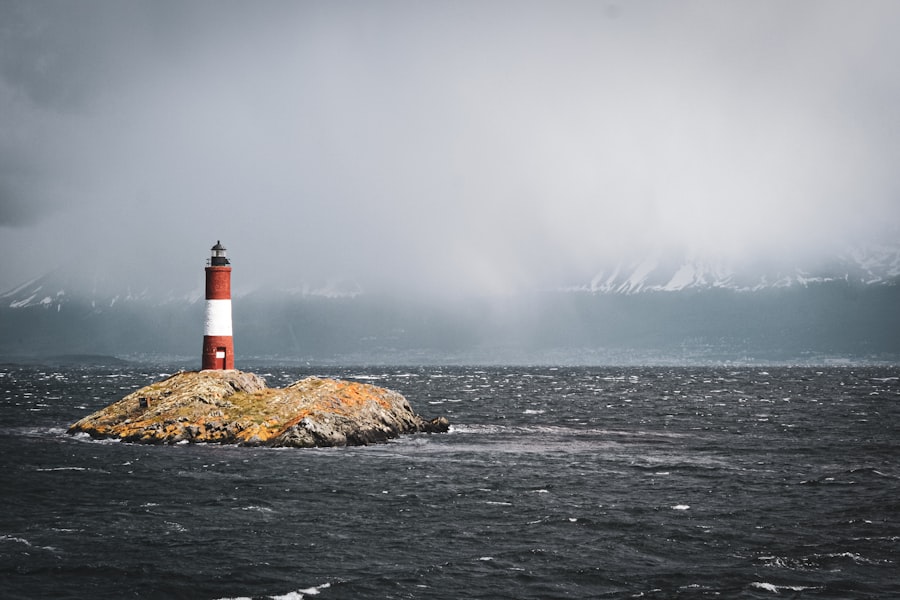
The history of maritime exploration and trade is punctuated by countless tales of bravery and disaster associated with Cape Horn. These historical accounts offer invaluable lessons and serve as a stark reminder of the unforgiving nature of this legendary passage.
The Age of Sail: A Trial by Fire
During the age of sail, rounding Cape Horn was considered one of the ultimate tests of a mariner’s skill and a ship’s seaworthiness. Ships engaged in trade between Europe and Asia, or those on the California gold rush routes, frequently had to confront its challenges. Many vessels, laden with precious cargo and hopeful passengers, were lost to its fury. The iconic clipper ships, designed for speed, often pushed their limits to round the Horn, facing immense pressure on their delicate structures.
Modern Voyages: Continued Respect for the Elements
While modern vessels are far more robust and equipped with advanced navigation and communication systems, Cape Horn continues to command respect. Even today, solo sailors attempting circumnavigations or participants in demanding offshore races face the same elemental challenges. The tales of capsized yachts, broken masts, and harrowing rescues serve as a testament that the Cape’s power remains undiminished. These modern accounts often highlight the crucial role of technological preparedness and the unwavering human spirit in the face of adversity.
The Ghost Ships of the Past: Echoes of Lost Souls
The seabed around Cape Horn is a graveyard of countless shipwrecks. These lost vessels and their crews, their stories often untold, serve as a somber reminder of the immense toll the Cape has exacted throughout history. Tales of ghost ships and phantom sightings are often attributed to the region, adding a layer of mystique and dread to its already fearsome reputation. These legends, while perhaps embellished, speak to the profound impact the Cape has had on the human psyche.
Cape Horn, located at the southern tip of South America, is a significant geographical landmark known for its treacherous waters and dramatic landscapes. The region’s unique geography has fascinated explorers and researchers alike, making it a subject of various studies. For those interested in learning more about the intricate details of this area, a related article can be found at My Geo Quest, which delves into the geographical features and historical significance of Cape Horn. This exploration not only highlights the natural beauty of the region but also its importance in maritime navigation.
Strategies for Survival: Skill, Preparation, and Respect
| Geographic Feature | Details |
|---|---|
| Location | Southern tip of South America |
| Coordinates | 55°58′47″S 067°16′18″W |
| Landforms | Rocky cliffs, islands, and fjords |
| Climate | Cold, windy, and unpredictable |
| Ecology | Rich marine life, including whales and penguins |
Successfully navigating the treacherous geography of Cape Horn is not a matter of luck but of meticulous planning, expert seamanship, and an unwavering respect for the power of nature. Modern mariners employ a combination of historical wisdom and cutting-edge technology to increase their chances of survival.
Weather Forecasting and Routing: The Art of Prediction
Advanced weather forecasting is absolutely critical. Sailors meticulously study meteorological charts and forecasts, seeking to identify favorable weather windows and predict the onset of storms. Sophisticated routing software can help mariners plot the most efficient and safest course, taking into account prevailing winds, currents, and known weather patterns. This proactive approach aims to avoid the worst of the Cape’s fury.
Vessel Preparedness: A Seaworthy Fortress
A vessel undertaking the passage must be in peak condition. This includes robust hull construction, reliable engines, well-maintained sails and rigging, and comprehensive safety equipment. Storm sails, heavy-duty anchors, and redundant navigation systems are essential. The crew must be thoroughly trained in emergency procedures, including damage control, man overboard recovery, and survival at sea. Every aspect of the vessel must be able to withstand the extreme forces it will encounter.
Seamanship and Navigation: The Human Element
The skill of the helmsman and the navigator is paramount. The ability to read the sea, anticipate wave patterns, and steer a vessel through mountainous seas requires years of experience and innate talent. Understanding the nuances of sail trim in extreme winds, maintaining steerage way, and making critical course corrections under pressure are all part of the demanding skillset. Constant vigilance and clear communication among the crew are vital for making split-second decisions.
Respect for the Cape: The Ultimate Prerequisite
Perhaps the most crucial element for survival is an ingrained respect for Cape Horn. Arrogance or underestimation of its power is a recipe for disaster. Sailors who approach the Cape with humility, acknowledging its potential for violence, are more likely to be prepared and to make the prudent decisions necessary for safe passage. It is a place that demands deference, where the captain’s authority is often secondary to the raw, unyielding might of the ocean. Navigating Cape Horn is not about conquering nature, but about coexisting with it, however precariously.

Why Cape Horn Has Some of the Worst Seas on Earth
FAQs
What is the geography of Cape Horn?
Cape Horn is the southernmost headland of the Tierra del Fuego archipelago of southern Chile. It is located on Hornos Island in the Wollaston Islands, part of the Tierra del Fuego archipelago.
What is the climate like at Cape Horn?
Cape Horn has a cold and windy climate, with strong winds and high waves being common. The area experiences a subpolar oceanic climate, with cool summers and cold winters.
What is the significance of Cape Horn geographically?
Cape Horn is significant as it marks the northern boundary of the Drake Passage, the body of water between South America’s Cape Horn and the South Shetland Islands of Antarctica. It is also a major point on the route of the clipper ships that sailed between the Atlantic and Pacific Oceans during the 19th century.
What is the landscape like at Cape Horn?
The landscape at Cape Horn is characterized by rugged cliffs, strong winds, and rough seas. The area is also home to a variety of wildlife, including seabirds and marine mammals.
What are some geographical features near Cape Horn?
Near Cape Horn, there are several other islands and archipelagos, including the Wollaston Islands, Hermite Islands, and the Diego Ramírez Islands. The area is also known for its treacherous waters and challenging sailing conditions.