Deep beneath the surface, far from the verdant fields and shimmering rivers we observe, lies a vast, unseen reservoir of life-sustaining water. This subterranean realm, termed an aquifer, is a critical component of Earth’s hydrological cycle, playing a profound role in supporting ecosystems, agriculture, and human civilization. Understanding the geology of these hidden worlds is not merely an academic pursuit; it is a vital endeavor for ensuring the sustainable management of our planet’s most precious resource. This exploration delves into the intricate geological formations that make up aquifers, unraveling their formation, composition, and the complex processes that govern the movement and storage of groundwater.
An aquifer, in its simplest definition, is an underground layer of permeable rock or sediment that holds and transmits groundwater. The term itself, derived from the Latin words “aqua” (water) and “ferre” (to carry), aptly describes its function. However, the presence of water alone does not qualify a geological formation as an aquifer. Crucially, it must possess two key properties: a sufficient amount of pore space (porosity) to store water and the ability to allow that water to flow through it (permeability). These characteristics are intrinsically linked to the geological materials that form the aquifer.
Porosity: The Storage Capacity of the Earth
Porosity refers to the volume of empty spaces, or pores, within a rock or sediment. These spaces can take various forms, from the tiny gaps between grains of sand to larger fissures and fractures within bedrock. The percentage of void space within a given volume of material is its porosity value.
Primary Porosity: The Spaces Between the Grains
Primary porosity is inherent to the material in its original state and is a result of the depositional environment. For instance, well-sorted sand deposits, where the grains are of uniform size and shape, tend to have higher primary porosity than poorly sorted gravel or clay. The arrangement and packing of individual grains significantly influence how much space is available for water to occupy. Methods like sedimentation and compaction during the formation of sedimentary rocks are key in determining this initial pore space.
Secondary Porosity: Enhancements to Storage
Secondary porosity develops after the sediment or rock has formed. This can occur through various geological processes, such as the dissolution of minerals, creating vugs (small cavities) or larger solution channels within the rock. Fracturing, caused by tectonic stresses or other geological events, can also introduce significant secondary porosity, connecting otherwise isolated pores and increasing the overall storage potential. This is particularly important in dense, crystalline rocks that would otherwise have very low primary porosity.
Permeability: The Flow of Subterranean Waters
While porosity dictates how much water can be stored, permeability determines how easily that water can move through the material. Permeability is a measure of the interconnectedness of pore spaces. If the pores are well-connected, water can flow relatively freely. If they are isolated, even a material with high porosity may have low permeability, making it a poor aquifer.
Intergranular Permeability: The Gaps That Connect
This is the most common type of permeability found in sedimentary aquifers. It refers to the ability of water to flow through the spaces between individual grains of sand, gravel, or silt. The size, shape, and sorting of these grains, along with the degree of cementation between them, all influence intergranular permeability. Larger and less angular grains, with less fine material filling the gaps, generally lead to higher permeability.
Fissure and Fracture Permeability: Cracks in the Crust
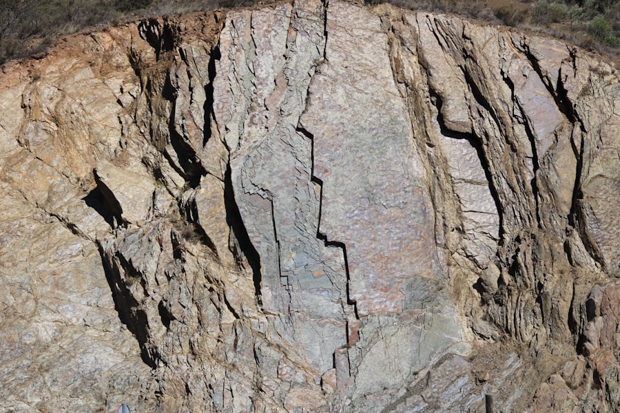
In consolidated rocks like granite or basalt, permeability is often dominated by fissures, joints, and fractures. These cracks and openings act as conduits for groundwater flow. The width, length, and connectivity of these fractures are critical factors. A dense network of wide, interconnected fractures can create a highly permeable aquifer, even in a rock that is otherwise dense and impermeable.
Karstic Permeability: Dissolution Dominance
Karst aquifers, formed in soluble rocks like limestone or dolomite, are characterized by their unique and often unpredictable permeability. Dissolution by slightly acidic groundwater creates intricate networks of caves, sinkholes, and underground channels. Water flow in karst systems can be exceptionally rapid, often bypassing the finer pore spaces characteristic of other aquifer types. This can lead to rapid contamination pathways.
Aquifer geology is a crucial aspect of understanding groundwater resources and their management. For those interested in delving deeper into this topic, a related article that provides valuable insights is available at this link: Understanding Aquifer Geology. This article explains the various types of aquifers, their geological formations, and the significance of aquifer recharge in maintaining sustainable water supplies.
The Architects of the Underground: Aquifer Formation Processes
The creation of aquifers is a long and complex geological narrative, shaped by the forces of deposition, lithification, and subsequent geological events. Understanding these processes provides crucial insights into the location, extent, and characteristics of underground water resources.
Sedimentary Deposition: The Building Blocks of Aquifers
The vast majority of productive aquifers are composed of sedimentary rocks and unconsolidated sediments. These materials are formed from the accumulation and compaction of sand, silt, clay, and gravel, often transported by rivers, glaciers, or wind. The depositional environment plays a significant role in determining the porosity and permeability of the resulting formations.
Alluvial Plains and River Systems: Porous Pathways
Rivers are powerful agents of erosion and deposition, creating vast alluvial plains characterized by layers of sand, gravel, and silt. These deposits often exhibit excellent porosity and permeability, forming some of the most significant aquifers globally. The sorting of sediment by the river’s flow dictates the aquifer’s characteristics; coarser materials deposited in higher-energy environments generally yield more permeable formations.
Glacial Deposits: Heterogeneous Reservoirs
Glaciers, during their advance and retreat, carve out landscapes and deposit a wide range of materials, from fine clays to large boulders. Glacial outwash plains, formed by meltwater streams, often contain well-sorted sands and gravels that create productive aquifers. However, glacial till, a poorly sorted mixture of all sediment sizes, can exhibit very low permeability, acting as aquitards or confining layers.
Coastal and Marine Environments: Salinity Considerations
Coastal areas and shallow marine environments can also host significant aquifers. Sand dunes, barrier islands, and offshore sandbars are often composed of well-sorted sands with good hydrological properties. However, these aquifers can be susceptible to saltwater intrusion, a phenomenon where saline water from the ocean encroaches into freshwater aquifers, rendering them unusable.
Igneous and Metamorphic Rocks: Fractured Foundations
While primarily associated with sedimentary materials, aquifers can also exist within igneous and metamorphic rocks, although typically with different characteristics. These rocks, formed under intense heat and pressure, are generally dense and impermeable in their fresh state. However, geological processes can introduce secondary porosity.
Volcanic Rocks: Lava Flows and Fractures
Volcanic terrains, particularly those with extensive lava flows, can form aquifers. The cooling and contraction of lava can create numerous fractures and vesicles (gas bubbles), providing storage and pathways for groundwater. Highly fractured basalt or porous tuff can function as effective aquifers, though their yield can be variable.
Crystalline Rocks: The Importance of Faults and Fractures
In igneous and metamorphic rocks like granite, gneiss, or schist, groundwater primarily resides within fractures and faults. These linear features, created by tectonic activity or cooling stresses, act as the primary conduits for water movement. The density and interconnectedness of these fracture networks are paramount to the aquifer’s productivity. Understanding the regional fault systems is crucial for exploring and managing groundwater in these rock types.
The Dynamics of Water: Groundwater Flow and Movement
Once water infiltrates the ground, it enters a complex subsurface environment where it is subject to various forces that govern its movement and distribution. Understanding these dynamics is essential for predicting aquifer behavior, managing extraction, and assessing contamination risks.
The Driving Force: Gravity and Hydraulic Gradient
The primary force driving groundwater flow is gravity. Water moves from areas of higher elevation and higher pressure to areas of lower elevation and lower pressure. This pressure difference is quantified by the hydraulic head, which represents the total energy of the groundwater. The steeper the difference in hydraulic head over a given distance, the stronger the hydraulic gradient and the faster the groundwater flow.
Hydraulic Head: The Water’s Potential Energy
Hydraulic head is the sum of the elevation head (the physical elevation of the water table or potentiometric surface) and the pressure head (the pressure exerted by the overlying water). In an unconfined aquifer, the hydraulic head is generally equivalent to the elevation of the water table. In a confined aquifer, it is represented by the elevation to which water would rise in a tightly cased well.
Hydraulic Gradient: The Direction of Flow
The hydraulic gradient is the change in hydraulic head per unit of distance. It is a vector quantity, indicating both the magnitude and direction of the steepest descent of the hydraulic head. Groundwater invariably flows in the direction of decreasing hydraulic head, moving from higher potential energy to lower potential energy.
Darcy’s Law: Quantifying Groundwater Velocity
Darren’s Law is a fundamental principle that describes the flow of fluids through porous media. It states that the flow rate of groundwater is directly proportional to the hydraulic conductivity of the aquifer material and the hydraulic gradient, and inversely proportional to the viscosity of the fluid.
Hydraulic Conductivity: The Ease of Flow
Hydraulic conductivity ($K$) is a property of the aquifer material that quantifies how easily water can flow through it. It takes into account both the porosity and the permeability of the material. Materials with higher hydraulic conductivity allow for faster groundwater flow.
Specific Discharge and Seepage Velocity: Real vs. Apparent Flow
Darcy’s Law calculates the specific discharge ($q$), which is the volume of water flowing per unit area of the aquifer per unit time. This is often referred to as the “Darcy velocity” and represents an apparent flow rate. The actual seepage velocity of individual groundwater particles is slower because they must navigate through the tortuous pathways of the pore spaces.
Types of Aquifers: Layers of Water and Rock

Aquifers are not uniform in their structure or the way they are bound by surrounding geological formations. Their classification is based on their confinement and the presence of overlying impermeable layers, which significantly influence groundwater pressure and behavior.
Unconfined Aquifers: Open to the Surface
Unconfined aquifers, also known as water table aquifers, are the most common type. Their upper surface is the water table, which is the phreatic surface where the pore water pressure is equal to atmospheric pressure. These aquifers are directly recharged by precipitation infiltrating from the surface.
The Water Table: A Dynamic Boundary
The water table is not a static entity; it fluctuates in response to precipitation, evaporation, and water withdrawal. During wet periods, the water table rises, and during dry periods or periods of heavy pumping, it can decline. This fluctuation directly impacts the available groundwater resource.
Recharge and Discharge: The Water’s Journey
Recharge to unconfined aquifers occurs through infiltration of rainfall and surface water. Discharge can occur through springs, seepage into rivers and lakes, or through wells. The balance between recharge and discharge is critical for maintaining the sustainability of unconfined aquifers.
Confined Aquifers: Trapped Beneath Impermeable Layers
Confined aquifers are bounded above and below by impermeable or semi-permeable layers, known as aquicludes or aquitards, respectively. Groundwater within confined aquifers is under pressure greater than atmospheric pressure, and its surface is represented by the potentiometric surface.
Aquicludes and Aquitards: The Protective Barriers
Aquicludes are virtually impermeable layers that prevent significant water flow. Aquitards are layers of low permeability that can restrict but not entirely stop water movement. These confining layers protect the confined aquifer from direct recharge from the surface and can create artesian conditions.
Artesian Wells: Natural Plumbing Systems
When a confined aquifer is penetrated by a well, water will rise in the well to the level of the potentiometric surface. If the potentiometric surface is above the ground surface, the well will flow under its own pressure, creating an artesian well. Sub-artesian wells have the potentiometric surface above the top of the aquifer but below the ground surface, requiring a pump to bring water to the surface.
Leaky Aquifers: Partially Confined Systems
Leaky aquifers, or semiconfined aquifers, are situated between aquitards that allow a slow rate of leakage. Recharge or discharge can occur through these semi-permeable layers, with the rate of flow depending on the permeability of the aquitard and the hydraulic head difference.
Aquifer geology is a fascinating subject that delves into the characteristics and behaviors of underground water reservoirs. For those interested in exploring this topic further, a related article can be found on MyGeoQuest, which provides in-depth insights into the various types of aquifers and their significance in water supply management. You can read more about it in this informative piece on MyGeoQuest. Understanding aquifer geology is essential for sustainable water resource management and environmental conservation.
The Geologist’s Toolkit: Exploring and Understanding Aquifers
| Geological Parameter | Explanation |
|---|---|
| Porosity | The percentage of void space in the rock or sediment that can hold water. |
| Permeability | The ability of the rock or sediment to transmit water through connected pore spaces. |
| Aquifer Type | Describes the geological formation that contains and transmits groundwater, such as unconfined, confined, or artesian aquifers. |
| Hydraulic Conductivity | The ability of the aquifer material to transmit water under a hydraulic gradient. |
The study of aquifer geology involves a sophisticated array of techniques and tools that allow geologists to map, characterize, and monitor these vital subsurface resources. This understanding is crucial for sustainable water management.
Geophysical Surveys: Peering Beneath the Surface
Geophysical methods employ physical principles to infer subsurface conditions without direct excavation. These techniques are non-invasive and can cover large areas efficiently.
Seismic Surveys: Sound Waves to Map Layers
Seismic surveys use artificially generated sound waves that travel through the earth. By measuring the time it takes for these waves to reflect or refract off different geological layers, geologists can create a picture of the subsurface stratigraphy and identify potential aquifer formations.
Electrical Resistivity Surveys: Water Content and Lithology
Electrical resistivity surveys measure the electrical resistance of subsurface materials. Water, especially if it contains dissolved salts, is more conductive than most rock and sediment. By mapping variations in electrical resistivity, geologists can identify zones saturated with water and infer the lithology of the subsurface.
Hydrogeological Investigations: Drilling and Pumping Tests
Direct investigation through drilling and pumping tests provides the most definitive information about aquifer properties.
Well Drilling and Core Sampling: Direct Evidence
Drilling wells allows geologists to obtain direct samples of subsurface materials (cores) for laboratory analysis of porosity, permeability, and lithology. The logs generated during drilling provide a stratigraphic record of the subsurface.
Pumping Tests: Measuring Aquifer Performance
Pumping tests involve pumping water from a well at a known rate and monitoring the decline in water levels in observation wells. The data from these tests are analyzed using mathematical models to determine key aquifer parameters such as hydraulic conductivity, transmissivity (the ability of the aquifer to transmit water horizontally), and storativity (how much water the aquifer releases from or stores when the head changes). These are vital for predicting aquifer response to pumping.
Remote Sensing and GIS: Large-Scale Analysis
Remote sensing technologies, such as satellite imagery and aerial photography, combined with Geographic Information Systems (GIS), enable the analysis of large-scale geological features, land use, and hydrogeological indicators. This facilitates regional aquifer assessment and management.
The hidden world of aquifers is a testament to the dynamic and intricate nature of Earth’s geological processes. From the granular architecture that dictates water storage to the pressure gradients that drive its flow, each geological aspect contributes to the vital function of these underground reservoirs. By employing a sophisticated array of scientific tools and analytical techniques, geologists continue to unravel the mysteries of these subterranean realms, ensuring that humanity can sustainably manage and utilize this indispensable resource for generations to come. The responsible stewardship of our aquifers is not just an environmental imperative; it is fundamental to the continued prosperity and well-being of our global society.

The Water Beneath America’s Breadbasket
FAQs
What is an aquifer?
An aquifer is a body of permeable rock or sediment that can contain or transmit groundwater. It can be a layer of sand, gravel, or rock that holds water and allows it to flow through.
How does an aquifer form?
Aquifers are formed over long periods of time as water seeps into the ground and becomes trapped in porous rock or sediment. The water then accumulates in the spaces between the particles, creating an underground reservoir.
What role do aquifers play in the water cycle?
Aquifers play a crucial role in the water cycle by storing and releasing groundwater. They provide a sustainable source of water for wells, springs, and rivers, and help maintain streamflow during dry periods.
What are the different types of aquifers?
There are two main types of aquifers: confined and unconfined. Confined aquifers are located between impermeable layers of rock or clay, while unconfined aquifers are not confined by impermeable layers and are more susceptible to contamination.
Why is it important to protect and manage aquifers?
It is important to protect and manage aquifers to ensure a sustainable supply of clean water for drinking, agriculture, and industry. Overuse and contamination of aquifers can lead to depletion and degradation of this vital resource.