Here is an article about “Unraveling Rocky Mountain Sediments,” written in the third person and exceeding 1,500 words, with the requested structure:
The Rocky Mountains, a colossal spine of Earth’s crust thrust skyward, are not merely a testament to tectonic forces but also a vast, intricate repository of geological history. Beneath their dramatic peaks and rugged slopes lies a narrative etched in stone, woven from the very fabric of the planet’s past. This narrative is written in the sediments – the fragmented remnants of ancient lands, seas, and life that have been compressed, cemented, and uplifted over unimaginable eons. To unravel the secrets held within these rocky layers is to embark on a journey through time, witnessing the rise and fall of continents, the ebb and flow of ancient oceans, and the evolution of life itself. Geologists, armed with hammers, microscopes, and an insatiable curiosity, dedicate their careers to deciphering this grand testament. Their work is a meticulous excavation of memory, piecing together clues from the composition, texture, and arrangement of rock formations to understand the dynamic processes that sculpted one of North America’s most iconic landscapes. The story of the Rockies is, at its core, the story of its sediments.
The Significance of Sedimentary Rocks
Sedimentary rocks are not just inert piles of earth; they are the fundamental librarians of Earth’s history. Unlike igneous rocks formed from molten magma or metamorphic rocks transformed by heat and pressure, sedimentary rocks are formed from the accumulation and lithification of pre-existing materials, or through chemical precipitation. This process inherently records the environmental conditions under which these materials were deposited.
A Window into the Past
- Paleoenvironmental Reconstruction: The type of sediment deposited, its grain size, and the presence of certain minerals can reveal whether the environment was a shallow sea, a deep ocean basin, a meandering river, a vast desert, or a glacial landscape. For instance, well-rounded, polished grains of quartz often indicate transport by wind or water over long distances, suggesting arid or fluvial environments. The presence of marine fossils definitively points to deposition in an ancient ocean.
- Paleoclimatic Indicators: Certain sedimentary structures and mineral assemblages act as proxies for past climates. Ripple marks, for example, are indicative of moving water or air, with their size and shape offering clues about flow velocity and water depth. Evaporite minerals like halite (rock salt) and gypsum signal prolonged periods of evaporation in arid or semi-arid environments, often associated with enclosed basins or ephemeral lakes.
- Stratigraphic Correlation: The sequence of sedimentary layers, or strata, provides a fundamental framework for understanding geological time. Distinctive rock units, characterized by their lithology (rock type) and fossil content, can be recognized and traced across vast distances, allowing geologists to correlate rock formations in different regions and establish a timeline of events.
The Rockies: A Complex Stratigraphic Archive
The Rocky Mountain range, due to its long and complex geological history involving multiple episodes of mountain building, sedimentation, and erosion, presents a particularly rich and diverse sedimentary record. From the Precambrian basement rocks that form the roots of the modern mountains to the Cenozoic deposits that mantle their slopes, a staggering array of sedimentary environments has been preserved. Understanding these sediments is crucial for unraveling the tectonic evolution of the region, the history of ancient life, and the origins of valuable mineral and energy resources.
Rocky Mountain sediments are a fascinating subject that sheds light on the geological history of the region. For a deeper understanding of the processes that shaped these sediments, you can explore a related article that delves into sedimentary formations and their significance in the Rocky Mountains. This article provides insights into the various types of sediments found in the area and their implications for understanding past environments. To read more, visit this link.
Building the Foundation: Precambrian and Paleozoic Roots
The earliest chapters of the Rocky Mountains’ story are written in the ancient and often deeply buried sedimentary rocks of the Precambrian and Paleozoic eras. These layers, predating the formation of complex life, nevertheless offer profound insights into the planet’s early geological conditions.
Precambrian Sediments: The Ancient Framework
The Precambrian Eon, spanning from the Earth’s formation over 4.5 billion years ago to the dawn of the Cambrian period about 541 million years ago, is a vast expanse of time represented by some of the oldest rocks in the Rockies. These ancient sediments offer glimpses into a world vastly different from our own, a world shaped by primordial continents, early oceans, and the very beginnings of life.
Archean and Proterozoic Deposits
- Banded Iron Formations: These striking, layered rocks are critical evidence of the Great Oxidation Event, a pivotal moment in Earth’s history when oxygen, produced by early photosynthetic organisms, began to accumulate in the atmosphere and oceans. In the Precambrian Rockies, where these formations are found, the presence of alternating bands of iron-rich minerals (like hematite and magnetite) and silica-rich chert suggests periods of oxygen production, followed by chemical precipitation of iron as oxygen levels fluctuated.
- Volcaniclastic Rocks: Interspersed with chemical precipitates and early sedimentary rocks are volcaniclastic layers. These are sediments derived from volcanic activity, such as ash, lava fragments, and volcanic bombs. Their presence indicates a geologically active Precambrian crust, with early volcanic arcs and rift zones contributing to the burgeoning continental landmasses that would eventually form the foundation of North America.
- Stromatolites: These fossilized microbial mats, formed by the activity of cyanobacteria (blue-green algae), are among the earliest indicators of life on Earth. In Precambrian outcrops of the Rockies, stromatolites show that life, though simple, was present and actively shaping its environment, contributing to the deposition of calcium carbonate and other minerals.
Paleozoic Seas and Shores
The Paleozoic Era (541 to 252 million years ago) witnessed the emergence of complex marine life and the assembly of the supercontinent Pangaea. Much of this era saw the region now occupied by the Rocky Mountains submerged beneath warm, shallow seas, a stark contrast to the towering mountains of today.
The Cambrian Explosion and Marine Dominance
- Shallow Marine Carbonates: The Cambrian period is characterized by widespread deposition of limestones and dolomites, formed primarily from the skeletal remains of marine organisms. These carbonate rocks, often containing abundant trilobite and brachiopod fossils, indicate a stable, shallow marine environment with clear, warm waters. The uniformity of these layers across many parts of the Rockies highlights the extensive nature of these ancient seas.
- Sandstones and Mudstones: Deposited closer to ancient coastlines or in areas of increased riverine input, sandstones and mudstones from the Cambrian and Ordovician periods attest to the fluctuating shorelines. Quartz-rich sandstones suggest erosion of older continental landmasses, while finer-grained mudstones indicate calmer waters or deposition farther from the shore.
Devonian Reefs and Mississippian Carbonate Platforms
- Devonian Reef Complexes: During the Devonian period, warm, shallow seas in the Rockies teemed with life, leading to the formation of extensive reef systems. These ancient reefs, now exposed as fossiliferous limestones and dolomites, are complex structures built by corals, algae, and other marine invertebrates. Their intricate textures and fossil assemblages provide detailed insights into the biodiversity and ecological conditions of these Devonian seas.
- Mississippian Carbonates: The Mississippian saw the further development of vast carbonate platforms, similar to the modern-day Bahamas. Extensive deposition of limestones and dolomites occurred, often featuring oolitic sands (spherical grains formed by the precipitation of calcium carbonate) and evidence of tidal flats. These deposits represent stable, sunlit conditions ideal for carbonate accumulation.
Late Paleozoic Coal Swamps and Marginal Marine Environments
- Pennsylvanian and Permian Coal Beds: Towards the end of the Paleozoic Era, as coastlines retreated and Pangaea began to coalesce, vast swampy deltas formed. The Pennsylvanian and Permian periods are marked by deposits of coal, formed from the accumulation of organic matter in these oxygen-poor swamp environments. These coal seams are valuable energy resources and important indicators of ancient terrestrial and deltaic ecosystems.
- Red Beds and Evaporites: In areas that experienced increased aridity or inland seas with limited circulation, red-colored sandstones and shales (often referred to as “red beds”) and evaporite minerals like gypsum and halite were deposited. These formations signal a shift towards more arid climates and restricted marine environments before the dramatic tectonic events of the Mesozoic Era.
The Age of Reptiles: Mesozoic Seas, Rivers, and Dinosaurs
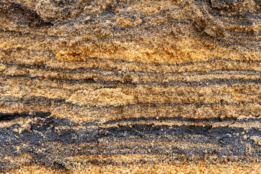
The Mesozoic Era (252 to 66 million years ago) is perhaps most famously known as the “Age of Dinosaurs,” and the sedimentary rocks of the Rocky Mountains bear indelible witness to this period. This era was characterized by significant tectonic activity, the breakup of Pangaea, and the eventual formation of the Western Interior Seaway, a vast inland sea that profoundly influenced the sedimentary record of the region.
Early Mesozoic Subsidence and Rifting
The beginning of the Mesozoic saw the continued assembly of Pangaea and the early stages of rifting that would eventually lead to its breakup. This period in the Rocky Mountain region is marked by the deposition of sediments reflecting these evolving tectonic settings.
Triassic Red Beds and Dune Fields
- Arid Continental Environments: Triassic sediments in the Rockies are often dominated by red-colored sandstones, shales, and conglomerates. These “red beds” strongly suggest deposition in hot, arid continental environments, characterized by flash floods, ephemeral rivers, and extensive desert dune fields. The red color comes from iron oxides that formed in oxidized conditions.
- Dinosaur Footprints and Fossils: While less widespread than later Mesozoic deposits, some Triassic formations preserve early dinosaur footprints and fragmentary fossils, offering tantalizing glimpses into the first large terrestrial reptiles that roamed the nascent supercontinent.
Jurassic Marine Incursions and Continental Deposits
- Sundance Sea Sediments: In some areas, particularly in the western Rockies, the Jurassic period saw a partial transgression of the sea, forming the Sundance Sea. Sediments deposited in this shallow, brackish to marine environment include shales, sandstones, and limestones, often containing marine invertebrate fossils.
- Morrison Formation – A Dinosaur Paradise: The Late Jurassic Morrison Formation is one of the most famous dinosaur-bearing rock units in the world, and significant exposures exist within the Rocky Mountains and adjacent areas. This formation represents a complex array of terrestrial environments, including floodplains, river channels, and lake margins, where vast ecosystems thrived. It has yielded an astonishing diversity of dinosaur fossils, including iconic species like Allosaurus, Stegosaurus, and Apatosaurus, making it a treasure trove for paleontologists studying the giants that once ruled the Earth.
The Cretaceous Western Interior Seaway: A Continental Sea
The Cretaceous Period (145 to 66 million years ago) was dominated by the formation and eventual regression of the Western Interior Seaway. This immense inland sea stretched from the Arctic Ocean to the Gulf of Mexico, bisecting the North American continent. The sedimentary record of this period in the Rockies is overwhelmingly marine.
The Niobrara Formation: Chalk Seas and Ancient Life
- Marine Chalks and Shales: The Niobrara Formation, famous for its fossil content, is composed of remarkably pure chalks and limestones interbedded with shales. These deposits indicate deposition in the deeper, more open waters of the Western Interior Seaway. The fine grain size of the chalk is due to the accumulation of microscopic marine organisms known as coccolithophores.
- Fossil Riches of the Niobrara: The Niobrara is renowned for preserving an extraordinary array of marine life from the Cretaceous, including ancient marine reptiles like mosasaurs and plesiosaurs, giant marine turtles, large predatory fish like Xiphactinus, and numerous species of ammonites and bivalves. The exceptional preservation of soft tissues in some specimens is a testament to the unique depositional conditions.
The Clastic Wedge: Sediments from Growing Mountains
As the Laramide Orogeny began in the Late Cretaceous, the western edge of the continent started to uplift, shedding vast quantities of sediment into the Western Interior Seaway. This resulted in the formation of immense clastic wedge deposits, characterized by thick sequences of sandstones, shales, and conglomerates that prograded eastward from the rising mountains.
- Shoreline and Deltaic Facies: Closer to the paleo-shoreline, these deposits include sandstones representing beaches, barrier islands, and deltaic systems. These are often rich in plant remains and can preserve ripple marks, cross-bedding, and evidence of tidal influence.
- Deep Marine Shales and Turbidites: Farther east, into the former seaway, these wedge sediments transition into finer-grained shales and more massive sandstones deposited by underwater avalanches known as turbidites. These record the deposition of sediment from deltas and shelf edges into deeper marine basins.
The Age of Mammals: Tertiary Landscapes and Mountain Building
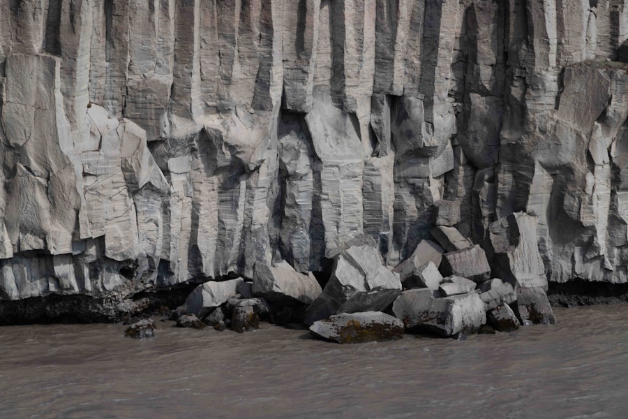
The Cenozoic Era (66 million years ago to the present) is the “Age of Mammals,” and it is during this era that the iconic, modern Rocky Mountains as we perceive them truly began to take shape. The sedimentary record of this period is dominated by terrestrial deposition related to intense mountain-building processes and the subsequent erosion and infilling of basins.
The Laramide Orogeny and Basin Deposition
The Laramide Orogeny, a prolonged period of mountain building that affected the western United States and Canada, began in the Late Cretaceous and continued well into the Eocene epoch. This immense tectonic event dramatically uplifted and deformed the Earth’s crust, creating the ancestral Rockies.
Paleogene Basin Infilling
- Fluvial and Lacustrine Sediments: As the Laramide mountains rose, vast intermontane basins formed between the uplifts. These basins were then filled by sediments eroded from the surrounding mountains. These infilling sequences are often composed of conglomerates, sandstones, and shales deposited by rivers and in lakes.
- Fossilized Mammalian Faunas: The Paleogene (Eocene and Oligocene) deposits in these basins are particularly important for understanding the evolution of early mammals. Fossil vertebrate assemblages from these layers provide crucial evidence of the diversification and radiation of mammalian lineages following the extinction of the dinosaurs. These fossils are often found in lakebed or floodplain deposits.
Mid-Cenozoic Volcanism and Erosion
The Oligocene and Miocene epochs saw widespread volcanic activity in and around the Rocky Mountains, as well as continued erosion of the uplifted terrain.
Volcanic Ash and Lava Flows
- Extensive Ash Beds: Volcanic eruptions produced enormous quantities of ash that blanketed vast areas. These ash deposits, when lithified, form bentonitic shales and tuffs, which are valuable marker horizons for stratigraphic correlation and serve as proxies for volcanic activity.
- Lava Flows and Pyroclastic Deposits: In some regions, particularly in the southern Rockies and adjacent areas, significant lava flows and pyroclastic deposits attest to more explosive volcanic events. These igneous rocks, interspersed with sedimentary layers, tell a story of a dynamic and volcanically active landscape.
Miocene and Pliocene Basin and Range Extension
While the Laramide Orogeny was primarily compressional, later Cenozoic tectonics introduced extensional forces, particularly in the Basin and Range Province that borders the western Rockies. This led to the formation of fault-block mountains and valleys.
- Alluvial Fan Deposits: Sediments eroded from the flanks of these newly formed mountains accumulated as thick alluvial fan deposits in the intervening valleys. These are characterized by poorly sorted conglomerates and sandstones deposited by ephemeral, debris-laden streams.
- Lake Sediments and Evaporites: Some valleys became sites of closed basins, leading to the formation of saline lakes and the deposition of evaporite minerals, similar to Triassic and Permian deposits but in a different tectonic context.
Rocky Mountain sediments provide fascinating insights into the geological history of the region, revealing a complex interplay of natural processes over millions of years. For those interested in exploring this topic further, a related article can be found at My Geo Quest, which delves into the various sedimentary formations and their significance in understanding the Earth’s past. This resource offers a comprehensive look at how these sediments have shaped the landscape and contributed to our knowledge of geological evolution.
Quaternary Glaciations: The Sculptors of the Modern Landscape
| Depth (m) | Grain Size (mm) | Porosity (%) |
|---|---|---|
| 0-10 | Coarse | 25 |
| 10-20 | Medium | 20 |
| 20-30 | Fine | 15 |
The most recent geological epoch, the Quaternary (2.6 million years ago to the present), is dominated by cycles of glaciation and interglacial periods. These ice ages, while not forming new sedimentary rocks in the way of earlier eras, profoundly reshaped the existing landscape and left behind a distinctive suite of glacial and periglacial deposits.
The Power of Ice: Glacial Sediments
During the Pleistocene epoch, massive ice sheets advanced from highland areas, including the highest peaks of the Rockies, carving out valleys and depositing vast quantities of sediment.
Till and Moraines: Direct Evidence of Ice
- Till (Boulder Clay): This is unsorted, unstratified sediment deposited directly by glacial ice. It’s a heterogeneous mixture of clay, silt, sand, gravel, and boulders, often with striated (scratched) rocks. Distinctive till sheets and ridges, known as moraines, mark the former extent and margins of glaciers.
- Terminal and Recessional Moraines: These prominent landforms, composed of till, delineate the farthest reach of a glacier (terminal moraine) and mark positions where glaciers paused during their retreat (recessional moraines). Extensive moraine systems are a hallmark of the higher elevations of the Rockies.
Stratified Drift: Meltwater Processes
As glaciers melted, meltwater streams carried and sorted glacial debris, depositing it in stratified layers.
- Outwash Plains: Vast plains formed by meltwater streams depositing sand and gravel are known as outwash plains. These are typically characterized by horizontally layered deposits of sorted and rounded sediment.
- Eskers and Kames: Eskers are sinuous ridges of sand and gravel deposited by meltwater streams flowing within or beneath glacial ice. Kames are irregular mounds of sand and gravel deposited where meltwater ponds or ice cavities collapse.
Periglacial and Post-Glacial Deposits
Even beyond the direct reach of glaciers, cold climates associated with glaciations influenced landscapes, leading to periglacial processes and subsequent post-glacial sedimentation.
Aeolian and Mass-Wasting Deposits
- Loess Deposits: Windblown silt, known as loess, was transported from outwash plains and deposited in thicker accumulations on nearby uplands. Loess deposits are fine-grained and can be fertile soils.
- Talus Slopes and Scree: In mountainous regions, freeze-thaw cycles broke down rocks, leading to the accumulation of talus slopes and scree fields – accumulations of angular rock fragments at the base of cliffs.
- Alluvial Fan and River Terraces: After glacial retreat, rivers continued to erode and transport sediment, forming new alluvial fans and terracing their valleys. These deposits are crucial for understanding post-glacial landscape evolution and river dynamics.
Unlocking Riches: Economic and Scientific Significance of Rocky Mountain Sediments
The sedimentary layers of the Rocky Mountains are not merely geological puzzles; they are also invaluable resources and critical keys to understanding a wide range of scientific disciplines. From fossil fuels that power modern society to the very origins of life, these ancient strata hold immense economic and scientific significance.
Fossil Fuels: Energy from Ancient Ecosystems
The formation of organic matter in specific paleoenvironmental conditions, followed by burial and transformation under heat and pressure, has created vast reservoirs of fossil fuels within the sedimentary rocks of the Rockies.
Coal Deposits: Preserved Swamplands
- Pennsylvanian and Cretaceous Coal: The widespread coal seams, particularly those from the Pennsylvanian period (associated with ancient swampy deltas) and the Cretaceous period (formed in coastal plain environments), are a direct result of the accumulation of terrestrial plant material. These coals have been a significant energy source for centuries, fueling industrial development.
- Formation and Resource Potential: The quality and quantity of coal deposits are directly related to the thickness of the overlying strata, the duration of swamp deposition, and the geological history of burial and uplift, all dictated by the sedimentary record.
Petroleum and Natural Gas: Under Pressure in Ancient Seas and Basins
- Reservoirs in Ancient Carbonates and Sandstones: Porous and permeable sedimentary rocks, such as limestones, dolomites, and sandstones, act as natural reservoirs for oil and natural gas. These hydrocarbons originate from the organic matter deposited in ancient marine environments (like the Paleozoic seas and the Cretaceous Western Interior Seaway) or in continental basins.
- Source Rocks and Traps: Fine-grained shales, rich in organic matter, serve as source rocks where oil and gas are generated. Subsequent migration through permeable layers and entrapment by impermeable cap rocks (often shales or evaporites) form the commercially viable deposits we extract today. The structural geology and stratigraphic history, as revealed by sedimentary sequencing, are crucial for identifying petroleum traps.
Mineral Resources: Sediments as Ores and Guides
Beyond fossil fuels, sedimentary rocks are also the primary hosts for many important mineral deposits.
Sedimentary Iron and Manganese Deposits
- Precambrian Banded Iron Formations: As discussed earlier, the ancient Banded Iron Formations of the Precambrian are immense accumulations of iron oxides and silica, representing a significant global iron resource.
- Oxidation and Enrichment: In some areas, later sedimentary and weathering processes have further concentrated iron and manganese oxides, forming economically viable deposits in younger sedimentary sequences.
Evaporite Minerals: Salts from Ancient Seas
- Halite, Gypsum, and Potash: Deposits of halite (rock salt), gypsum, and potash salts are formed through the evaporation of water in arid basins or restricted marine environments. These minerals have numerous industrial uses, from food production to fertilizer.
- Paleoclimatic Indicators: The presence and thickness of evaporite layers are direct indicators of past arid or semi-arid conditions, providing valuable paleoclimatic data.
Paleontology and the History of Life
The sedimentary strata of the Rocky Mountains are arguably one of the most important paleontological archives on Earth.
Dinosaur Fossils: A Window into the Mesozoic
- The Morrison Formation: The world-renowned fossil sites within the Morrison Formation (Late Jurassic) and numerous Cretaceous dinosaur-bearing units provide unparalleled insights into the diversity, evolution, and ecology of dinosaurs. The exceptional preservation found in many of these sedimentary sequences allows for detailed anatomical studies and reconstructions.
- Paleoecology: The specific sedimentary environments in which dinosaur fossils are found – river floodplains, lake margins, deserts – allow paleontologists to reconstruct the paleoecology of these ancient creatures and their ecosystems.
Early Life and Paleoclimate Records
- Stromatolites and Microbial Fossils: Precambrian stromatolites and other microfossil evidence from sedimentary rocks offer crucial information about the earliest forms of life on Earth and the chemical conditions of the early planet.
- Marine Invertebrate Faunas: Paleozoic and Mesozoic marine sedimentary rocks are rich in fossils of trilobites, brachiopods, ammonites, and corals, providing detailed records of marine biodiversity, evolutionary lineages, and the changing geography and oceanography of ancient Earth.
Paleoclimatology and Stratigraphy
- Climate Proxies: As detailed previously, sedimentary structures, mineral composition, and fossil assemblages act as invaluable proxies for reconstructing past climates, sea-level fluctuations, and atmospheric conditions.
- Stratigraphic Framework: The layered nature of sedimentary rocks provides the fundamental framework for geological dating and correlation across vast regions. This stratigraphic framework is essential for understanding the timing of tectonic events, evolutionary changes, and environmental shifts.
In conclusion, the sedimentary rocks of the Rocky Mountains are far more than just inert geological formations. They are a dynamic, multi-layered archive of Earth’s history, holding the keys to understanding the planet’s evolving landscapes, its diverse life forms, and the very processes that have shaped our world. Each layer, each grain of sand, each fossil is a word in a cosmic chronicle, waiting patiently for those who seek to unravel its profound and captivating story.

The Water Beneath America’s Breadbasket
FAQs
What are Rocky Mountain sediments?
Rocky Mountain sediments are the materials that have been eroded and transported from the Rocky Mountains and deposited in various locations, such as river valleys, floodplains, and lakes.
What types of sediments are found in the Rocky Mountains?
The Rocky Mountains contain a variety of sediments, including sand, gravel, silt, and clay. These sediments are the result of weathering and erosion of the mountain rocks and are transported by rivers and streams.
How do Rocky Mountain sediments contribute to the landscape?
Rocky Mountain sediments play a crucial role in shaping the landscape. They contribute to the formation of valleys, canyons, and alluvial fans. Additionally, they provide fertile soil for agriculture and support diverse ecosystems.
What processes are involved in the formation of Rocky Mountain sediments?
The formation of Rocky Mountain sediments involves several processes, including weathering, erosion, transportation, and deposition. Weathering breaks down the rocks into smaller particles, which are then transported by water, wind, or ice and eventually deposited in new locations.
How do scientists study Rocky Mountain sediments?
Scientists study Rocky Mountain sediments through various methods, including field observations, laboratory analysis of sediment samples, and the use of remote sensing technologies. These studies help researchers understand the geological history and environmental changes in the Rocky Mountains.