In an era saturated with digital cartography, where GPS devices often guide our every turn, it’s easy to forget the profound and complex history embedded within the lines and symbols that delineate our world. The National Geographic documentary, The World Unveiled: A Geography Documentary, dives deep into this fascinating history, presenting a compelling narrative that transcends mere geographical representation. This documentary, also known by the more pointed title Maps: Power, Plunder and Possession, meticulously unpacks how maps are not simply passive depictions of reality, but active tools of power, instruments of conquest, and foundations for international law. It reveals how the very act of mapping has shaped our understanding of territories, influenced economic ambitions, and fueled political struggles throughout history, a theme vigorously explored through a specific episode and its insightful title, “Mapping the World.”
This comprehensive exploration is readily accessible to burgeoning geographers and curious minds alike, with key segments and related content available on National Geographic’s YouTube channel and the National Geographic Documentary Film platform. Furthermore, audiences can find expanded discussions and contextual pieces through Dailymotion, often as part of broader BBC series that resonate with the documentary’s core themes. The World Unveiled doesn’t shy away from the often-uncomfortable truths of how geographical knowledge has been weaponized, nor does it overlook the immense wealth and strategic advantage derived from controlling and understanding the Earth’s surface. From the foundational discoveries that first delineated continents to the ongoing, intricate negotiations over territorial claims, the documentary offers a panoramic view of humanity’s relationship with its abode.
The Cartographer’s Canvas: More Than Just Ink on Parchment
At its heart, The World Unveiled asserts that maps are far more than abstract representations; they are deliberate creations, imbued with intent and consequence. The documentary masterfully illustrates how the cartographer, often working under the patronage of powerful rulers or ambitious nations, was not merely an artist but a political operative. Their choices of projection, scale, and what to include or omit held immense weight, dictating perceptions of space, ownership, and even influence. The very act of drawing a border, marking a resource, or naming an unchartered territory was an assertion of dominance, a claim staked on the global stage.
The Birth of the Mapmaker’s Authority
Early episodes delve into the rudimentary beginnings of mapmaking, tracing the evolution from ancient celestial observations to the more sophisticated navigational charts of the Age of Exploration. Here, the documentary highlights the extraordinary intellectual leap required to conceive of a flat projection of a spherical Earth, a feat that fundamentally altered humanity’s understanding of its place in the cosmos. This early period was characterized by a fierce competition for knowledge. The ability to accurately chart coastlines, identify navigable waterways, and locate valuable resources conferred immediate economic and military advantages, solidifying the mapmaker’s role as a pivotal figure in the emerging global power dynamics. Their charts were not just guides; they were blueprints for empire.
Early Explorers and the Shifting Boundaries of the Known World
The documentary showcases the brave, and often brutal, voyages of early explorers. Figures like Columbus, Magellan, and Cook are not presented solely as adventurers, but as individuals whose discoveries, guided by and contributing to new maps, irrevocably altered geopolitical landscapes. The introduction of America as a distinct continent, for example, wasn’t merely a scientific observation; it was a cartographic revolution that opened up vast new territories for colonization, exploitation, and the subsequent redrawing of global power structures. The World Unveiled emphasizes that these maps, born from perilous journeys and often biased observations, became the legal and political justifications for territorial claims, sowing the seeds for centuries of conflict and cultural upheaval.
The Art and Science of Projection: Whose World is it Anyway?
A crucial aspect explored is the inherent subjectivity in mapmaking, particularly concerning map projections. The documentary explains how different projection methods, while mathematically sound, can distort spatial relationships, exaggerating the size of certain landmasses while diminishing others. This is not a trivial detail; it has profound implications for how we perceive the relative importance and scale of different regions. The film subtly suggests that early European mapmakers, for instance, often employed projections that placed their own continents at the center, visually reinforcing a sense of global dominance and centrality. This raises a critical question: whose worldview is being perpetuated when we look at a map?
If you’re interested in exploring the fascinating connections between geography and human culture, you might want to check out a related article that delves deeper into this topic. The article discusses how geographical features influence societal development and cultural practices around the world. You can read more about it in this insightful piece: Geography and Culture: A Complex Relationship.
Mapping the Center: Contested Territories and the Struggle for Influence
The episode titled “Mapping the World” serves as a potent focal point within The World Unveiled, directly addressing the contentious issue of claiming geographical significance. It highlights the historical aspiration to be recognized as the “center of the world,” a desire that manifests not just in philosophical or cultural terms, but in tangible cartographic assertions. This section of the documentary argues that the struggle for political influence is intrinsically linked to the authority to define and present the world map. It’s a battle waged with lines on paper, projected images, and the narrative power of geographical positioning.
The Arctic’s New Frontier: A Cartographic Cold War
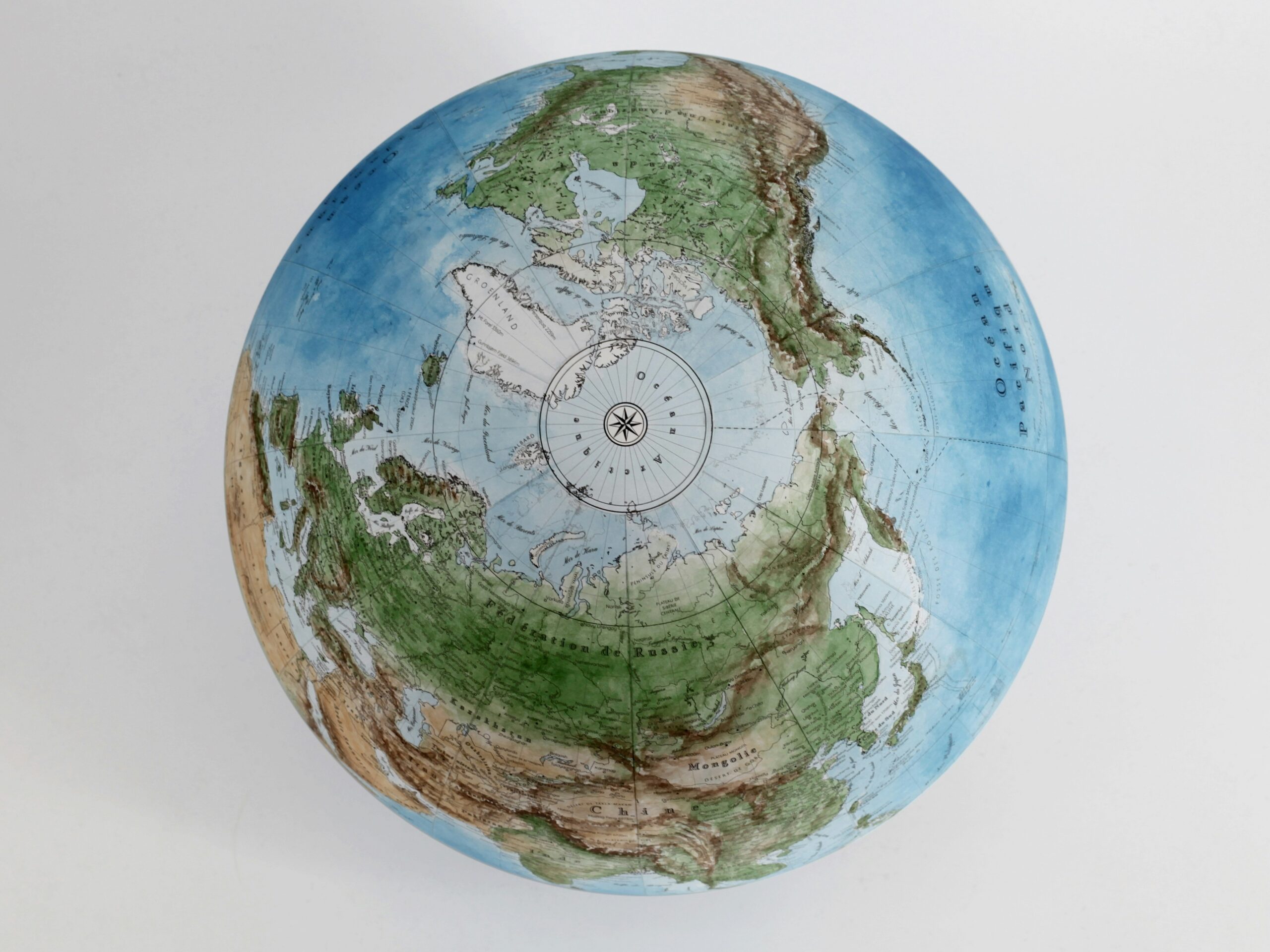
One of the most compelling contemporary examples explored is the unfolding territorial dynamics in the Arctic. With melting ice caps revealing new shipping routes and potential resource deposits, the Arctic has become a crucial geopolitical hotspot. The World Unveiled demonstrates how a new Arctic map, meticulously crafted and strategically presented, can become a powerful tool in international negotiations and potential disputes. The documentary illustrates how nations are vying to solidify their claims, not just through physical presence but through the assertion of territorial waters, exclusive economic zones, and historical maritime rights, all of which are defined and defended using detailed cartographic data.
The Legal Framework of Possession: How Maps Legitimise Claims
The documentary meticulously examines the intricate relationship between geography, international law, and the concept of possession. It reveals how maps have historically served as the primary evidence for property rights, both on land and at sea. Agreements like the United Nations Convention on the Law of the Sea (UNCLOS) rely heavily on precisely defined geographical coordinates and maritime boundaries, which are, in turn, meticulously charted and presented through official maps. The World Unveiled shows how the interpretation and presentation of these maps can become central to legal battles, arbitration, and the very determination of national sovereignty and resource allocation.
The Subtle Art of Influence: Beyond Borders and Boundaries
Beyond formal legal frameworks, The World Unveiled also dissects the more subtle ways that maps exert influence. The documentary suggests that the way a region is depicted – whether it is highlighted, marginalized, or labeled in a particular way – can shape public perception, attract investment, or deter unwanted attention. This extends to the naming of geographical features, the representation of indigenous territories, and the emphasis placed on certain resources. The film underscores that the cartographer’s pen can be as potent as a diplomat’s speech in shaping the narrative of a contested region’s identity and its place in the global order.
Wealth and the World: Economic Ambitions Drawn on Maps
The documentary unequivocally links the creation and control of maps to the pursuit of wealth and economic dominance. From the earliest days of trade and exploration to the modern scramble for resources, geography has been a key determinant of fortune. The World Unveiled illustrates how maps have been instrumental in identifying, claiming, and exploiting valuable commodities, thereby enabling the accumulation of immense wealth for nations and individuals. The ability to chart trade routes, locate mineral deposits, and understand agricultural potential has always been intrinsically tied to economic prosperity, and maps are the essential tools for this endeavor.
The Age of Discovery: Plundering Continents, Charting Fortunes
The Age of Exploration is revisited, not just as a period of grand voyages, but as a concerted effort to map the unknown for material gain. The World Unveiled emphasizes how explorers, driven by the promise of gold, spices, and other riches, meticulously charted coastlines and river systems, opening up new territories for exploitation. These maps were not neutral; they were instruments of plunder, guiding conquistadors to Aztec treasures and colonial powers to the fertile lands of Africa and Asia. The documentary draws a stark connection between the detailed geographical knowledge captured on these maps and the subsequent extraction of vast wealth from colonized regions.
Resource Mapping: From Gold Rush to Oil Fields
The documentary extends its economic analysis to more recent history, highlighting the critical role of resource mapping in driving global economies. The discovery and charting of goldfields during the various gold rushes, the meticulous surveying for oil reserves in the Middle East, and the ongoing exploration for rare earth minerals in remote regions – all of these endeavors are underpinned by sophisticated geographical mapping. The World Unveiled argues that the nations possessing the most accurate and comprehensive geographical data are often best positioned to negotiate favorable resource extraction agreements, thereby securing significant economic advantages.
Trade Routes and Economic Powerhouses: The Geography of Commerce
The very structure of global trade has been shaped by geographical considerations, and maps are the essential tools that delineate these networks. The World Unveiled explores how the identification of strategic choke points, efficient shipping lanes, and accessible markets has been paramount to building economic powerhouses. The documentary illustrates how cartographic advances have facilitated the expansion of global commerce, connecting producers to consumers across vast distances and fundamentally altering the world’s economic geography. The ability to visualize and optimize these trade routes, directly through map analysis, remains a cornerstone of international business.
Beyond the Surface: Uncovering Hidden Worlds Through Geography
The World Unveiled doesn’t solely focus on the terrestrial. The documentary ventures beneath the waves and into unexplored subterranean realms, showcasing the power of geographical exploration in revealing the hidden wonders of our planet. This expansion into unseen landscapes underscores the continuous evolution of cartography and its capacity to unlock previously inaccessible knowledge and resources. The spirit of discovery, as embodied by companion content such as the exploration of “Secret Sunken Cities,” aligns perfectly with the documentary’s overarching theme of geographical revelation.
Submerged Civilizations: The Geography of Lost Worlds
The exploration of “Secret Sunken Cities” serves as a compelling example of how geographical tools are being used to uncover the mysteries of the past. These underwater explorations, utilizing advanced sonar and submersibles, are creating detailed bathymetric maps of submerged archaeological sites. The World Unveiled highlights how this form of mapping not only preserves our heritage but also offers invaluable insights into past climates, sea levels, and the lives of ancient civilizations. It demonstrates that the “surface” of our world is just the beginning of its geographical story.
Caves and Subterranean Networks: Mapping the Earth’s Inner Depths
The documentary also touches upon the complex and challenging process of mapping subterranean environments. From vast cave systems to intricate underground tunnel networks, the exploration and charting of these hidden realms require specialized techniques and a deep understanding of geological formations. The World Unveiled implicitly suggests that these subterranean maps, while perhaps less publicly visible, are crucial for understanding groundwater resources, geological stability, and even the potential for mineral extraction. The drive to map extends to every conceivable corner of our planet.
The Role of Exploration in Advancing Geographic Knowledge
Central to the documentary’s narrative is the intrinsic link between exploration and the advancement of geographic knowledge. The World Unveiled celebrates the spirit of inquiry that has driven individuals like Paul Salopek, whose extensive journeys through regions like northern India, as documented in companion content, provide invaluable on-the-ground geographic and cultural insights. These firsthand accounts, coupled with advanced mapping technologies, allow for a richer and more nuanced understanding of the world, pushing the boundaries of what we know and how we represent it. Salopek’s dedication to walking the globe, documenting local perspectives, and charting the human experience through a geographical lens exemplifies the enduring spirit of discovery.
In exploring the fascinating world of geography, the documentary “The Changing Earth” offers a compelling look at how our planet’s landscapes have evolved over time. For those interested in delving deeper into the subject, a related article can be found at My Geo Quest, which provides insightful information about various geographical phenomena and their impact on human civilization. This resource enhances the understanding of the intricate relationship between geography and our daily lives.
The Future of the Map: Navigating an Ever-Changing World
As The World Unveiled: A Geography Documentary eloquently demonstrates, the map is a dynamic entity, constantly evolving with our understanding of the planet and the ever-shifting geopolitical landscape. The documentary, through its focus on contemporary issues like the Arctic and its historical explorations, leaves the viewer with a profound appreciation for the power and enduring relevance of geography in shaping our world. The digital age may have ushered in new forms of cartography, but the fundamental principles of understanding space, power, and possession through geographical representation remain as potent as ever.
Digital Cartography and the Democratization of Mapping
The documentary acknowledges the transformative impact of digital cartography. Tools like GIS (Geographic Information Systems) and satellite imagery have revolutionized mapmaking, making it more accessible, dynamic, and detailed than ever before. The World Unveiled hints at how this democratization of mapping technology allows for a wider range of voices and perspectives to contribute to our collective understanding of the world. This shift also presents new challenges, as the sheer volume of data and the potential for manipulation require critical engagement with all forms of geographical representation.
Global Challenges and the Cartographic Response
The documentary implicitly suggests that the world’s most pressing challenges – climate change, resource scarcity, migration crises – are fundamentally geographical in nature. Addressing these issues will require sophisticated geographical analysis and innovative cartographic solutions. The World Unveiled leaves the audience considering how future maps will need to represent complex environmental data, track human movement, and inform sustainable development strategies. The ability to visualize and understand these interconnected global systems through maps will be crucial for navigating the future.
The Enduring Legacy: Maps as Tools for Understanding and Action
Ultimately, The World Unveiled serves as a powerful reminder that maps are not merely tools for navigation; they are instruments of understanding, catalysts for action, and enduring symbols of humanity’s ceaseless quest to comprehend and interact with its environment. The documentary’s deep dive into the political, economic, and cultural implications of cartography encourages viewers to look at every map, whether ancient parchment or digital display, with a critical eye and a newfound appreciation for the complex stories they tell. The world, indeed, is unveiled, not just by traversing its landscapes, but by the very lines and symbols that endeavor to capture its essence.

Why Russia Can Never Feel Safe
FAQs
What is a geography documentary?
A geography documentary is a film or video production that explores and educates viewers about various aspects of the Earth’s physical features, climate, natural resources, and human populations. These documentaries often showcase different regions of the world and provide in-depth information about their unique characteristics.
What are the benefits of watching a geography documentary?
Watching a geography documentary can provide viewers with a better understanding of the world around them. It can help increase awareness about environmental issues, cultural diversity, and the interconnectedness of different regions. Additionally, it can inspire a sense of curiosity and appreciation for the Earth’s natural beauty.
What are some popular geography documentaries?
Some popular geography documentaries include “Planet Earth” and “Blue Planet” by the BBC, “Our Planet” on Netflix, “Human Planet” by the BBC, and “The Story of Earth” by National Geographic. These documentaries offer stunning visuals and compelling storytelling to engage audiences in learning about the world’s geography.
How can geography documentaries be used in education?
Geography documentaries can be used as educational tools in classrooms to supplement traditional learning materials. They can provide real-world examples and visual representations of geographic concepts, making the subject matter more engaging and relatable for students. Additionally, they can help foster a sense of global awareness and environmental stewardship.
Where can I watch geography documentaries?
Geography documentaries can be found on various streaming platforms such as Netflix, Amazon Prime Video, Disney+, and National Geographic. Additionally, many documentaries are available for purchase or rental on DVD or Blu-ray. Some educational institutions and libraries may also offer access to geography documentaries for academic purposes.