Russia Unveiled: Exploring the Nation Through Maps
Russia, a nation of immense geographical and cultural breadth, is increasingly presenting itself to the world through the intricate lens of cartography. Far beyond mere lines on paper, modern Russian mapping initiatives are weaving together tradition with technology, and in doing so, are sparking both fascination and contention on the global stage. This exploration delves into the multifaceted ways Russia is being unveiled through maps, from vibrant digital tapestries celebrating its internal diversity to broader geopolitical statements etched onto the global map.
The St. Petersburg International Economic Forum often serves as a stage for showcasing Russia’s forward-thinking projects, and in recent times, an innovative interactive display has captured significant attention. This is no ordinary map; it is a vibrant, tactile representation of the nation, brought to life through the art of national embroidery. More than just a decorative piece, this “Map of Russia” is an ambitious digital project designed to offer a deep dive into the country’s rich tapestry of cultures and economic strengths. The very fabric of the nation’s identity is literally woven into its representation, with each stitch carrying a layer of meaning.
MARMA Lab: The Architects of the High-Tech Tapestry
The ingenuity behind this unique cartographic endeavor is attributed to MARMA Lab, a renowned entity at the forefront of immersive digital media. Their expertise lies in seamlessly blending age-old folk craftsmanship with the most advanced technological innovations. The result is what has been aptly described as a “high-tech tapestry.” This fusion is not merely aesthetic; it serves a crucial purpose: to bridge the gap between Russia’s profound cultural heritage and the dynamic realities of modern innovation. This approach ensures that the map resonates with a diverse audience, from locals seeking to reconnect with their roots to international visitors eager to understand the multifaceted nature of Russia. The lab’s commitment to this project underscores a broader trend in showcasing national identity through engaging, accessible mediums.
Unpacking the Digital Layers: QR Codes and Content
The true power of the embroidered map lies in its interactive capabilities. Each meticulously stitched section of the map is equipped with a scannable QR code. This seemingly simple technological addition unlocks a wealth of digital information. Upon scanning a QR code with a smartphone, users are presented with a gateway to a vast repository of digital content. This content is curated to highlight the diverse aspects of the regions depicted on the map. Expect to find in-depth cultural facts, breathtaking images of iconic landmarks, profiles of regional brands that represent local economies, and crucial economic highlights. The emphasis is on providing a granular view of Russia, moving beyond broad generalizations to celebrate the unique contributions of its many ethnic groups and localities. This approach fosters a more nuanced understanding of the nation’s internal landscape.
A Departure from Political Boundaries: Focus on Internal Diversity
Critically, the embroidered “Map of Russia” distinguishes itself from traditional cartographic representations by deliberately eschewing political boundaries as its primary organizing principle. Instead, its focus is squarely placed on the nation’s internal diversity. This shift in perspective is profound. It allows users to traverse the country not by crossing national borders on a political map, but by exploring the distinct traditions, identities, and historical narratives of its myriad regions and ethnic communities. The map becomes a tool for cultural discovery, offering insights into the lives and legacies of hundreds of distinct groups. It’s a conscious effort to unveil the soul of Russia through its people and their cultural expressions, rather than through its geopolitical frontiers.
For a deeper understanding of Russia’s vast geography and its historical significance, you can explore the article “Russia Explained with Maps” available at MyGeoQuest. This resource provides insightful visual representations that illustrate the country’s diverse landscapes, regional divisions, and geopolitical dynamics, making it easier to grasp the complexities of Russia’s territory and its impact on global affairs.
The Global Cartographic Stage: Russia’s Assertions on World Maps
While the embroidered map offers an inward-looking and culturally rich exploration of Russia, its unveiling occurs within a broader global context of Russian cartographic initiatives that carry significant geopolitical weight. These concurrent efforts reveal a nation not only celebrating its internal diversity but also actively reshaping and asserting its territorial aspirations on the international stage. This dynamic duality in Russian mapping practices reflects the complex interplay of domestic identity construction and external geopolitical ambition. The creation and dissemination of maps, in this sense, become potent tools of communication and influence.
The Specter of “New Russia” Maps: Expanding Territorial Claims
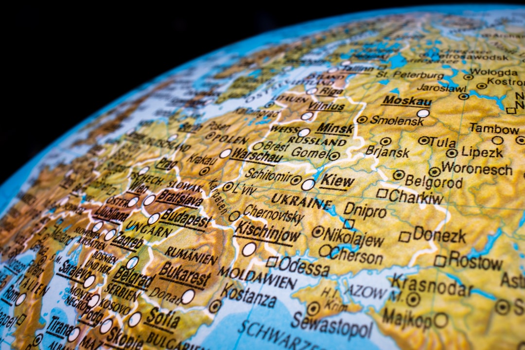
Beyond the celebratory digital tapestry, other Russian cartographic projects have emerged, drawing considerable international scrutiny. Chief among these are the recently unveiled “New Russia” maps. These maps are not merely academic exercises or projections; they represent a tangible assertion of territorial claims that extend far beyond Russia’s internationally recognized borders. The scope of these claims is particularly concerning, encompassing significant portions of Ukraine, as well as parts of Poland and Romania. This bold geographic redefinition suggests a deliberate attempt to project a vision of a territorially expanded Russia, a vision that directly challenges established international norms and borders. The very act of drawing these lines on a map carries potent symbolic and political implications.
Geopolitical Tensions and Territorial Assertions
The unveiling of these “New Russia” maps is inextricably linked to the prevailing geopolitical tensions that characterize the current global landscape. These cartographic statements are not made in a vacuum; they are active participants in ongoing disputes over territory, influence, and national sovereignty. The expansionist claims represented on these maps serve as a stark reminder of Russia’s assertive foreign policy and its willingness to challenge the existing international order. They reflect a strategic effort to project power and influence, communicating a clear message about Russia’s perceived historical rights and future ambitions in its neighboring regions. The cartographic assertion becomes a visual manifestation of these broader political objectives.
The Power of Cartography in Shaping Narratives
In the realm of international relations, maps are far more than simple representations of geography. They are powerful instruments for shaping narratives, constructing identities, and asserting political legitimacy. The “New Russia” maps, in this context, are designed to legitimize territorial claims and to foster a particular understanding of historical rights and national destiny. By presenting these expanded boundaries as factual, Russia seeks to influence perceptions, both domestically and internationally. This strategic use of cartography underscores its enduring significance as a tool of soft power and as a vehicle for communicating complex geopolitical agendas. The lines drawn on these maps carry the weight of historical revisionism and future aspirations.
Regional Narratives: Deep Dives into Specific Landscapes
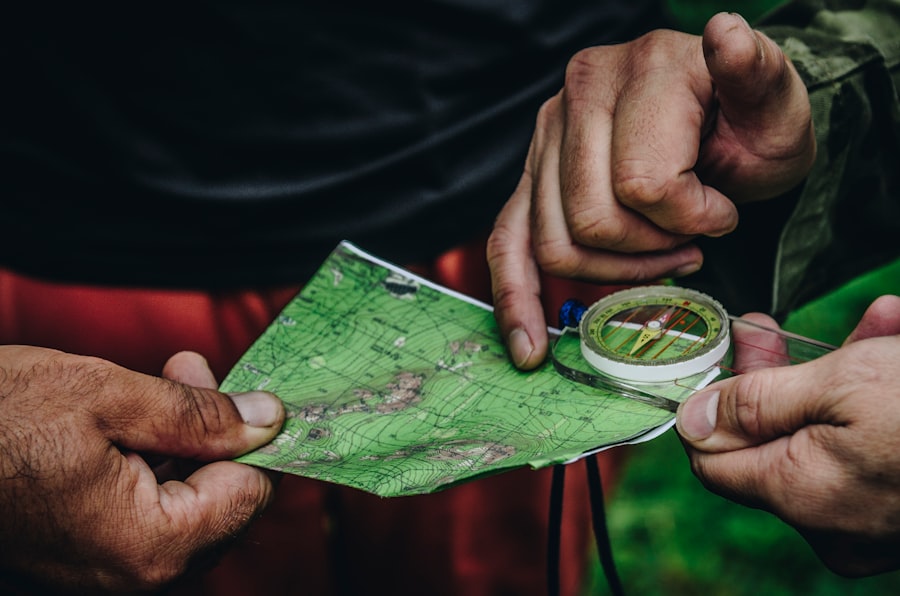
The embroidered map, by its very design, invites users to explore Russia on a regional level, and this micro-level understanding is crucial for appreciating the nation’s vastness and diversity. Each region offers its own unique story, shaped by geography, history, climate, and the cultural mosaic of its inhabitants. From the frozen expanses of Siberia to the sun-drenched Black Sea coast, and from the ancient Volga heartland to the remote reaches of the Far East, every corner of Russia tells a distinct tale. Interactive maps that delve into these specifics allow for a more intimate and nuanced appreciation of the country’s multifaceted identity.
The Arctic Frontier: Exploration and Economic Potential
The vast Arctic territories of Russia, often shrouded in a veil of ice and mystery, are another area where mapping plays a critical role. These regions, once considered remote and inhospitable, are now at the forefront of global interest due to climate change and the increasing economic potential of the Northern Sea Route. Maps detailing seafloor topography, ice conditions, resource deposits, and indigenous settlements are essential for scientific research, logistical planning, and geopolitical strategic considerations. The exploration of the Arctic through sophisticated mapping technologies reveals a Russia that is looking towards its northern frontiers with a keen eye on both scientific discovery and economic opportunity. This involves not just static representations but dynamic, data-rich maps that evolve with environmental conditions.
The Golden Ring: Tracing Historical Echoes
A journey through Russia’s Golden Ring offers a historical cartography lesson in itself. This cluster of ancient towns northeast of Moscow is a treasure trove of historical churches, monasteries, and Kremlin walls, each bearing witness to centuries of Russian history and Orthodoxy. Maps of this region connect travelers to architectural wonders, historical sites, and legends that shaped the nation’s spiritual and cultural identity. By tracing the routes connecting these historic centers, one can visualize the evolution of Russian statehood and the enduring influence of its cultural heritage. The intricate details within these maps reveal the layers of time that define this historically significant area.
The Caucasus Region: A Crossroads of Cultures
The Caucasus, a region of dramatic mountain landscapes and a bewildering array of ethnic groups, presents a complex cartographic challenge and a rich opportunity for exploration. Maps of this area must account for a diverse topographical tapestry, intricate borders between distinct ethnic enclaves, and the historical narratives that have shaped this volatile yet culturally vibrant region. Exploring the Caucasus through maps allows for an understanding of its role as a historical crossroads, where civilizations have met, clashed, and coexisted for millennia. The maps become tools for unraveling the intricate social and political dynamics of this unique corner of Russia, highlighting its resilient cultural tapestry.
Siberia: From Exile to Resource Hub
Siberia, a land of immense scale and staggering natural beauty, has a history deeply intertwined with mapping. Initially charted by explorers and later by convicts during its time as a penal colony, its vastness was gradually revealed. Today, maps of Siberia are crucial for understanding its immense natural resources, its scattered indigenous populations, and the ongoing development of its economic potential, particularly in the energy sector. From charting the mighty Siberian rivers to identifying mineral wealth and mapping the delicate ecosystems, the cartography of this region is vital for both conservation and development, revealing a land of extremes and immense untapped capacity.
The Data Behind the Delineation: Technological Innovations in Russian Mapping

The “Map of Russia” project and its broader implications are underpinned by significant technological advancements in the field of cartography. The integration of digital technologies has revolutionized how geographic information is collected, processed, and presented, moving beyond traditional static representations to dynamic, interactive, and data-rich platforms. These innovations are not only enhancing our understanding of Russia but also shaping how the nation presents itself to the world. The underlying commitment to leveraging cutting-edge technology is a common thread across various Russian mapping initiatives.
Geographic Information Systems (GIS): The Digital Backbone
At the core of modern mapping lies Geographic Information Systems (GIS). These powerful software systems enable the capturing, storage, analysis, and management of all types of geographically referenced data. For Russia, GIS is instrumental in managing its vast territory, from urban planning and infrastructure development to environmental monitoring and resource management. The embroidered map, while embracing traditional art, ultimately relies on a sophisticated digital infrastructure for its interactive elements, demonstrating how GIS forms the invisible backbone of even the most aesthetically driven cartographic projects. The ability to layer and analyze diverse datasets is crucial for understanding the complexities of such a large nation.
Remote Sensing and Satellite Imagery: Seeing from Above
The advent of remote sensing technology and high-resolution satellite imagery has dramatically transformed our ability to map the Earth’s surface. Russia, with its immense landmass and strategically important territories, heavily relies on these technologies. Satellite imagery provides detailed visual data of landscapes, allowing for accurate mapping of physical features, changes in land use, and environmental monitoring. This is essential for everything from tracking deforestation and ice melt in the Arctic to assessing damage from natural disasters and planning infrastructure projects in remote areas. The visual evidence provided by satellites offers an objective and expansive view that complements more localized mapping efforts.
Big Data and Analytics: Extracting Insights from Geographic Information
The sheer volume of geographic data being generated today necessitates advanced tools for analysis. Big data analytics platforms are increasingly being employed to process and derive meaningful insights from vast datasets related to spatial information. This includes analyzing population movements, economic activity patterns, environmental trends, and even social media data with geographic tags. By applying these analytical techniques to cartographic information, Russia can gain a deeper understanding of its own demography, resource distribution, and societal dynamics, informing policy decisions and shaping its national development strategies. The ability to process and interpret large datasets is paramount in understanding contemporary Russia.
Virtual and Augmented Reality: Experiencing the Landscape
The MARMA Lab’s work on the embroidered map hints at a broader trend towards utilizing Virtual Reality (VR) and Augmented Reality (AR) in cartography. These immersive technologies offer new ways to experience and interact with geographic information. Imagine virtually walking through historical sites on the Golden Ring or seeing augmented reality overlays of infrastructure projects depicted on a city map. As these technologies mature, they hold the potential to make Russian landscapes and their stories more accessible and engaging for both domestic and international audiences, blurring the lines between physical exploration and digital immersion. This new frontier of cartographic representation promises to be a significant development in how we engage with geographical data.
For those looking to understand the complexities of Russia’s geography and its impact on global politics, an insightful resource can be found in the article that explains Russia through detailed maps. This piece not only highlights the vastness of the country but also delves into its historical and cultural significance. To explore this further, you can check out the article here.
The Cartographer’s Intent: Decoding the Messages Embedded in Russian Maps
| Map | Explanation |
|---|---|
| Political Map | Shows the borders of Russia and its neighboring countries |
| Population Density Map | Illustrates the distribution of population across Russia |
| Natural Resources Map | Highlights the various natural resources found in different regions of Russia |
| Climate Map | Displays the different climate zones within Russia |
Understanding Russian maps requires an awareness of the intent behind their creation. Every line drawn, every label chosen, and every projection employed carries a message, whether explicit or implicit. From celebrating cultural heritage to asserting territorial sovereignty, the cartographic endeavors discussed reveal a nation actively engaged in shaping its narrative and projecting its influence on the world stage. The context in which these maps are unveiled and the audiences they are intended for are crucial in decoding their underlying meanings.
Cultural Diplomacy and National Branding
The embroidered “Map of Russia” serves as a prime example of how cartography can be wielded as a tool for cultural diplomacy and national branding. By highlighting the rich diversity of ethnic groups, traditions, and regional economic strengths, the project aims to present a positive and multifaceted image of Russia to the international community. It’s an effort to showcase the nation’s creativity, innovation, and deep cultural roots, fostering goodwill and attracting investment. This approach contrasts with more traditional forms of national branding that might focus solely on economic might or political power.
Historical Revisionism and Justification of Claims
Conversely, maps like the “New Russia” variants often serve as instruments of historical revisionism and as justifications for territorial claims. By redrawing borders to encompass territories with significant historical or ethnic Russian populations, these maps aim to legitimize their assertions in the eyes of domestic audiences and potentially to garner support on the international stage. This strategic use of cartography seeks to create a sense of historical inevitability and entitlement, framing territorial expansion as a redress of past injustices or as a natural restoration of historical spheres of influence.
The Role of Cartography in Information Warfare
In the contemporary geopolitical climate, maps have become increasingly potent tools in information warfare. The dissemination of maps that challenge established borders or promote alternative historical narratives can be used to sow discord, destabilize adversaries, and influence public opinion. The unveiling of “New Russia” maps, in this regard, can be seen as a form of assertive cartography designed to create strategic ambiguity and to test the resolve of international actors. The visual representation of territorial claims serves as a constant reminder of ongoing disputes and potential flashpoints.
A Glimpse into Russia’s Future Aspirations
Ultimately, the various cartographic initiatives emanating from Russia offer a revealing glimpse into its present ambitions and future aspirations. The celebratory digital map speaks to a desire for internal cohesion and the celebration of a diverse national identity. Meanwhile, the more assertive territorial maps signal a nation seeking to reassert its influence on the global stage and to revise what it perceives as an unfavorable international order. By studying these maps, one can begin to decipher the complex and often contradictory messages Russia is sending to both its own citizens and the wider world, charting a course through a landscape of tradition, innovation, and geopolitical assertion.

Why Russia Can Never Feel Safe
FAQs
What is the geographical location of Russia?
Russia is the largest country in the world, spanning across Eastern Europe and Northern Asia. It shares borders with 14 countries and is surrounded by the Arctic and Pacific Oceans.
What are the major geographical features of Russia?
Russia is known for its diverse geography, including the Ural Mountains, the Siberian Plain, the Caucasus Mountains, and the vast Siberian taiga. It also has several major rivers, including the Volga, Lena, and Ob.
How is Russia’s climate and weather?
Russia experiences a wide range of climates due to its vast size. The northern regions have a polar climate, while the southern regions have a humid continental climate. The country also experiences extreme temperature variations, with very cold winters and hot summers.
What are the main natural resources of Russia?
Russia is rich in natural resources, including oil, natural gas, coal, timber, and minerals such as iron ore, nickel, and copper. It is one of the world’s leading producers of oil and natural gas.
How does Russia’s geography impact its economy and politics?
Russia’s vast geography and abundant natural resources play a significant role in its economy and politics. The country’s energy resources, particularly oil and natural gas, have a major impact on global markets and geopolitics. Additionally, the diverse geography presents challenges for infrastructure development and regional disparities in economic development.