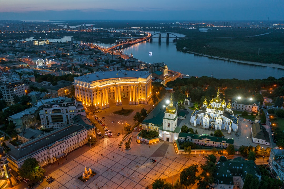
Ukraine, a nation of immense historical and cultural significance, also boasts a geography as varied and captivating as its people. Spanning a substantial portion of Eastern Europe, its landscapes range from the rolling steppes that have sustained agriculturally for millennia to the dramatic peaks of its western mountains. This article delves into the multifaceted geography of Ukraine, exploring its dominant features, its vital river systems, its extensive coastlines, and the distinct vegetation and biomes that define its ecological richness, all while acknowledging the contemporary geographical realities that shape its present and future.
The overwhelming majority of Ukraine, approximately 95% of its total area, is characterized by the expansive and largely flat East European Plain. This vast, contiguous landmass has profoundly shaped the country’s history, economy, and settlement patterns. The plain is not merely a uniform expanse of flatness; it comprises a mosaic of fertile steppes, undulating plateaus, and gently sloping terrain, making Ukraine the largest country located entirely within the European continent. This colossal stretch of land has served as a historical crossroads, a route for migrations, and a fertile breadbasket for centuries.
The Steppes: Ukraine’s Fertile Heartland
At the heart of the East European Plain lie Ukraine’s renowned steppes, a defining feature of the nation’s geography. These are not arid deserts but vast, treeless grasslands, characterized by rich, black soil known as chernozem. This exceptionally fertile soil, often referred to as “black earth,” is a geological treasure, formed over millennia from the decomposition of organic matter in a climate that allowed for lush grass growth. The chernozem is incredibly rich in humus and nutrients, making it ideal for agriculture. Historically, the steppes were home to nomadic peoples and cavalry, their lives dictated by the open plains and seasonal migrations. Today, these same steppes are the agricultural engine of Ukraine, supporting vast fields of wheat, barley, corn, and sunflowers. The sheer scale of these cultivated plains is breathtaking, stretching to the horizon in an unbroken tapestry of agricultural abundance. This agricultural prowess has historically positioned Ukraine as a major global exporter of grain, a role that continues to be pivotal to its economy and international standing. The flatness of the steppes also facilitates ease of movement and large-scale farming operations, contributing to the efficiency of its agricultural sector.
Plateaus and Rolling Hills: Subtle Topographical Variation
While the steppes are the most iconic feature of the East European Plain, the landscape also includes areas of higher ground and more varied topography in the form of plateaus. These plateaus, often found in central and western Ukraine, present a more undulating terrain than the absolute flatness of the steppes. They are typically characterized by gently rolling hills, dissected by river valleys and gullies. These regions are also highly fertile and extensively cultivated, but the subtle elevation changes create a more picturesque landscape. The presence of these plateaus, coupled with the vast plains, prevents the landscape from becoming monotonous, offering a visual rhythm to the country’s expansive interior. These areas are also important for human settlement, with towns and villages often nestled in valleys or perched on the gentler slopes, benefiting from both fertile land and natural protection.
For a deeper understanding of Ukraine’s diverse geography, you may find the article on My Geo Quest particularly insightful. It explores the various geographical features of Ukraine, including its plains, mountains, and rivers, as well as their impact on the country’s culture and economy. To read more, visit My Geo Quest.
The Mountainous Periphery: Nature’s Dramatic Edges
While the colossal East European Plain dominates the Ukrainian landscape, the country is not entirely devoid of mountainous terrain. Mountains are strategically confined to its western and southern borders, covering a mere approximately 5% of the nation’s total area. These mountainous fringes, however, introduce a dramatic contrast to the prevailing flatness, offering different climates, ecosystems, and opportunities for human activity. The presence of these ranges has also historically served as natural barriers, influencing trade routes and defense strategies.
The Carpathian Mountains: A Southwestern Frontier
In the southwest of Ukraine lies the majestic Carpathian Mountain range, a significant geographical feature that forms a part of the larger Carpathian arc stretching across several European countries. The Ukrainian Carpathians are characterized by rounded peaks, deep valleys, and extensive forests, primarily consisting of beech and coniferous trees. The highest point in Ukraine, Hora Hoverla, stands at an impressive 2,061 meters above sea level, a testament to the range’s alpine character. This region presents a stark contrast to the eastern plains, with its rugged terrain, cooler climate, and distinct flora and fauna. The Carpathian Mountains have historically been a refuge for distinct ethnic and cultural groups, contributing to the rich tapestry of Ukrainian heritage. They are also a vital source of timber and water for the country, with numerous rivers originating in their slopes. Tourism, particularly ecotourism and winter sports, is also a growing industry in this picturesque region. The valleys within the Carpathians are often home to charming villages, showcasing traditional architecture and rural lifestyles.
The Crimean Mountains: A Southern Coastal Barrier
Along the southern coast of the Crimean Peninsula, which juts into the Black Sea, the Crimean Mountains form a distinctive range. Unlike the broader expanse of the Carpathians, the Crimean Mountains are more of a rugged escarpment that drops precipitously towards the coast in many areas. These mountains are lower than the Carpathians, with their highest point, Roman-Kosh, reaching 1,545 meters. They are geologically distinct, with a history of limestone formation and erosion that has resulted in dramatic cliffs, caves, and karstic landscapes. The Crimean Mountains create a varied microclimate along the southern coast, providing shelter from the harsher northern winds and contributing to a more Mediterranean-like climate in the coastal resorts. This unique geographical setting has made the southern coast of Crimea a popular destination for tourism and a historical site of strategic importance. The mountains also harbor unique ecosystems and endemic species adapted to their specific environment.
The Lifeblood of the Land: Ukraine’s Major River Systems

Rivers are the arteries of any nation, and Ukraine is no exception. The country is crisscrossed by an intricate network of rivers, each playing a crucial role in its ecology, economy, and human settlement. However, one river stands out as the undisputed monarch of Ukraine’s waterways: the Dnieper. This colossal river not only bisects the nation but also serves as a vital transportation route, a source of hydroelectric power, and a natural divider that has influenced the country’s development for centuries.
The Dnieper River: The Great Ukrainian Waterway
The Dnieper River, approximately 1,095 kilometers of which flow through Ukraine, is the longest river within the country and the fourth longest in Europe. Originating in Russia, it flows south through Belarus and then dramatically arcs across Ukraine before emptying into the Black Sea. The Dnieper has been the backbone of Ukrainian civilization for over a millennium, facilitating trade between the Baltic and Black Seas during the Kyivan Rus’ period. Today, it remains a critical artery for cargo transportation, with ports and industrial complexes lining its banks. The river is also dammed at several points, creating a series of reservoirs that generate substantial hydroelectric power, a significant contributor to Ukraine’s energy supply. The Dnieper’s broad, navigable waters have also shaped the location of major Ukrainian cities, with Kyiv, the capital, strategically situated on its banks. The river valley itself is a rich agricultural region, benefiting from alluvial soils deposited by its annual floods. The Dnieper’s influence profoundly shapes the nation’s internal geography and its connection to the wider world.
Other Significant Waterways: A Network of Connectivity
While the Dnieper commands the most attention, Ukraine is endowed with other significant rivers that contribute to its hydrological landscape and economic vitality. The Danube River, Europe’s second-longest river, forms a part of Ukraine’s southwestern border, offering access to Central Europe and the Black Sea. Its delta is a unique ecotone of immense biodiversity. The Dniester River, flowing through the western part of the country, is another important waterway, supporting agriculture and providing water resources. Further east, the Southern Buh River winds its way to the Black Sea, carving scenic valleys and supporting local economies. The Donets River, a tributary of the Don, flows through eastern Ukraine, a region that has seen significant industrial development, with the river playing a role in water supply for these urban centers and industrial areas. This network of rivers not only provides essential resources but also connects different regions of Ukraine and links it to neighboring countries, fostering trade and cultural exchange.
The Maritime Gateway: Ukraine’s Coastal Geography
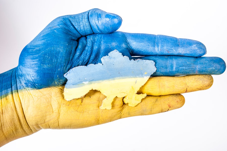
Ukraine’s geography is significantly defined by its extensive exposure to two important bodies of water: the Black Sea and the Sea of Azov. This extensive coastline, stretching for 2,782 kilometers, has historically been a gateway for trade, a source of livelihood, and a point of strategic contention. The interplay between the land and these saltwater bodies has shaped port cities, fishing industries, and the nation’s maritime capabilities.
The Black Sea Coastline: A Grand Expanse
Ukraine boasts a substantial coastline along the Black Sea, a vast inland sea that connects to the Mediterranean. This southern fringe offers a diverse array of coastal features, from sandy beaches and marshlands to dramatic cliffs. The Black Sea coast is home to some of Ukraine’s most significant cities and ports, including Odesa, a historic hub of trade and culture known for its grand architecture and bustling harbor. The warm climate along much of the Black Sea coast, particularly on the Crimean Peninsula, has made it a popular destination for domestic and international tourism, with numerous resorts and health spas. The waters of the Black Sea support a fishing industry, though environmental concerns have impacted fish stocks in recent decades. The strategic importance of this coastline cannot be overstated, as it provides Ukraine with crucial access to international shipping routes, vital for its exports and imports.
The Sea of Azov: A Shallow, Saline Basin
To the east of Crimea, Ukraine also borders the Sea of Azov, a smaller, shallower, and more saline body of water connected to the Black Sea by the narrow Kerch Strait. The Sea of Azov is noted for its abundant fish populations and its historical significance as a center for fishing and maritime trade. Its shallow depth means it warms up more quickly in the summer, making its coastal areas popular for recreation. However, the Sea of Azov has also been a focal point of geopolitical tension, particularly regarding control of the Kerch Strait, which is the sole maritime link between the Sea of Azov and the Black Sea. The geography of this region, with its relatively small land bridges and narrow straits, has made it susceptible to territorial disputes and strategic maneuvering. The ongoing impact of these geopolitical shifts on the environmental and economic status of the Sea of Azov remains a significant concern.
The Kerch Strait: A Strategic Narrows
The Kerch Strait is a critical geographical feature, acting as the natural link between the Sea of Azov and the Black Sea. It separates the easternmost tip of the Crimean Peninsula from Russia’s Taman Peninsula. This strait, approximately 4.5 kilometers wide at its narrowest point, is a vital, albeit often contested, waterway. Historically, it has been a crucial artery for naval and commercial shipping serving the ports on both the Sea of Azov and the Black Sea. Its strategic importance has been amplified in recent years, making it a focal point of international attention and a symbol of ongoing territorial disputes. Control and navigation rights through the Kerch Strait have significant implications for regional security and maritime commerce.
Understanding the geography of Ukraine is essential for grasping the complexities of its history and culture. For those interested in a deeper exploration of this topic, you can find valuable insights in a related article that delves into the various geographical features and their significance. This resource provides a comprehensive overview that complements the information about Ukraine’s landscape and borders. Check out the article here: geography of Ukraine for more details.
The Tapestry of Life: Ukraine’s Vegetation Zones and Biomes
| Aspect | Details |
|---|---|
| Area | 603,500 square kilometers |
| Capital | Kyiv |
| Population | Approximately 41 million |
| Bordering Countries | Russia, Belarus, Poland, Slovakia, Hungary, Romania, Moldova |
| Major Rivers | Dnieper, Dniester, Southern Buh |
| Major Cities | Kyiv, Kharkiv, Odesa, Dnipro, Lviv |
Ukraine’s diverse geography gives rise to a fascinating array of vegetation zones and biomes, each characterized by distinct plant communities and supporting a rich variety of wildlife. This ecological diversity is a testament to the country’s varied climate and soil conditions, contributing to its reputation as a significant agricultural producer and a haven for biodiversity. The transition across Ukraine from north to south paints a vivid picture of changing landscapes and ecological systems.
Polissya: The Northern Wetlands and Forests
In the northern reaches of Ukraine, the landscape is dominated by Polissya, a region characterized by extensive marshlands, bogs, and mixed forests. This area is a mosaic of dense woodlands, primarily composed of pine, oak, birch, and alder, interspersed with vast wetlands and peat bogs. The high water table and marshy terrain have historically made Polissya a challenging environment for large-scale agriculture, thus preserving large tracts of natural habitat. This region is a critical breeding ground for numerous bird species and provides a sanctuary for a variety of wetland-dependent wildlife, including beavers and various amphibians. The intricate network of rivers and streams that crisscross Polissya contributes to its unique hydrological character. This zone represents the northernmost expression of Ukraine’s ecological diversity.
The Forest-Steppe: A Transition Zone
As one moves southward from Polissya, the landscape gradually transitions into the forest-steppe zone. This is an ecotone, a transitional region that blends characteristics of both the northern forests and the southern steppes. Here, deciduous forests, typically consisting of oak and other broadleaf species, are interspersed with open grasslands. The soil in the forest-steppe zone is generally fertile, though not as universally rich as the chernozem of the true steppe. This zone has been extensively cultivated, with forests often cleared for farmland. However, pockets of natural vegetation remain, supporting a diverse array of plant and animal life that bridges the gap between the two major biomes. The forest-steppe is a crucial agricultural region, yielding significant harvests of grain and other crops.
The Steppe: Grasslands and Agricultural Powerhouse
The southernmost and most extensive vegetation zone in Ukraine is the steppe. As discussed earlier, these are vast, treeless grasslands characterized by incredibly fertile chernozem soils. The climate in the steppe is drier and warmer than in the northern zones, with hot summers and cold winters. Historically, these plains were covered by diverse grasses, wildflowers, and hardy shrubs, supporting nomadic herds and a rich wildlife population, including various rodents, large birds of prey, and historically, wild horses and saiga antelopes. Today, the Ukrainian steppe is largely transformed into cultivated farmland, making it the country’s prime agricultural region and a key contributor to its status as a global breadbasket. While much of the natural steppe has been converted to agriculture, remnants of original steppe ecosystems can still be found in protected areas, showcasing the remarkable biodiversity that once flourished across these expansive plains.
Biodiversity Hotspots: Ukraine’s Rich Fauna and Biomes
Ukraine’s diverse geographical features, from its mountain peaks to its coastal wetlands and vast steppes, create a rich tapestry of habitats that support an exceptional level of biodiversity. The country hosts two major biomes – the mixed forest and the steppe – which, in combination with its numerous river systems and coastlines, provide a home for an astounding array of flora and fauna. This ecological richness positions Ukraine as a significant contributor to Europe’s overall biodiversity.
A Haven for Wildlife: Fauna of Ukraine
The faunal diversity of Ukraine is truly remarkable, with an estimated 70,000 species recorded, accounting for a substantial 35% of Europe’s total biodiversity. This rich array includes a wide range of mammals, birds, reptiles, amphibians, and insects. Large mammals such as wolves, wild boars, foxes, and deer are found in the forested and mountainous regions. The steppes, though largely agricultural, still support populations of rodents, such as ground squirrels and hamsters, which in turn are prey for birds of prey like eagles and falcons. Birdlife is particularly abundant, with numerous migratory species using Ukraine’s river valleys and coastal areas as vital stopover points. The wetlands of Polissya are a crucial habitat for waterfowl and waders. The country also harbors endemic relict species, remnants of past climatic periods, which often possess unique adaptations to their specific environments. This extraordinary biodiversity underscores the ecological importance of Ukraine’s varied landscapes.
Endemic Relict Species: Living Legacies
Among the fauna of Ukraine, the presence of endemic relict species holds particular scientific interest. These are species that have survived in isolated pockets from past geological and climatic eras, offering insights into evolutionary history. For example, certain species of amphibians and insects in the Carpathian Mountains are considered relict species, having persisted in these specific microclimates for millennia. The unique geological formations and varying altitudes across Ukraine have facilitated the survival of these ancient lineages. Their presence highlights the importance of preserving these diverse habitats, as they are not only reservoirs of current biodiversity but also living museums of natural history.
Contemporary Geographical Realities: Navigating a Changing Landscape
As Ukraine navigates the complexities of the 21st century, its geography is not static. Geopolitical shifts, particularly those occurring in the eastern regions and concerning the Crimean Peninsula, continue to profoundly impact the nation’s territorial integrity and its spatial organization. These ongoing developments necessitate an understanding of a geography that is dynamic and subject to evolving political realities.
Territorial Integrity and Shifting Borders
The geopolitical landscape of Eastern Europe has been in flux, leading to reports of territorial changes in eastern Ukraine. These developments have a direct impact on the geographical definition and control of significant portions of the nation’s landmass. The administrative boundaries and the practical implementation of geographical management are directly affected by these evolving circumstances. Understanding Ukraine’s geography today requires acknowledging the contested nature of certain territories and the ongoing debates surrounding their sovereignty. These shifts have implications for resource management, infrastructure, and the movement of people.
The Status of Crimea: A Contested Peninsula
The Crimean Peninsula, with its unique geographical position bordering the Black Sea and its distinct mountain and coastal features, has become a focal point of ongoing international debate and territorial claims. The de facto control and administration of Crimea have shifted, leading to complex legal and political implications regarding Ukraine’s sovereign territory. This ongoing situation significantly alters the geographical perception and administration of this strategically important region. The future of Crimea’s geographical status remains a critical element in understanding Ukraine’s present and future geographical landscape.
In conclusion, Ukraine’s geography is a grand narrative told through its vast plains, its dramatic mountain fringes, its life-giving river systems, and its extensive coastlines. From the fertile chernozem steppes that feed the world to the ancient forests and wetlands teeming with life, each element contributes to the country’s unparalleled ecological richness and its enduring cultural identity. As Ukraine continues to evolve, its geographical tapestry, though currently woven with threads of geopolitical change, remains a testament to its natural heritage and its potential for resilience.

Why Russia Can Never Feel Safe
FAQs
What is the geography of Ukraine like?
Ukraine is the largest country in Europe by land area, covering 603,500 square kilometers. It is located in Eastern Europe and is bordered by Russia to the east, Belarus to the north, Poland and Slovakia to the west, and Hungary, Romania, and Moldova to the south. The country has diverse geography, including plains, plateaus, and mountains.
What are the major geographical features of Ukraine?
The major geographical features of Ukraine include the Carpathian Mountains in the west, the Crimean Mountains in the south, and the Dnieper River, which is the longest river in Ukraine. The country also has the Black Sea to the south and the Sea of Azov to the southeast.
How does the geography of Ukraine impact the country?
The diverse geography of Ukraine impacts the country in various ways. The fertile plains in the north and the west make it an important agricultural region, while the mountains and rivers provide opportunities for tourism and outdoor activities. The access to the Black Sea and the Sea of Azov also plays a significant role in trade and transportation.
What is the climate like in Ukraine?
Ukraine has a temperate continental climate, with hot summers and cold winters. The climate varies from region to region, with the southern coast experiencing a more Mediterranean climate due to its proximity to the Black Sea.
How does the geography of Ukraine contribute to its cultural and historical significance?
The diverse geography of Ukraine has contributed to its cultural and historical significance. The country has been a crossroads of various civilizations and has a rich history of trade, migration, and cultural exchange. The different geographical regions have also influenced the development of distinct cultural traditions and practices within the country.