
The sheer immensity of the Soviet Union was a concept that defied easy comprehension. Spanning an astounding expanse of approximately 22.4 million square kilometers, it commanded over one-sixth of Earth’s terrestrial surface. This colossal dominion stretched across eleven time zones, a testament to its unparalleled geographical reach. Even after its dissolution, the geopolitical entity that inherited the bulk of its territory, the Russian Federation, continues to hold the distinction of being the world’s largest nation. To explore the Soviet Union’s geography is to embark on a journey through a kaleidoscope of environments, a testament to the planet’s formative forces acting across an almost unfathomable scale. The diversity was not merely in extent but in the very fabric of its varied terrains and climates, profoundly shaping the lives and cultures of its more than 100 distinct ethnic groups, who, at its zenith, numbered around 290 million souls.
The northernmost reaches of the Soviet Union were defined by the stark, unforgiving beauty of the tundra. This vast, treeless expanse, perpetually frozen for much of the year, presented a unique set of challenges and opportunities. It was a land of permafrost, where the ground remained frozen solid for at least two consecutive years, and only the very top layer thawed during the brief, intense summer months.
Life in the Permafrost: Adaptations of Flora and Fauna
Despite its seemingly barren nature, the tundra teemed with a specialized ecosystem. Low-lying, hardy vegetation dominated, including mosses, lichens, sedges, and dwarf shrubs. These plants were adept at surviving the harsh conditions, with short growing seasons and limited nutrients. Animal life was equally resilient, adapted to the extreme cold and scarcity of food. Reindeer, with their thick coats and broad hooves, grazed on lichens. Arctic foxes, ptarmigans, and lemmings also found sustenance in this challenging environment. The summer months brought a surge of migratory birds, flocking to the wetlands and tundra to breed, transforming parts of the landscape into vibrant nesting grounds.
The Lure of the North: Resources and the Human Footprint
The allure of the Arctic and its adjacent tundra lay not in its abundance of arable land but in its rich mineral resources. Vast deposits of oil and natural gas were discovered and exploited, particularly in regions like western Siberia. Indigenous peoples, such as the Nenets and Chukchi, had lived in harmony with the tundra for millennia, their nomadic lifestyles dictated by the movements of reindeer herds and the seasonal shifts. The Soviet era saw significant industrialization and infrastructure development, including the construction of ports and pipelines, aimed at extracting these natural riches. This often led to profound environmental changes and significant social impacts on the traditional ways of life of the indigenous populations. The Murmansk coast, for instance, remained ice-free year-round due to the warm North Atlantic Current, providing crucial access to the Barents Sea and serving as a vital naval base and fishing hub.
For those interested in exploring the intricate geography of the Soviet Union, a related article can provide valuable insights into its vast landscapes and diverse regions. This article delves into the various geographical features that defined the Soviet Union, from its expansive plains to its towering mountain ranges. To learn more about this fascinating topic, you can read the article here: Soviet Union Geography.
The Verdant Expanse: Taiga and the Great Forests
South of the tundra lay the taiga, a biome of immense coniferous forests that stretched across an enormous swathe of the Soviet Union, particularly in Siberia. This was the largest forest zone on Earth, a sea of green that represented a critical part of the planet’s lungs.
The Siberian Pine and the Endless Woods
The dominant tree species in the taiga were pines, firs, spruces, and larches. The Siberian larch, in particular, was noteworthy for its ability to thrive in extremely cold climates and its resilience to fire. These dense forests provided vital habitats for a wide array of wildlife. Moose, brown bears, wolves, lynx, and various rodent species roamed these vast woodlands. Birds such as the Siberian owl and the capercaillie were common. The sheer scale of the taiga meant that many of these ecosystems remained relatively undisturbed for long periods, though resource extraction, particularly timber, began to exert pressure.
Rivers of Life: The Hydrological Arteries of the Taiga
The taiga was crisscrossed by a network of mighty rivers, which served as vital arteries for both the ecosystem and human activity. The Ob, Yenisei, and Lena rivers, among the longest in the world, flowed northwards across Siberia, eventually emptying into the Arctic Ocean. These rivers not only supported aquatic life but also provided essential routes for transportation, logging, and the establishment of settlements. The annual spring thaw and subsequent meltwater floods played a crucial role in the hydrology of the region, shaping the landscape and replenishing the soil. The forests of the taiga were also instrumental in regulating climate and influencing hydrological cycles across vast distances.
The Golden Sea: Steppes and Arable Lands
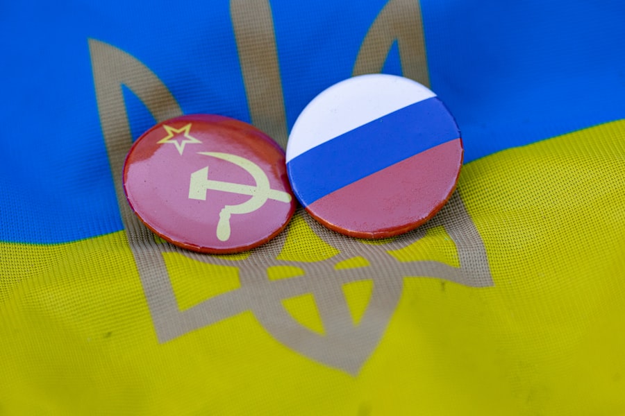
Moving further south, the landscape transitioned into the vast, rolling steppes. These were expansive grasslands, characterized by their fertile chernozem soils, which made them some of the most productive agricultural regions within the Soviet Union.
The Breadbasket of the Union: Agriculture and its Challenges
The Ukrainian steppes, in particular, were renowned as the “breadbasket of the Soviet Union” due to their rich, dark soil, ideal for growing grains like wheat, barley, and maize. This agricultural productivity was crucial for feeding the nation and for export. However, the steppes also presented their own environmental challenges. Droughts were a recurring problem, and the open landscape made them susceptible to soil erosion. The Soviet Union implemented large-scale irrigation projects and agricultural collectivization programs in an attempt to maximize yields, sometimes with unintended ecological consequences, such as salinization of the soil in arid regions.
Nomadic Heritage and Shifting Landscapes
Historically, the steppes were the domain of nomadic peoples, renowned for their horsemanship and their ability to adapt to the open plains. While the Soviet era largely suppressed nomadic lifestyles in favor of settled agriculture and industrialization, the legacy of these traditions remained. The vastness of the steppes, devoid of significant tree cover, offered a sense of boundless open space, a stark contrast to the dense forests and rugged mountains found elsewhere in the union. The wind was a constant companion, shaping the subtle contours of the land and, in drier periods, whipping up dust storms.
The Arid Heartlands: Deserts and Semi-Arid Regions

Vast swathes of Central Asia, particularly within the Turan Lowland, were home to arid deserts and semi-arid regions. These were some of the driest and hottest parts of the Soviet Union, presenting a formidable environment for human settlement and agricultural development.
The Karakum and Kyzylkum: Landscapes of Extremes
The Karakum and Kyzylkum deserts were the most prominent arid landscapes. Characterized by sand dunes, gravel plains, and salt flats, these areas received very little rainfall. Life here was sparse, with specialized flora and fauna adapted to extreme heat and water scarcity. Hardy desert shrubs, such as saxaul, and resilient desert animals, like the jerboa and the fennec fox, managed to survive. The vastness and harshness of these deserts often made them ideal for testing military equipment and for conducting large-scale agricultural projects that required significant water resources, such as cotton cultivation.
Engineering the Oasis: Irrigation and the Amu Darya and Syr Darya Rivers
The Soviet Union undertook ambitious projects to bring life to these arid lands, primarily through extensive irrigation systems. The Amu Darya and Syr Darya rivers, which historically flowed into the Aral Sea, were diverted to irrigate vast cotton fields. This engineering feat transformed parts of the desert into fertile agricultural land, but at a devastating cost to the Aral Sea, which dramatically shrank, leading to severe ecological and humanitarian crises in the region. The attempt to “conquer” nature through massive engineering projects epitomized a certain approach to resource management characteristic of the Soviet era. This region also encompassed salt flats, such as the Kara-Bogaz-Gol, a hyper-saline gulf of the Caspian Sea, where salt extraction was a significant industry.
The geography of the Soviet Union is a fascinating subject that encompasses vast landscapes, diverse climates, and unique natural resources. For those interested in exploring this topic further, a related article can be found at My Geo Quest, which delves into the intricate geographical features and historical significance of the region. Understanding the geographical context of the Soviet Union not only enhances our knowledge of its past but also sheds light on the environmental challenges faced by the successor states today.
The Majestic Barriers: Mountains and High Plateaus
| Aspect | Details |
|---|---|
| Area | 22,402,200 square kilometers |
| Population | 293 million (in 1991) |
| Capital | Moscow |
| Major Cities | Leningrad, Kiev, Tashkent |
| Geography | Extensive plains, vast forests, and numerous mountain ranges |
| Climate | Diverse climate zones including arctic, subarctic, temperate, and subtropical |
The Soviet Union was punctuated by some of the world’s most spectacular mountain ranges and high plateaus, forming natural barriers and influencing climate and biodiversity across vast regions.
The Caucasus: A Confluence of Peaks and Peoples
The Caucasus Mountains, forming a formidable range between the Black Sea and the Caspian Sea, represented a region of exceptional geographical and cultural diversity. These towering peaks, including Mount Elbrus (5,642 m), the highest mountain in Europe, were home to numerous ethnic groups, each with their own distinct languages and traditions. The varied altitudes within the Caucasus created a range of microclimates, supporting a rich array of flora and fauna, from subtropical forests on the Black Sea coast to alpine meadows and snow-capped peaks. This region was also a crossroads for ancient civilizations and trade routes, with its rugged terrain often fostering isolation and the preservation of distinct cultural identities.
The Pamirs and Tien Shan: The Roof of Asia
Further east, the Pamirs and Tien Shan mountain ranges formed part of the vast “roof of Asia.” The Pamirs, often called the “Great Pamir,” harbored Communism Peak (now Ismoil Somoni Peak), which, at 7,495 meters, was the highest point in the entire Soviet Union and a formidable challenge for mountaineers. These ranges are characterized by rugged, glaciated peaks, high-altitude deserts, and serene alpine lakes. The Tien Shan mountains, meaning “celestial mountains,” showcased dramatic sheer cliffs, ice fields, and deep valleys. These mountains played a significant role in the hydrological systems of Central Asia, with glacial meltwaters feeding major rivers. Their remote nature and challenging terrain also meant that they harbored unique biodiversity, and some areas remained relatively untouched. The presence of active volcanoes in the Kamchatka Peninsula in the far east added another dimension to the Soviet Union’s dramatic mountainous landscapes, showcasing geological forces at play.
The exploration of the Soviet Union’s diverse geography, from the frozen tundras of the north to the arid deserts of the south and the towering peaks of its mountain ranges, reveals a land of extraordinary contrasts. It was a territory shaped by immense geological forces and diverse climatic conditions, providing habitats for resilient life forms and serving as a cradle for a multitude of human cultures. The legacy of this vast geographical tapestry continues to be explored and understood, a testament to the power and variety of our planet.

Why Russia Can Never Feel Safe
FAQs
What were the main geographical features of the Soviet Union?
The Soviet Union was the largest country in the world, spanning over 22 million square kilometers. It encompassed a wide range of geographical features, including vast plains, mountain ranges, and diverse climate zones.
What were the major mountain ranges in the Soviet Union?
The Soviet Union was home to several major mountain ranges, including the Caucasus Mountains, the Ural Mountains, and the Pamir Mountains. These ranges played a significant role in shaping the geography and climate of the region.
What were the main climate zones in the Soviet Union?
The Soviet Union had a diverse range of climate zones, including arctic tundra in the north, temperate forests in the west, and arid deserts in the south. The country experienced a wide range of temperatures and precipitation levels due to its vast size and varied geography.
What were the major rivers and bodies of water in the Soviet Union?
The Soviet Union was home to several major rivers, including the Volga, the Dnieper, and the Lena. It also bordered several important bodies of water, such as the Caspian Sea, the Black Sea, and the Baltic Sea, which played a crucial role in transportation and trade.
How did the geography of the Soviet Union impact its economy and development?
The diverse geography of the Soviet Union influenced its economy and development in various ways. The vast plains facilitated agricultural production, while the mountain ranges and rivers provided natural resources and transportation routes. The country’s varied climate zones also influenced the types of industries and economic activities that were prevalent in different regions.