
The question of how the 1480 cyclone specifically reshaped India’s geography is… well, it’s not a straightforward answer, mainly because “the 1480 cyclone” isn’t a widely recognized or documented single event in historical meteorological records for India.
Tropical cyclones have always been a part of the Indian subcontinent’s climate, especially along its long coastline. These powerful storms, fueled by warm sea waters, have undoubtedly played a role in shaping coastal landscapes over millennia. However, pinpointing a single cyclone in 1480 and detailing its specific geographical impact is challenging without more precise historical data.
What we can say is that cyclones of that era, and indeed any significant cyclone, would have caused changes. They would have:
- Altered coastlines: Through intense wave action and storm surges, they can erode land, deposit sediment, and even reshape river mouths.
- Affected river systems: Flooding and sediment transport can change river courses.
- Impacted ecosystems: Coastal vegetation gets battered, and marine environments can be temporarily disrupted.
The lack of precise records for a 1480 event means any discussion needs to be more general, focusing on the known mechanisms by which cyclones influence geography, rather than attributing specific changes to a single, undocumented storm. Think of it less as a case study of the 1480 cyclone and more about how powerful cyclones in general have historically molded the Indian subcontinent.
When we talk about a cyclone’s impact on geography, we’re really talking about a cascade of powerful natural processes. These aren’t just big winds; they’re complex systems that interact with the land and sea in profound ways.
The Anatomy of a Tropical Cyclone
To appreciate the geographical impact, it’s helpful to understand what a cyclone is. These are rotating storm systems that form over warm tropical waters. They’re characterized by low atmospheric pressure at their center, surrounded by intense winds spiraling inwards.
Formation and Intensification
Cyclones draw their energy from the heat of the ocean surface. As warm, moist air rises, it cools and condenses, forming clouds and releasing latent heat. This process fuels the storm, leading to further intensification. The longer a cyclone lingers over warm waters, the stronger it can become.
The ‘Eye’ and the ‘Wall’
The most recognizable feature of a strong cyclone is its ‘eye’ – a calm, clear area at the center. Surrounding the eye is the ‘eyewall,’ where the most violent winds and heaviest rainfall occur. Both these features, while atmospheric, drive the physical forces that impact the land.
The Coastal Interface: Where Land Meets Sea
India’s vast coastline is particularly vulnerable and dynamic. It’s a zone of constant interaction between terrestrial and marine environments, and cyclones are major disruptors of this balance.
Erosion and Deposition
The most immediate geographical impact of a cyclone is often coastal erosion. Powerful waves, driven by high winds, relentlessly pound shorelines, sweeping away sand and soil.
Wave Action
The sheer force of breaking waves can literally carve into cliffs and beaches. Over hours, a cyclone can significantly alter the shape of a coastline, creating new inlets or widening existing ones.
Sediment Transport
While erosion is a key factor, cyclones also redistribute vast amounts of sediment. This material, eroded from one area, can be deposited elsewhere, creating new sandbars, expanding deltas, or burying existing coastal features.
The 1480 cyclone had a profound impact on the geography of India, reshaping coastlines and altering river systems in ways that are still studied today. For a deeper understanding of the effects of this historical weather event on India’s landscape, you can explore a related article that delves into the geographical transformations caused by natural disasters throughout history. To read more, visit My Geo Quest.
Historical Weather Patterns and Their Significance
While a specific “1480 cyclone” might not be a pinpointable event in historical records, the patterns of cyclones and their broad influence are a consistent part of India’s climatic history. Understanding these historical patterns helps us infer potential impacts.
Cyclones in South Asian History
The Bay of Bengal and the Arabian Sea are historically active regions for tropical cyclones. Evidence from historical texts, although often not detailed meteorological records, suggests that devastating storms have struck the subcontinent for centuries.
Early Records and Observations
Ancient Indian texts, while not scientific in the modern sense, sometimes allude to severe weather events that could be interpreted as cyclones. These are often embedded within chronicles of rulers or natural disasters.
Literary Mentions
Poetry, religious texts, and geographical accounts from medieval India might contain descriptions of storms that, given the context and geographical location, bear the hallmarks of tropical cyclones. These are invaluable for understanding the perception and potential impact, even if precise data is absent.
The Impact of Long-Term Climate Shifts
Broader climate fluctuations over centuries could also influence the frequency and intensity of cyclones. Periods of warmer oceans, for instance, could foster more powerful storms.
Reconstructing Past Events
Without precise records for 1480, reconstructing the geography of that period relies on inferential methods. This involves looking at geological evidence and understanding the general behavior of cyclones.
Geological Evidence
Coastal geomorphology – the study of landforms like beaches, dunes, and estuaries – can sometimes reveal evidence of past major storm events. Layers of sediment, the presence of specific types of debris, or unusual landform formations could indicate significant historical inundation or erosion.
Sediment Cores
Analyzing sediment cores from coastal areas, including marine or estuarine deposits, can reveal layers of material that were deposited by a single, massive inundation event. The composition of these layers can tell us about the source of the sediment and the force of the water that transported it.
Inferring Scale from Modern Events
While direct evidence for 1480 is elusive, meteorologists and geographers study the documented impacts of modern, powerful cyclones on similar geographical areas. This allows them to infer the potential scale of changes that a historical storm of comparable intensity might have wrought.
Potential Geographical Alterations by a Major Cyclone

Let’s consider the types of geographical changes a strong cyclone could have caused along India’s coast in the 15th century, even without a specific record for 1480.
Coastal Landform Transformation
The most visible and direct impacts would be on the immediate coastal landscape.
Beach Recession and Dune Formation
Major storm surges during a cyclone can strip beaches bare, causing significant recession. Conversely, the same surge can carry large quantities of sand inland, potentially forming new, albeit temporary, dune systems behind the original beach line.
Inland Inundation and Sediment Deposition
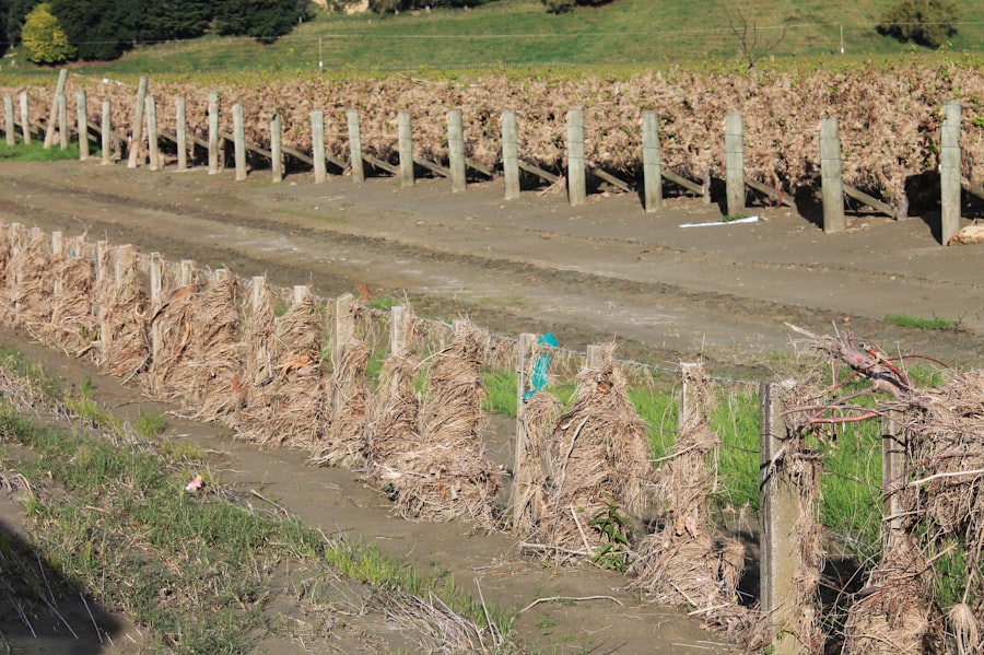
The force of a storm surge can push seawater far inland, inundating low-lying areas. This surge carries with it a significant amount of sediment, which is then deposited as the floodwaters recede. This can lead to the formation of new, shallow land deposits.
Estuarine and Deltaic Modifications
India’s major river deltas, like the Ganges-Brahmaputra and the Godavari, are naturally dynamic and sensitive to storm events.
Changes in River Channels
Powerful floods associated with cyclones can scour existing riverbeds and deposit sediment, potentially diverting or silting up parts of the delta’s intricate network of channels. This can alter the flow of fresh water and influence salinity in coastal areas.
Saltwater Intrusion
The influx of seawater during a storm surge can push saltwater further up river systems than usual. This can have long-term effects on downstream soil salinity and affect the types of vegetation that can grow in these areas.
Impact on Inland Water Bodies and Topography
The influence isn’t limited to the immediate coastline.
Freshwater Lake and Pond Alteration
Heavy rainfall accompanying a cyclone can lead to the flooding and overtopping of freshwater lakes and ponds.
Sedimentation and Changes in Depth
These water bodies can receive significant amounts of sediment washed in from surrounding land, leading to shallower depths and altered shapes.
Connection to Coastal Systems
In some cases, intense flooding can create temporary connections between freshwater bodies and the sea, further blurring the lines between these hydrological systems.
Undermining and Landslides
In more hilly or embankment-prone coastal regions, intense rainfall and high winds can contribute to localized landslides and the undermining of cliffs.
Soil Saturation
Prolonged heavy rainfall saturates the soil, reducing its shear strength and making it more susceptible to gravity-driven movement.
Undercutting by Waves
The relentless pounding of waves during a cyclone can undercut coastal cliffs, leading to collapses and further reshaping the topography.
Long-Term Ecological and Geological Consequences
Beyond the immediate physical reshaping, a significant cyclone would have lingering effects that influence the region’s ecology and further geological processes.
Altering Coastal Ecosystems
The natural balance of coastal flora and fauna is deeply affected by such events.
Vegetation Damage and Regeneration
Dense coastal vegetation, such as mangrove forests, are vital natural barriers but can be severely damaged by strong winds and inundation.
Mangrove Uprooting and Sediment Burial
The strong currents and wave action can uproot mangrove trees and bury them and surrounding areas under thick layers of sediment. Recovery can take years, and the composition of the surviving vegetation might change.
Impact on Coastal Fauna
The habitat disruption directly impacts the animals that depend on these ecosystems, from small invertebrates to larger reptiles and birds.
Soil Salinity and Agricultural Impact
The intrusion of saltwater has direct consequences for land use.
Agricultural Land Degradation
For centuries, coastal areas have been used for agriculture. A significant saltwater inundation can render this land infertile for extended periods due to increased soil salinity.
Changes in Crop Suitability
Farmers would have to adapt by switching to more salt-tolerant crops or finding new land, a significant economic and social disruption.
Groundwater Contamination
Saltwater intrusion doesn’t just affect surface soil; it can also contaminate freshwater aquifers used for drinking water and irrigation, posing a long-term challenge.
Reshaping Sediment Budgets and Coastal Dynamics
The material moved by a cyclone doesn’t just disappear; it becomes part of a larger geological process.
Sediment Delivery to the Sea
Cyclones can significantly increase the amount of sediment delivered from land to the sea, impacting coastal currents and potentially affecting marine life and seafloor topography.
Influence on Barrier Islands and Lagoons
The dynamic interplay of erosion and deposition influenced by cyclones can alter the shape and stability of barrier islands and the salinity and depth of lagoons behind them.
The 1480 cyclone had a profound impact on the geography of India, reshaping coastlines and altering river courses in ways that are still evident today. This catastrophic event not only caused widespread destruction but also led to significant changes in land use and settlement patterns. For a deeper understanding of how such natural disasters influence geographical features, you can explore a related article that discusses these transformations in detail at this link.
The Challenge of Specificity: “The 1480 Cyclone”
| Impact of 1480 Cyclone on India Geography |
|---|
| Increased coastal erosion |
| Changed river courses |
| Altered landforms and topography |
| Shifted sand dunes and coastal features |
| Created new islands and landmasses |
It’s crucial to reiterate why focusing on a singular “1480 cyclone” as a specific geographical driver is problematic from a historical and scientific standpoint.
Lack of Detailed Records
The primary challenge is the absence of meticulously kept meteorological records for the 15th century. Documenting wind speeds, rainfall totals, storm tracks, and precise duration and intensity was not a practice in the way it is today.
Comparing to Modern Events
What we can infer are potential impacts based on the types of geographical changes that any major cyclone could cause. If a storm in 1480 were of immense magnitude, comparable to, for instance, the 1999 Odisha Super Cyclone or the 2004 Indian Ocean Tsunami (though the latter was an earthquake-induced tsunami, it highlights the scale of coastal devastation), then its geographical imprint would have been substantial.
Estimating Intensity
Without specific data, any attempt to describe the “1480 cyclone” would involve a high degree of speculation, relying on generalized knowledge of cyclone behavior and the geological evidence of past major events in the region.
The Importance of General Processes
Therefore, it’s more productive to discuss the general impact of major cyclones on India’s geography rather than trying to attribute specific, documented changes to a single, unverified storm from 1480. The subcontinent’s geography has been continuously shaped by countless such events over millennia, each contributing to the island’s complex and ever-evolving landforms.
FAQs
1. What was the impact of the 1480 cyclone on India’s geography?
The 1480 cyclone caused significant changes to India’s geography, including the formation of new landmasses and alteration of coastlines.
2. How did the 1480 cyclone affect the landmasses in India?
The cyclone led to the creation of new islands and sandbars along the Indian coastline, reshaping the geography of the region.
3. What were the long-term effects of the 1480 cyclone on India’s geography?
The long-term effects of the 1480 cyclone included changes in river courses, erosion of coastal areas, and the formation of new geographical features such as estuaries and lagoons.
4. Did the 1480 cyclone have any impact on the population and settlements in India?
The cyclone’s impact on India’s geography likely affected the population and settlements, as changes in landmasses and coastlines could have led to displacement and migration of communities.
5. How does the 1480 cyclone compare to other natural disasters in India’s history in terms of geographical impact?
The 1480 cyclone is considered one of the most significant natural disasters in India’s history in terms of its impact on the country’s geography, leading to lasting changes in the landscape.