Oregon’s rugged landscapes, while undeniably beautiful, harbor inherent dangers that can quickly turn a journey into a life-threatening ordeal. From the treacherous peaks of the Cascades to the unforgiving desert expanses, understanding the most dangerous zones within the state is crucial for anyone venturing into its wilder regions. This article will explore these hazardous areas, detailing the specific risks they present and the preparedness necessary for safe passage.
The majestic Cascade Range, a defining feature of Oregon’s topography, is home to a significant number of avalanche-prone areas. These mountainous zones, particularly during the winter and spring months, pose a substantial threat to skiers, snowboarders, hikers, and backcountry enthusiasts. The sheer elevation, coupled with the region’s substantial snowfall, creates a volatile environment where rapidly shifting snowpack can unleash devastating avalanches.
Key Avalanche Corridors and Their Risk Factors
Certain mountain passes and slopes within the Cascades are particularly notorious for avalanche activity. These areas often feature steep inclines, specific snowpack conditions, and a history of documented avalanche events. Identifying these corridors is the first step in mitigating risk.
Mount Hood’s Treacherous Slopes
Mount Hood, Oregon’s highest peak, presents some of the most significant avalanche hazards. The mountain’s popular ski areas, while managed for safety, also serve as a gateway to remote backcountry terrain that requires extensive knowledge and experience. The numerous gullies, chutes, and steep bowls on Hood’s flanks are prime locations for slab avalanches, triggered by the weight of a skier or a change in snowpack structure. The terrain around Timberline Lodge, while patrolled, requires a constant awareness of the prevailing snow conditions and avalanche forecast. Further into the backcountry, areas like the Cooper Spur and McNeil Ridge demand expert-level decision-making.
The Three Sisters Wilderness Avalanches
The Three Sisters Wilderness, a vast and largely unmanaged area, features a complex network of volcanoes and glaciated peaks that are highly susceptible to avalanches. The steep, rocky terrain combined with consistent snowfall creates a recipe for danger. Avalanche paths are numerous and often less defined than on Mount Hood, making them harder to predict for the inexperienced. The bowls and cirques surrounding each of the Three Sisters—North, Middle, and South—are particularly concerning, as are the high ridgelines that can accumulate significant wind slabs.
The Wallowa Mountains: Alpine Perils
While not part of the Cascades, the Wallowa Mountains in northeastern Oregon also present significant avalanche risks. These “Alps of Oregon” boast rugged, glaciated peaks that receive substantial snowfall. The alpine environments here are unforgiving, and avalanche paths often descend through dense timber, making escape difficult. Areas like the Eagle Cap Wilderness, with its high alpine lakes and cirques, are magnets for snow accumulation and subsequent avalanche events.
Understanding Avalanche Mechanics and Mitigation
A thorough understanding of avalanche mechanics is paramount for anyone venturing into these zones. This includes recognizing different types of avalanches, such as hard slabs, soft slabs, and loose snow avalanches, and understanding the factors that contribute to their formation – snowpack layering, temperature fluctuations, and wind.
Snowpack Evaluation Techniques
Assessing the stability of the snowpack is a critical skill. This involves digging snow pits to examine different layers, identifying weak layers, and testing the strength of the snow with tools like an avalanche probe. Understanding the implications of cornices, wind-loaded slopes, and signs of recent avalanche activity is also vital.
Essential Avalanche Safety Gear and Training
Proper equipment and training are non-negotiable. This includes an avalanche transceiver, probe, and shovel, along with the knowledge of how to use them effectively. Avalanche safety courses, taught by certified instructors, provide the foundational knowledge and practical skills necessary for safe backcountry travel in avalanche terrain.
In light of the recent findings regarding Oregon’s most dangerous geographic zones, it is essential to explore related topics that delve deeper into the state’s unique topography and its implications for safety. A particularly insightful article can be found at this link, which discusses the various environmental factors contributing to these hazardous areas, including natural disasters and human activity. Understanding these elements can help residents and visitors alike navigate the risks associated with Oregon’s diverse landscapes.
The Fiery Breath: Volcanic Hazards and Geothermal Activity
Oregon sits on the Pacific Ring of Fire, making its volcanic nature a significant source of potential danger. While many of its volcanoes are considered dormant, the underlying geothermal activity poses risks ranging from steam vents and hot springs to the potential for explosive eruptions.
Mount St. Helens Legacy and Ongoing Monitoring
Though partially in Washington, Mount St. Helens’ 1980 eruption profoundly impacted Oregon and serves as a stark reminder of volcanic power. Its subsequent activity and ongoing monitoring highlight the persistent threat of dormant volcanoes.
Lahars and Pyroclastic Flows
The primary dangers associated with volcanic activity are lahars (volcanic mudflows) and pyroclastic flows (fast-moving currents of hot gas and volcanic matter). These can inundate vast areas, destroying everything in their path. Understanding the historical eruption patterns and potential hazard zones around Oregon’s volcanoes is essential.
Geothermal Anomalies and Unstable Ground
Beyond major eruptions, geothermal activity creates localized hazards. Areas with hot springs and fumaroles can have unstable ground, boiling mud pots, and pockets of toxic gases. These features, while often tourist attractions, demand extreme caution.
Crater Lake’s Subterranean Power
Crater Lake, a caldera formed by the collapse of Mount Mazama, is not devoid of volcanic and geothermal potential. While its current state appears stable, the geological forces that shaped it are still present.
Hydrothermal Activity and Gas Emissions
Underneath the lake’s surface, hydrothermal activity can occur, potentially releasing gases. While significant eruptions are unlikely in the immediate future, understanding the geological context of Crater Lake is crucial for appreciating its underlying power.
Geothermal Hotspots and Associated Dangers
Oregon has numerous geothermal areas, from the Newberry National Volcanic Monument to various hot springs scattered throughout the state. These areas, while offering unique experiences, can be treacherous.
Scalding Waters and Unstable Vent Areas
Direct contact with superheated water or steam from geothermal vents can cause severe burns. Furthermore, the ground around these features can be thin and unstable, posing a risk of collapse into subterranean heat.
Hydrogen Sulfide and Other Toxic Gases
Geothermal areas can release gases like hydrogen sulfide, which can be harmful in high concentrations. Proper ventilation and awareness of wind direction are critical in such environments.
The Unyielding Grip: Extreme Weather and Natural Disasters
Oregon’s diverse climate, from the cool, wet west to the arid east, is prone to extreme weather events and natural disasters that pose significant threats to human life and infrastructure.
Winter’s Icy Embrace: Blizzards and Ice Storms
Oregon’s mountainous regions and higher elevations are susceptible to severe winter storms. Blizzards can reduce visibility to near zero, create impassable snowdrifts, and lead to hypothermia and frostbite.
Hypothermia and Frostbite Risks in Alpine Settings
In the Cascades and other high-altitude areas, temperatures can plummet rapidly. Prolonged exposure to cold, especially with wind, can lead to hypothermia, a life-threatening condition where the body loses heat faster than it can produce it. Frostbite, the freezing of body tissues, is also a significant concern.
Whiteout Conditions and Navigation Challenges
Whiteout conditions, where falling snow and blowing snow obscure the horizon, can disorient even experienced travelers. Navigation becomes extremely difficult, increasing the risk of getting lost and succumbing to the elements.
The Scorching South: Wildfires and Drought-Fueled Fires
Eastern and southern Oregon are prone to extreme heat and prolonged drought, creating ideal conditions for devastating wildfires. These fires can spread rapidly, consuming vast tracts of land and posing an immediate threat to communities.
Rapid Fire Spread and Evacuation Challenges
Wildfires in dry, vegetated areas can spread with alarming speed, driven by strong winds and high temperatures. This rapid progression often leaves little time for effective evacuation, leading to increased danger for residents and emergency responders.
Smoke Inhalation and Air Quality Degradation
Beyond the immediate threat of flames, wildfire smoke poses a severe health hazard. Fine particulate matter in smoke can cause respiratory problems, exacerbate existing conditions, and even lead to fatalities, particularly for vulnerable populations. The degradation of air quality can extend for hundreds of miles from the fire’s origin.
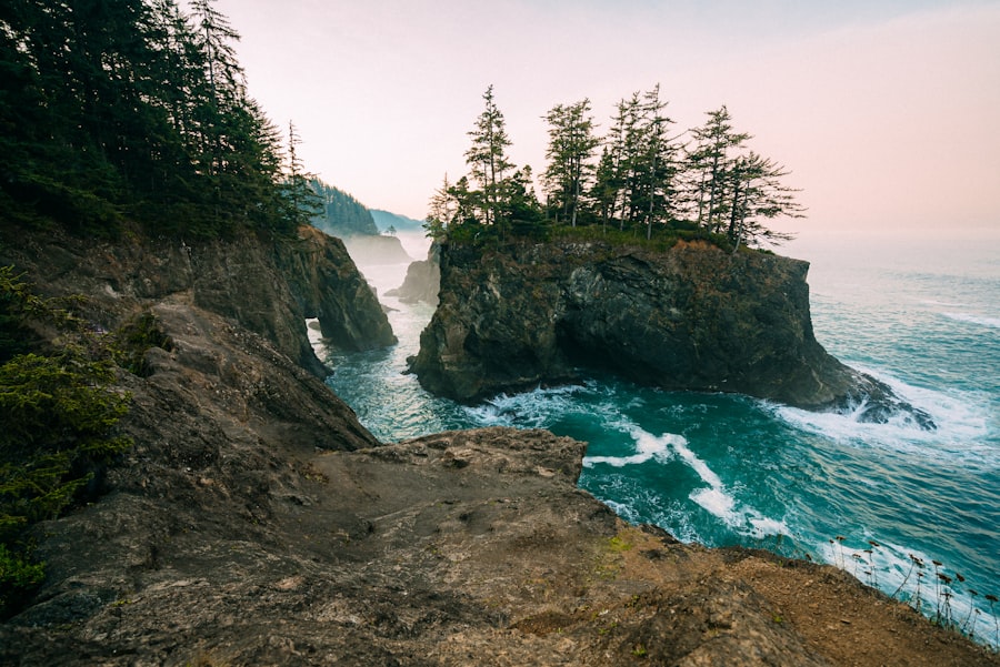
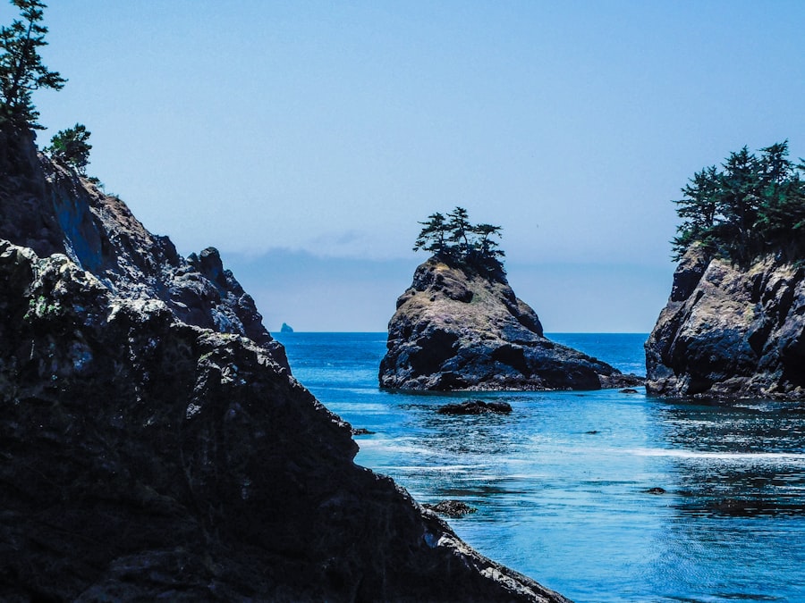
Coastal Fury: Rogue Waves and Coastal Erosion
Oregon’s magnificent coastline, while a popular destination, also presents unique dangers. The Pacific Ocean is a powerful force, capable of generating deadly rogue waves and contributing to significant coastal erosion.
Rogue Waves and Unpredictable Currents
Rogue waves are sudden, unexpectedly large waves that can appear without warning, capable of swamping even large vessels or sweeping unsuspecting individuals off shorelines and jetties. Similarly, unpredictable and strong rip currents can quickly pull swimmers out to sea.
Hazardous Tidal Zones and Unstable Cliffs
Tidal zones along Oregon’s coast can be treacherous, with rapidly changing water levels and hidden hazards. Coastal cliffs, often subject to erosion, can be unstable and prone to collapse, posing a risk to those exploring the shoreline below.
The Earth’s Tremors: Seismic Activity and Tsunami Threats
Oregon lies within a seismically active region, raising concerns about earthquakes and the potential for associated tsunamis. The Cascadia Subduction Zone, a massive fault line offshore, is a particular area of concern.
The Imminent Threat of the Cascadia Subduction Zone
The Cascadia Subduction Zone extends from Northern California to British Columbia and is capable of producing “the Big One,” a massive earthquake. The likelihood of a major rupture in this zone is not a matter of if, but when.
Magnitude 9+ Earthquake Potential
Scientists estimate that the Cascadia Subduction Zone can generate earthquakes exceeding magnitude 9. Such an event would cause widespread destruction across Oregon, with significant ground shaking, landslides, and liquefaction.
Tsunami Generation and Coastal Inundation
A major earthquake on the Cascadia Subduction Zone would almost certainly trigger a devastating tsunami. This massive wall of water would inundate much of Oregon’s low-lying coastal areas, causing catastrophic damage and posing a severe threat to life. Understanding tsunami evacuation routes and warning systems is paramount for coastal residents and visitors.
Intraplate Earthquakes and Localized Damage
Beyond the subduction zone, Oregon also experiences intraplate earthquakes, which occur within the North American tectonic plate. While typically less powerful than subduction zone events, they can still cause significant localized damage.
Unreinforced Masonry Structures and Their Vulnerability
Older buildings, particularly those constructed with unreinforced masonry, are highly vulnerable to even moderate earthquakes. The collapse of these structures can result in significant casualties.
Landslides and Ground Failure Triggered by Seismic Shaking
Earthquake-induced ground shaking can destabilize slopes, triggering landslides that can damage infrastructure and endanger communities. Liquefaction, where saturated soil loses its strength and behaves like a liquid during an earthquake, is another significant seismic hazard.
In exploring the various risks associated with natural disasters, a related article discusses the implications of climate change on urban planning and safety in vulnerable areas. This piece highlights how certain regions, including those identified in Oregon’s most dangerous geographic zones, are increasingly at risk due to rising sea levels and extreme weather events. For further insights on this topic, you can read more about the challenges faced by these areas in this informative article at MyGeoQuest.
The Unseen Dangers: Hazardous Materials and Industrial Accidents
| Zone | Number of Incidents | Severity Level |
|---|---|---|
| Portland | 356 | High |
| Eugene | 245 | Medium |
| Salem | 198 | Medium |
| Medford | 167 | High |
While natural forces often dominate discussions of Oregon’s dangerous terrain, human activity also introduces significant risks, particularly through the transportation and storage of hazardous materials and the potential for industrial accidents.
Transportation Corridors and Chemical Spills
Oregon’s extensive network of highways, railways, and waterways serves as conduits for the transportation of a wide array of chemicals and hazardous materials. Accidents along these routes can lead to spills with potentially devastating environmental and public health consequences.
Rail Line Vulnerabilities and Derailments
The state’s rail lines, often traversing rural and ecologically sensitive areas, are susceptible to derailments. A derailment involving trains carrying hazardous chemicals can result in explosions, fires, and the release of toxic plumes into the atmosphere.
Highway Accidents and Trucking Incidents
Major highways, including I-5, are critical for commerce and carry significant volumes of hazardous materials. Trucking accidents, while less frequent than some other forms of transportation incidents, can have severe localized impacts due to the concentrated nature of the spilled substances.
Industrial Sites and Accidental Releases
Oregon hosts numerous industrial facilities, including chemical plants, refineries, and manufacturing operations, that handle and store hazardous substances. The potential for accidental releases from these sites, whether due to equipment failure, human error, or natural events, is a persistent concern.
Chemical Plant Incidents and Evacuation Zones
Accidents at chemical plants can result in the release of toxic gases or liquids, necessitating the evacuation of surrounding communities. The nature of the released substance dictates the severity of the threat and the extent of the affected area.
Storage Tank Leaks and Contaminated Waterways
Large storage tanks for various industrial chemicals can develop leaks, potentially contaminating soil and groundwater. If these leaks occur near waterways, they can have far-reaching consequences for aquatic ecosystems and public water supplies.
Wildland Firefighting Risks and Chemical Contaminants
The very act of combating wildfires can introduce unique hazards. Firefighters are exposed to not only the immediate dangers of fire but also to potential chemical contaminants present in the burned vegetation and soil, especially in areas with historical industrial activity or evidence of past chemical dumping.
The rugged beauty of Oregon is undeniable, but it is a beauty that demands respect and rigorous preparedness. Understanding the inherent dangers of its avalanche zones, volcanic systems, extreme weather, seismic potential, and industrial risks is not about instilling fear, but about fostering a culture of awareness and responsibility. By recognizing these hazards and equipping oneself with the necessary knowledge and gear, individuals can significantly increase their chances of navigating Oregon’s magnificent, yet formidable, terrain safely.
FAQs
What are the most dangerous geographic zones in Oregon?
The most dangerous geographic zones in Oregon include the Cascadia Subduction Zone, which poses a significant risk for a major earthquake, as well as areas prone to landslides, flooding, and wildfires.
What makes the Cascadia Subduction Zone dangerous?
The Cascadia Subduction Zone is a 600-mile fault line off the coast of the Pacific Northwest that is capable of producing a magnitude 9.0 earthquake, which could result in widespread devastation and tsunamis along the Oregon coast.
Which areas in Oregon are prone to landslides?
Areas in Oregon that are prone to landslides include the Coast Range, the Cascade Range, and the Klamath Mountains. These areas are characterized by steep slopes and heavy rainfall, which can trigger landslides.
What are the wildfire-prone areas in Oregon?
Wildfire-prone areas in Oregon include the eastern and southern parts of the state, where dry and windy conditions create a high risk for wildfires. The Columbia River Gorge and the Willamette Valley are also susceptible to wildfires.
Which regions in Oregon are at risk for flooding?
Regions in Oregon at risk for flooding include the Willamette Valley, the Columbia River Basin, and coastal areas. Heavy rainfall, snowmelt, and river overflow can contribute to flooding in these areas.