Navigating the Singapore Strait, a critical artery in global maritime trade, presents a complex web of challenges that demand meticulous planning and execution, especially for oil tankers. This waterway, stretching approximately 105 nautical miles, is a crucible where navigational expertise meets the immense responsibility of transporting volatile cargo. For captains and crew of oil tankers, a thorough understanding of the Strait’s unique characteristics is not merely advantageous; it is a paramount requirement for safe and efficient passage. The following guide delves into the key considerations for oil tanker navigation within this vital maritime chokepoint.
The Singapore Strait is far from a placid river. It is a dynamic and bustling maritime battlefield, characterized by a confluence of factors that demand constant vigilance and precise maneuvering. A tanker captain, much like a seasoned general, must grasp the terrain, the enemy, and the arsenal at their disposal.
Geographical Features and Hydrography
The Strait’s bathymetry is a crucial factor. While generally deep enough for most supertankers in the main channel, extensive shallows and submerged hazards lie adjacent to it, requiring strict adherence to charted depths and designated fairways. The seabed can be uneven, with areas of sand, mud, and rock, impacting anchoring procedures and potentially posing risks in adverse weather if vessels stray off course. The presence of numerous islands and islets, such as Pulau Merlimau and Pulau Jong, creates complex tidal flows and navigational challenges, particularly in their vicinity. Understanding the precise depths and contours of the Strait forms the bedrock of safe passage.
Tidal Streams and Currents
The tidal streams in the Singapore Strait are notoriously strong and variable, often exceeding 5 knots, and can reach up to 8 knots during spring tides. These currents act like powerful, invisible hands, constantly pushing and pulling vessels. Predicting and counteracting these forces is a constant battle for navigators. The direction and strength of the tidal streams are influenced by the monsoon seasons, with the northeast monsoon bringing stronger currents from the South China Sea and the southwest monsoon pushing water from the Strait of Malacca. Cross-currents can also develop, particularly around headlands and islands, creating significant leeway for vessels. A thorough prediction of tidal streams, often aided by specialized software and Admiralty charts, is essential to maintain the intended track.
Weather Patterns and Visibility
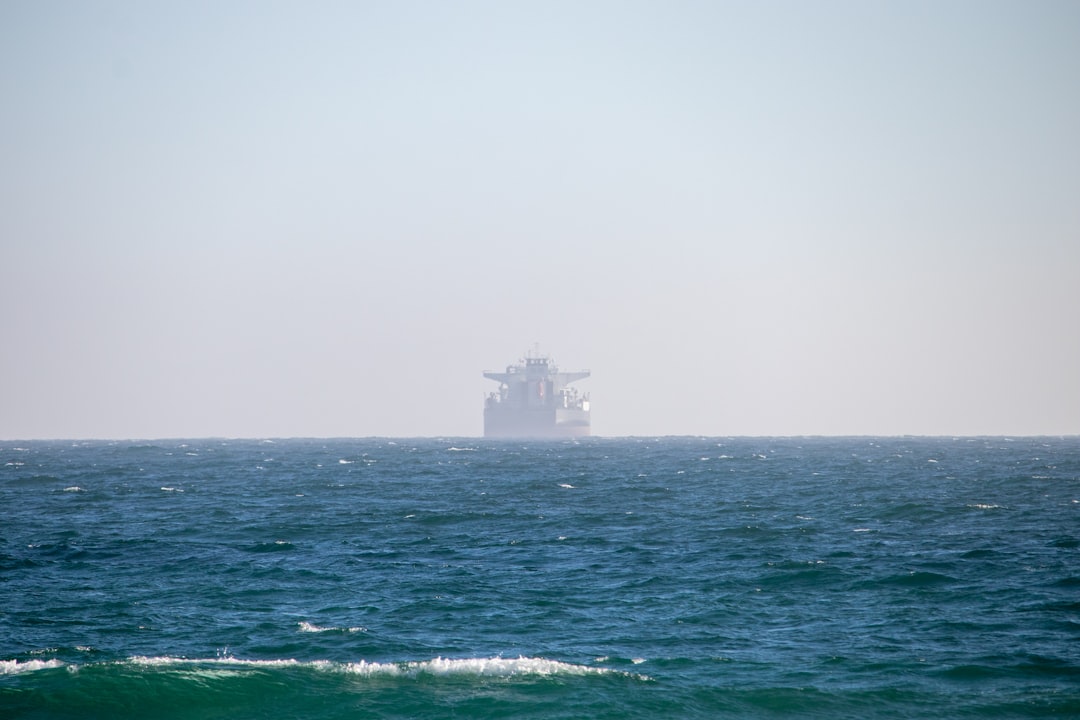
Singapore’s tropical climate means that vessels can encounter a range of weather conditions. Heavy rainfall, squalls, and thunderstorms are common, significantly reducing visibility and creating hazardous sea states. The Strait is also susceptible to the effects of the Intertropical Convergence Zone (ITCZ), which can bring prolonged periods of unsettled weather. Furthermore, haze from land-based fires, particularly during the dry season, can drastically impair visibility, transforming the seascape into an opaque veil. Low visibility is a tanker’s nemesis, amplifying the risks of collision. Radar, AIS, and other electronic aids become indispensable tools in such scenarios.
Navigating the Singapore Strait is a complex task for oil tankers due to the high volume of maritime traffic and the narrow channels that characterize the area. An insightful article that delves into the intricacies of this navigation process can be found at MyGeoQuest. This resource provides valuable information on the navigational challenges and strategies employed by vessels to ensure safe passage through one of the world’s busiest shipping lanes.
Managing Traffic Density: The Perpetual Rush Hour
The Singapore Strait is a veritable superhighway of maritime traffic, attracting a constant stream of vessels of all sizes and types. For an oil tanker, a leviathan of the seas, navigating this dense traffic is akin to a large truck trying to navigate a crowded city street during peak hour.
The Singapore VTS System
The Singapore Vessel Traffic Service (VTS) is a sophisticated and essential component of safe navigation in the Strait. Operating as the vigilant eyes and ears of the authorities, VTS provides crucial information on traffic movements, navigational hazards, and weather conditions. Adherence to VTS instructions and reporting procedures is not optional; it is a legal and safety imperative. Neglecting VTS advisories is like ignoring the traffic controller at a busy intersection; the consequences can be dire. Proactive communication with VTS, especially when encountering unusual situations or needing reassurance, is a hallmark of experienced mariners.
Collision Avoidance Techniques
The sheer volume of traffic necessitates a robust approach to collision avoidance. This involves constant 360-degree lookout, both visual and electronic. The International Regulations for Preventing Collisions at Sea (COLREGs) are the fundamental rules governing these interactions. For oil tankers, the principle of “a good lookout by all available means” takes on amplified importance. This includes not only visual sightings but also effective use of radar, AIS (Automatic Identification System), and ECDIS (Electronic Chart Display and Information System). Anticipating the movements of smaller vessels, such as fishing boats and pleasure craft, that may not always adhere to COLREGs, is a crucial aspect of defensive navigation. The “colreg rules” are the unwritten laws of engagement in this crowded arena.
Interaction with Other Vessel Types
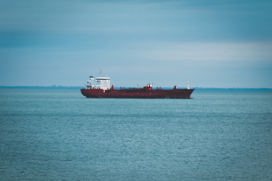
Oil tankers frequently interact with a diverse array of other vessels, including container ships, bulk carriers, general cargo ships, ferries, and numerous smaller craft. Each vessel type has its own operational characteristics and maneuvering capabilities. Understanding these differences is key to predicting their behavior. For instance, a large container ship may have a wider turning radius and a longer stopping distance than a smaller vessel. Conversely, faster vessels may present a rapidly closing threat. The inherent maneuverability limitations of an oil tanker, particularly when fully laden, must always be at the forefront of the navigator’s mind. Proactive communication via VHF radio, especially with vessels that appear to be on a collision course, can often avert dangerous situations.
Preparing for Passage: The Anchors of Safety

Preparation is not merely a preliminary step; it is the foundational work that ensures a smooth and safe voyage. For an oil tanker entering the Singapore Strait, this involves a multi-layered approach to risk mitigation.
Passage Planning and Risk Assessment
A comprehensive passage plan is the blueprint for navigating the Strait. This plan should meticulously detail the intended track, waypoints, speeds, contingency plans for emergencies, and anchorages. It goes beyond simply plotting a course; it involves a thorough risk assessment of all potential hazards, including traffic, navigational aids, weather, and the vessel’s own operational limitations. The plan should be developed and reviewed by the Master and all bridge watchkeeping officers. This includes considering pilotage requirements, VTS reporting points, and potential anchorages for awaiting berths or during adverse weather. A well-crafted passage plan is like a meticulously laid out battle strategy.
Chart Updates and Navigational Aids
Accurate and up-to-date charts are the lifeblood of safe navigation. For the Singapore Strait, this includes not only paper charts but also electronic charts used in ECDIS. Regular updates from official sources are crucial to reflect changes in depths, aids to navigation, and reported hazards. All navigational equipment, including radar, GPS, ECDIS, and echo sounders, must be regularly checked and calibrated. The reliability of these instruments is paramount. A faulty GPS or an outdated chart can be a portal to disaster. Reliance on a single navigational system is a gamble; redundancy and cross-checking are the safer bets.
Vessel Condition and Operational Readiness
The seaworthiness of the oil tanker itself is a fundamental prerequisite. This includes ensuring that all machinery is operational, particularly steering gear, propulsion systems, and navigation equipment. Bilge systems, fire-fighting equipment, and communication systems must be in perfect working order. For oil tankers, cargo manifold integrity, ballast systems, and cargo monitoring equipment are also critical. The vessel’s stability characteristics, especially when laden, must be thoroughly understood and monitored. A vessel that is not fit for purpose, or whose crew is not adequately trained in its operation, is a hazard in itself. The internal health of the ship is as important as the external environment.
Operational Considerations: The Art of Command
Once underway, the daily operations of an oil tanker in the Singapore Strait demand constant vigilance and skilled execution. These are the moments when theory meets reality, and the quality of command is tested.
Speed Management and Maneuverability
Given the Strait’s strong currents and dense traffic, judicious speed management is essential. Excessive speed reduces reaction time and increases stopping distances, a critical concern for large, laden tankers. Conversely, excessively slow speeds can make vessels more vulnerable to the effects of currents and can impede traffic flow. The navigator must constantly balance the need for timely progress with the imperative of safety. Understanding the vessel’s turning radius and stopping distances at various speeds and load conditions is paramount. These are not static numbers; they are dynamic variables influenced by wind, current, and the seabed.
Communication Protocols and Bridge Resource Management
Effective communication is the linchpin of safe operations. This includes clear and concise communication within the bridge team, between the bridge and the engine room, and with external parties such as VTS and other vessels. Bridge Resource Management (BRM) principles emphasize teamwork, clear roles and responsibilities, and effective decision-making under pressure. A robust BRM system ensures that all available information is considered and that potential risks are identified and mitigated. The bridge team, much like an orchestra, must perform in perfect harmony. Any discord can lead to a catastrophic performance.
Contingency Planning for Emergencies
Despite the best preparations, emergencies can and do occur. Therefore, comprehensive contingency plans for scenarios such as grounding, collision, fire, or pollution are vital. These plans must be regularly reviewed, drilled, and understood by all crew members. Familiarity with emergency equipment, evacuation procedures, and communication protocols for reporting incidents is crucial. The ability to respond swiftly and effectively to an emergency can significantly mitigate its consequences. Having a well-rehearsed emergency plan is akin to having a fire escape route clearly marked in a building.
Navigating the Singapore Strait is a complex task for oil tankers due to its busy shipping lanes and narrow passages. The intricacies of this vital waterway are highlighted in a related article that explores various navigation techniques and safety measures employed by vessels in the region. For more insights on this topic, you can read the article here. Understanding these navigation strategies is crucial for ensuring the safe and efficient transport of oil through one of the world’s busiest maritime corridors.
Beyond the Strait: Future Navigational Landscapes
| Metric | Description | Typical Value/Range | Notes |
|---|---|---|---|
| Traffic Separation Scheme (TSS) Width | Designated lanes for inbound and outbound tanker traffic | 1-2 nautical miles per lane | Ensures safe navigation in congested waters |
| Vessel Traffic Service (VTS) Coverage | Monitoring and communication system for vessel movements | 100% coverage of Singapore Strait | Operated by Maritime and Port Authority of Singapore |
| Average Speed of Oil Tankers | Speed maintained while transiting the strait | 8-12 knots | Speed limits enforced to reduce collision risk |
| Minimum Safe Passing Distance | Distance maintained between vessels to avoid collisions | 0.5 nautical miles | Varies depending on vessel size and conditions |
| Draft Limit | Maximum allowable draft for tankers navigating the strait | Up to 20 meters | Depends on tidal conditions and channel depth |
| Pilotage Requirement | Mandatory use of local maritime pilots for navigation | 100% for tankers over 200 GT | Ensures expert local knowledge for safe passage |
| Communication Channels | VHF radio channels used for coordination | Channels 12, 14, 16 | Channel 16 for distress and initial contact |
| Environmental Restrictions | Rules to prevent oil spills and pollution | Zero tolerance for illegal discharges | Strict enforcement by regional authorities |
The Singapore Strait is a microcosm of the challenges faced by maritime trade globally. As technology advances and shipping volumes continue to grow, navigational practices must evolve.
Technological Advancements in Navigation
The ongoing development and integration of advanced navigation systems, such as enhanced AIS, VTS capabilities, and predictive analytics for traffic and weather, offer significant potential for improving safety. Autonomous navigation technologies, while still in their nascent stages for large commercial vessels, represent a future frontier that could further transform maritime operations. The embrace of new technologies, when applied judiciously and with a thorough understanding of their limitations, promises to make waterways like the Singapore Strait even safer. Yet, technology is a tool, not a panacea; human judgment remains indispensable.
Environmental Considerations and Sustainable Shipping
The environmental impact of shipping, particularly oil transportation, is an ever-increasing concern. Navigating the Singapore Strait responsibly involves minimizing the risk of spills and ensuring compliance with stringent environmental regulations. This includes adherence to ballast water management protocols, waste disposal regulations, and the efficient operation of vessels to reduce emissions. The long-term sustainability of maritime trade depends on a commitment to environmental stewardship. The Strait is not just a traffic route; it is an ecosystem, and its health is our collective responsibility.
Regulatory Frameworks and International Cooperation
The navigability and safety of the Singapore Strait are underpinned by a complex web of international and national regulations. Continuous dialogue and cooperation between maritime nations, port authorities, and industry stakeholders are essential to adapting these frameworks to evolving challenges. The ongoing dialogue between flag states, port states, and shipping companies ensures that the rules of the road remain relevant and effective. Navigating these regulations is as crucial as navigating the physical waterway itself.
In conclusion, navigating the Singapore Strait as an oil tanker is a demanding yet achievable endeavor. It requires a deep respect for the forces of nature, a mastery of navigational tools and techniques, and an unwavering commitment to safety. By understanding the unique characteristics of the Strait, meticulously planning each passage, and operating with diligence and expertise, tanker crews can safely and efficiently traverse this vital maritime artery, ensuring the continued flow of global commerce. The Strait may be a challenge, but for those who are prepared and respectful, it is a path well-traversed.
WATCH NOW ▶️ SHOCKING: Malacca: The $10 Trillion Lie Revealed
FAQs
1. What is the Singapore Strait and why is it important for oil tankers?
The Singapore Strait is a narrow waterway located between the southern coast of Singapore and the Riau Islands of Indonesia. It is one of the world’s busiest shipping lanes, serving as a critical passage for oil tankers transporting crude oil and petroleum products between the Middle East, Asia, and other global markets.
2. How do oil tankers navigate safely through the Singapore Strait?
Oil tankers navigate the Singapore Strait by following designated shipping lanes, adhering to strict maritime traffic regulations, and using advanced navigation systems such as GPS and radar. Pilots with local knowledge often board tankers to guide them safely through the narrow and congested waters.
3. What are the main challenges faced by oil tankers in the Singapore Strait?
The main challenges include heavy maritime traffic, narrow channels, strong currents, and the risk of collisions or groundings. Additionally, environmental concerns and the need to prevent oil spills require careful navigation and adherence to safety protocols.
4. Are there any specific regulations governing oil tanker passage in the Singapore Strait?
Yes, the Singapore Strait is governed by international maritime laws and regional agreements, including the International Maritime Organization’s (IMO) Traffic Separation Scheme (TSS). These regulations mandate specific routes, speed limits, and communication protocols to ensure safe and efficient passage.
5. How do authorities monitor and manage oil tanker traffic in the Singapore Strait?
Authorities use Vessel Traffic Services (VTS) equipped with radar, Automatic Identification Systems (AIS), and communication networks to monitor ship movements in real-time. They provide navigational assistance, issue warnings, and coordinate traffic to prevent accidents and ensure smooth transit through the strait.