
The Tien Shan, often referred to as the “Water Tower of Asia,” is a colossal mountain range that plays an indispensable role in the water security of a vast swathe of the continent. Spanning across the borders of China, Kazakhstan, Kyrgyzstan, Tajikistan, and Uzbekistan, these towering peaks act as a crucial reservoir, collecting precipitation, storing it as snow and ice, and releasing it gradually throughout the year. This slow, steady release irrigates agricultural lands, sustains urban populations, and feeds vital river systems that underpin the livelihoods of hundreds of millions. Understanding the Tien Shan’s hydrological significance is paramount to grasping the intricate water dynamics of Central Asia and appreciating the challenges and opportunities associated with its management.
The Tien Shan’s imposing presence is not merely a geological feature; it is a functional landscape sculpted by millennia of tectonic forces and climatic shifts. Its sheer scale dictates its hydrological impact, influencing regional weather patterns and serving as a natural armature for the surrounding lowlands.
Defining the Range
The Tien Shan, literally meaning “Celestial Mountains” in Chinese, is one of the largest mountain systems in Central Asia. It stretches for approximately 2,900 kilometers (1,800 miles) in an east-west direction. Its westernmost extent reaches into Uzbekistan, while its eastern reaches are found in Xinjiang, China. The range is characterized by a series of parallel and intersecting mountain chains, creating a complex topography of high peaks, deep valleys, and extensive plateaus.
Elevation and Peaks
The average elevation of the Tien Shan is considerable, with many peaks soaring above 5,000 meters (16,400 feet). The highest point in the range is Pobeda Peak (also known as Jengish Chokusu), standing at 7,439 meters (24,406 feet), straddling the border between Kyrgyzstan and China. Other prominent peaks include Khan Tengri, a strikingly beautiful pyramid-shaped mountain, and Muztagh Ata. These high-altitude zones are critical because they are the primary sites of snowfall and glacier accumulation, the raw materials for the region’s water supply.
Glaciers: The Frozen Reservoirs
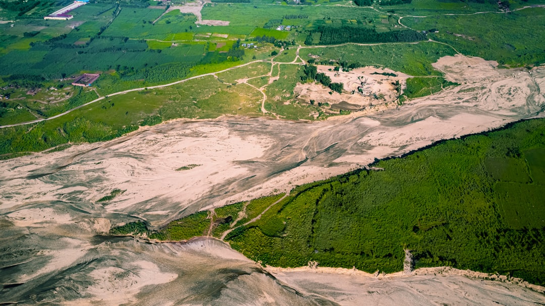
The Tien Shan is home to a significant number of glaciers, estimated to cover an area of roughly 7,600 square kilometers (2,900 square miles). These glaciers act as enormous natural refrigerators, storing vast quantities of water in the form of ice. The largest glaciers, such as the Engilchek Glacier in Kyrgyzstan, are among the longest outside of the polar regions. The slow melting of these glaciers, particularly during the warmer months, provides a consistent source of water that supplements the meltwater from seasonal snowpack.
The Tien Shan mountain range, often referred to as the “Water Tower of Asia,” plays a crucial role in supplying water to millions of people across Central Asia. For a deeper understanding of its significance and the challenges it faces due to climate change and human activity, you can read a related article that explores these issues in detail. Check it out here: Water Resources and Climate Change in the Tien Shan Region.
The Hydrological Engine: Snow and Ice Melt
The primary function of the Tien Shan as a water tower lies in its ability to capture, store, and release water through the melt of snow and ice. This process is a delicate balancing act, influenced by seasonal temperature fluctuations and precipitation patterns.
Precipitation Patterns
The Tien Shan receives considerable precipitation, largely in the form of snow at higher elevations. The range acts as a barrier to moisture-laden air masses moving from the west and north. As these air masses are forced upwards over the mountains, they cool, condense, and release their moisture as precipitation. The eastern and northern slopes tend to receive more precipitation than the southern and western slopes, leading to regional variations in snow cover and glacier extent.
The Seasonal Cycle of Melt
The hydrological cycle in the Tien Shan is characterized by a distinct seasonal rhythm. During the winter months, temperatures plummet, and precipitation falls as snow, accumulating across the higher elevations and feeding the glaciers. As spring arrives and temperatures rise, the snowpack begins to melt, releasing a surge of water into the river systems. This spring melt is often the most significant contributor to river flow, especially in the early part of the agricultural season.
Glacier Melt: A Summer Lifeline
While spring melt from snowpack is crucial, the sustained melt from glaciers becomes increasingly vital as the summer progresses and snow cover diminishes. Glacier meltwater provides a more consistent and prolonged water supply during the hottest months, when evapotranspiration rates are highest and agricultural demand is at its peak. This meltwater acts as a buffer, ensuring that river flows do not drop to critically low levels during the dry season.
Impact of Climate Change
The delicate balance of the Tien Shan’s hydrological system is increasingly threatened by climate change. Rising global temperatures are leading to accelerated glacier melt, meaning that while there might be a temporary increase in water availability, the long-term prognosis is concerning. As glaciers shrink, their capacity to store water diminishes, raising fears of future water scarcity in the region. This phenomenon is akin to a savings account being rapidly depleted without sufficient deposits.
Rivers Born from the Heights: Asia’s Arteries
The meltwater from the Tien Shan is the genesis of some of Central Asia’s most important river systems, which serve as lifelines for agriculture, industry, and human settlement across vast distances.
The Syr Darya and Amu Darya Basins
Two of the most significant river basins originating from the Tien Shan are the Syr Darya and the Amu Darya. The Syr Darya, formed by the confluence of the Naryn and Kara Darya rivers, flows through Kyrgyzstan, Tajikistan, Uzbekistan, and Kazakhstan. Its waters are vital for irrigating the fertile Fergana Valley, a major agricultural breadbasket for the region. The Amu Darya, though its more distant headwaters lie in the Pamirs, also draws significant water from tributaries influenced by the Tien Shan’s southern flanks, traversing Turkmenistan and Uzbekistan.
The Tarim River and its Tributaries
In China, the Tien Shan contributes substantially to the Tarim River basin. The Tarim River, a major inland river in Xinjiang, is fed by numerous meltwater streams originating from the Tian Shan’s northern slopes and the Kunlun Mountains to its south. The Tarim basin supports a significant agricultural population, particularly in the fertile oases that dot the otherwise arid Xinjiang region.
Transboundary Water Management Challenges
The rivers that flow from the Tien Shan are inherently transboundary, meaning they cross national borders. This creates complex challenges for water management, as upstream and downstream nations have differing needs and priorities. The historical development of large-scale irrigation projects, particularly during the Soviet era, has significantly altered river flows, leading to ongoing debates and potential conflicts over water allocation. Ensuring equitable and sustainable water sharing is a persistent geopolitical and environmental challenge.
The Human Dimension: Sustaining Life and Livelihoods
The water flowing from the Tien Shan is not just an abstract hydrological phenomenon; it is the very foundation upon which human societies in Central Asia have been built and sustained.
Agriculture: The Primary Beneficiary
Agriculture is the dominant economic activity in many of the regions watered by Tien Shan rivers. The fertile plains and valleys, if provided with sufficient irrigation, are capable of producing significant yields of cotton, grains, fruits, and vegetables. The availability of meltwater directly dictates the extent and productivity of these agricultural lands, influencing food security and economic stability for millions. The Tien Shan, in this regard, is the silent partner in every harvest.
Urban Water Supply
Beyond agriculture, the rivers originating from the Tien Shan are essential for supplying drinking water to a multitude of cities and towns across Central Asia. As populations grow, so does the demand for this vital resource. The reliability of these water sources, therefore, has direct implications for public health and urban development.
Hydroelectric Power Generation
The mountainous terrain and substantial water flows also make the Tien Shan region an attractive location for hydroelectric power generation. Numerous dams and power plants have been constructed along the rivers, providing electricity to industrial and residential areas. This, however, further complicates water management, as dam operations can affect downstream flows for irrigation and other uses.
The Looming Shadow of Scarcity
While the Tien Shan has historically been a reliable source of water, the specter of scarcity looms larger due to the combined pressures of population growth, increased agricultural demand, and the impacts of climate change. Nations are increasingly looking for ways to conserve water, improve irrigation efficiency, and explore alternative water sources, but the fundamental reliance on the Tien Shan’s meltwater remains.
The Tien Shan mountain range, often referred to as the water tower of Asia, plays a crucial role in supplying water to millions of people across Central Asia. Its glaciers and snowmelt are vital for sustaining rivers that nourish agricultural lands and support diverse ecosystems. For a deeper understanding of the environmental challenges facing this region, you can read a related article that explores the impact of climate change on the Tien Shan and its significance for the surrounding communities. To find out more, visit this informative resource.
Future Outlook and Conservation Imperatives
| Metric | Value | Details |
|---|---|---|
| Location | Tien Shan Mountains | Central Asia, spanning Kyrgyzstan, Kazakhstan, and China |
| Elevation | Up to 7,439 meters (Jengish Chokusu peak) | Highest peak in the Tien Shan range |
| Glacier Coverage | Approximately 8,000 km² | Major source of freshwater in the region |
| Annual Snowfall | Varies, up to 1,000 mm | Contributes to glacier mass and water supply |
| Rivers Fed | Over 20 major rivers | Includes Syr Darya, Ili, and Tarim rivers |
| Population Dependent | Over 30 million people | Relies on Tien Shan water for agriculture and drinking |
| Environmental Concerns | Glacier retreat and water scarcity | Due to climate change and human activity |
The long-term sustainability of the Tien Shan as a water tower hinges on a multifaceted approach that acknowledges both its immense value and its increasing vulnerability.
Monitoring and Research
Continuous monitoring of glacier mass balance, snowpack depth, and river flow is essential. Scientific research into the impacts of climate change on the Tien Shan’s hydrological system is crucial for developing informed adaptation strategies. This includes understanding the rate of glacier retreat and its implications for future water availability.
Sustainable Water Resource Management
Effective transboundary cooperation on water resource management is paramount. This involves equitable allocation of water resources, improved water use efficiency in agriculture and industry, and the development of integrated water management plans that consider the needs of all stakeholders, from the smallest village to the largest city.
Glacier Preservation Efforts
While large-scale intervention to halt glacier melt is currently not feasible on a global scale, local efforts can focus on reducing pollution in mountain environments and minimizing human impact on fragile ecosystems. The preservation of the Tien Shan’s glaciers is not just about water; it’s about safeguarding a vital component of the planet’s cryosphere.
Adapting to a Changing Climate
Societies reliant on the Tien Shan’s water must adapt to the realities of a changing climate. This may involve shifting agricultural practices, investing in water-saving technologies, and diversifying economic activities to reduce an overreliance on water-intensive industries. The resilience of these communities will be tested in the coming decades, and proactive measures are essential. The Tien Shan, as Asia’s lifeline, demands our careful stewardship and a profound understanding of its delicate ecological balance.
▶️ STOP: The Middle Corridor Is A Death Trap
FAQs
What is the Tien Shan water tower of Asia?
The Tien Shan water tower of Asia refers to the Tien Shan mountain range, which acts as a crucial source of freshwater for Central Asia. It is often called a “water tower” because its glaciers and snowfields feed many important rivers in the region.
Where is the Tien Shan mountain range located?
The Tien Shan mountain range is located in Central Asia, stretching across several countries including Kyrgyzstan, Kazakhstan, Uzbekistan, and China.
Why is the Tien Shan called a water tower?
The Tien Shan is called a water tower because its glaciers and snowmelt provide a significant portion of the freshwater supply for surrounding countries. This water supports agriculture, drinking water, and ecosystems downstream.
What rivers originate from the Tien Shan mountains?
Several major rivers originate from the Tien Shan mountains, including the Syr Darya and the Ili River, which are vital for irrigation and water supply in Central Asia.
How is climate change affecting the Tien Shan water tower?
Climate change is causing glaciers in the Tien Shan to retreat, which threatens the long-term availability of freshwater in the region. Reduced glacier mass can lead to decreased river flow, impacting agriculture and water security for millions of people.